The area around Donegal Bay has some of the most spectacular seascapes in Ireland, including the dramatic Doonbristy sea stack off Downpatrick Head and the soaring cliffs of Slieve League. Many people feel the Slieve League cliffs are more dramatic than the better-known Cliffs of Moher. They certainly are higher at 1,952ft (595m) compared to the 656ft (200m) Cliffs of Moher.
From our anchorage at Ballyglass we toured the Mayo coast just south of Donegal Bay, then crossed the bay to spend several nights anchored at Teelin while we waited out a storm system. Trip highlights from June 28th through July 1st, 2017 follow. Click any image for a larger view, or click the position to view the location on a map. And a live map of our current route and most recent log entries always is available at http://mvdirona.com/maps
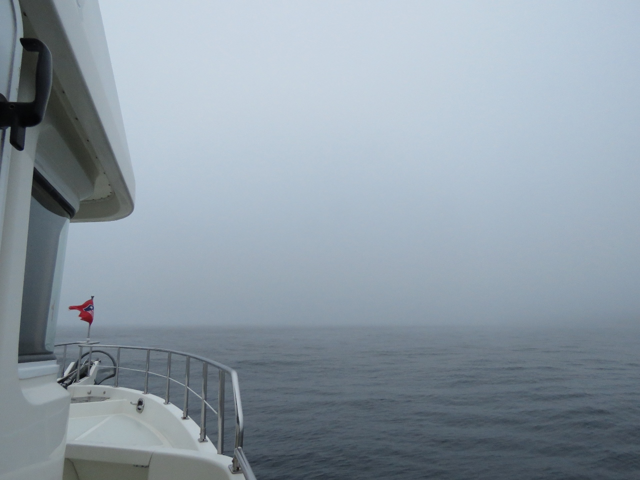 |
Fog
Position: -9 52.90, 54 19.54
We’d been looking forward taking in the cliffs and dramatic seascape along the coast east of Broad Haven Bay, but were disappointed to wake up to a fog so thick we could barely see the bow of the boat. The weather changes here quickly, so we decided to stick with our original plan and follow the north Mayo coast before running northeast across Donegal Bay to Teelin.
|
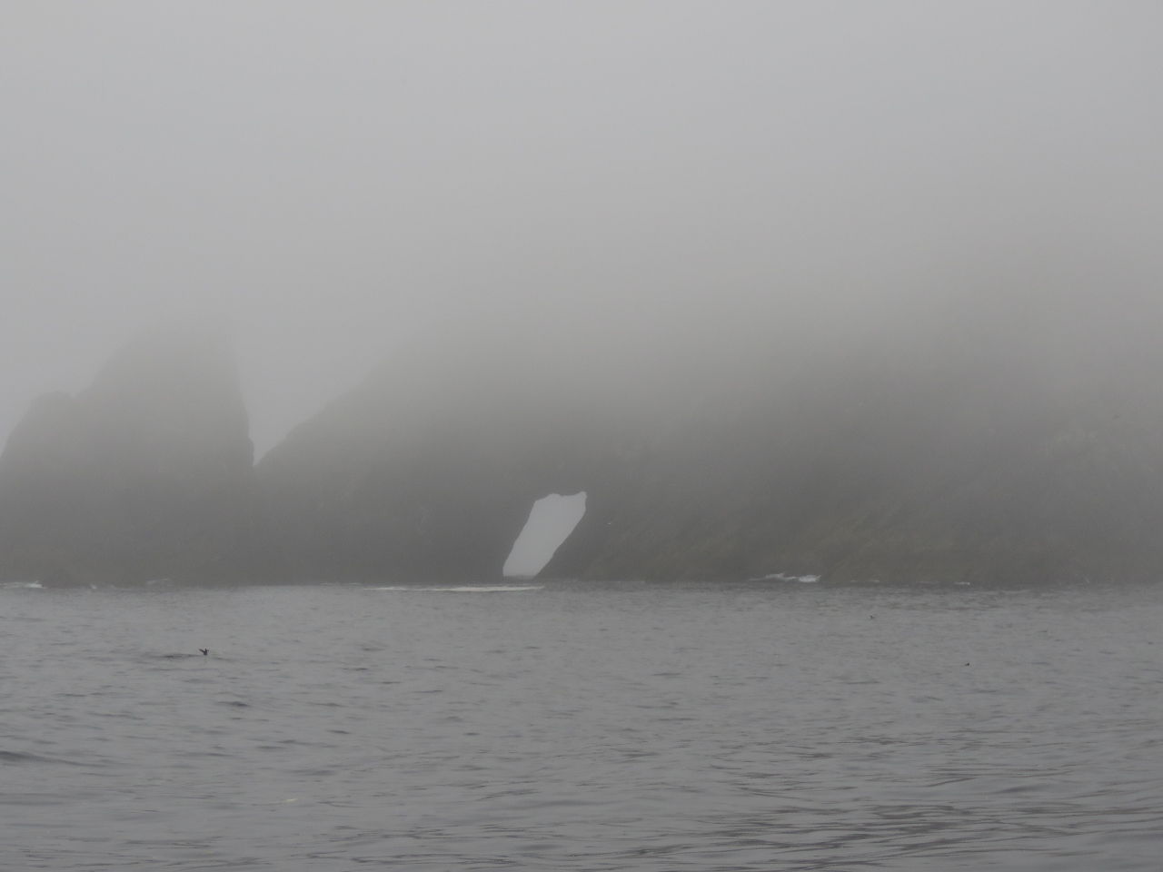 |
The Stags
Position: -9 47.85, 54 21.87
The weather hadn’t improved at all when we reached the Stags of Broadhaven. The tops were hidden in the mist, but we could at least make out the tunnel that runs clear through one of the islets.
|
 |
Belderg Harbour
Position: -9 31.88, 54 19.60
Visibility was improving as we neared Belderg Harbour and we were starting to see why our cruising guide recommended touring this coastline.
|
 |
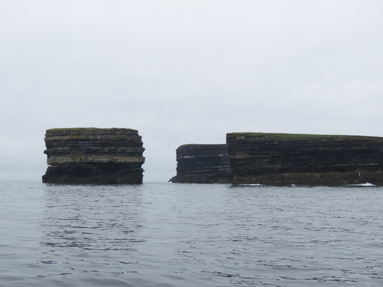
Conaghra Point
Position: -9 28.91, 54 19.47
Sea arch just east of Conaghra Point
|
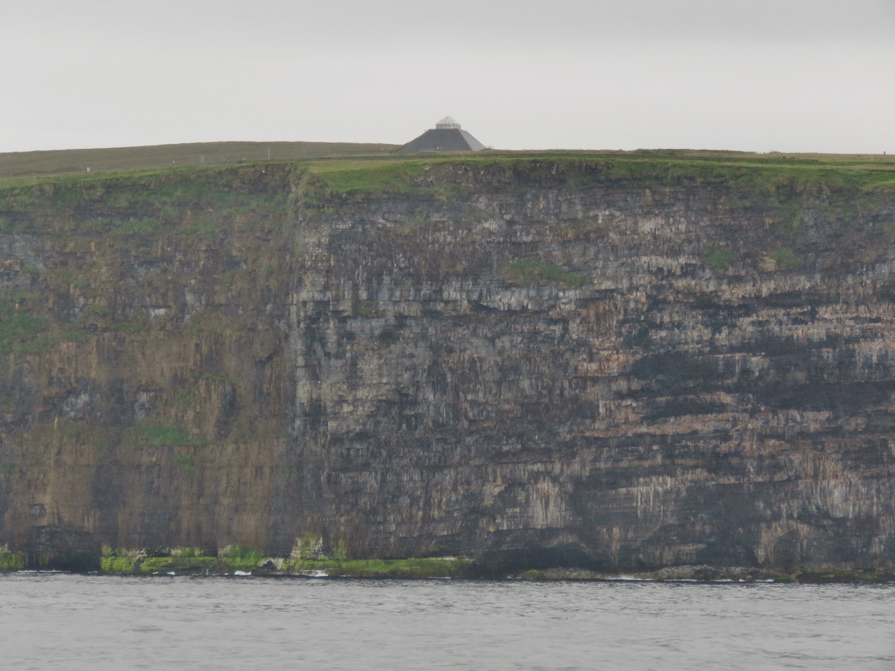 |
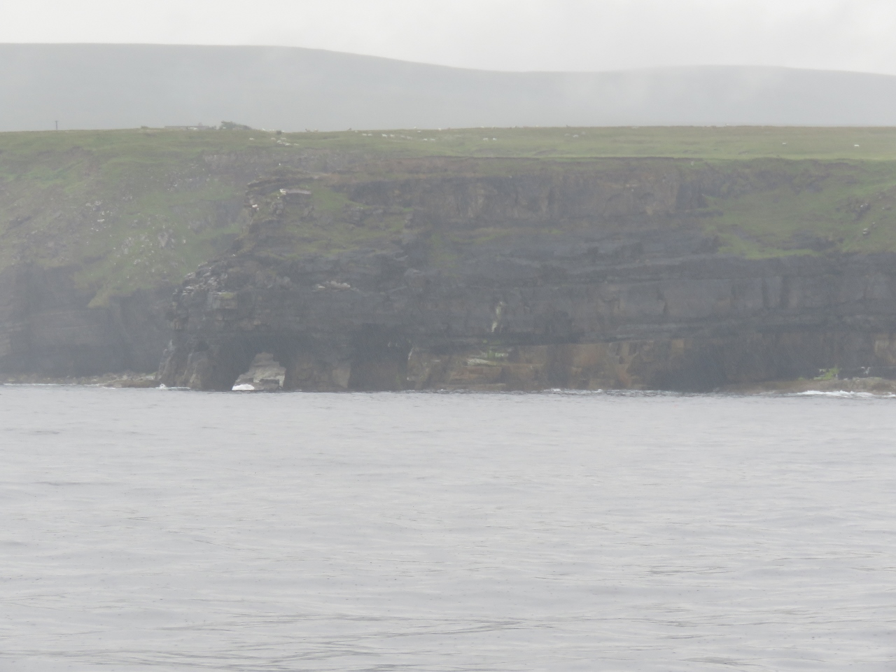
Ceide Fields
Position: -9 27.28, 54 19.08
Covering several square miles, the Ceide Fields are the largest Stone Age site and the oldest known collection of agricultural fields in the world. The pyramid-shaped building atop the cliff is the Ceide Fields visitor center.
|
 |
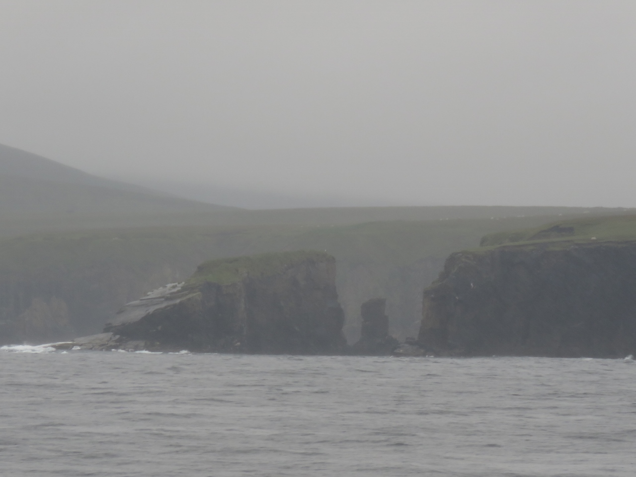
Arches
Position: -9 27.01, 54 18.75
Just east of the Ceide Fields, this headland is punctuated with sea arches and caves.
|
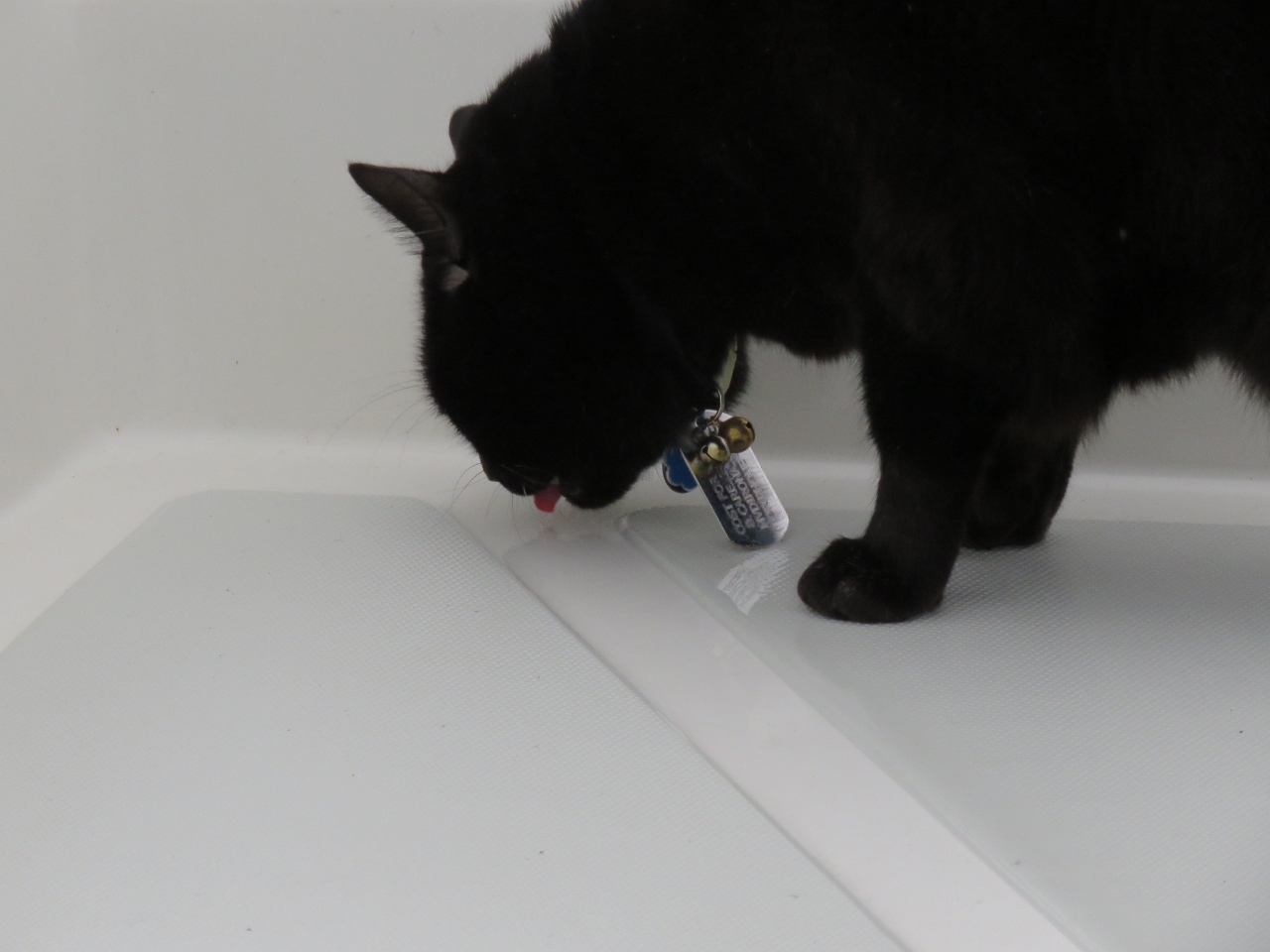 |
Spring Water
Position: -9 26.73, 54 18.79
Spitfire loves fresh “spring” water and is always out lapping it up on deck after a rainfall. Often he doesn’t wait for the rain to stop and gets soaked, but doesn’t seem to mind.
|
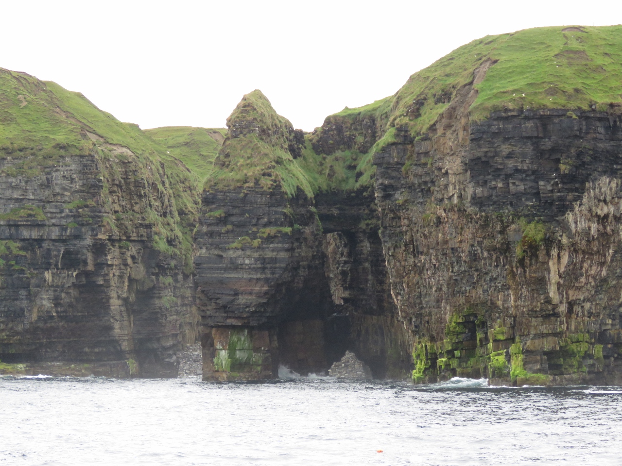 |
Spire and Arch
Position: -9 26.62, 54 18.79
The coast east of Ceide Fields is especially dramatic. To the right of this spire is a hole clear through the cliff with a sea arch below.
|
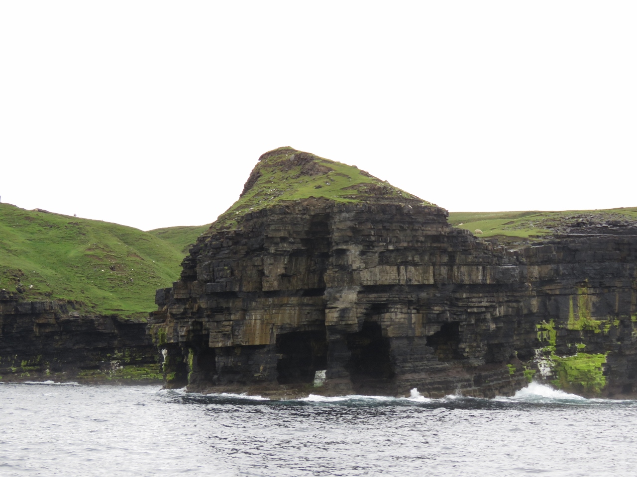 |
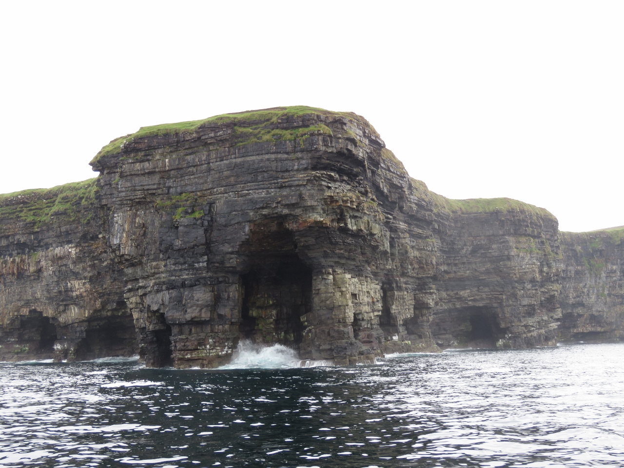
Tunnel
Position: -9 26.45, 54 18.74
This headland is so riddled with arches and tunnels that we could see clear through to the other side.
|
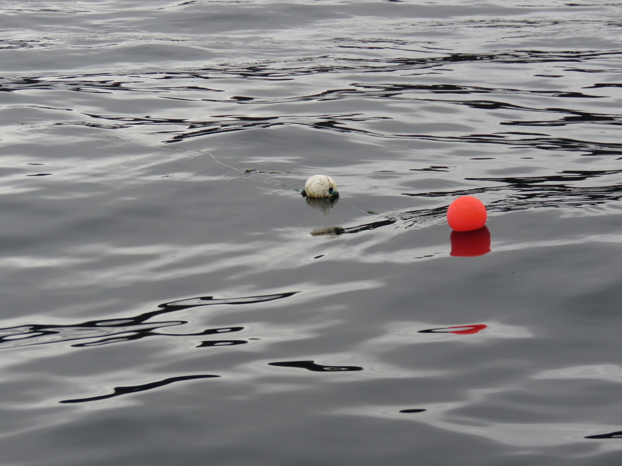 |
Floating Line
Position: -9 25.88, 54 18.87
We give fishing floats a wide berth. Partly we don’t want to damage fishing gear and partly we don’t want them to get tangled in our stabilizers or props and potentially disable the boat. This particular fisherman is using floating line and has put down 50-100ft more line than needed for the depth (the line barely is visible streaming off to the left of the buoy). The combination of excess line, it floating, and strong current allowed us to catch one.
We first heard a thumping noise and stopped the boat. We then tried hard astern to back out of whatever we had caught. Up popped a few bits of line and a buoy. It appears the Spur Cutters actually do work. In our previous boat we would have had to use SCUBA gear to clear the snagged line. Here the problem was dealt with in minutes with no vibration or fouled gear. We really hate to see the line cut, but long runs of floating line trailing out in the current can be incredibly difficult to see. |
|
|
Downpatrick Head
Position: -9 21.35, 54 19.44
The dramatic Doonbristy sea stack off Downpatrick Head. What an incredibly beautiful coastline.
|
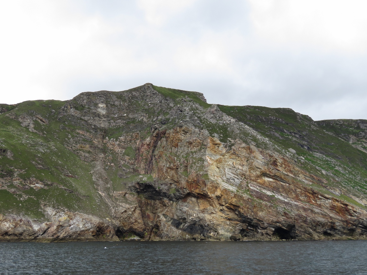 |
Leahan Mountain
Position: -8 45.68, 54 39.11
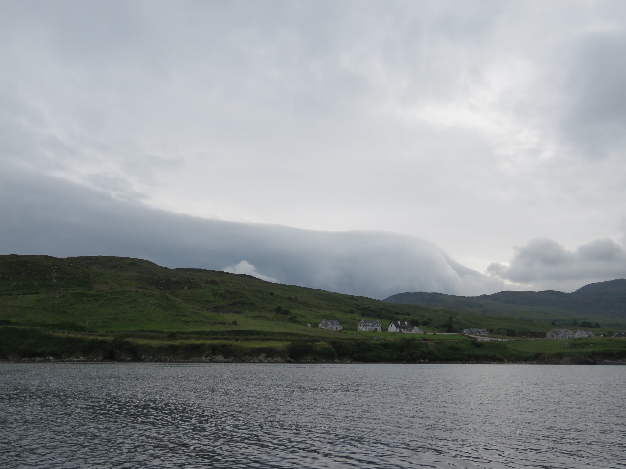
From Downpatrick Head, we crossed Donegal Bay towards Teelin. 1,400ft (427m) Leahan Mountain rises nearly straight up from the sea on the north side of Donegal Bay.
|
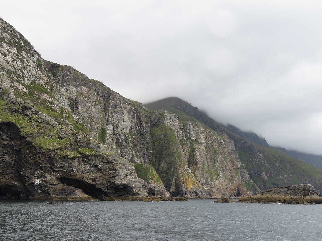 |
Cliffs
Position: -8 45.00, 54 39.03
Looking east along the shoreline from Leahan Mountain. The cliffs of Slieve League are barely visible, disappearing into the clouds, in the distance.
|
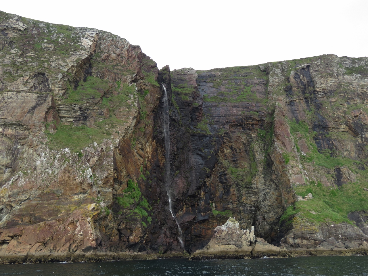 |
Waterfall
Position: -8 44.17, 54 38.90
The Irish west coast seems to have an endless variety of incredible scenery.
|
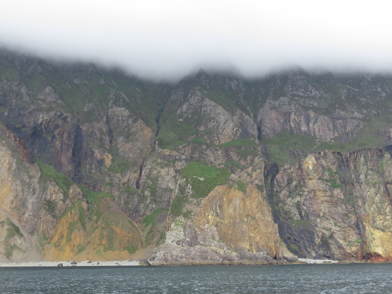 |
Slieve League
Position: -8 42.40, 54 38.27
Many people feel the Slieve League cliffs are more spectacular than the better-known Cliffs of Moher. They certainly are higher at 1,952ft (595m) compared to the 656ft (200m) Cliffs of Moher. The Slieve League cliffs definitely are an impressive sight, even if we couldn’t see the tops for the clouds.
|
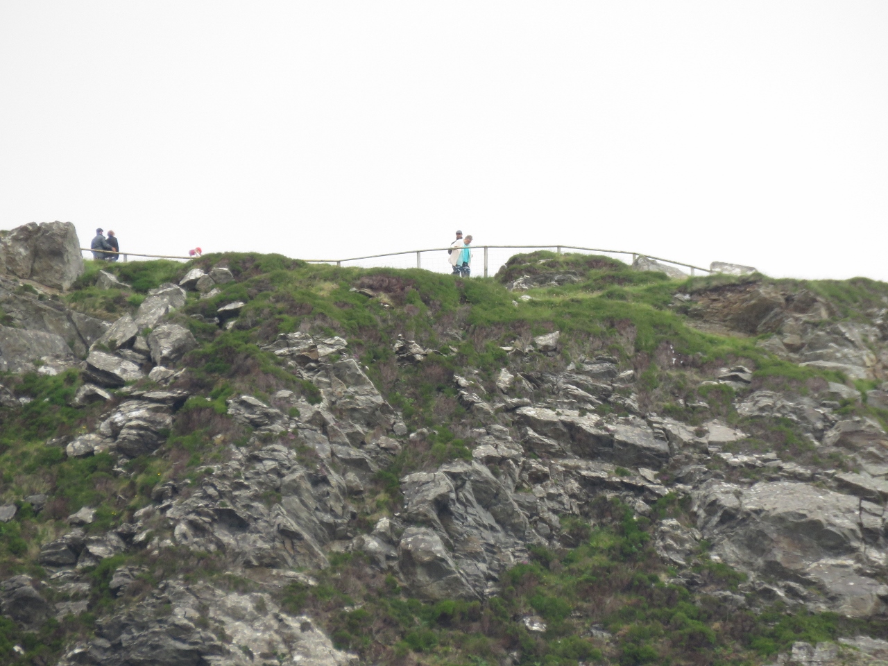 |
Viewpoint
Position: -8 41.43, 54 37.93
Despite the poor weather, the Slieve League viewpoint had a lot of visitors.
|
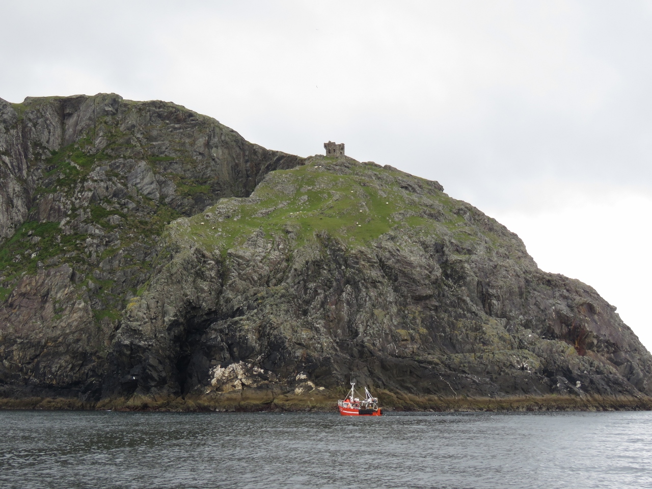 |
Carigan Head
Position: -8 41.30, 54 37.21
Fishboat working below the Napoleanic signal tower on Carigan Head.
|
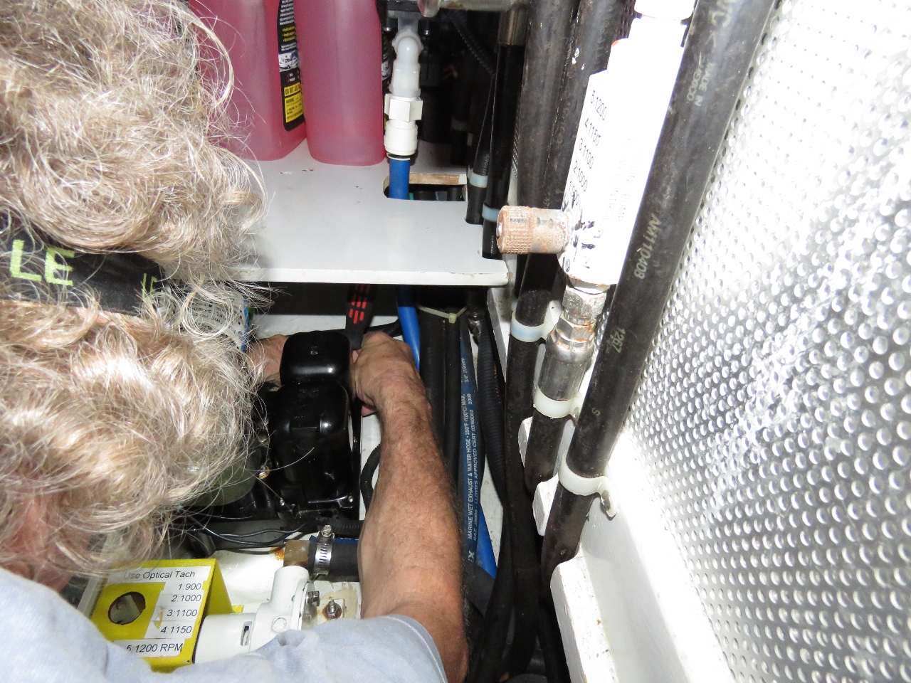 |
Bilge Pump
Position: -8 37.89, 54 37.56
On our North Atlantic crossing, we ran into an issue where the main bilge pump was pumping water but it was falling behind. We opened the pump up and found the rivet that hold the pump output valve together had failed due to corrosion. The pump was pumping fine but the output was less than it should have been.
Once we changed the valve, the pump was again keeping up with the problem. It’s a bit of a fragile design in that these valves can fail any time. This afternoon, after anchoring for the night at Teelin Habour, James cleaned the engine room and again noticed pump output is poor. It was exactly the same problem as before where the pump was pumping fine but just seemed “slow”. |
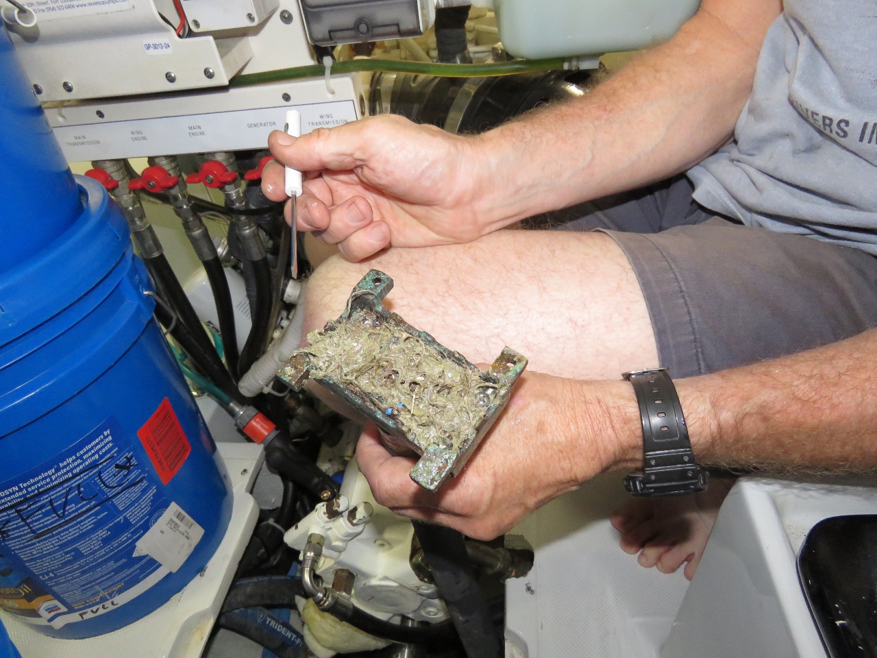 |
Clogged
Position: -8 37.89, 54 37.56
James took the pump apart expecting to see another valve problem but it was fine. The strainer was clear and unplugged so we ended up thinking we might have been wrong about the pump output being lower than normal. It turns out that, in addition to the strainer higher up in the hose system, there is a course strainer at bottom of the bilge and it had become partially plugged with debris.
We suspect that while we were taking on so much water (Alarms at 1:15am), build debris, hair, etc. was washed down into the bilge. This is yet another way for this pump to end up producing far less volume. There just seem to be far to many ways for that pump to not be there when we need it. We plan to supplement it with a more reliable and far higher volume pump as soon as possible. |
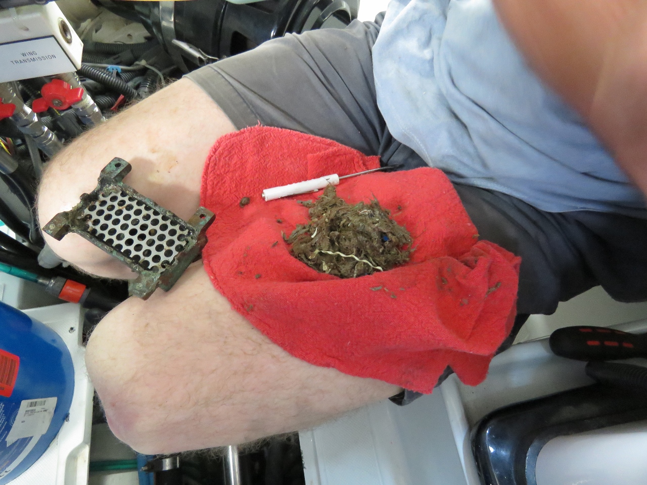 |
Debris
Position: -8 37.89, 54 37.56
It turns out if you fill the bilge area of an eight-year-old boat with water and it gets viguoursly sloshed around by the storm, you can catch quite a bit of debris in what we thought was a pretty clean boat. We will move to a bilge pump system that can pump water and debris in far higher quantities and is much more reliable.
|
 |
Fishery Patrol
Position: -8 37.89, 54 37.56
A capable-looking Fishery Patrol boat at Teelin Harbour.
|
 |
Ominous Cloud
Position: -8 37.88, 54 37.56
We’ll stay in Teelin Harbour for a few days while a system passes through. This rather ominous-looking cloud might be the start of that system.
|
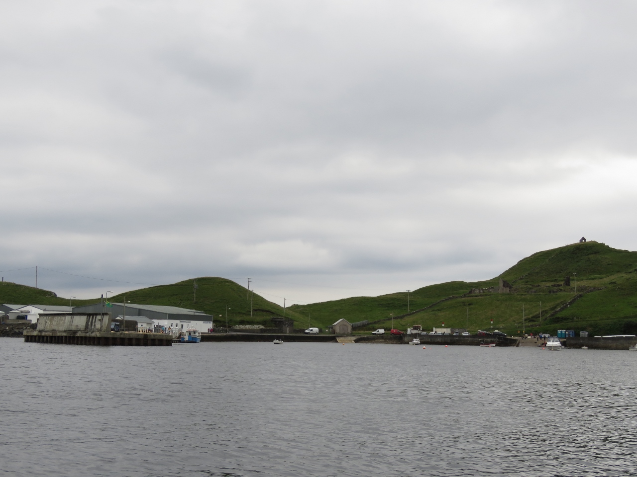 |
Teelin
Position: -8 37.89, 54 37.56
Looking south to the docks in Teelin Harbour. Note the high wall protecting the docks from southerly weather—the harbour is exposed in that direction. We are expecting strong northerly winds over the next few days, so should have good shelter here.
|
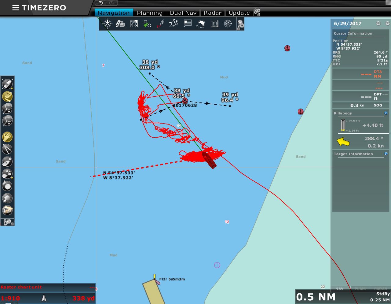 |
Boat Position
Position: -8 37.85, 54 37.54
You can see from the chartplotter screen shot that when we initially anchored, the boat mostly was sitting west of and not far from where we dropped the hook. As the winds came up from the north, we were pushed directly south of the anchor and much further from it.
|
 |
Wind
Position: -8 37.83, 54 37.54
About 36 hours ago, the morning after we arrived in Teelin, the winds picked up from the north as expected. Since then we’ve been seeing steady 20-knot northerly winds with gusts into the 40s.
|
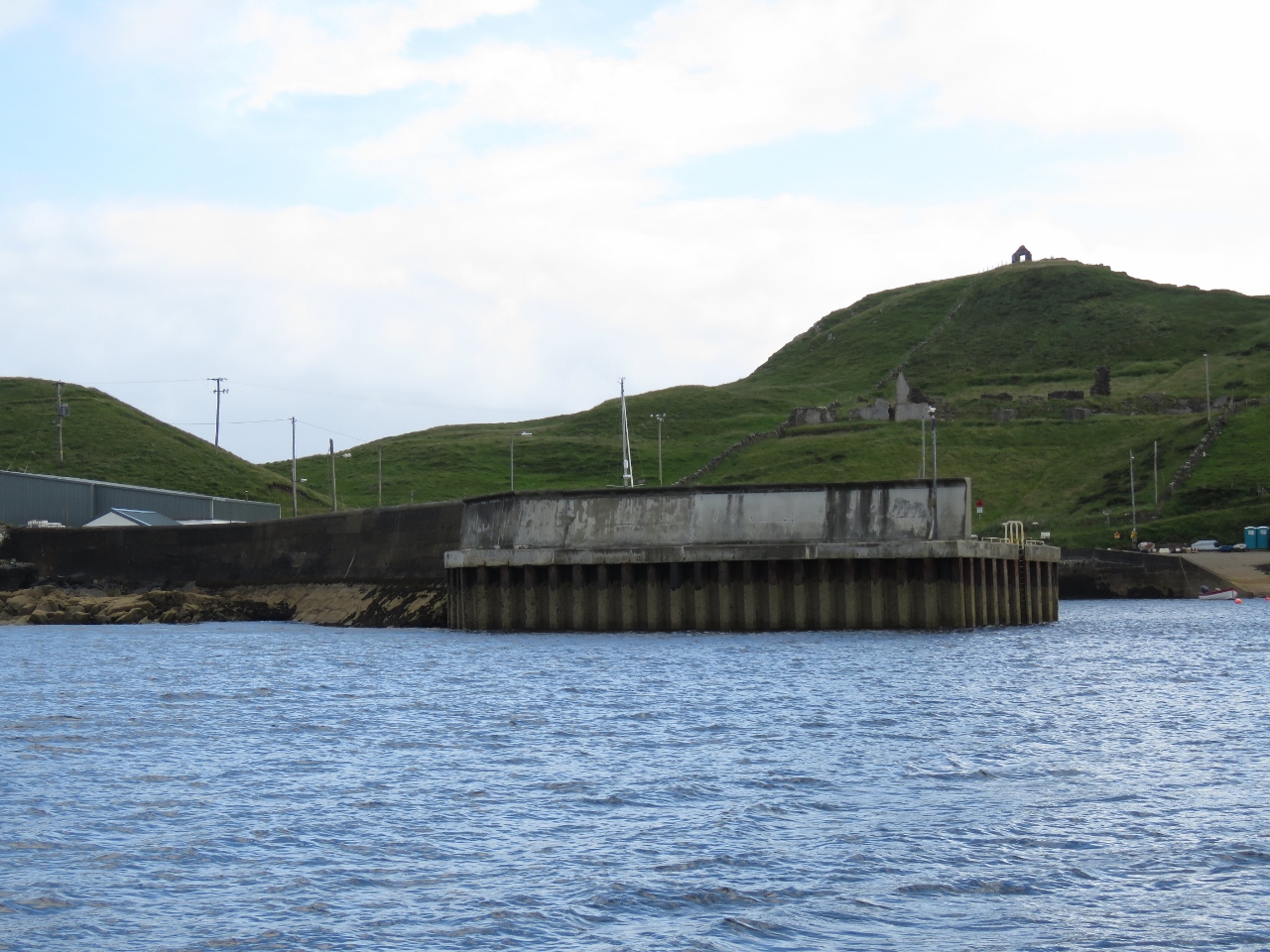 |
Wall
Position: -8 37.82, 54 37.55
With the winds pushing us south, we’re getting a better view to that wall protecting the dock at Teelin Harbour. Needing a wall that big means conditions must get pretty nasty here in a southerly blow.
|
 |
Lunch
Position: -8 37.81, 54 37.55
The winds are still up, but with little fetch conditions are reasonably calm in our anchorage and the cockpit is sheltered enough to have lunch on deck.
|

|
Click the travel log icon on the left to see these locations on a map, with the complete log of our cruise.
On the map page, clicking on a camera or text icon will display a picture and/or log entry for that location, and clicking on the smaller icons along the route will display latitude, longitude and other navigation data for that location. And a live map of our current route and most recent log entries always is available at http://mvdirona.com/maps. |
If your comment doesn't show up right away, send us email and we'll dredge it out of the spam filter.