Our stop at Arranmore Island was as much to avoid an upcoming weather system as it was to tour the island. But it ended up being an incredible stop. We really enjoyed our bike tour of the island and a dinghy trip to Burtonport on the mainland, met many of the locals, and really had a good time.
Trip highlights from July 3rd through 6th, 2017 follow. Click any image for a larger view, or click the position to view the location on a map. And a live map of our current route and most recent log entries always is available at http://mvdirona.com/maps
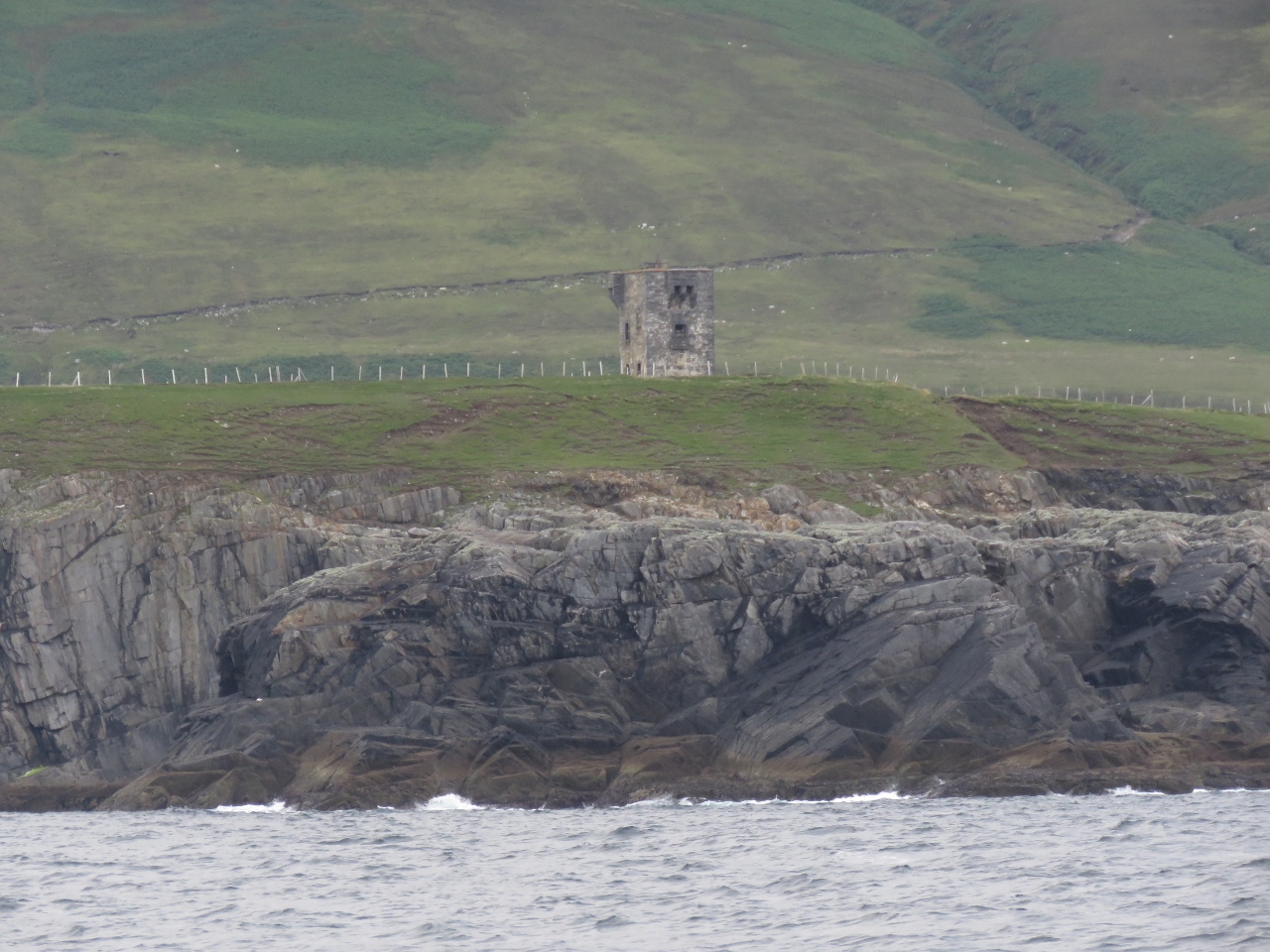 |
Malin Beg Head
Position: -8 48.68, 54 39.82
The Napoleanic signal tower at Malin Beg Head as we depart Teelin for Arranmore Island.
|
 |
Nuclear Lighthouse
Position: -8 48.68, 54 40.02
The Commissioners of Irish Lights have used the light at Rathlin O’Birne as a test-bed for new and experimental power sources and installed six different methods since 1900. The most unusual was an isotope powered thermo-electric generator known as RIPPLE X (Radio Isotope Powered Prolonged Life Equipment-Mark Ten). Irish Light’s only nuclear-powered light operated from 1974 until 1987, when the generator output was longer sufficient to power the light and it was replaced by short-lived wind power and eventually solar panels in 1993.
|
 |
Black Rock Point
Position: -8 34.58, 54 58.61
Craggy, steep cliffs behind a spire at Black Rock Point at the southwest corner of Arranmore Island.
|
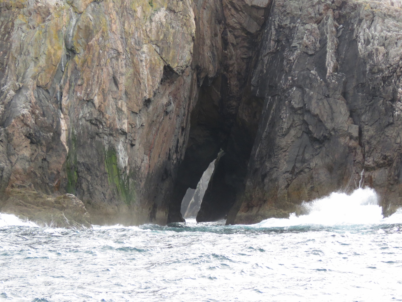 |
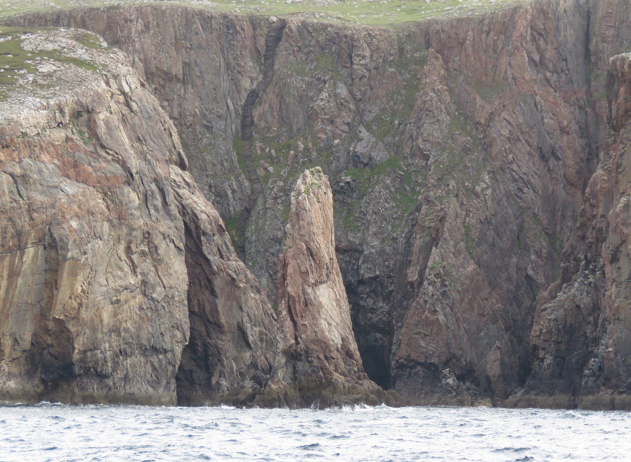
Illanaran Island
Position: -8 34.70, 54 58.76
Sea arch through Illanaran Island off Arranmore Island.
|
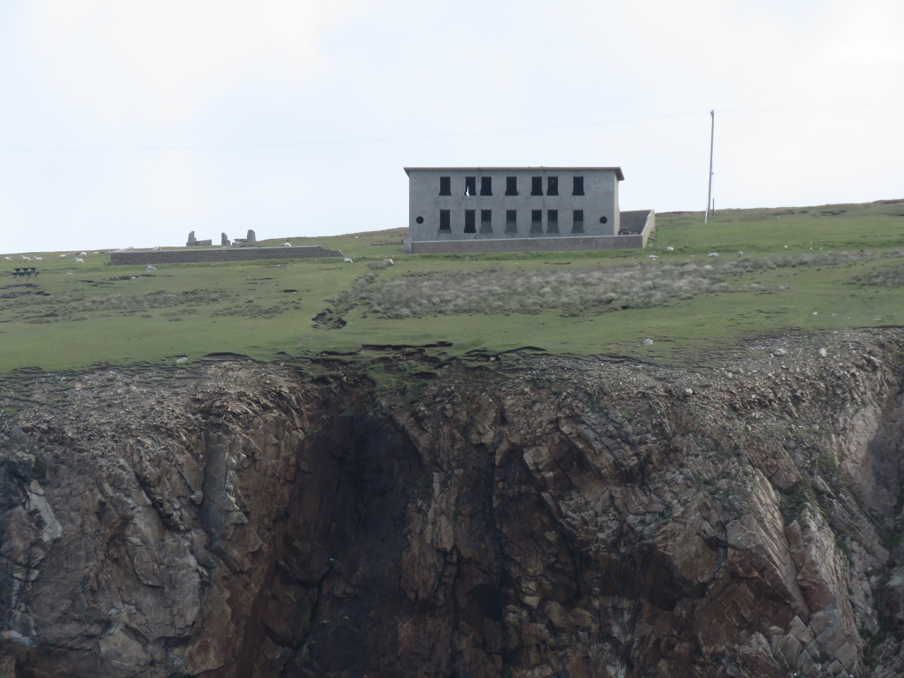 |
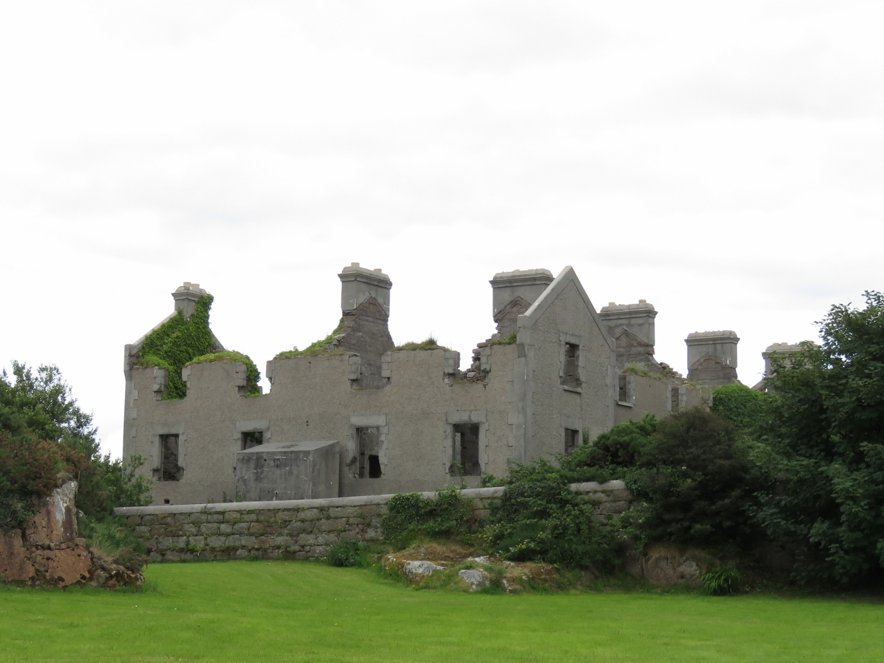
Coast Guard
Position: -8 34.07, 55 0.57
The old Coast Guard station at the northwest corner of Arranmore Island. As were many in Ireland, the station was burned and abandoned during the Irish War of Independence, fought between 1919 and 1921.
|
 |
Rinrawros Point
Position: -8 34.23, 55 0.81
A light was first lit in 1798 at Rinrawros Point on the northwest corner of Arranmore Island. The current structure was built in 1859.
|
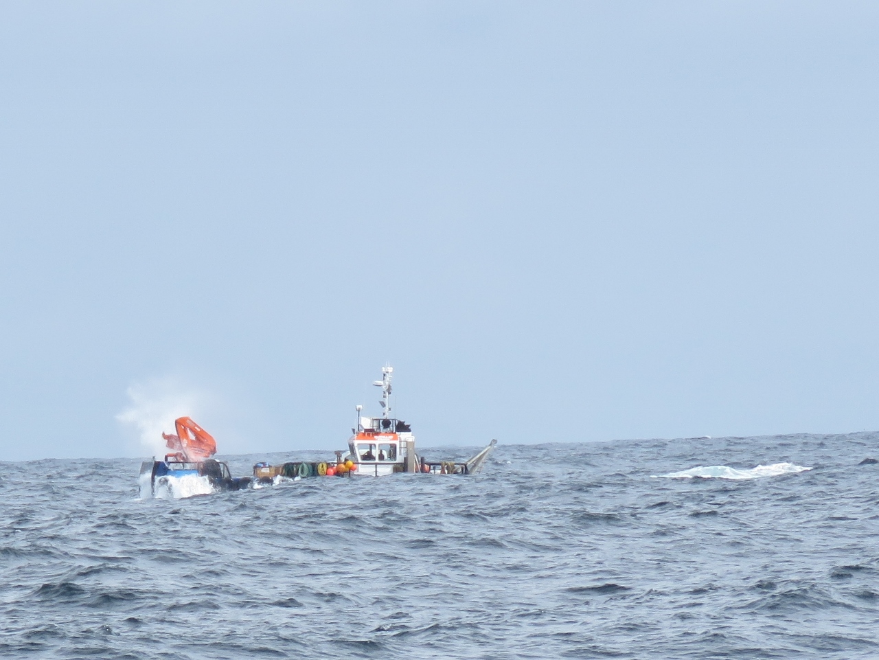 |
Swell
Position: -8 33.74, 55 1.24
This landing craft was almost disappearing in the big swell off the north end of Arranmore Island.
|
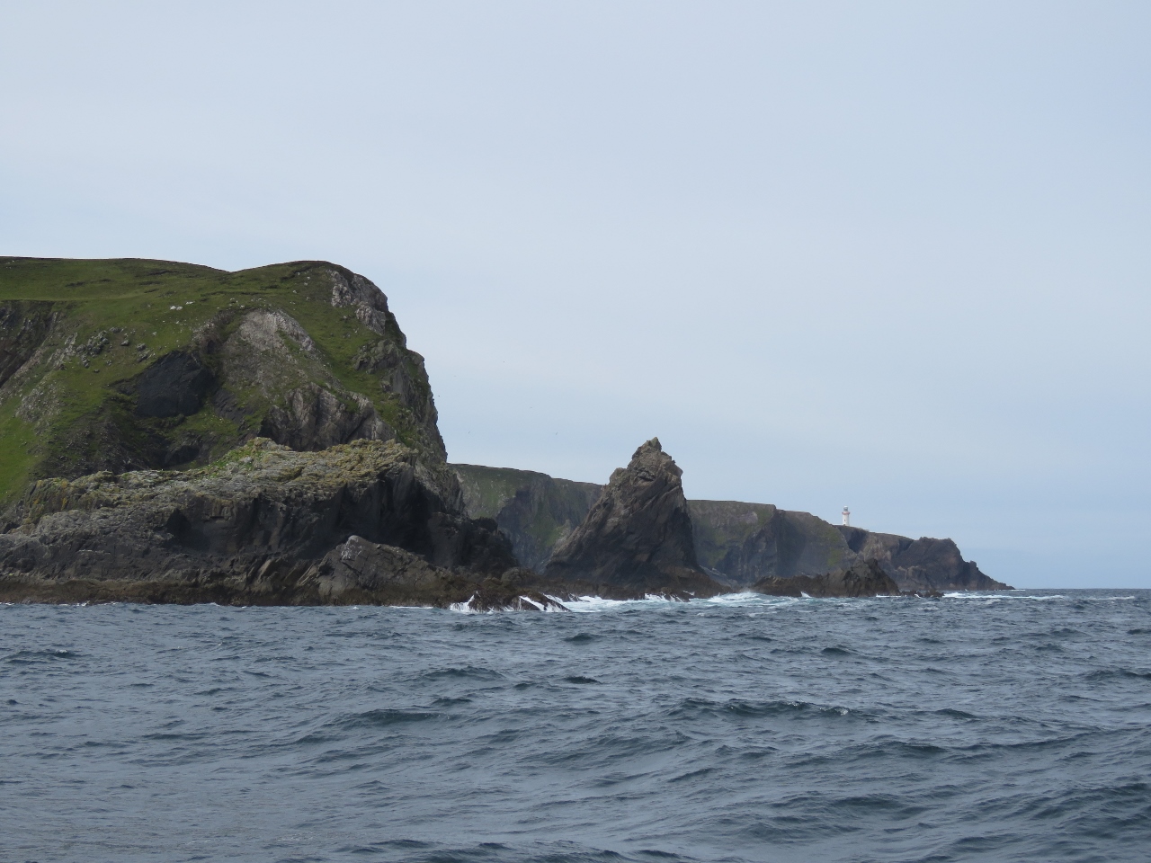 |
Torneady Point
Position: -8 31.97, 55 1.56
Looking southwest from Torneady Point to the lighthouse on Rinrawros Point.
|
 |
Beacon
Position: -8 29.05, 54 59.96
Marker beacon guiding us into the anchorage at Aran Road.
|
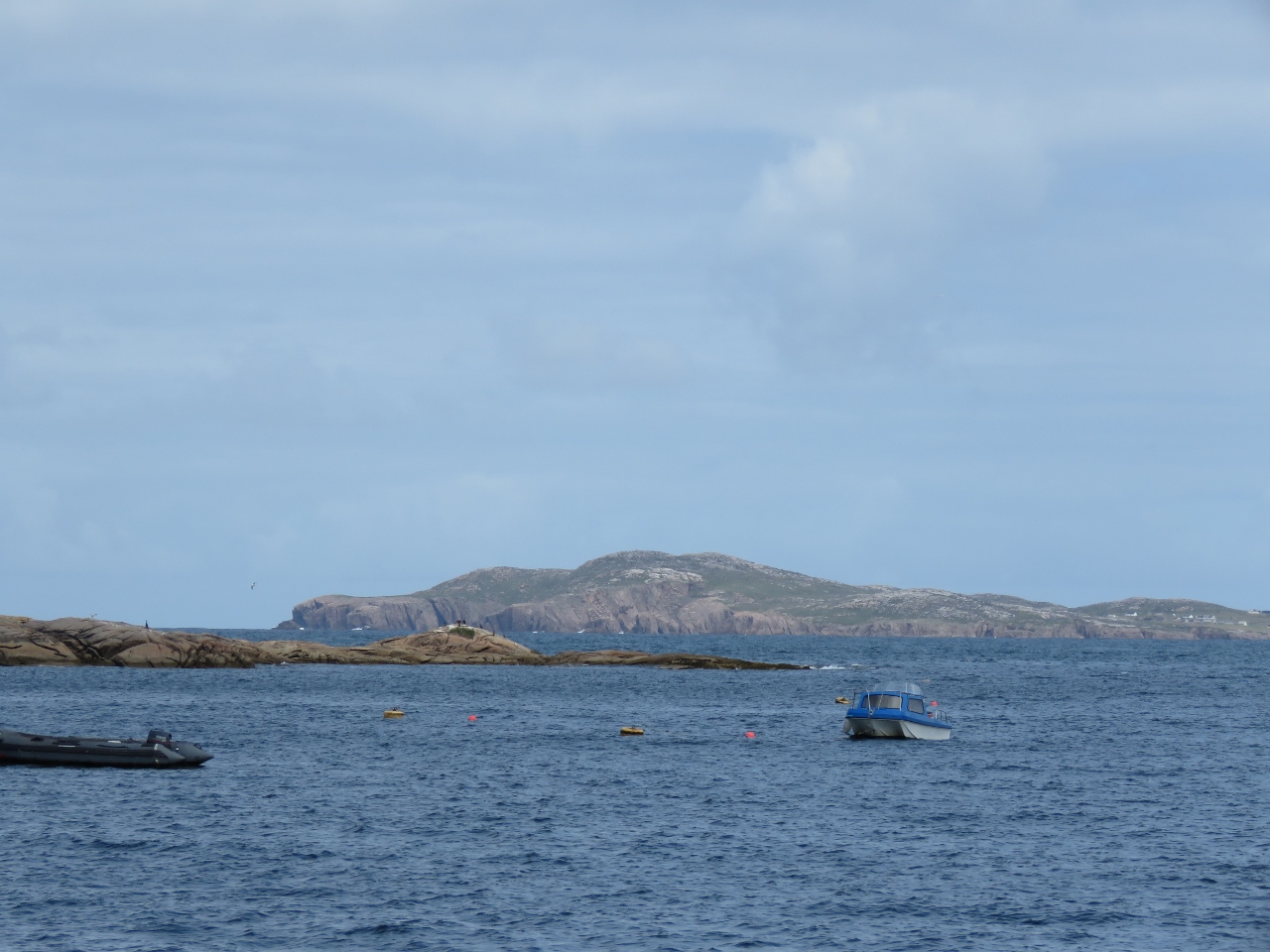 |
Owey Island
Position: -8 29.56, 54 59.51
Looking north to Owey Island from the anchorage at Aran Road.
|
 |
Loads
Position: -8 29.58, 54 59.50
A battery on-off switch for the tender is a good idea for safety reasons and to prevent loads from drawing down the battery unexpectedly. We routinely turn off the battery switch when not using the tender. Several loads on our tender are directly connected to the battery, however, rendering the off-on switch ineffective. We’ve had situations when the bilge pump sticks on and by the time we’re back to the tender, the battery is flat. We carry a spare battery in the tender for this reason.
Today we replaced the start battery and moved all electrical loads to the battery switch to eliminate possible current leaks. This also protects the start battery should the bilge pump get stuck on. The downside to this approach is the bilge pump will not run when the battery switch is off. |
 |
Battery Testing
Position: -8 29.56, 54 59.51
Our backup battery for the tender couldn’t start the motor, so James is investigating why. The battery tester indicated it was at 70% charge, so that wasn’t the problem.
|
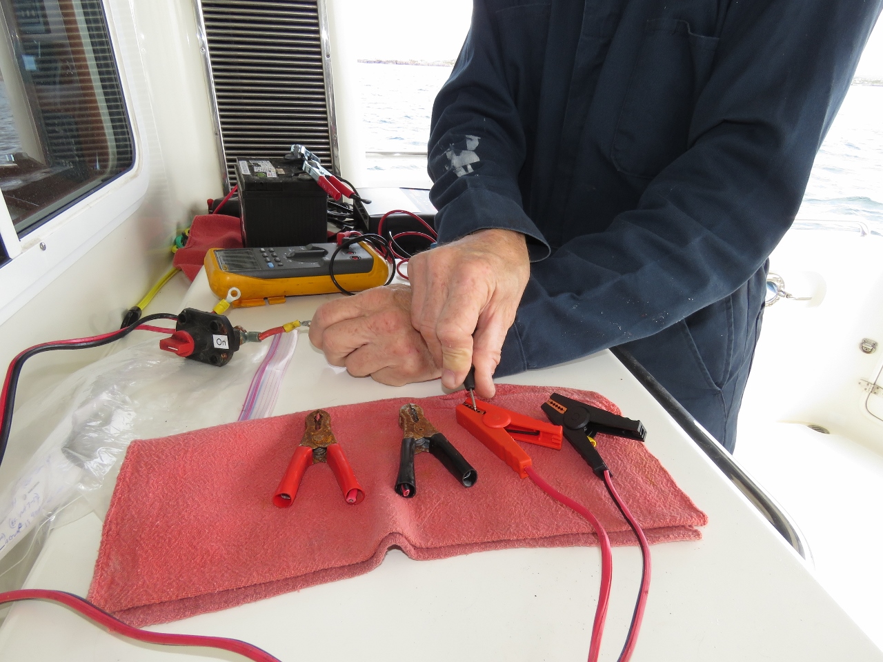 |
Battery Clips
Position: -8 29.56, 54 59.51
Further testing found the battery cables at 3M ohms. The problem was the alligator clamps. which had rusted. After changing them for new ones, testing yielded a fraction of an ohm and it all works now
|
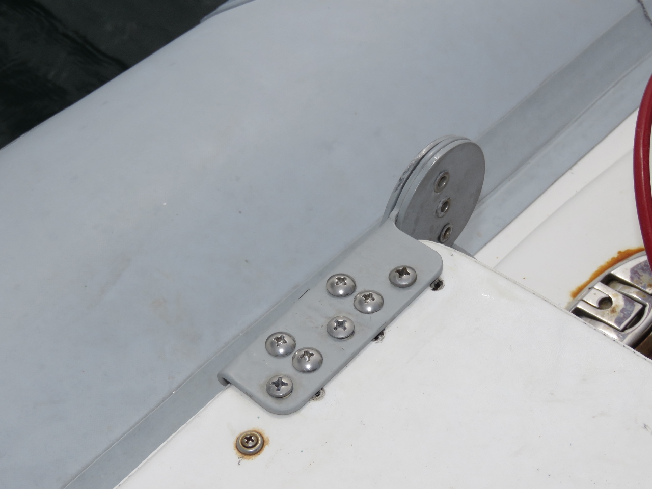 |
Seat Back
Position: -8 29.57, 54 59.50
The seat back on our AB VST 12 tender is loose because the wood is rotting. It is difficult to change because it is inside the seat upholstery, so we put four more screws in different locations to hold it more securely. This worked well, but eventually will stop working. The tender is 8 years old and goal is for it to last 10 years. Likely it will be a struggle to get it there—it’s lived a pretty tough life.
|
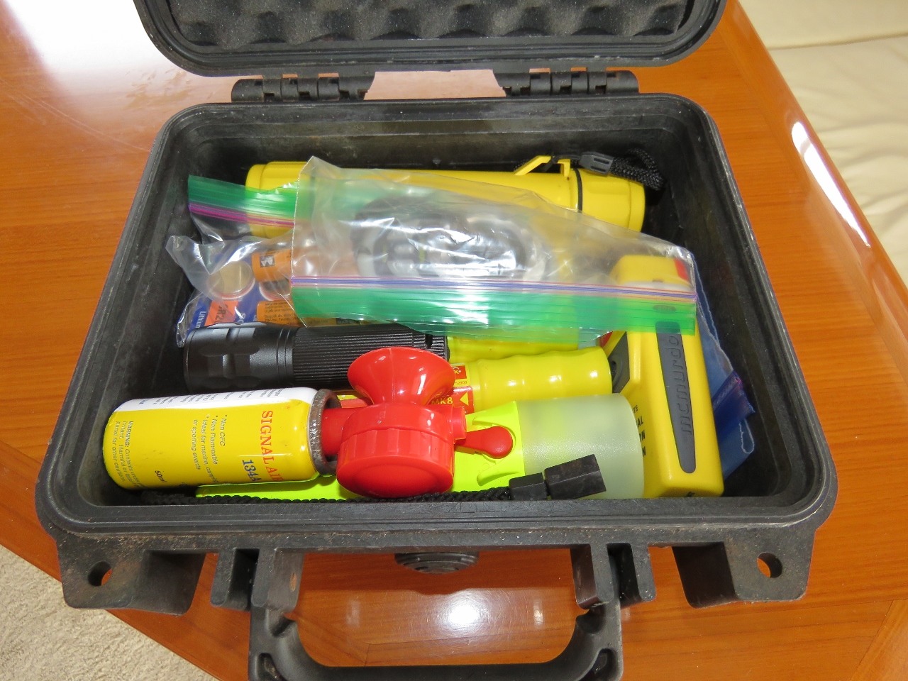 |
Emergency Kit
Position: -8 29.58, 54 59.50
We keep an emergency kit in the tender inside a waterproof case that includes flares, flashlights, a GPS, a depth-sounder, a personal EPIRB and a horn. Today we serviced the kit, replacing all batteries and testing all equipment.
|
 |
At Anchor
Position: -8 29.54, 54 59.53
At anchor on Aron Roads with Arranmore Island behind us.
|
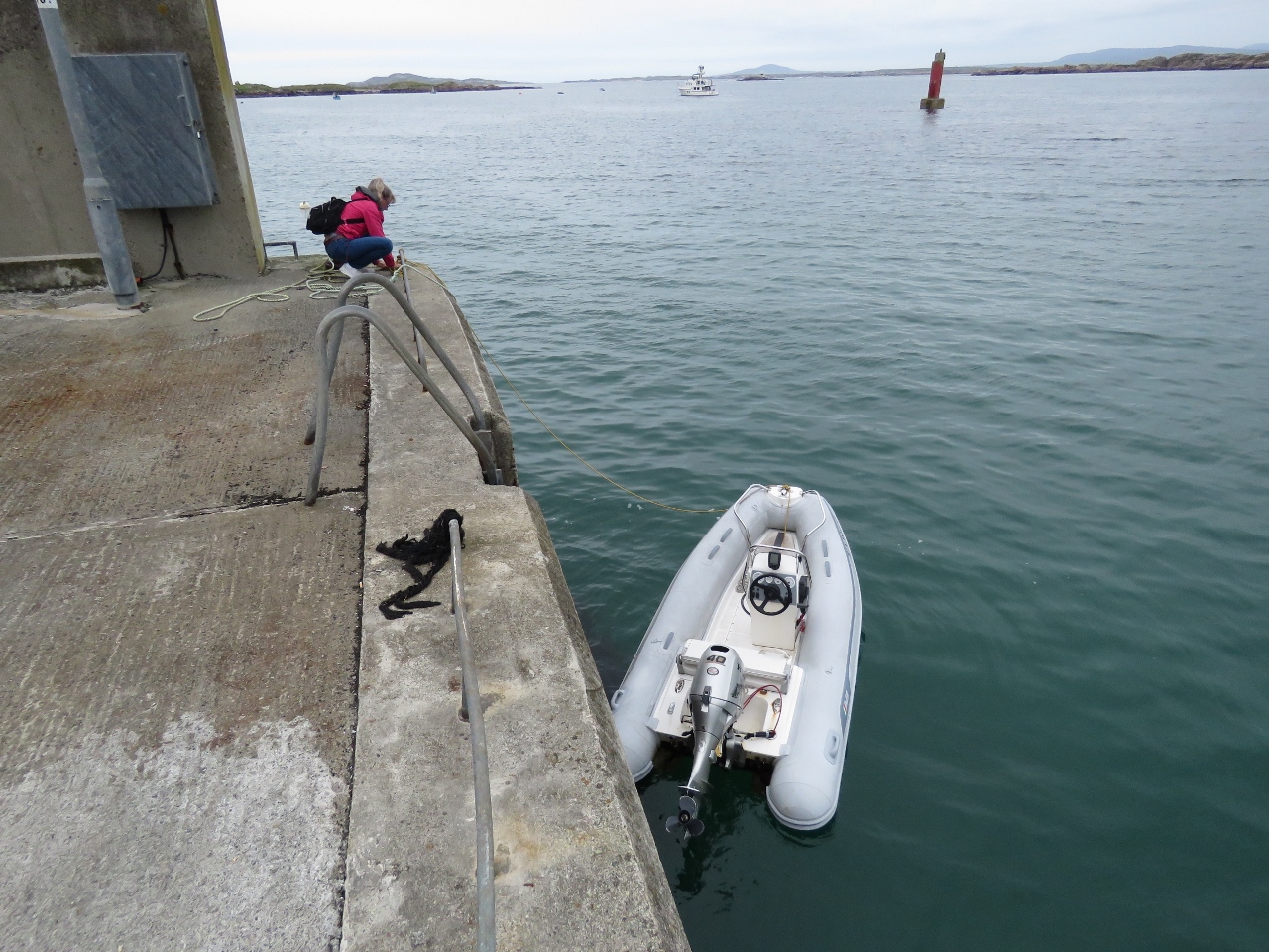 |
Pier
Position: -8 29.76, 54 59.39
Tying the tender off to the pier at Leabgarrow on Arranmore Island.
|
 |
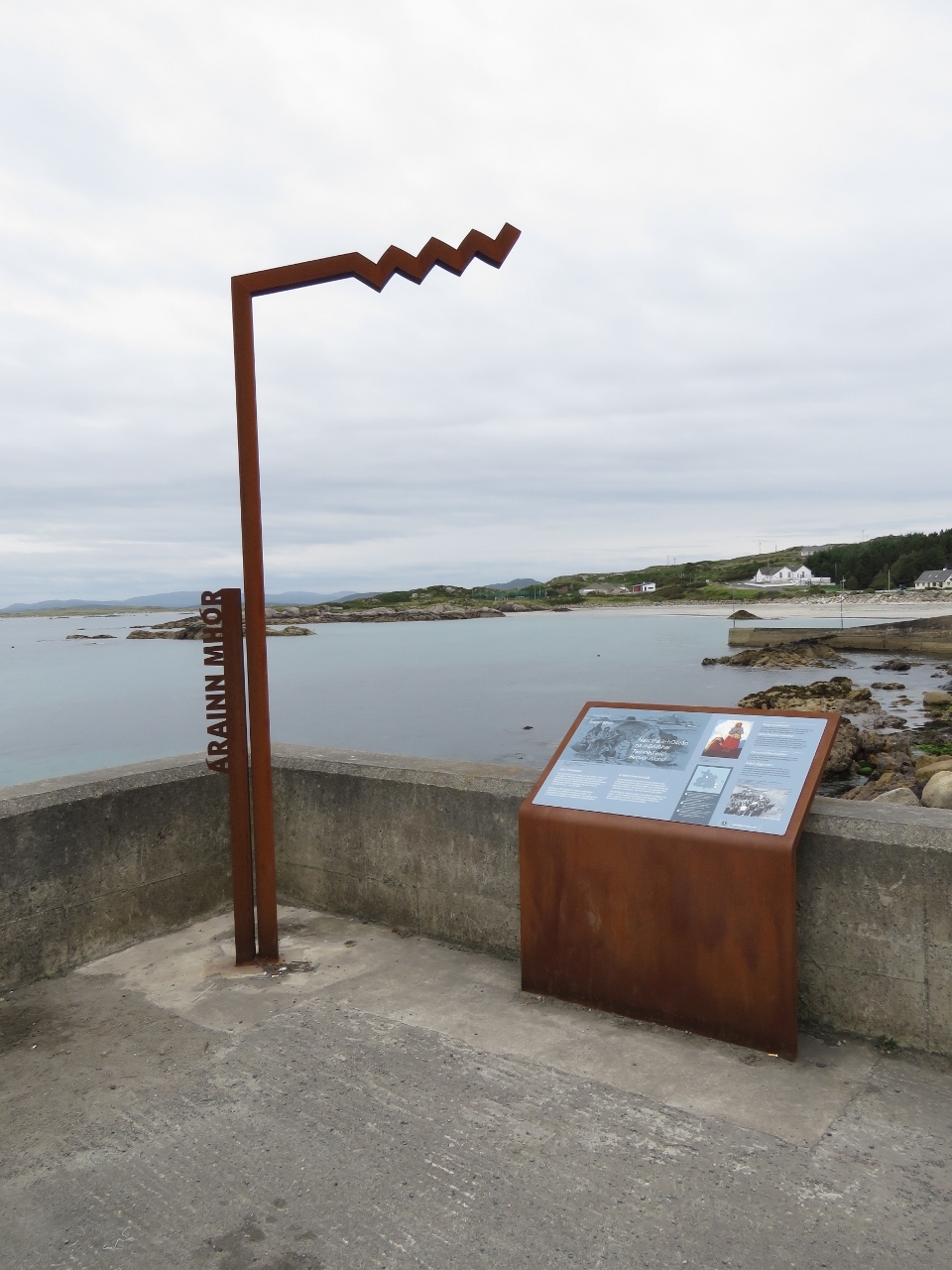
Welcome
Position: -8 29.82, 54 59.38
A stone at the foot of the dock welcomes visitors Oilean Arainn Mhoir. Oilean is Irish for Island, and Arainn Mhoir is typically translated to Arranmore. But the official name of the island is not clear. The Ordnance Survey and the charts label the island as Aran, locals refer to it as Arranmore and the County Council spell it Aranmore.
|
 |
Wild Atlantic Way
Position: -8 29.82, 54 59.37
Another “Wild Atlantic Way” sign, part of a successful marketing campaign to promote tourism along Ireland’s West Coast.
|
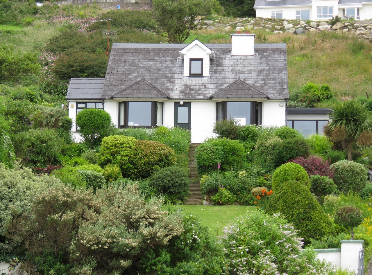 |
Garden
Position: -8 29.82, 54 59.23
A traditional English country garden on Arranmore Island.
|
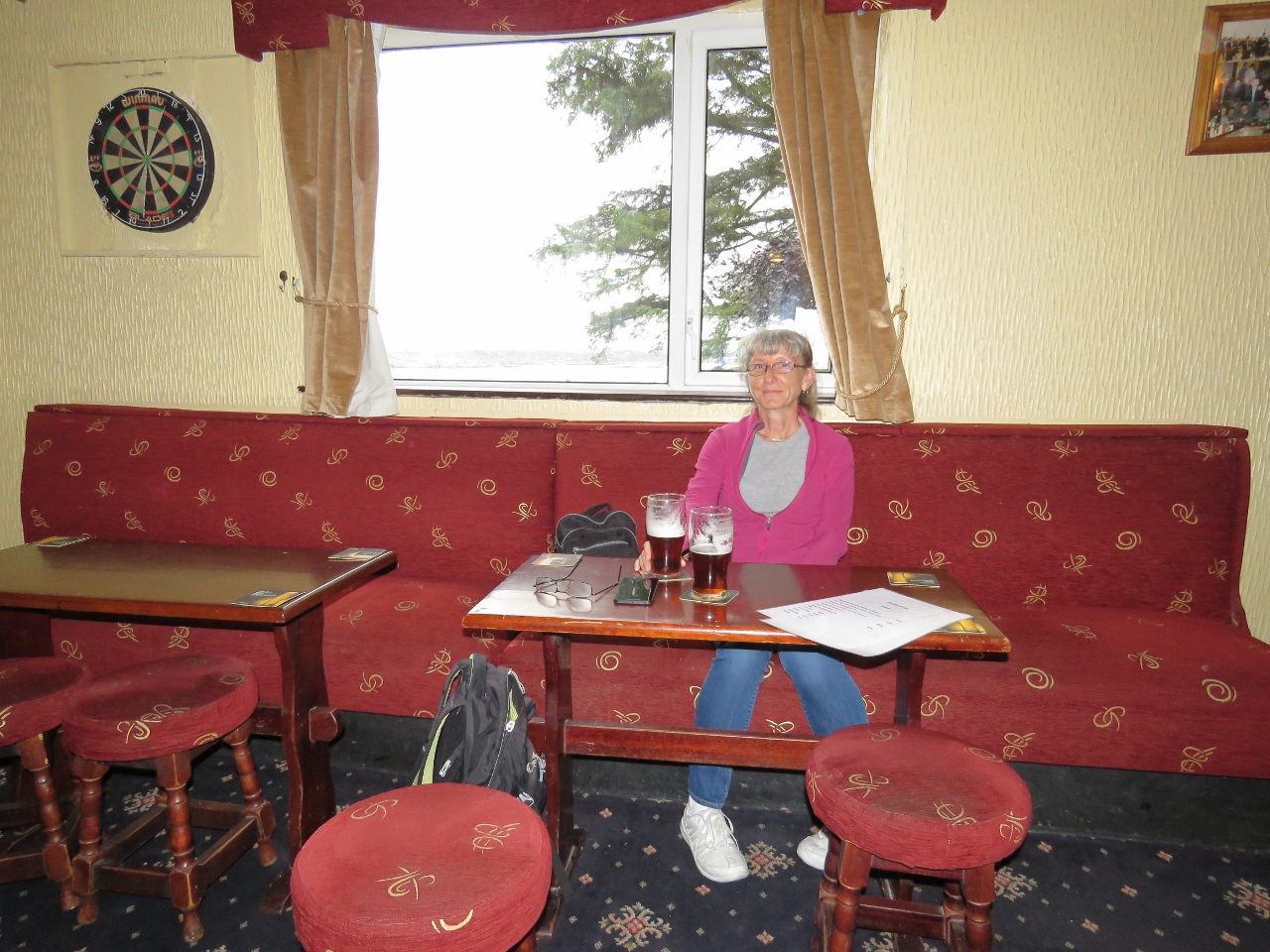 |
The Glen
Position: -8 30.00, 54 59.39
We had a good dinner overlooking the lawn and the bay at the Glen Hotel.
|
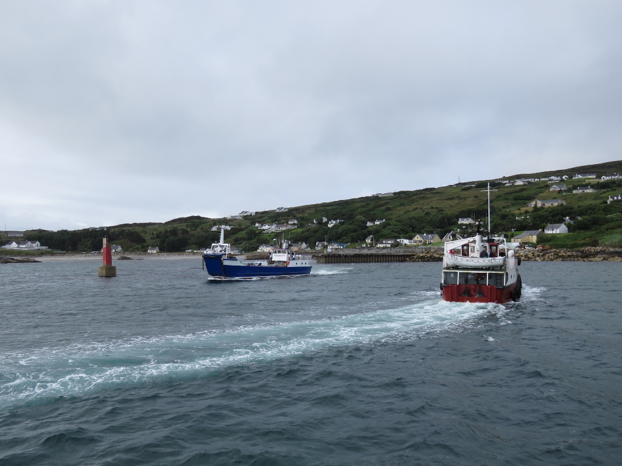 |
Ferries
Position: -8 29.60, 54 59.50
Two different companies operate ferries to Arranmore Island from Burtonport on the mainland. We were surprised that there was enough business to support that. Here the two ferries are passing in the narrow channel to the pier on Arranmore.
|
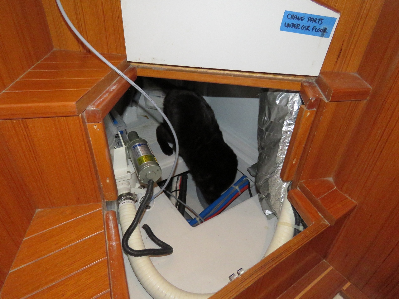 |
Spitfire
Position: -8 29.61, 54 59.50
We had some of the storage space opened up under the pilot house stairs to investigate routing for a wire run. Spitfire, as usual, immediately crawled inside to check it out.
|
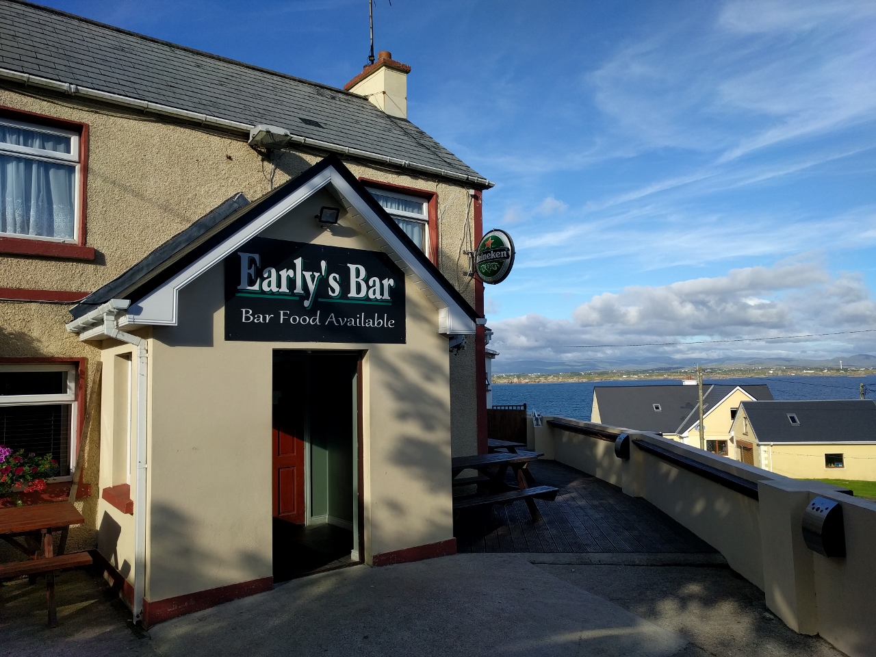 |
Early’s Bar
Position: -8 29.86, 54 59.33
We had an excellent wood-fired pizza for dinner at Early’s Bar.
|
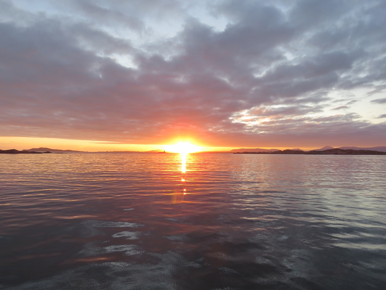 |
Sunrise
Position: -8 29.58, 54 59.51
Beautiful sunrise from the anchorage at Arranmore Island.
|
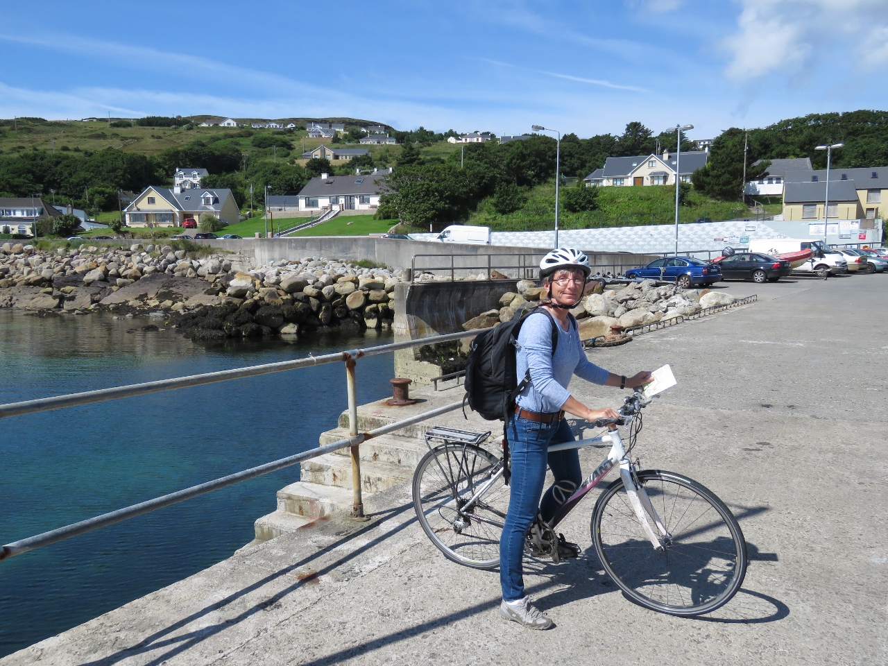 |
Bikes
Position: -8 29.79, 54 59.40
With sunny weather forecast, we ran the bikes ashore in the tender for a tour of Arranmore Island.
|
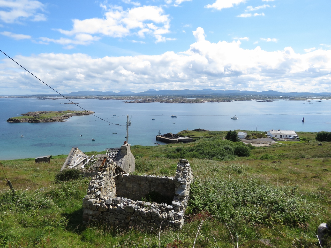 |
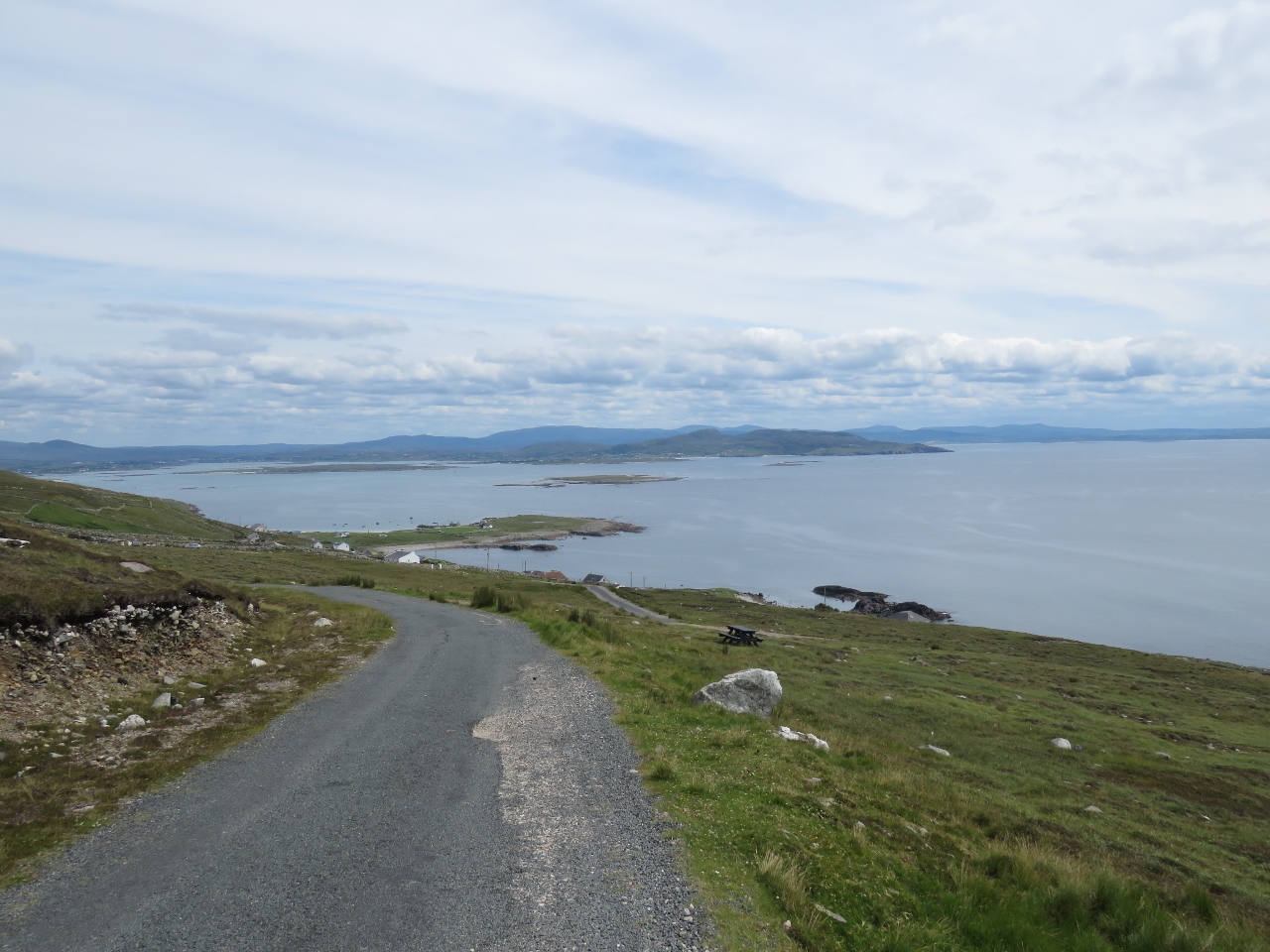
Aran Road
Position: -8 30.12, 54 59.60
The view to the anchorage at Aran Road. Dirona is the rightmost boat in the picture, just right of center. The road up from the pier was very steep and we barely made it without stopping to walk the bikes. But the view was worth it.
|
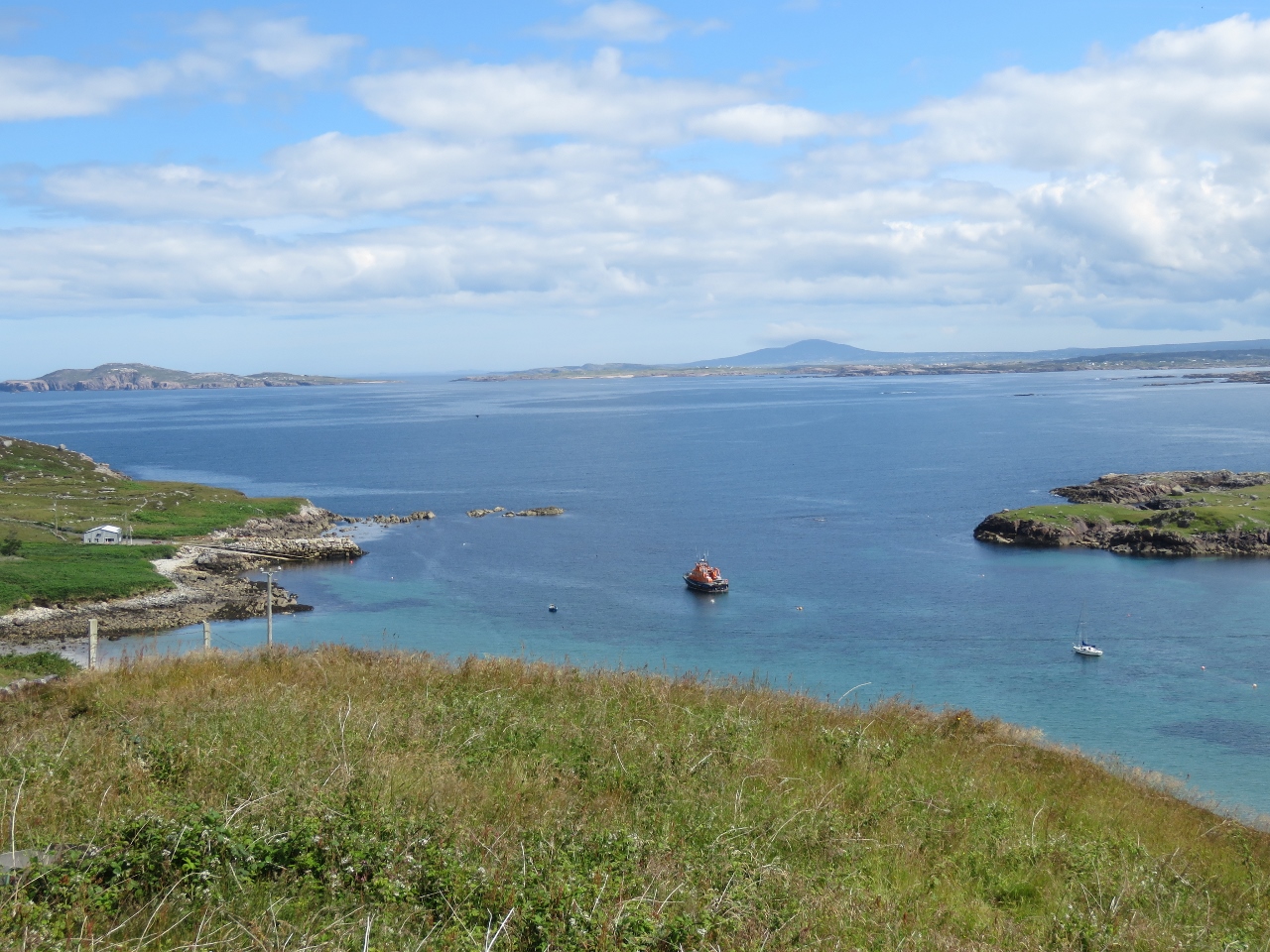 |
RNLI
Position: -8 30.12, 54 59.60
The Leabgarrow RNLI lifeboat moored on a buoy.
|
 |
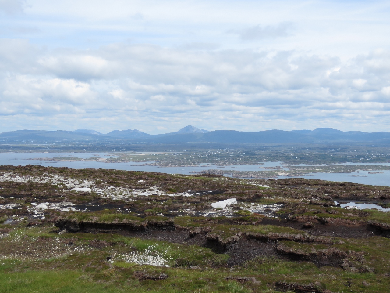
Bellachreesh Bay
Position: -8 31.00, 55 0.18
Looking across Bellachreesh Bay to Owey Island. We believe that is Errigal Mountain visible in the distance on the right.
|
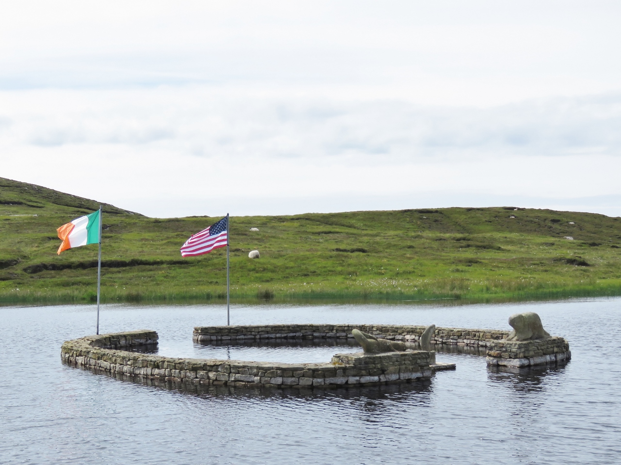 |
Memorial
Position: -8 32.05, 55 0.12
In 1851, Charlie O’Donnell and his family emigrated to Beaver Island, Michigan after being evicted from their Arranmore home during the potato famine. Many more families from Arranmore followed. The two islands have been closely linked ever since and were twinned in 2000. This memorial commemorates the connection, with a beaver statue representing Beaver Island, an otter representing Arranmore and a fish in the middle representing the connection between the two islands.
|
 |
Peat
Position: -8 32.48, 55 0.25
All over the island we saw old and new trenches dug into the peat, and bags of peat near some of the newer trenches. We speculated that it was exported for gardening, but later in the day learned the real purpose.
|
 |
God’s Tear
Position: -8 33.04, 55 0.46
On October 31st in 1982, Wayne Dickinson left Boston for Ireland in his tiny 8′ 11″ boat God’s Tear. After 142 days at sea, a Force 10 (48-55 knots) storm drove him ashore at the cliffs beyond where Jennifer is standing. He managed to get ashore and reach the lighthouse where he was later rescued, but his boat was lost. At the time, God’s Tear was the smallest craft to ever cross the Atlantic.
|
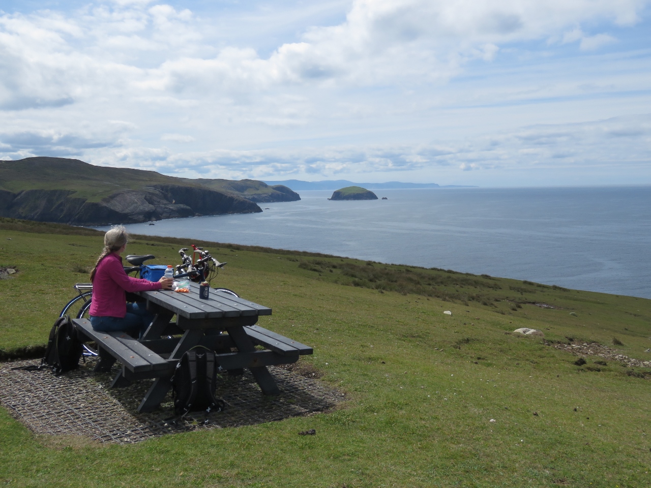 |
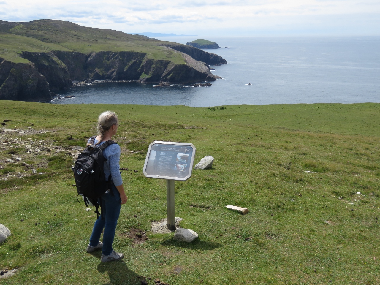
Lunch
Position: -8 33.57, 55 0.78
At Rinrawros Point we had a picnic lunch with an awesome view along the west coast of Arranmore Island.
|
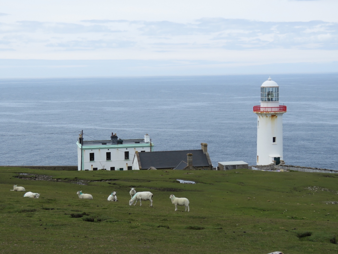 |
Lighthouse
Position: -8 33.47, 55 0.86
Looking down to the lighthouse at Rinrawros Point that we’d passed on our way to the anchorage at Arranmore Island.
|
 |
Cliffs
Position: -8 33.47, 55 0.86
A great view to the cliffs and spires along the north shore of Arranmore Island.
|
 |
Survey Plane
Position: -8 33.47, 55 0.86
A survey plane flew low over the island as we were taking in the views.
|
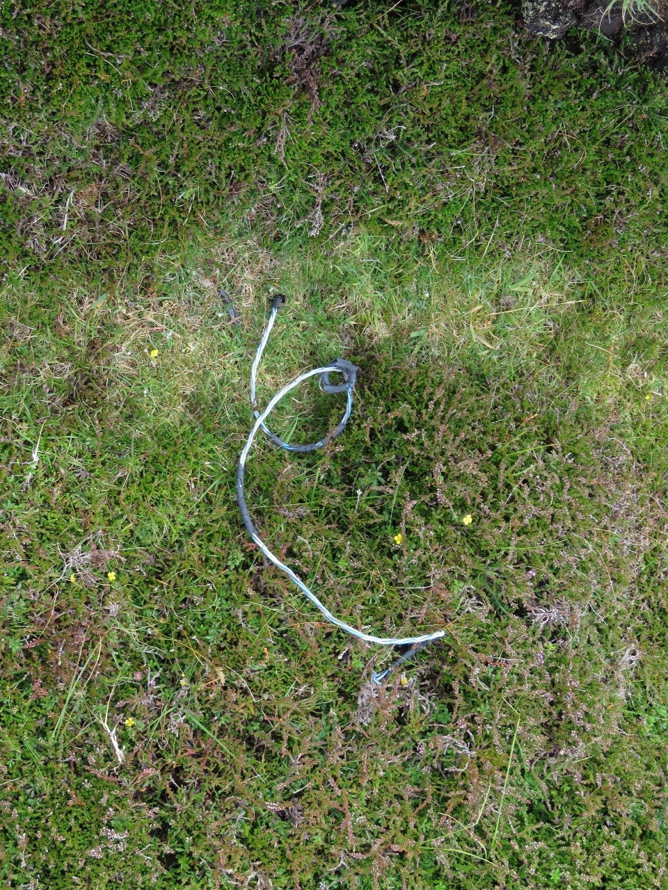 |
Wire
Position: -8 33.47, 55 0.84
We noticed this wire sticking out of the ground as we returned back to our bikes. We’re a good quarter-mile from the closest building, and couldn’t guess what it might be for.
|
 |
Coast Guard Station
Position: -8 33.52, 55 0.76
The old Coast Guard station near the lighthouse was burned and abandoned during the Irish War of Independence, fought between 1919 and 1921.
|
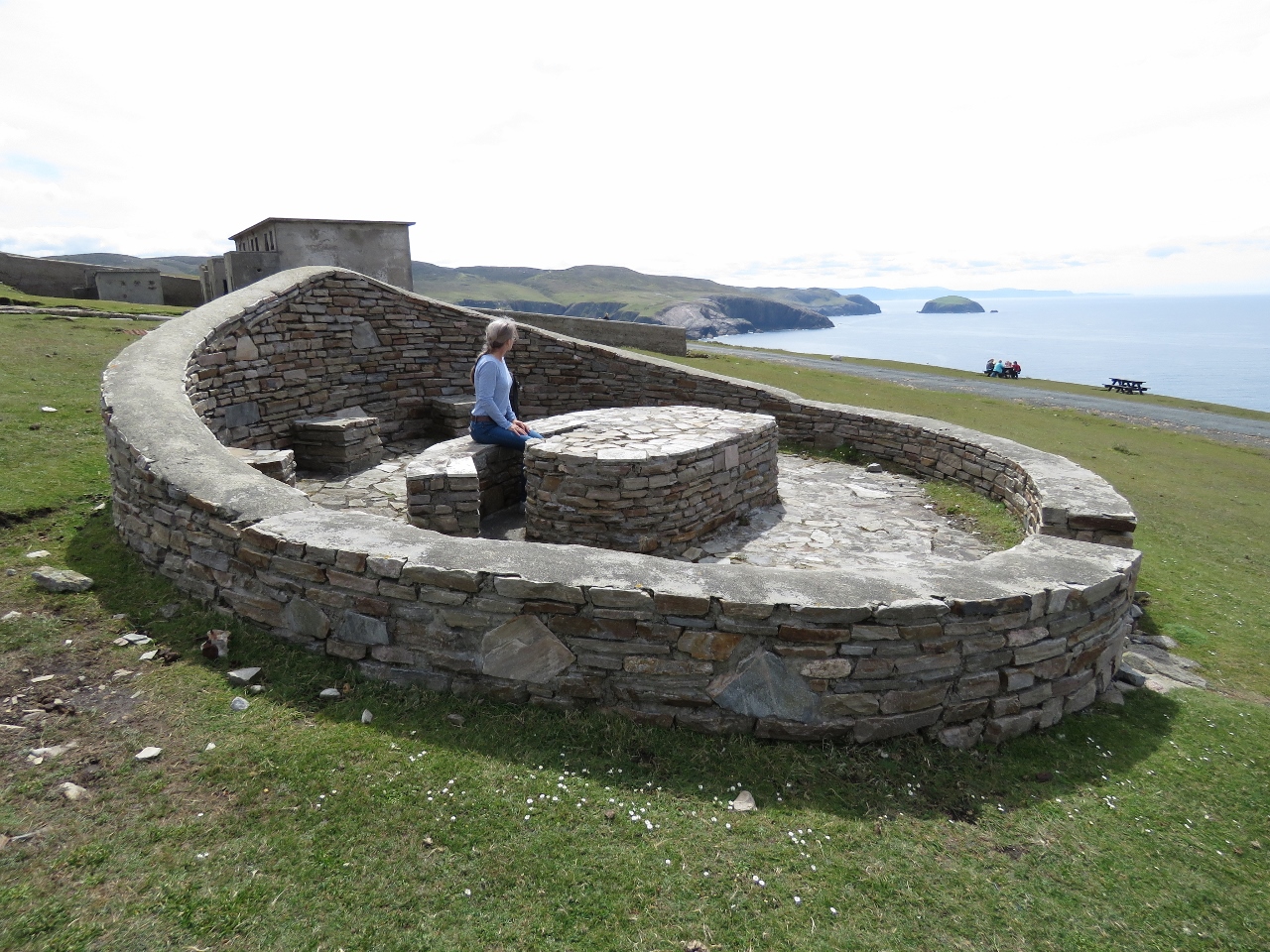 |
Ring Fort
Position: -8 33.57, 55 0.80
Several picnic areas on the island are built in the shape of a ring fort.
|
 |
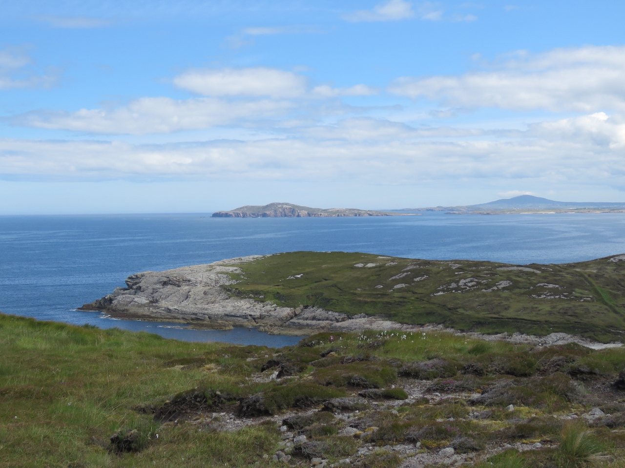
Cnoc an Iolair
Position: -8 31.81, 54 59.45
Great views across Aran Sound from 226m Cnoc an Iolair, which means “Hill of the Eagle” in Irish. This is the 2nd highest hill on the island. The official highest is point is 227m Croc na Naomh (Hill of the Saints) nearby to the southwest.
|
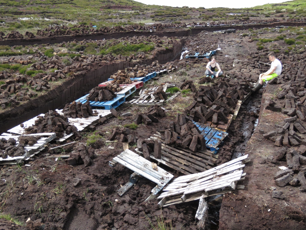 |
Harvesting Peat
Position: -8 32.63, 54 59.58
We stopped and spoke to two people who were harvesting peat and learned that they weren’t exporting it as we’d surmised, but were gathering it to burn as fuel in the winter. The peat is first dug out by hand, then stacked to dry, and eventually bagged for transport home.
|
 |
Illanaran Island
Position: -8 33.09, 54 59.20
Looking down to Illanaran Island on the southwest corner or Arranmore.
|
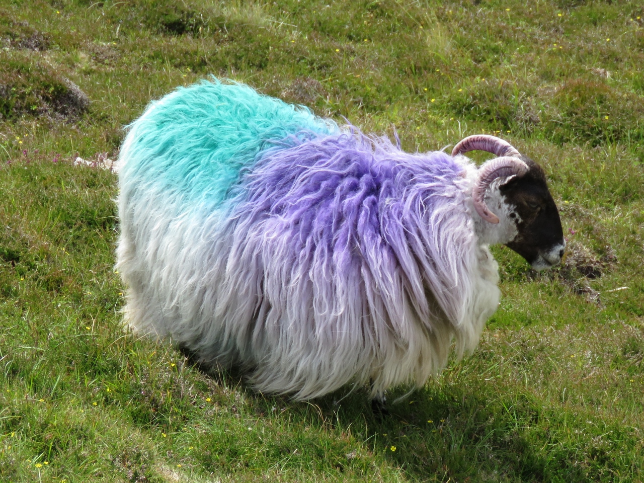 |
Sheep
Position: -8 33.02, 54 58.97
Colorfully-dyed sheep are all over the island. The colors identify the owner.
|
 |
South Sound of Aran
Position: -8 32.96, 54 58.73
The view across the South Sound of Aran as we turn the corner and head along the south shore of Arranmore.
|
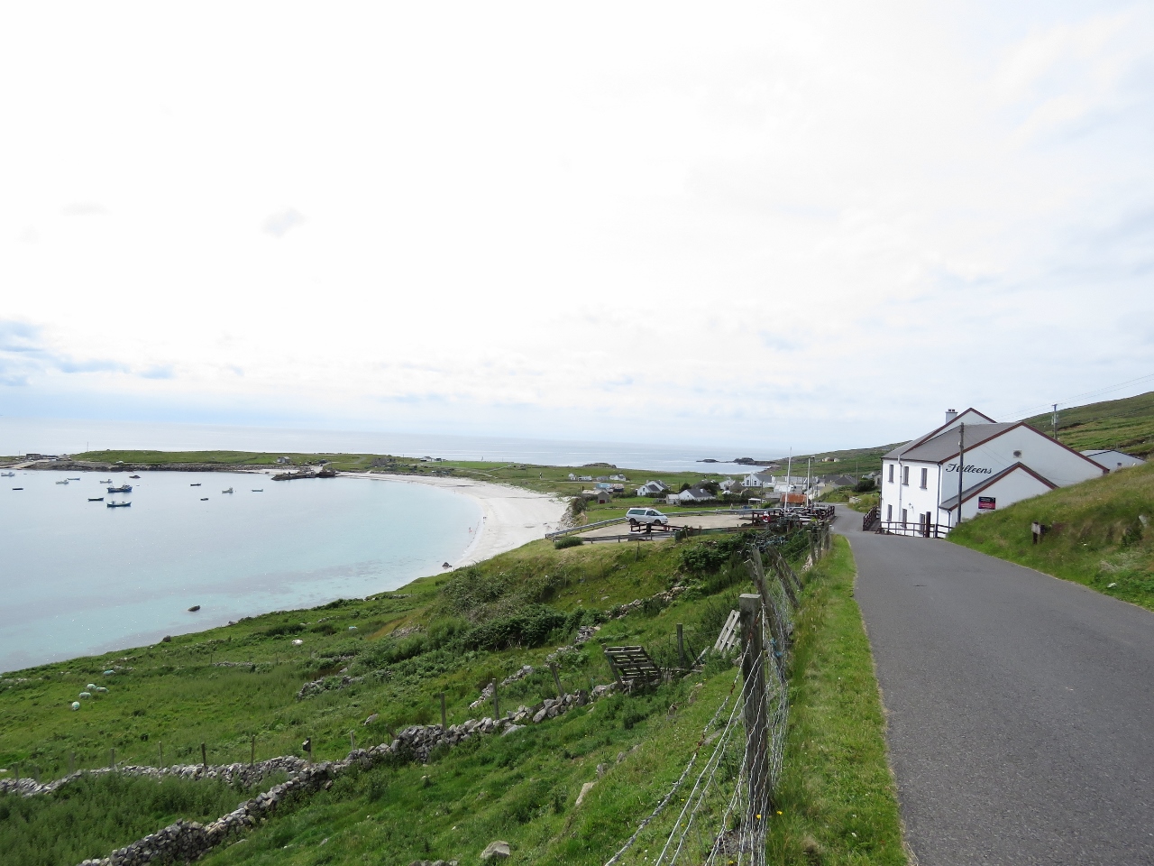 |
Killeens
Position: -8 30.89, 54 58.46
We were hoping to stop in for a pint on the deck at Killeens pub overlooking Rossillion Bay, but it wasn’t open. Possibly it was just too early in the day, but a “For Sale” sign suggests it might no longer be in business. Too bad if it’s closed permanently—it’s such a great location.
|
 |
Beach
Position: -8 29.76, 54 59.17
Several sailing skiffs had just been launched of the beach as we arrived back into Leagbarrow.
|
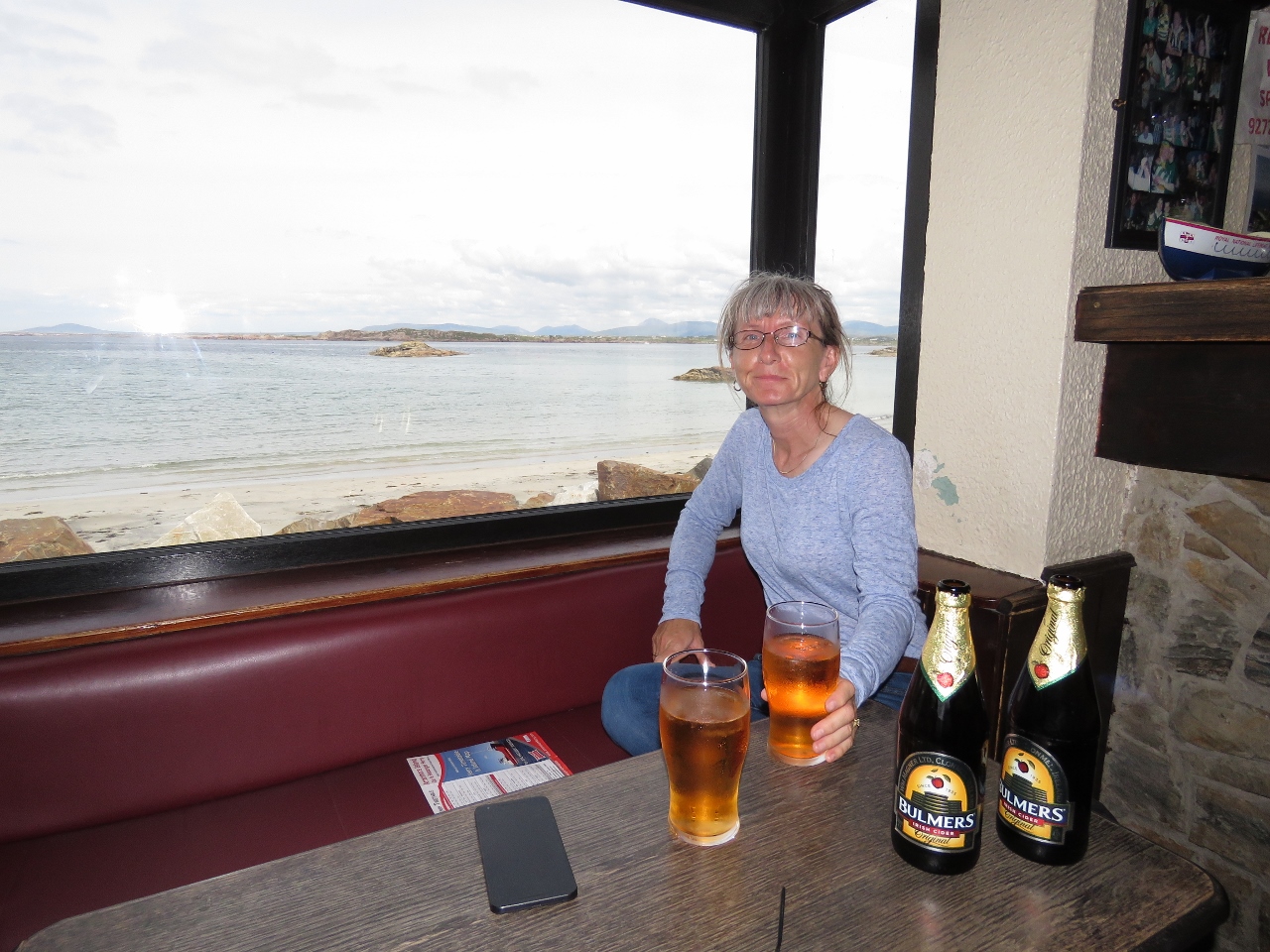 |
Phil Ban’s
Position: -8 29.83, 54 59.22
Bulmer’s Cider with a window seat overlooking the beach at Phil Ban’s pub.
|
 |
Burtonport
Position: -8 26.51, 54 58.98
We dropped the bikes off at Dirona then ran the tender along the ferry route to Burtonport on the mainland. The run was quite scenic, through a narrow and winding but very well-marked channel.
|
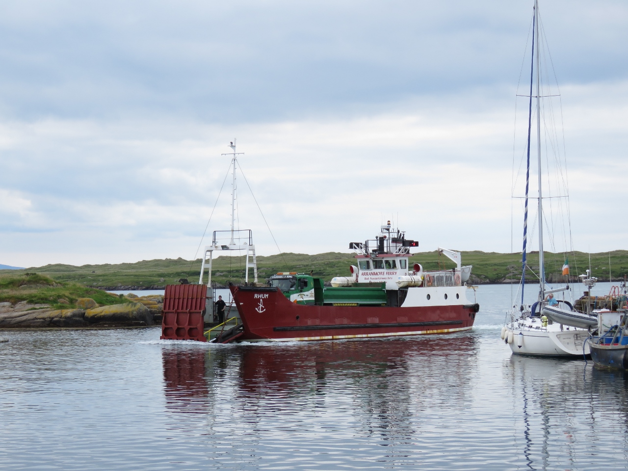 |
Red Ferry
Position: -8 26.52, 54 58.98
The blue ferry was in port as we arrived, and shortly was replaced by the red ferry. The ferries get on and off the dock efficiently. They open their hydraulic gate well before they arrive and it’s almost all the way lowered by the time the reach the pier.
|
 |
Coast Guard Station
Position: -8 26.14, 54 59.10
The ruins in Burtonport of another coast guard station destroyed during the Irish War of Independence.
|
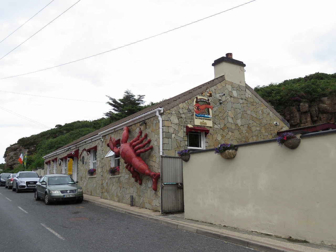 |
Lobster Pot
Position: -8 26.40, 54 59.04
“Where are we going for dinner?” asked James. “The Lobster Pot”, Jennifer replied. “Where’s that?”. “It’s the one right there with the giant lobster on the side”. “Right.”
|
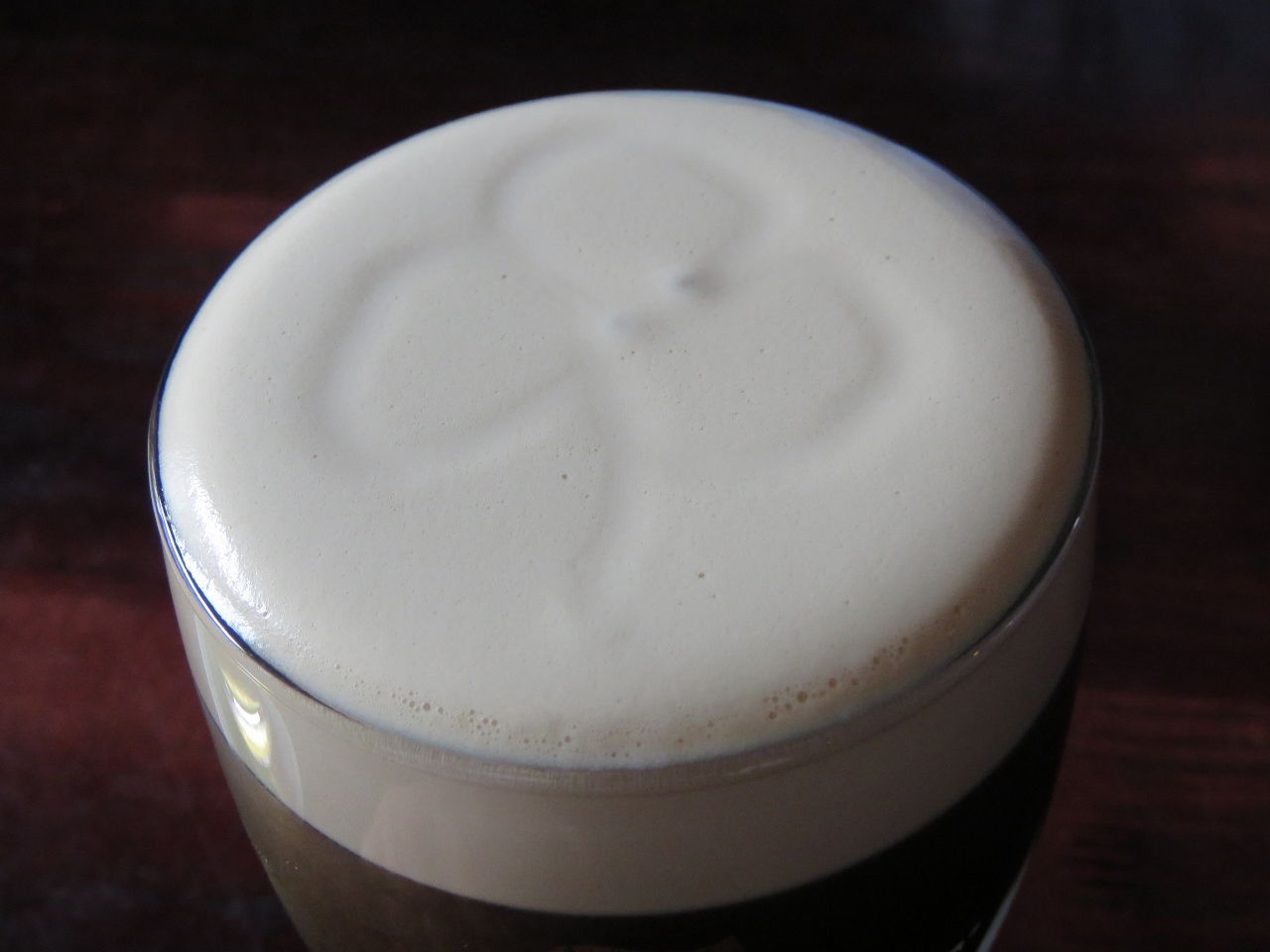 |
Shamrock
Position: -8 26.41, 54 59.03
The bartender at the Lobster Pot drew a perfect shamrock in the top of Jennifer’s Guinness.
|
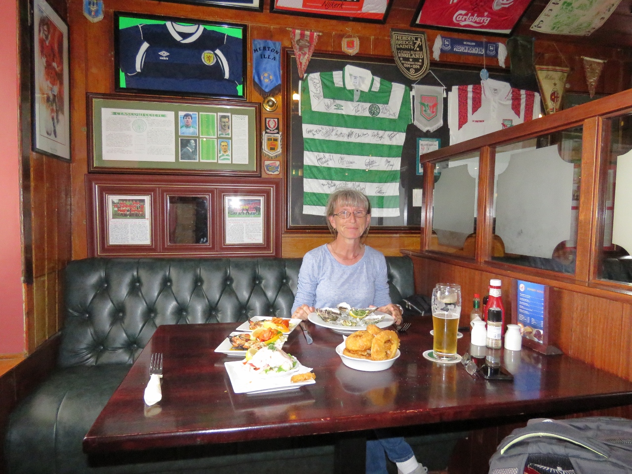 |
Dinner
Position: -8 26.41, 54 59.03
We had an excellent seafood meal at the Lobster Pot, surrounded by sports memorabilia. It’s not often you get a great meal at a restaurant with a giant plastic lobster on the side, but this was delicious.
|
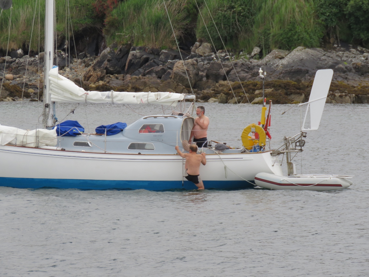 |
Swimming
Position: -8 29.58, 54 59.54
This sailboat arrived last night, moored briefly at the ferry pier and then came out to anchor. This morning two gents were swimming off the side. The water is warmer than we’d expect at 64F (17C), likely due to the Gulf Stream, but it has to get a lot warmer than that before we’d be tempted to swim.
|
 |
Offloading
Position: -8 29.56, 54 59.54
A fish boat offloading their catch at the old pier just off the anchorage.
|
 |
Micro Tender
Position: -8 29.56, 54 59.54
When we got the new micro tender, we kept the old one and stowed it under the dinghy on top of our fender boards. We’ve been finding the deck difficult to clean with them there, so transferred both the micro-tender and the fender boards into the anchor locker and strapped the micro-tender into a shelf.
|
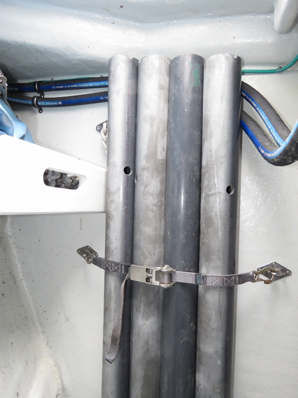 |
Fender Boards
Position: -8 29.56, 54 59.54
Fender boards hang horizontally between two or more pilings and the fenders on the boat, allowing the boat to shift position fore-and-aft with the fenders falling between the pilings. Fender boards also can protect the fenders when moored against an abrasive cement wall. Most people build fender boards from wood, but we went with schedule 80 PVC which doesn’t rot or splinter and has better strength-to-weight ratio. We’d been keeping them under the dinghy but found a great spot for them strapped them to the side of the anchor locker. The area under the dinghy is now clear and much easier to keep clean.
|
|
|
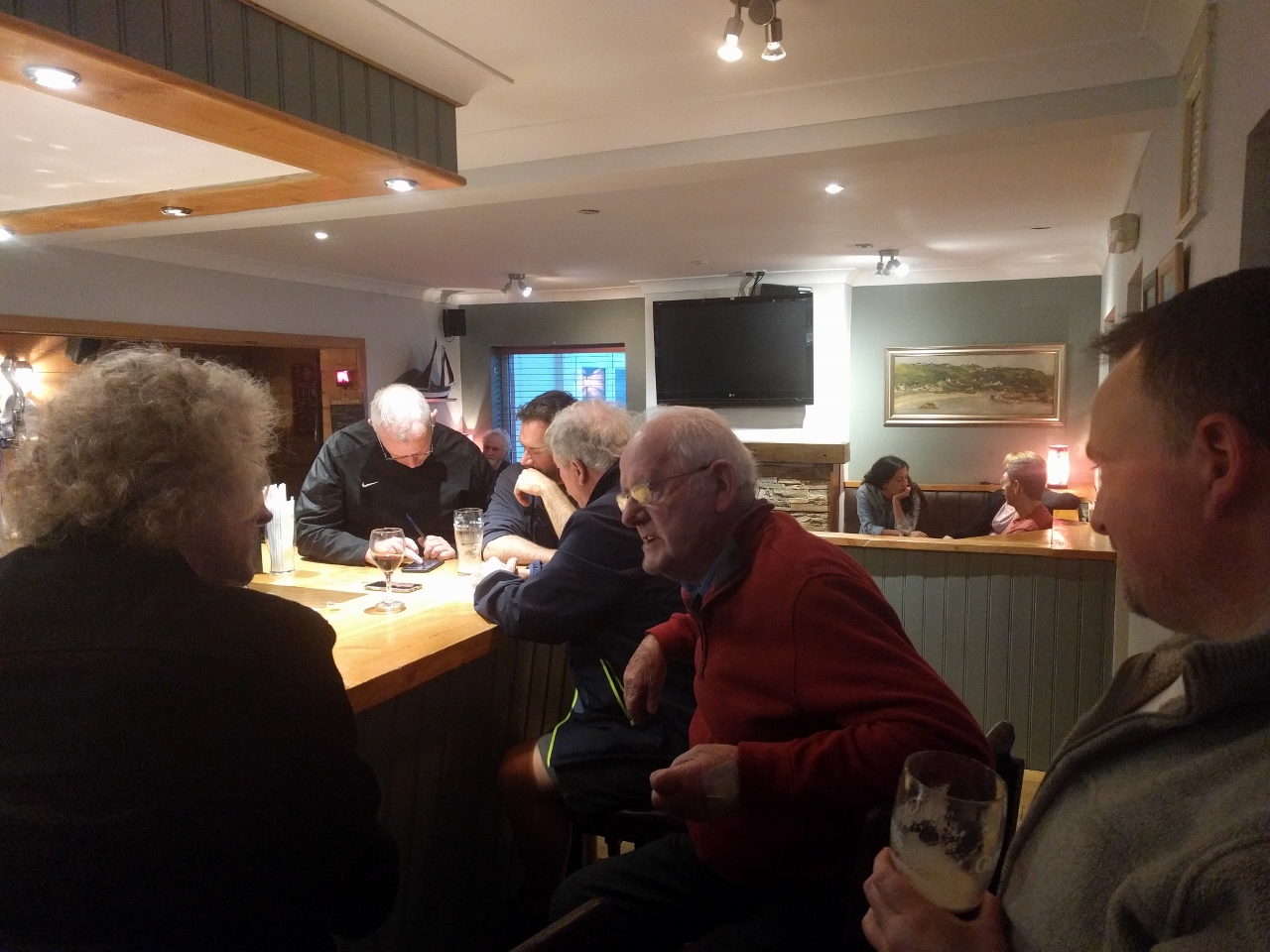
Early’s Bar
Position: -8 29.90, 54 59.35
Another great meal at Early’s Bar, this time their popular fish and chips. The pub was almost completely full at 5:30, which seemed quite early, particularly for Ireland. But tourists want to have dinner before taking the final ferry back to the mainland at 7:30pm. Once that ferry left, the pub quickly emptied of tourists and transformed into a locals bar.
Leftmost in the picture, with his head down and writing, is the owner Jerry Early. We’d met Jerry earlier today when he’d stopped by to say hello while coming ashore from his fishing boat. On Jerry’s right are an American father-and-son who descend from Arranmore and were in town to visit relatives and see their ancestral home. In the red sweater is Andrew Early, Jerry’s father, who purchased the bar in 1966 and ran it until 1990. And rightmost in the photo is local Adrian Begley, who’d noticed the Nordhavn anchored out in the harbour and sent us email to say hello and welcome us to the island. We had a wonderful evening and ended up staying way too late. People often talk of going to the South Pacific to “see the natives in their natural environment.” For us, this the kind of “natives in their natural environment” that we enjoy the most. We had an incredible time, and there was always a full Guinness in front of us. |

|
Click the travel log icon on the left to see these locations on a map, with the complete log of our cruise.
On the map page, clicking on a camera or text icon will display a picture and/or log entry for that location, and clicking on the smaller icons along the route will display latitude, longitude and other navigation data for that location. And a live map of our current route and most recent log entries always is available at http://mvdirona.com/maps. |
Lovely to hear of your trip.a great bog, thanks