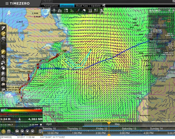
We’ve been studying the weather every day as we prepare for our Atlantic crossing from Newport, RI to Kinsale, Ireland. We use a variety of data sources, including NOAA surface analysis and 500MB forecasts. The sources we rely most heavily on are GRIB files containing data from computer-generated models such as NOAA GFS and WAVEWATCH III (WW III). The GRIB data includes predicted wind speed, barometric pressure, and wave height, period and direction. The data is purely computer-generated and is not a weather forecast, rather the model data is one of the sources meteorologists use to create the forecasts.
The video below shows a visualization using today’s WW III model data of our intended route in our PC-based chartplotter software, TimeZero Professional. A major weather system is deepening over the Atlantic on May 2nd and 3rd. And two systems are moving up the US eastern seaboard on May 2nd and 6th. The weather definitely does not look good for an Atlantic crossing this week. Conditions look to be improving next week, but weather models aren’t very accurate two weeks out so we’ll have to wait and see what develops.
Update 2017-May-06: North Atlantic 500mb Forecast

Hi Jennifer & James,
I’m wondering if you have checked out FastSeas.com online weather routing? It is heavily oriented to sailors, but you can set up polars for a motorboat (and you can see wave height forecasting along an intended route).
Also I’m pretty sure that the developer Jeremy Waters could modify the routing algorithm to pay more attention to waves and less to wind when calculating routes and/or departure dates, if more powerboaters showed interest.
Since I wrote about it last Nov., FastSeas started charging a subscription but it’s reasonable and it’s easy to test it out for free.
Thanks very much for the suggestion Ben. The FastSeas web site looks excellent. The data source for FastSeas is NOAA GFS which is one of the two weather models we use daily. They have much better graphics and do route planning as well. Another alternative that has been recommended to us many times is Predictwind who appear to have developed quite a following in the cruising community.
Thanks for pointing out FastSeas.