We’d never heard of Thunderbolt, Georgia, nor the superyacht yard there, until we were referred to Ian Anderson, an electronics installer at local Mackay Communications. Following an overnight run from Halifax Harbor, we spent three busy but enjoyable days at Thunderbolt Marine while we upgraded our KVH V7 mini-VSAT satellite data system to the latest KVH V7-IP system.
Trip highlights March 20th through 24th, 2017 follow. Click any image for a larger view, or click the position to view the location on a map. And a live map of our current route and most recent log entries always is available at http://mvdirona.com/maps
 |
Dark
Position: -81 0.68, 29 12.23
We left Halifax Harbor this morning on the 5:34 high tide, giving us “plenty” of water, at nearly 8ft, to exit. Daylight is nearly two hours away, so most of the 14-mile transit south to Ponce de Leon Inlet will be in the dark.
|
 |
Ponce de Leon Lighthouse
Position: -80 55.19, 29 4.07
We’re finally getting some light as we near Ponce de Leon Inlet. The ICW is well-marked and we had no difficulty navigating in the dark. Depths were as predicted everywhere except for two areas of shoaling at either end of the Ponce de Leon Cut. At the north end, we needed to stay well to the west to avoid shallows extending from the east shore, and at the south end two or three sand ripples in a row of less than 7ft were along the north side of the channel near the junction buoy.
|
 |
Sand
Position: -80 55.15, 29 4.59
The last few days have been quite windy from the north and the jetty is covered with sand from waves crashing over. To the right of the ATV, someone is out with a leaf-blower cleaning off the sand.
|
 |
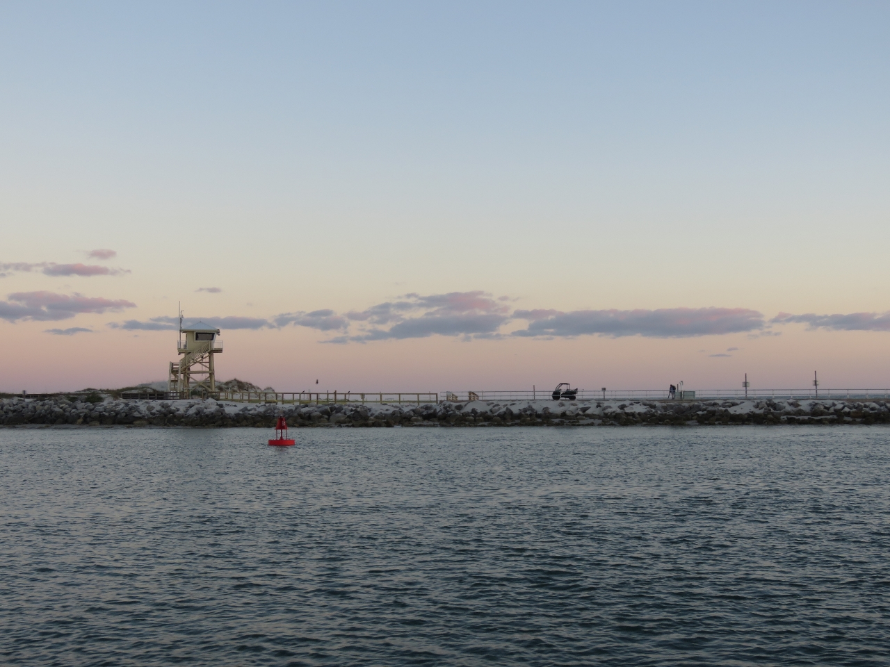
Jetty
Position: -80 55.07, 29 4.66
We were a little concerned about exiting through Ponce de Leon Inlet because the channel has only a least depth of 14ft and this is another inlet where the buoys are constantly being moved to match the shifting channel due to shoaling.
We were exiting on an ebbing tide near low water and a large swell against could generate rough seas. Winds have been settled overnight and waves were predicted to be 3-5 ft, so it shouldn’t be rough, but local conditions can vary. Also, the jetty was damaged during Hurricane Mathew and the light on the end swept away. The local Coast Guard office told us that the buoys are all on station and the light was scheduled to be replaced Feb 1st, but we didn’t see the light as we passed. The buoys did seem accurate though and overall the exit was uneventful. We hardly pitched at all as we passed through and saw a least depth of about 14ft briefly, with depths mostly 18ft or more. |
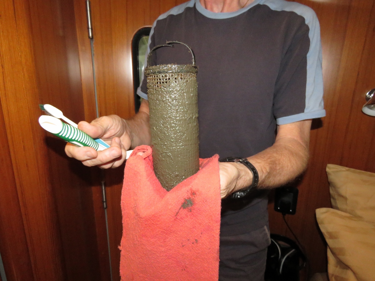 |
Strainer
Position: -80 53.16, 29 55.44
The sea strainer for our HVAC system was thick with growth from all the A/C operation in warm Florida waters.
|
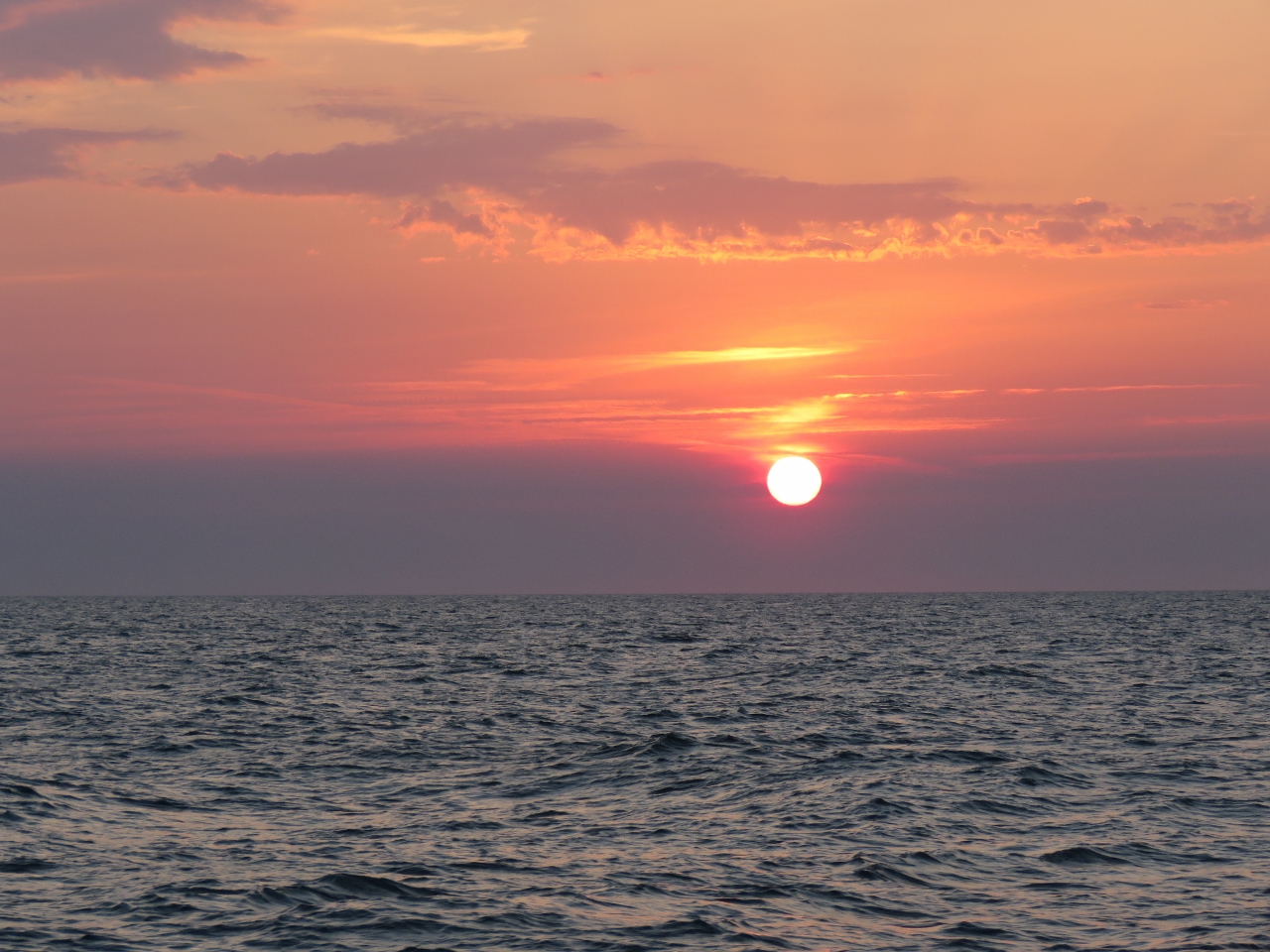 |
Sunrise
Position: -80 53.15, 31 50.61
Sunrise as we approach Savannah. We slipped through between two storm systems and had a nice, easy run with calm conditions the whole way from Daytona.
|
 |
Wassaw Sound
Position: -80 57.59, 31 55.32
Wassaw Sound is another coastal bar that shifts constantly due to shoaling and the buoys are moved to reflect the channel. We’d labelled on our chart the last known positions of buoys 4 and 8, but 4 was missing and 8 was farther south. A third buoy, 6, supposedly should be there as well, but we had no location data for it. On a 2ft low tide, we saw about 10 minimum going through. This would not be a bar to cross in rough weather.
|
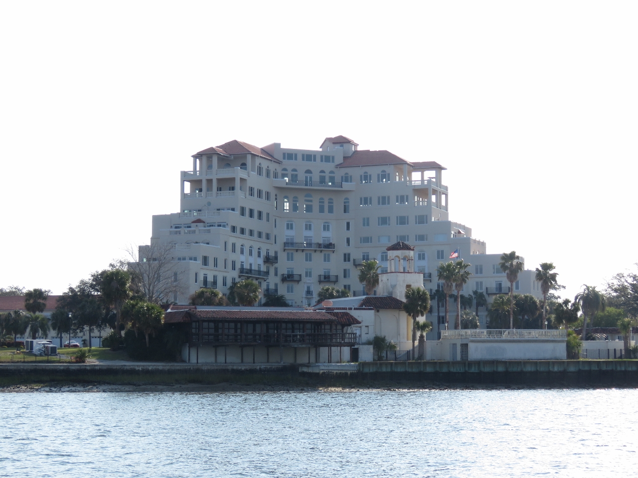 |
Wilmington Islands Sheraton
Position: -81 0.31, 32 0.42
The old Wilmington Island Sheraton resort is now a condo complex. The property was once owned by the Teamsters pension fund and Jimmy Hoffa, the notorious Teamsters president, was rumoured to have been buried there after his disappearance in 1975.
|
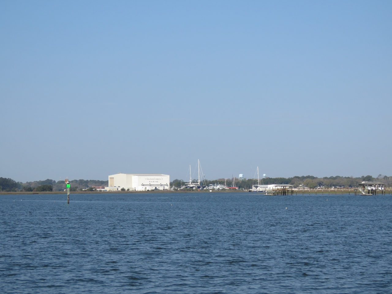 |
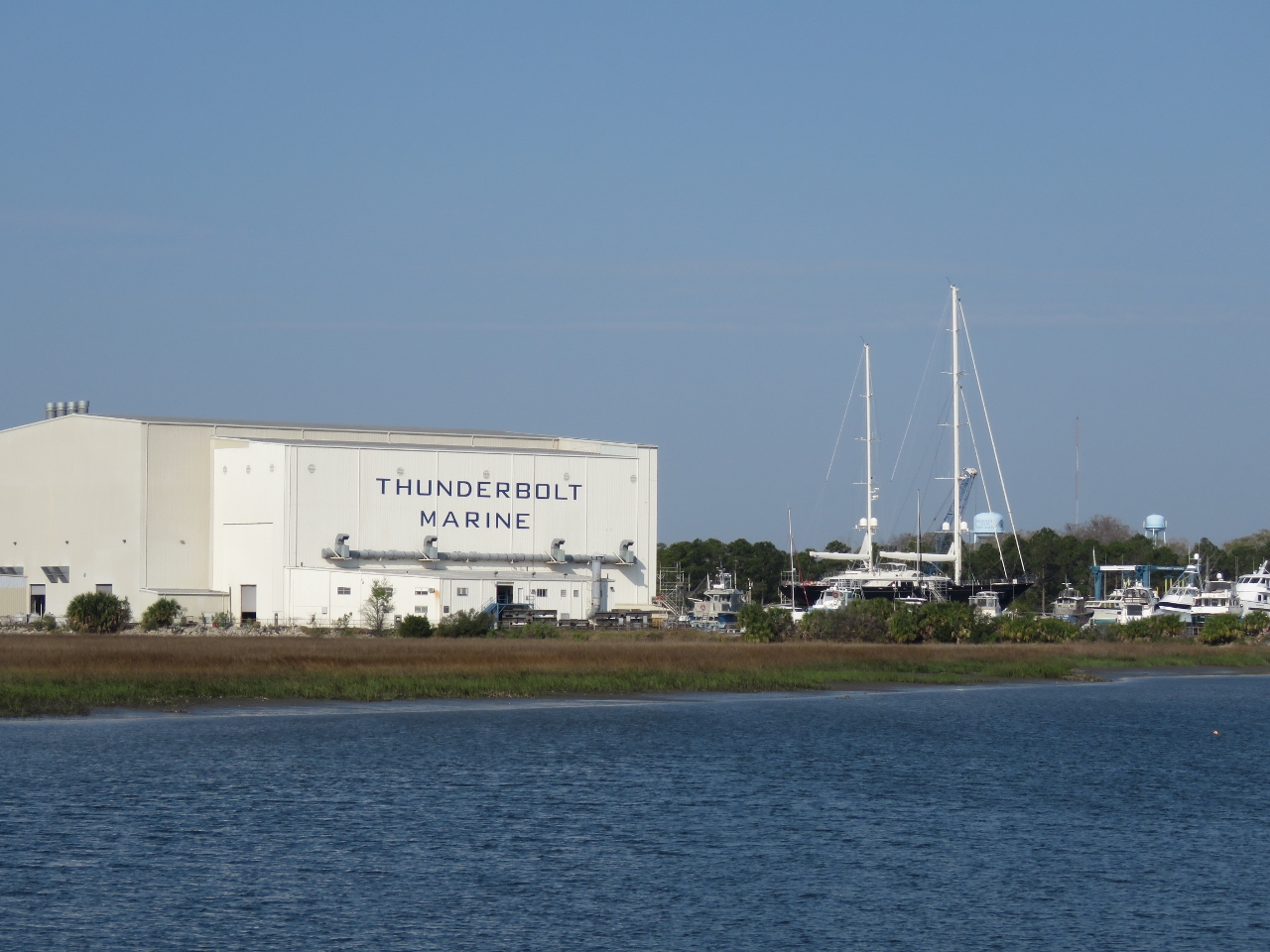
Thunderbolt
Position: -81 1.84, 32 1.29
The massive vessel service building at Thunderbolt Marine, our destination, is visible a long way off.
|
|
|
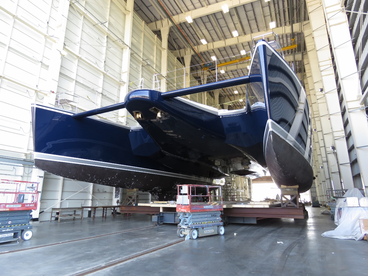
Tamsen
Position: -81 2.50, 32 1.37
Thunderbolt Marine specializes in superyachts. The busy season is mostly over for that, but a few still are in the yard. At the right of the photo, the masts of the 170ft (50m) super-yacht Tamsen extend well above the roof of the huge vessel service building.
|
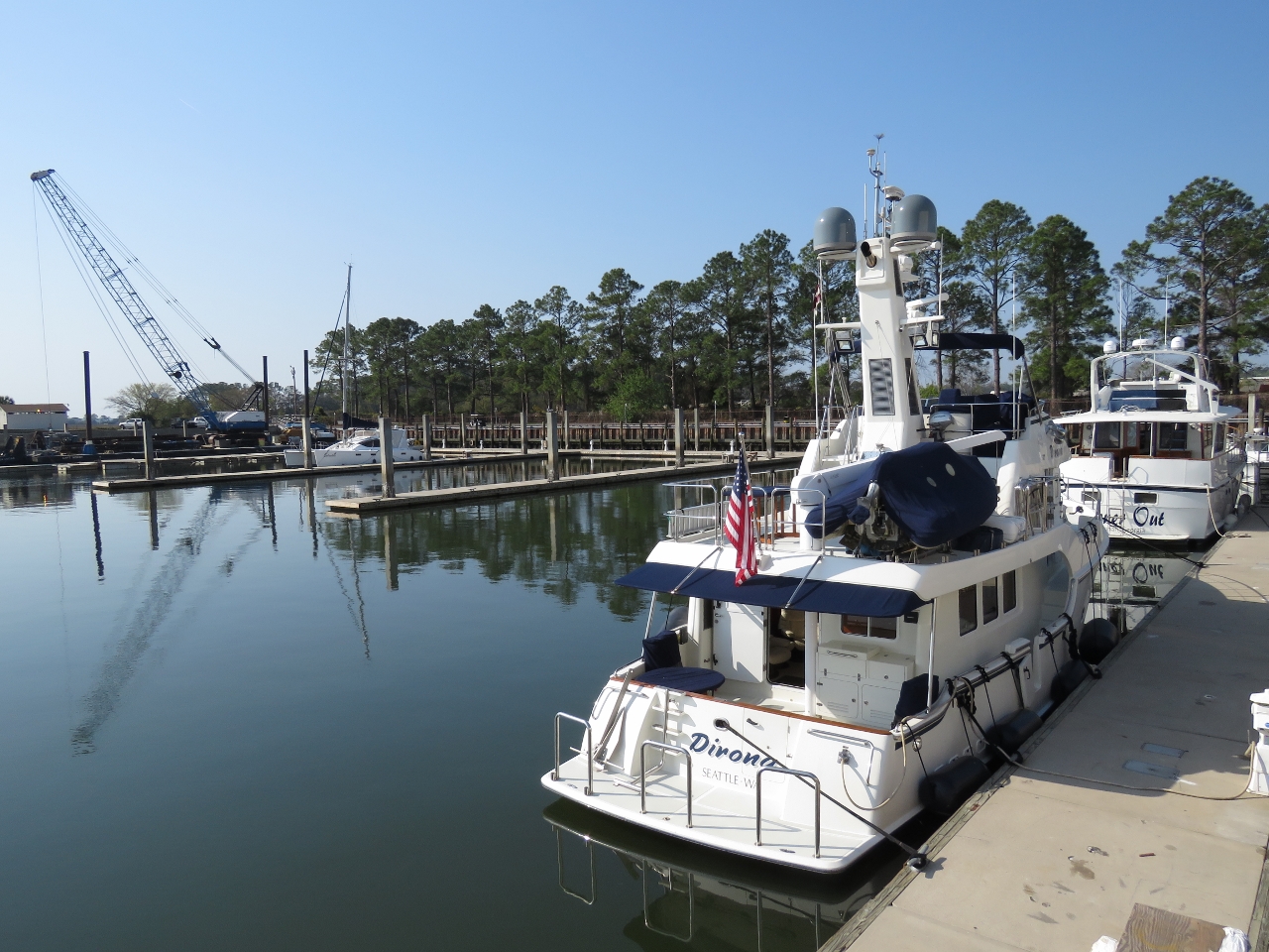 |
Moored
Position: -81 2.90, 32 1.45
Tied off at the Thunderbolt Marine docks.
|
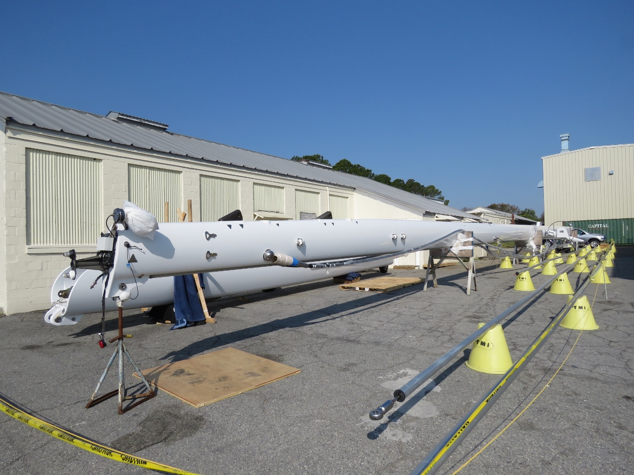 |
Mast
Position: -81 2.90, 32 1.45
This mast laid out ashore adjacent to our berth is at least 100ft long and full of hydraulics.
|
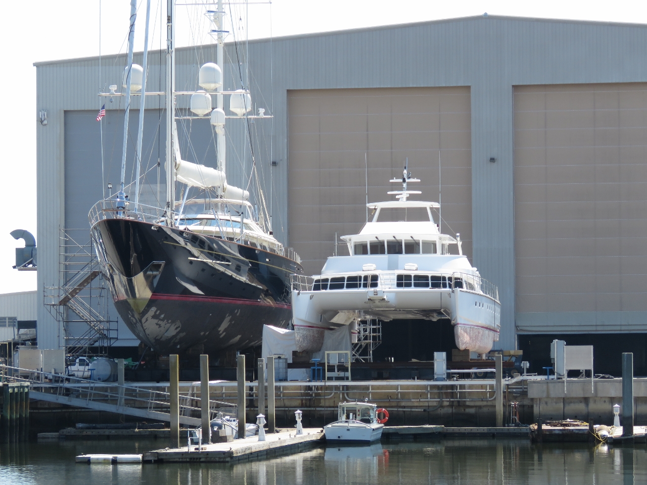 |
Tamsen and Bonefish.
Position: -81 2.90, 32 1.45
Tamsen and Bonefish, a custom 80ft catamaran, on the hard at Thunderbolt Marine.
|
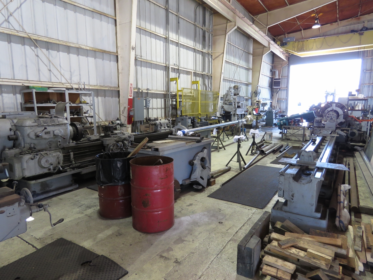 |
Machine Shop
Position: -81 2.91, 32 1.45
Near our berth, Thunderbolt has a very well-equipped machine shop.
|
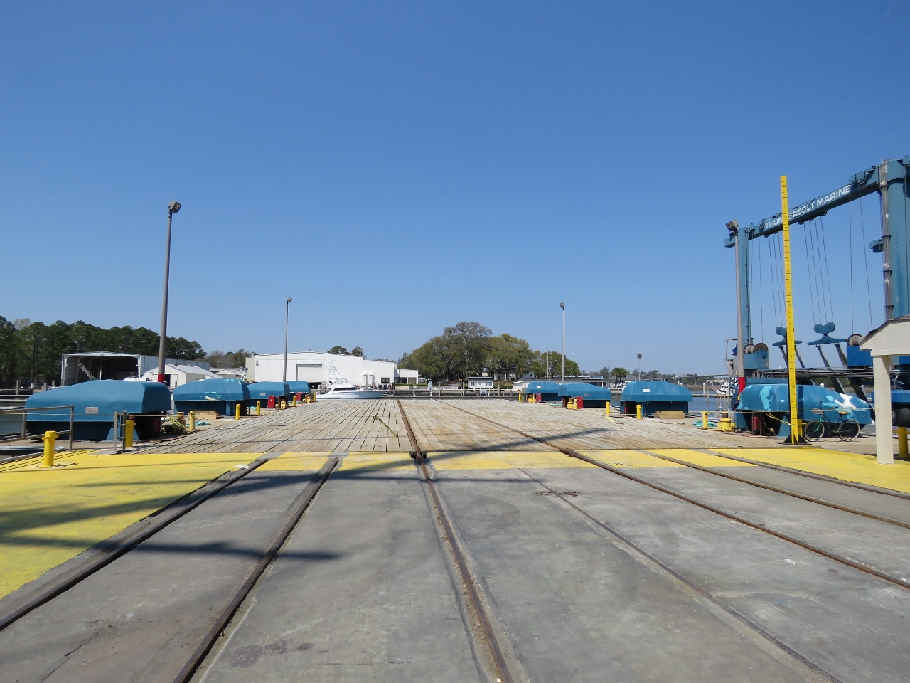 |
Syncrolift
Position: -81 2.82, 32 1.40
Thunderbolt’s syncrolift and rail system was built in the 1960s and is capable of lifting boats up to 1,150 tons.
|
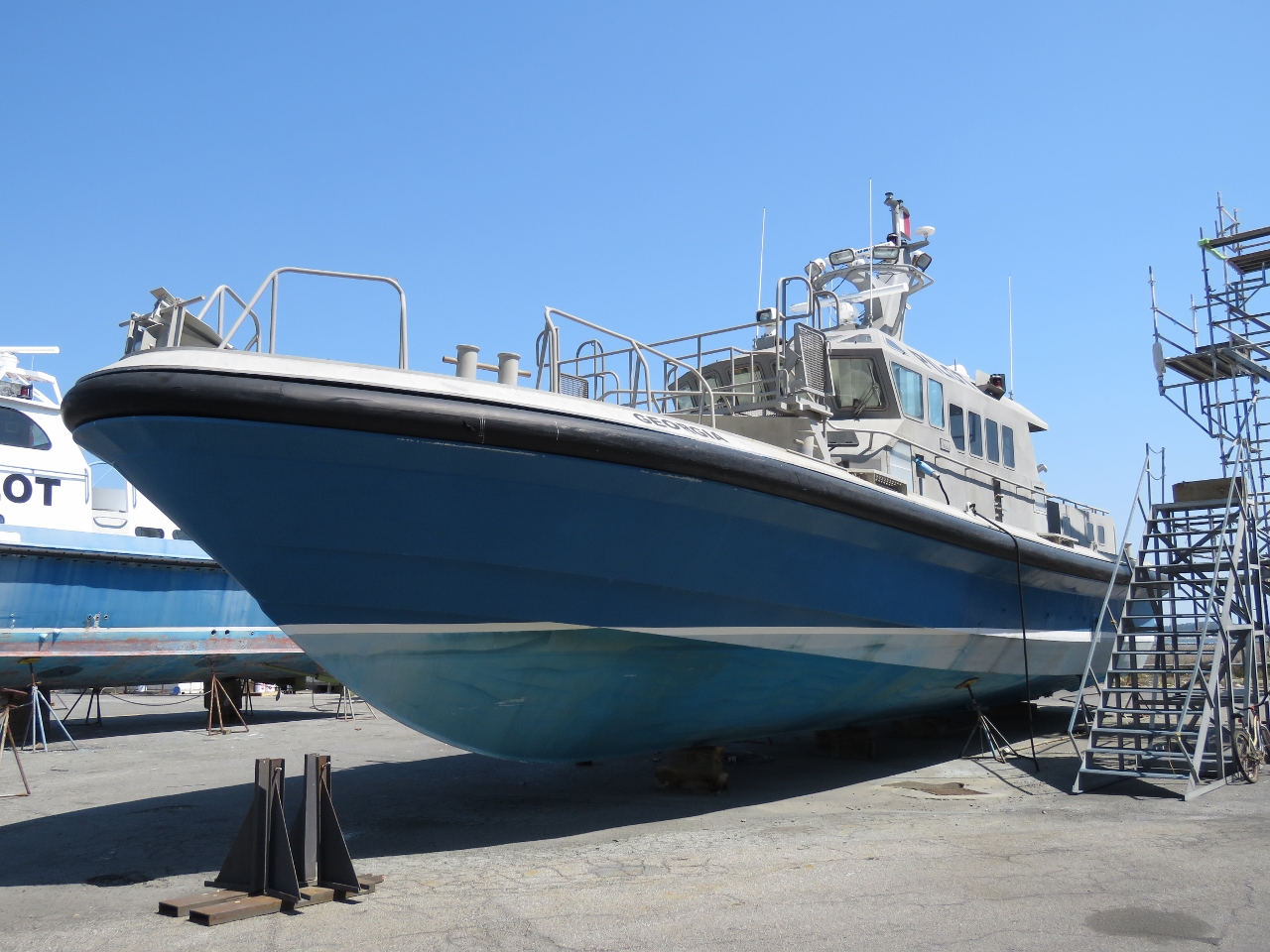 |
Georgia
Position: -81 2.79, 32 1.36
The Georgia, one of two pilot boats on the yard.
|
 |
Compass Rose
Position: -81 2.79, 32 1.36
160ft (48m) Compass Rose weighs in at 285 tonnes and can carry 41,000 gallons of diesel.
|
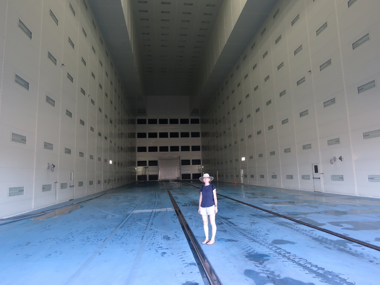 |
Paint Bay
Position: -81 2.82, 32 1.34
The ultra-modern paint bay in Thunderbolt Marine’s vessel service building.
|
 |
Cat
Position: -81 2.80, 32 1.30
We believe the mast next to our berth is from this catamaran.
|
 |
Stern
Position: -81 2.76, 32 1.32
View to the stern of Compass Rose.
|
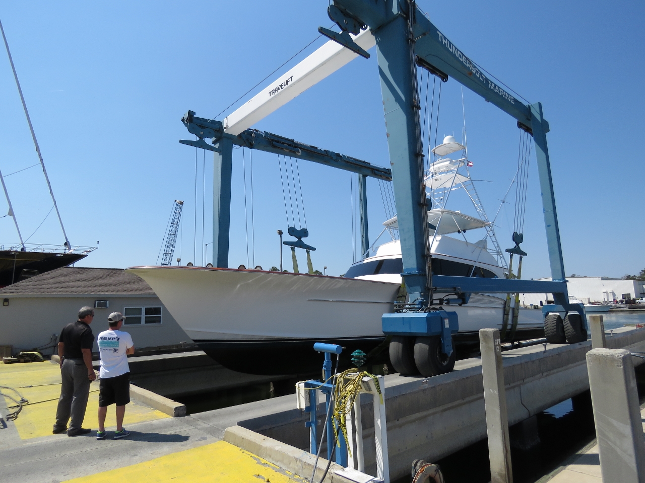 |
TraveLift
Position: -81 2.80, 32 1.40
For the “smaller” boats, Thunderbolt also has a 150-ton Marine Travelift.
|
 |
Gladiator
Position: -81 2.75, 32 1.40
The crew of racing yacht Gladiator were polishing the hull to a shiny finish in preparation for an upcoming race in Charleston. The yacht is of the Yacht Club Costa Smerelda and Royal Thames Yacht Club and races in the 52 Super Series, the world’s leading grand prix monohull yacht racing circuit.
|
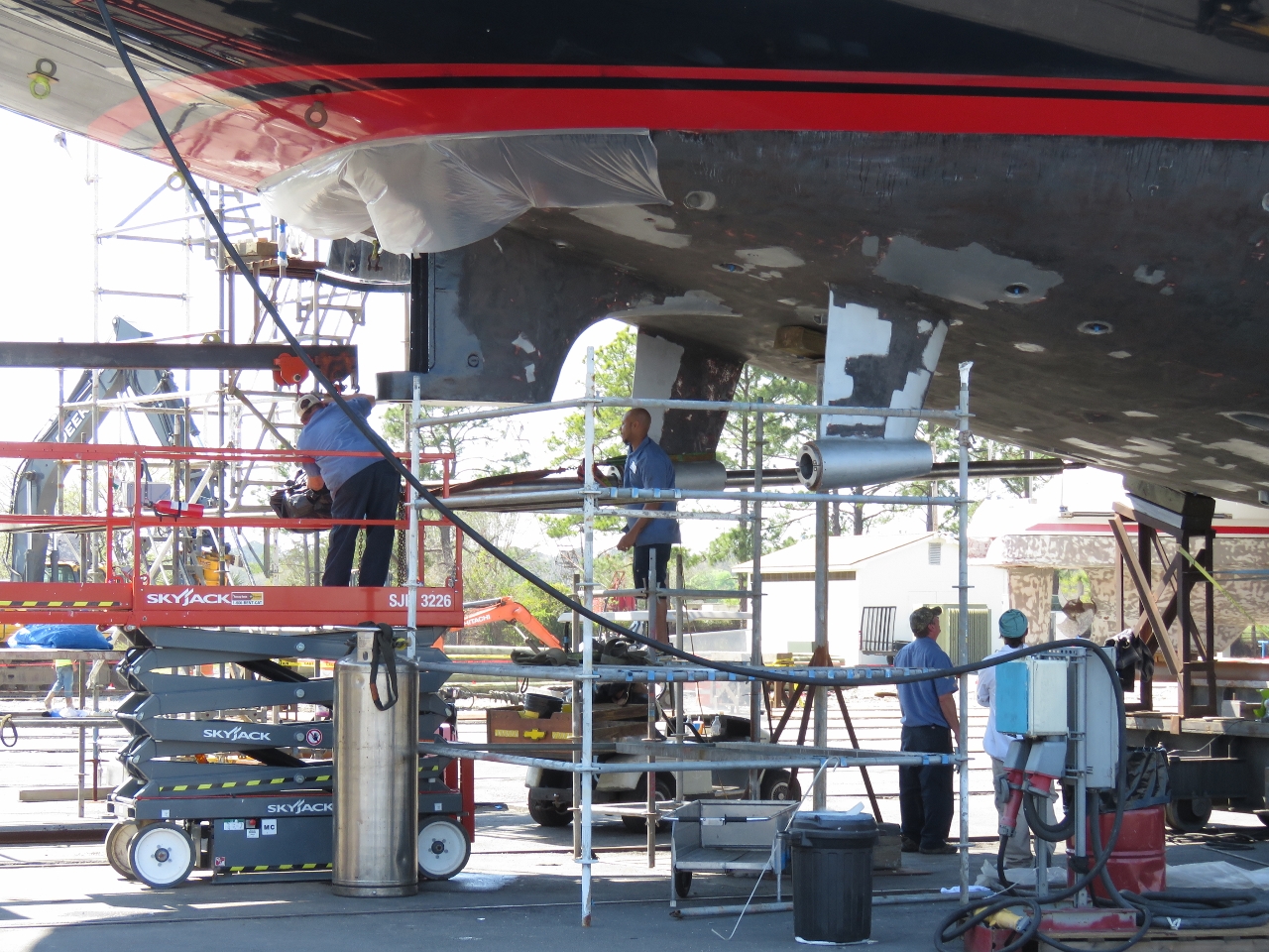 |
Prop Shaft
Position: -81 2.81, 32 1.37
Installing one of Tamsen‘s two prop shafts.
|
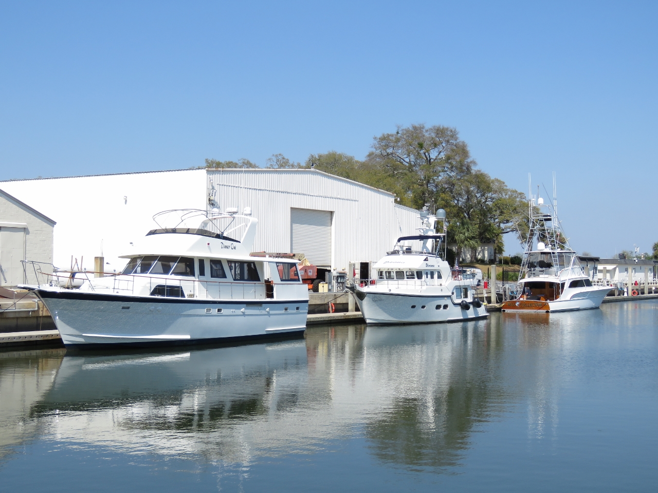 |
Basin
Position: -81 2.93, 32 1.43
View across the marina basin to our berth.
|
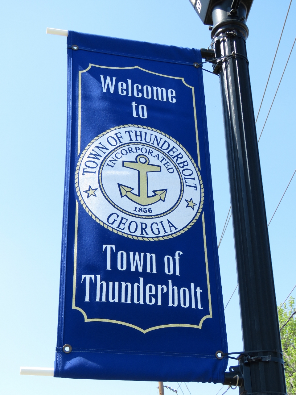 |
Town of Thunderbolt
Position: -81 3.01, 32 1.67
After walking around the yard, we walked into the adjacent town of Thunderbolt. The town was Incorporated in 1856 and is a major Georgia shrimping port.
|
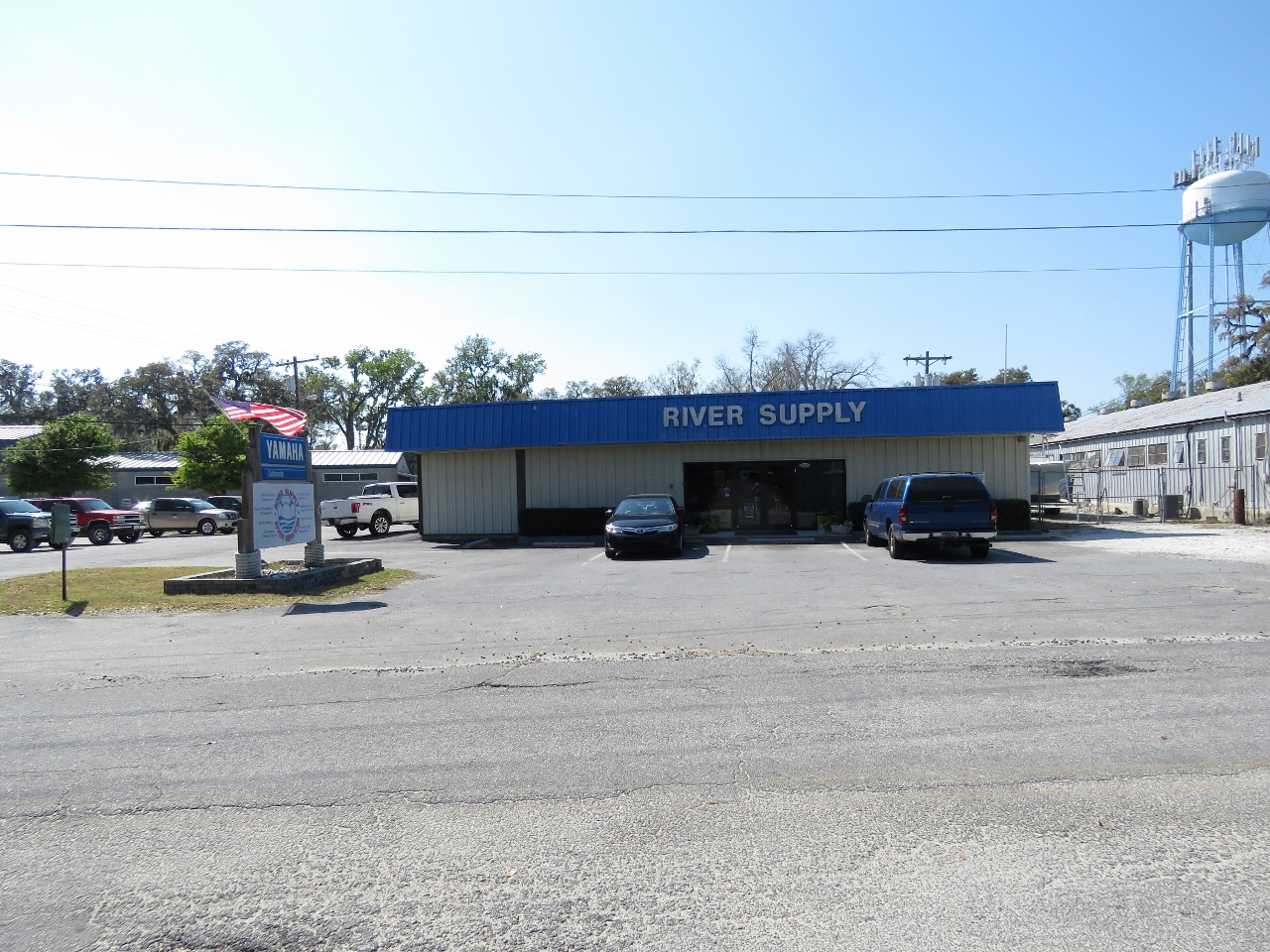 |
River Supply
Position: -81 3.05, 32 1.84
River Supply marine chandlery has a great selection of goods.
|
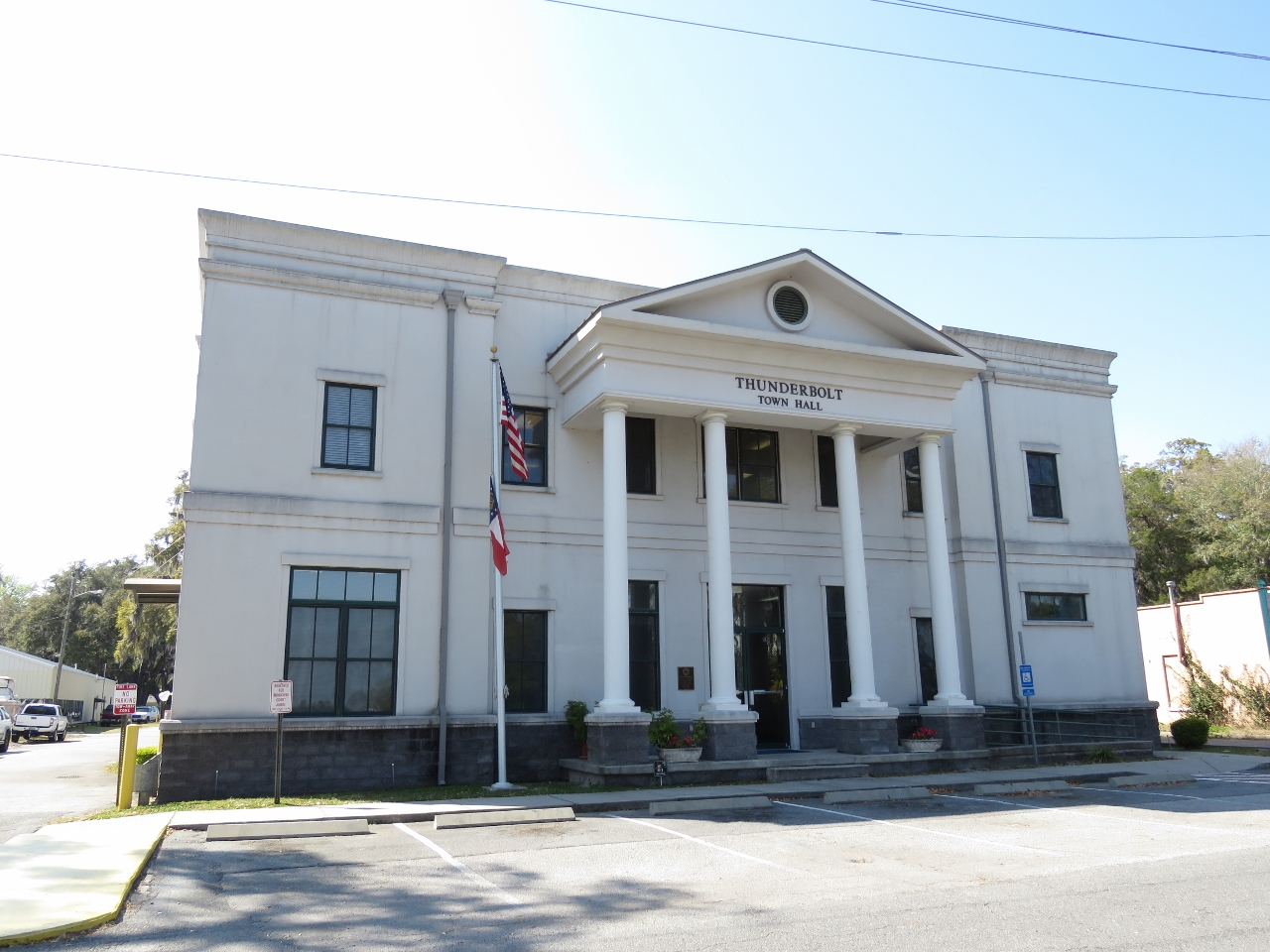 |
Town Hall
Position: -81 3.03, 32 1.91
The Thunderbolt Town Hall building.
|
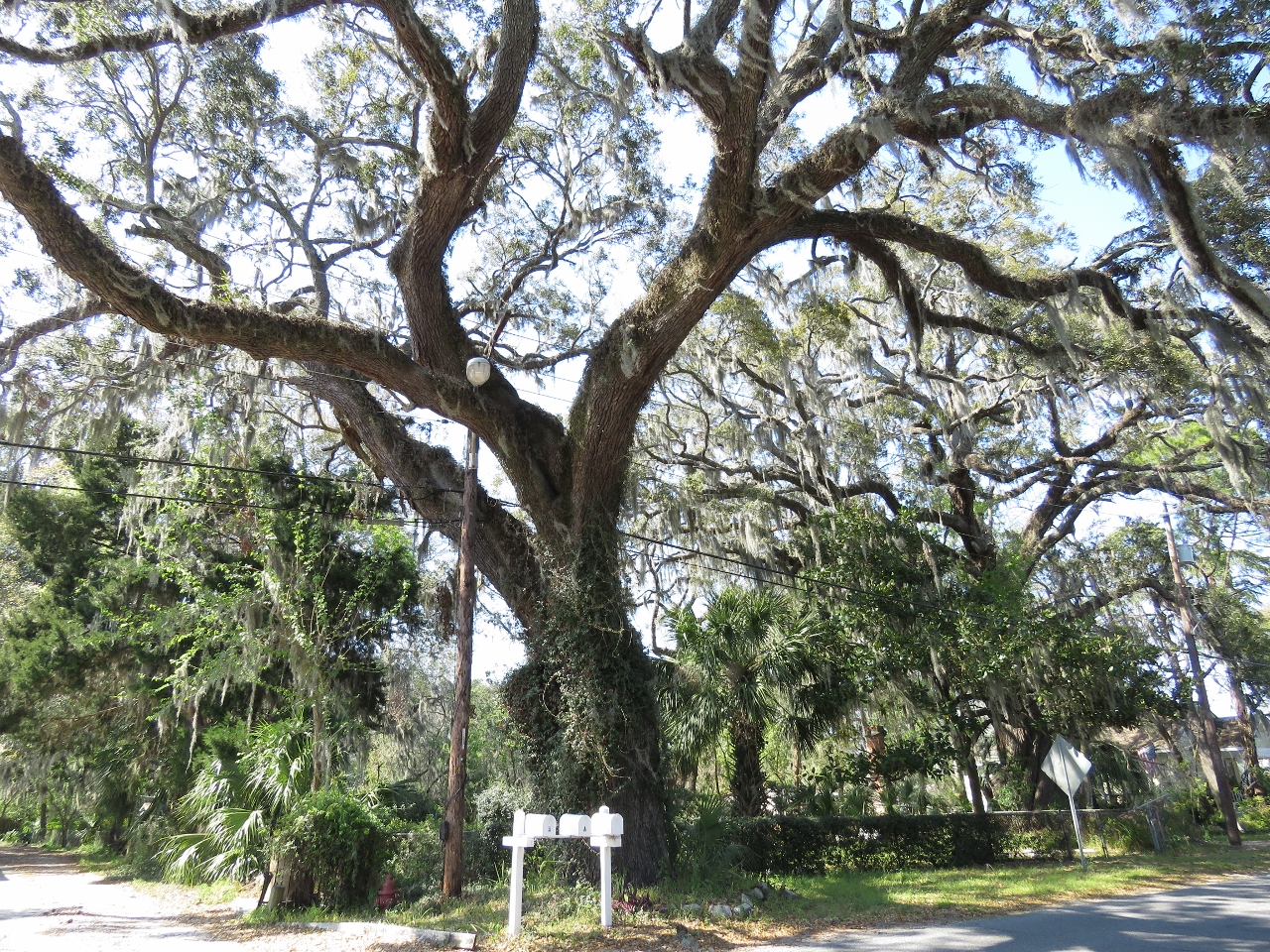 |
Oaks
Position: -81 3.02, 32 1.92
Massive Live Oaks abound in Thunderbolt. This one had grown right around a street lamp.
|
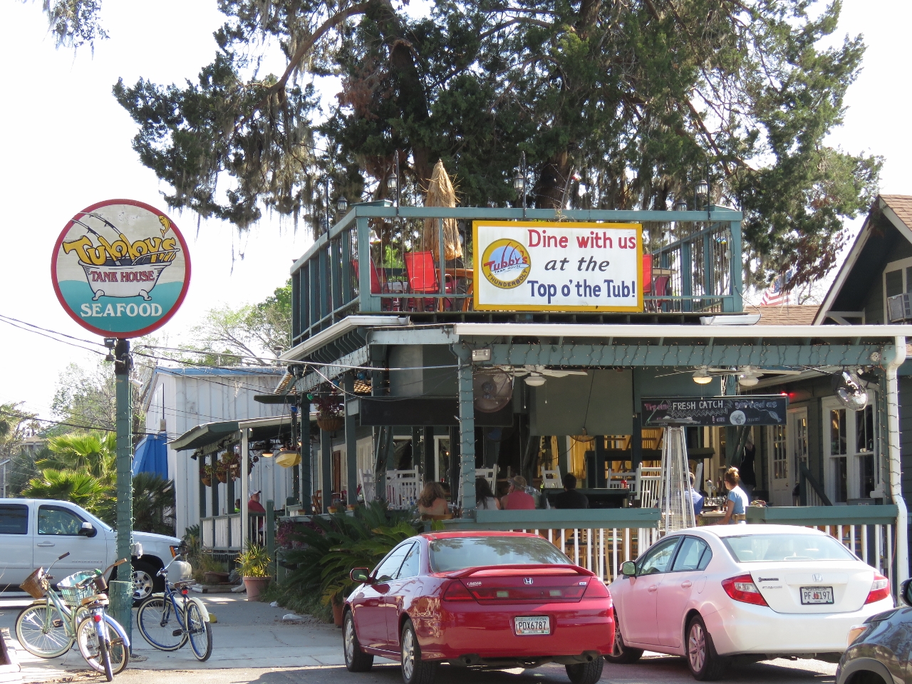 |
Top o’ The Tub
Position: -81 3.05, 32 1.79
Jennifer sorely wanted to have dinner at Top ‘o The Tub at Tubby’s Tank House, but it was closed due to gnats.
|
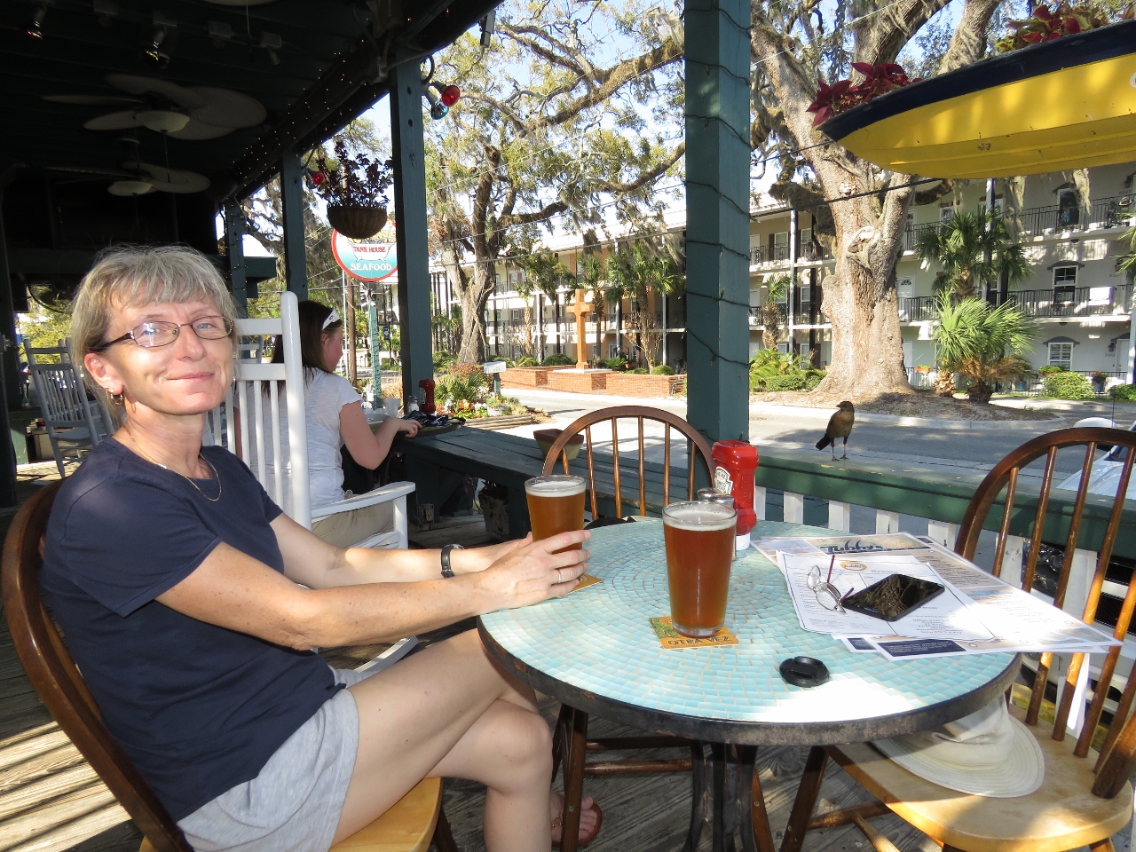 |
Tubby’s Tank House
Position: -81 3.05, 32 1.79
We settled for a lazy meal on the deck at Tubby’s Tank House. When we left Florida yesterday, the temperature was in the 50s. In Thunderbolt it was in the 80s when we arrived.
|
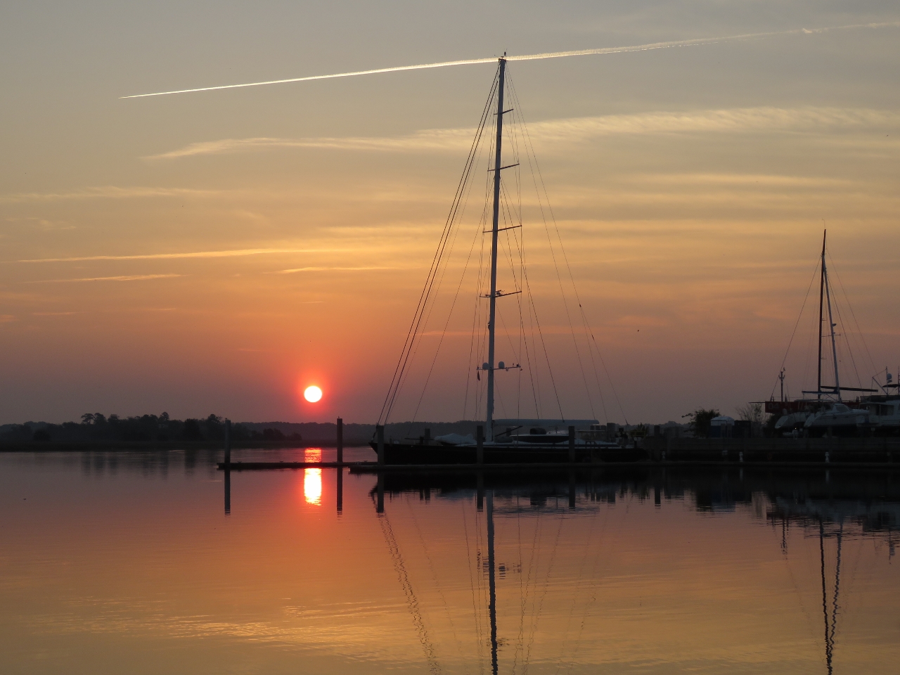 |
Dawn
Position: -81 2.90, 32 1.45
A beautiful calm morning looking across the moorage basin at Thunderbolt Marine.
|
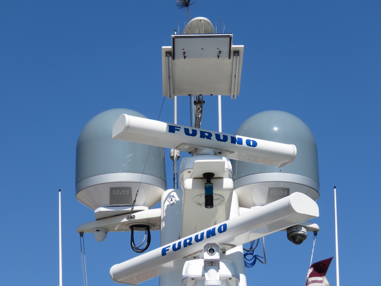 |
V7-IP
Position: -81 2.90, 32 1.46
The reason we stopped at Thunderbolt was to upgrade our KVH V7 mini-VSAT satellite data system to the latest KVH V7-IP system. On Dirona few components are more mission-critical to our ability to operate away from civilization. Our V7 system is one of the initial installs from back in early 2011 and it’s working fine. There’s really no need to replace it. However, the new system has some very attractive features and our old V7 system has a lot of hours on it.
The new KVH TracVision satellite television system is extremely appealling with LNB auto-skew control rather than our current system’s manual skew control, but we decided to stick with the existing M7 TracVision system for now. The Thunderbolt Marine stop was about the V7, however we did change the base on the M7 to match the new V7. We’ll blog the details. |
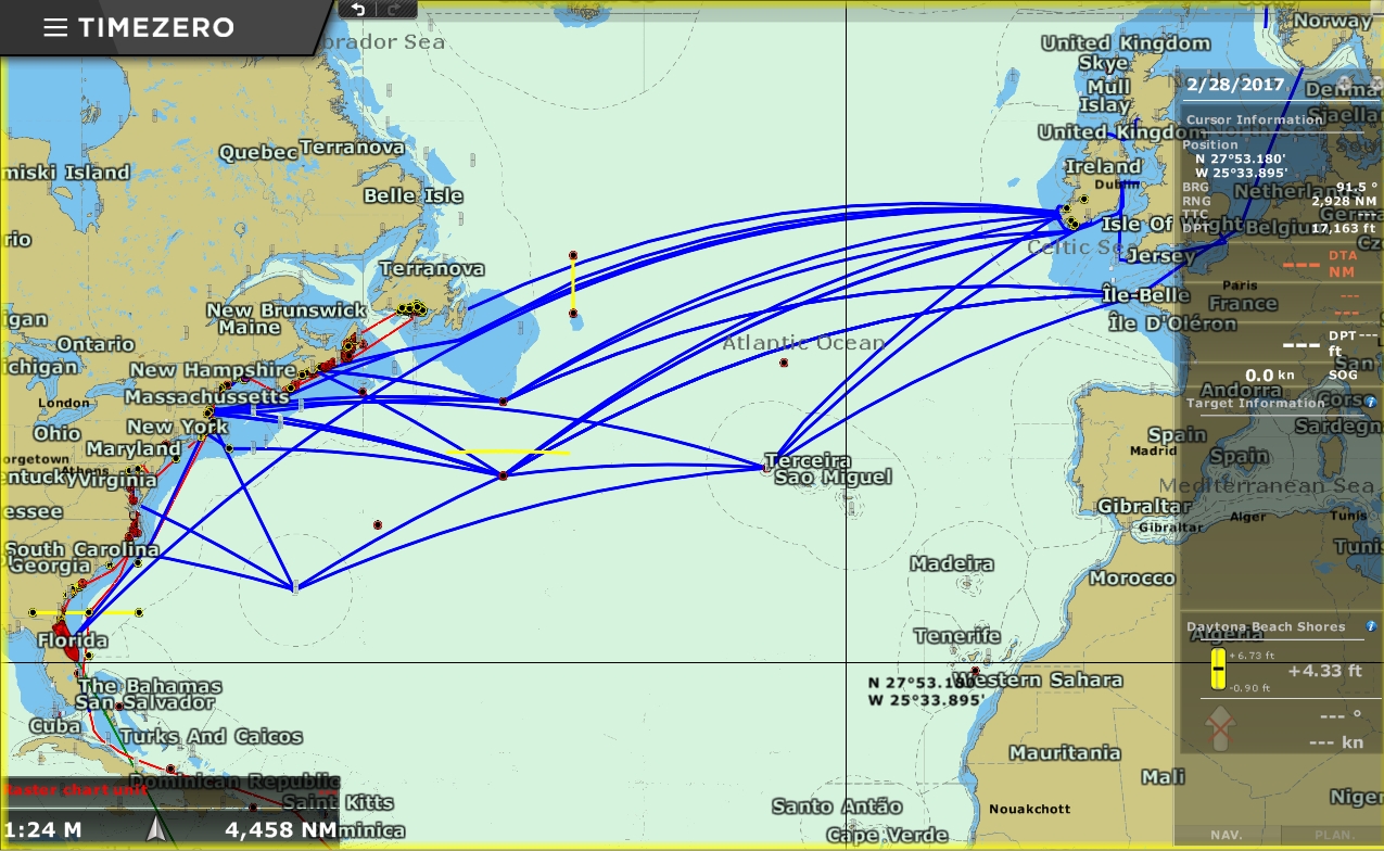 |
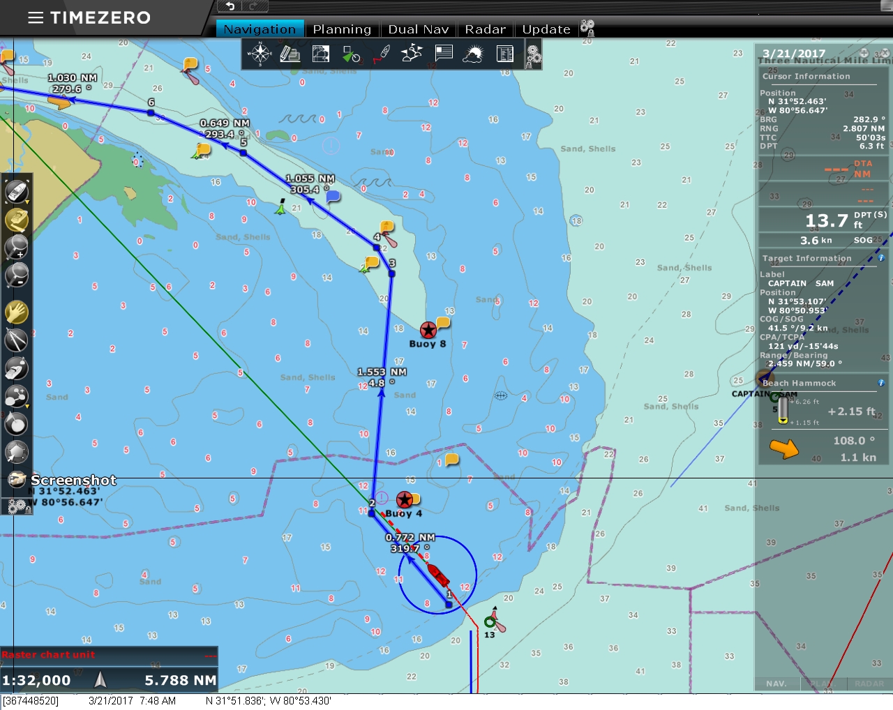
Route Planning
Position: -81 0.83, 29 12.17
We’ve been looking at a variety of routes for our upcoming Atlantic passage and earlier posted some of the possibilities. Timothy Daleo asked about the waypoints besides Bermuda and the Azores on the screenshot, so here’s some more detail.
The yellow lines near Newfoundland are the ice pack extent in May of 2016 using the International Ice Patrol iceberg charts. The most current chart is here. The other waypoints are mostly from Jimmy Cornell’s World Cruising Routes and are for avoiding hazards or picking up favorable conditions. The one closest to New York is to clear Nantucket Shoals and the one south of Newfoundland is to clear the Grand Banks. The two just east of Nova Scotia and south of the horizontal yellow line are for ice avoidance. If we were departing from Nova Scotia with no ice, we could continue from the Nova Scotia waypoint to the Grand Banks waypoint. Otherwise we should proceed to waypoint below the yellow line before turning eastward. The waypoint about 350 miles north of the Azores is from Cornell’s Ocean Atlas and is for avoiding low pressure systems coming off Nova Scotia. Cornell’s recommendation there is stay south of 45N until east of 30W. And the waypoint 350 miles northeast of Bermuda is for getting as quickly into the prevailing winds as possible on a departure from Bermuda to Northern Europe. And that yellow bar down by Florida is the hurricane restriction line for our boat insurance. We’re not covered for named storms south of that line between July 1st and October 31st. Ideally we’d run 1,700nm from Newfoundland to Ireland, but would have to wait until at least July for the icebergs to clear. For a direct run between the US and Ireland that avoids the ice risk, Newport RI and area is the closest point of departure. But the 2,900nm run will put us in the North Atlantic for three weeks, a long time to go without seeing a major low pressure system. The first part of the route from Newport south of the possible ice range is identical whether going to Cork directly, or to the Azores. Even after that waypoint, the two routes don’t differ that much, so our plan is to start with the fuel we need to make the 2,900nm run directly to Cork, but make the decision a week or so into the trip based on weather conditions and safety considerations whether to run directly to Cork or stop in the Azores en route. |
 |
Click the travel log icon on the left to see these locations on a map, with the complete log of our cruise.
On the map page, clicking on a camera or text icon will display a picture and/or log entry for that location, and clicking on the smaller icons along the route will display latitude, longitude and other navigation data for that location. And a live map of our current route and most recent log entries always is available at http://mvdirona.com/maps. |
If your comment doesn't show up right away, send us email and we'll dredge it out of the spam filter.