We found winter boating in Chesapeake Bay to be surprisingly similar to the Pacific Northwest, with the same advantages and disadvantages. The main disadvantage of course is the weather. Storms are more frequent and fierce, so we need to watch the forecasts more carefully, the days are shorter, and the temperature is colder. The temperature isn’t so troublesome as we can just dress warmer when outside and our Olympic diesel furnace keeps us warm at anchor. Our flotation suits continue to be among our favourite winter boating gear. The suits are similar to ski jumpsuits, but with built-in flotation and extra insulation. We use Mustang 2175s, which are standard issue with the Coast Guard on both sides of the Canada-US border. We can toss these on over light clothing, add a pair of gloves and perhaps some ear warmers, and be instantly warm in the coldest weather.
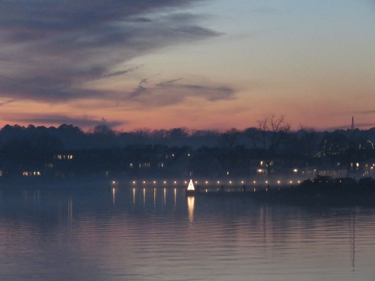
The many advantages of winter boating include reduced marina rates, having even the most crowded summer anchorage all to ourselves, the slower pace of small towns empty of tourists, and the winter lights. The lights are one advantage of winter’s shorter days. Whether from a passing ship, a moored boat, or a nearby house, we enjoy being snug inside with a view to lights twinkling in the distance. The show gets even better during the Christmas season, when colorful holiday light displays are put on afloat and ashore.
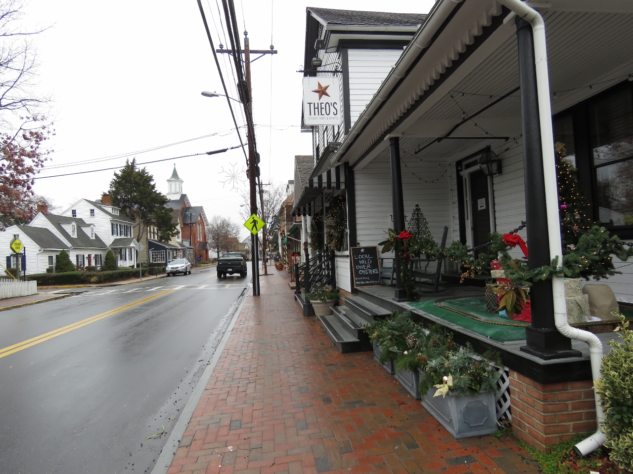
St. Michael’s is a great example. The normally-crowded summer anchorage was empty the entire time we were there. We ran the tender ashore to to stroll through town, had lunch in a restaurant with mostly local patrons, and visited the excellent Chesapeake Bay Maritime Museum with perhaps a half-dozen other guests. And at night we enjoyed the lights ashore from the anchorage.
Trip highlights from December 13th and 14th, 2016 in St. Michael’s, Maryland follow. Click any image for a larger view, or click the position to view the location on a map. And a live map of our current route and most recent log entries always is available at http://mvdirona.com/maps
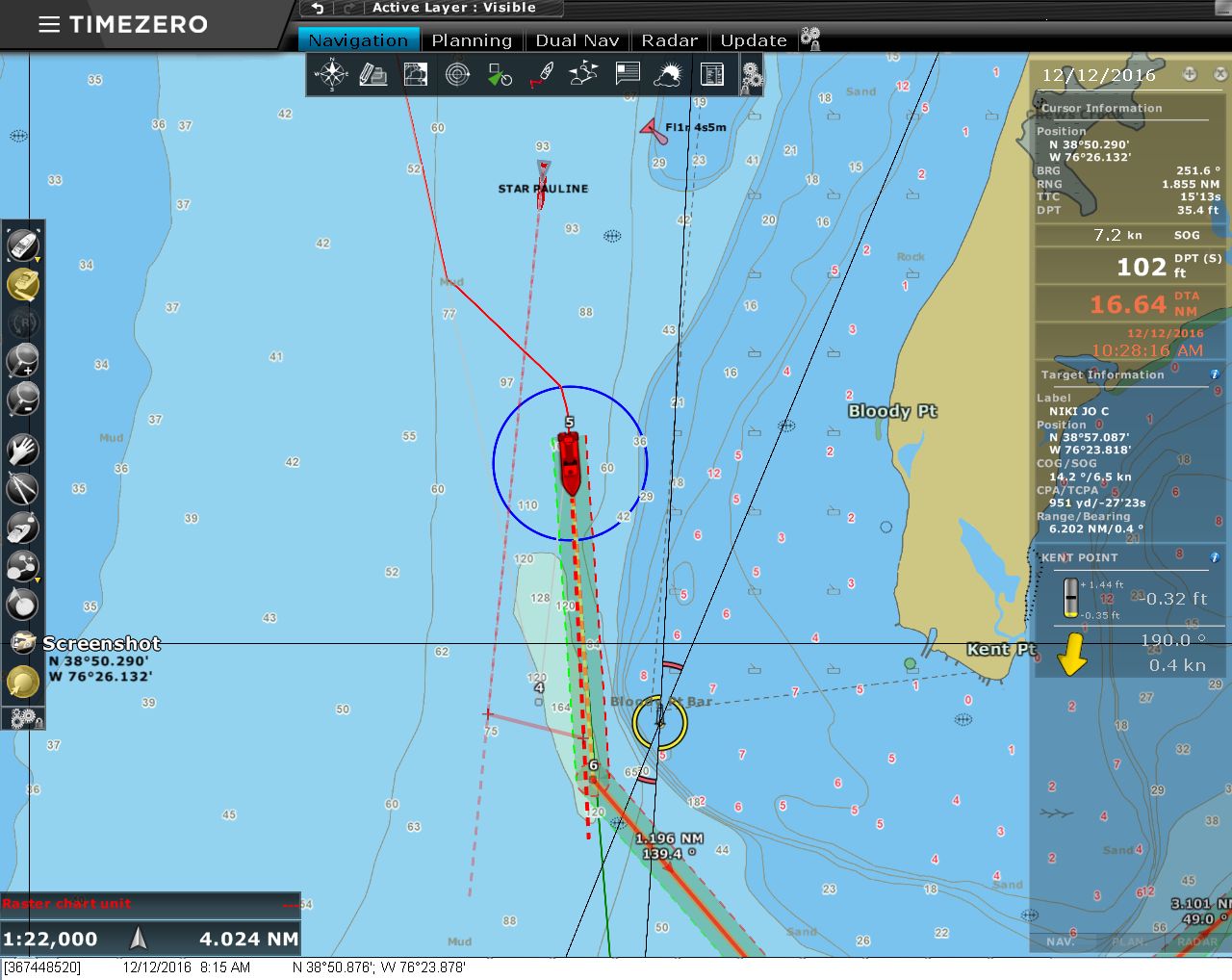 |
CPA
Position: -76 23.87, 38 50.73
We’re really liking the new TimeZero Professional software. One feature that we find particularly useful is the new Closest Point of Approach (CPA) visualization. When an AIS or ARPA target is approaching from any direction, the software draws a line showing where our CPA to that target will be and that line is updated in real-time as the boats move. You can see it in the picture where the Star Pauline is passing from behind on our starboard side. Its course is veering slightly away from us and the red line between their course line and ours shows both the location of the CPA and the distance. The CPA line alone is most useful, but because the CPA line shows up even if a target is not currently visible on the screen, the CPA line also provides an early alert of an approaching target.
|
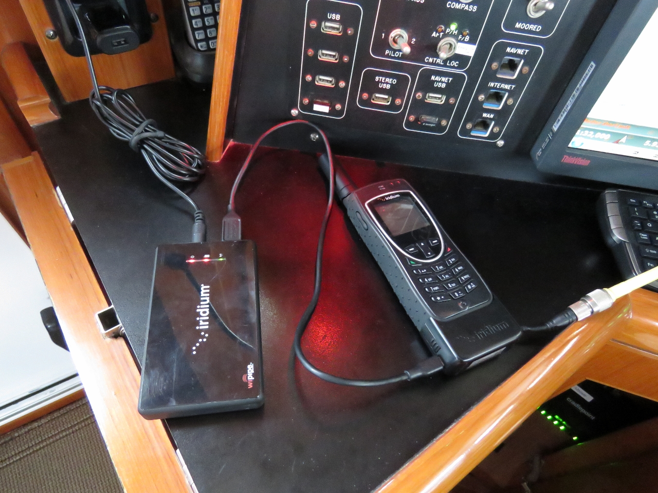 |
Iridium Testing
Position: -76 16.59, 38 51.65
We maintain an Iridium system as a backup in case our primary satellite systems are unavailable. Iridium expires their email accounts annually if you do not use it. It’s annoying that a paid-for system requires you to actually use it in order to maintain the service, but that’s the way it is so we test it annually.
|
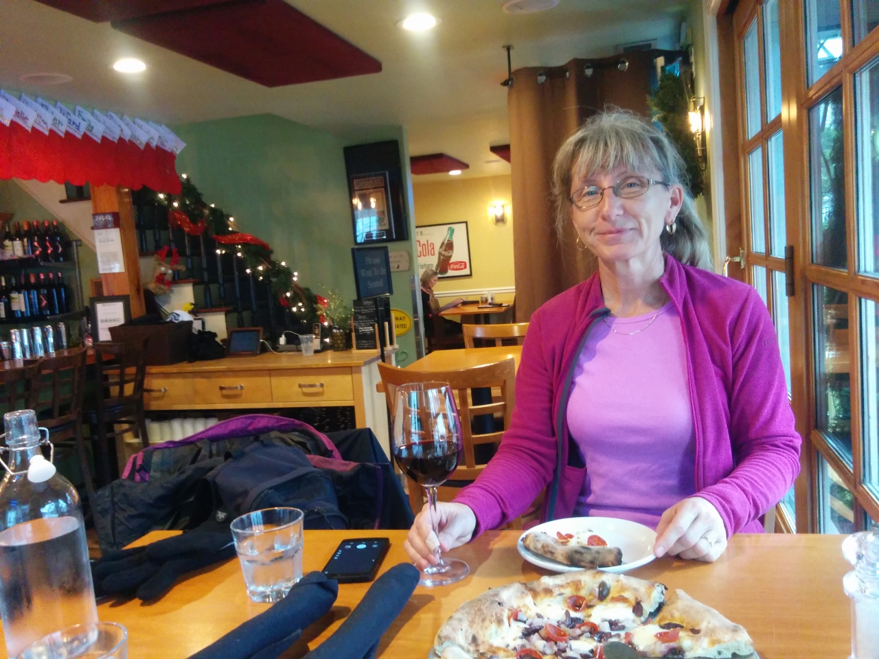 |
Ava’s
Position: -76 13.41, 38 47.00
We anchored for the night in St. Michael’s and ran the tender ashore for an exceptional pizza lunch at Ava’s Pizzeria & Wine Bar.
|
 |
St Michaels
Position: -76 13.43, 38 47.04
After lunch, we walked around town a bit. St. Michael’s has a large number of appealing-looking restaurants for its size and looks like a great place to spend a few days.
|
 |
Chesapeake Bay Maritime Museum
Position: -76 13.17, 38 47.25
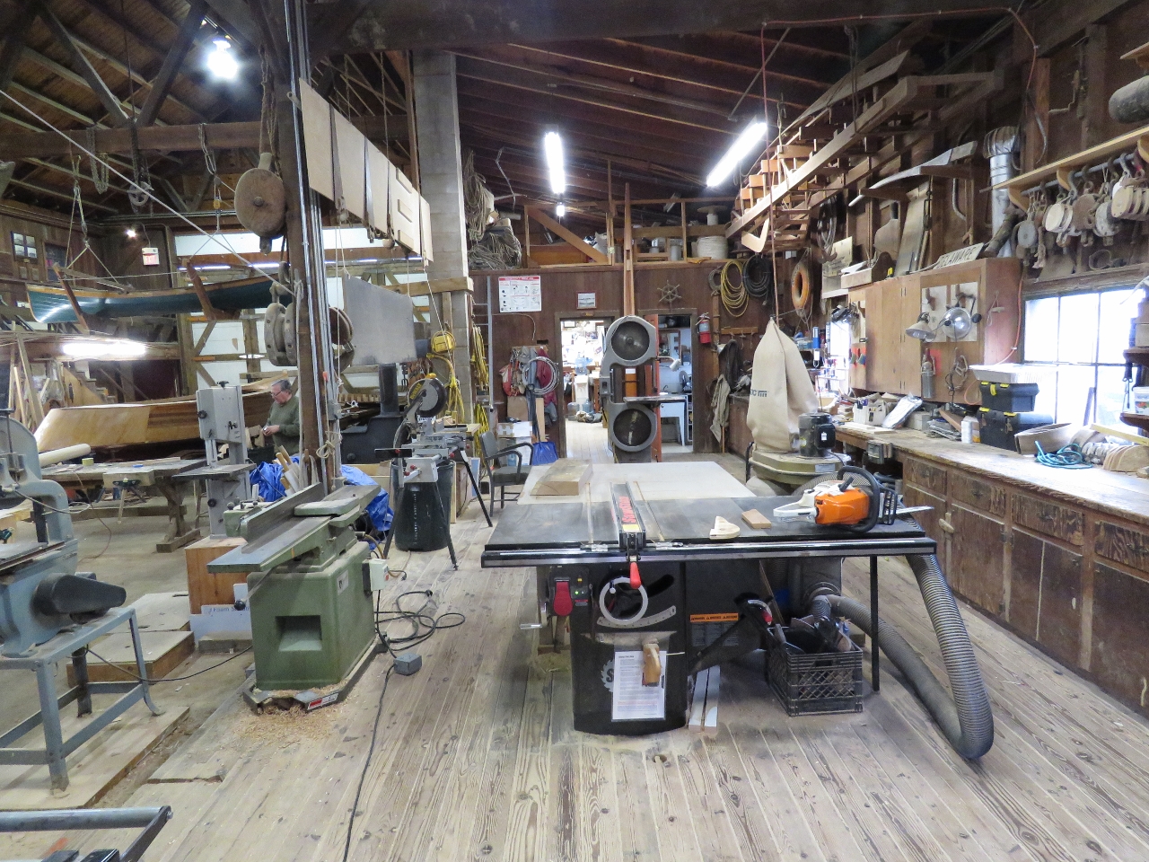
One of the reasons we stopped in St. Michael’s was to visit the highly-rated Chesapeake Bay Maritime Museum. Here we are in the Boat Shop, where traditional wooden boats and accessories are built and restored.
|
 |
Edna E. Lockwood
Position: -76 13.18, 38 47.22
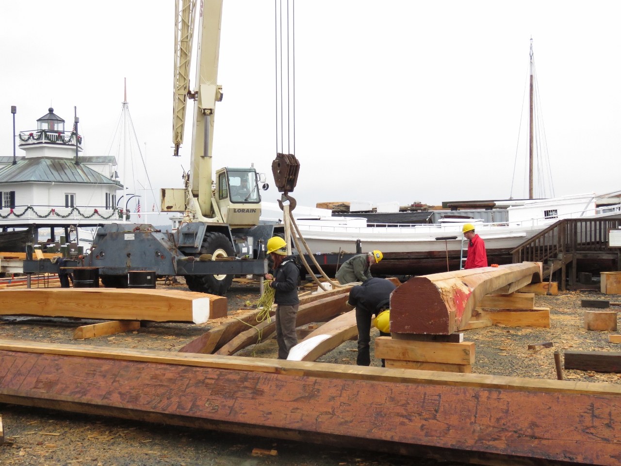
A major project underway at the museum is the restoration of the Edna E. Lockwood, a National Historic Landmark and the last of the sailing log oyster dredges. The hull is made of pine logs, rather than sawn lumber, indicating it was built at a time when large trees were more readily available than milled timber.
|
 |
Hooper Straight Lighthouse
Position: -76 13.15, 38 47.26
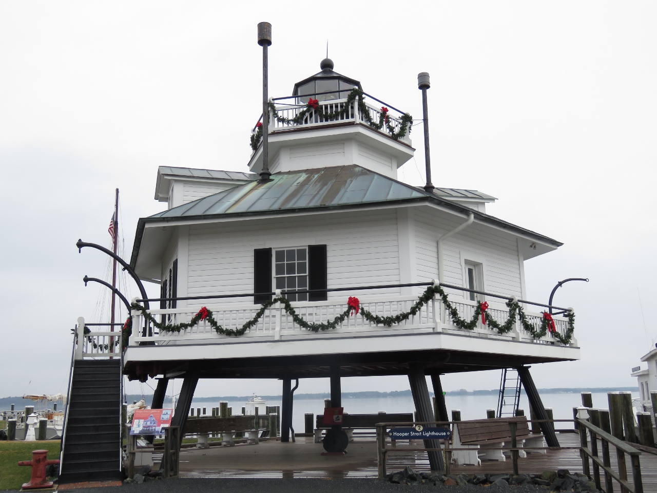
The Hooper Straight Lighthouse was built in 1879 about 40 miles south of the museum in Hooper Strait. The museum bought and transported it here in 1966 to save it from demolition after an automated light was installed and the house no longer needed.
|
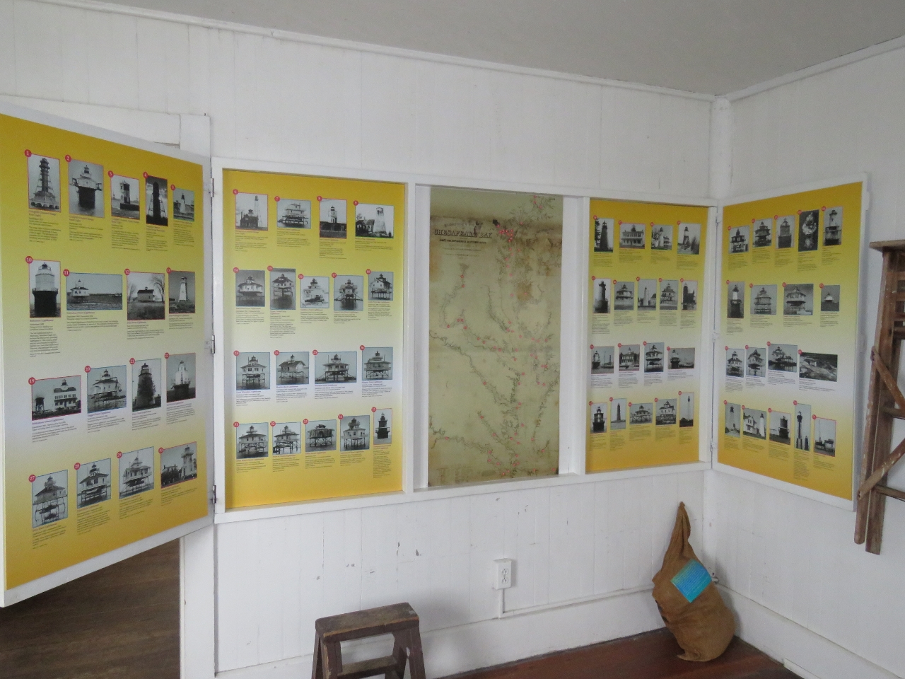 |
Lighthouses
Position: -76 13.15, 38 47.26
Inside the Hooper Straight Lighthouse is an extensive museum detailing life in the lighthouse. This display shows seventy-one lighthouses that were installed in Chesapeake Bay. That’s a lot of lighthouses.
|
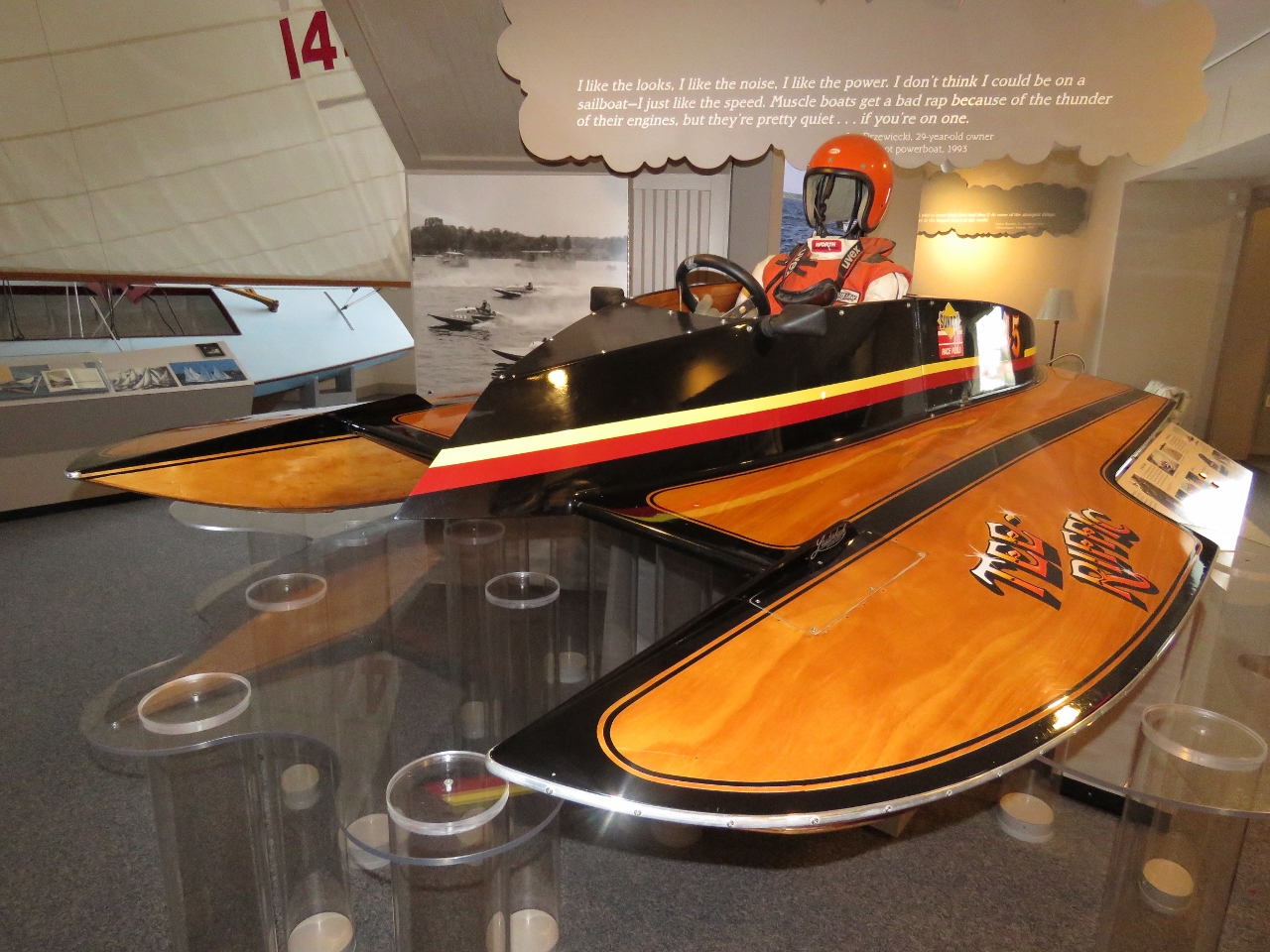 |
Hydroplane
Position: -76 13.17, 38 47.26
One large building at the museum describes the recreational history of Chesapeake Bay, including locally-built hydroplanes.
|
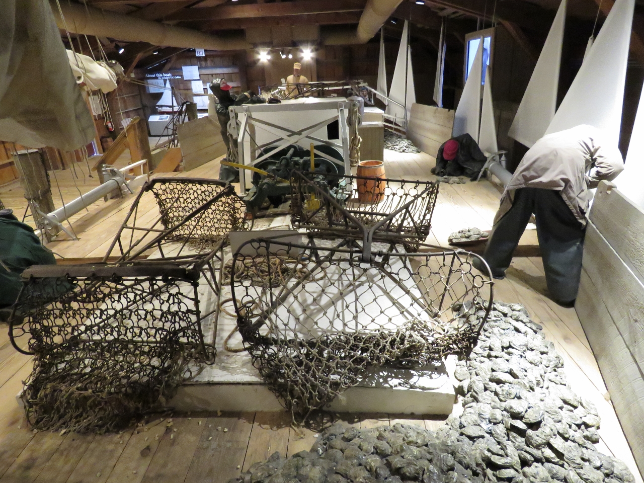 |
Oyster Boat
Position: -76 13.27, 38 47.30
The “Oystering on the Chesapeake” exhibit features a full-size oyster boat with audio of the crew at work.
|
 |
Steam Engine
Position: -76 13.29, 38 47.34
This 12ft-tall, 2-cylinder, 700HP steam engine came from a railroad tug that ferried railroad cars on car floats across the Chesapeake Bay.
|
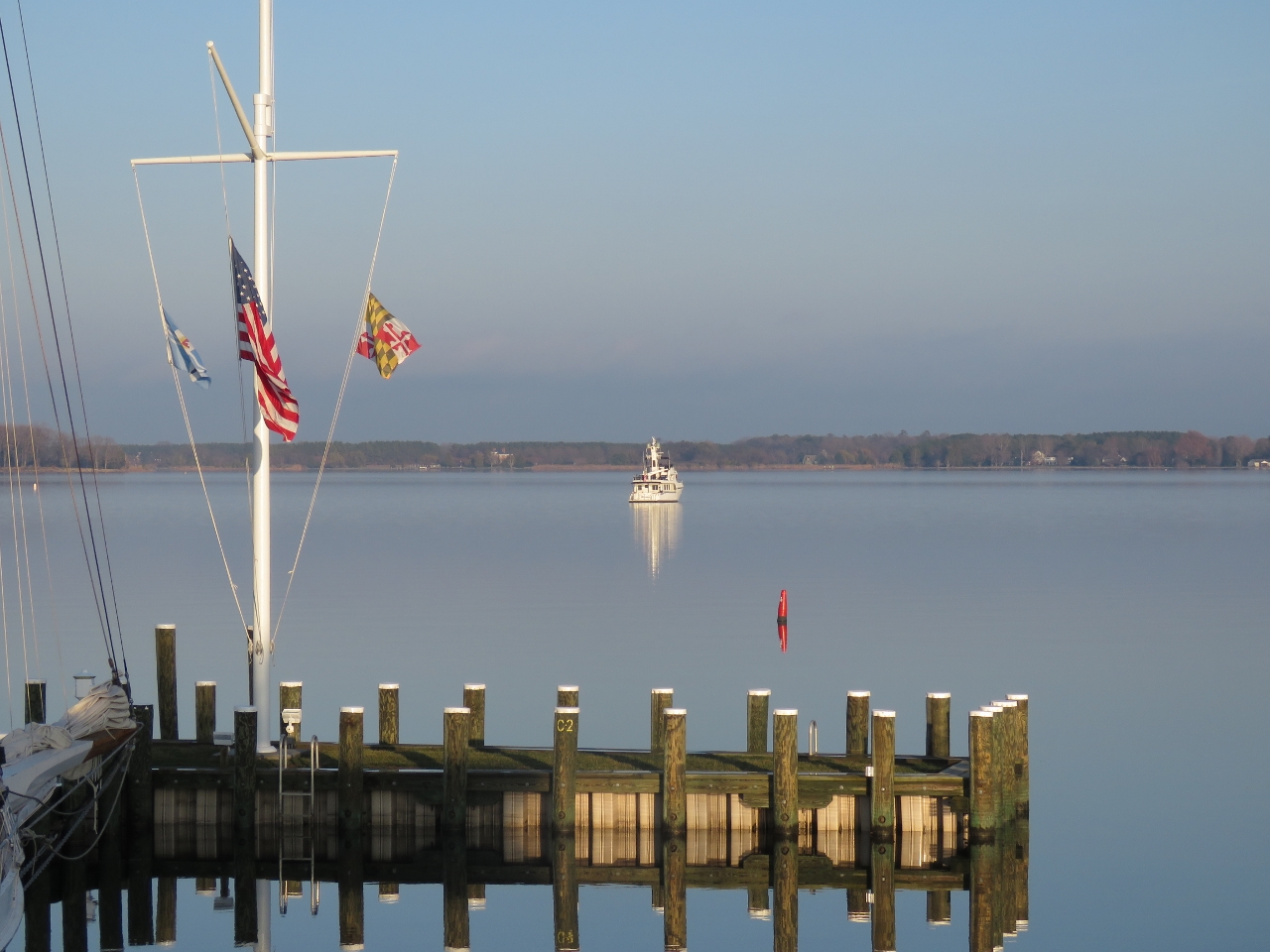 |
Anchorage
Position: -76 13.16, 38 47.26
A view to our peaceful anchorage. The area can get quite busy in the summer, but we’re the only ones here. We’ve always enjoyed the solitude that winter boating brings.
|
|
|
Winter Lights
Position: -76 12.84, 38 47.37
One upside to winter’s shorter days is the nighttime lights. Whether from a passing ship, a moored boat, or a nearby house, we enjoy being snug inside with a view to lights twinkling in the distance. The show gets even better during the Christmas season, when colorful holiday light displays are put on afloat and ashore.
|
 |
Mustang 2175
Position: -76 12.85, 38 47.36
Jennifer raising the anchor, snug and warm in her Mustang 2175 flotation suit.
|

|
Click the travel log icon on the left to see these locations on a map, with the complete log of our cruise.
On the map page, clicking on a camera or text icon will display a picture and/or log entry for that location, and clicking on the smaller icons along the route will display latitude, longitude and other navigation data for that location. And a live map of our current route and most recent log entries always is available at http://mvdirona.com/maps. |
In your travels on the Chesapeake and in the Caribbean, how has the draft of the Nordhavn affected your plans? Really appreciate your efforts in documenting your travels.
Draw almost never impacts our decisions on where to go but there are times on the intra-coastal where we were moving slowly and backing down to look for a deeper channel. Our current marina slip is 6’7″ at low water and that is what we draw. Some marinas in the area don’t have sufficient water to float us so our water draw does constrain slightly.
Our air draft of 30′ and our water draft of 6’7″ are on the high side for similarly sized power boats so there are some places where the boat won’t go. But, thus far on our travels, it’s a rare location where we blocked by these constraints. The only constraint that we have felt limited by thus far is we would love to do the Great Loop but getting down below 19’1″ is a challenge even with our hinged stack. We could do it but it requires a crane and it’s a lot of work and Dirona probably isn’t the ideal boat for the great loop For that, we might use a faster and smaller boat.
Ocean going power boats do draw more water and it is a constraint on where you can go in some areas but it’s amazing how infrequently the constraint comes into play in the real world. It hasn’t had much impact on us at all.
Thanks for sharing your latest adventures on the Chesapeake James. Along with some intrepid mariners, it seems like you have everything pretty much all to your selves. Definitely a plus in the museums and marinas. Nice to know the length of sunlight each day is increasing and spring will be here in a couple of months.
Now that we are near the Georgia northern boarder, the weather is warm and and there are a lot of boaters. Surprisingly, Charleston City Marina was completely full for most of the time we were there.