Except for a brief transit around the Palm Beach area, we’ve not traveled the Intracoastal Waterway (ICW) in Dirona. In our first leg along the ICW, we headed 12 miles south from Portsmouth, Virginia to the town of Great Bridge. Depths were at least 10 feet all the way, except for about 8.5ft at Great Bridge, and all but one of the bridges we passed under that day are either normally-open or have sufficient clearance for us to pass under when closed. We also transited the only lock on the Virginia Cut route through the ICW.
A video of our complete transit between Norfolk and Great Bridge on Dec. 19th, 2016 is at https://youtu.be/p-b0uPOkXt8 and trip highlights follow. Click any image for a larger view, or click the position to view the location on a map. And a live map of our current route and most recent log entries always is available at http://mvdirona.com/maps
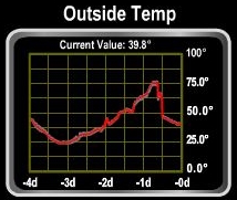 |
Temperature Swing
Position: -76 17.58, 36 50.65
The temperature has mostly been in the mid 30s over the past week or so. Three days ago it fell to a low of 24°F and then yesterday soared to a high of 76°F then fell back down to 40°. Its back down to 40 this morning.
|
 |
Beltline Railroad Lift Bridge
Position: -76 17.43, 36 48.75
The Beltline Railroad Lift Bridge in its normally-open position.
|
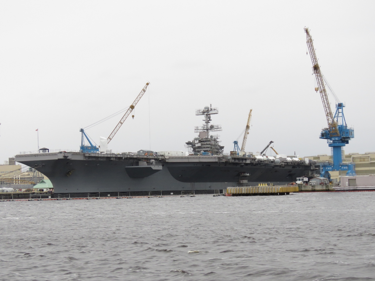 |
Harry S. Truman
Position: -76 17.43, 36 48.63
We believe this is the Nimitz-class aircraft carrier Harry S. Truman at the Norfolk Naval Shipyard in Portsmouth, but we couldn’t see any identifying name or number. The Harry S. Truman is scheduled to be in the yard there for maintenance for 10 months starting in August of this year.
|
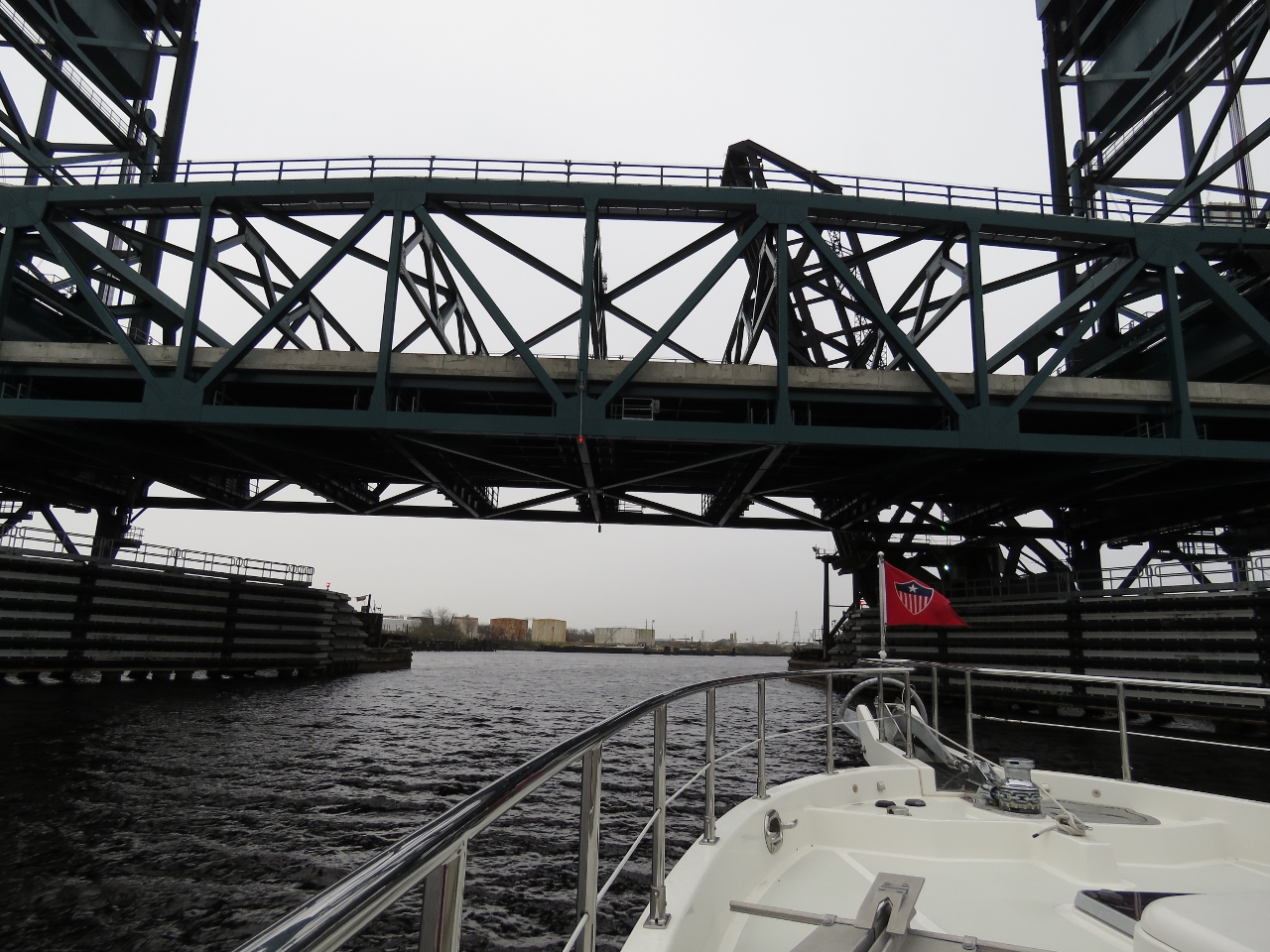 |
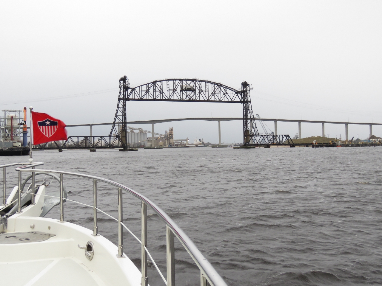
Gilmerton Lift Bridge
Position: -76 17.79, 36 46.28
The fourth bridge we passed under, the Gilmerton Lift Bridge, had a minimum clearance of 35ft closed. This is only 5 ft above our 30-ft air draft, but good enough for us to pass.
|
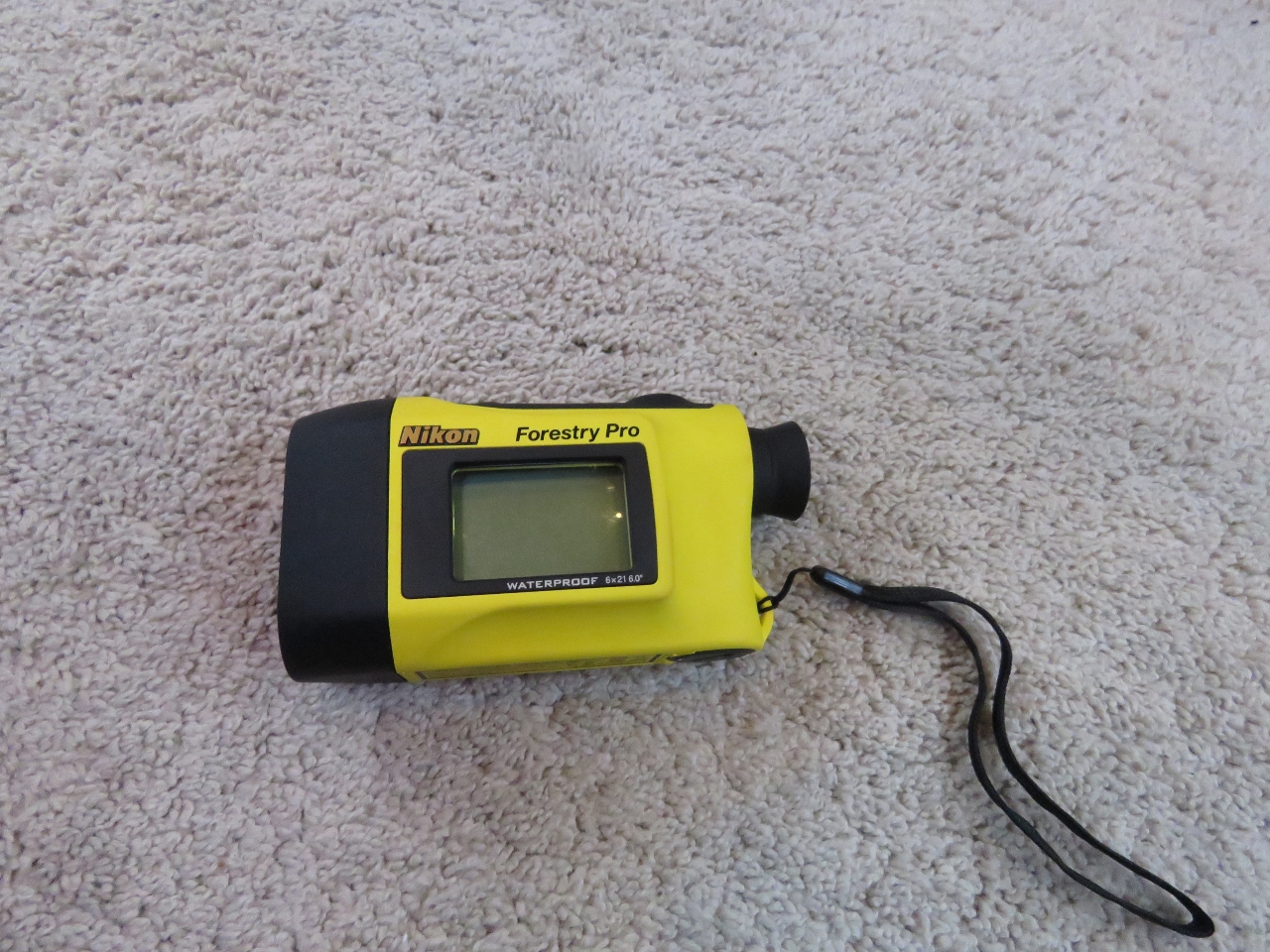 |
Range Finder
Position: -76 17.84, 36 46.18
We use a Nikon Forestry Pro Laser Rangefinder. The device is easy to use and incredibly accurate. Well before we were committed to passing under, the gauge measured the Gilmerton Lift Bridge clearance at 36ft, which matched the tidal gauge at the bridge. Along the ICW the bridges clearances are well-marked, but we’ve found several places in the world where they’re not marked at all and the gauge comes in quite handy.
|
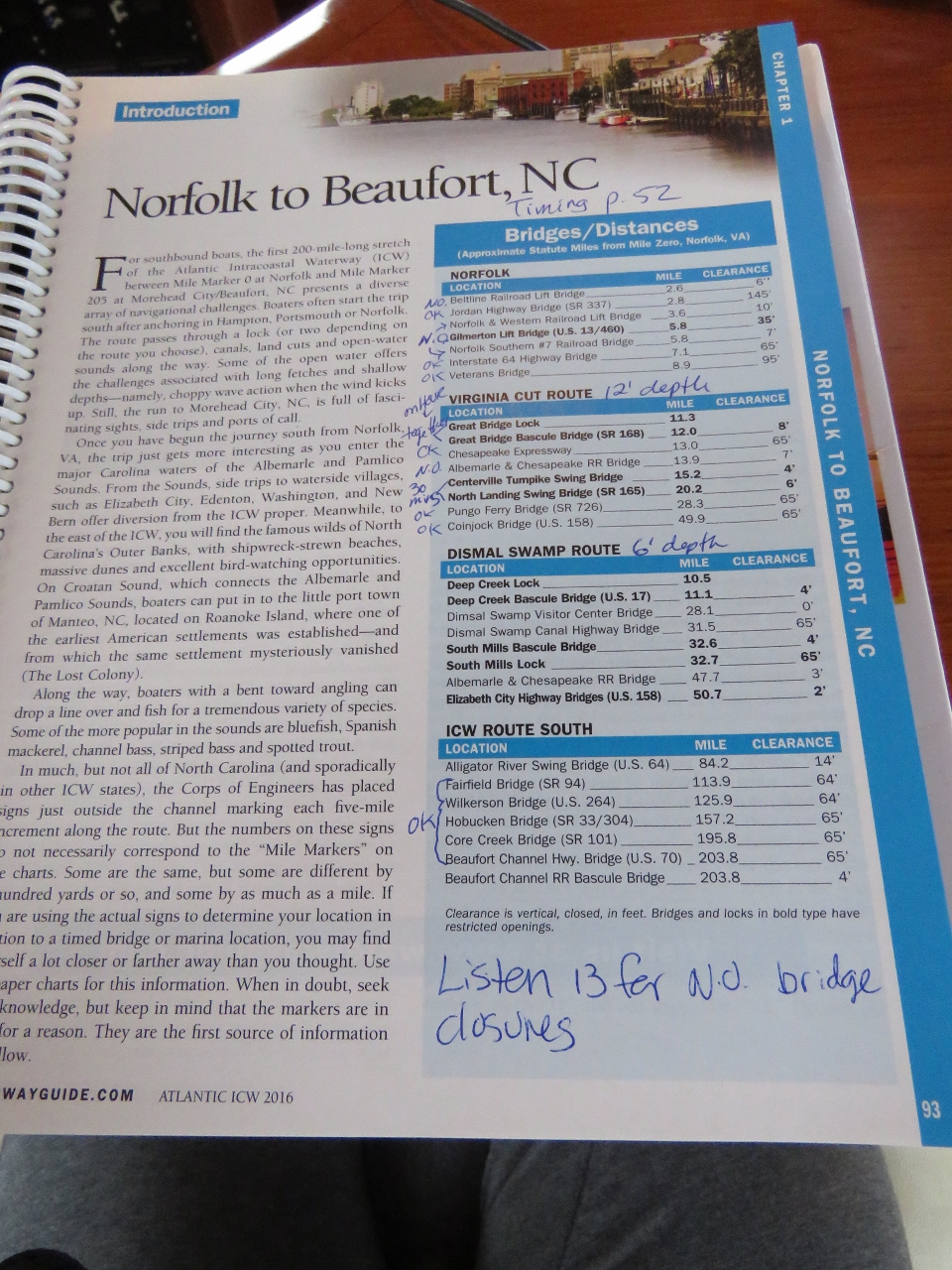 |
Waterway Guide
Position: -76 17.92, 36 45.96
We’ve been using the Waterway Guide cruising guides along the east coast and have found them accurate and quite useful. This page shows all the bridge clearance between Portsmouth, VA and Beaufort, NC. A separate section in the guide provided detailed timing information for all the bridges along the ICW. This made it easy for us to plan our route and know which bridges we needed to have opened—only four in total. Three of the four open on a fixed schedule, so we need to time our arrival at them.
|
|
|
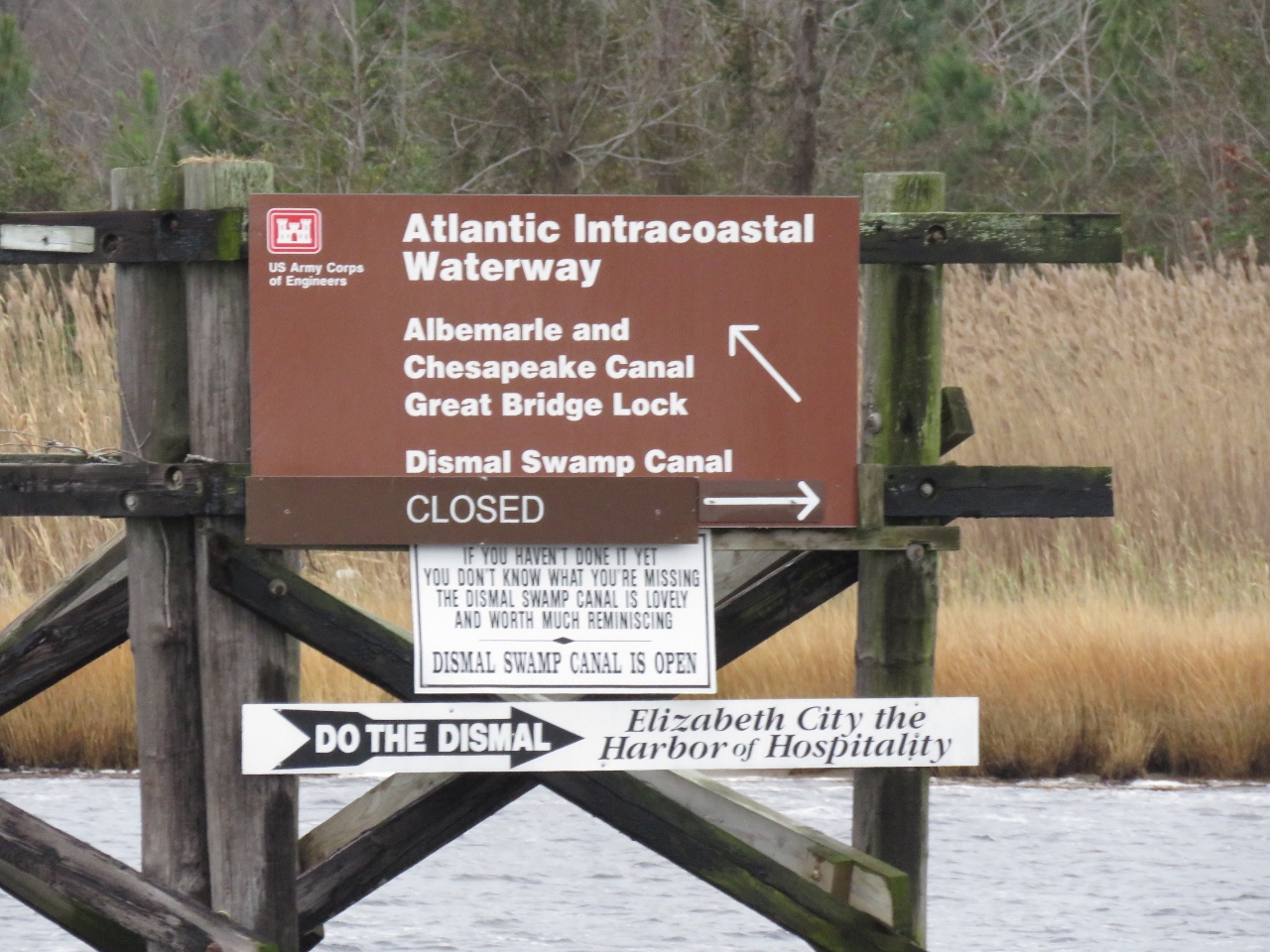
Branch
Position: -76 17.75, 36 45.15
The ICW branches here into two routes. We’re taking the Virginia Cut, which is charted at 12ft. The Dismal Swamp route is charted at 6ft and currently is closed, likely due to low water levels.
|
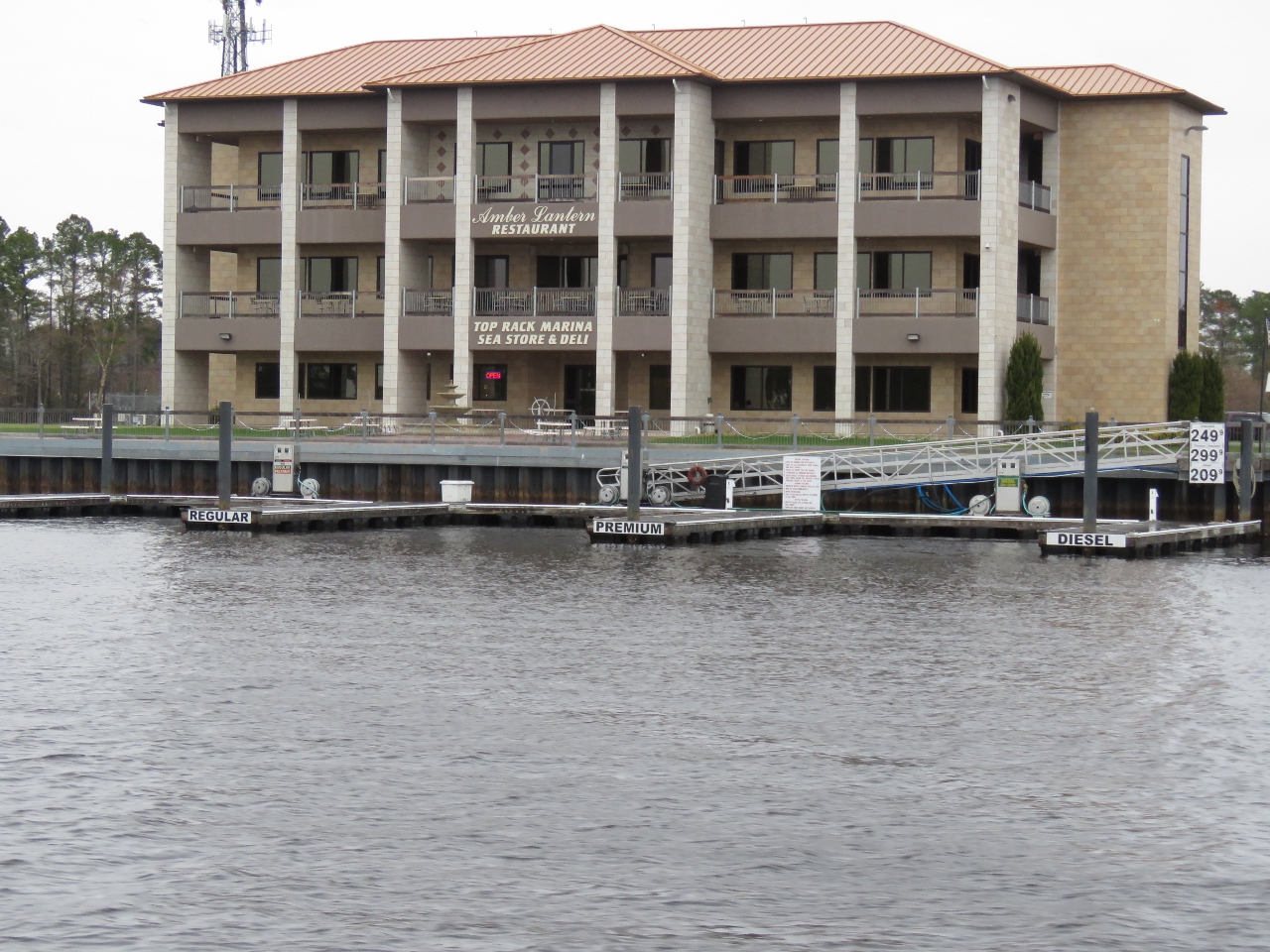 |
Fuel
Position: -76 17.68, 36 44.18
This fuel dock had one finger pier for diesel, a second for regular gas and a third for premium gas.
|
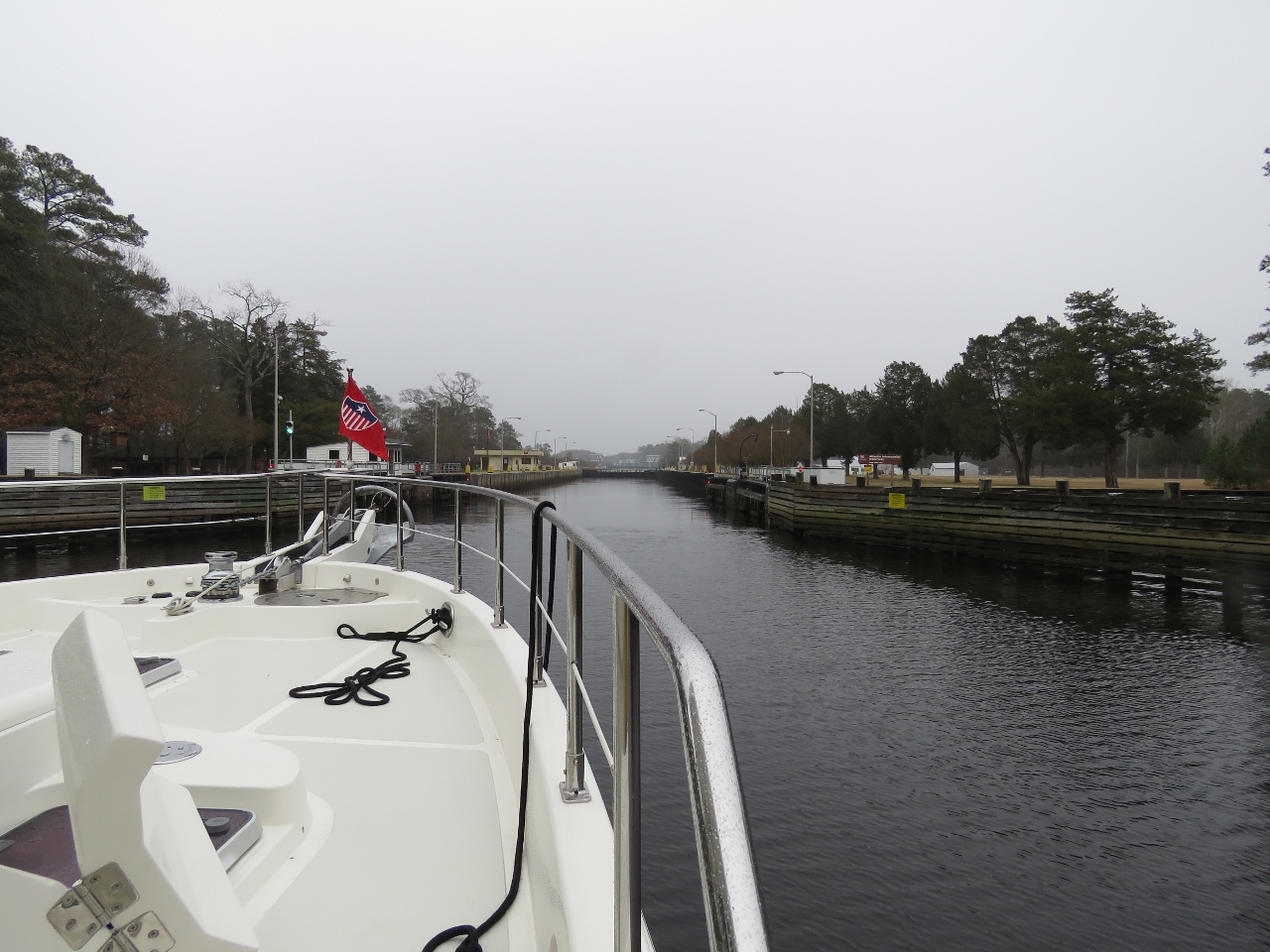 |
Great Bridge Lock
Position: -76 14.84, 36 43.41
Waiting for the gates to open at the Great Bridge Lock. This is the only lock on the Virginia Cut route through the ICW (two locks are along the alternate Dismal Swamp route). All the locks we’ve passed through so far have been tide-level locks. The Great Bridge Lock instead separates the saltwater of the Elizabeth River from the freshwater of the Albemarle and Chesapeake Canal.
|
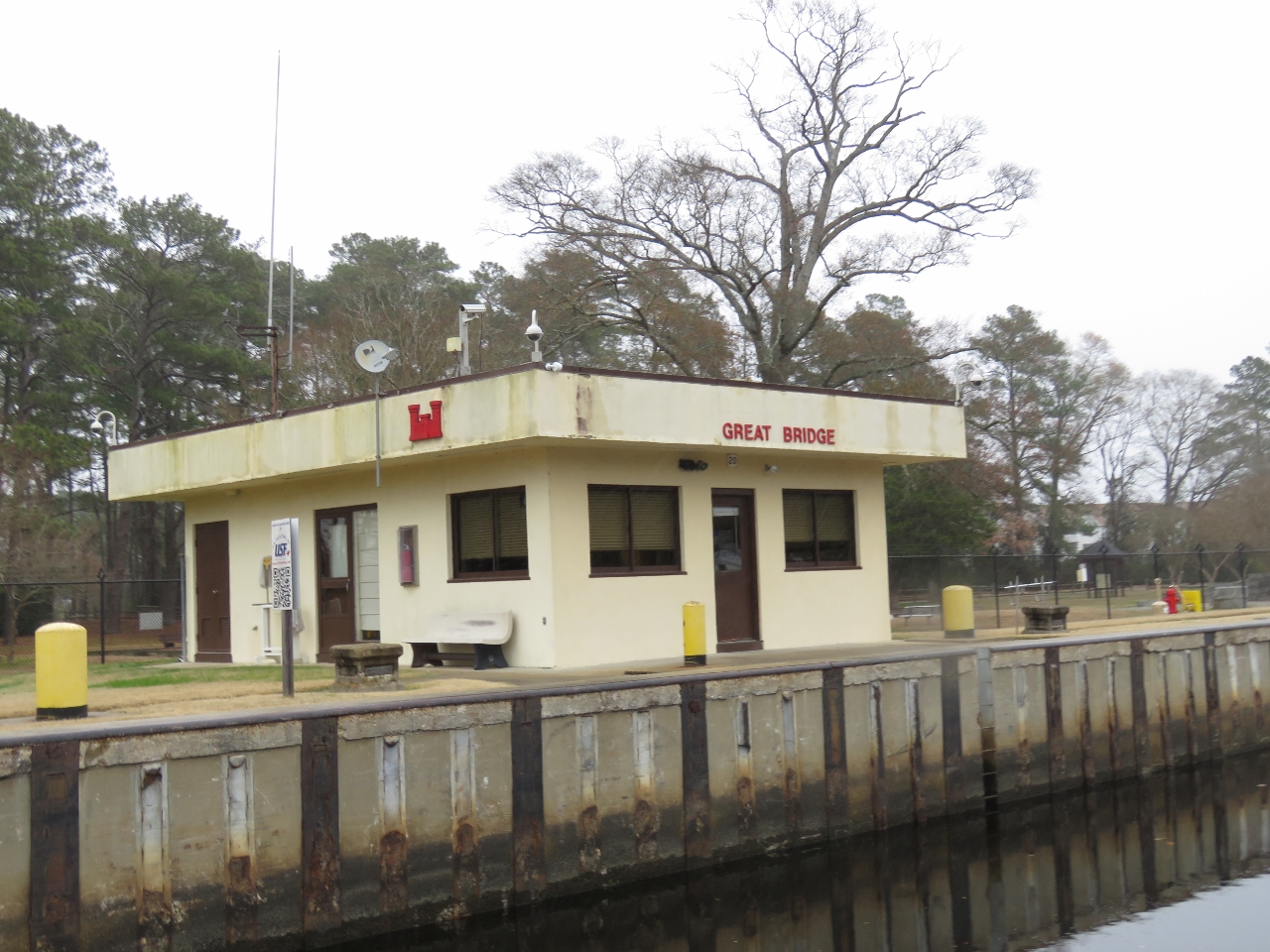 |
Army Corps
Position: -76 14.82, 36 43.40
The Great Bridge Lock is another US Army Corp of Engineers facility.
|
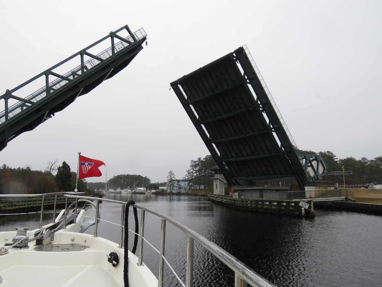 |
Great Bridge Bascule Bridge
Position: -76 14.28, 36 43.22
The Great Bridge Bascule Bridge opens only on the hour and the lock coordinates its opening with bridge. We arrived at 9:40am and passed through the locks just before the 10am bridge opening.
|
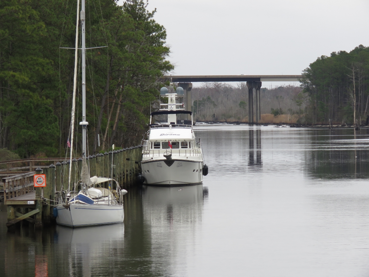 |
Moored
Position: -76 14.39, 36 43.22
Moored for the night at the town of Great Bridge. A video of our complete transit from Norfolk to Great Bridge is at https://youtu.be/p-b0uPOkXt8.
|
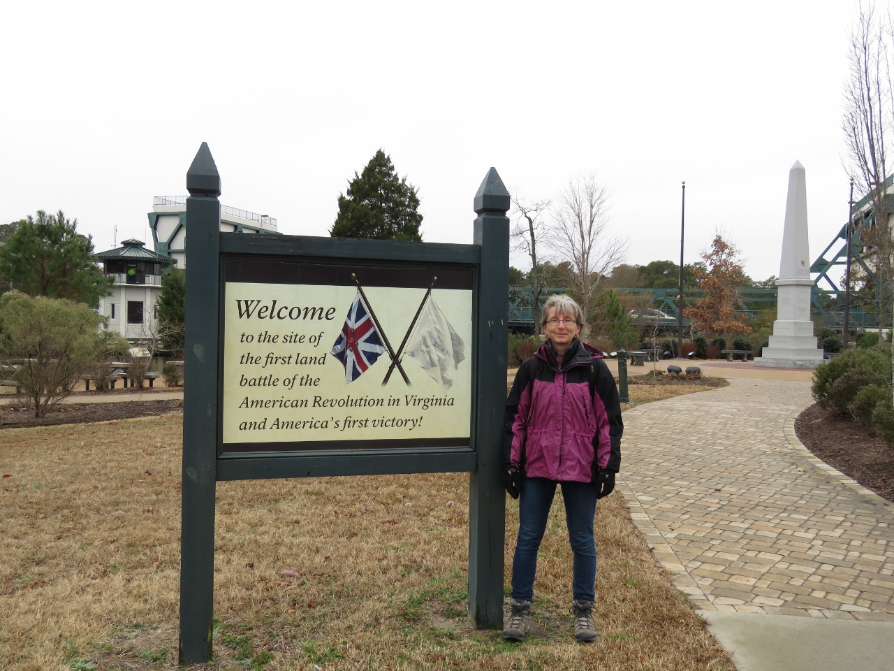 |
Battlefield Park
Position: -76 14.35, 36 43.30
The Great Bridge Battlefield and Waterways Park commemorates the first American victory in the Revolutionary War. The defeat of the British here allowed the local militia to capture Norfolk and gain a naval base from which to attack the British.
|
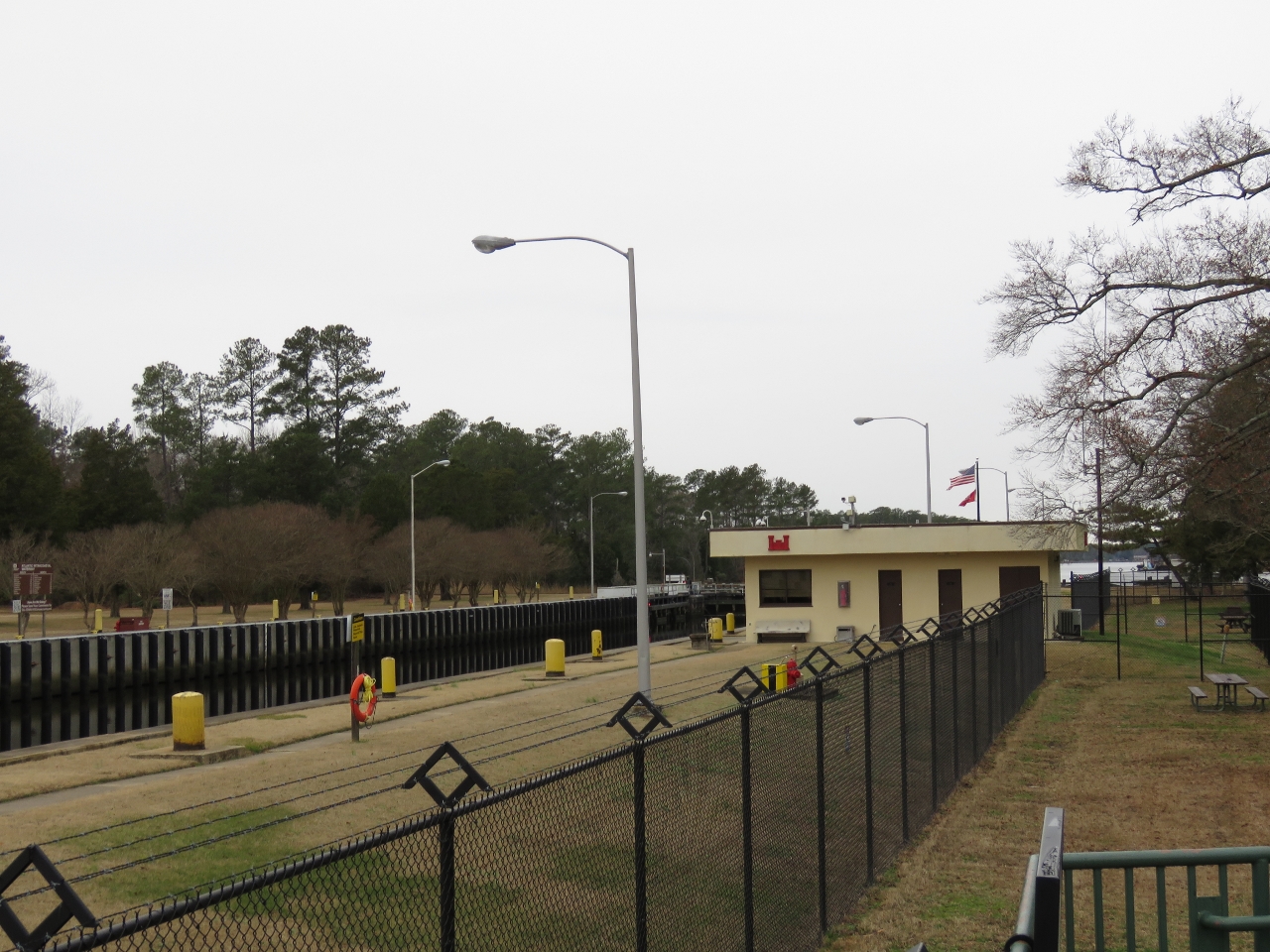 |
Park
Position: -76 14.76, 36 43.41
A view to the Great Bridge Lock from the adjacent public park. Not many people were around in mid-December, but signs warned of traffic congestion and difficult parking or even turning around.
|
 |
Kelly’s Tavern
Position: -76 14.53, 36 43.34
We had a great lunch overlooking the Elizabeth River at Kelly’s Tavern.
|
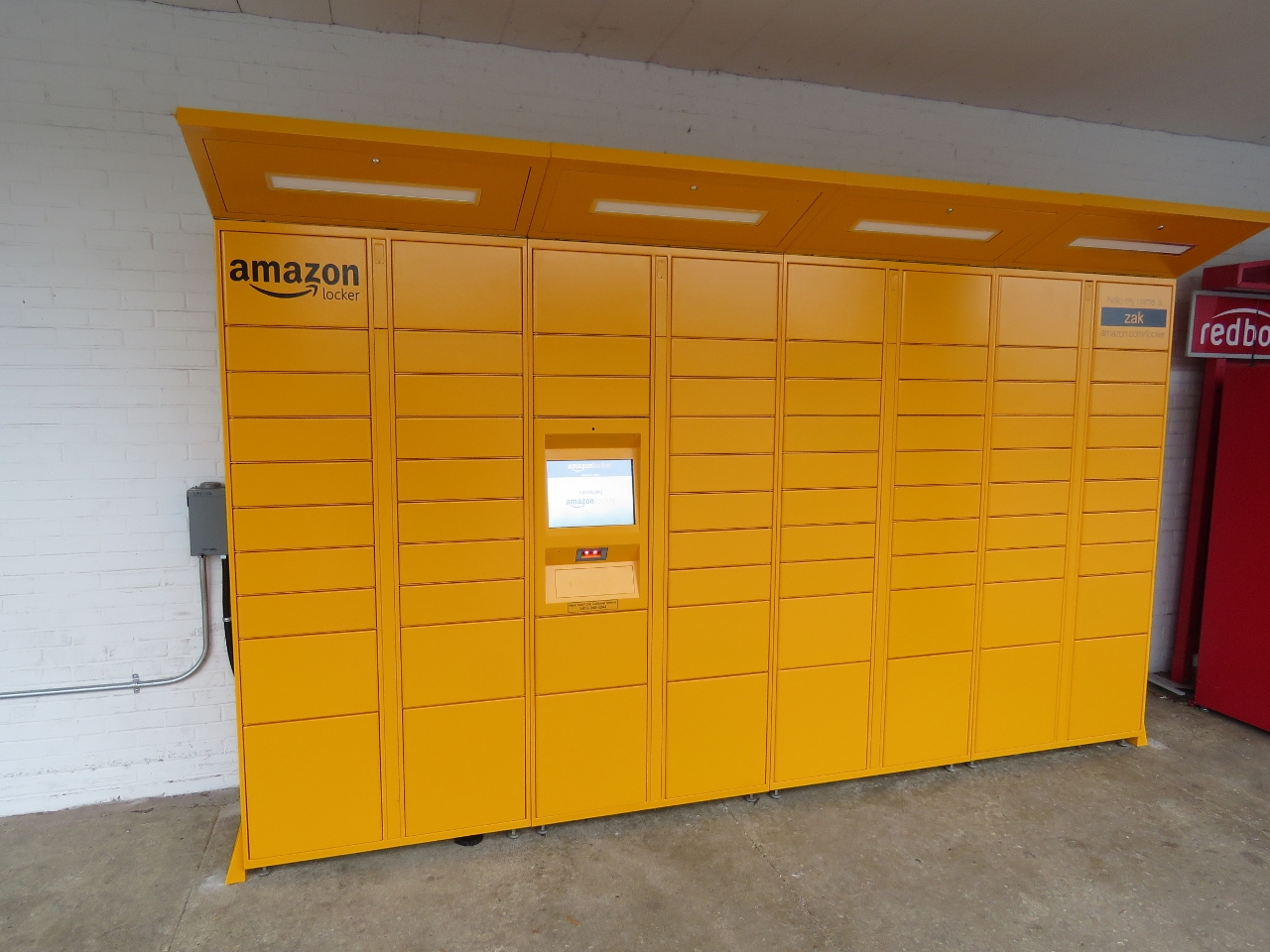 |
Amazon Locker
Position: -76 14.26, 36 42.89
Our first sighting of an Amazon Locker, a self-service parcel delivery and return location.
|

|
Click the travel log icon on the left to see these locations on a map, with the complete log of our cruise.
On the map page, clicking on a camera or text icon will display a picture and/or log entry for that location, and clicking on the smaller icons along the route will display latitude, longitude and other navigation data for that location. And a live map of our current route and most recent log entries always is available at http://mvdirona.com/maps. |
If your comment doesn't show up right away, send us email and we'll dredge it out of the spam filter.