Acadia National Park is Maine’s most popular tourist destination, with miles of rocky coastline and fabulous mountain-top views. With clear and calm forecast, we spent the day taking in the highlights and natural beauty of this impressive park.
Trip highlights from September 26th, 2016 follow. Click any image for a larger view, or click the position to view the location on a map. And a live map of our current route and most recent log entries always is available at http://mvdirona.com/maps
 |
Visitors Center
Position: -68 14.76, 44 24.50
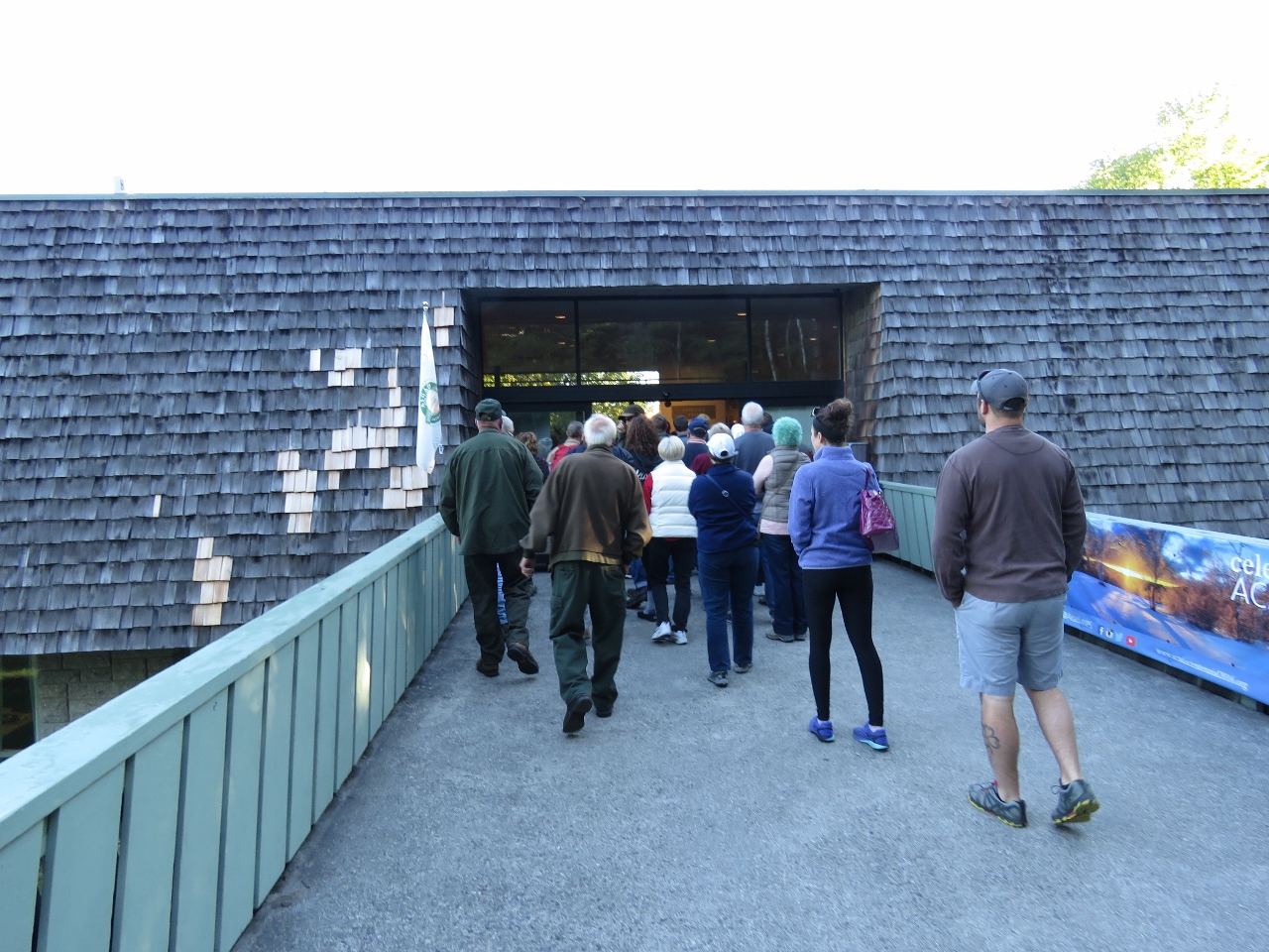
After picking up a rental car, we drove straight to the main visitor center to pickup a park pass. We weren’t the only ones to arrive just before they opened at 8:30am. Fortunately we were processed quickly and underway within fifteen minutes.
|
 |
Cadillac Mountain
Position: -68 13.42, 44 21.19
Our first stop in the park was a drive to the top of 1,527ft Cadillac Mountain for a spectacular 360° view of Mount Desert Island. This is view looking north, with the town of Bar Harbor visible on the right.
|
 |
Breakfast
Position: -68 13.42, 44 21.08
We had a late breakfast along the eastern slope. The Cranberry Islets are in the distance to the south.
|
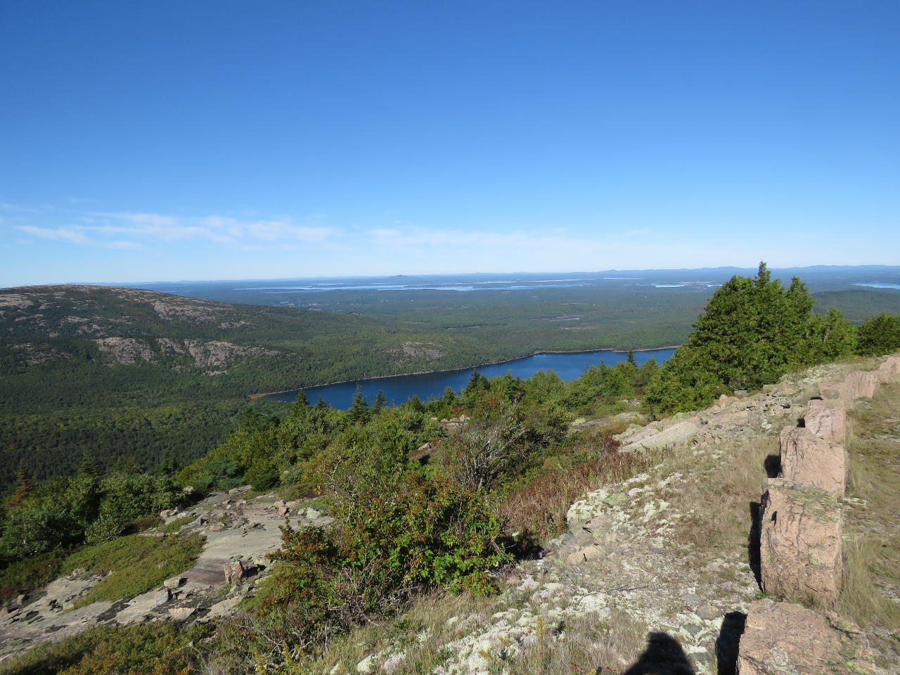 |
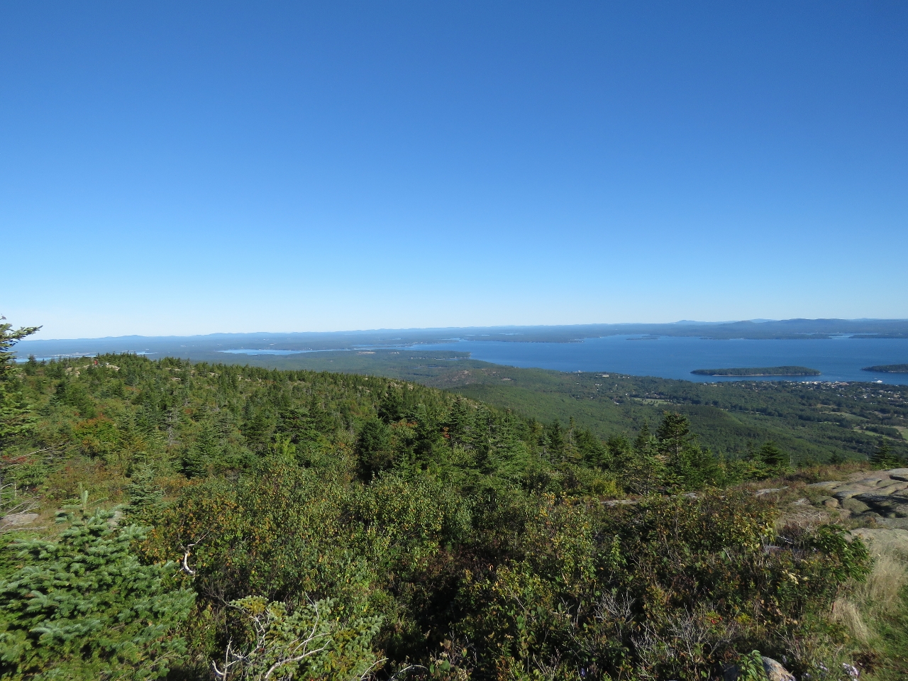
Eagle Lake
Position: -68 13.84, 44 20.93
The view looking northwest across Eagle Lake as we descend from Cadillac Mountain. Mt Desert Narrows, between Mt Desert Island and the mainland, is visible in the distance.
|
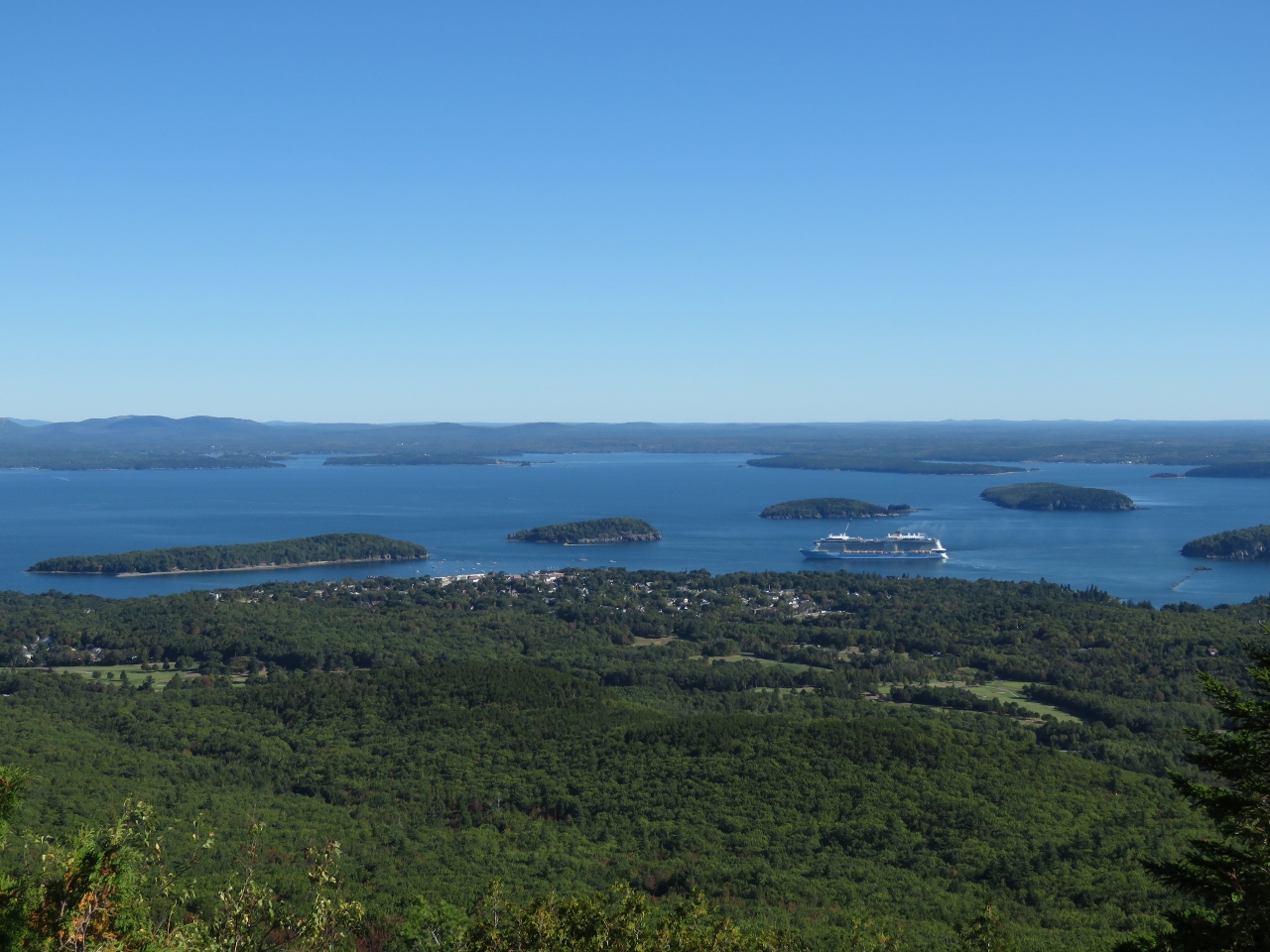 |
Bar Harbor
Position: -68 13.70, 44 21.35
A view to Bar Harbor from the Cadillac Mountain road with the cruise ship Anthem of the Seas moored offshore. Bar Harbor is a popular cruise ship destination—two passed us overnight en route while we were underway for Maine.
|
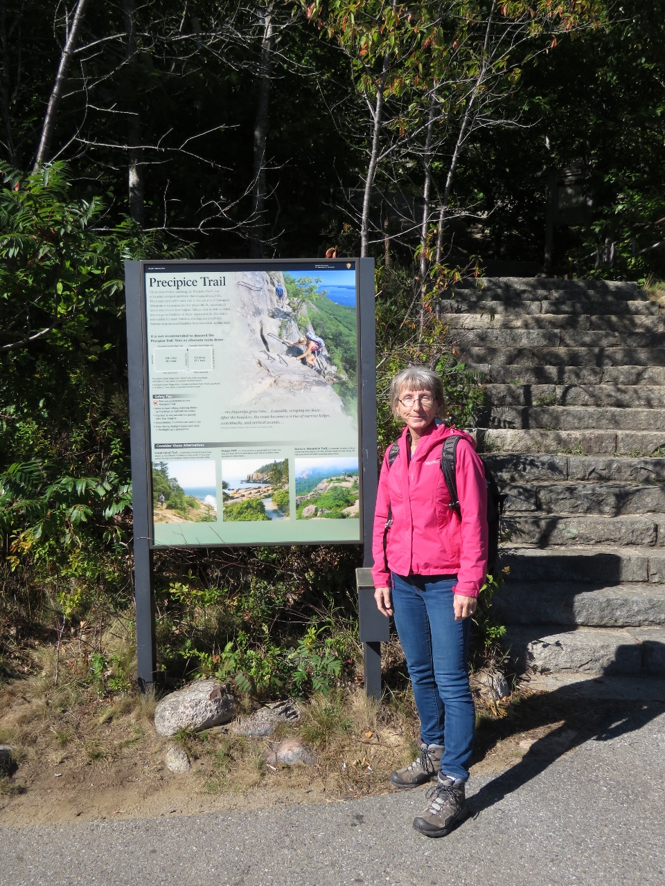 |
Precipice Trailhead
Position: -68 11.30, 44 20.97
At the trailhead for the famous Precipice Trail that leads to the top of 1058ft Champlain Mountain. The near-vertical trail with climbing rungs and ladders throughout to help thorough the many steep sections. The trail is so steep, and has so much foot traffic, that the sign recommends following one of several alternate routes back down.
|
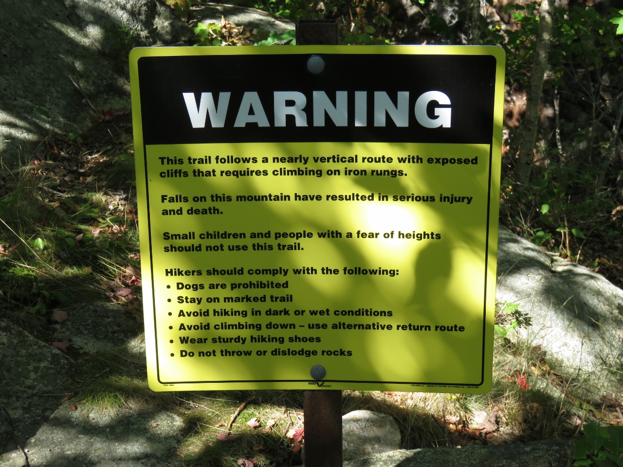 |
Warning
Position: -68 11.33, 44 20.96
Several warning signs like this were along the Precipice Trail. The first two sentences read “This trail follows a nearly vertical route with exposed cliffs that require climbing on iron rungs. Falls on this mountain have resulted in serious injury and death.” The trail wasn’t that difficult—we’ve climbed worse in Newfoundland.
|
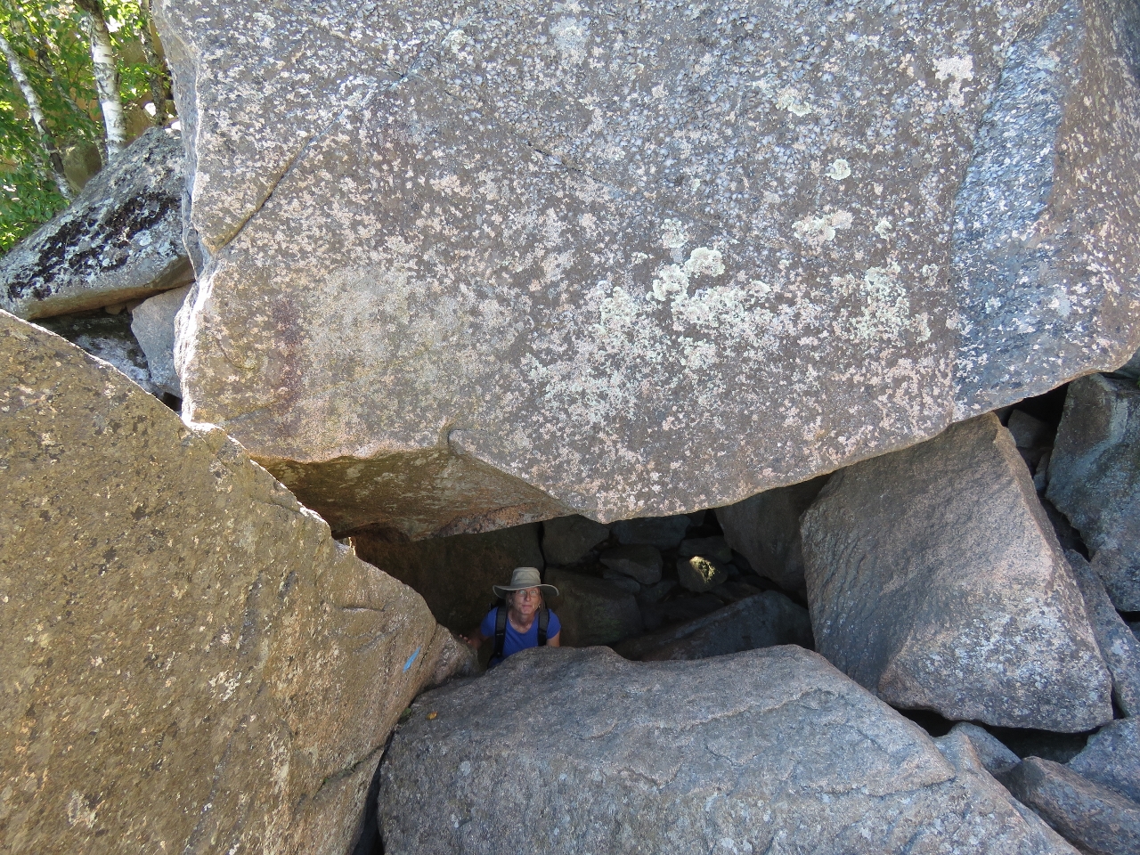 |
Under the Rock
Position: -68 11.41, 44 20.99
At one point, the trail passes under this huge boulder.
|
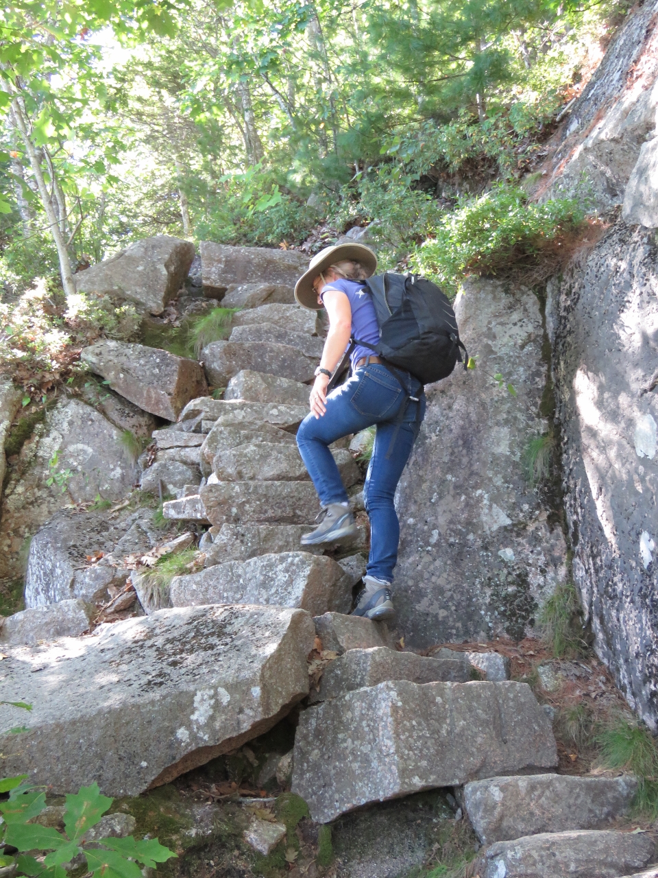 |
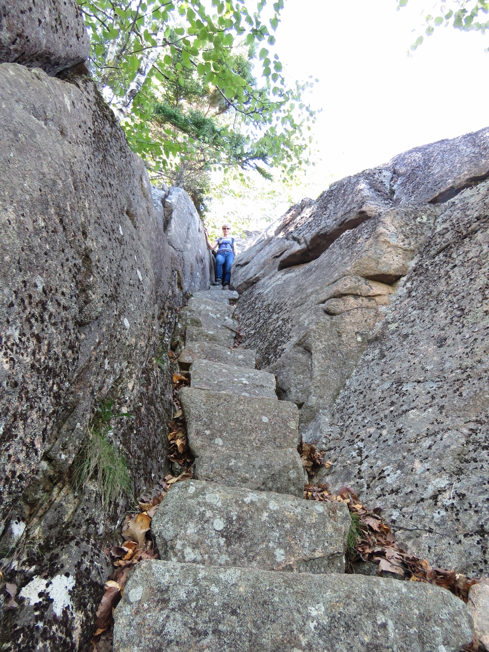
Steps
Position: -68 11.46, 44 21.00
The Precipice Trail, like every trail we followed in Acadia, is incredibly well-built. Here Jennifer is climbing one of several beautifully-constructed stone staircases.
|
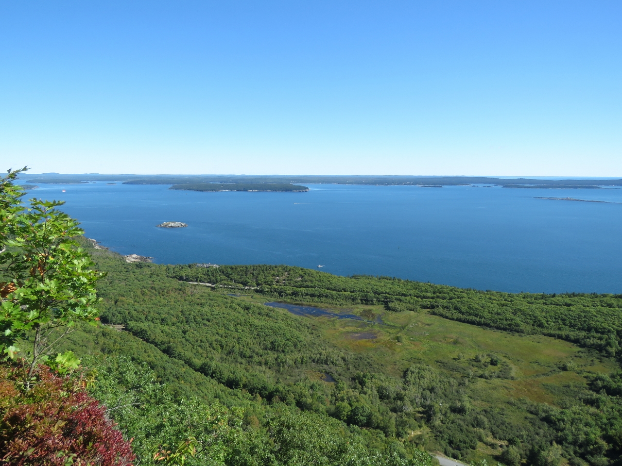 |
View
Position: -68 11.47, 44 20.98
The fabulous view from partway up the Precipice Trail looking northeast toward Frenchman Bay and the eastern end of Mt. Desert Narrows.
|
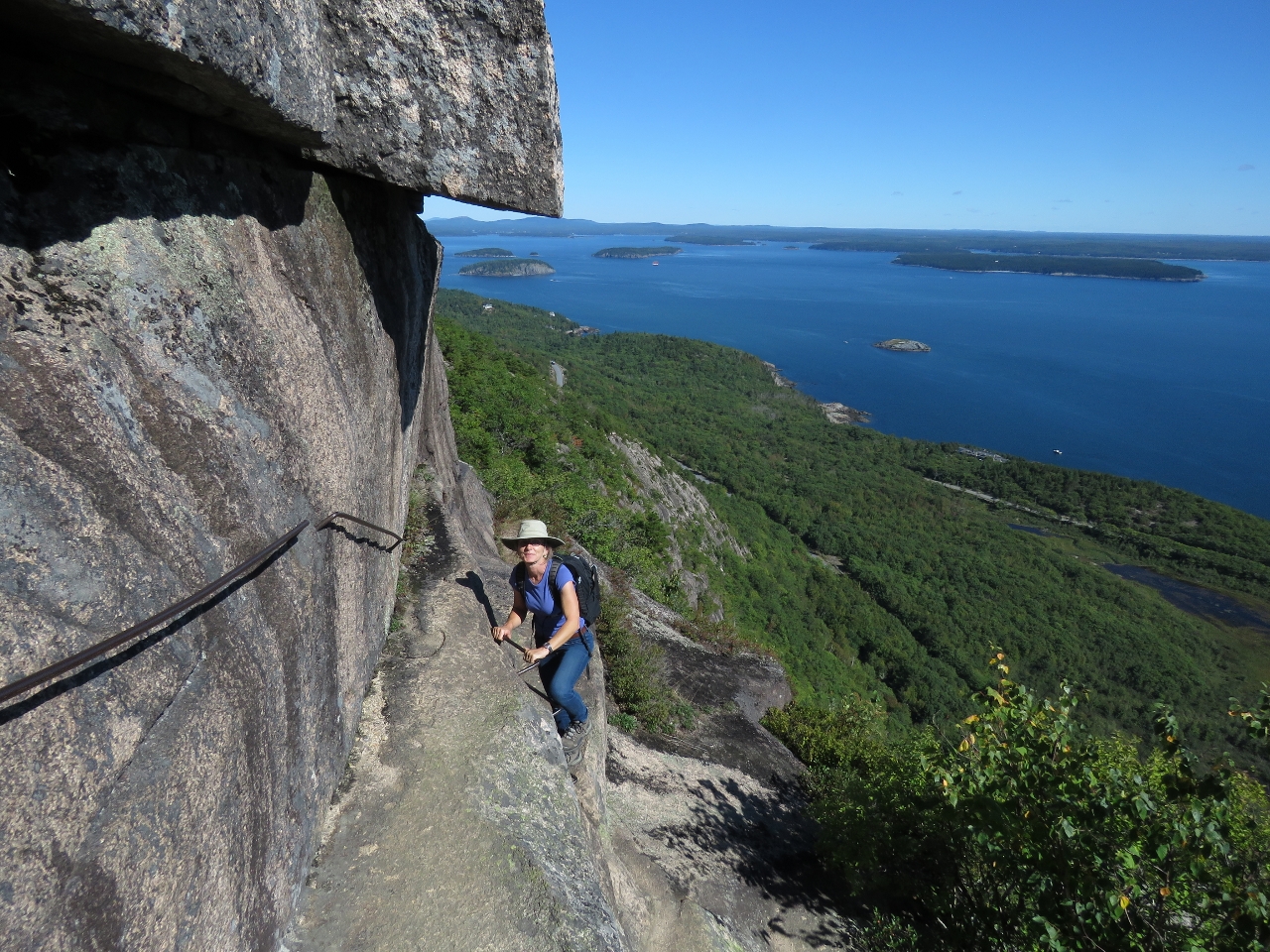 |
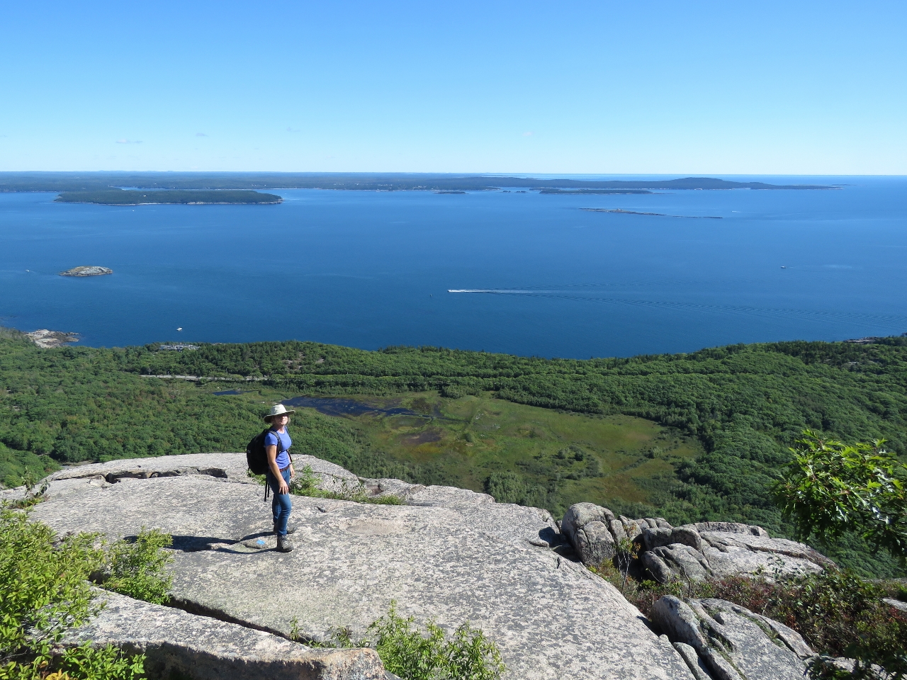
Climbing the Edge
Position: -68 11.49, 44 20.99
If you have a fear of heights, this is not the trail for you. But it was a fun and exciting climb, with astonishing views along the way. Overall the trail wasn’t as difficult as we were expecting. The dangerous portions always had handholds.
|
|
|
Champlain Mountain
Position: -68 11.53, 44 21.00
The sweeping view east from the top of 1058ft Champlain Mountain.
|
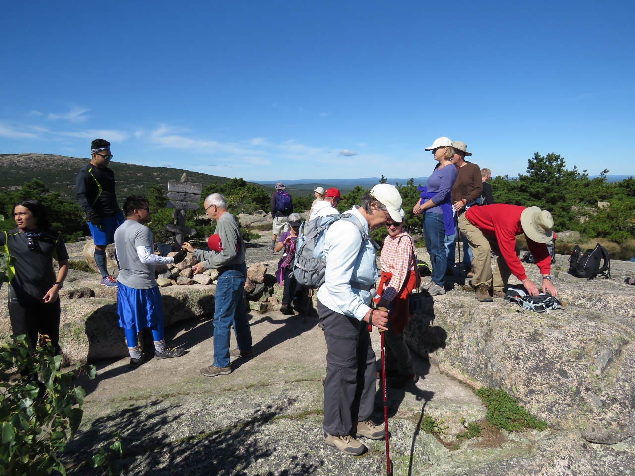 |
Crowds
Position: -68 11.63, 44 21.06
Severals trails lead to the top of Champlain Mountain, so not all these people came up the Precipice Trail. But our trail was surprisingly busy given the relative difficulty and how late we were in the seasoon. The parking lot at the trailhead was full and we passed several groups on the way up.
|
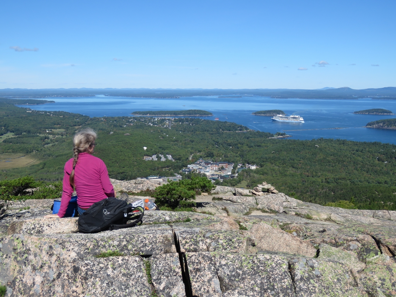 |
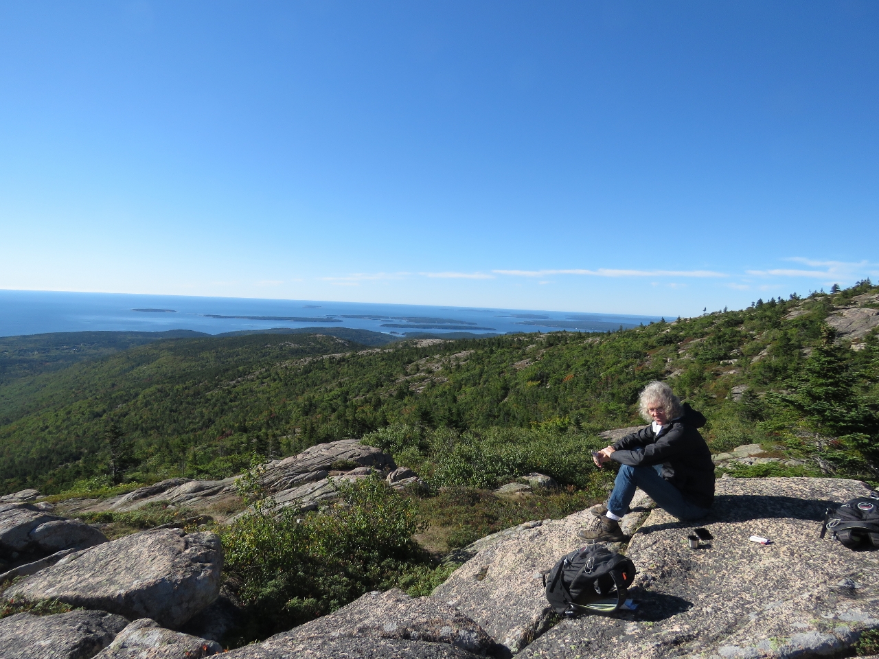
Lunch
Position: -68 11.65, 44 21.14
Lunch with a view to Bar Harbor from the top of Champlain Mountain.
|
 |
Mouse
Position: -68 11.45, 44 21.34
We passed this tiny mouse on the Orange & Black trail back to the car.
|
 |
Orange & Black Trail
Position: -68 11.41, 44 21.32
The Orange & Black goes up and down through several sets of granite stairs like this one. We were really impressed with the quality of the trail.
|
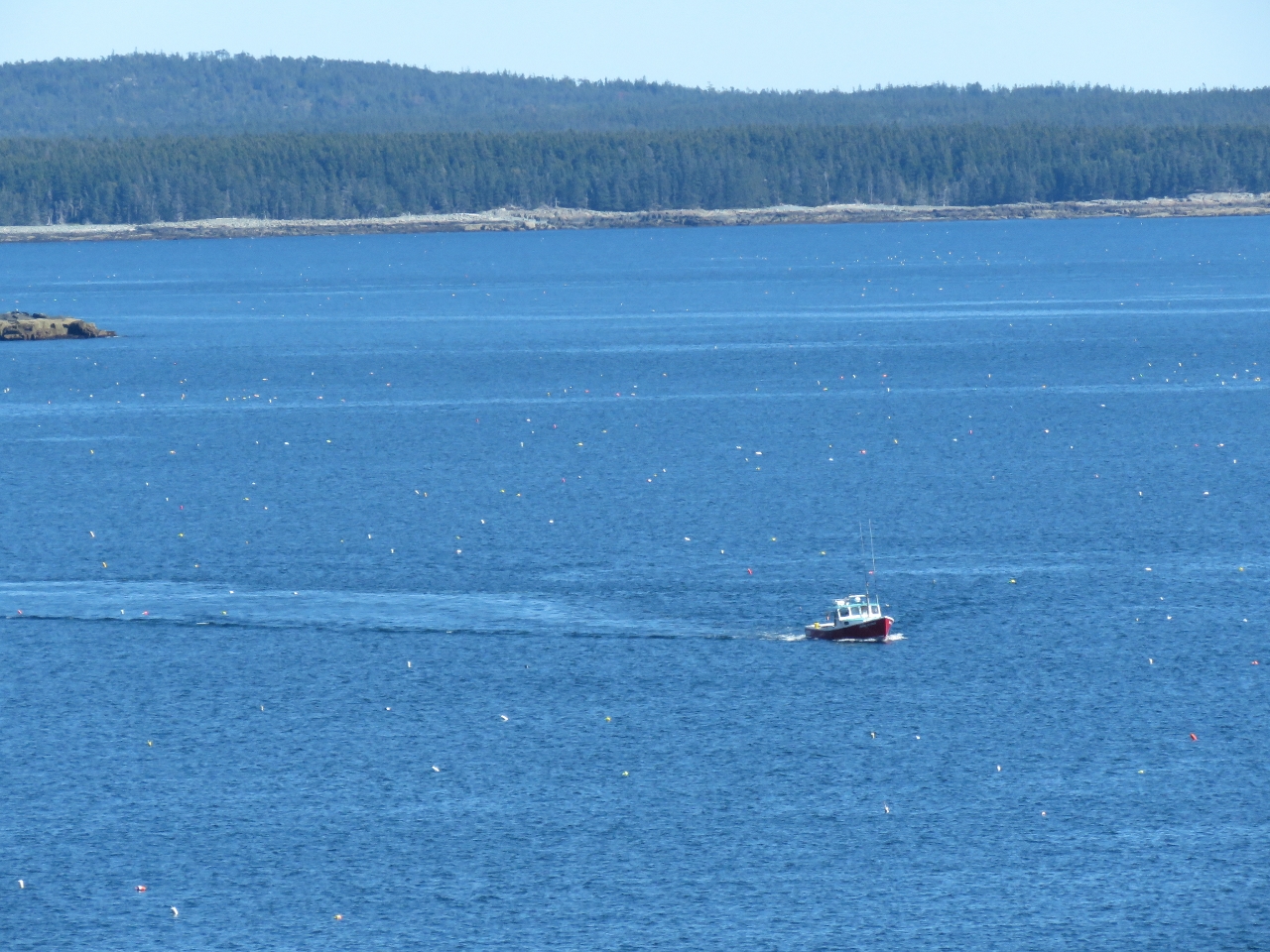 |
Floats
Position: -68 10.65, 44 20.39
The view to sea from the Schooner Head Overlook. At first we thought all those dots in the water were birds, but they are lobster floats. Boating in Maine requires a fair amount of attention at the helm.
|
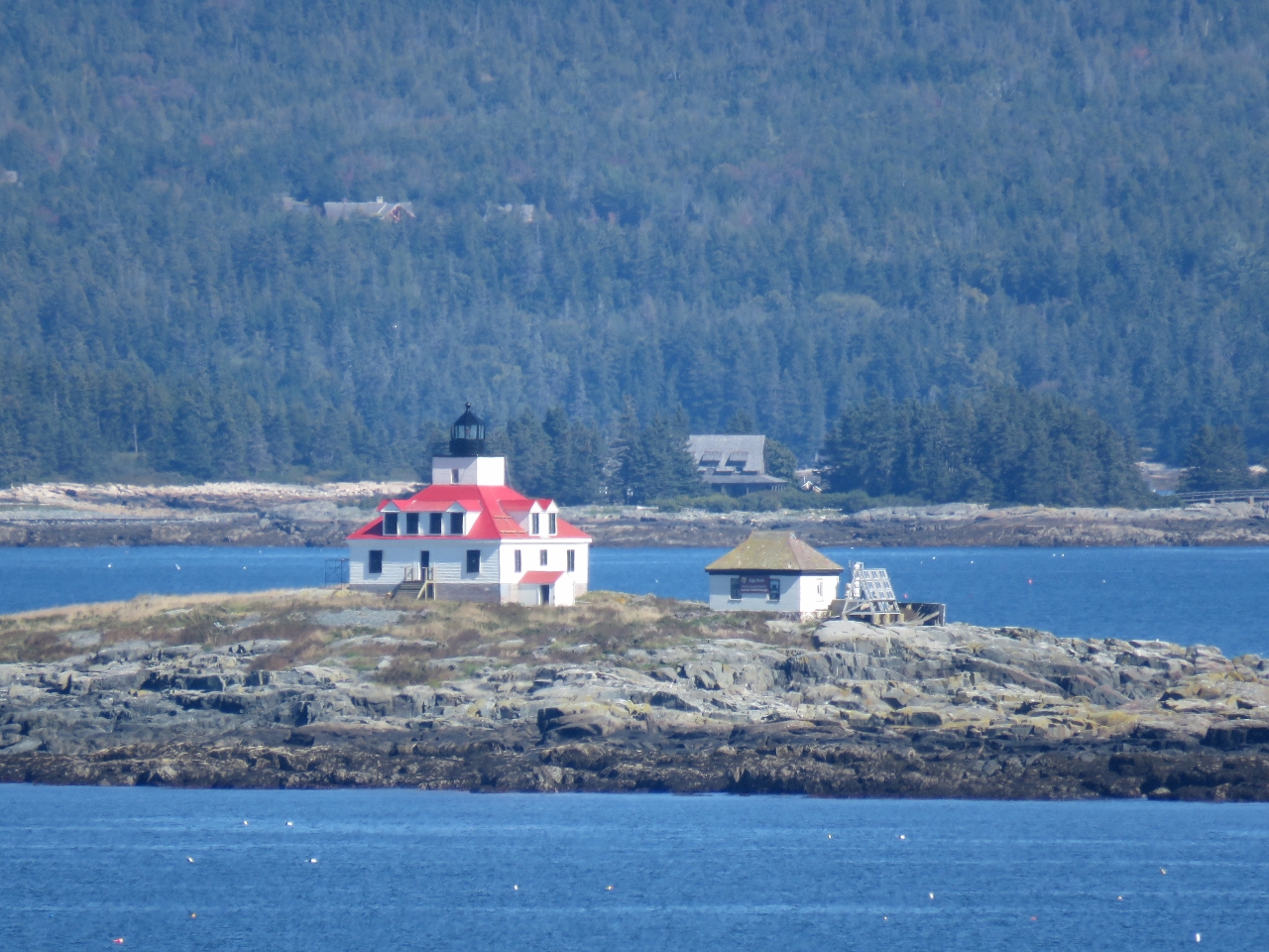 |
Egg Rock Lighthouse
Position: -68 10.65, 44 20.39
A view to the Egg Rock Lighthouse from the Schooner Head Overlook. The light was first lit in 1875 and now is automated.
|
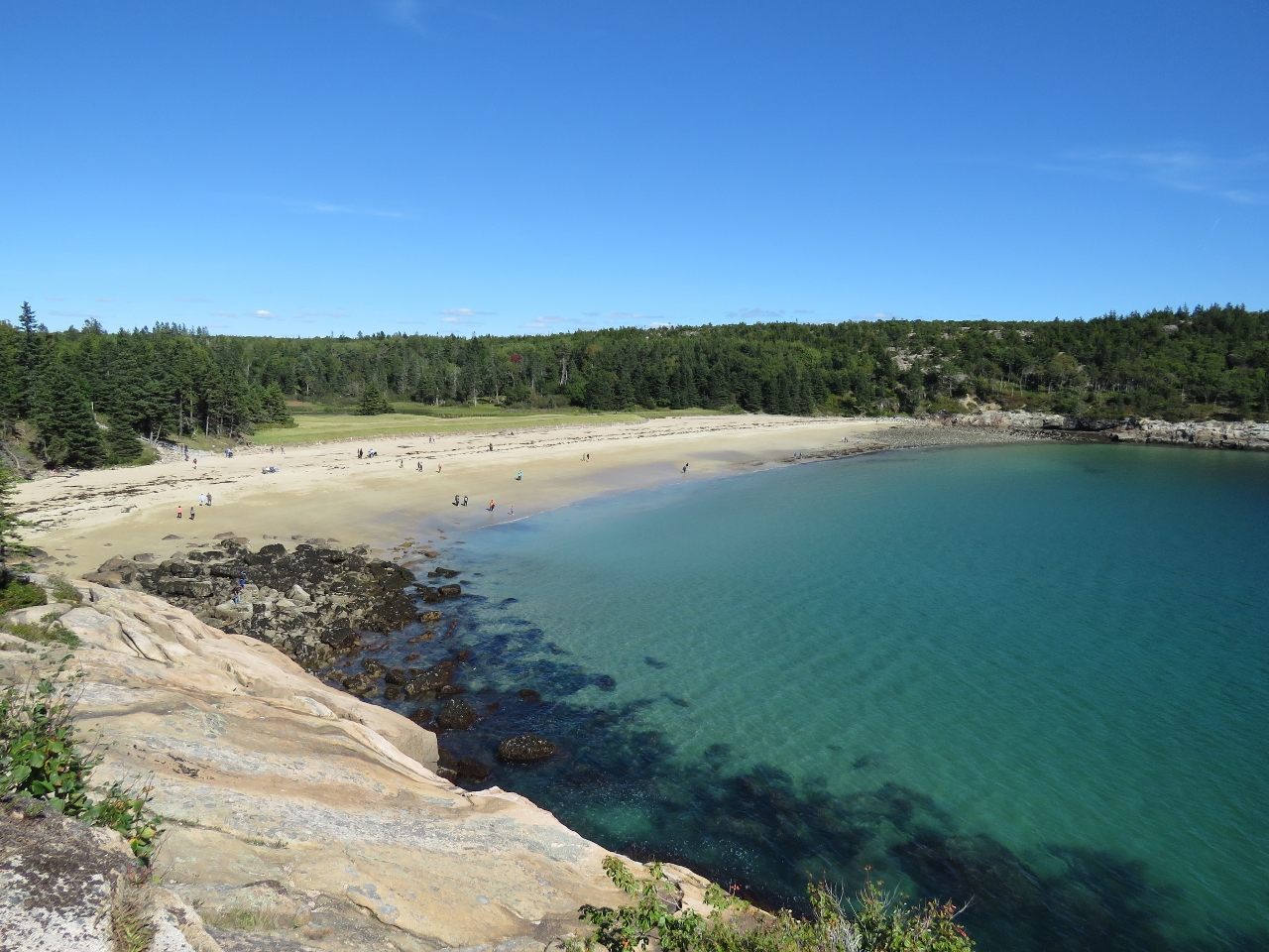 |
Sand Beach
Position: -68 11.07, 44 19.68
Sand Beach, being one of the few beaches in the area, is exceedingly popular in the summer. The water is 60°F at best and too cold for most people to swim, but lots will go there to sun on the beach and finding parking in the summer is a real challenge. We viewed it from afar from a lookout along the Ocean Path trail.
|
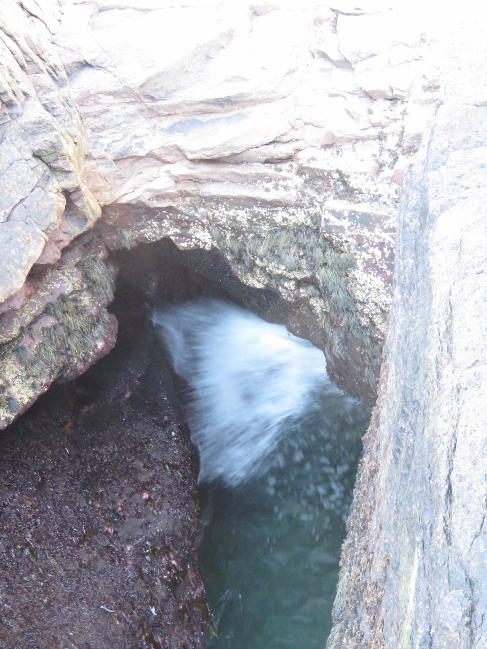 |
Thunder Hole
Position: -68 11.31, 44 19.24
In big seas and storms, water surges into Thunder Hole and air trapped in a small cave at the head escapes with a thunderous boom. It was pretty tame in today’s calm conditions. But that didn’t stop the masses of people from checking it out. Thunder Hole is one of the most popular attractions in the park.
|
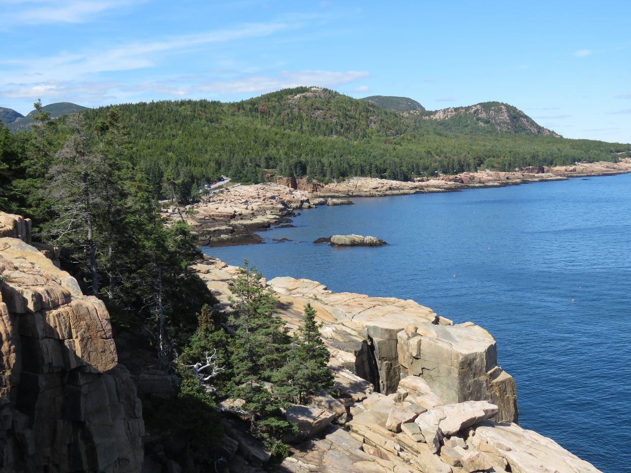 |
Otter Cliffs
Position: -68 11.35, 44 18.68
Looking north along Otter Cliffs that rise vertically about 110ft above the sea. Sand Beach is just out of the picture on the right.
|
 |
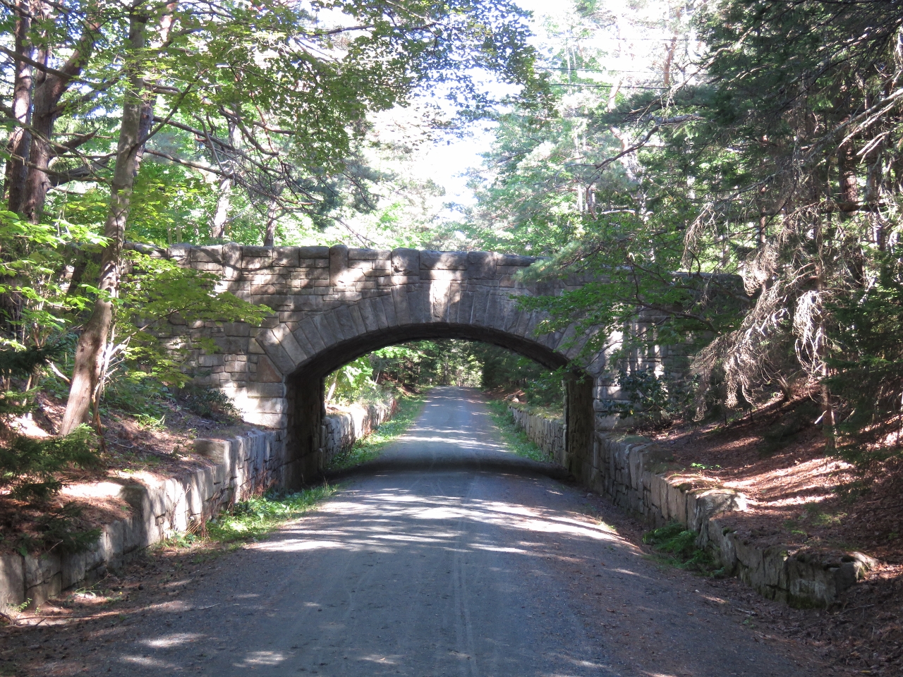
Stanley Brook Bridge
Position: -68 14.83, 44 18.62
Between 1913 and 1940, millionaire philanthropist John D. Rockefeller Jr. built 45 miles of carriage trails on Mt. Desert Island. He also financed the construction of 16 stone bridges at gorge and stream crossings. The Stanley Brook Bridge, built in 1933, is the last of the sizteen constructed. The three arches allow traffic, a hiking trail, and the brook to travel underneath.
|
 |
Jordan Pond Road Bridge
Position: -68 14.74, 44 18.57
Jordan Pond Road bridge was built in 1932 near the Stanley Brook Bridge and carries Jordan Pond Road over a carriage road.
|
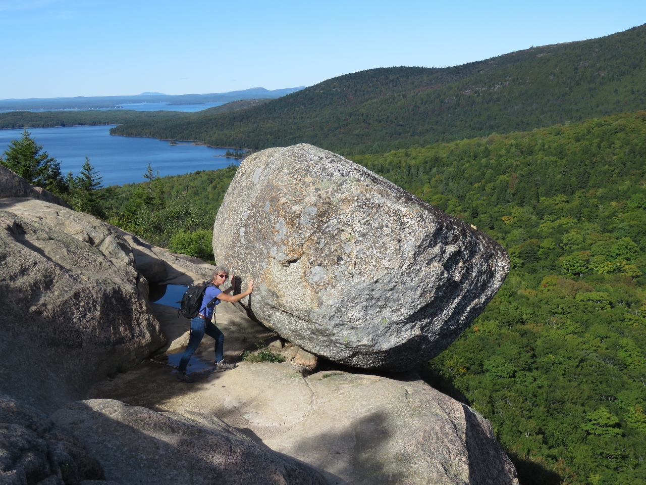 |
Bubble Rock
Position: -68 15.19, 44 20.37
We walked the Bubble Rock Trail up to Bubble Rock, a glacial erratic deposited during the Ice Age. Despite Jennifer’s best effort, she could not budge the 14-ton boulder. Eagle Lake, that we saw earlier this morning on the Cadillac Mountain road, is visible in the background.
|
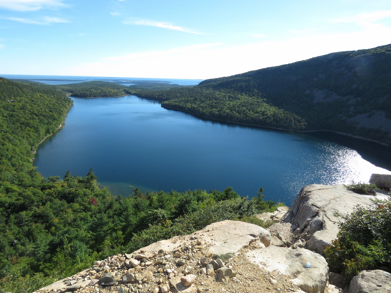 |
Jordan Pond
Position: -68 15.23, 44 20.26
We returned to the parking lot along the South Bubble Track. This is the view looking north across Jordan Pond and out to sea. Acadia is incredibly beautiful—we can see why it is so popular.
|
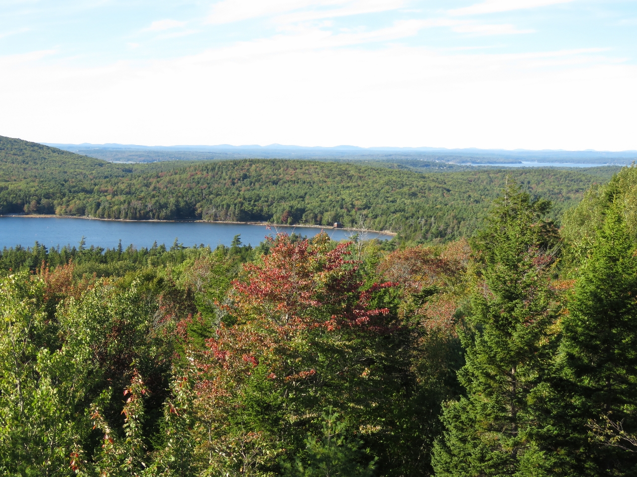 |
Fall Colors
Position: -68 14.37, 44 22.08
An overlook to Eagle Lake with some fall colors just starting to show in the leaves.
|
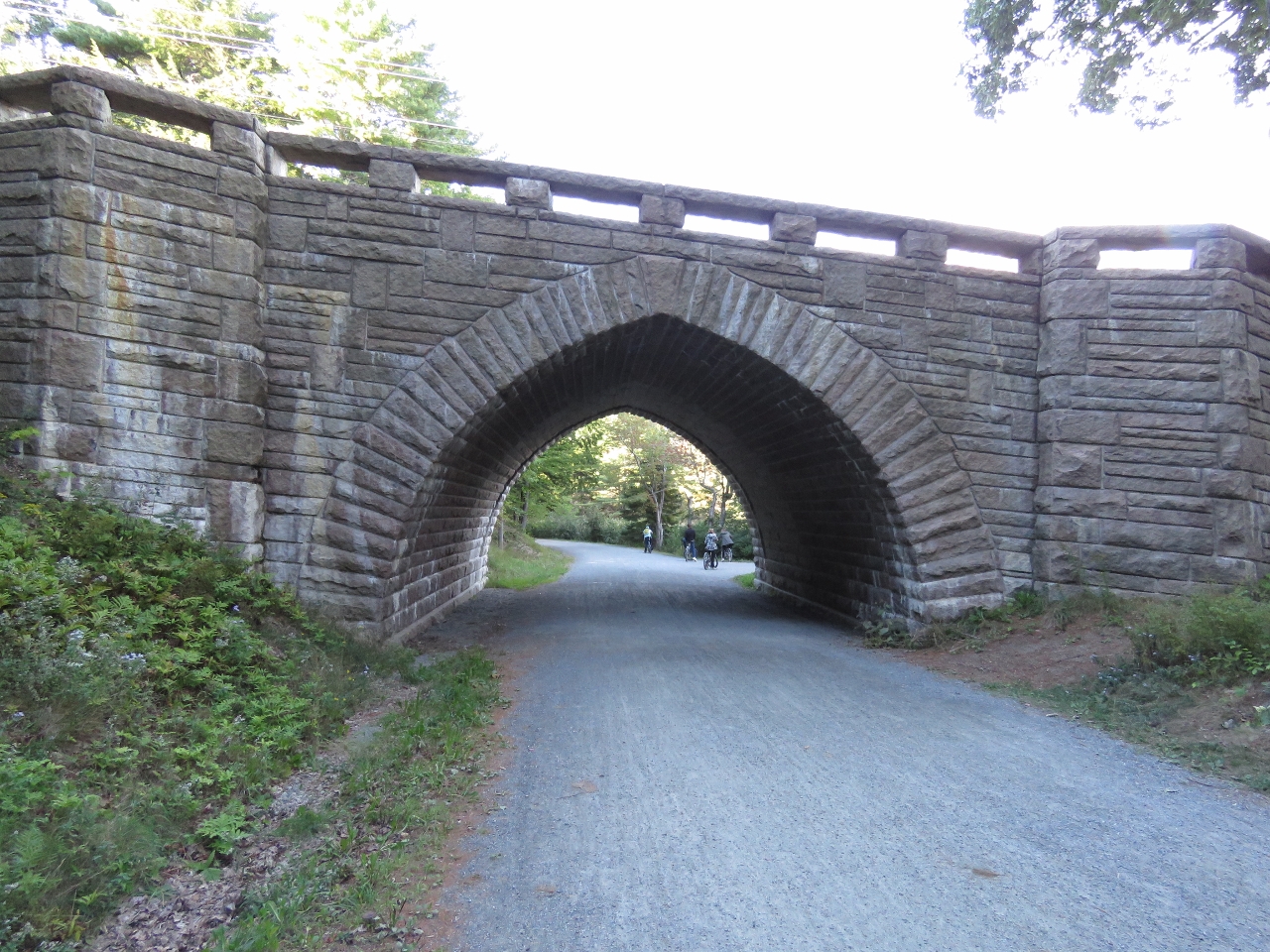 |
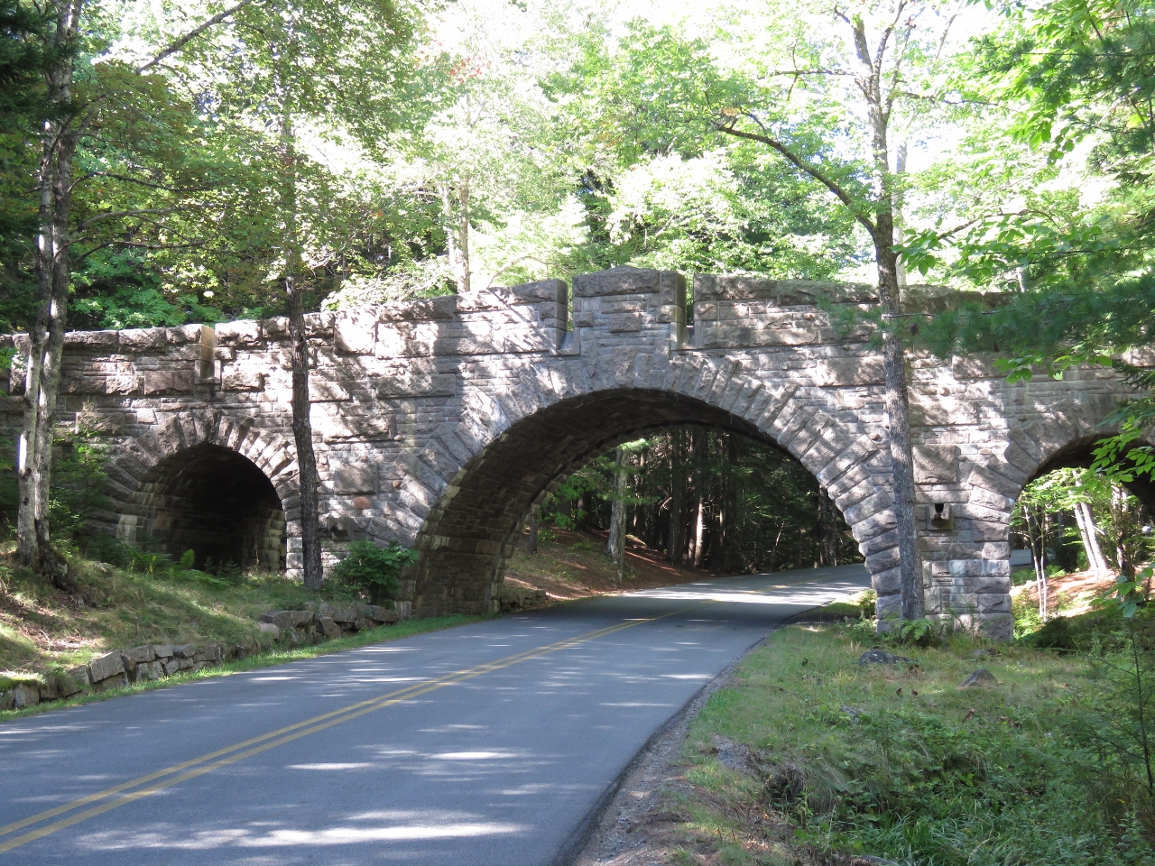
Eagle Lake Bridge
Position: -68 15.19, 44 22.67
The graceful arch-shaped Eagle Lake Bridge was built in 1923 at the north shore of Eagle Lake. This and Jordan Pond Road bridge are the only two of the sixteen Rockefeller bridges built to carry car traffic over the carriage roads.
|

|
Click the travel log icon on the left to see these locations on a map, with the complete log of our cruise.
On the map page, clicking on a camera or text icon will display a picture and/or log entry for that location, and clicking on the smaller icons along the route will display latitude, longitude and other navigation data for that location. And a live map of our current route and most recent log entries always is available at http://mvdirona.com/maps. |
If your comment doesn't show up right away, send us email and we'll dredge it out of the spam filter.