The Liscomb River Trail has two excellent features. The first is a suspension bridge overlooking a waterfall where you can cross the river and return on the other side, and the second is an excellent restaurant at the head to enjoy a drink or a meal after the hike. From Guysborough we passed through Canso and spent a night at Port Howe before stopping at Liscomb Harbour to hike the trail.
Trip highlights from September 11th through 13th, 2016 in eastern Nova Scotia follow. Click any image for a larger view, or click the position to view the location on a map. And a live map of our current route and most recent log entries always is available at http://mvdirona.com/maps
 |
Queensport Lighthouse
Position: -61 16.16, 45 20.96
We diverted course slightly to view the scenic Queensport Lighthouse. The lighthouse was built in 1936 and is an evolution from the traditional design of having the house and light separate. We were jokingly guessing that a light house keeper who had to shuttle through gales between house and light finally was involved in this more modern design.
|
 |
Canso
Position: -60 59.03, 45 20.29
Looking north to Canso as we pass through Canso Harbour. Visibility is poor with gusty winds and rain.
|
 |
Range Markers
Position: -60 59.03, 45 20.29
A sea of navigation markers guide boats through convoluted and shallow Canso Harbour. These range markers on Grave Island are one of several sets en route.
|
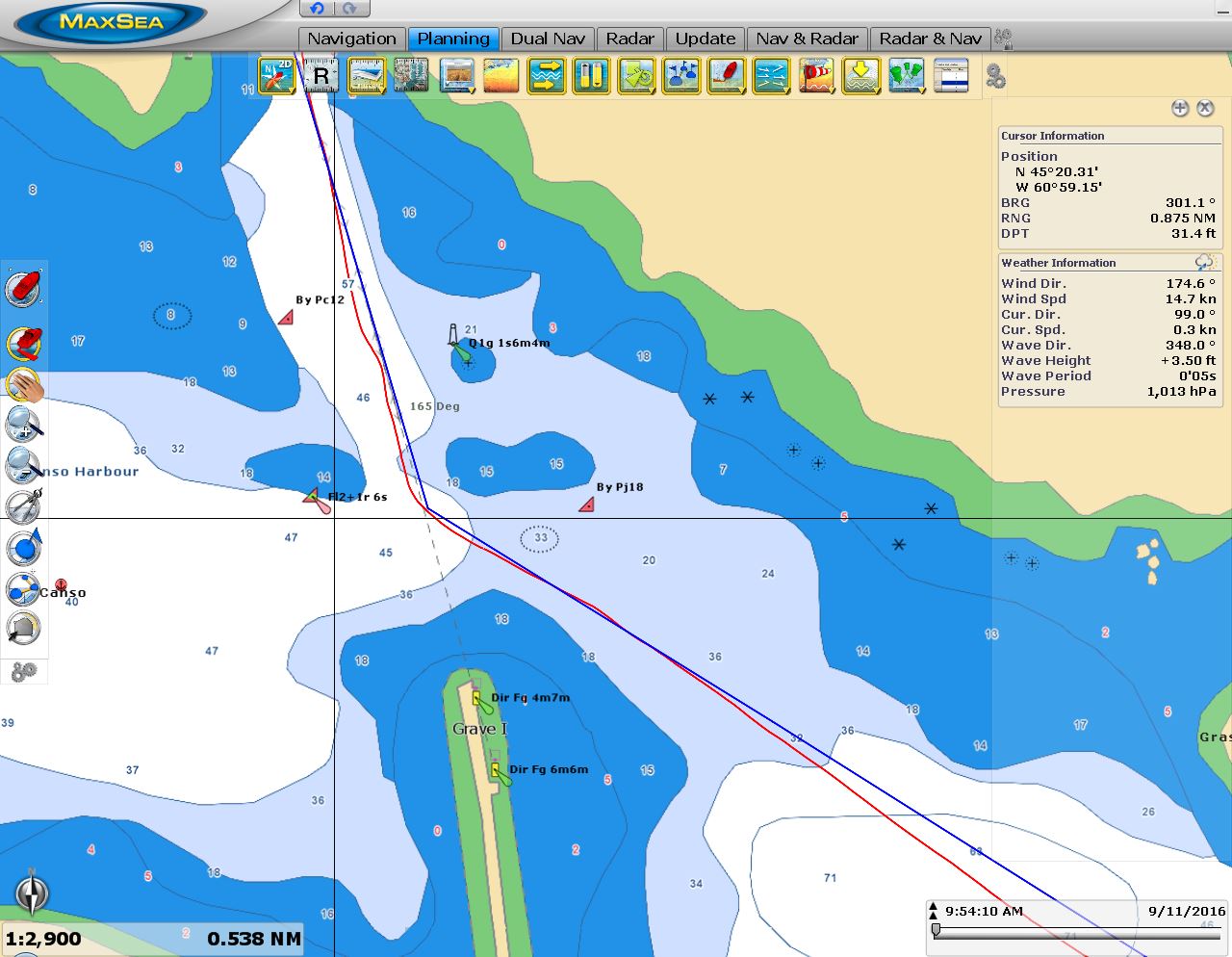 |
C-Map
Position: -60 57.84, 45 19.76
Our older C-Map charts showed a red mark northeast of the Grave Island range markers and a preferred channel mark to the northwest. But the buoyage looked quite different as we approached, a little concerning especially in the gusty winds and poor visibility.
|
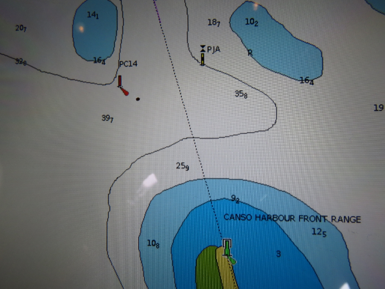 |
Navionics
Position: -60 57.32, 45 19.40
Our newer Navionics charts showed what we actually saw on approaching Grave Island, a cardinal bouy to our east and a read mark to our west. It appears the buoyage has changed a bit in the harbour over the past few years.
|
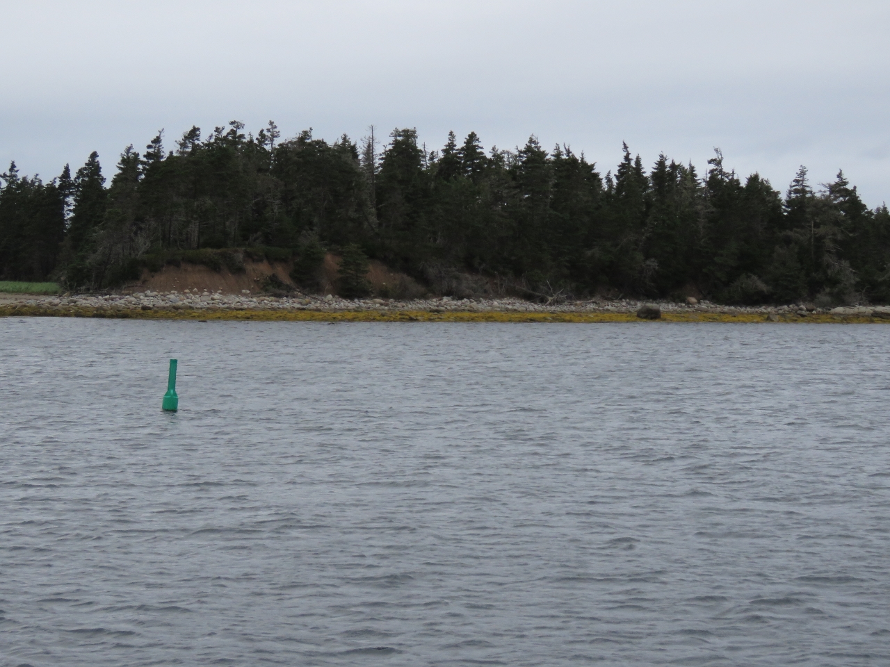 |
Andrew Passage
Position: -60 58.08, 45 18.53
We opted to pass through Andrew Passage rather than going around the outside of Andrew Island. It didn’t really save much time, but we figured it would be more interesting and sheltered. The only potentially difficult part is the shallow bar at the north end of the channel. We saw a least depth of about 13ft on a 1.6ft tide at Canso Harbour. As at Canso Harbour, the buoyage was different from what are older C-MAP charts showed, but consistent with the newer Navionics charts.
|
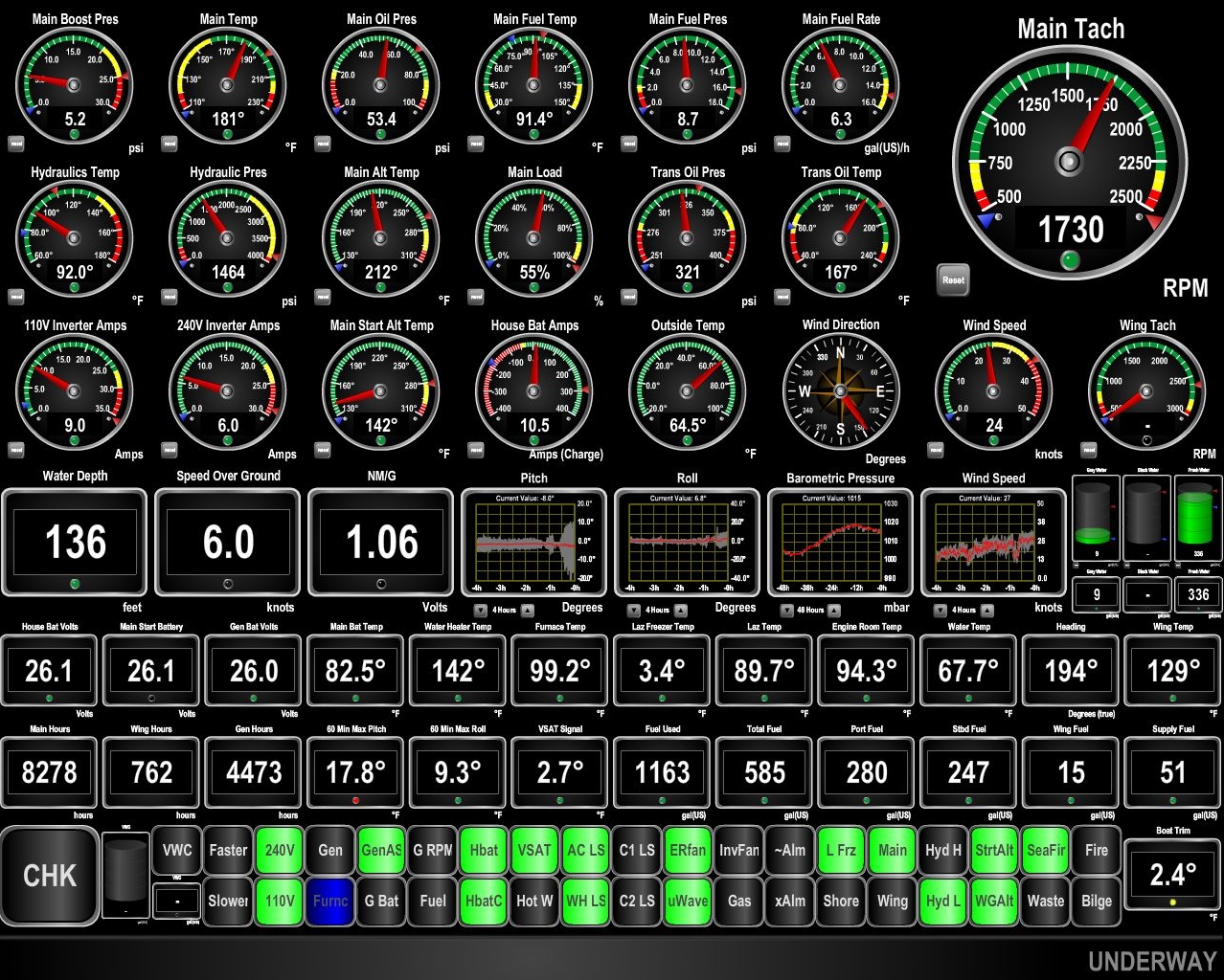 |
Pitch
Position: -60 57.95, 45 14.56
Andrew Passage was sheltered as expected, with several spots we might have anchored. Outside the winds were blowing a steady 25knts from the southwest and we were pitching nearly 18 degrees at times (4th gauge from the left reading 17.8 degrees near the bottom of the display).
|
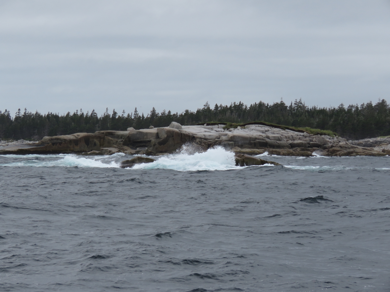 |
Black Rock
Position: -61 4.29, 45 13.68
Waves churned over ominous-looking Black Rock at the entrance to Port Howe. We initially were planning to run a little farther south to Yankee Cove, but the weather forecast indicated conditions would worsen around noon, so we stopped at Port Howe instead.
|
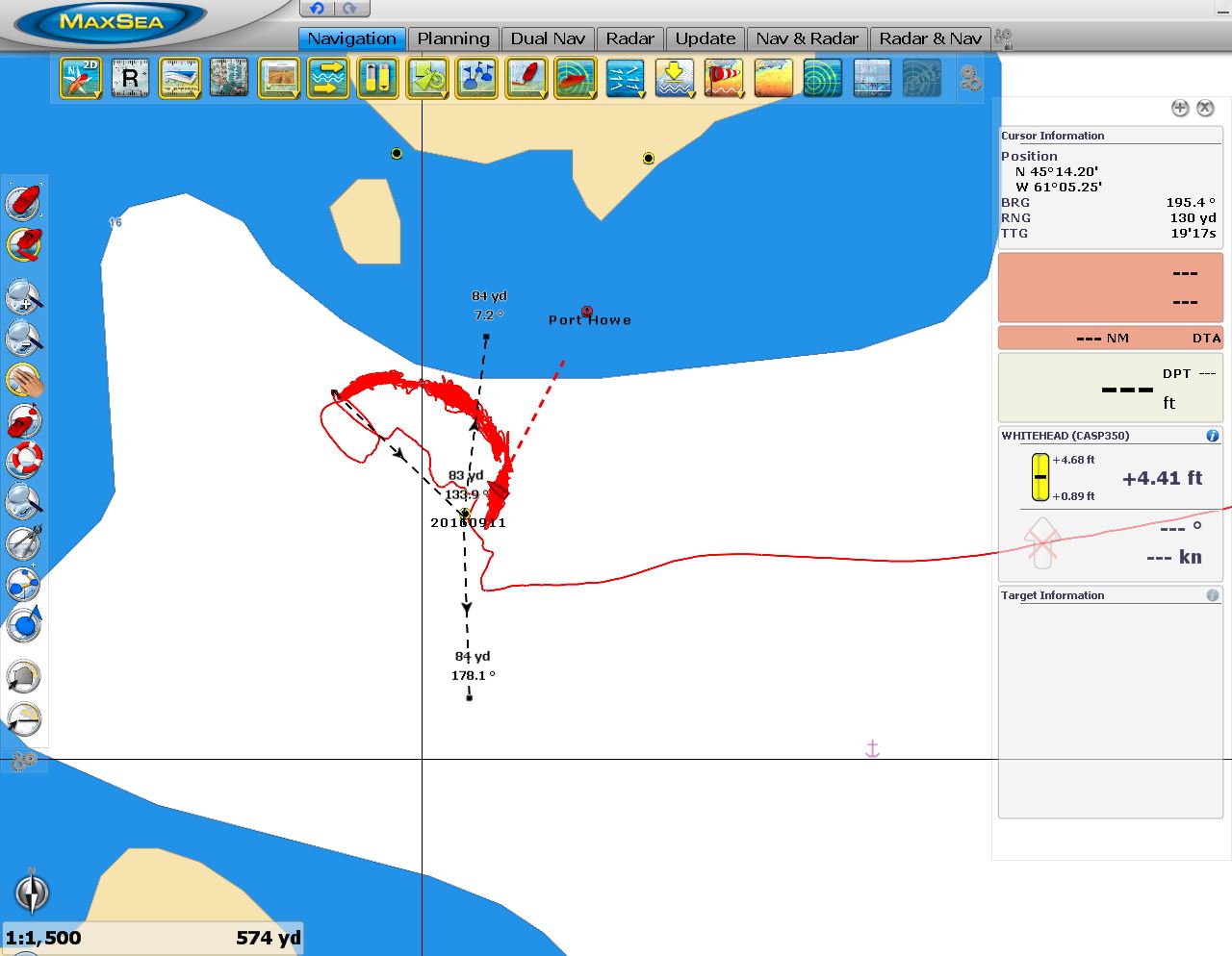 |
Anchorage Track
Position: -61 5.23, 45 14.26
When we arrived at Port Howe the winds were blowing from the southeast. Some swell reached the anchorage, but it wasn’t noticable except for a brief period as the winds shifted and put us beam-to the seas. The winds were supposed to back to the northwest quickly and it did exactly that, putting us more perpendicular to the swell.
You can see our track while we are at anchor showing the initial winds from the southeast, that formed the top half of the arc. As the winds backed to the northwest, this formed the bottom part of the arc. The yellow marks near the top of the display show where shore actually is on radar—a lot farther north than the chart indicates. The mark labelled with a date near the boat is where we dropped anchor and then pulled back to the northwest, to the top left of the arc, to set the anchor. Our swing arc is on a rode length about half of the real rode length and offset from where the anchor was set. We’ve not seen this before, but it looks like the anchor rode got snagged on some underwater debris and rather than rotating about the anchor, we were rotating around a point about 100ft away from where the anchor was dropped and retrieved. Fortunately the anchor and rode came up without difficulty. |
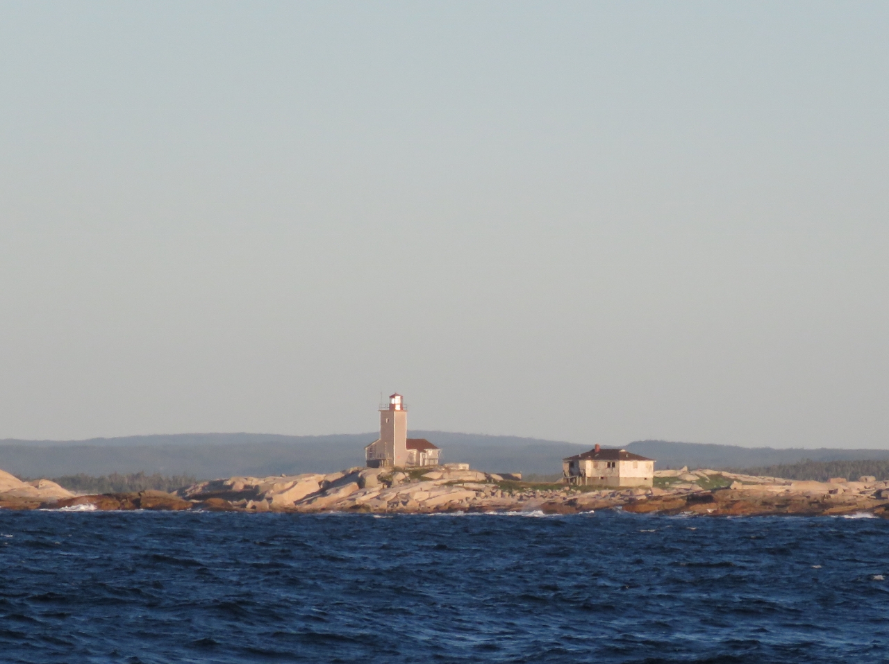 |
White Head Island
Position: -61 6.91, 45 11.30
The morning sun setting the White Head Island light aglow as we pass to the south.
|
 |
Pipelines
Position: -61 32.32, 45 2.83
We’re about to cross over the two pipelines that run over 100 miles between mainland Nova Scotia and Sable Island. In the 1990s, a massive natural gas field was discovered off Sable Island and Canada’s first natural gas project began operation there in 1999. Most of the $1.9-billion Nova Scotia has made from offshore energy comes from this field.
|
 |
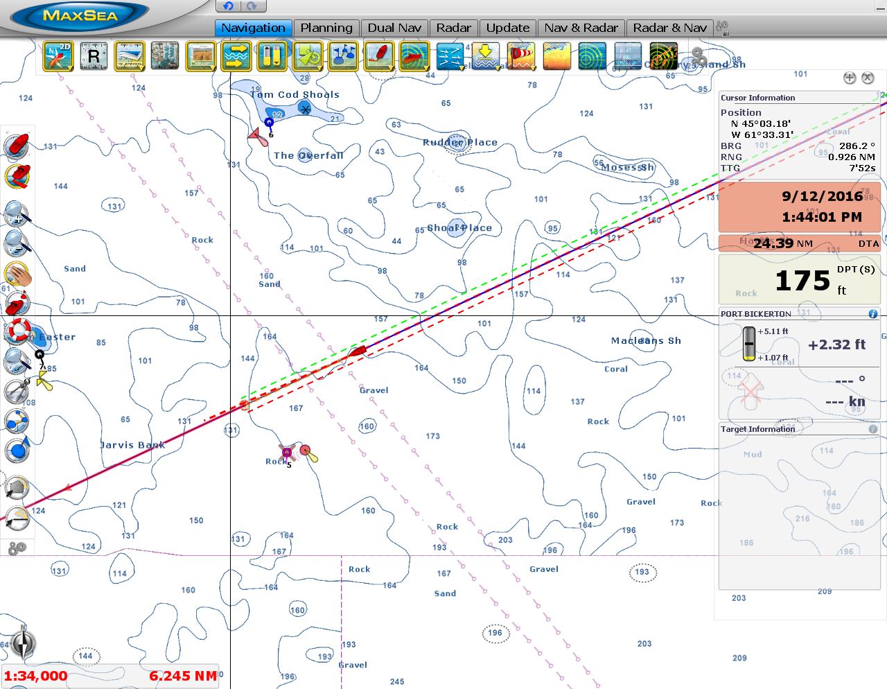
Winds
Position: -61 53.67, 44 58.49
The prevailing southwest winds that carried us north to Newfoundland are now right on the bow. We’re not pitching quite as much as yesterday’s run to Port Howe, but are seeing a maximum over the past hour of nearly twelve degrees.
|
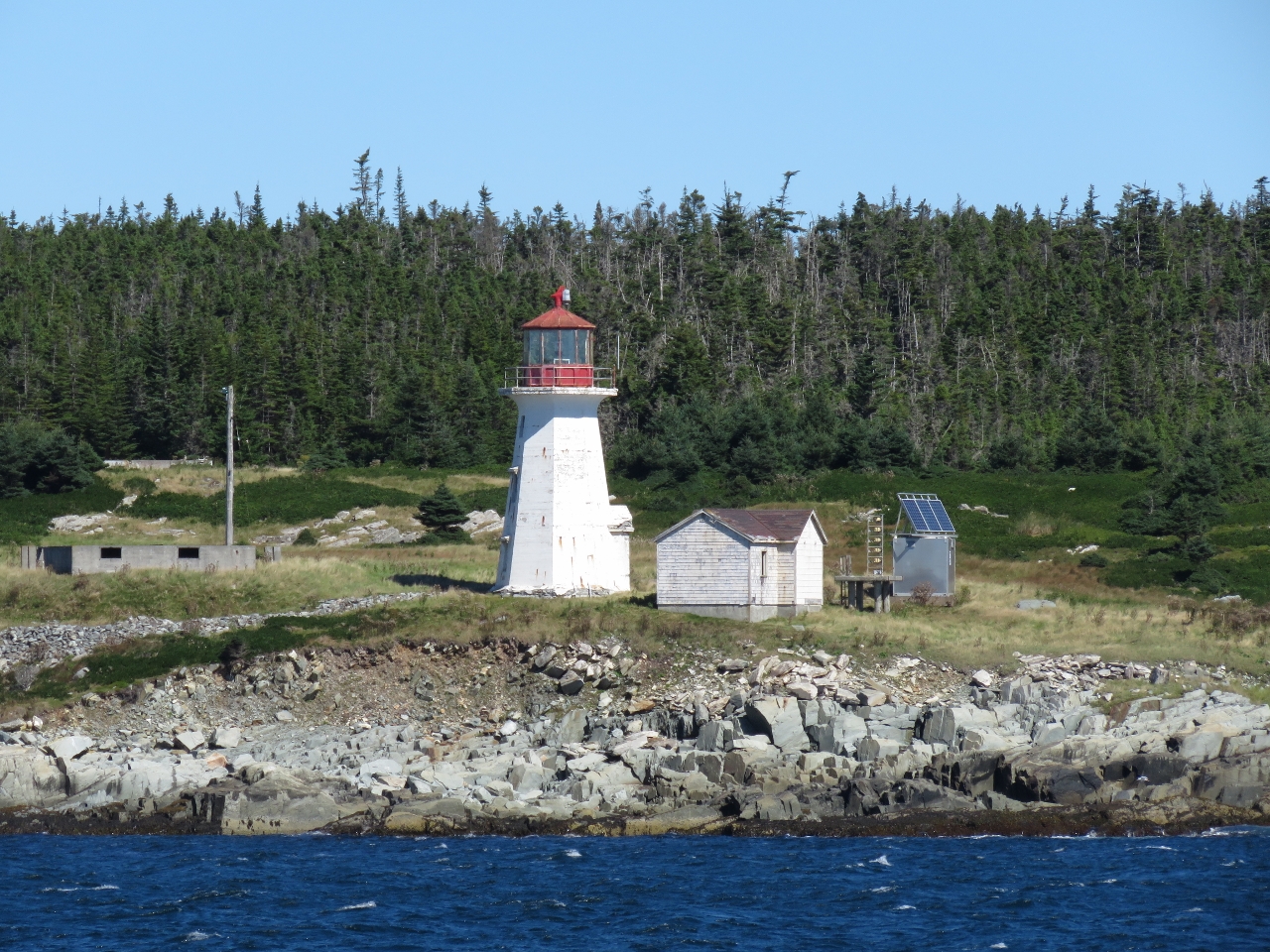 |
Liscomb Island
Position: -61 58.43, 44 59.03
The seas are settling as we pass the Liscomb Island lighthouse in the entrance to Liscomb Harbour.
|
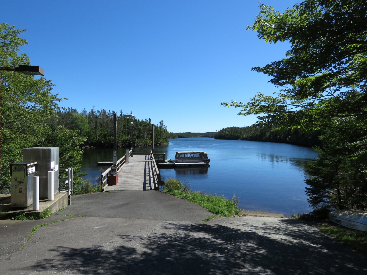 |
Wharf
Position: -62 6.18, 45 0.76
Within minutes of anchoring in Liscomb Harbour, we had the tender down and ran up the Liscomb River to the Liscombe Lodge to hike the Liscomb River Trail. This is looking south downriver. We’re tied off out of sight on the left side of the wharf.
|
 |
Bears
Position: -62 5.75, 45 0.91
A sign at the trail head warns of bears. We didn’t see any signs of bears though.
|
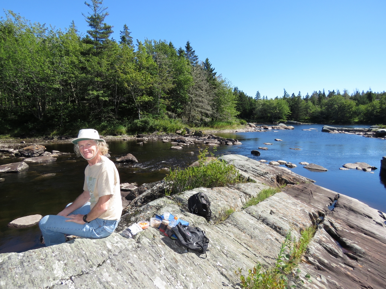 |
Lunch
Position: -62 5.73, 45 0.91
We’d arrived at Liscomb Harbour shortly before 2pm and stopped for a late picnic lunch along the Liscomb River before the hike.
|
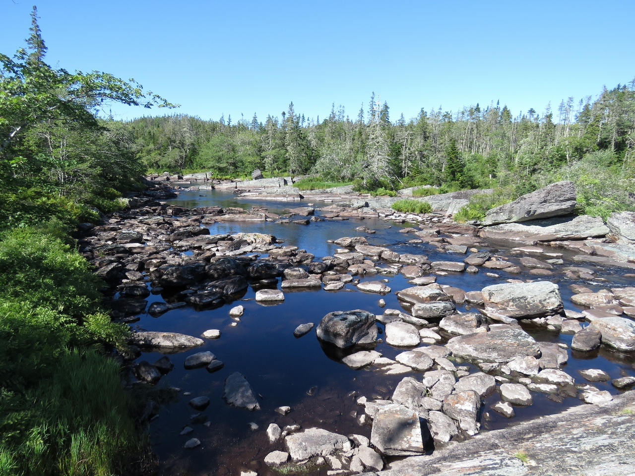 |
Crooked Falls
Position: -62 5.81, 45 1.07
The water levels are low right now in mid-September, so the Crooked Falls aren’t doing much right now. But we’re enjoying the scenery.
|
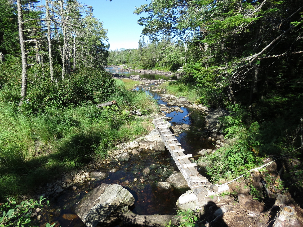 |
Footbridge
Position: -62 6.39, 45 1.36
The trail is well-built and maintained, with several footbridges spanning creeks and muddy sections.
|
|
|
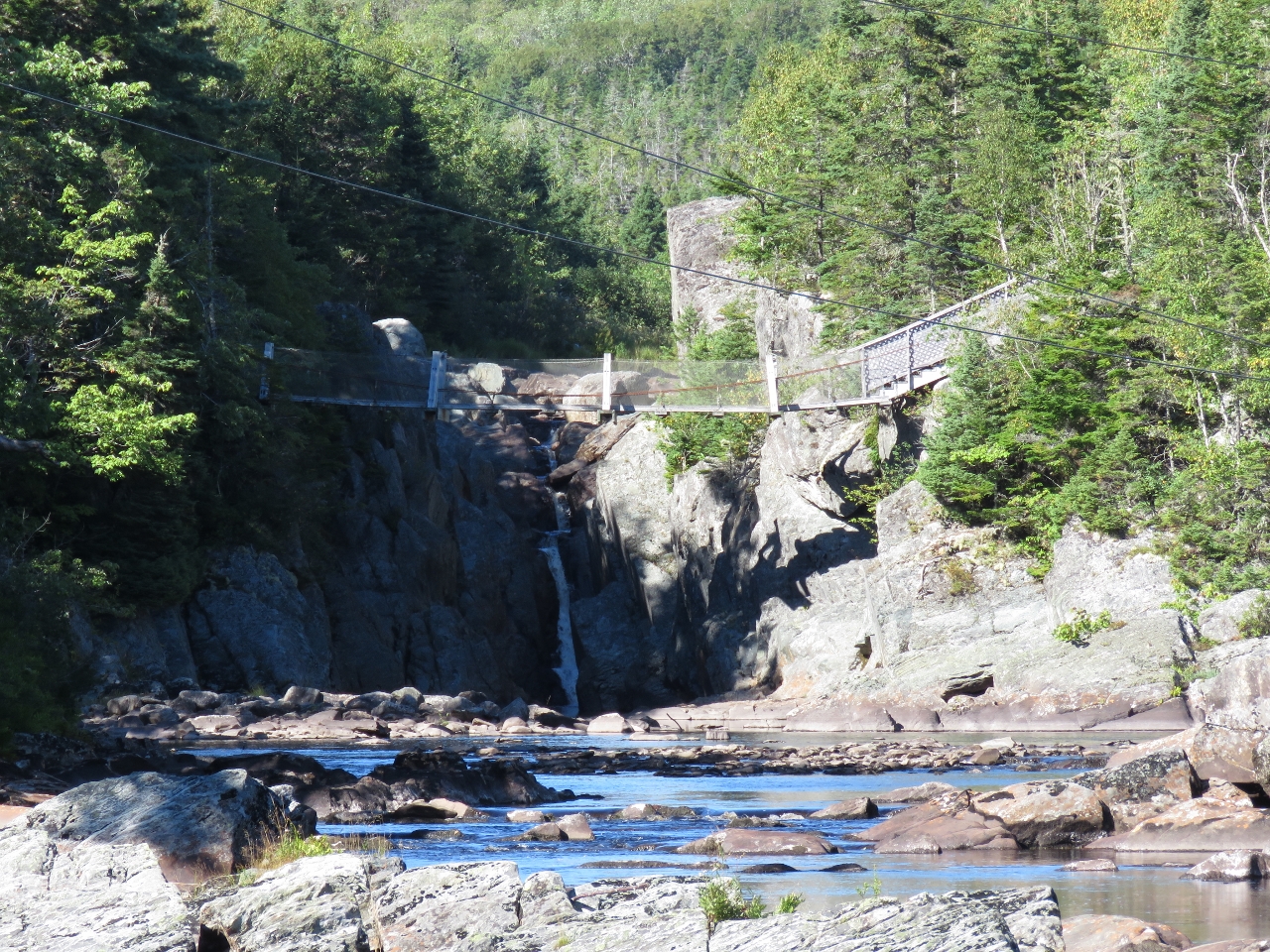
Suspension Bridge
Position: -62 6.34, 45 1.96
We’ll cross this suspension bridge and return to the lodge along the east side of the river. Beyond the bridge, Liscomb Falls are spilling into a narrow gorge.
|
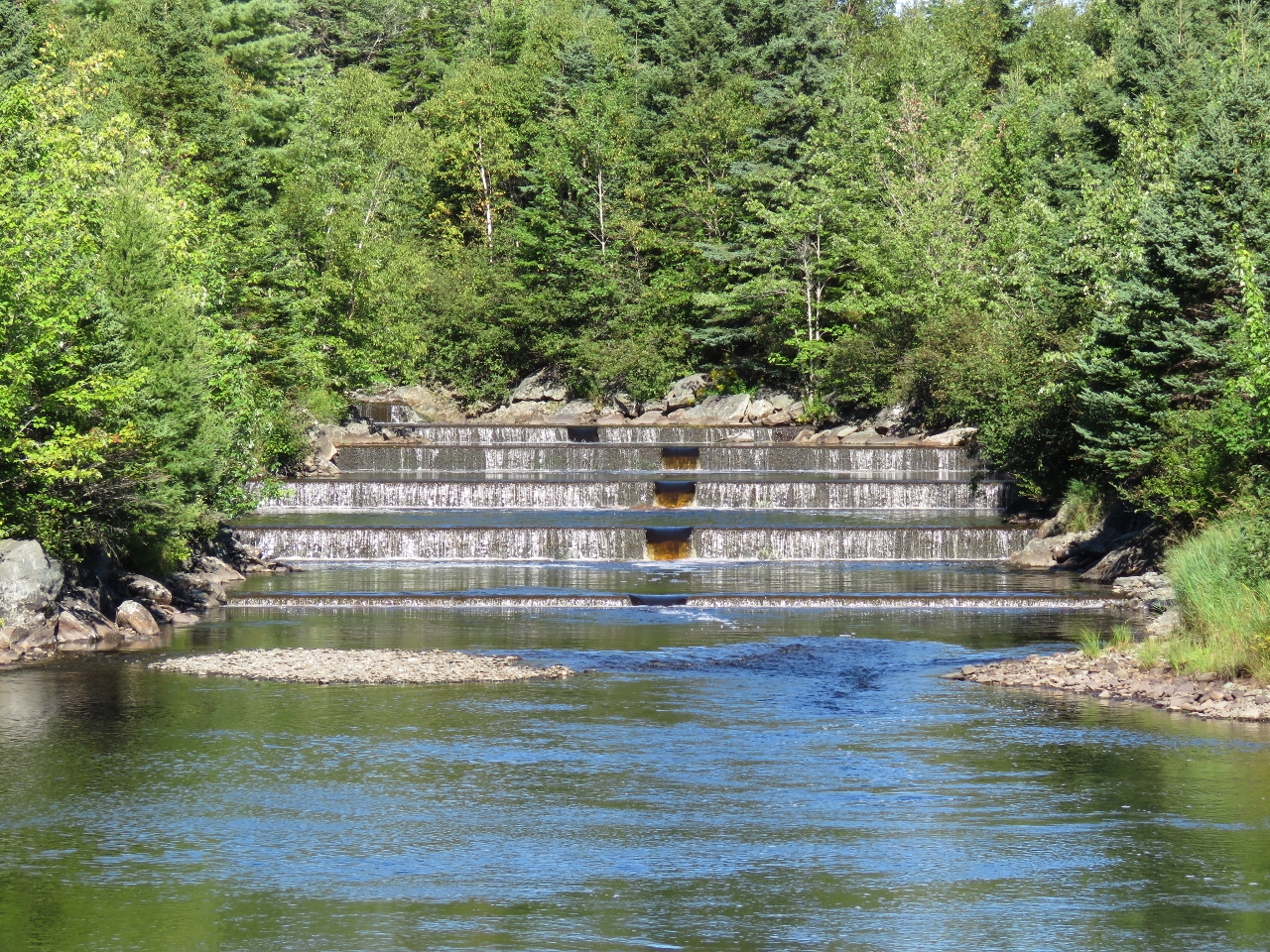 |
Fish Ladder
Position: -62 6.35, 45 2.04
This 15-level fish ladder along the Liscomb River was built to help reconstruct the Atlantic salmon runs. A hydro dam built in the early 1900s prevented salmon from accessing the higher reaches of the river.
|
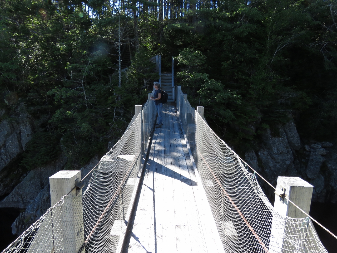 |
Crossing
Position: -62 6.31, 45 2.07
Taking in the view from the suspension bridge across the river.
|
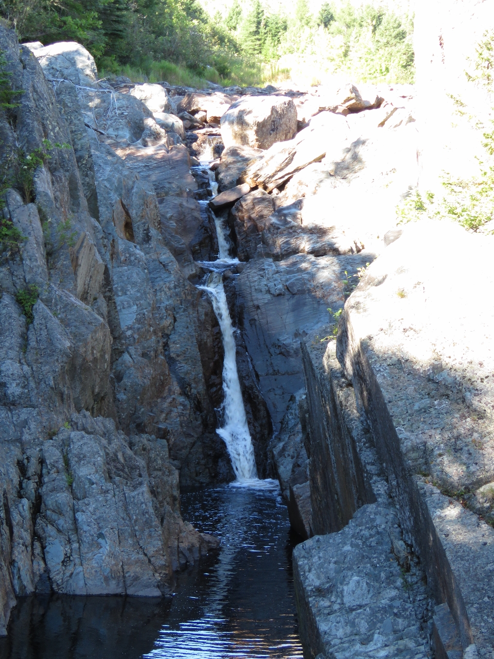 |
Liscomb Falls
Position: -62 6.32, 45 2.07
Liscomb Falls isn’t running very hard this late in the summer, but still are a pretty sight.
|
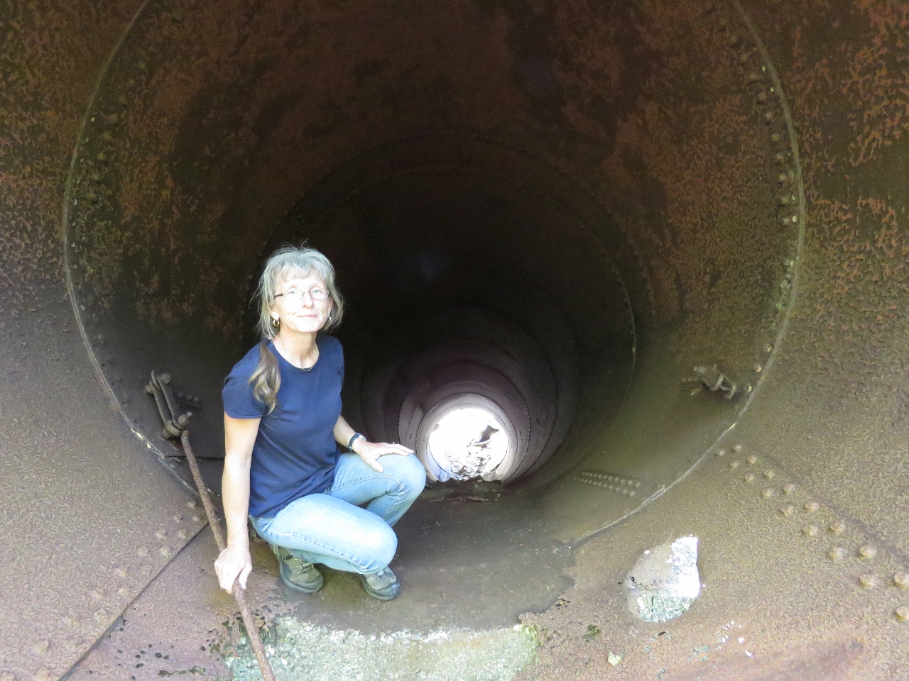 |
Pipe
Position: -62 6.30, 45 2.07
Jennifer crouching inside the pipe from the old hydro dam alongside the trail. We believe the dam was removed sometime in the late 20th century. This is the only substantial remains we could find.
|
 |
Frog
Position: -62 5.78, 45 1.14
A well-camouflaged frog along the trail.
|
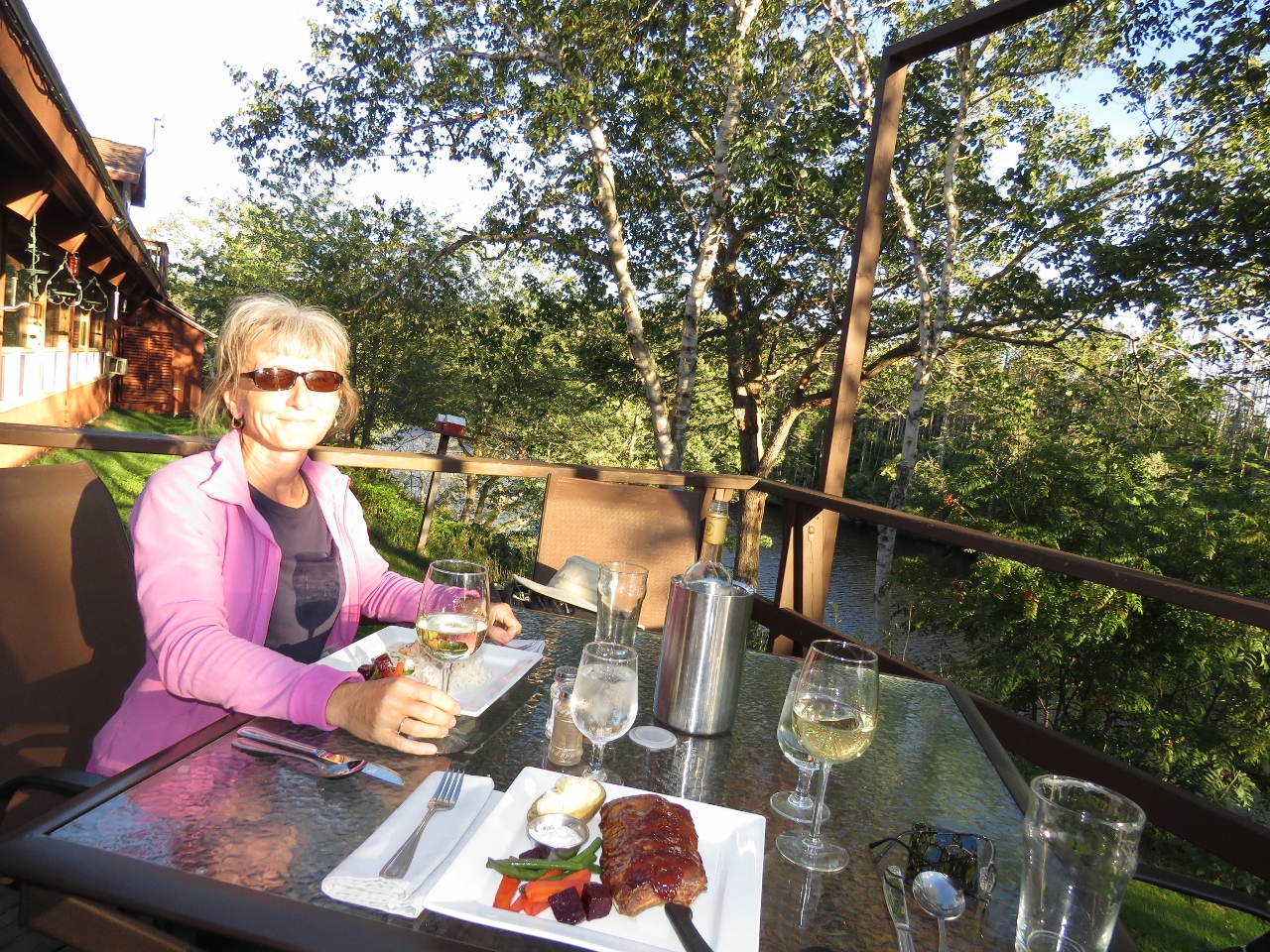 |
Liscombe Lodge
Position: -62 6.10, 45 0.73
We finished the day with an excellent meal on the patio of the highly-rated Liscombe Lodge. Jennifer is having planked salmon, the house specialty.
|
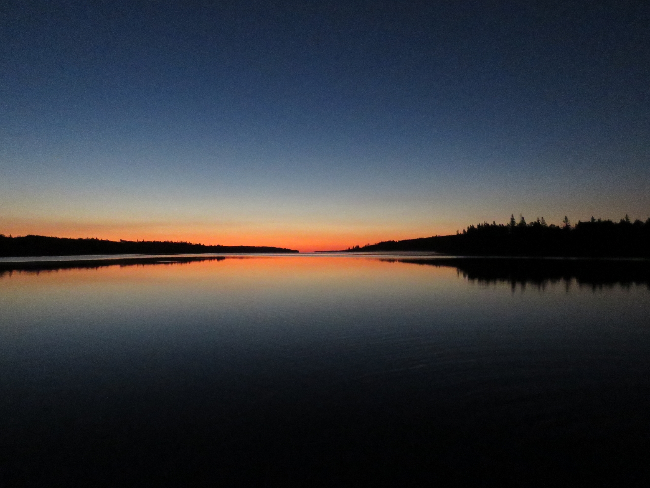 |
Sunrise
Position: -62 4.87, 45 0.11
A beautiful sunrise at the Liscomb River. We call these “Roy Vickers” sunrises, after one of our favourite Pacific Northwest artists who often depicts these colours in his work.
|
.jpg)

|
Click the travel log icon on the left to see these locations on a map, with the complete log of our cruise.
On the map page, clicking on a camera or text icon will display a picture and/or log entry for that location, and clicking on the smaller icons along the route will display latitude, longitude and other navigation data for that location. And a live map of our current route and most recent log entries always is available at http://mvdirona.com/maps. |
If your comment doesn't show up right away, send us email and we'll dredge it out of the spam filter.