
Despite 1) falling rain, 2) a forecast for thunderstorms, 3) an exposed run through the edge of the North Atlantic 4) uncertainty about anywhere to land the tender, and 5) a potentially difficult re-entry to Little Bras d’Or channel into a strong ebb current against a freshening northerly wind, the shorter and admittedly slightly more crazy member of the team badly wanted to run the tender twenty miles from the head of St. Andrews Channel through Little Bras d’Or channel to have lunch at a Sydney pub.
Trip highlights from our September 1st and 2nd follow. Click any image for a larger view, or click the position to view the location on a map. And a live map of our current route and most recent log entries always is available at http://mvdirona.com/maps
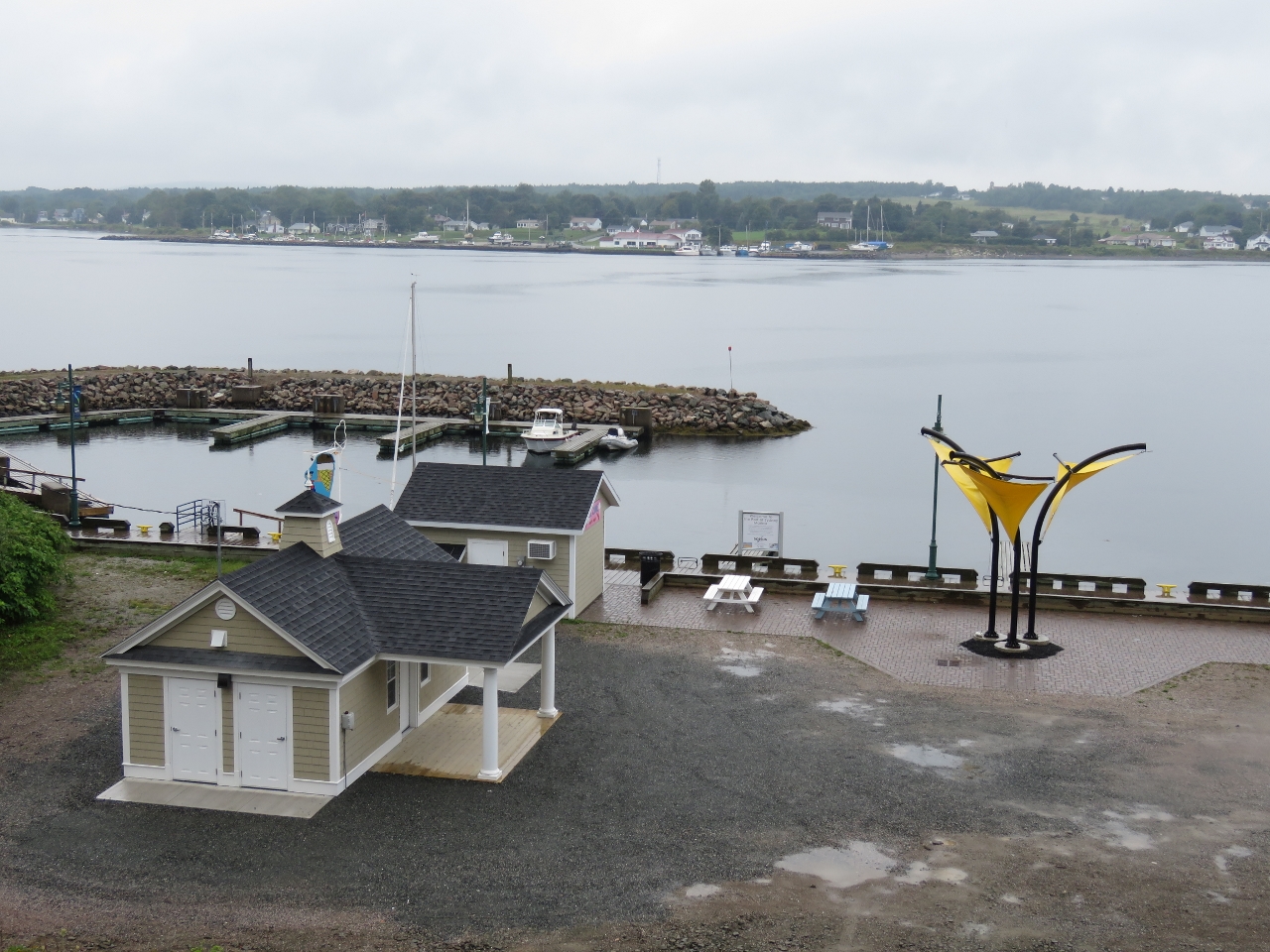 |
Port of Sydney Marina
Position: -60 11.77, 46 8.32
We made it through to Sydney and discovered the small Port of Sydney Marina right downtown. Our tender is tied at the outer pier near the right end of the rock breakwater.
|
 |
Governors
Position: -60 11.76, 46 8.38
Three pubs were within walking distance of the Port of Sydney Marine and the Governors was top of our list.
|
|
|
Mission Accomplished
Position: -60 11.76, 46 8.38
Rain fell during most of our run to Sydney, but we’d bundled up in rain gear and stayed relatively dry. We had an excellent meal at Governors, particularly the 72-hour-cooked ribs, with local craft beers. Mission accomplished. Well, sort of. We still had to get back to Dirona.
|
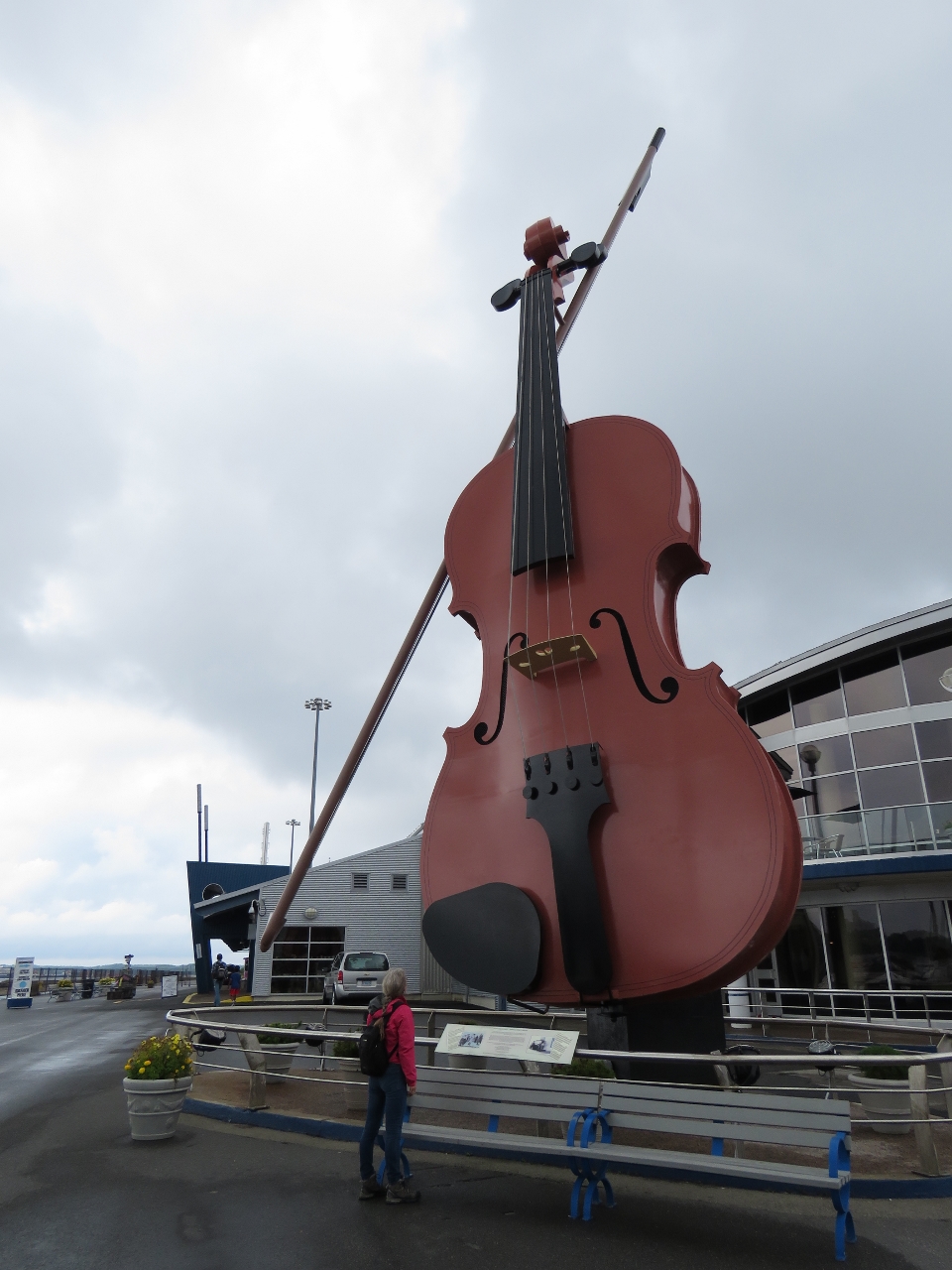 |
Big Ceilidh Fiddle
Position: -60 11.93, 46 8.52
The 55ft (17m) Big Ceilidh Fiddle at Sydney’s cruise ship pavilion recognizes the importance of fiddle music in the musical heritage of Cape Breton Island.
|
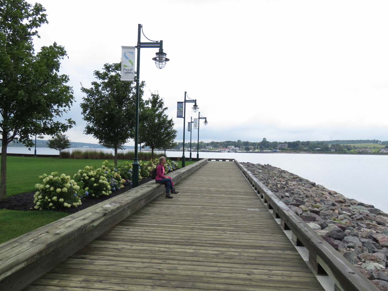 |
Boardwalk
Position: -60 11.90, 46 8.51
Sydney has a nice boardwalk that runs much of the length of the waterfront.
|
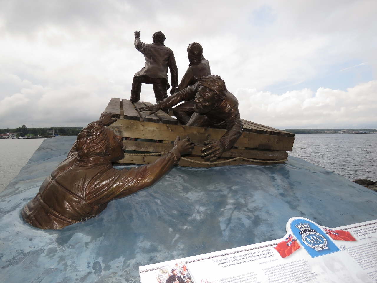 |
Merchant Navy Memorial
Position: -60 11.88, 46 8.38
This memorial to those who served in Canada’s merchant navy during World War II was unveiled a few months ago. Early in the war, Sydney became an assembly point for convoys carrying coal, steel and other materials essential for the Allied war effort. In addition to the danger of German attacks, the Sydney convoys often were made up of ships hastily pressed into service and never meant for the open sea. Due to the demand for manpower in the armed forces and industry, many who served on these boats were as old as forty or fifty or as young as fourteen. A total of 177 convoys sailed from Sydney between 1939-1945, often averaging more than 14 ships in a convoy. German U-Boats successfully attacked 48 Sydney convoys, sinking 226 ships. The memorial features three mariners inside a Carley Float, a life raft made of wooden slots latched over used oil drums. A fourth mariner in the water is being rescued by one of the men inside. One of the mariners is standing in the raft and seemingly waving his hand to attract the attention of a passing boat. Convoys were not allowed to stop regardless of the reason, so such survivors often weren’t rescued. |
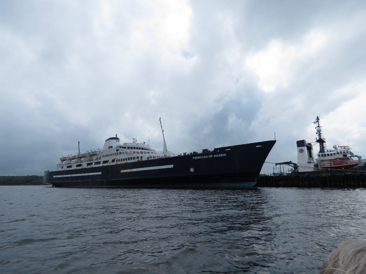 |
Princess of Acadia
Position: -60 12.96, 46 9.28
The rain had stopped, so we spent some time touring the Sydney waterfront before returning to Dirona/ This is the retired ferry Princess of Acadia run across the Bay of Fundy between Digby, Nova Scotia and Saint John, New Brunswick. The ferry can carry 650 passengers and 180 automobile equivalents and was in operation from June of 1971 to October of 2015.
|
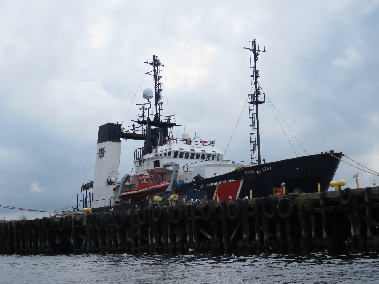 |
Ryan Leet
Position: -60 13.01, 46 9.34
The Ryan Leet is a 281ft (66.70m) ocean-going salvage tug powered by 2 3600 BHP main engines with a bollard pull of 69 metric tons.
|
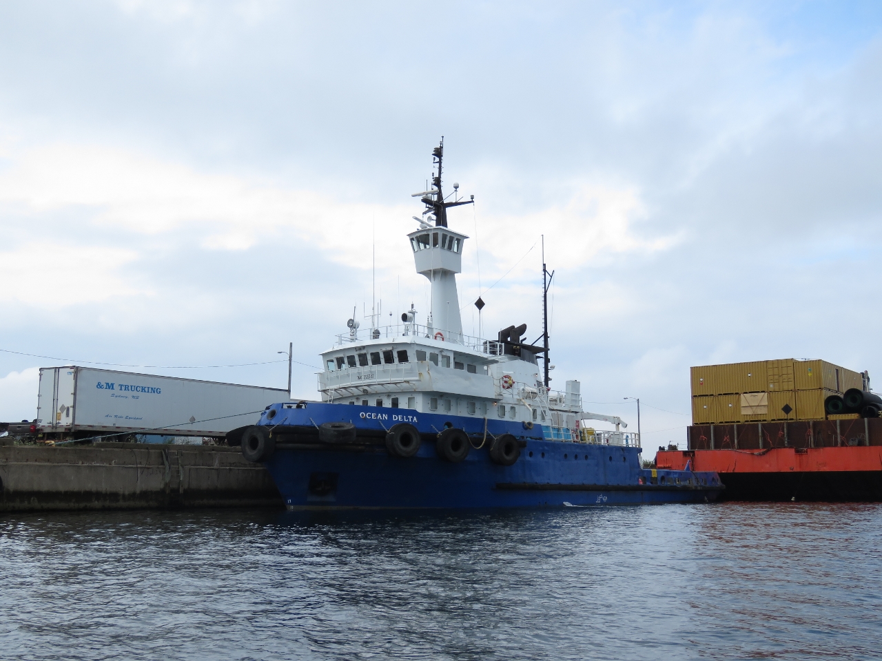 |
Ocean Delta
Position: -60 13.04, 46 9.39
The 136ft (41m) tug Ocean Delta was built in Norway and is owned by Quebec-based Ocean Group.
|
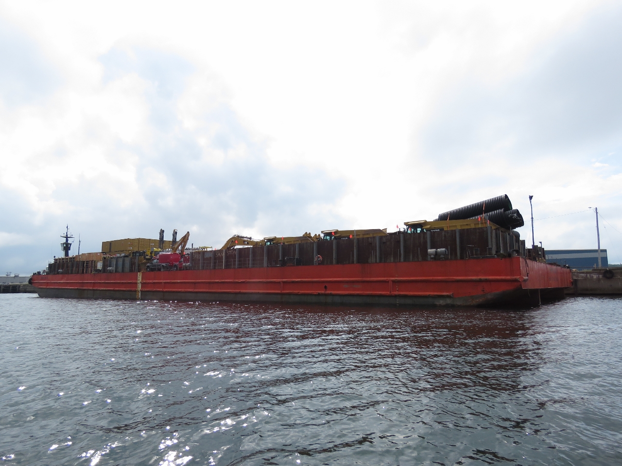 |
Mining Equipment
Position: -60 13.04, 46 9.42
Behind the Ocean Delta was a barge full of mining equipment including several large trucks and stacks of portable lighting. AIS later showed the ship underway for Voisey Bay, Labrador, where a 6,000 ton-per-day open-pit mine and concentrator operation is located.
|
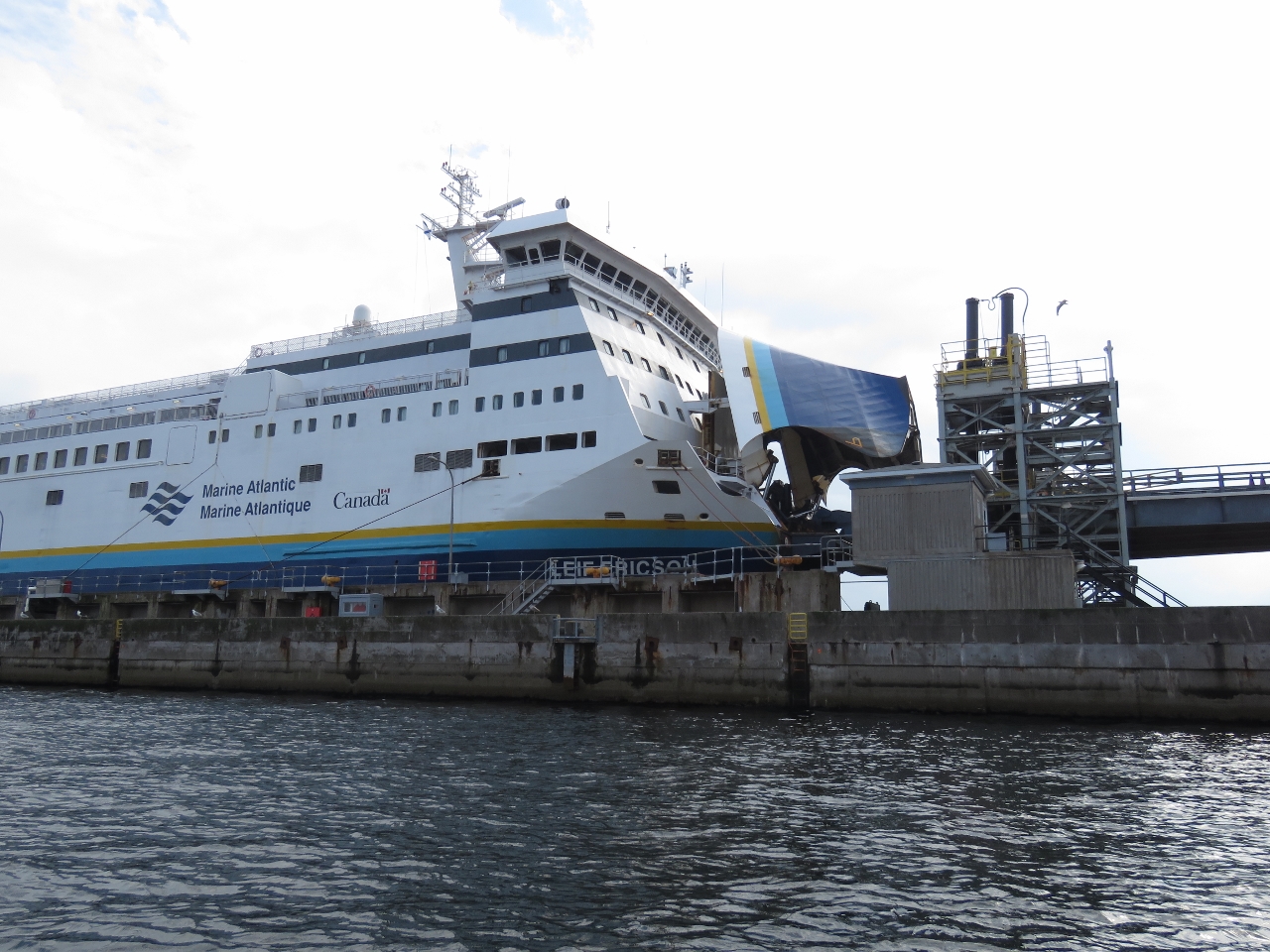 |
Leif Ericson
Position: -60 14.49, 46 12.57
Between 1991 and 2001, the Norway-built MV Leif Ericson operated across the English Channel between Dover, England, and Calais, France. The Canadian government purchased the ferry in 2001 for it’s Crown Corporation Marine Atlantic to operate between North Sydney, Nova Scotia and Port aux Basques, on the southwest corner of Newfoundland. The ship is named to mark the 1000th anniversary of Norse explorer Leif Ericson who arrived in the New World nearly 500 years before Christopher Columbus. The vessel has a capacity of 500 passengers and 300 passenger vehicles (combination of automobiles and tractor trailers), but usually carries only commercial vehicles, leaving passenger traffic to the MV Blue Puttees and MV Highlanders.
|
 |
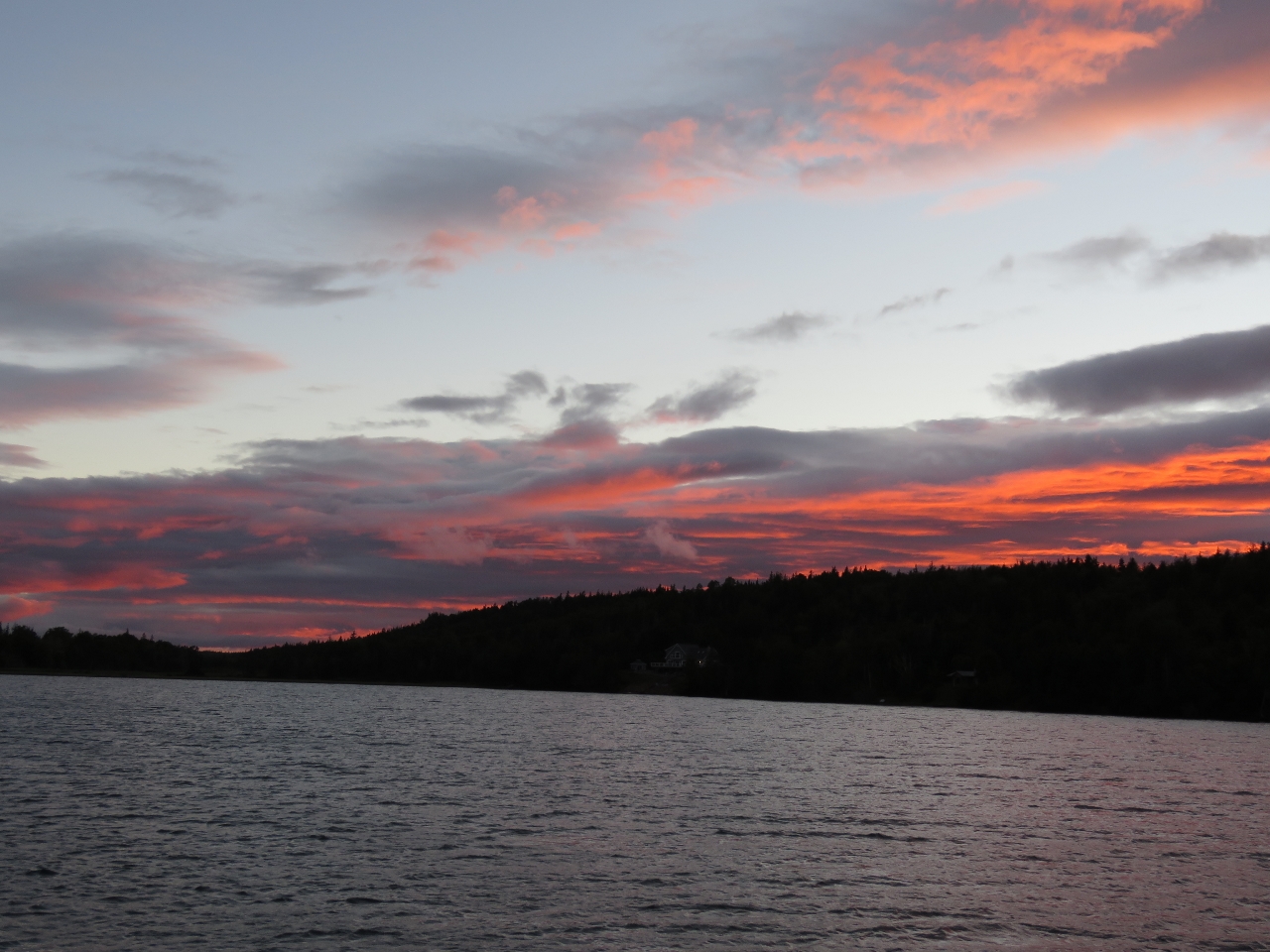
Little Bras d’Or
Position: -60 17.11, 46 18.63
We’d be arriving back at Little Bras d’Or near maximum ebb, which at nearby Great Bras d’Or was around 3.5 knots. We didn’t have any about the current in Little Bras d’Or, but assumed it would be worse due to the narrower channel. We’d also read that the channel had been semi-closed to navigation with a fixed bridge due to dangerous currents. The wind had picked up from the northeast, against the ebb, as we returned back to Little Bras d’Or channel and waves were kicking up a bit too. Fortunately the channel entry was sheltered from northeast winds and waves and we had only the current to contend with. The flow was strong at several knots, but nothing our 30-knot tender couldn’t easily manage.
|
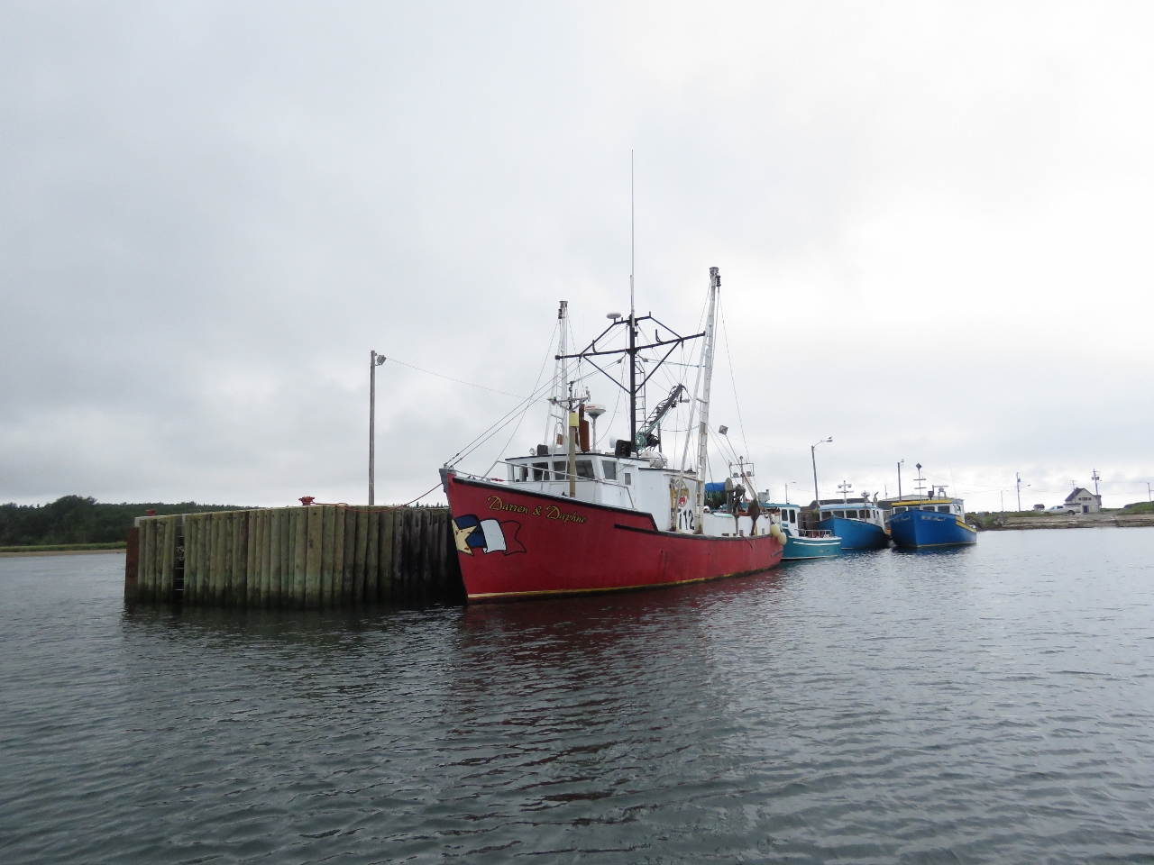 |
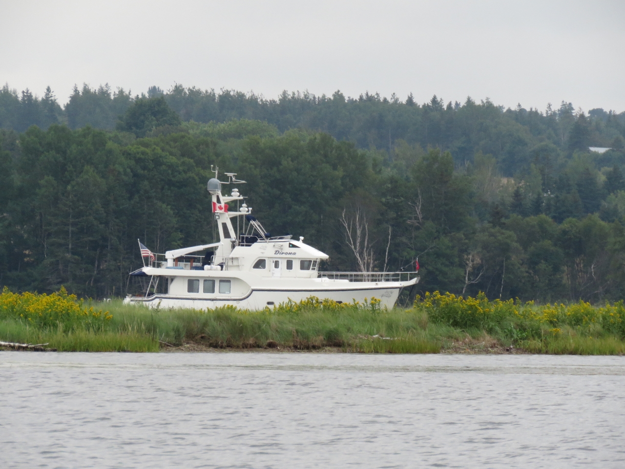
Fishing Vessels
Position: -60 17.01, 46 18.51
Dozens of fishing vessels were moored along Little Bras d’Or, all of them impressively maintained.
|
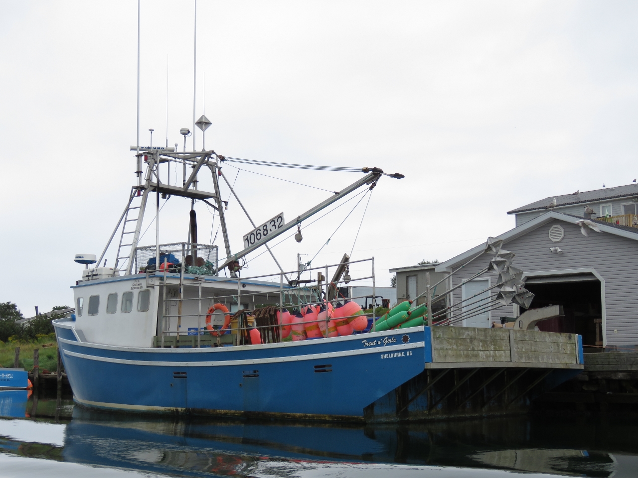 |
Trent n’ Girls
Position: -60 17.14, 46 18.22
The fishing vessel Trent n’ Girls was carrying large radar reflectors similar to the ones we’d seen on the run from Palm Beach to Boston.
|
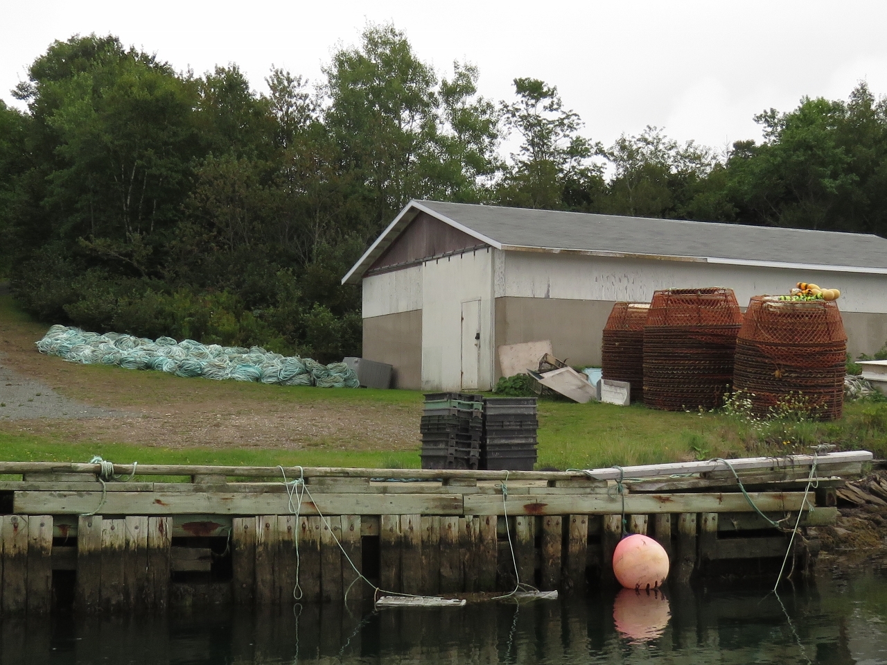 |
Traps
Position: -60 17.13, 46 18.18
Large traps and line piled at a shed near Trent n’ Girls.
|
 |
Anchorage
Position: -60 18.09, 46 15.11
The view to our anchorage at the head of St. Andrews Channel over a small spit from the bay opposite.
|
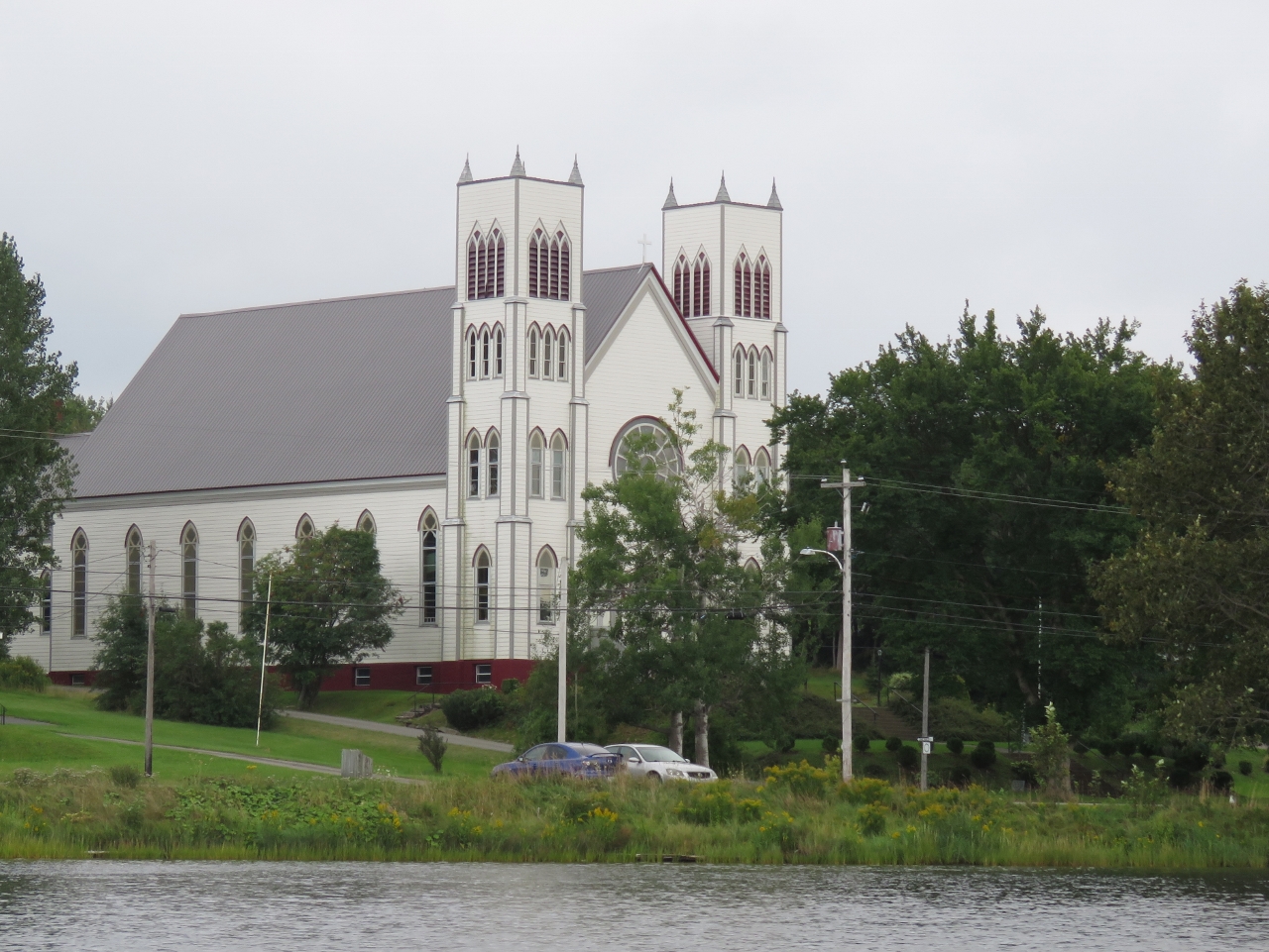 |
Church
Position: -60 17.53, 46 14.71
We ran the tender into a small lagoon off the anchorage, where this large church stood. We’ve seen a large number of churches on Cape Breton Island, ranging from small and simple to large and grand like this one.
|
 |
Long Island
Position: -60 24.44, 46 10.85
On our way out of St. Andrews Channel we passed through the narrow channel east of Long Island. A few cabins were alongshore, but no people were in evidence. A sandspit at the south end of the channel constricts the entry more than is apparent on the chart.
|
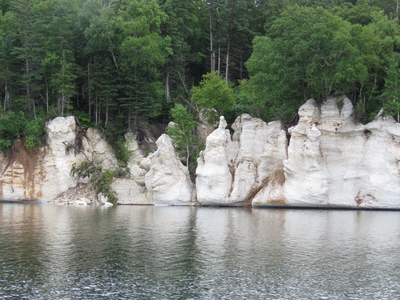 |
Cliffs
Position: -60 32.25, 46 8.25
The unusual weather-sculpted cliffs along the west shore of Island Point reminded us of the ones we saw at Langgi in the Kimberley region of Western Australia.
|
 |
Island Point Harbour
Position: -60 32.98, 46 7.74
We anchored for the night at the head of Island Point Harbour. The winds came up from the north about 15-20 for much of the day, sending wind waves into the anchorage, but settled down by evening.
|

|
Click the travel log icon on the left to see these locations on a map, with the complete log of our cruise.
On the map page, clicking on a camera or text icon will display a picture and/or log entry for that location, and clicking on the smaller icons along the route will display latitude, longitude and other navigation data for that location. And a live map of our current route and most recent log entries always is available at http://mvdirona.com/maps. |
If your comment doesn't show up right away, send us email and we'll dredge it out of the spam filter.