
You’d think by now that we might be getting tired of yet another view hike with a waterfall. Not yet. But even if we were, Aviron Bay would perk us right back up again. There we anchored off a one thousand-foot waterfall and climbed to the clifftops for sweeping views of the anchorage and surrounding area.
Trip highlights from August 24th follow. Click any image for a larger view, or click the position to view the location on a map. And a live map of our current route and most recent log entries always is available at http://mvdirona.com/maps
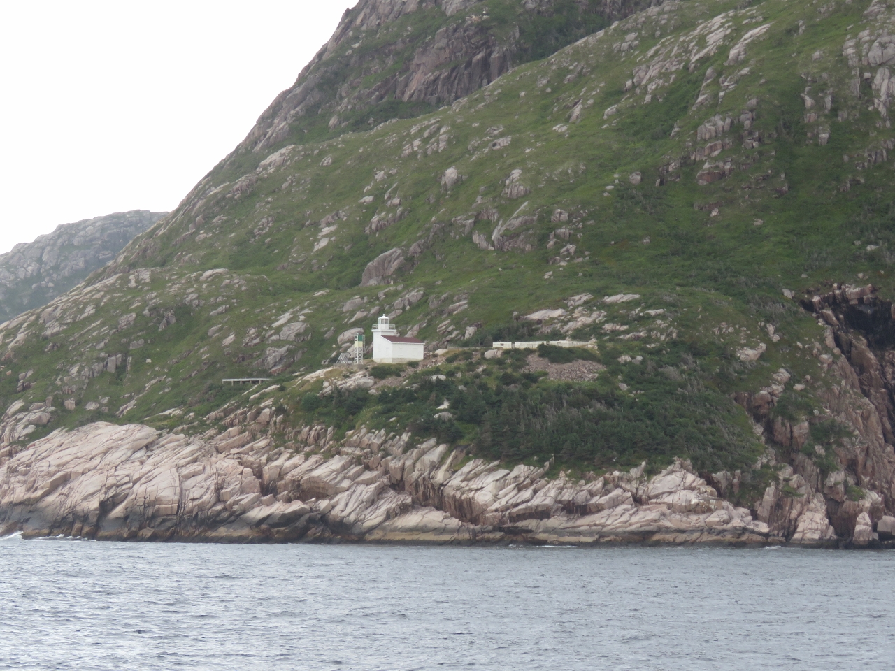 |
West Point Light
Position: -56 43.33, 47 33.72
Light and helicopter service pad perched on the cliff at West Point outside the village of Francois.
|
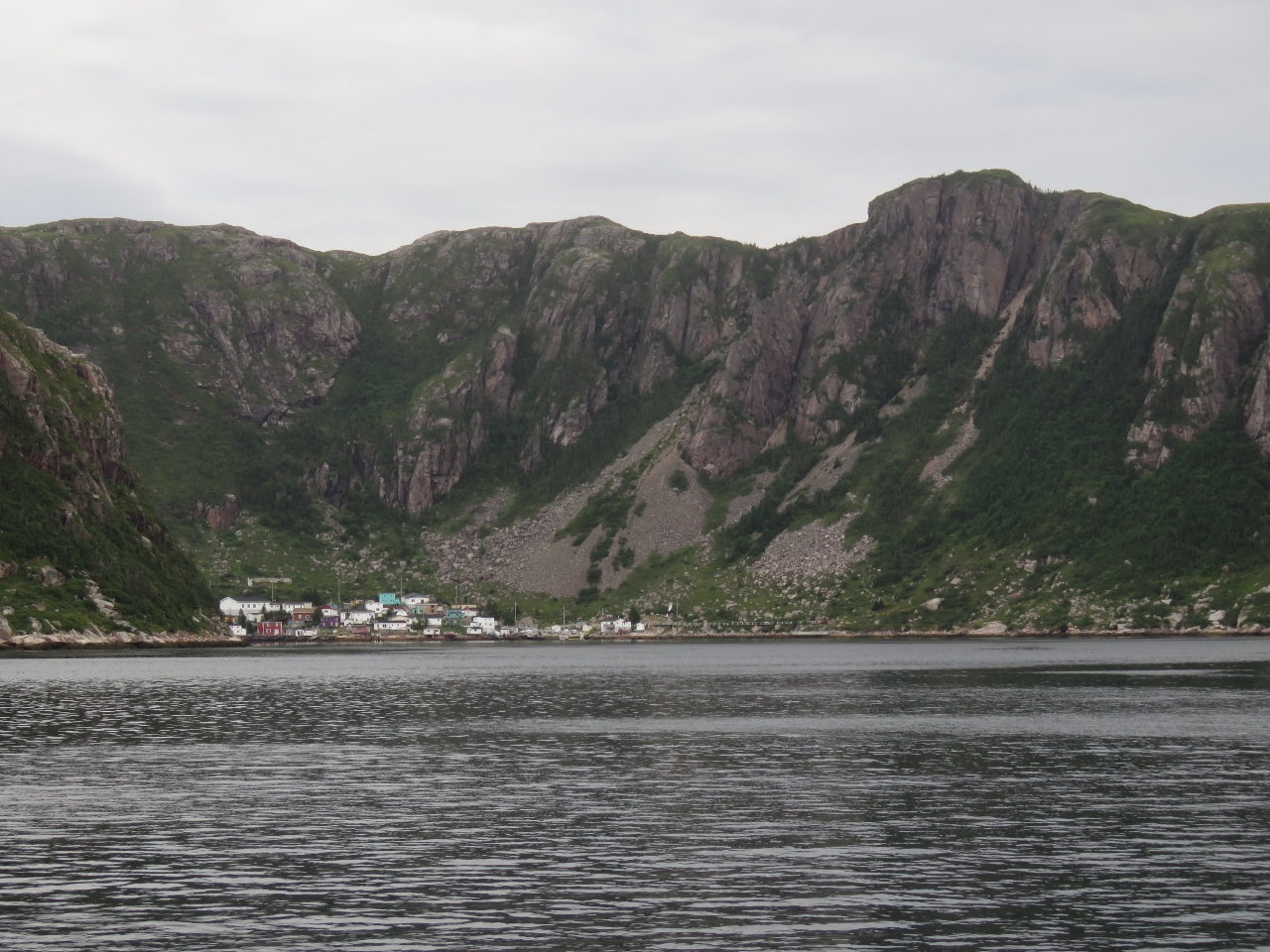 |
Francois Bay
Position: -56 44.33, 47 34.11
The outport of Francois strung below steep cliffs at the head of Francois Bay. A ferry serves the community once a week from Hermitage about 40 miles east near Gaultois, and six days a week from Burgeo about 40 miles west.
|
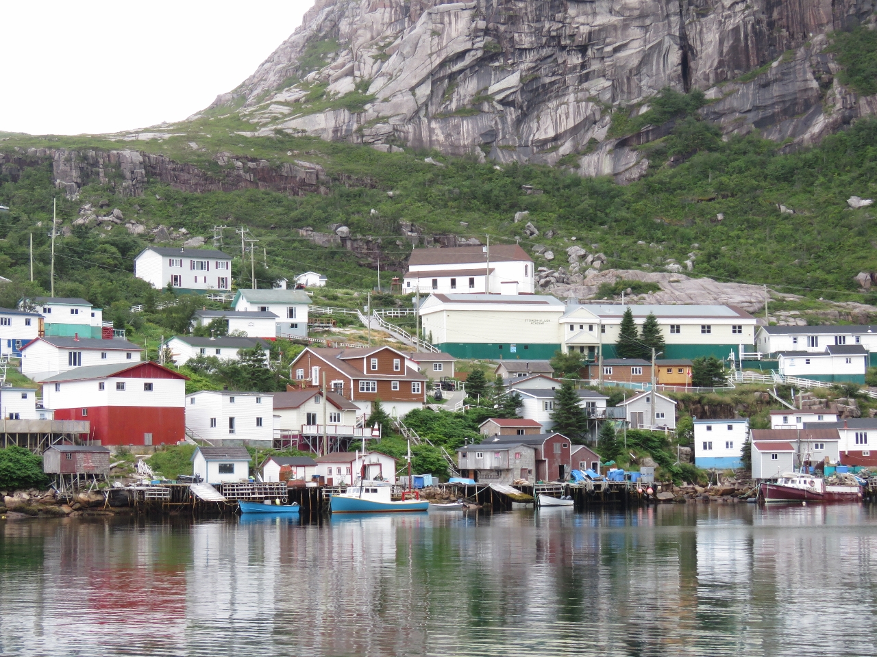 |
Francois
Position: -56 44.55, 47 34.72
Well-kept homes perched above fishing boats in the village of Francois, locally-pronounced “Franz-way”. As at Gaultois, the preferred method of land transportation seems to be all-terrain vehicle. The large white building at the upper right with the green base is the St. Simon & St. Jude Academy covering kindergarten to Grade 12. Francois does have a dock for visiting yachts, but we’re enjoying being out in the wilds too much so didn’t feel like stopping.
|
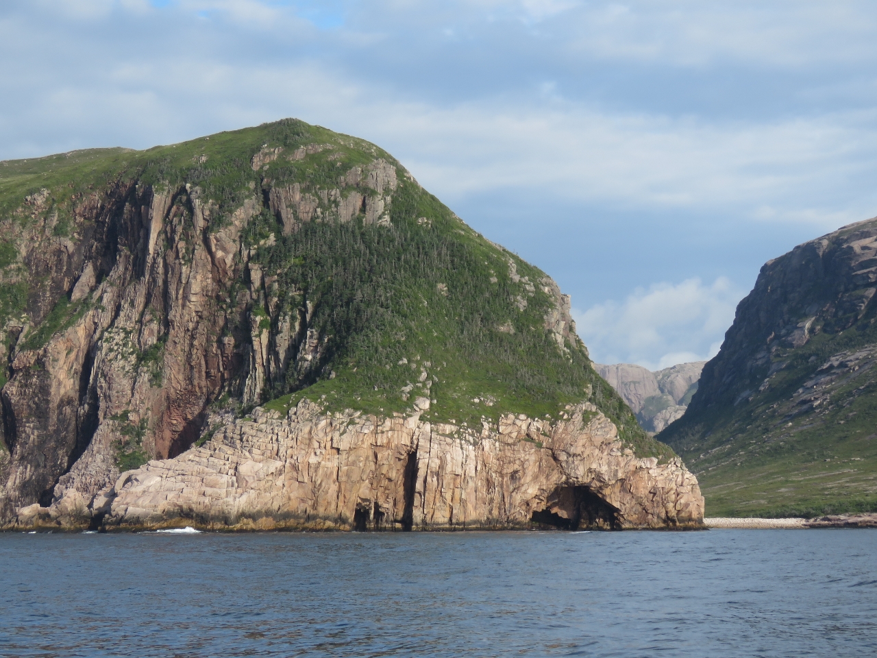 |
Bagg Head
Position: -56 46.53, 47 32.24
Caves beneath rugged cliffs at Bagg Head as we near Aviron Bay. The scenery here in Newfoundland is absolutely amazing–we never tire of it.
|
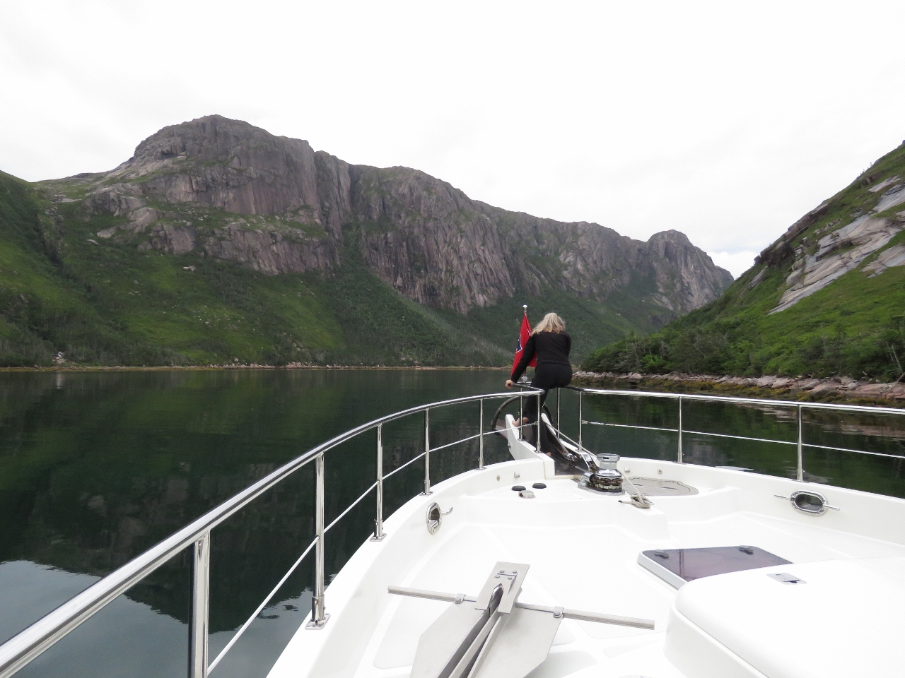 |
Bow Watch
Position: -56 48.73, 47 35.24
Jennifer watching for hazards at the bow as we cross the bar before the inner basin at the head of Aviron Bay. The entry was relatively easy. At low tide, we saw a minimum depth of 16ft and the water was clear enough we could see bottom.
|
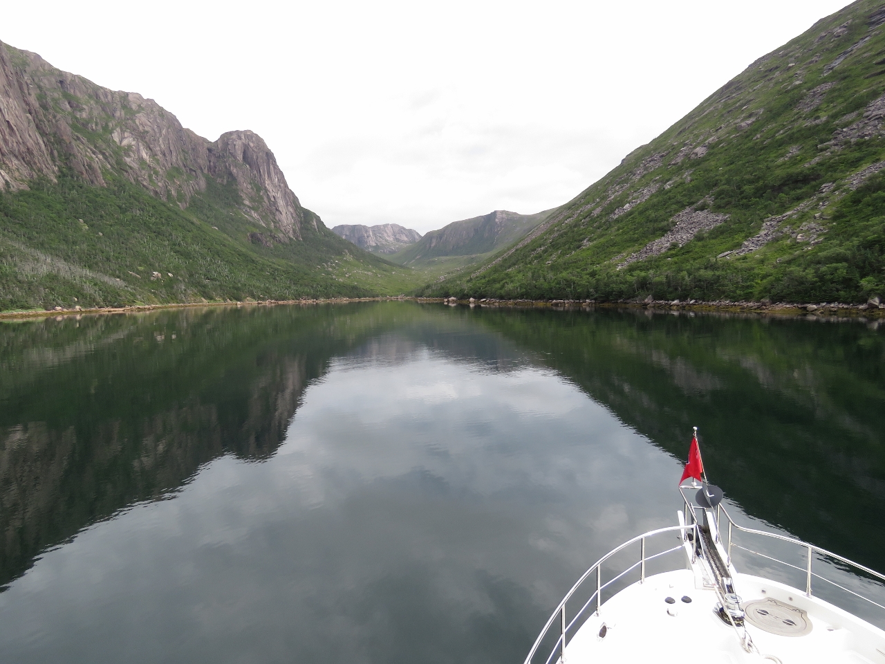 |
Anchorage
Position: -56 48.91, 47 35.38
The beautiful scenery looking north to the head of the inner basin at Aviron Bay from the anchorage.
|
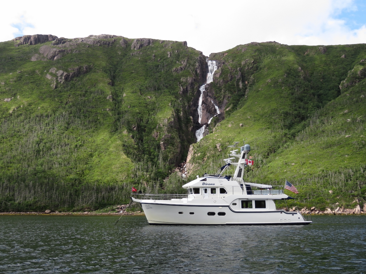 |
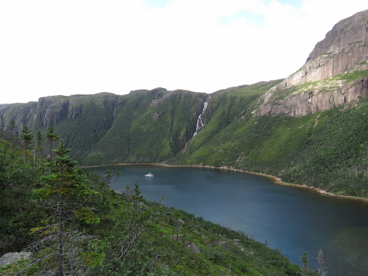
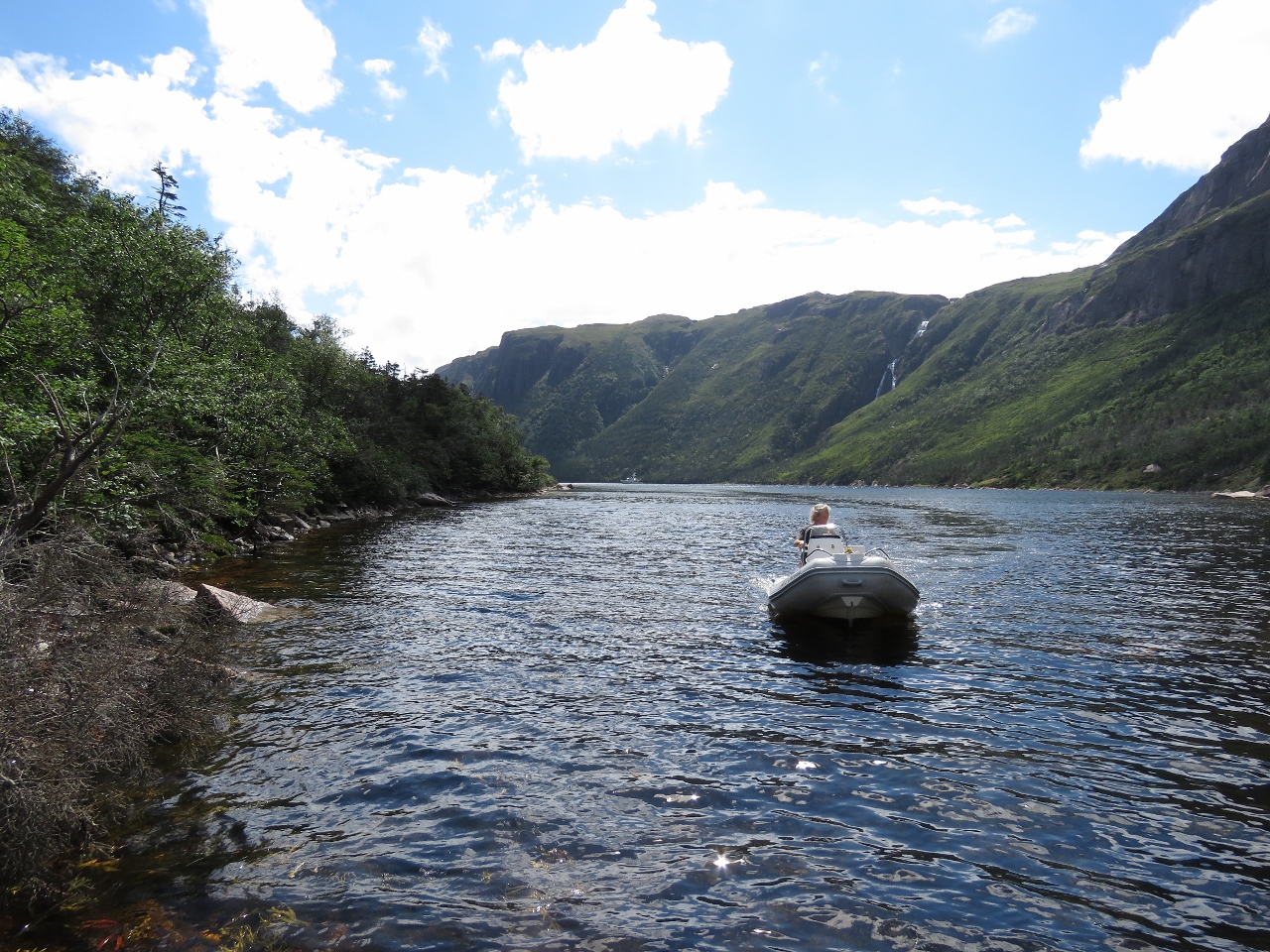
Falls
Position: -56 48.89, 47 35.42
The view to the head of Aviron Bay is impressive, but the real draw of this anchorage are the spectacular falls that cascade and plunge into the basin from 1,000ft up.
|
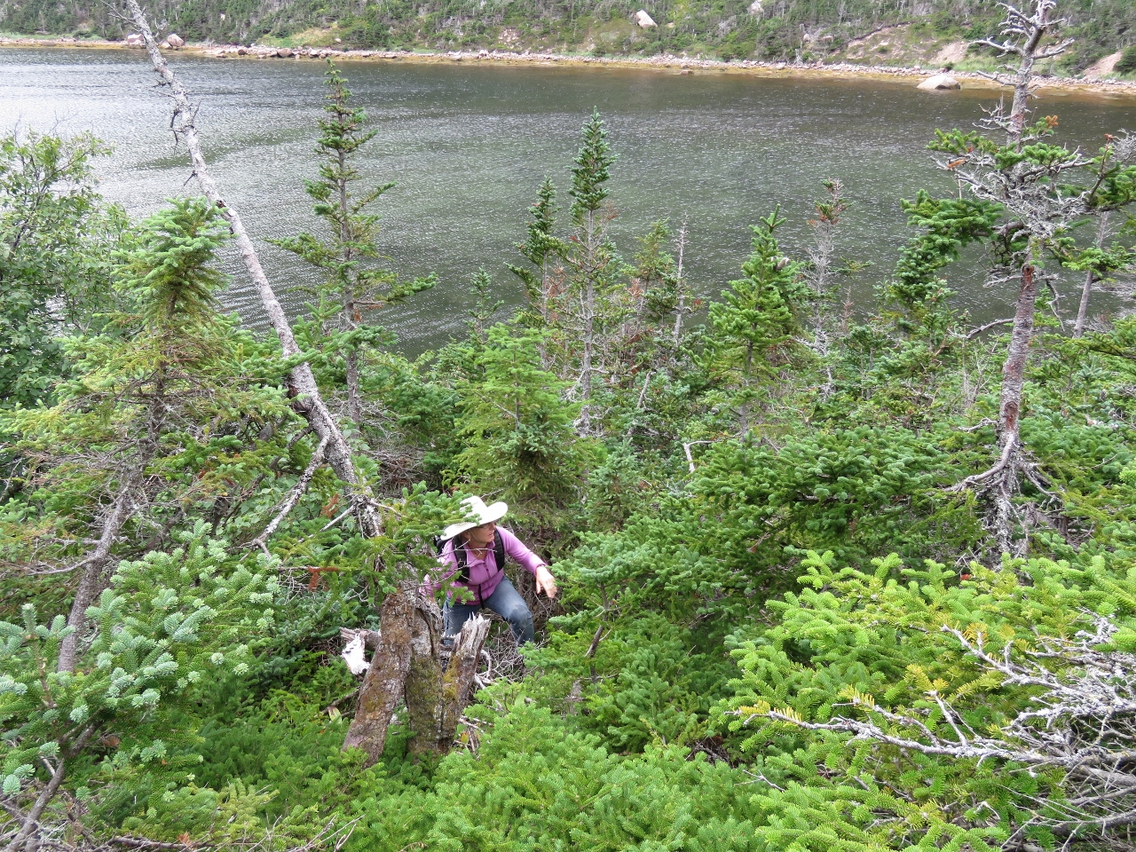 |
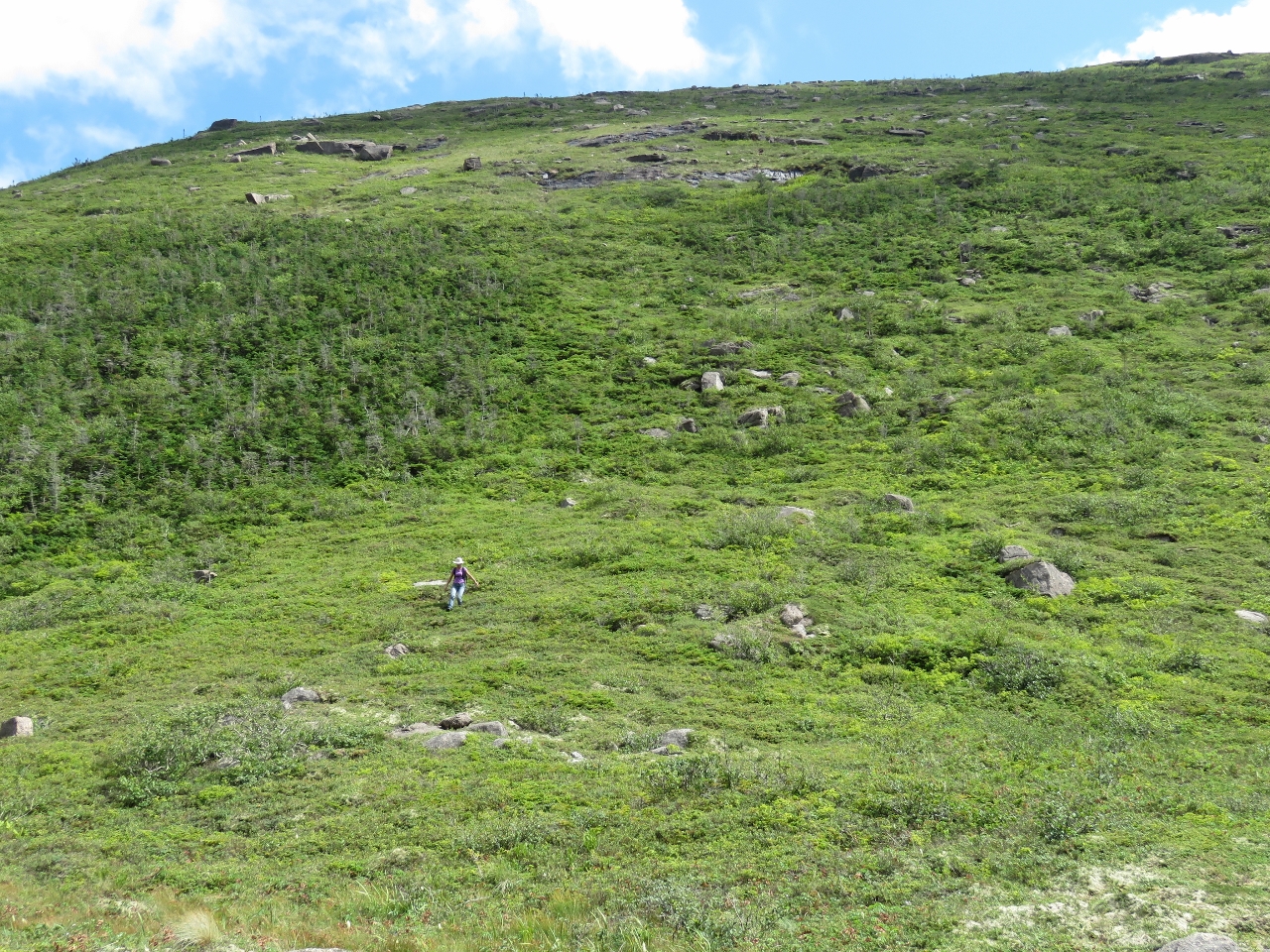
Brush
Position: -56 48.82, 47 35.61
Shore access is difficult at Aviron Bay as the slopes are steep and heavily treed near the water. But we had to find a way to reach the top for an view around the area. Jennifer is just clearing a band of thick trees near shore.
|
 |
Slide
Position: -56 48.73, 47 35.63
Above the near-shore trees we found a mostly clear, but very steep, route up rock slides.
|
 |
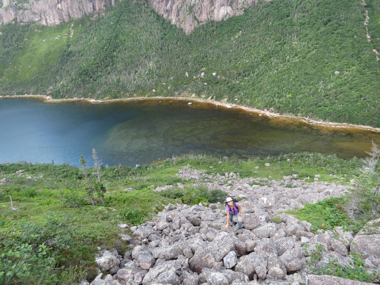
Partway
Position: -56 48.73, 47 35.63
The view partway up at 235ft was already impressive.
|
|
|
Lunch
Position: -56 48.56, 47 35.57
We had our lunch at this fabulous perch 760ft up. Wow, what a view!
|
 |
Aviron Bay
Position: -56 48.51, 47 35.42
After lunch we walked south along the hilltops. This is the view looking back down Aviron Bay the way we’d come earlier today.
|
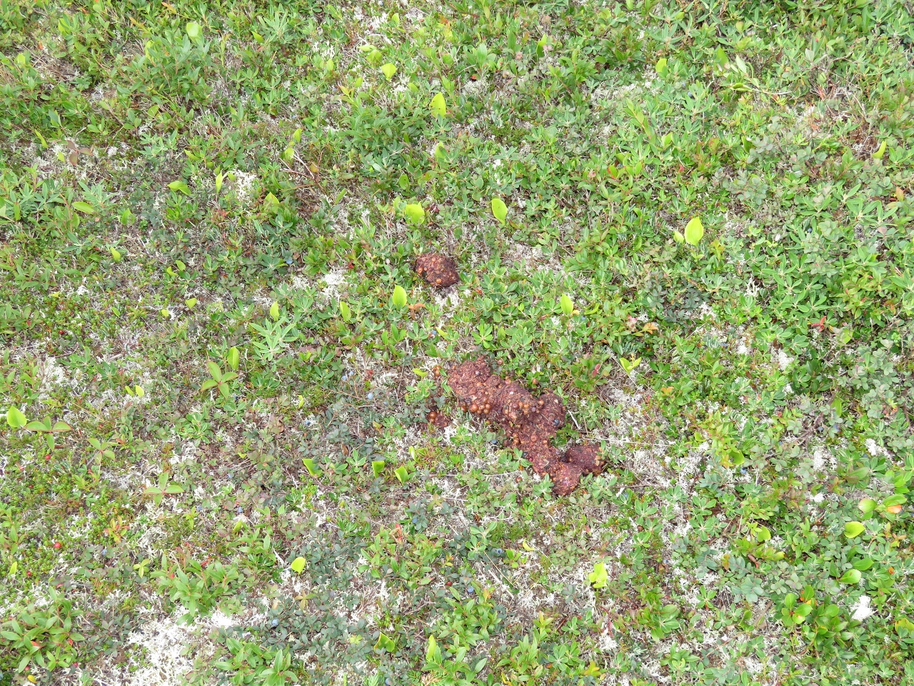 |
Scat
Position: -56 48.37, 47 35.53
Judging by the berries, we think this is bear scat we saw up in the hills above Aviron Bay. Newfoundland does have black bears.
|
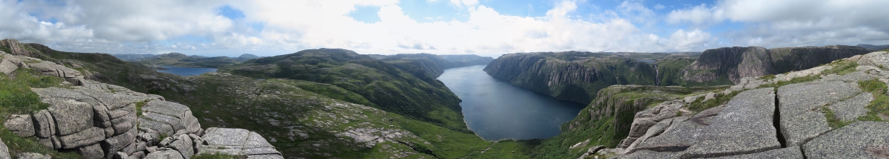 |
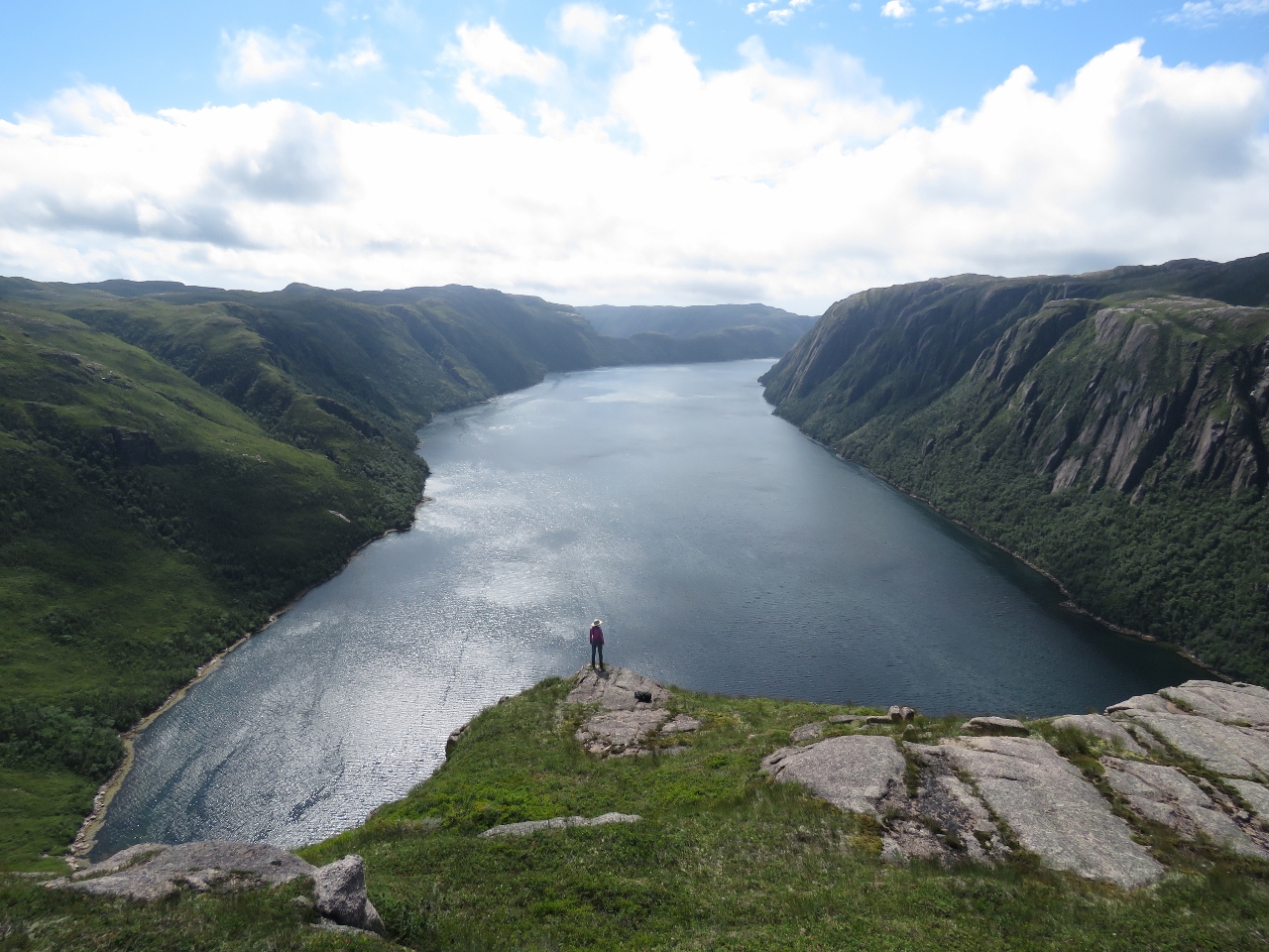
Very Top
Position: -56 48.23, 47 35.57
We continued climbing to a higher point in the nearby hills. This is the view from 1,050ft up. On the left are mountain lakes and at center is Aviron Bay. Our anchorage is out of the picture to the right. (Click to enlarge.)
|
 |
Lakes
Position: -56 48.05, 47 35.75
The view 1,138ft up looking southeast across several large mountain lakes. The village of Francois is just beyond the farthest visible lake.
|
 |
Descending
Position: -56 48.66, 47 35.95
Our ascent was quite steep, so we decided to try descending farther north and following the river back to the tender. The going was steep, but generally manageable and better than the route up. This is Jennifer at about 200ft above sea level.
|
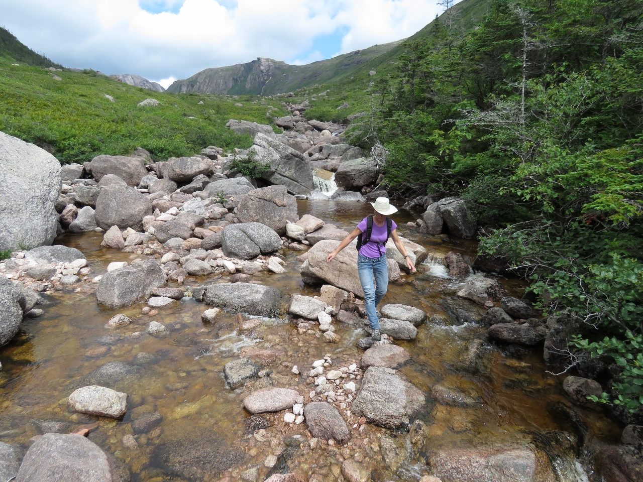 |
River
Position: -56 48.80, 47 35.80
Jennifer jumping rocks on our way back down-river.
|
 |
High Tide
Position: -56 48.82, 47 35.71
We’d tied the tender off near low tide around the farthest point visible in the distance on the left. We returned at high tide to find no easy land route back from the river mouth. James left Jennifer with both backpacks and made a run through the trees to reach the tender expediently. Here he is returning to retrieve Jennifer.
|
 |
Gusts
Position: -56 48.89, 47 35.41
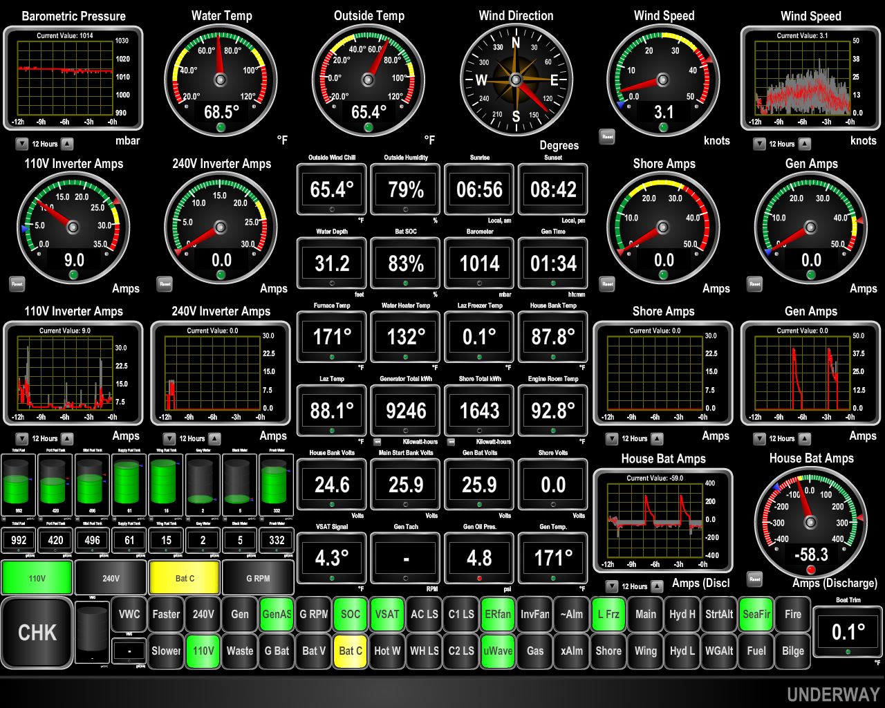
We’d read that the topography at the head of Aviron Bay can produce gusty winds. While the West Point Light was recording winds of 10-15 kts, we saw gusts to 39kts (anemometer at top right of screen shot).
|
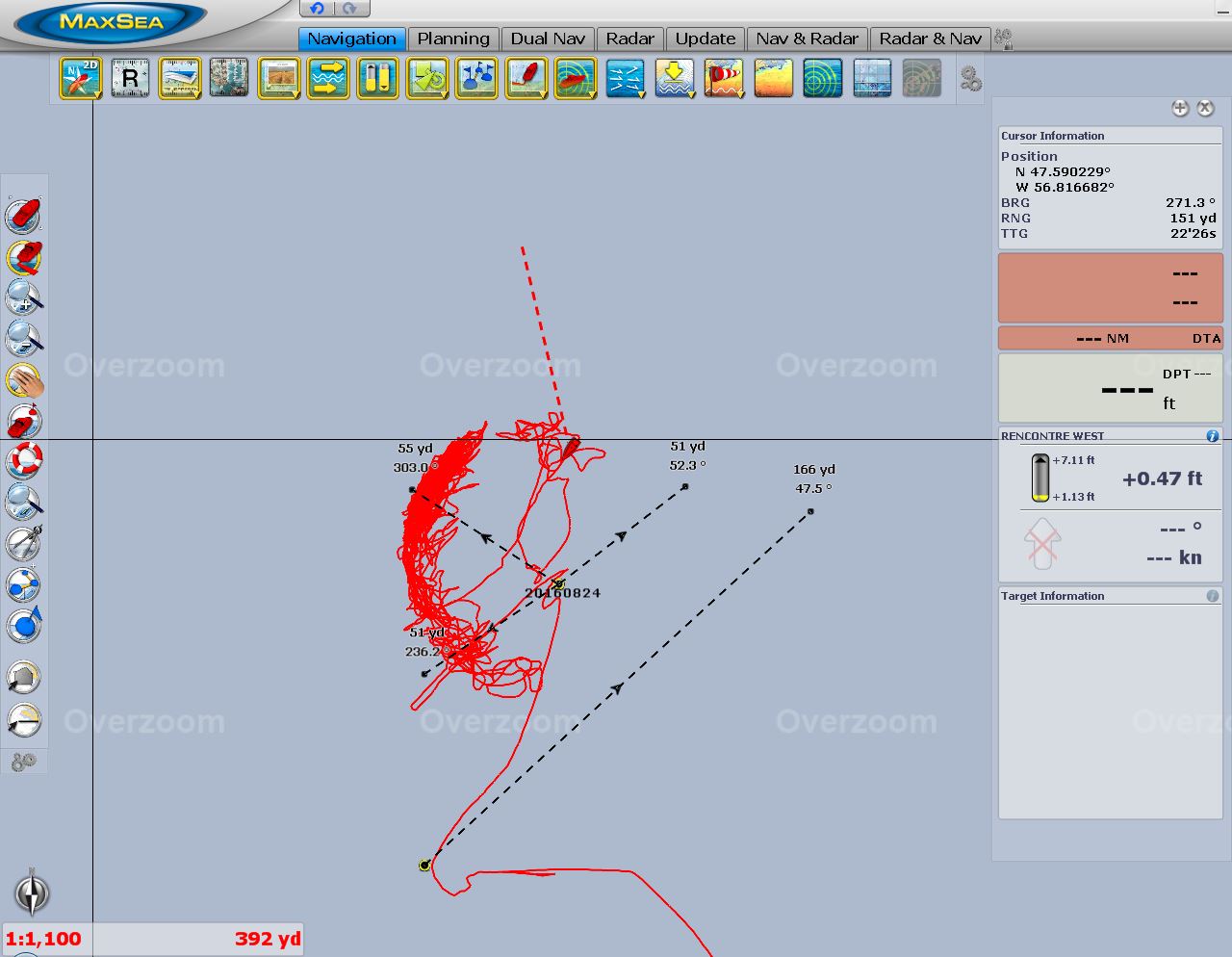 |
Swing area
Position: -56 48.89, 47 35.41
When we first arrived at the anchorage, we nosed up to the shallows off the falls and placed the circular mark near the bottom of the screenshot at the limit of safe anchoring depth. The circular mark where the two lines intersect is where we dropped the anchor in 23ft. The red line shows our boat’s movement at anchor—the arc-shape shows how the boat was pushed back during the big wind gusts. The 55-yard dividers we’ve drawn northwest and southwest from the anchor mark allow us to determine at a glance if the boat has moved beyond where we expect it to, indicating that the anchor might be dragging. The Rocna anchor is amazing. Having cruised all over the world, it has yet to slip after setting.
|

|
Click the travel log icon on the left to see these locations on a map, with the complete log of our cruise.
On the map page, clicking on a camera or text icon will display a picture and/or log entry for that location, and clicking on the smaller icons along the route will display latitude, longitude and other navigation data for that location. And a live map of our current route and most recent log entries always is available at http://mvdirona.com/maps. |
Late comment, but that is Indeed bear scat/poo :-)
Greetings from the Arctic Circle, enyoing the blog!
We figured so. You signed “Greetings from the Arctic Circle.” That sounds interesting — where are you located?