Sam Hitches Harbour is as beautiful as Little Bay, and also has a waterfall at the head. It seems like it’s a rare anchorage here that doesn’t have a waterfall. Newfoundland is exactly our kind of cruising grounds: solitude with amazing natural scenery. Except for a few local-looking boats docked at Harbour Breton, we’ve not seen another cruising pleasure craft since we arrived in the province.
Trip highlights from August 8th follow. Click any image for a larger view, or click the position to view the location on a map. And a live map of our current route and most recent log entries always is available at http://mvdirona.com/maps
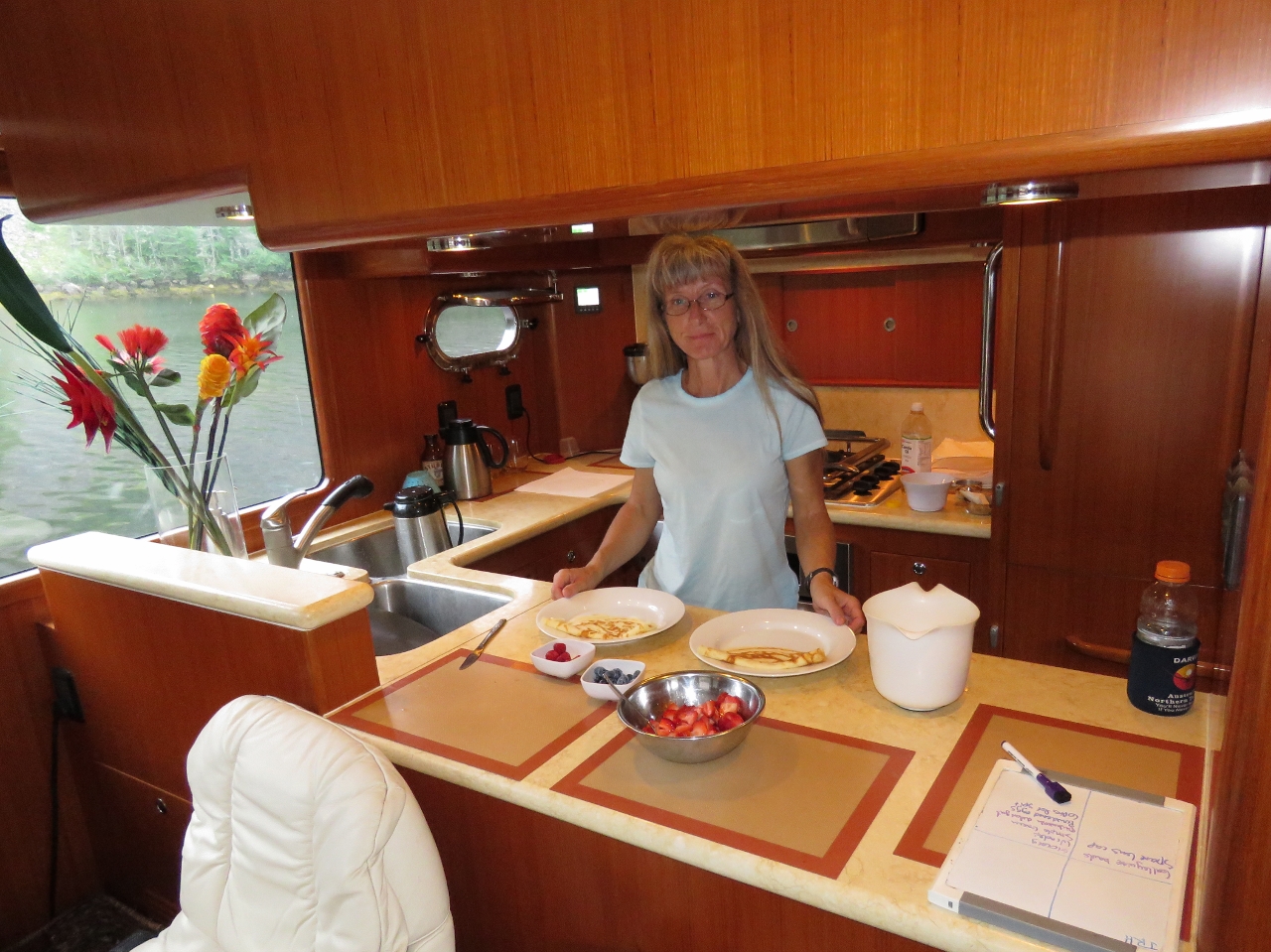 |
Crepes
Position: -56 0.92, 47 38.00
Jennifer making crepes for breakfast.
|
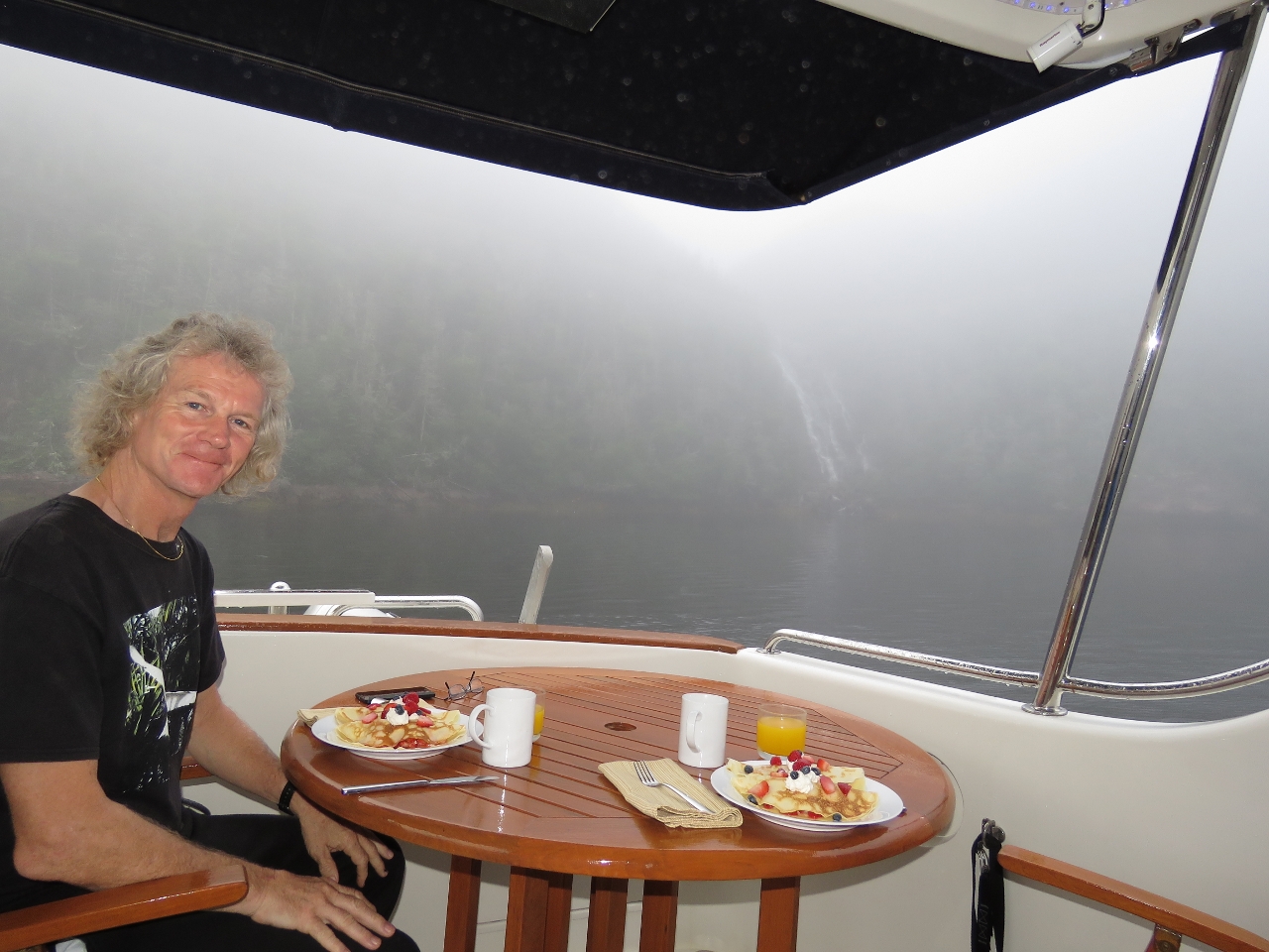 |
Happy Birthday!
Position: -56 0.92, 47 38.00
A special breakfast of crepes with fresh berries and whipped cream to celebrate James’ birthday today. You can see in the background that a reasonably thick fog has settled in the bay, with the waterfall just visible in the background even though it’s fairly close.
|
 |
Clear
Position: -56 0.92, 47 38.00
The fog lifted later this morning and the sun came out, so we got a few more shots of the waterfall from the tender. Little Bay has been a pretty spectacular anchorage.
|
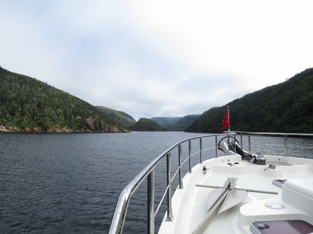 |
Entering
Position: -56 3.01, 47 37.56
Looking north down mountainous Sam Hitches Harbour from the mouth as we enter.
|
 |
Anchoring
Position: -56 2.59, 47 38.79
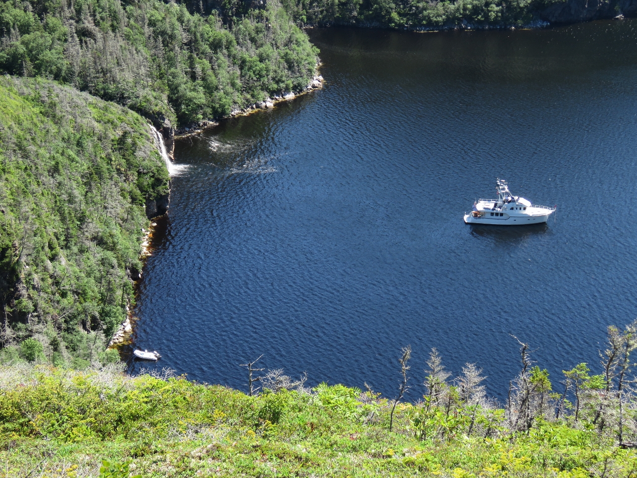
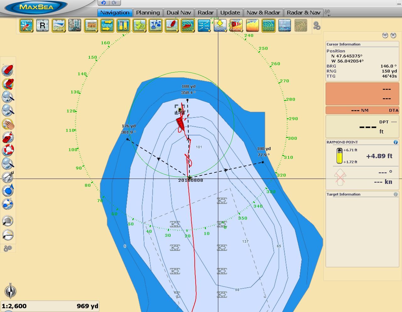
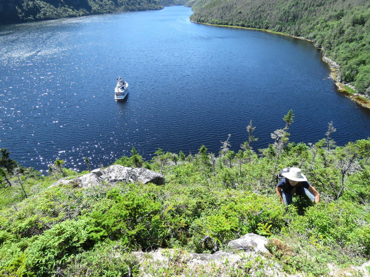
Sam Hitches Harbour is as beautiful as Little Bay, and also has a waterfall at the head. The water depth under the falls is 130ft though, even deeper than Little Harbour at 100ft. The swing diameter is 350 yards, which seems like a lot, but that would mean we had room to put out only 400ft of rode which is a scope of 3:1. We prefer 5:1 for a shallower angle of tension on the anchor should the winds come up, but the weight of that much chain will decrease the likelihood that the chain would pull taught, so we’ll tolerate it if the holding is good. We measured carefully to determine the exact place to position the boat to have equal distance from all hazards. With 400ft of chain out we held well on testing the set at 1,300RPM.
|
 |
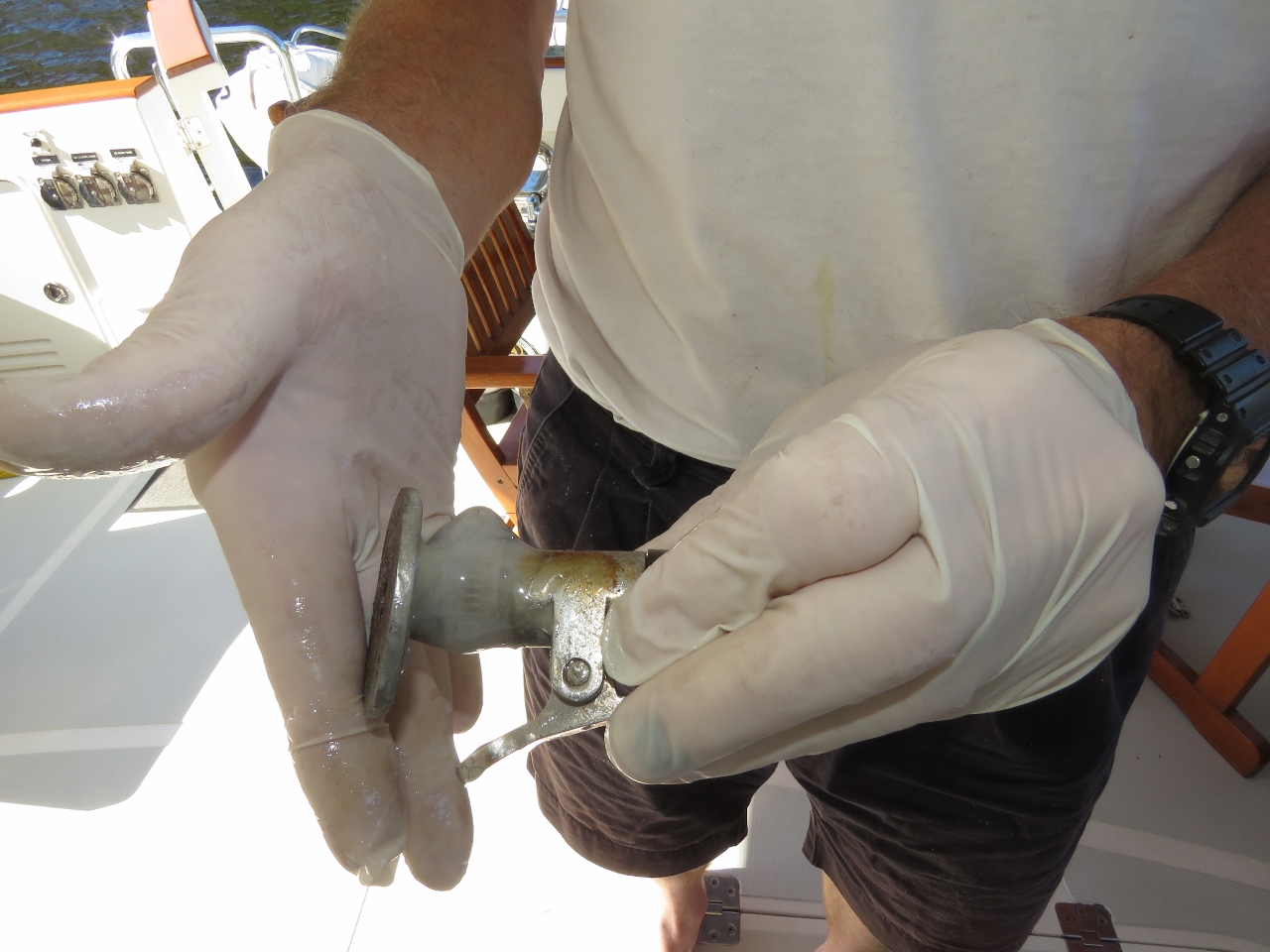
Chain
Position: -56 2.57, 47 38.77
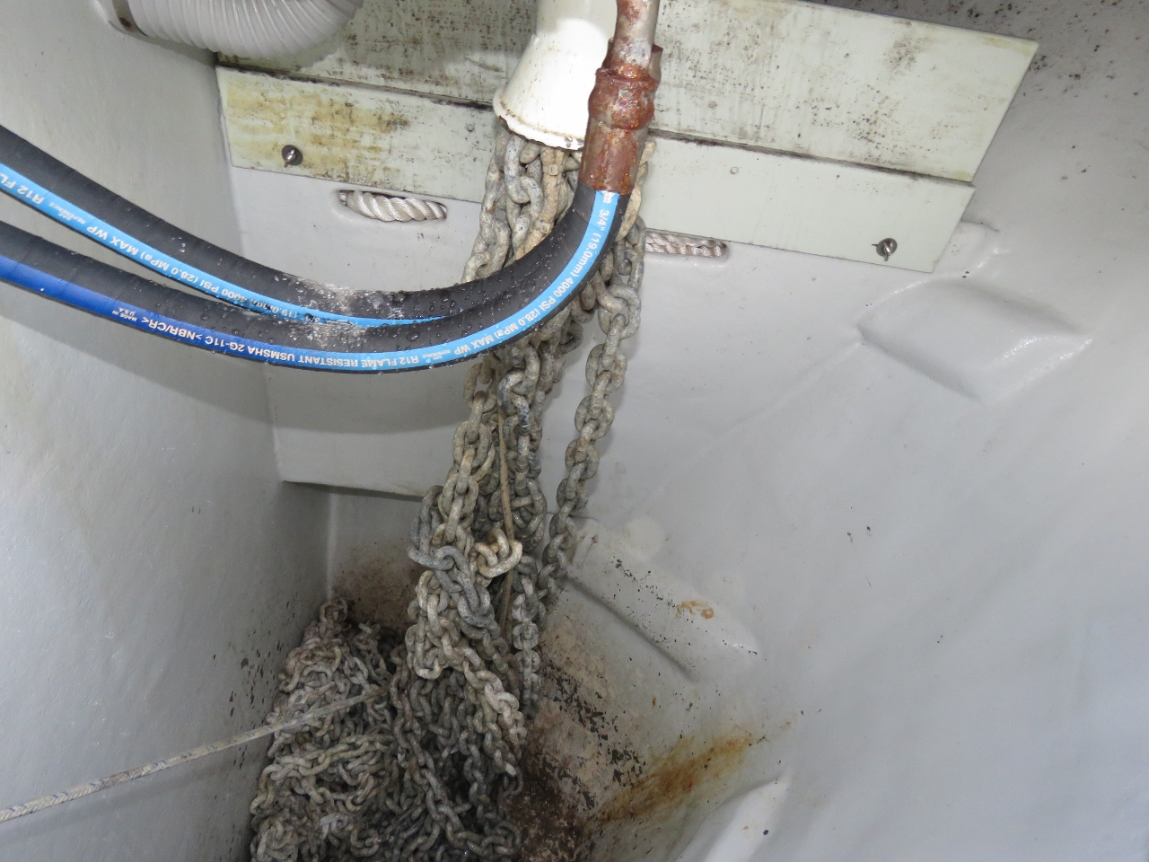
As we neared 400ft of chain out, we could hear the windlass struggling against chain tangles. We opened up the chain locker and saw the knot pictured. It seems almost impossible that we could ever be in rough enough water that the last 150ft of rode would actually have some full knots in it. In order for that to happen, all 500ft of chain (at 2lbs a foot that’s 1,000 lbs) has to be lifting off the bottom of the locker as the boat moves in rough seas .
|
 |
Washdown
Position: -56 2.57, 47 38.77
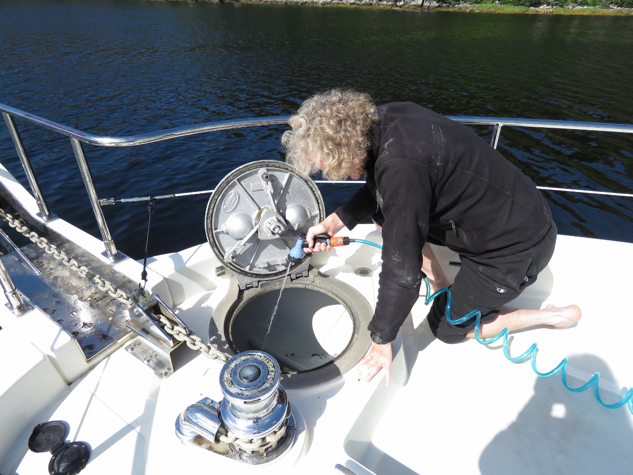
We let out all the chain to untangle it then took the opportunity to hose down the anchor locker while it was empty. We haven’t washed down the anchor locker since Alaska five years ago.
|
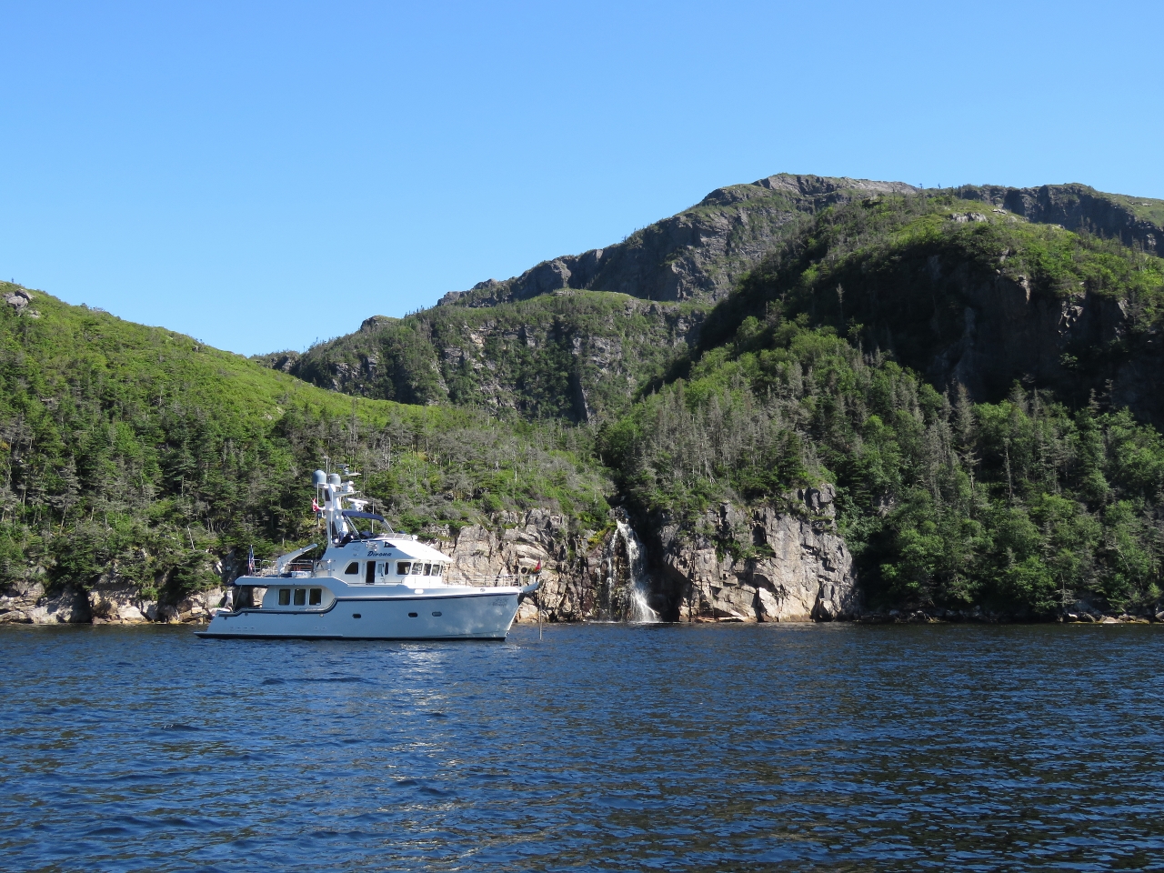 |
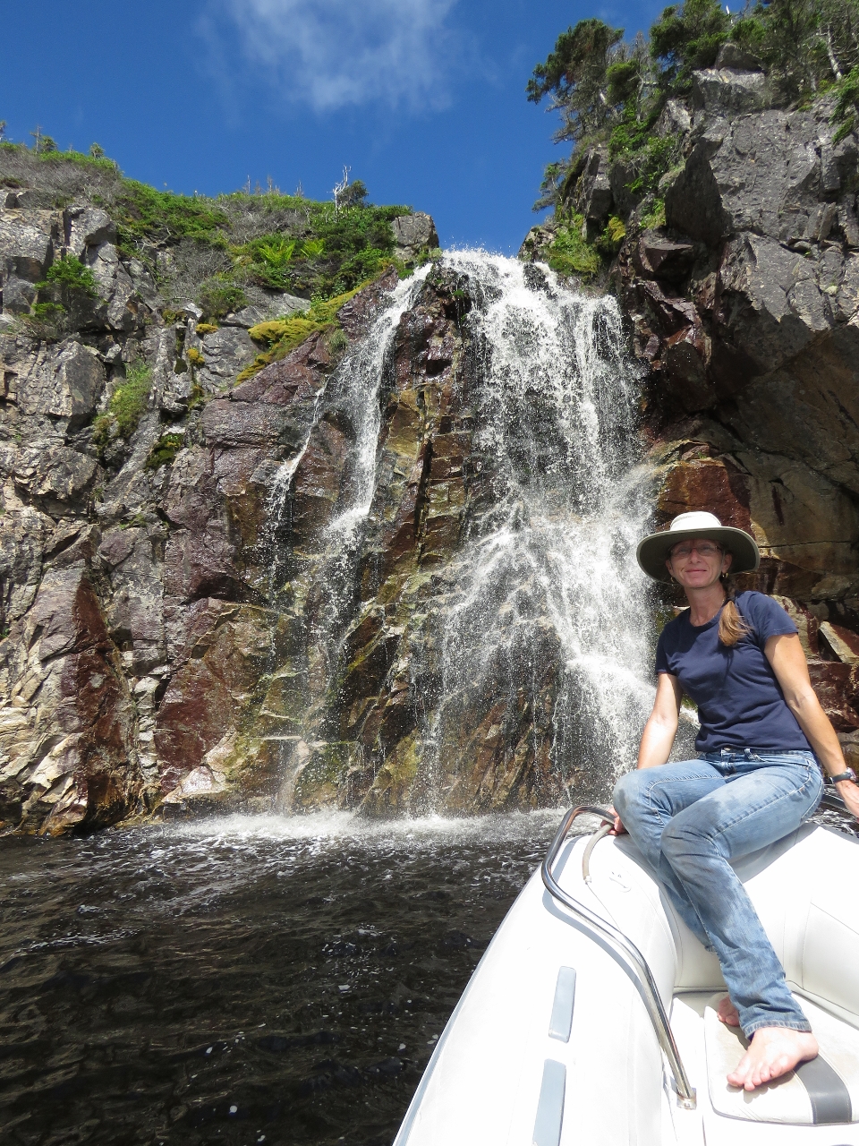
Sam Hitches Harbour
Position: -56 2.59, 47 38.79
At anchor off the waterfall in beautiful Sam Hitches Harbour.
|
 |
Door latch
Position: -56 2.59, 47 38.79
We were not able to get a replacement cockpit door latch before leaving Boston, but Justin at Nordhavn parts has two ready for us when we get back to civilization. We’ve been using a bungee cord to hold the door open, but this is inconvenient. So today James tried securing the two pieces with a hose clamp and gluing the whole mass together with 5-minute epoxy. So far, it’s holding well and we have a working door latch again.
|
 |
Climbing
Position: -56 2.60, 47 38.84
Looking for a place to climb to a view, we landed the tender about 150ft west of the falls, at the base of a cliff where the tree line was lowest. There we found a rough trail leading diagonally up towards the falls. We climbed straight up when the track continued more east and reached a low bluff above the anchorage. The view from hear already was pretty impressive.
|
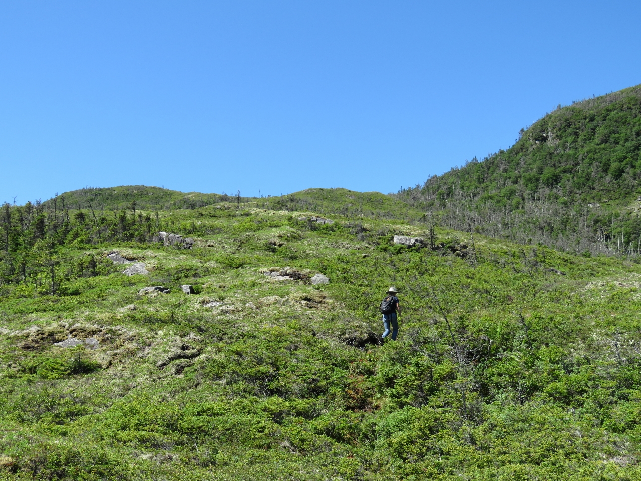 |
Goal
Position: -56 2.63, 47 38.88
Our goal was the hilltop at the upper left of the photo. Much of the walking was relatively easy through open groundcover, but we had to push through thick trees in a few valleys along the way.
|
|
|
Halfway
Position: -56 2.77, 47 38.84
Halfway to the top we got a great view of the anchorage, the waterfall and even the tender.
|
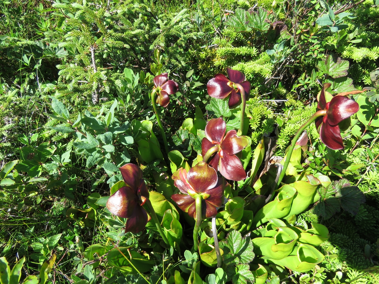 |
Pitcher Plant
Position: -56 2.85, 47 38.82
Pitcher Plants, Newfoundland’s official flower, grew in the open meadows along the way. The plant feeds on insects that drown in its water-filled lower cups.
|
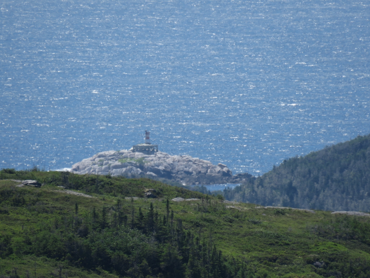 |
Tinker Rock
Position: -56 2.90, 47 38.77
We’ve gained enough altitude that we can see Tinker Rock that we passed to enter Bay d’Epoir.
|
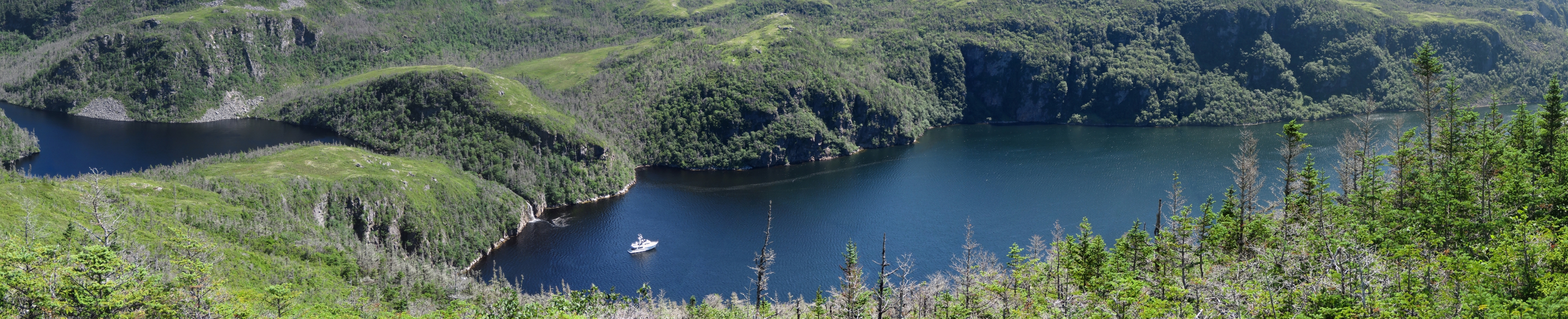 |
View
Position: -56 2.89, 47 38.77
We finally reached the hill we were aiming for, 500ft up. The view from there is amazing. At the left of the photo is the lake that feeds the waterfall we’re anchored under.
|
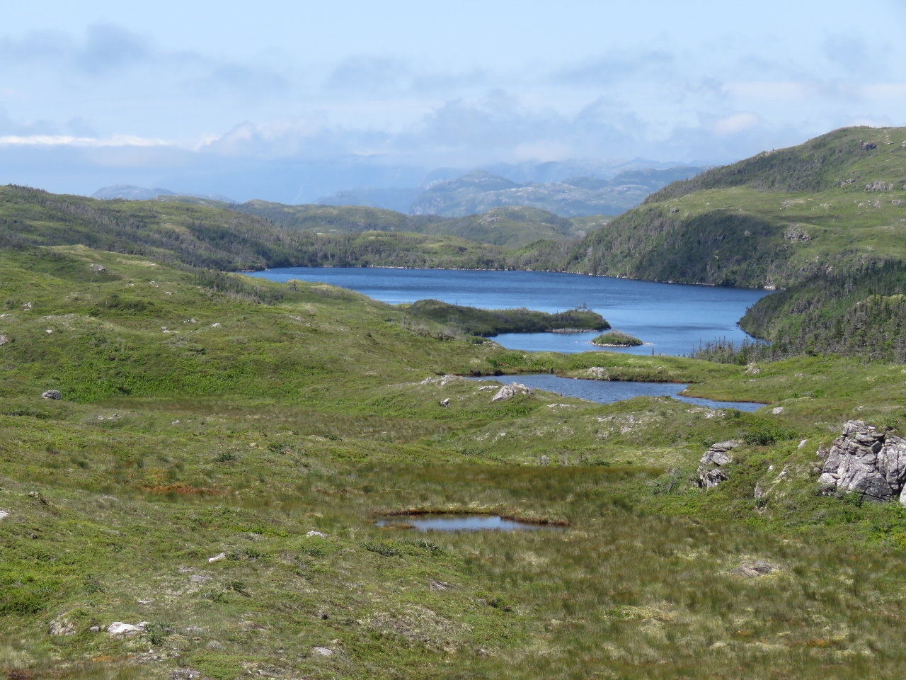 |
Lakes
Position: -56 2.99, 47 38.78
The view looking west from the summit was pretty impressive too, with a series of lakes and more mountains in the distance.
|
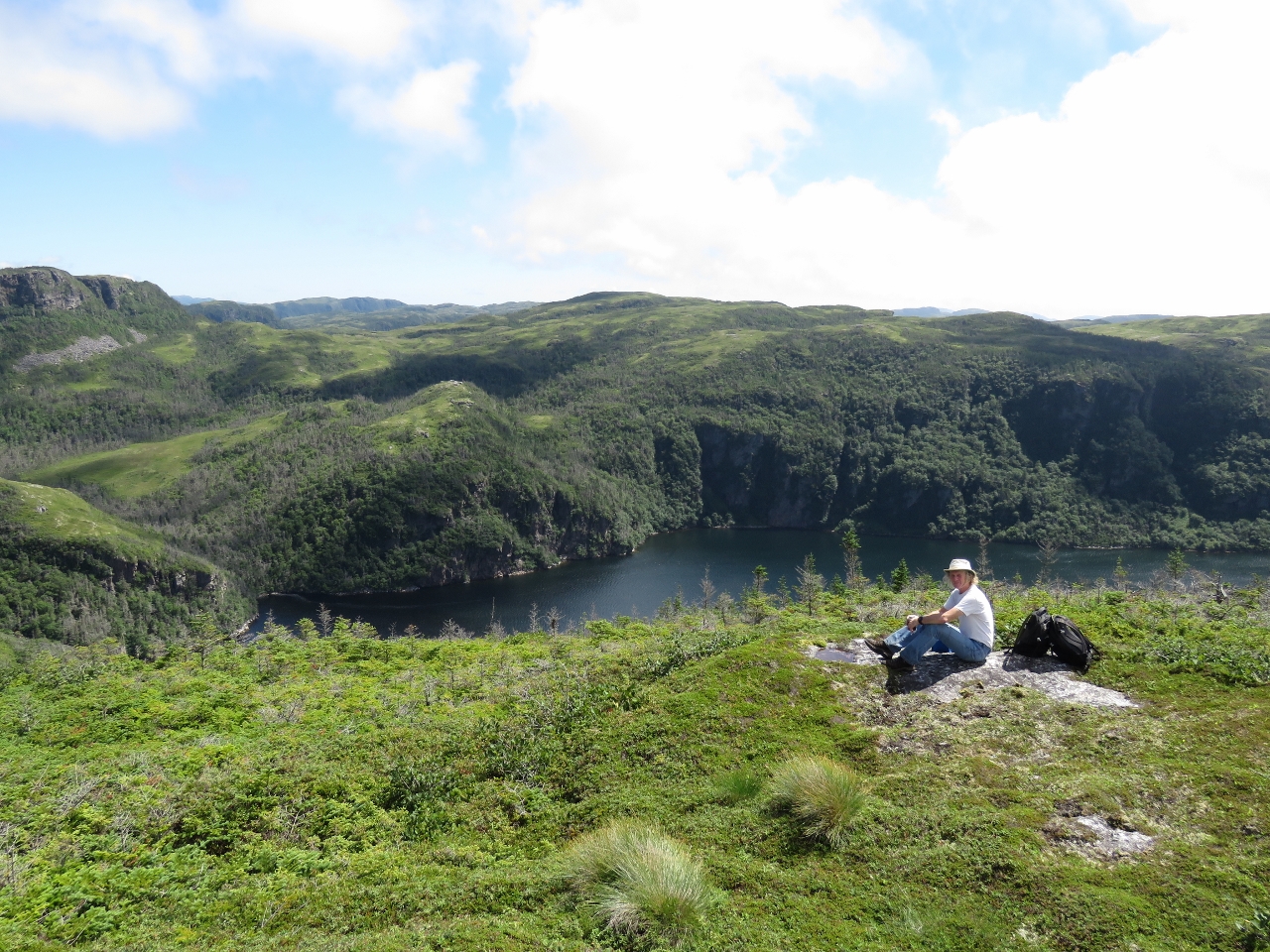 |
Lunch
Position: -56 2.91, 47 38.77
Lunch with a view above the anchorage at Sam Hitches Harbour. Boy, we’re loving Newfoundland.
|
 |
Falls
Position: -56 2.56, 47 38.81
A close-up view of the falls after we returned back from our hike.
|

|
Click the travel log icon on the left to see these locations on a map, with the complete log of our cruise.
On the map page, clicking on a camera or text icon will display a picture and/or log entry for that location, and clicking on the smaller icons along the route will display latitude, longitude and other navigation data for that location. And a live map of our current route and most recent log entries always is available at http://mvdirona.com/maps. |
Happy birthday, Jamie.
I didn’t realize that some of your sightseeing hikes are serious (in the sense of wild & long). Have you needed any special safety precautions?
Thanks for the birthday greeting Frank. We just got back from a 5 hour hike where we worked up 1,100′ above the current anchorage and what an anchorage it is. Right in front of a massive waterfall falling hundreds of feet above us. On the longer runs we bring the satellite phone with us and always have a VHF radio with us.
In Alaska years ago I jumped a stream and landed badly twisting my ankle — it was not that serious and I still could walk but it was challenging. It’s a reminder of what a mess it could be if one of us broke a leg or something similar. We try to be careful.
The other issue that brings some risk is our tender can cover massive distances and we often due. If it ever failed to start, it could take a 1/2 day to row back. It’s always been super reliable and I do carry a spare battery but nothing is perfect.
Beautiful pictures. It wouldn’t be hard to believe you are the first two people to ever touch that land.