The first permanent settlers inhabited Pushthrough, at the mouth of Northern Arm, in 1812. The population reached 209 by 1884 and peaked at 247 in 1961. Between 1966 and 1968, a third of the 50 families relocated and the entire community resettled in 1969. Much has been written about the negative impacts of the resettlement program, but life in these outports wasn’t easy. At the time of resettlement in 1969, most men were employed away from Pushthrough, leaving their wives to run the households. Without electricity or running water, this was an arduous task. Water had to be transported twice daily from a well that might be 200-300 yards away. A wood-burning stove had to be fed constantly to boil water, cook meals and bake bread. Someone had to row out to chop and transport that wood. A bucket, emptied daily, served as a toilet. And all housework was done by hand—the weekly laundry usually took the entire day.
Trip highlights from August 17th and 18th follow. Click any image for a larger view, or click the position to view the location on a map. And a live map of our current route and most recent log entries always is available at http://mvdirona.com/maps
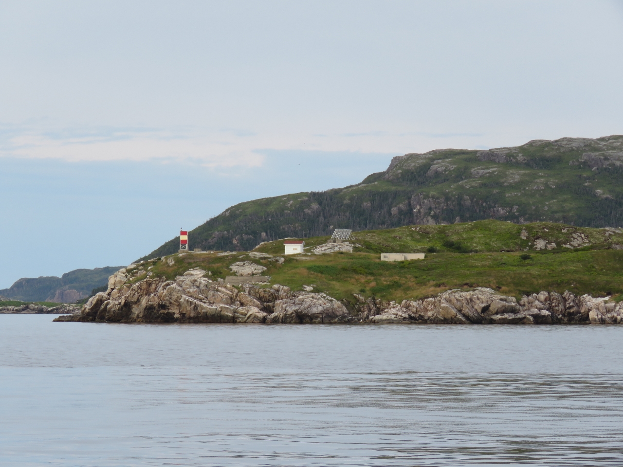 |
Dawson Point
Position: -56 8.30, 47 38.81
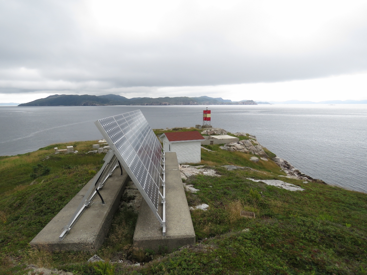
The original lighthouse on Dawson Point was built in 1916. As recently as 1990, the site contained a keeper’s house and several utility buildings. Today the only structure besides the light tower is a small shed supporting a fog horn and a solar panel array.
|
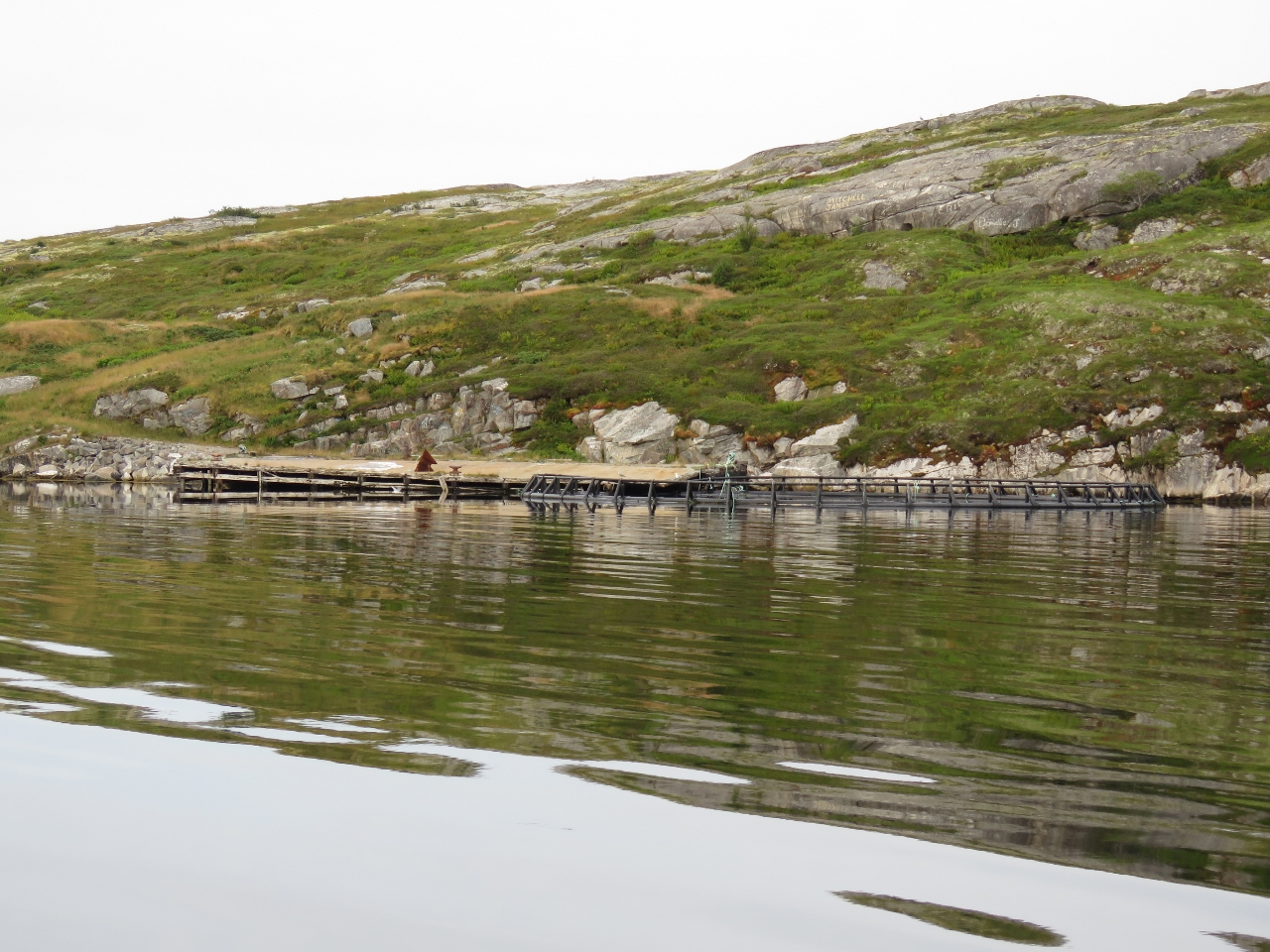 |
Government Wharf
Position: -56 9.48, 47 38.74
An aquaculture pen tied off to the remains of the Government Wharf at Pushthrough, another resettled Newfoundland outport (a community accessible only by boat). The name Pushthrough derives from Pushthrough Gut, the narrow channel between the mainland and the off-lying island where the Dawson’s Point light is located. The seas surge through this narrow channel, driven by tidal currents and southerly gales.
|
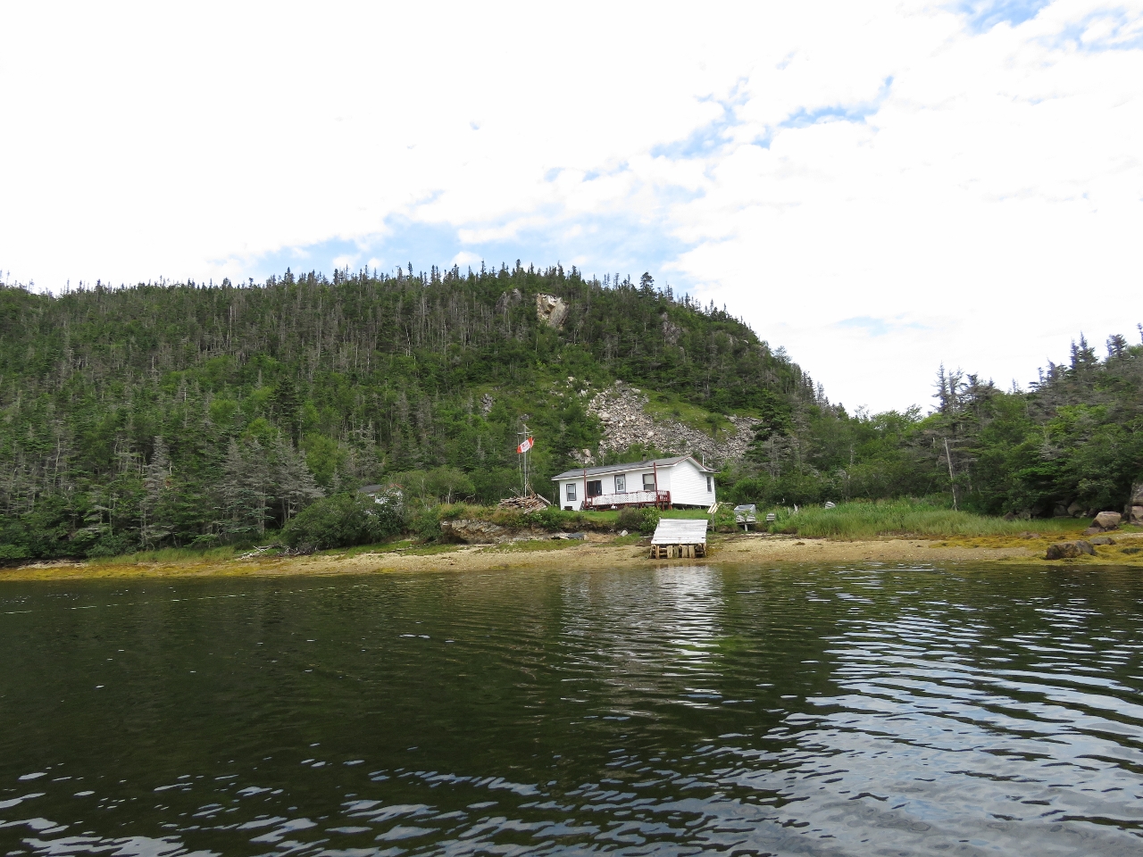 |
Cabin
Position: -56 10.86, 47 38.78
Cabin ashore inside The Barasway, a small lagoon at the head of our anchorage in Great Jervis Harbour. Most of the cabins we’ve seen here are flying a Canadian flag of some sort (here it’s the Molson Canadian flag from the advertising campaign that included the “I Am Canadian” rant). This is more national flags than we’re used to seeing in our Canadian travels.
|
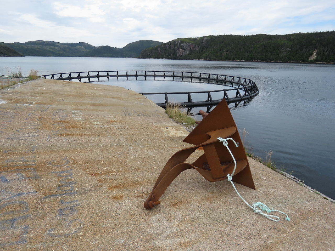 |
Anchor
Position: -56 9.56, 47 38.63
We landed the tender at the old Pushthrough government wharf to walk ashore. This is an anchor used to moor the fish pens. If you look closely you can see that the shank is bent over almost ninety degrees. That must have been quite a storm.
|
|
|
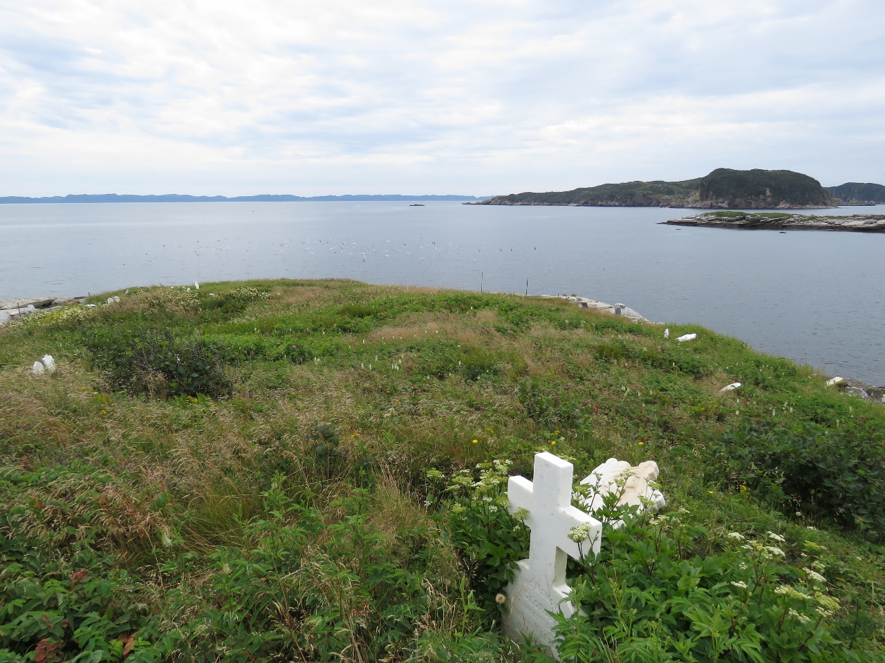
Graveyard
Position: -56 9.44, 47 38.50
The Anglican graveyard on the hill above the abandoned community at Pushthrough.
|
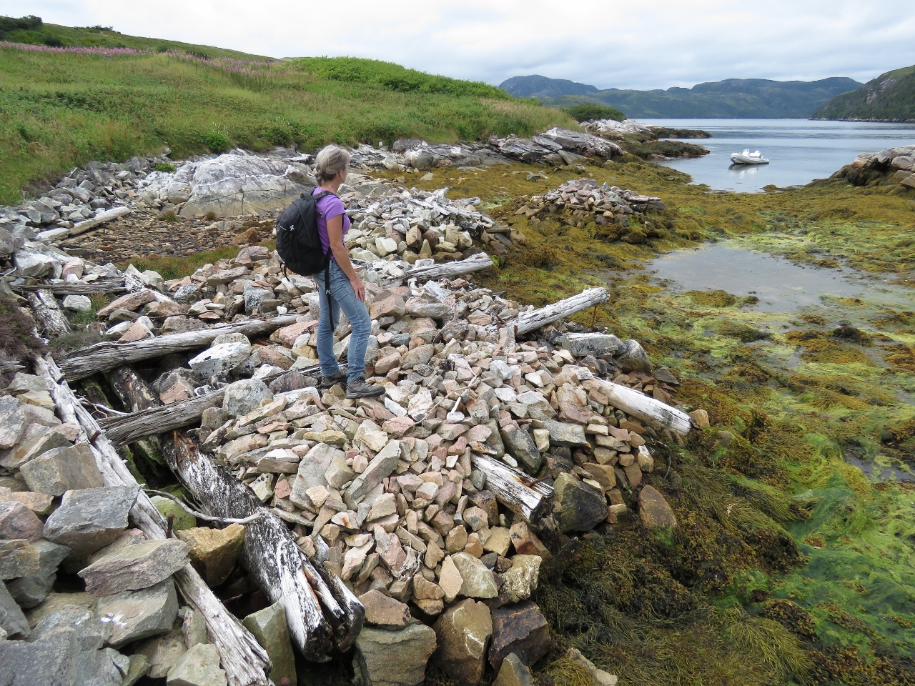 |
Wharf Ruins
Position: -56 9.21, 47 38.63
Getting across the Pushthrough Gut looked a little difficult, so we ran the tender around to walk to the light at Dawson Point. Jennifer is standing on the ruins of the wharf on the west side of the island. The two piles of rocks to the left were supported a pier extending out to sea.
|
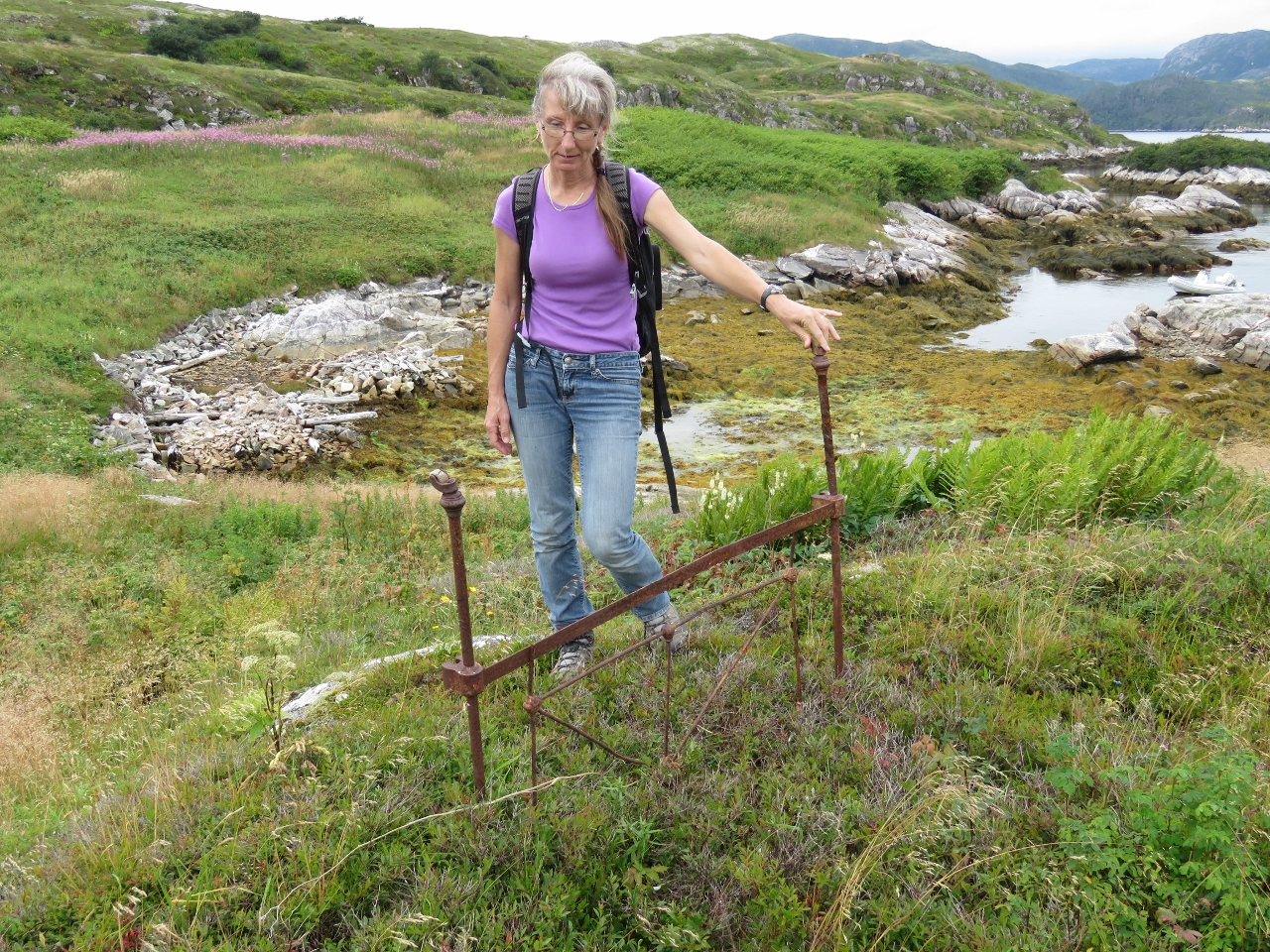 |
Bedpost
Position: -56 9.18, 47 38.63
We found this rusted bedpost lying in the grass.
|
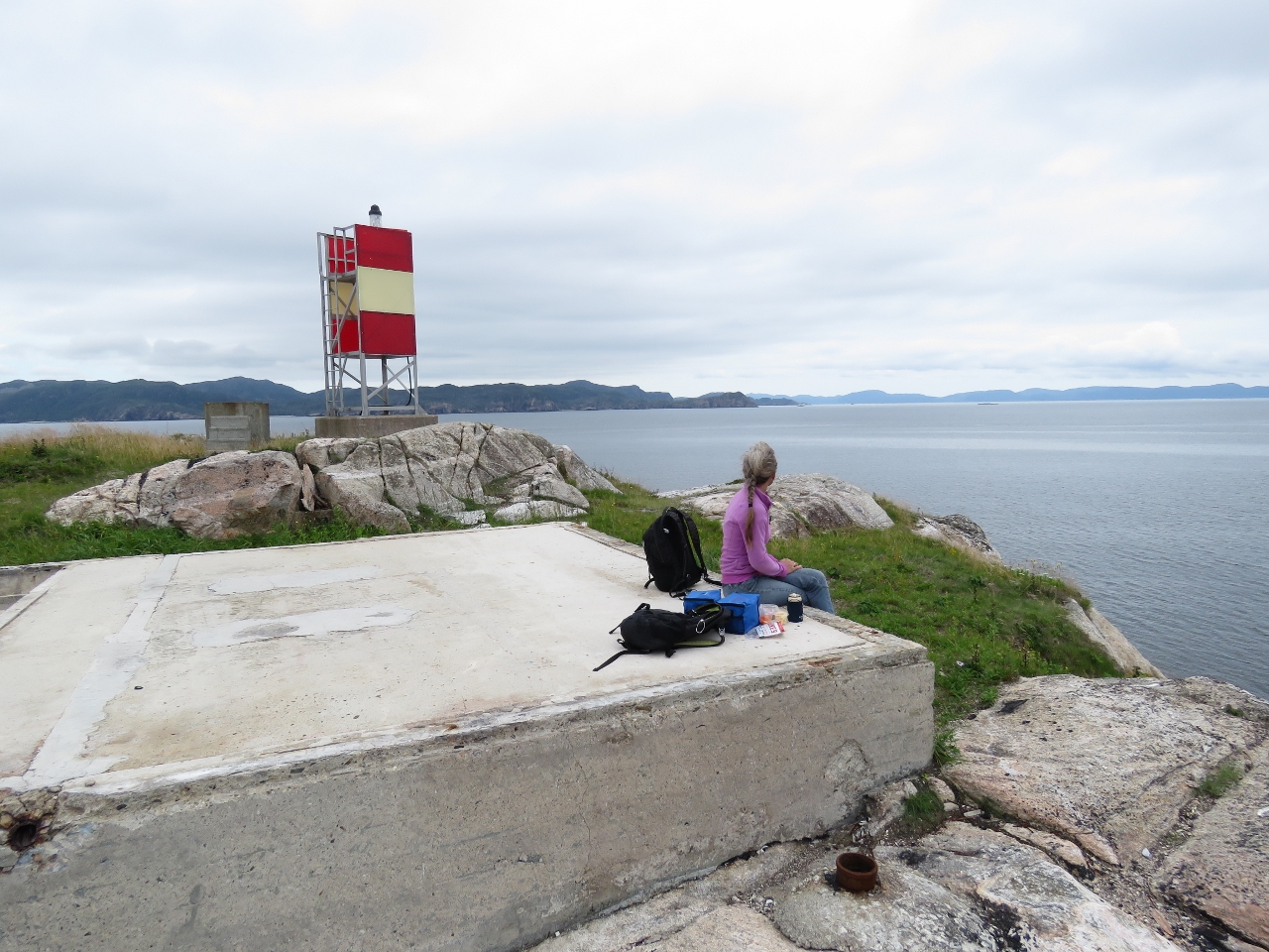 |
Lunch
Position: -56 8.97, 47 38.60
Lunch at Dawsons Point. Jennifer is sitting on the foundation of one of the old structures before the light was automated.
|
 |
Light station
Position: -56 9.00, 47 38.60
Looking past the solar panel and foghorn shed toward the southwest end of Long Island. Foundations from the old structures are visible on either side of the point.
|
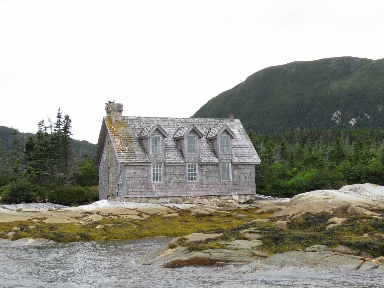 |
Modern House
Position: -56 10.10, 47 39.33
We noticed this house in Great Jervis Bay before passing Great Jervis Island to reach our anchorage. From a distance, it appeared to be made of stone, but was shingle on closer inspection. The house was more elaborate and modern than most of the cabins we’ve seen in the area, but had several broken windows and appeared to be abandoned.
|
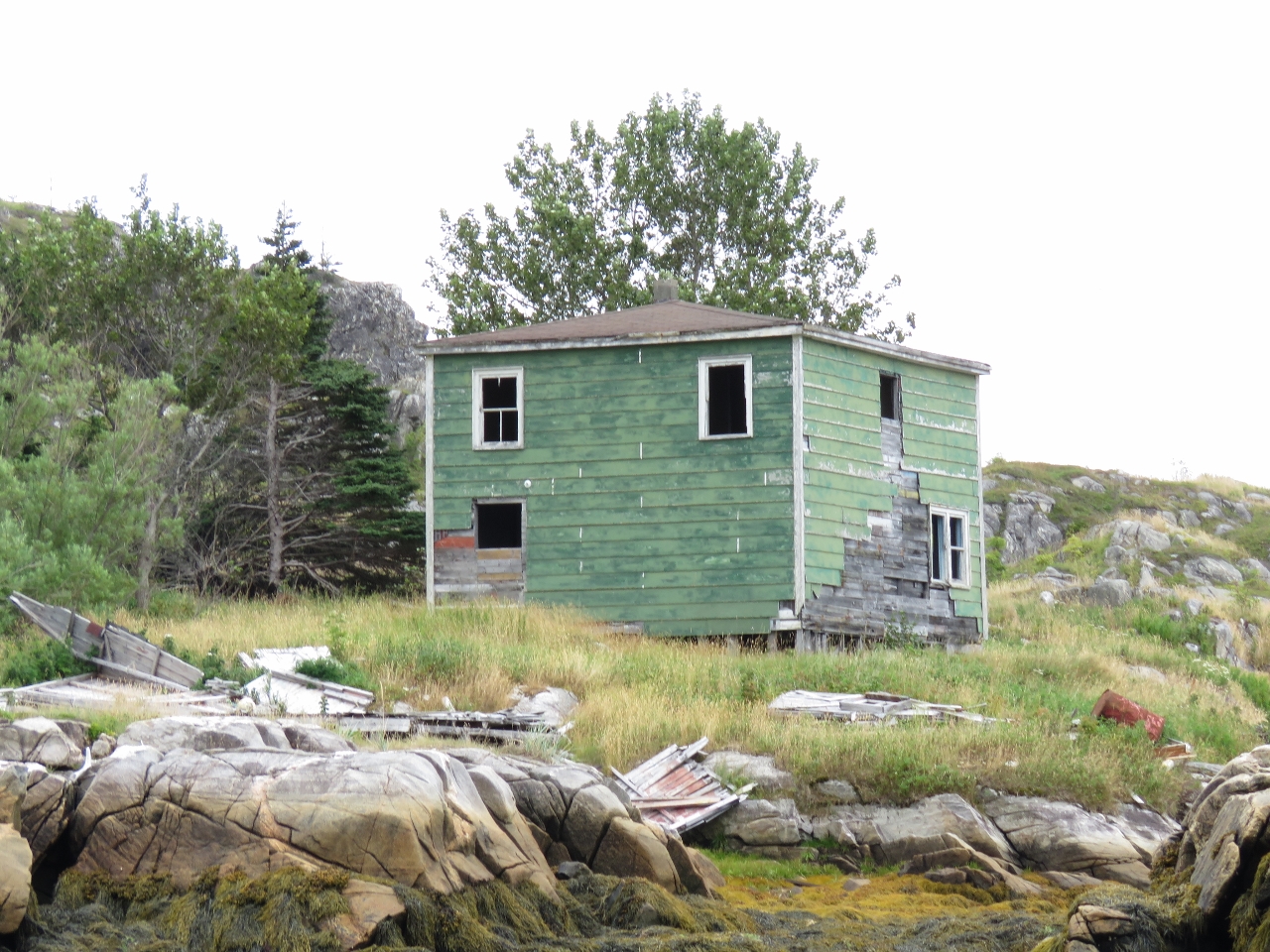 |
Traditional House
Position: -56 9.91, 47 39.53
A traditional, and seemingly long-abandoned house, at Shallop Cove.
|
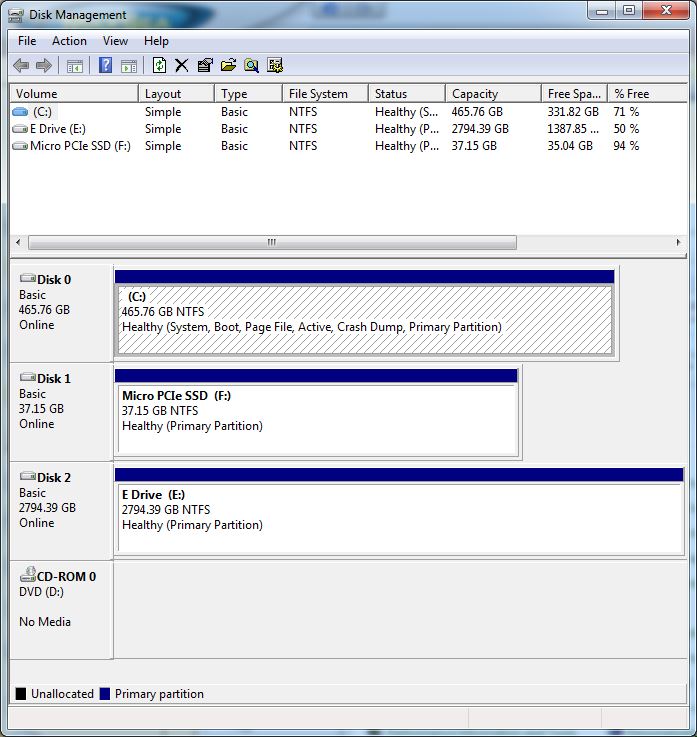 |
Boot Files
Position: -56 10.43, 47 38.79
When we finished copying the data over to our spare disk and swapped the disks, the nav computer would no longer boot. Yikes! We put the original disks back in and after two attempts the system did boot up properly. We discovered that when we’d updgraded the nav computer to 64-bit Windows, we’d inadvertently installed the boot environment files on the data disk, and those files can’t be simply copied across to the new disk. So without that original disk installed the system won’t boot. Fixing that sounded non-trivial, but we found a Windows tool called bcdboot that easily fixed the problem. So now we are back up and running on the new drive. The Disk Management screen shot shows the proper setup. Our operating system is stored on Disk 0, which is also designated as System, indicating where the boot files are located. But before we ran bcdboot, Disk 2, our failing disk, was marked as System.
|
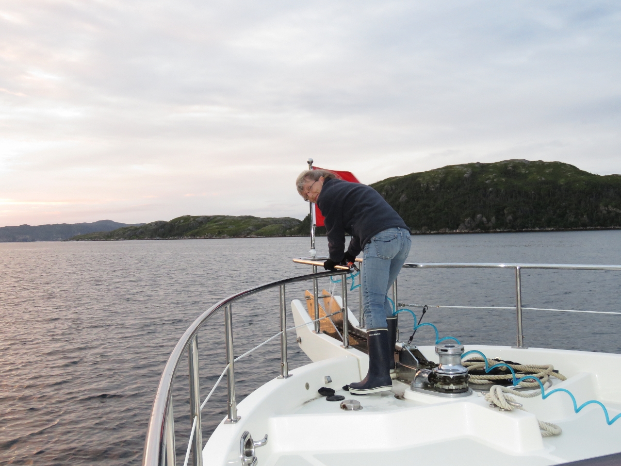 |
Brrr!
Position: -56 10.43, 47 38.79
We lef the anchorage early this morning. With the temperature barely 60F, Jennifer is wearing gloves while raising the anchor for the first time since perhaps Tasmania over eighteen months ago.
|
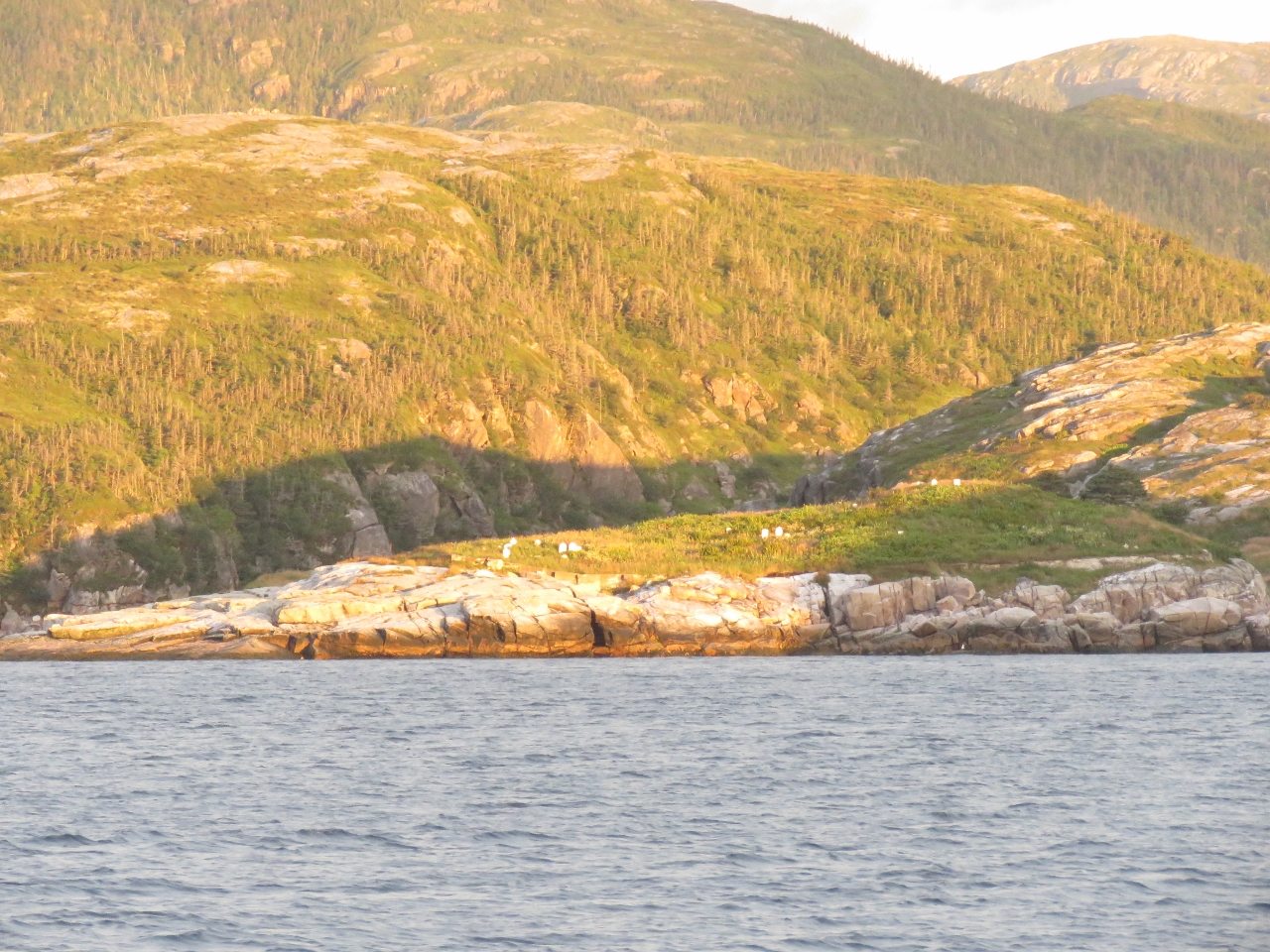 |
Graveyard
Position: -56 8.65, 47 38.48
The Pushthrough graveyard lit up in the morning sun.
|

|
Click the travel log icon on the left to see these locations on a map, with the complete log of our cruise.
On the map page, clicking on a camera or text icon will display a picture and/or log entry for that location, and clicking on the smaller icons along the route will display latitude, longitude and other navigation data for that location. And a live map of our current route and most recent log entries always is available at http://mvdirona.com/maps. |
If your comment doesn't show up right away, send us email and we'll dredge it out of the spam filter.