
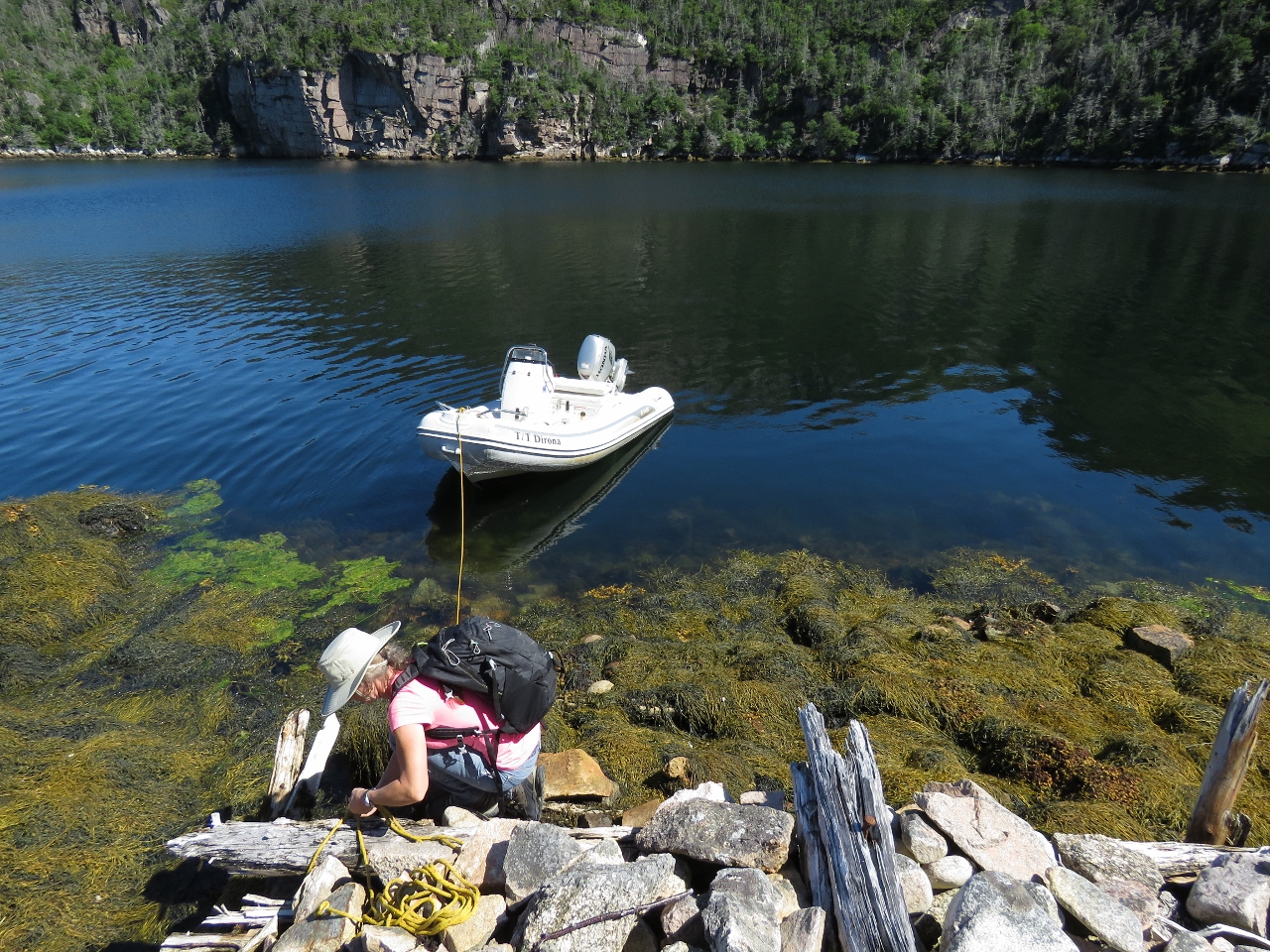
In 1961 when best-selling Canadian author Farley Mowat visited Piccaire, he could barely find room to tie his skiff to the crowded new Government wharf. He prefered to anchor off Piccaire and make the three-mile walk overland if he wanted to reach the nearby town of Gaultois. Little remains of that new Government wharf today, or anything else in Piccaire, following resettlement. However, the trail to Gaultois is in excellent condition.
Gaultois is the only community on Long Island in Bay d’Espoir to have resisted resettlement. The name is pronounced “Gaul-tus” in the typical Newfoundland rendering of the area’s many French place names. Following Mowat’s lead, we anchored on the Piccaire side and made an enjoyable walk to Gaultois to explore this traditional Newfoundland outport (a community accessible only by water or air).
Trip highlights from August 10th follow. Click any image for a larger view, or click the position to view the location on a map. And a live map of our current route and most recent log entries always is available at http://mvdirona.com/maps
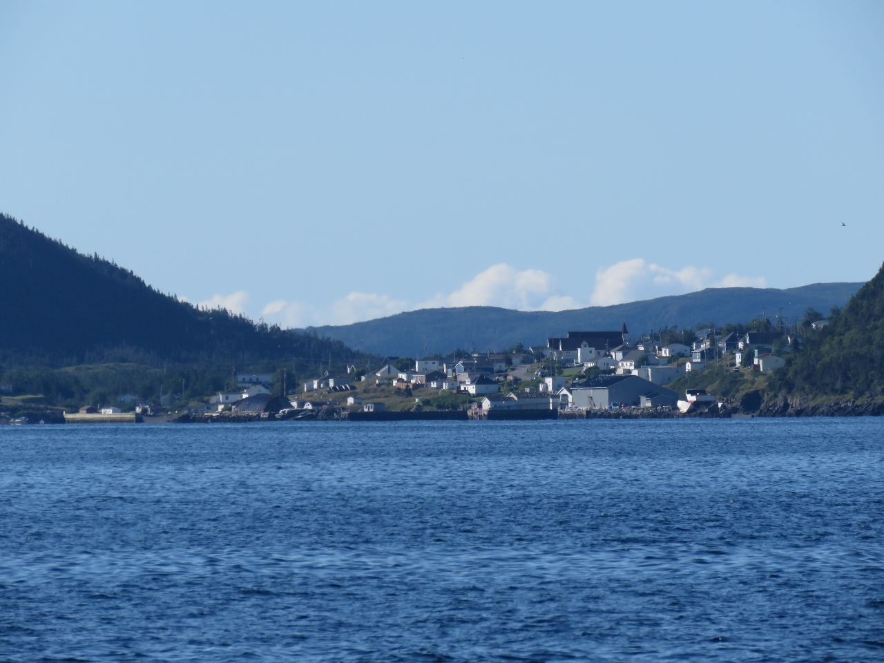 |
Hermitage
Position: -55 56.85, 47 36.06
The town of Hermitage to our south is connected by road to Highway One.
|
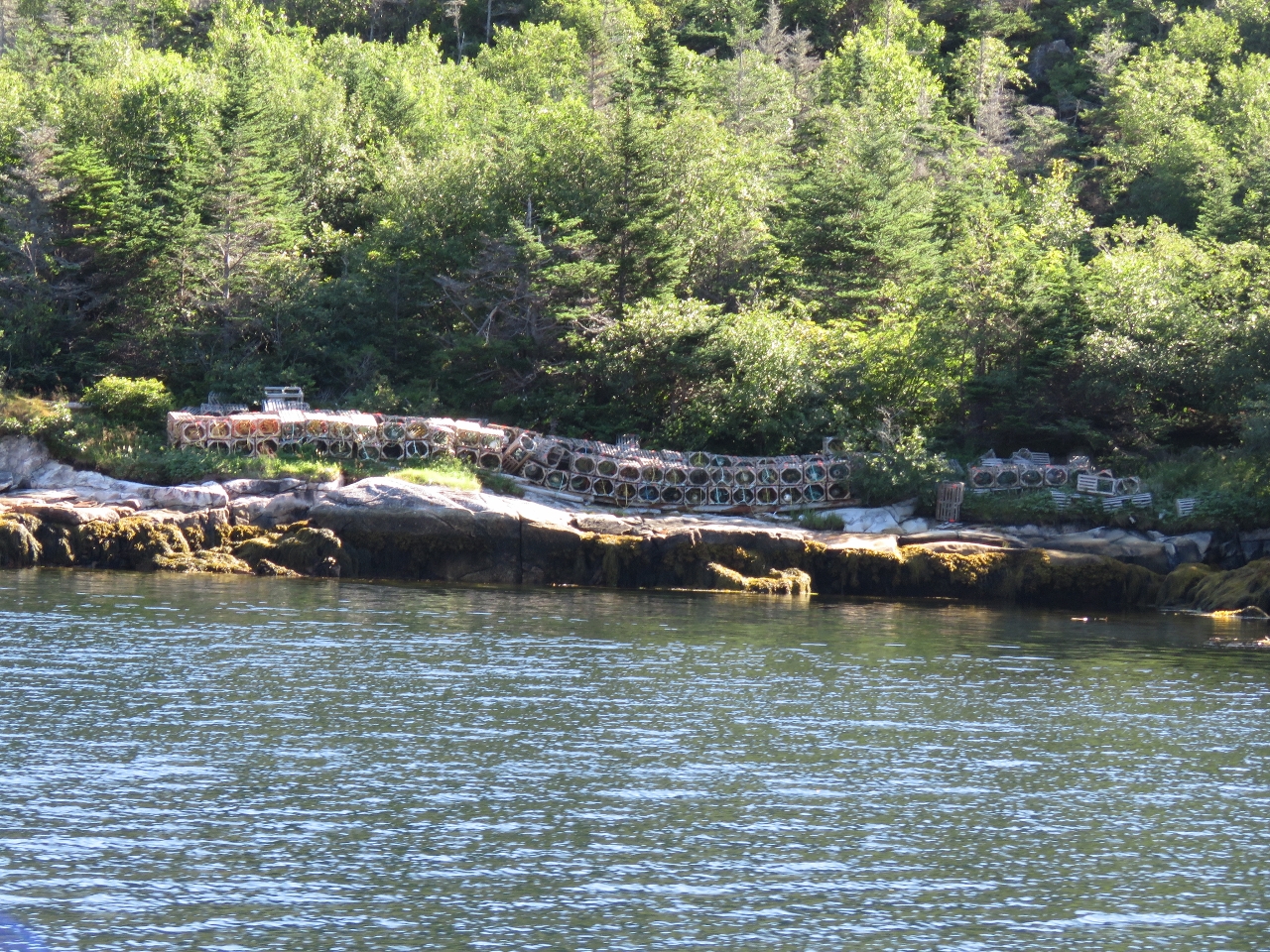 |
Lobster pots
Position: -55 56.17, 47 36.79
Dozens of lobster pots stored ashore at Pink Bottom in Piccaire Harbour.
|
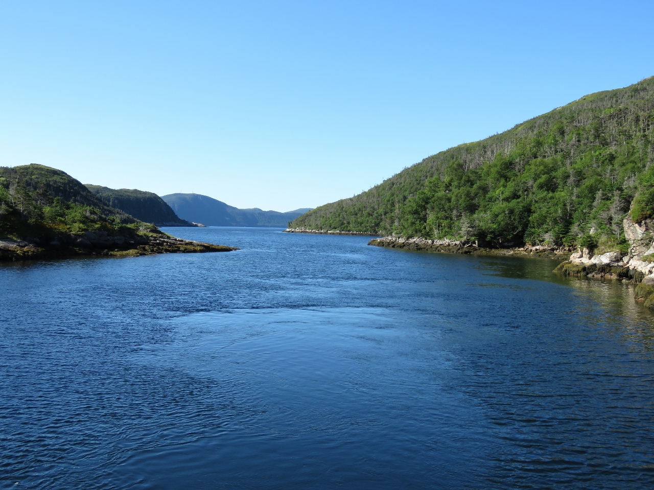 |
Narrows
Position: -55 56.14, 47 37.13
Looking back on the narrows into Northwest Arm at the head of Piccaire Harbour. The charts didn’t give the minimum depth, but it looked shallow. We crept through at a half-knot with a bow watch and could see a shallow rock bar that looked about 10ft under the water about halfway in. We eased over it at a half-knot a and saw a minimum depth of 8ft on a 3ft tide at Hermitage, a little tight for our 6ft 7in draft. Fortunately the tidal ranges here are relatively small, so channels like this have little-to-no current compared to ones we’re used to in British Columbia with its larger tidal exchanges.
|
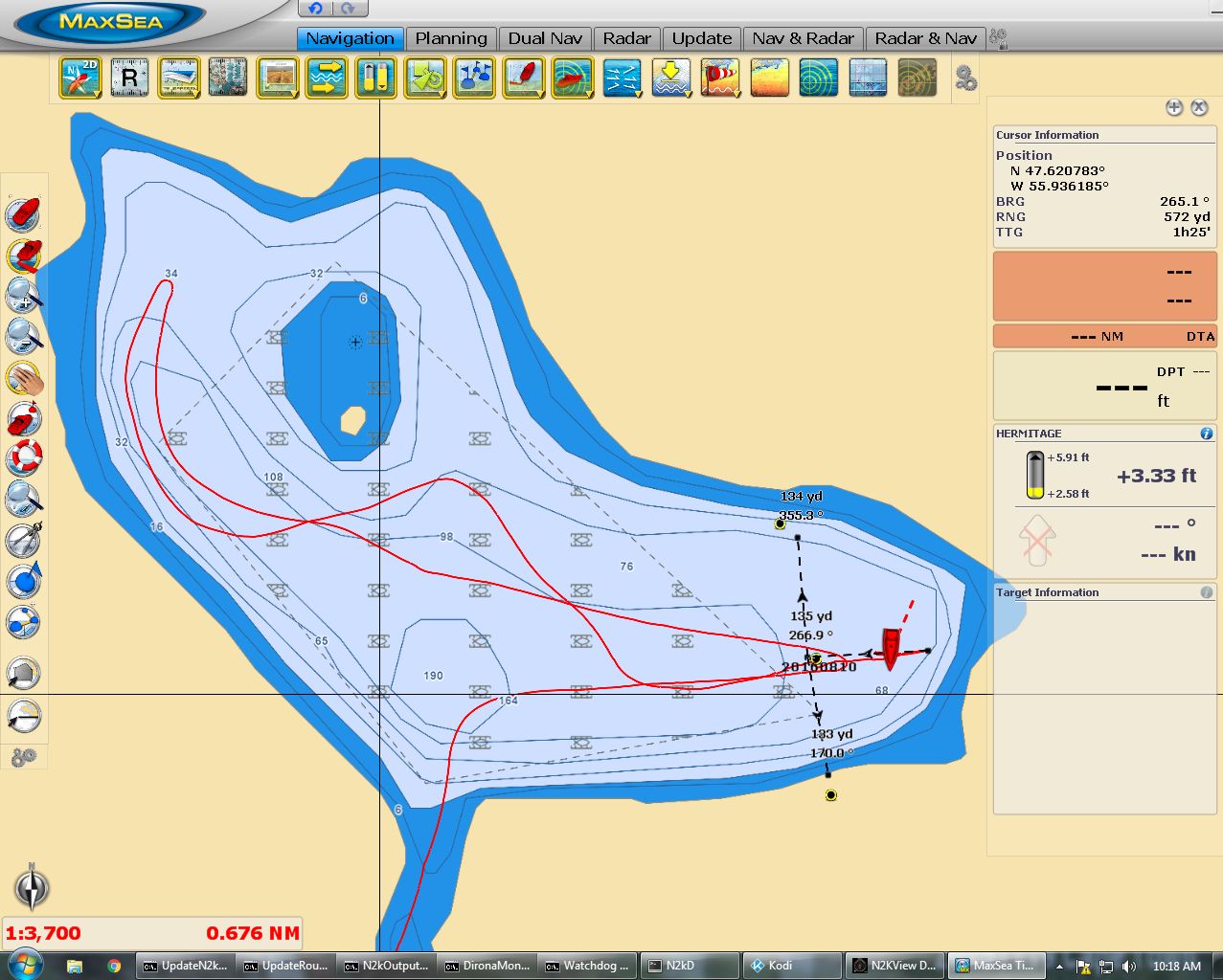 |
Anchoring
Position: -55 55.75, 47 37.27
We toured throughout Northwest Arm and could only find sufficient swing room for the depth in the eastern end, but in 130ft. The charts were a fair bit off–the yellow-and-black marks indicate where the radar showed the actual shoreline. The three dividers we drew determine the central place to drop the anchor and also to indicate the maximum range we should swing. If we are concerned later that we might have dragged anchor, we can consult the dividers to check if we are beyond the range.
|
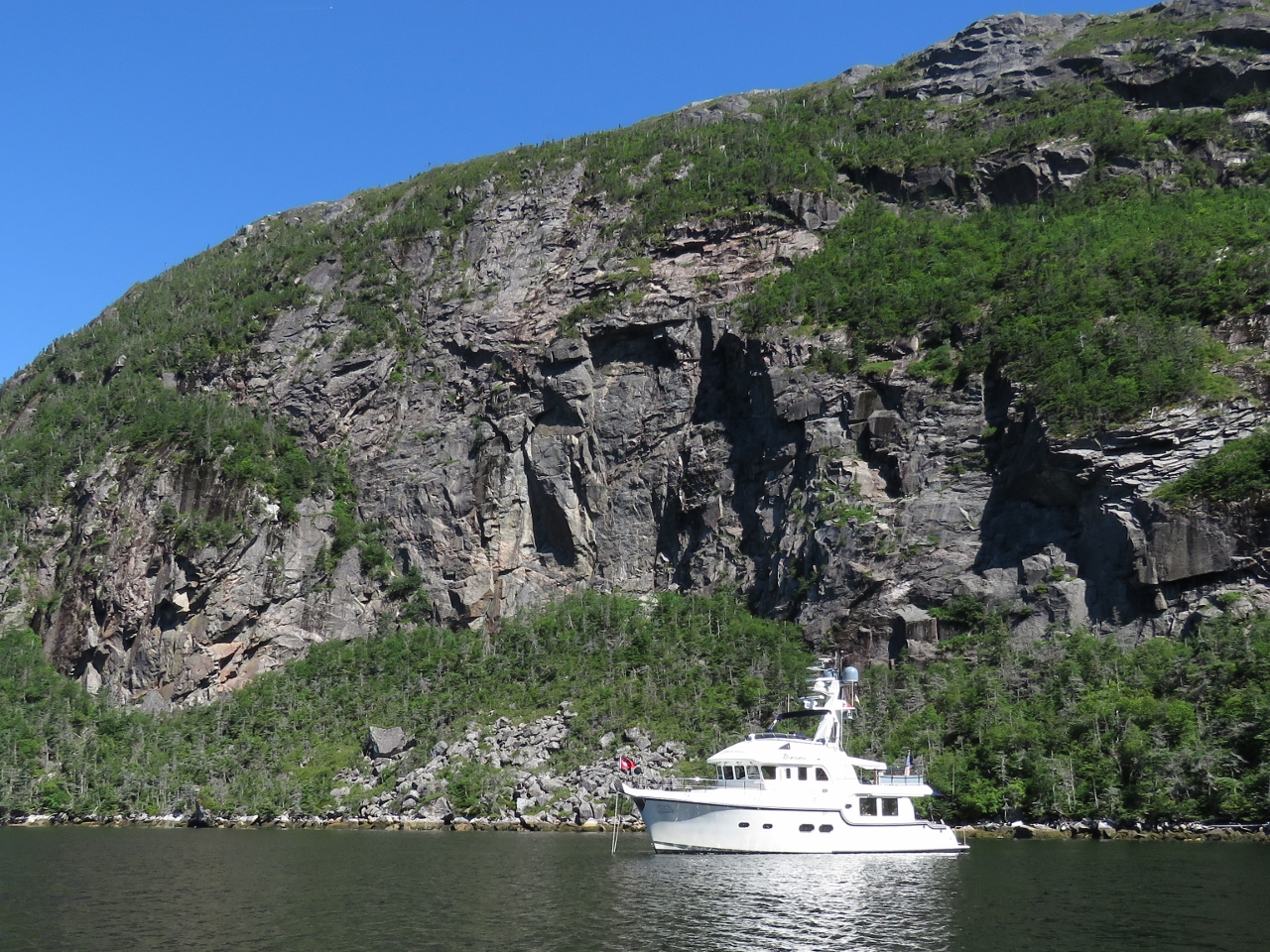 |
Northwest Arm
Position: -55 55.77, 47 37.26
Fortunately the only place in Northwest Arm we could find to drop hook also was the most scenic below a sheer cliff.
|
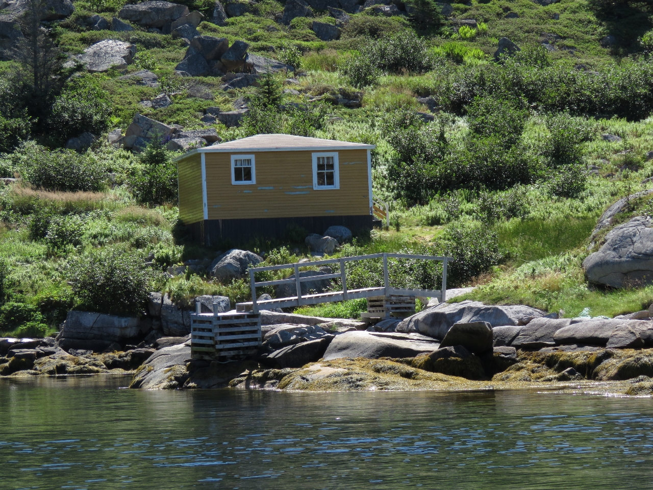 |
Piccaire
Position: -55 56.01, 47 36.70
A modern cabin and dock at the site of the old settlement of Piccaire, another Newfoundland village that was abandoned in the resettlement program.
|
 |
Government Wharf
Position: -55 56.02, 47 36.68
In 1961, the Government Wharf at Piccaire was new and packed with skiffs. There’s not much left of it now.
|
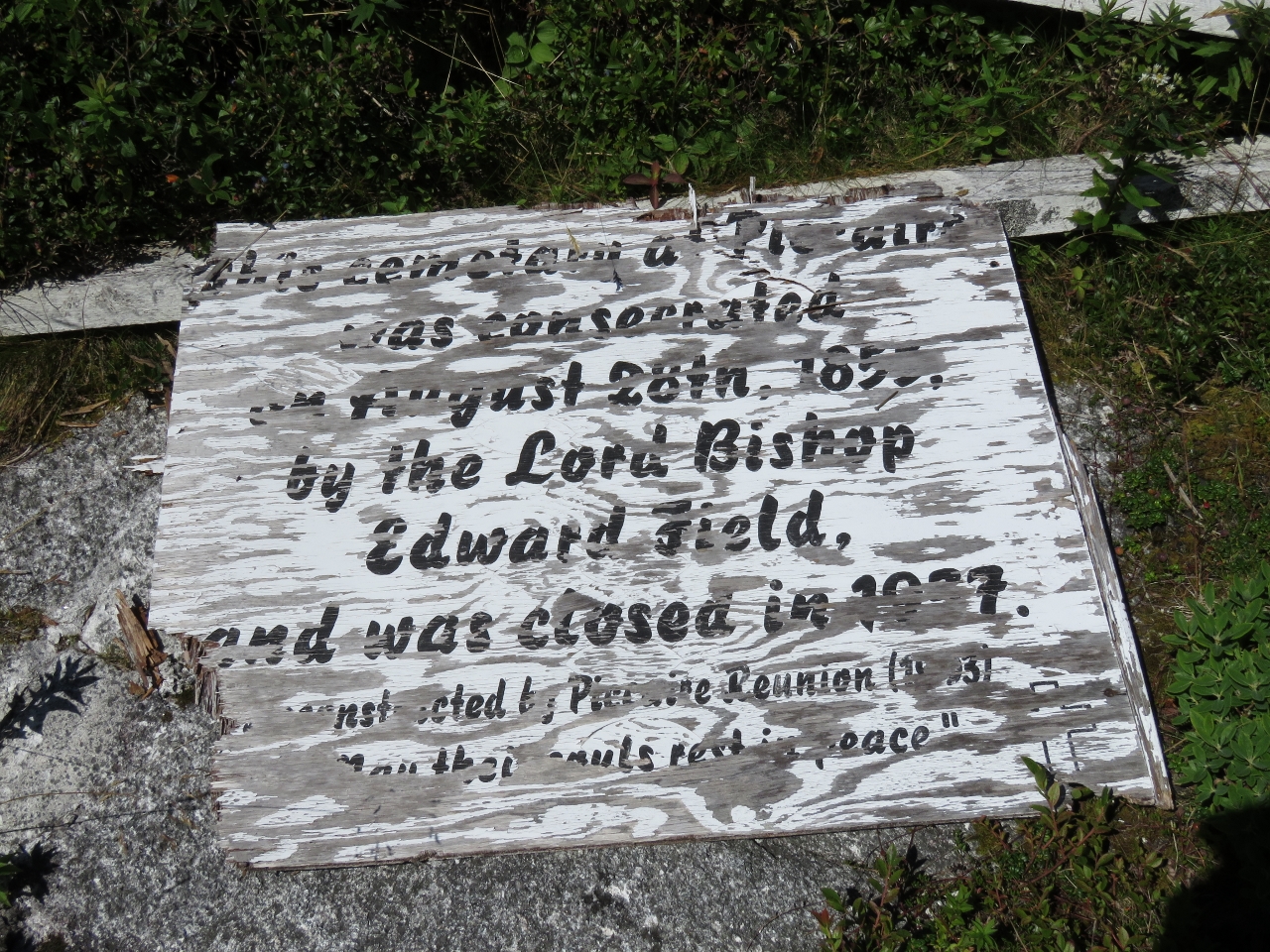 |
Cemetery
Position: -55 56.02, 47 36.67
This sign at the Piccaire Cemetery indicates it was consecrated Auguste 28, 1855 and closed in what looks like 1977. The sign was constructed by the Piccaire (Resettlement) Reunion that in 1993 apparently drew over 300 people.
|
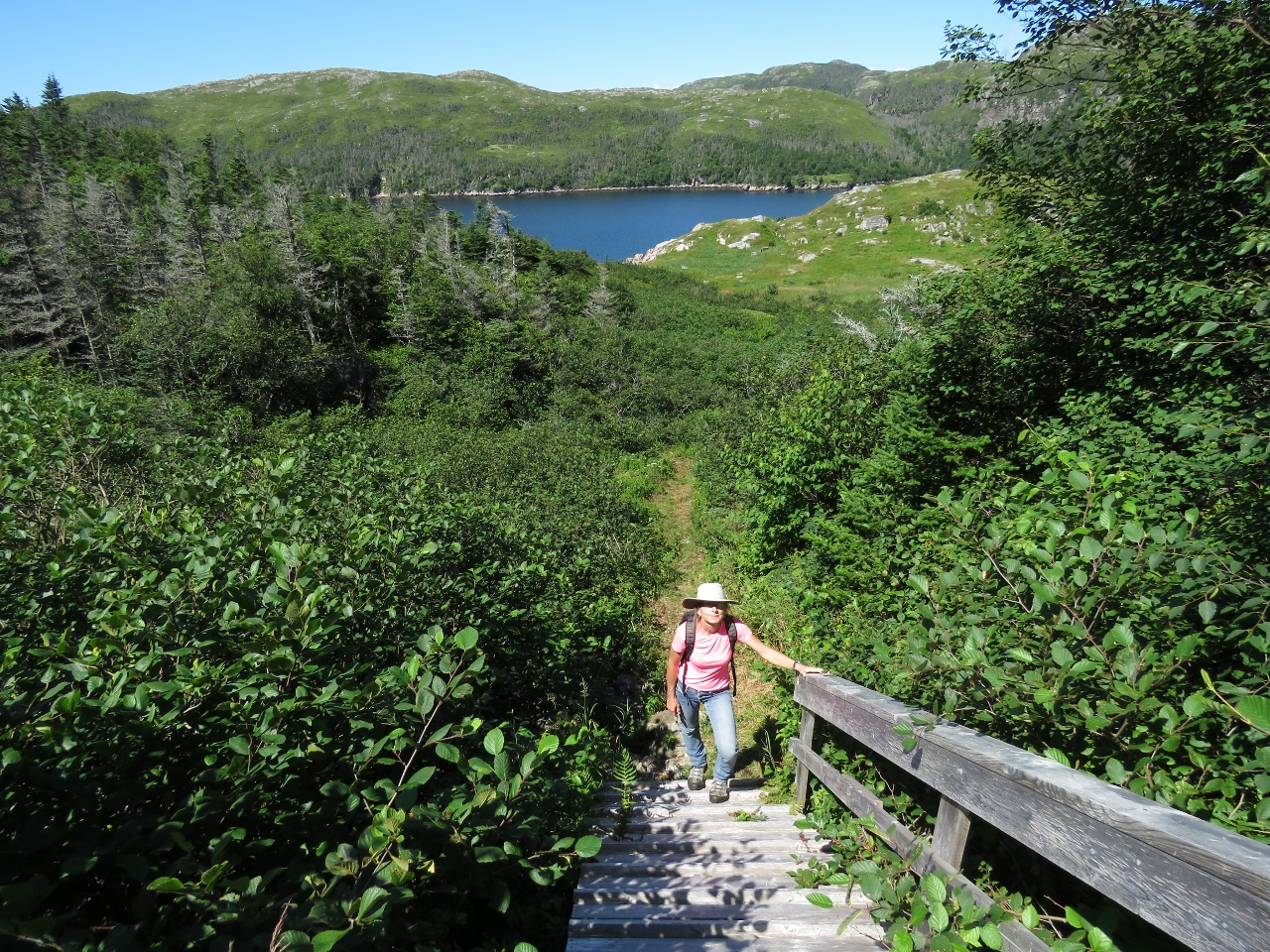 |
Trail
Position: -55 55.93, 47 36.58
We’d read about a three-mile trail to the active town of Gaultois, but weren’t sure what kind of shape it would be in. We were happy to find the trail had been freshly cleared and was one of the best trails we’ve walked in months.
|
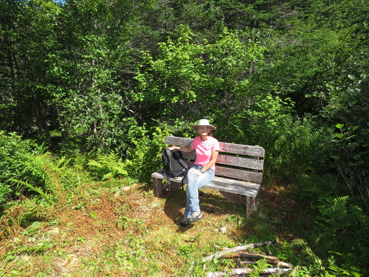 |
Bench
Position: -55 55.84, 47 36.55
The trail was quite impressive, with a bench not far along.
|
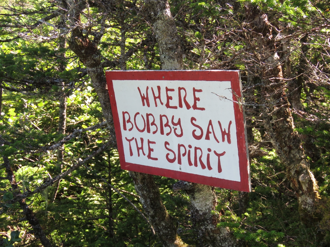 |
Sign
Position: -55 55.63, 47 36.53
Several whimsical signs like this were along the trail, and also ones naming points along the way and giving the direction to Piccaire and Gaultois.
|
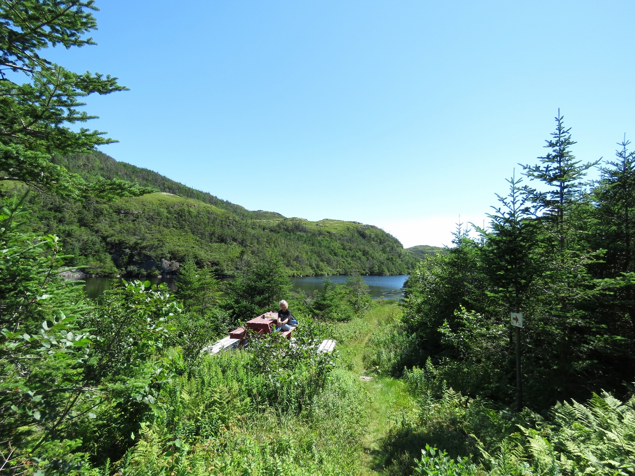 |
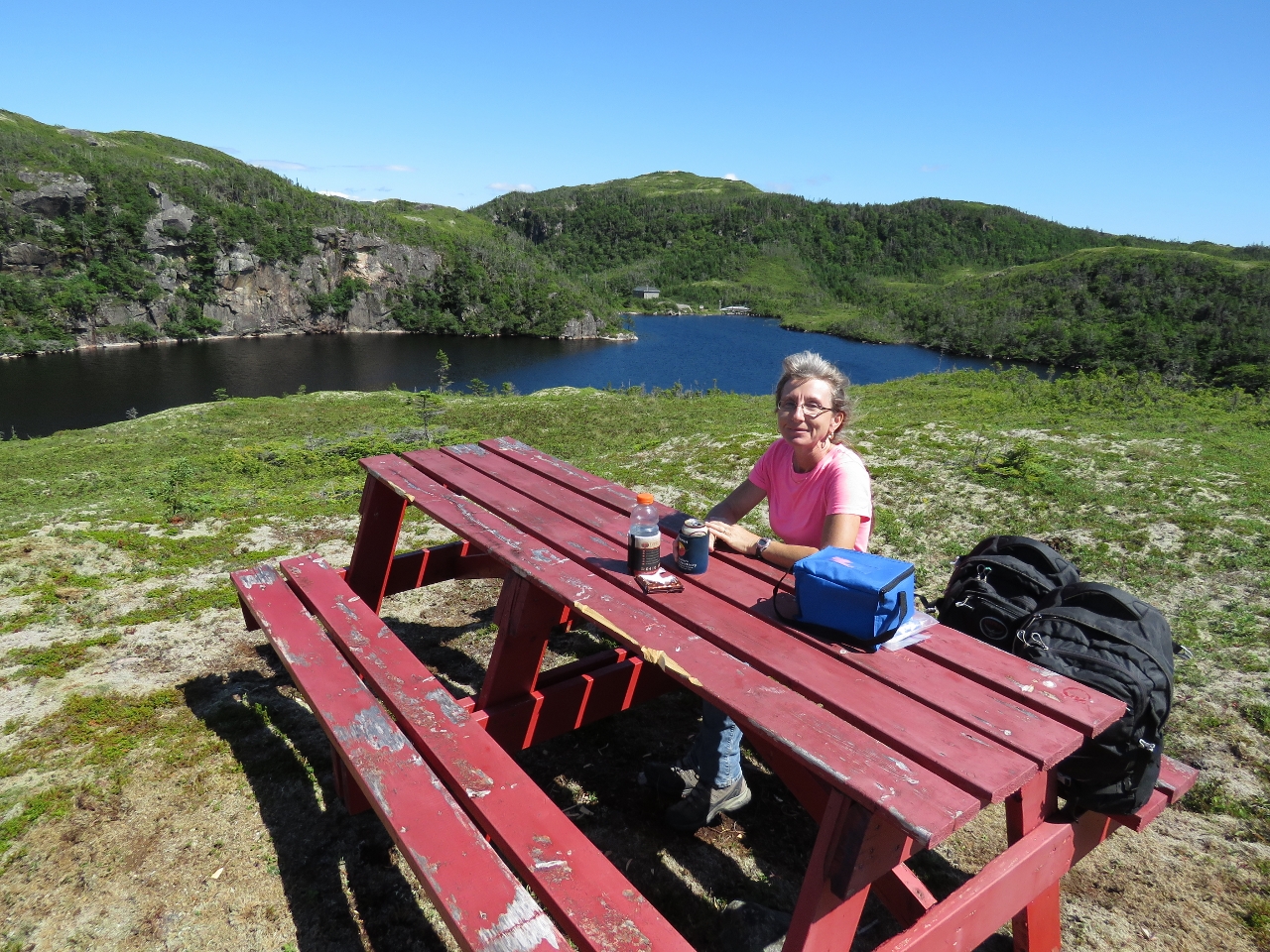
Winter House Pond
Position: -55 55.37, 47 36.63
About a third of the way to Gaultois, we came across a picnic table overlooking a pond with a sign reading “Winter House Pond”. It was such a perfect picnic spot we stopped there and had lunch.
|
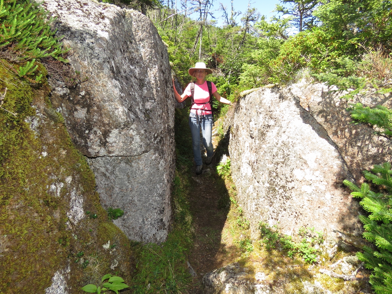 |
Boulders
Position: -55 54.91, 47 36.42
Passing between large boulders on the trail between Piccaire and Gaultois.
|
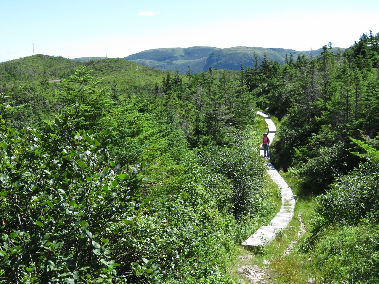 |
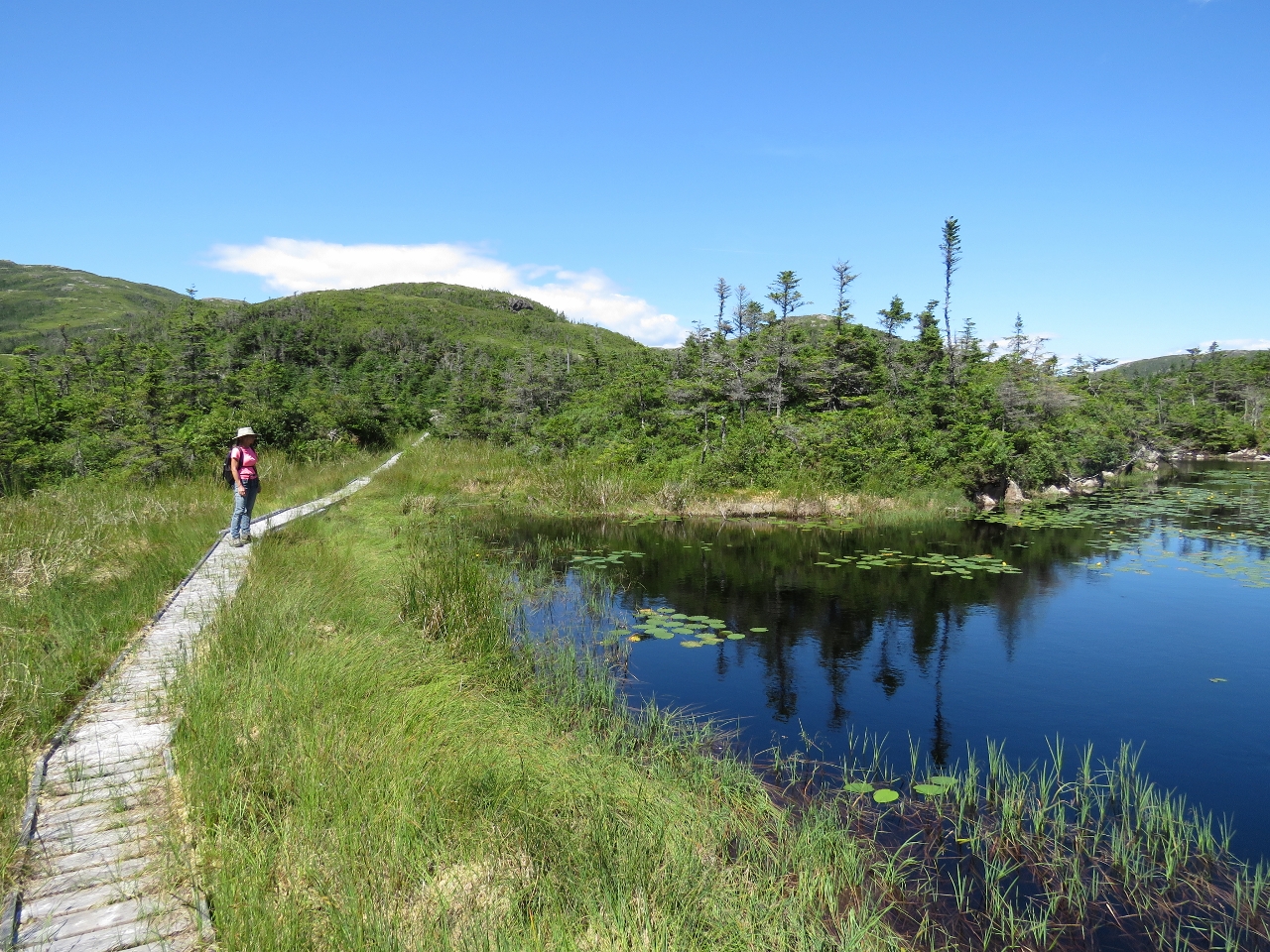
Boardwalk
Position: -55 54.64, 47 36.29
At several places along the trail, boardwalks and walkways had been built over boggier areas.
|
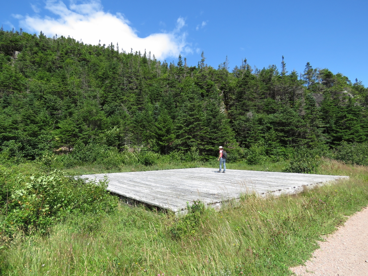 |
Helicopter pad
Position: -55 54.47, 47 36.32
We passed what could only be a helicopter pad as we neared the town of Gaultois.
|
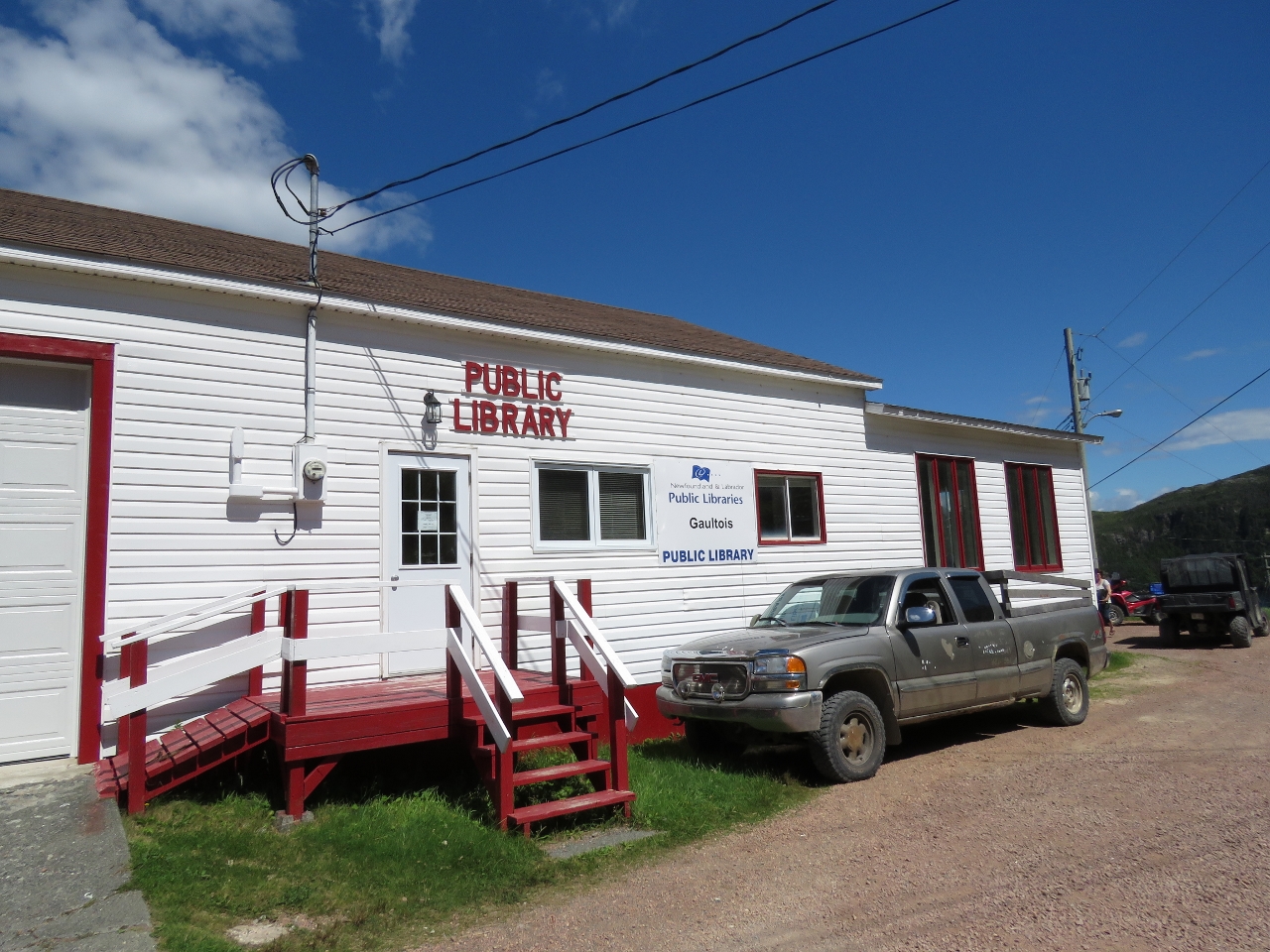 |
Library
Position: -55 54.41, 47 36.38
The Gaultois Public Library on the outskirts of town.
|
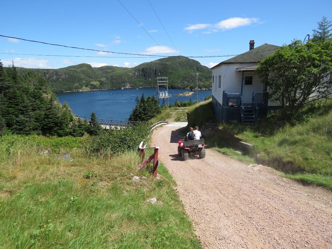 |
ATV
Position: -55 54.34, 47 36.38
Except for the truck parked at the library, we didn’t see any other vehicles other than ATVs and a motorcycle. Gaultois is accessible only by water or air and ATVs seem to be the way to get around here. This is looking down the hill from the library toward the harbour at Gaultois.
|
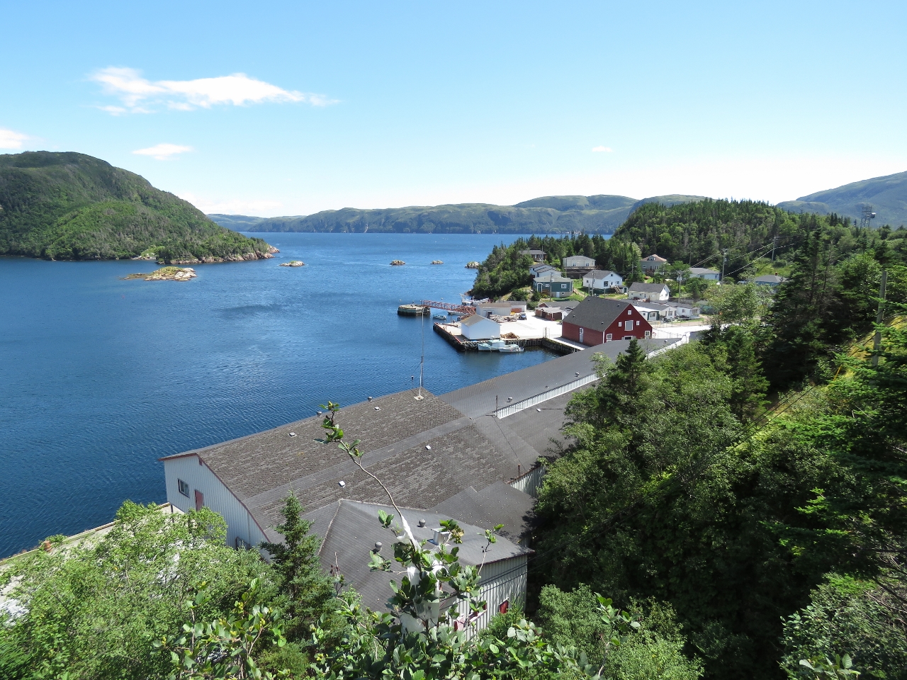 |
Gaultois
Position: -55 54.27, 47 36.41
Looking southwest above the old Gaultois Fishplant toward the wharves. Gaultois is the only community on Long Island to have resisted the resettlement process.
|
|
|
Ramps
Position: -55 54.29, 47 36.50
Many of the houses have ramps behind for boats to be pulled up and out of the water. All the boats were very carefully secured with multiple lines, presumably because the winds here can be strong.
|
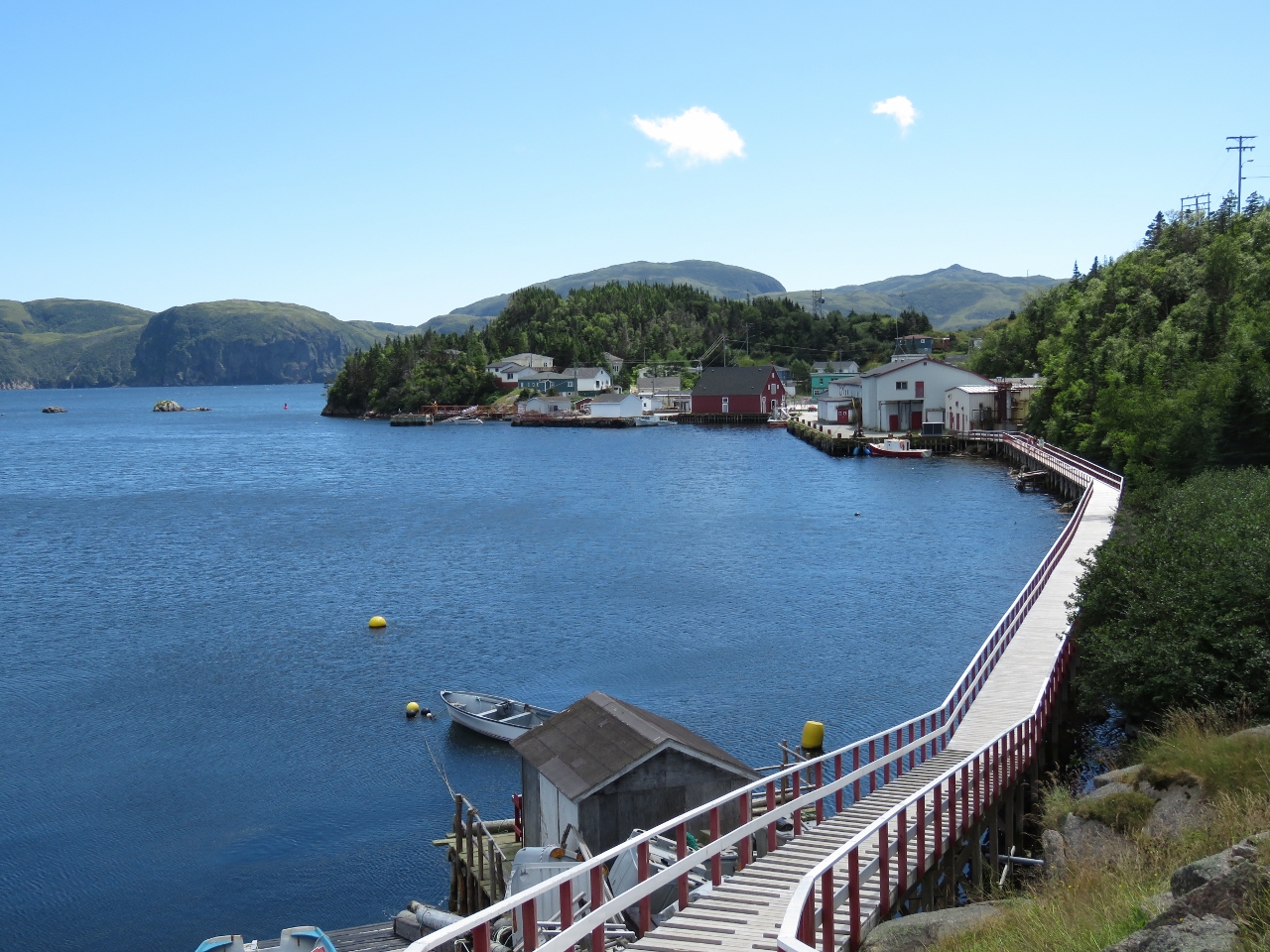 |
Gaultois Boardwalk
Position: -55 54.29, 47 36.55
Looking south from the center of town along the boardwalk to leading to the wharves. The ferry from Hermitage lands at the wharves on the left.
|
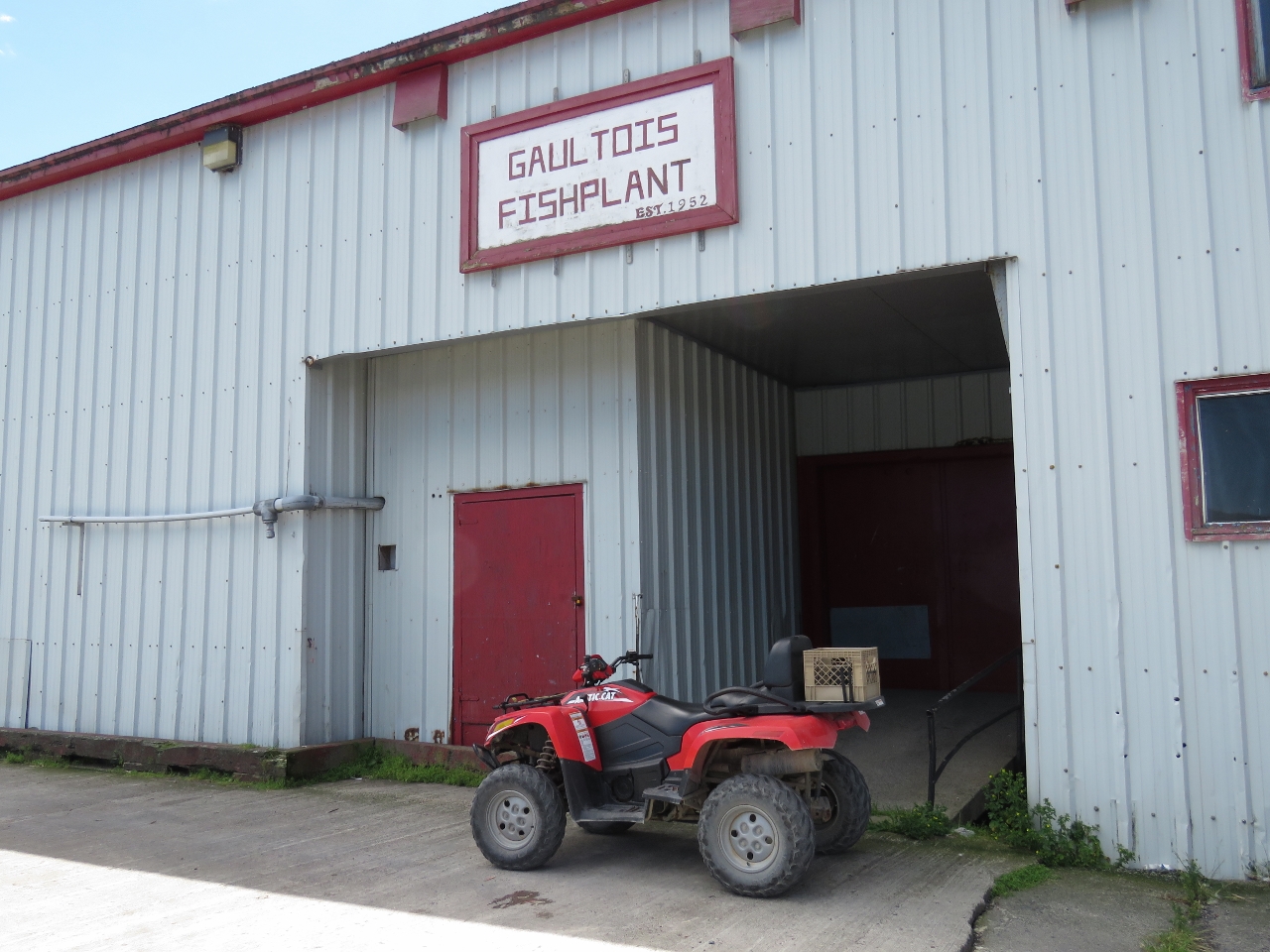 |
Fishplant
Position: -55 54.24, 47 36.43
The Gaultois Fishplant was established in 1952 and officially closed in 2010.
|
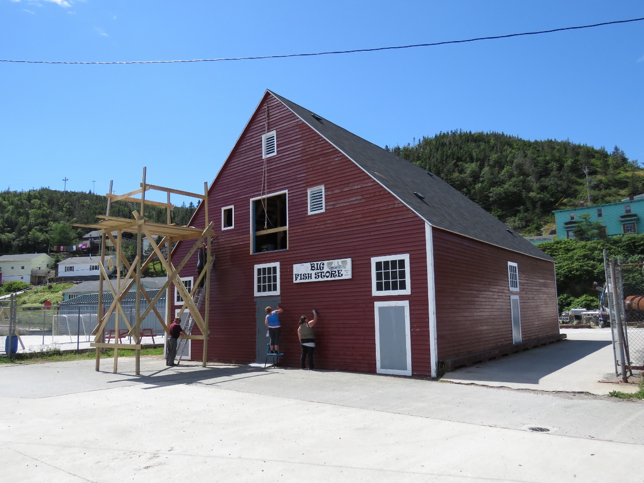 |
Big Fish Store
Position: -55 54.20, 47 36.39
Locals were out repainting and repairing the “Big Fish Store”, built in the 1800s.
|
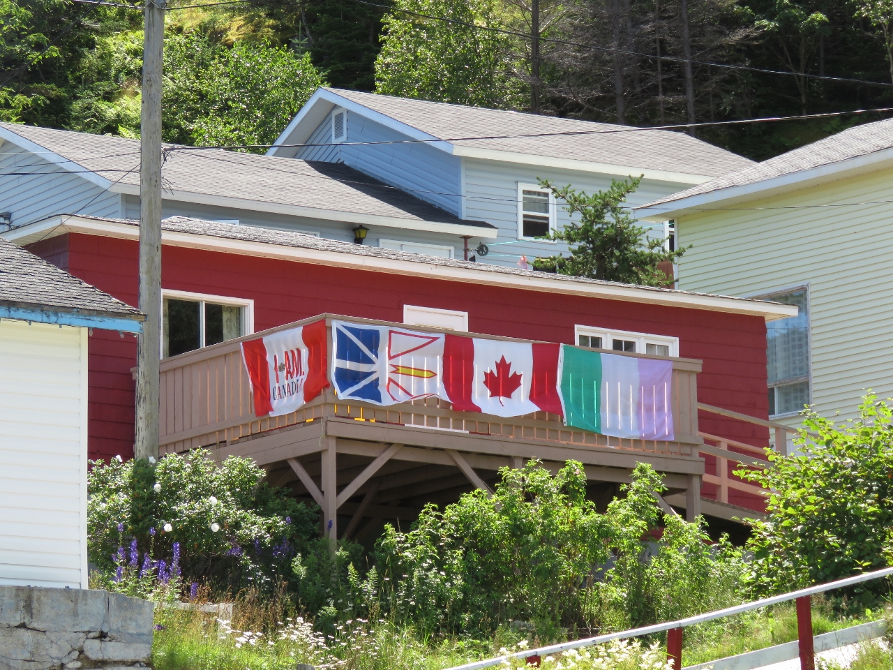 |
Flags
Position: -55 54.19, 47 36.35
A great set of flags displayed at a Gaultois balcony. From left to right are a Molson Canadian flag from the advertising campaign that included the “I Am Canadian” rant; the Newfoundland and Labrador provincial flag; the Canadian flag; and the Newfoundland Tricolor, an unofficial flag popular in Newfoundland since the early 1900s.
|
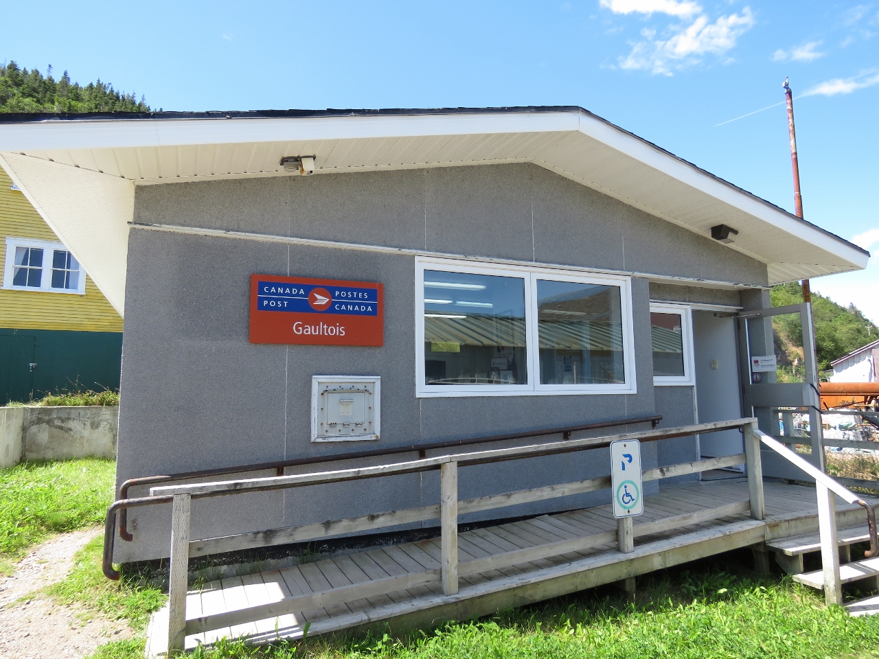 |
Canada Post
Position: -55 54.20, 47 36.36
We haven’t seen a Canada Post sign for a long time.
|
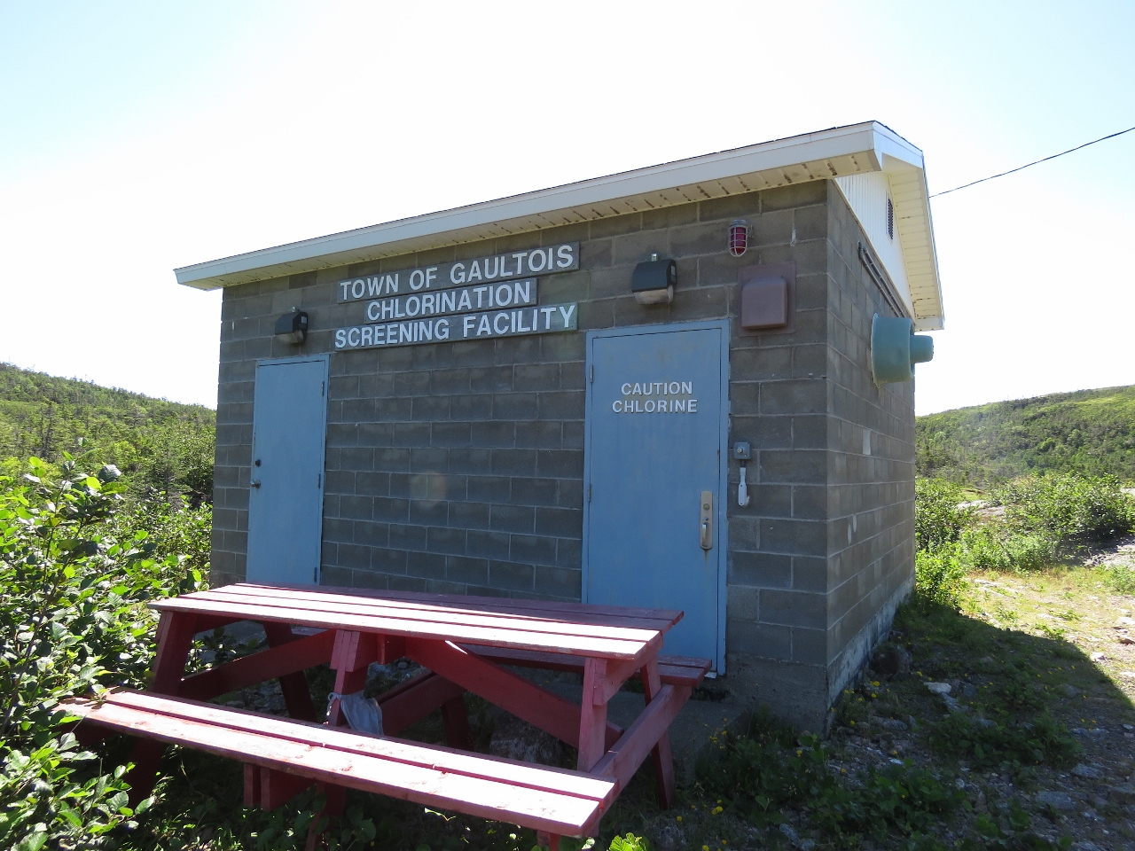 |
Chlorination Facility
Position: -55 54.73, 47 36.49
On our way to Gaultois from Piccaire, we could see a hut across one of the lakes shortly before a fork in the trail where both paths led to Gaultois. We took the southern fork on the way there and from town followed the other fork. The hut we could see in the distance was the Gaultois water chlorination facility.
|
 |
Black Duck Pond
Position: -55 54.77, 47 36.47
Another great boardwalk along the edge of Black Duck Pond.
|
 |
The Lookout
Position: -55 54.96, 47 36.48
Having a break and enjoying the sweeping views at “The Lookout”, about halfway between Gaultois and Piccaire.
|
 |
Click the travel log icon on the left to see these locations on a map, with the complete log of our cruise.
On the map page, clicking on a camera or text icon will display a picture and/or log entry for that location, and clicking on the smaller icons along the route will display latitude, longitude and other navigation data for that location. And a live map of our current route and most recent log entries always is available at http://mvdirona.com/maps. |
Well, I was in Gaultois (Galltway–Quebecois pronunciation) in 2019 and walked over to Piccaire, where there is now a shelter shack where one could easily snooze with a sleeping bag. Also, I picked a lot of wild blueberries on the way. Great outport. Somehow, I missed the library. I wonder if it’s still there. I wonder how many years Gaultois has left. I’ll be going. back in September on my way to McCallum, which will probably be resettled in the near future and thus end the ferry.
G. Tod Slone
Barnstable, MA 02630
todslone@hotmail.com
It’s sad to see those towns gone like that. It will be tough on Gaultois to lose the ferry–hope they can hang on.
Enjoy your trip–it’s such a beautiful part of the world.
Jennifer
“The Dog Who Wouldn’t Be” is also a really enjoyable Mowat read about his adventures as a kid with Mutt, his loyal canine companion. Mutt was quite the character and you can’t help but laugh out loud as Mowat explains in detail the shenanigans that made Mutt famous to many of his followers. Light hearted and a thoroughly enjoyable read.
Although Spitfire might not like it! After all, it’s about a Mutt. ;o)
You’re right that Spitfire wouldn’t approve, but that sounds like another good read to add to my list. Thanks for the suggestion. (Too bad it’s not available on Kindle either.)
Glad that you’re mentioning Fawley Mowat. Our entire family read “The Boat Who Wouldn’t Float” one summer while cruising on a 37-foot ketch. Later when I was in the Navy, I read two of his other books, “The Grey Seas Under” and “The Serpent’s Coil.” Both are non-fiction books about salvage tugs operating in the Atlantic from 1930 – 1948, saving ships that had been torpedo or damaged during hurricanes (or in one case, both). Warning: Reading these books could put a severe damper on one’s desire for crossing an ocean.
Sorry — Farley, not Fawley.
Going to school in Canada Mowat’s books were often on our reading lists, but it’s been ages since I read one. I’m currently reading “A Whale for the Killing” and very much enjoying it. I’d forgotten how well he writes– he can set a detailed scene in a surprisingly few words such that you feel you are right there. I’ve not read those salvage books you mention–I’ll add them to my reading list.
You’re correct in how well he writes and can provide such detail. That is why I said his two salvage tug stories could change people’s thoughts on ocean travel. But I think you’re a bit past that. Good luck finding those books. Not on Kindle, but Amazon does have paperbacks. Maybe if you hit a city in Newfoundland that has a book store, you could get lucky. Thanks for all the great updates.
Bummer they aren’t available for Kindle. But they sound interesting enough we might have to break down and buy the books if we come across them.
Wow, Newfoundland looks really amazing James. I’m sure the air must be so fresh; almost intoxicating. Glad you made it through the Narrows okay. Those “pillows” and swirls sure mean rocks aren’t too deep below.
Yes, we have found several tight little places where we were creeping in with only a few feet of water to spare. At times we move as slowly has 0.5 kts when creeping past these obstructions. It’s not a sand or mud bottom in these narrow sections. A mistake with a rock bottom can become a big problem in a hurry so we are careful.