Stellwagen Bank is an 842-square-mile federally-protected marine sanctuary about 25 miles east of Boston that is famous for whale-watching. A 19-mile plateau there rises to within 100 feet of the water surface, compared to the surrounding waters that are 300 to 600 feet deep. The steep sides of the plateau cause deep-water currents to rise up, carrying nutrients to the surface that sustain a diverse and healthy ecosystem. We took a New England Aquarium whale-watching tour to Stellwagen Bank and spent more than an hour beside two groups of whales, one of which included a juvenile.
Highlights from July 1st follow. Click any image for a larger view, or click the position to view the location on a map. And a live map of our current route and most recent log entries always is available at http://mvdirona.com/maps
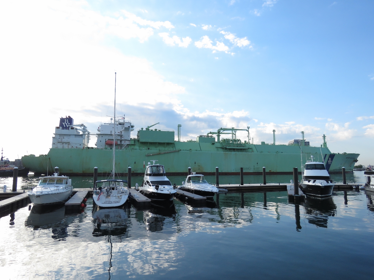 |
BW GDF Suez Boston
Position: -71 2.90, 42 22.52
The 908ft x 142ft BW GDF Suez Boston towering over the Charlestown Marina as it exits Boston Harbor. This video, shot from the bridge of the ship, shows the ship entering the harbor on an earlier trip: at https://www.youtube.com/watch?v=Dq3pUUQSQ4c. Rather than passing staight under the Tobin MemorialBridge, the ship turns before the bridge then backs under the bridge and onto the Distrigas terminal adjacent to the Mystic Power Generationg Station.
|
 |
Downtown
Position: -71 2.82, 42 21.91
Approaching downtown Boston on the ferry from Charlestown Navy Yard to Long Wharf.
|
 |
Mesa Verde
Position: -71 2.70, 42 21.59
The amphibious warfare ship USS Mesa Verde arriving with a fireboat escort for the 35th annual Boston Harborfest, a four-day celebration of the city’s history and harbor. The 684-ft ship is designed to deliver a fully equipped battalion of up to 800 Marines.
|
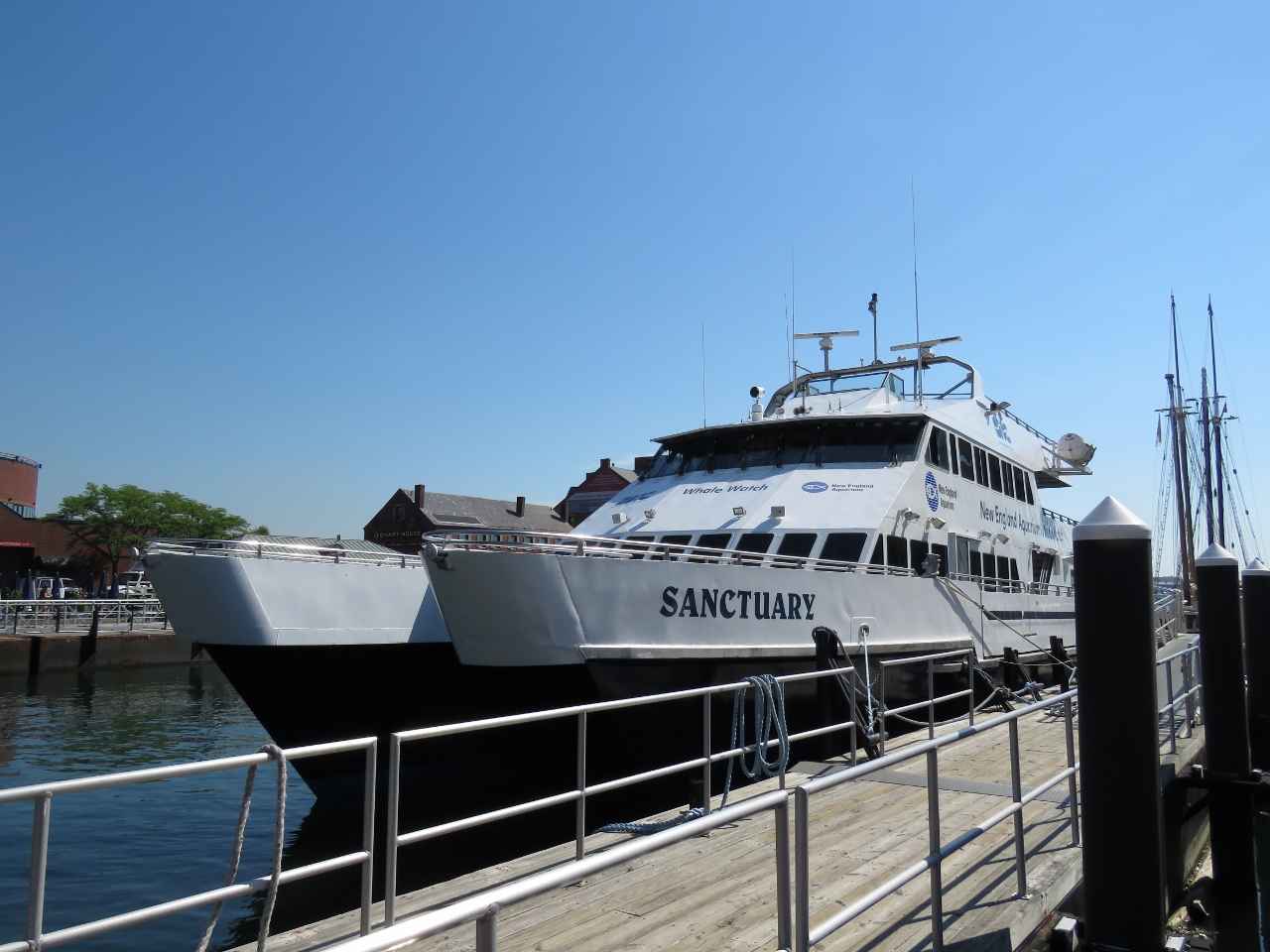 |
Sanctuary
Position: -71 3.01, 42 21.56
We took the ferry over the Long Wharf and will soon be getting onto the whale-watching boat Sanctuary, one of several in the fleet of whale-watching boats that are a joint venture with Boston Harbor Cruises and the New England Aquarium. We’ll be heading to Stellwagen Bank, an 842-square-mile federally protected marine sanctuary about 25 miles east of Boston (about a one-hour run in the nearly 35-knot catamaran). Stellwagen Bank is a 19-mile plateau about 100 feet below the surface, compared to the surrounding waters that are 300 to 600 feet deep. The steep sides of the plateau cause deep-water currents to rise up, carrying nutrients to the surface that feed the local ecosystem.
|
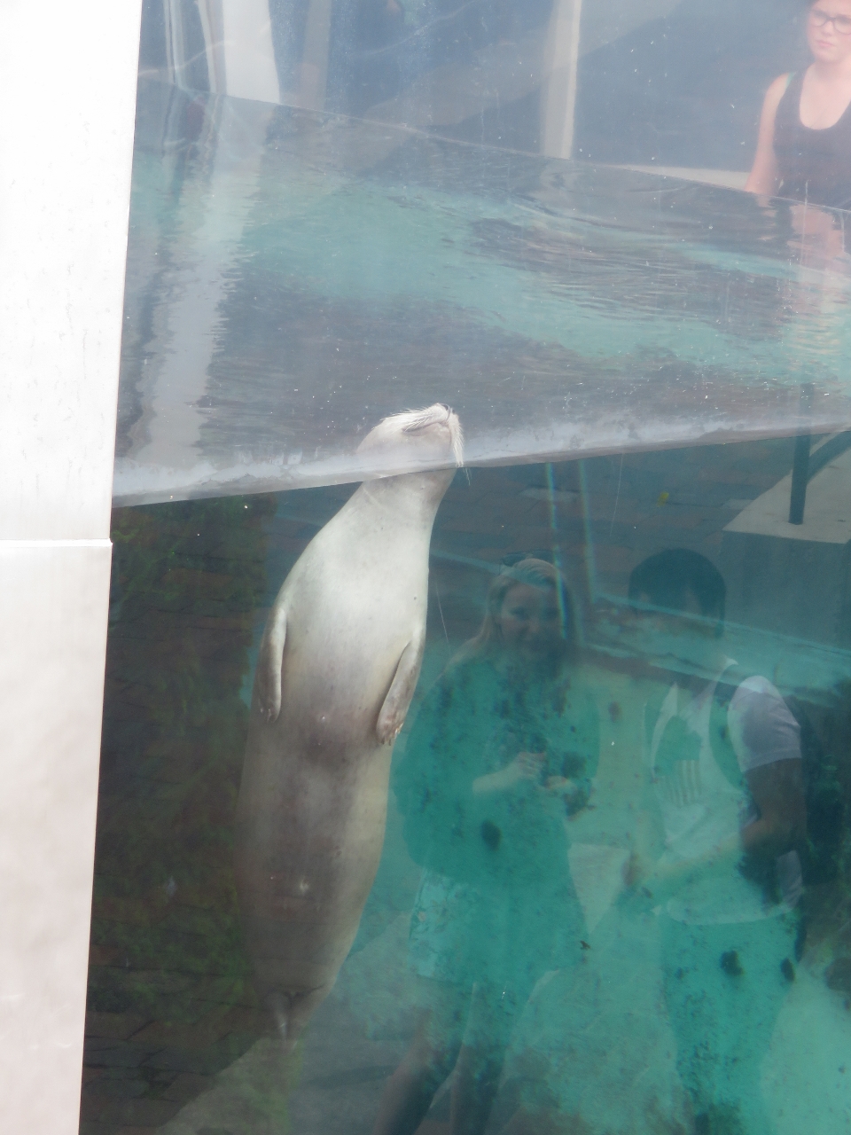 |
Harbor Seals
Position: -71 3.00, 42 21.57
While waiting for our whale-watching trip to board, we watched the Atlantic Harbor Seals swimming in the 42,000-gallon tank outside the New England Aquarium.
|
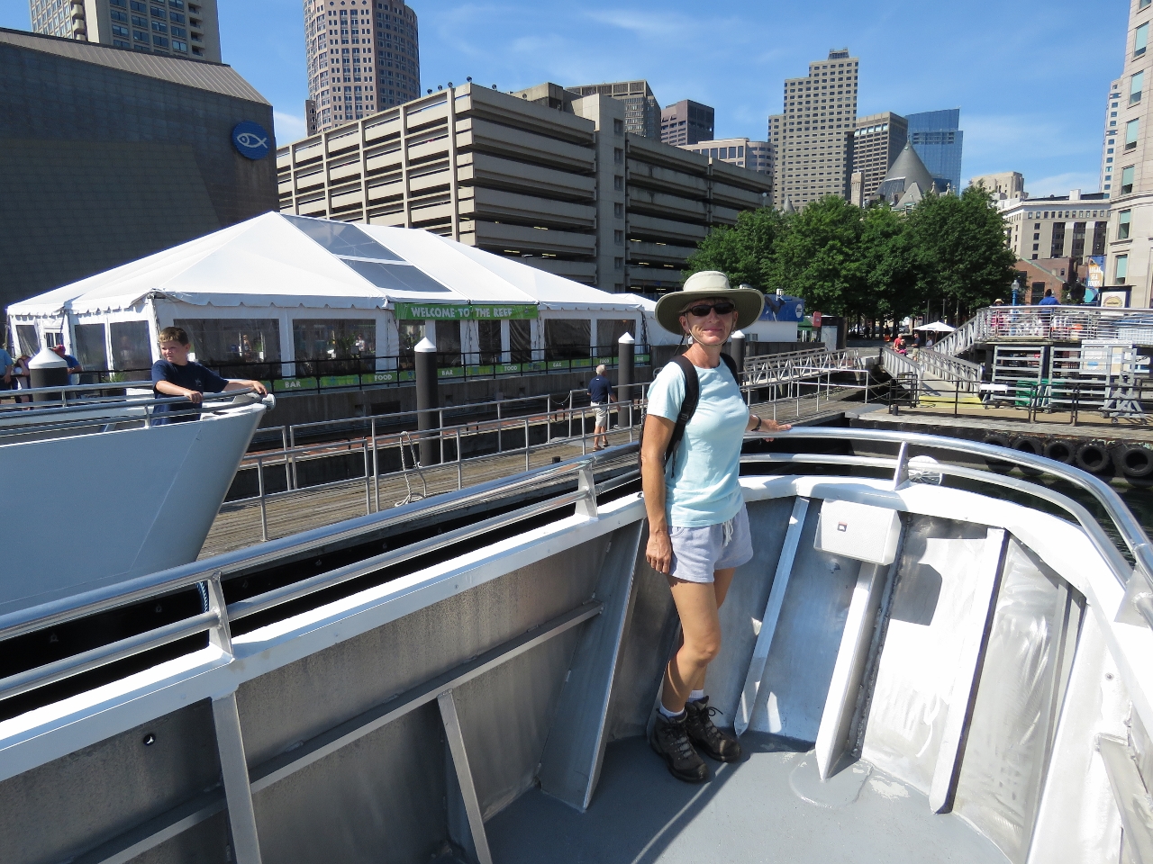 |
Bow
Position: -71 3.01, 42 21.57
We boarded last to board, but still snagged the prime viewing spot on the bow. There’s no seats at this location, but the view of the whales is unbeatable.
|
 |
Harborfest
Position: -71 2.87, 42 21.58
Musicians doing a sound-check for the Harborfest music concert on Long Wharf.
|
 |
World Trade Center
Position: -71 2.04, 42 21.24
Boston’s World Trade Center, decorated with the flags of all the countries that the city trades with.
|
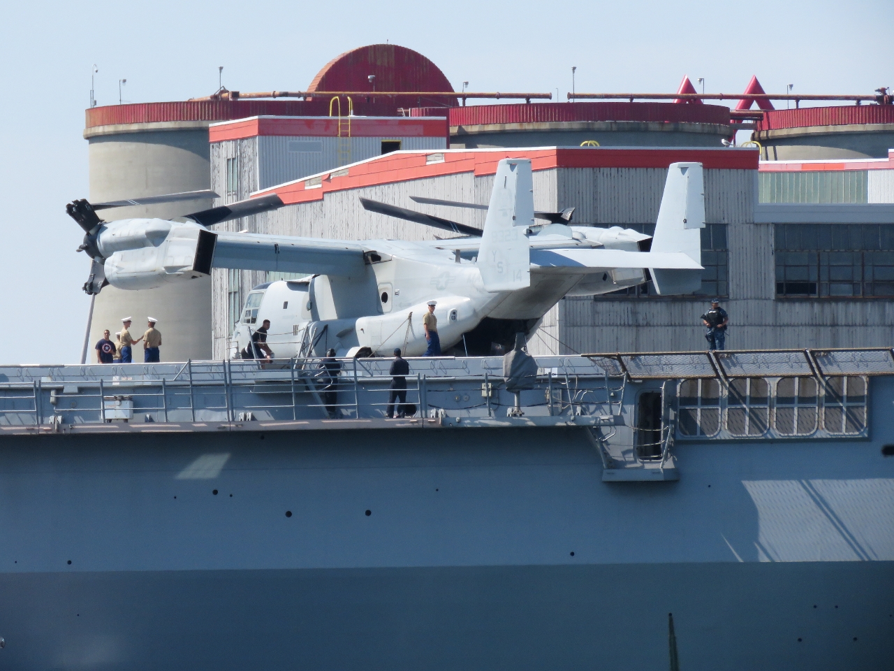 |
V-22 Osprey
Position: -71 1.37, 42 21.00
A Bell Boeing V-22 Osprey tilt rotor aircraft on the deck of the amphibious warfare ship USS Mesa Verde.
|
|
|
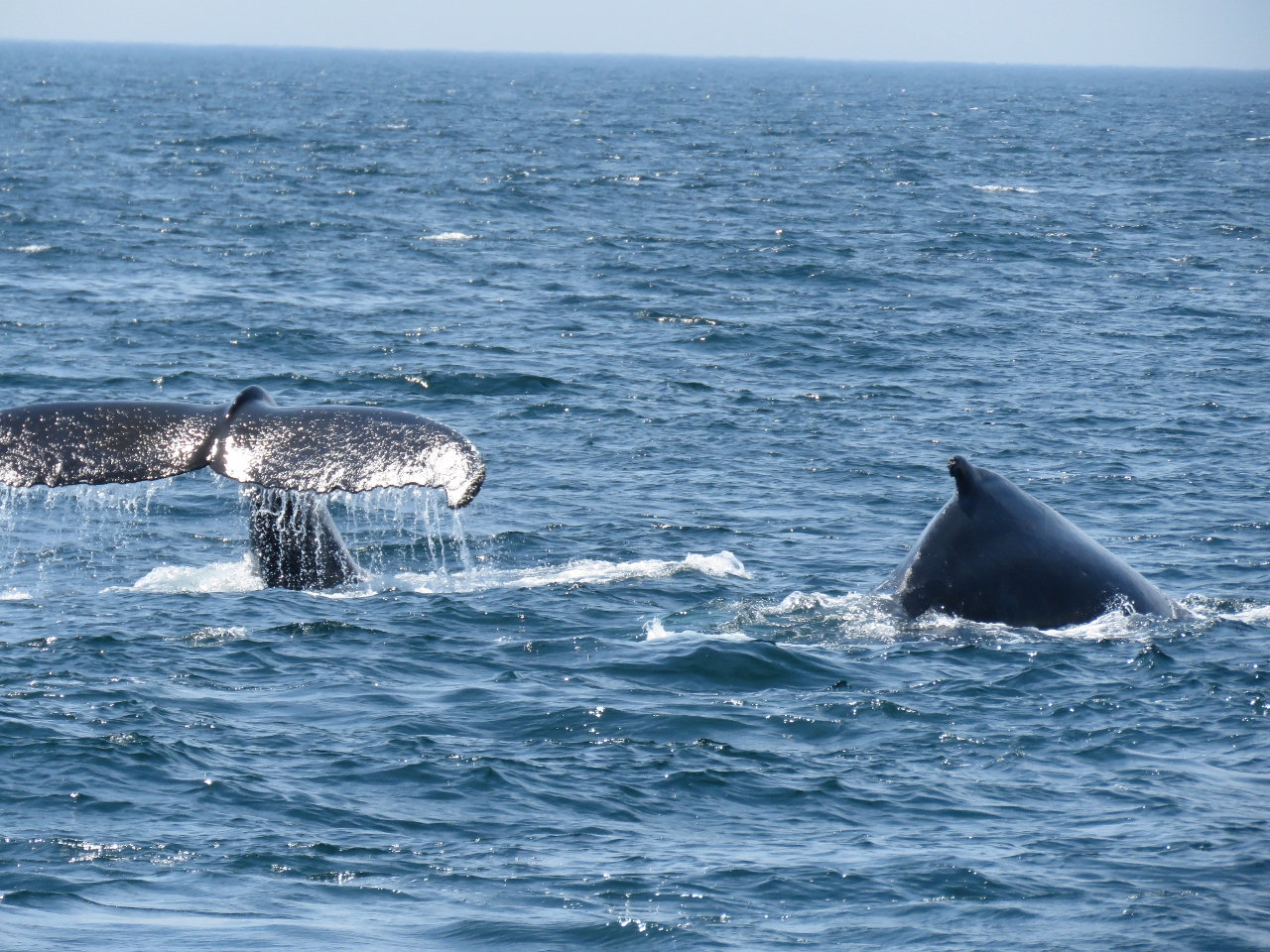
Humpbacks
Position: -70 14.76, 42 13.89
We spent more than an hour beside two groups of whales, one of which included a juvenile. The whales were magnificent–we could have stayed for hours. The video https://youtu.be/hyliaIWbwyc shows our trip out to the Stellwagen Bank and highlights from the sightings.
|
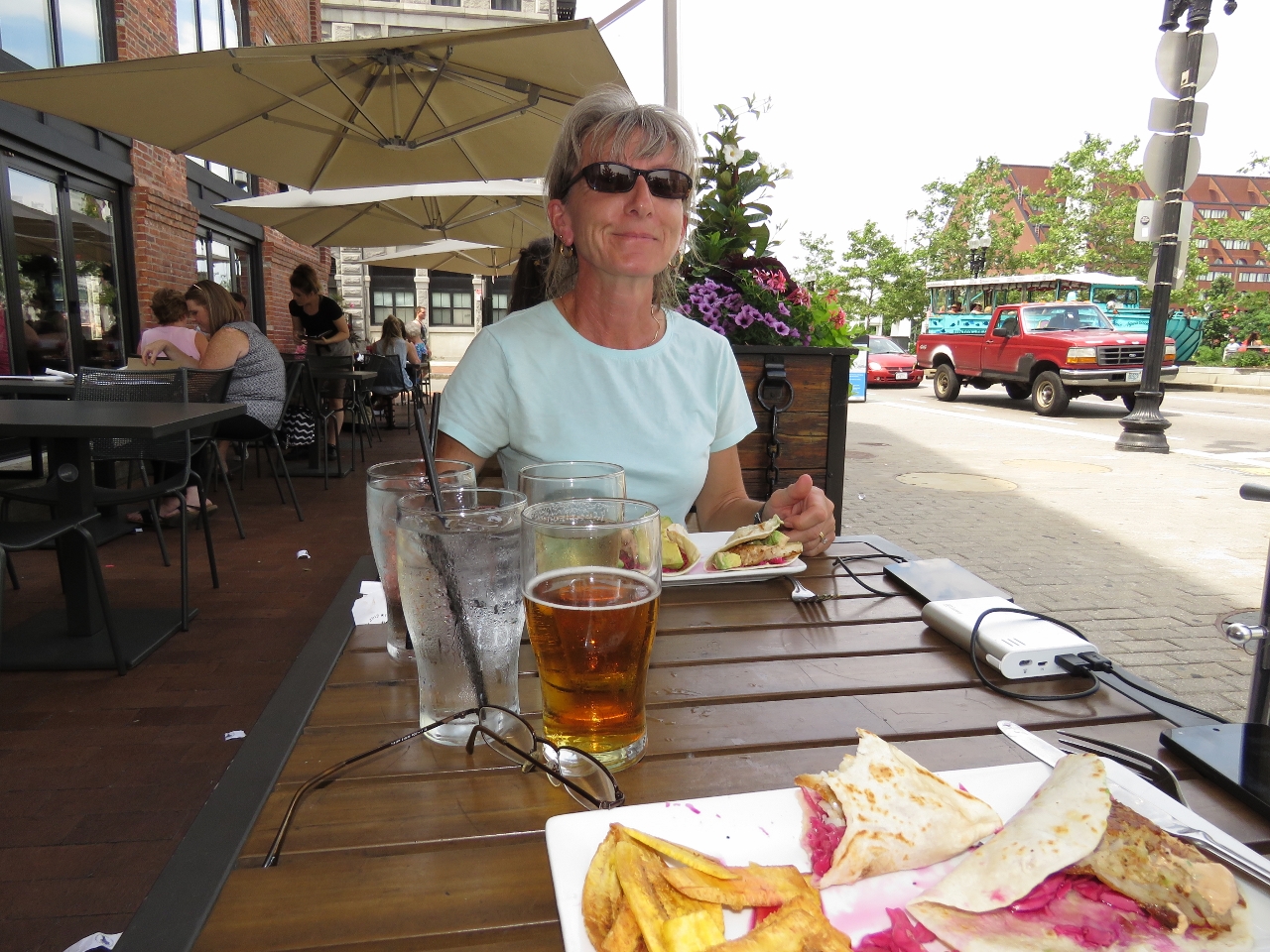 |
Granary Tavern
Position: -71 3.12, 42 21.52
Delicious fish tacos for lunch street-side at the Granary Tavern.
|
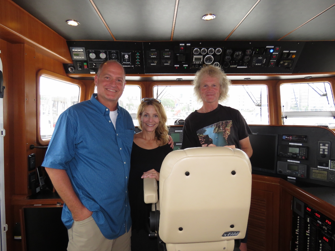 |
Lisa and Greg
Position: -71 2.90, 42 22.52
Boston-based airline employees Lisa and Greg Moore stopped by for a visit. They also have a home and boat in Seattle, where they cruise much of the territory we did in the Pacific Northwest. We had a fun evening discussing boating and flying, first on Dirona and later over dinner at the Navy Yard Bistro.
|

|
Click the travel log icon on the left to see these locations on a map, with the complete log of our cruise.
On the map page, clicking on a camera or text icon will display a picture and/or log entry for that location, and clicking on the smaller icons along the route will display latitude, longitude and other navigation data for that location. And a live map of our current route and most recent log entries always is available at http://mvdirona.com/maps. |
If your comment doesn't show up right away, send us email and we'll dredge it out of the spam filter.