On our first three days in St. Helena, we handled the country arrival overhead, spent some time exploring in and around the main center of Jamestown, and made a trip to the St. Helena Distillery for a tour and tasting. The island most famous as Napolean’s place of exile has a rich and varied history that is very much in evidence as we walked about. We also took on fuel for the 3,650nm run to Barbados, filling every available tank to capacity. There is no fuel dock at St. Helena–fueling is done via barge brought out to the boat. We were expecting that keeping the heavy barge from bashing against Dirona in the heavy swell of the completely unprotected anchorage would be a challenge. But our big ProStock marine inflatable fenders did their job and the whole process went remarkably smoothly.
Trip highlights from January 4th through 7th. follow. Click any image for a larger view, or click the position to view the location on a map. And a live map of our current route and most recent log entries always is available at http://mvdirona.com/maps
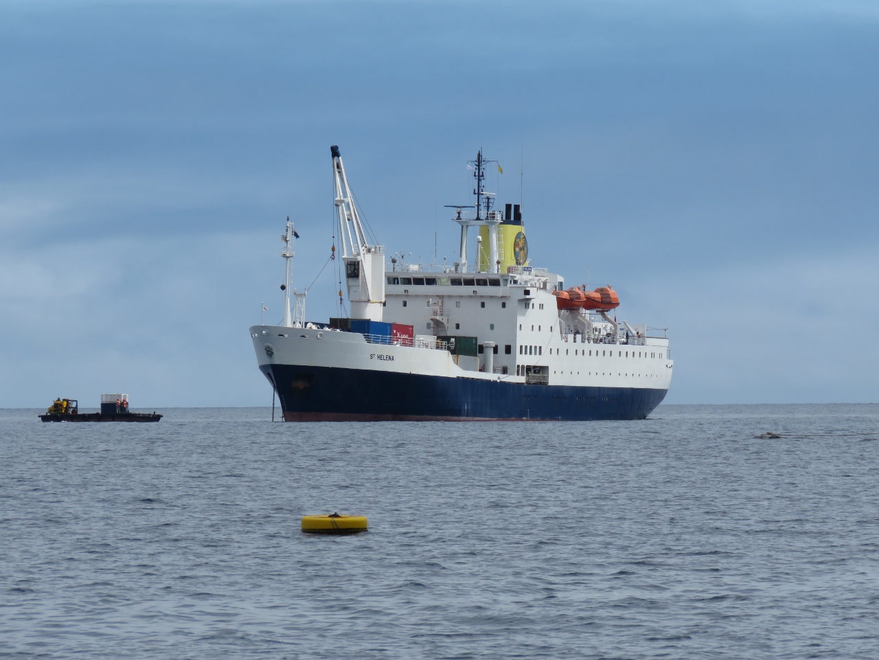 |
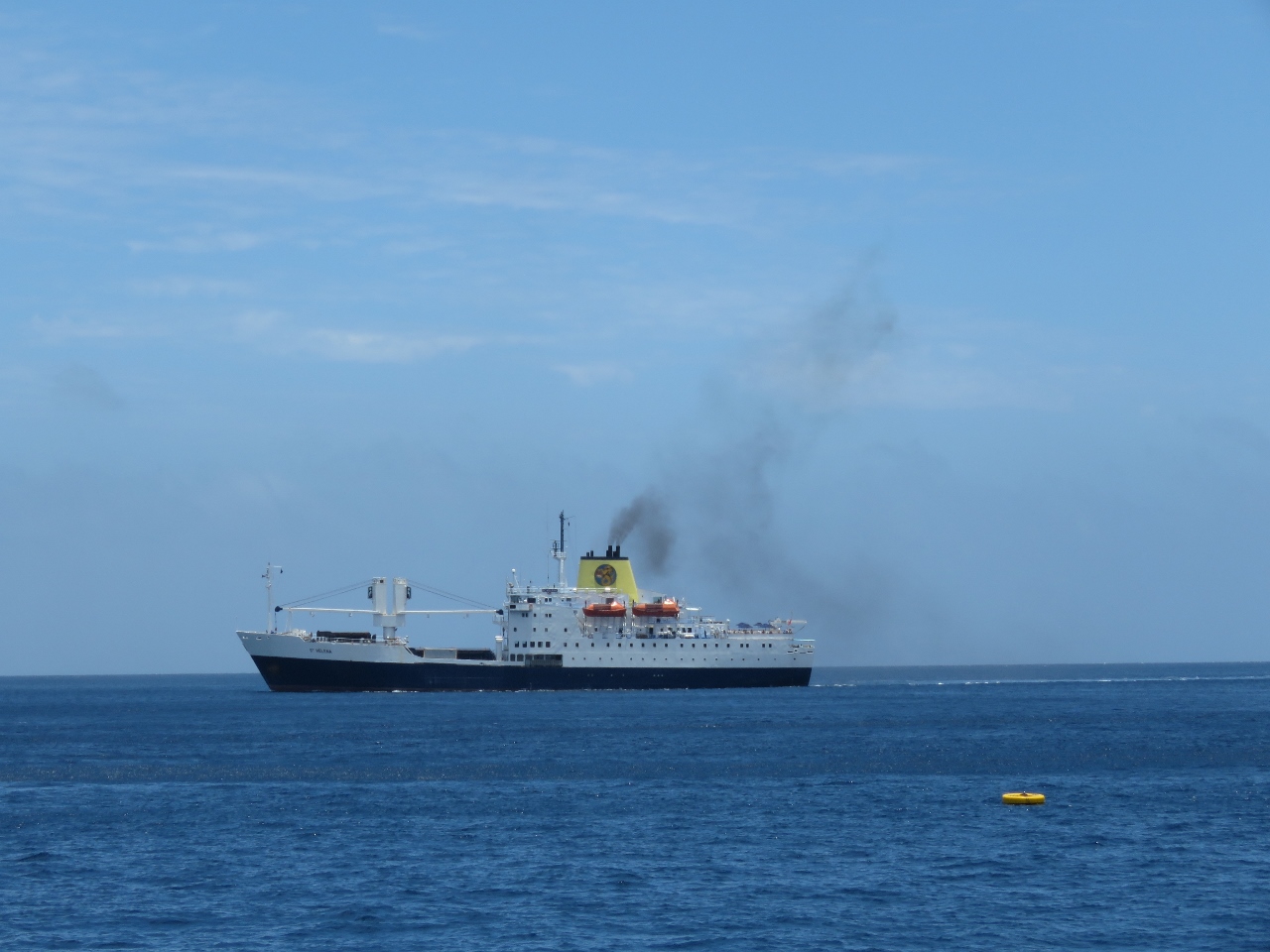
RMS at anchor
Position: -5 43.51, -15 55.50
The RMS arrived into Jamestown shortly before we did and already was at anchor by the time we arrived.
|
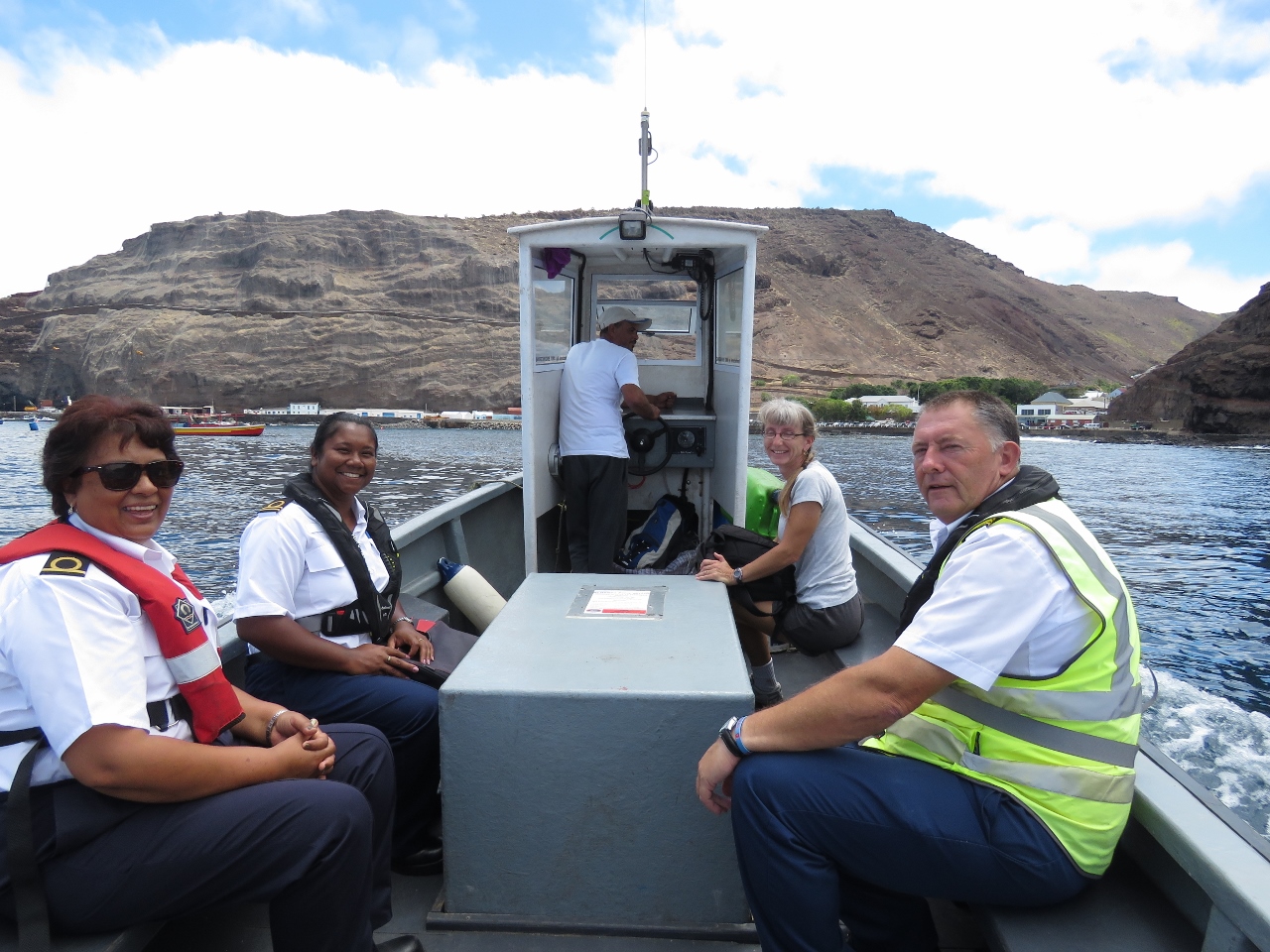 |
Ferry
Position: -5 43.27, -15 55.37
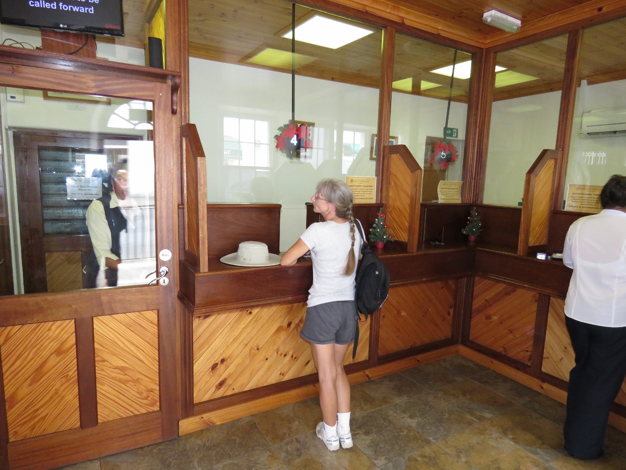
Customs (left) and the Harbour Master came out on the harbour ferry to clear us through. We had to wait an hour or so while they cleared the RMS through, but they were fast and efficient once on board. We then rode back them on the ferry into Jamestown.
|
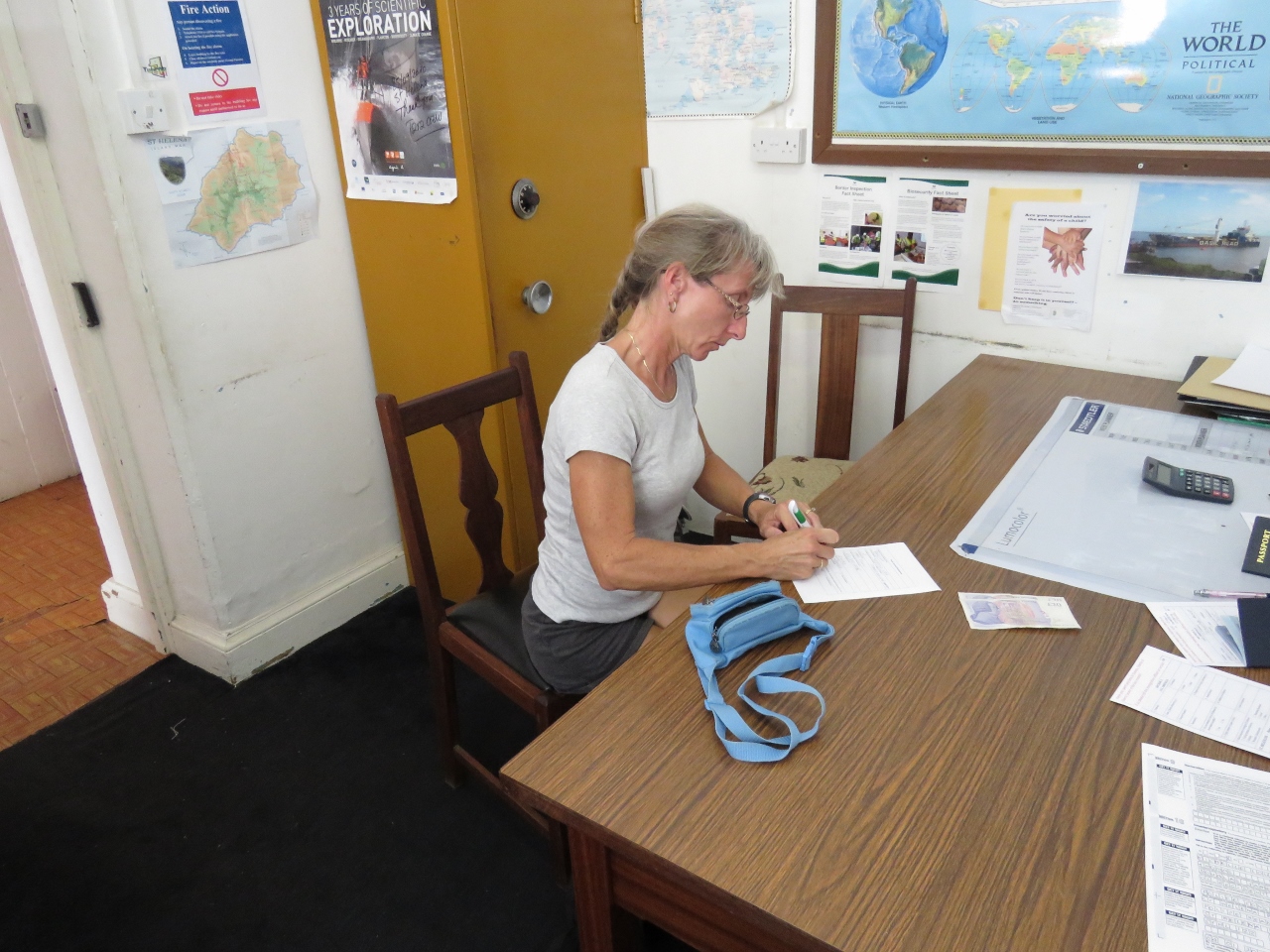 |
Immigration
Position: -5 43.10, -15 55.52
Once ashore, we went to the local police station to clear immigration. As with Customs, this was an efficient process with little paperwork.
|
 |
Main Street
Position: -5 43.03, -15 55.61
Looking south down Main Street in Jamestown. Well-preserved colonial-era buildings line both sides of the street.
|
 |
Bank
Position: -5 43.03, -15 55.61
We stopped off at the bank to exchange the remainder of our Rand for St. Helena Pounds. Converting less-common currency gets more difficult the farther you are away from that country, so we try to convert at the first opportunity. In Cape Town we could sell Mauritius Rupees, but not Vanuatu currency.
|
 |
Sure
Position: -5 43.02, -15 55.57
At the Sure store to purchase a Sim card for our mobile phone. The service is expensive and rather slow, but pretty much anything is more cost-effective than BGAN .
|
 |
Castle Gardens
Position: -5 43.04, -15 55.49
Beautiful Castle Gardens provide a shady retreat from the hot sun.
|
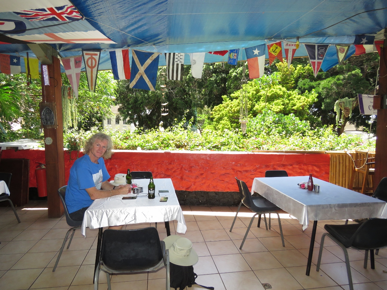 |
Anne’s Place
Position: -5 43.05, -15 55.49
Lunch at Anne’s Place overlooking the Castle Gardens.
|
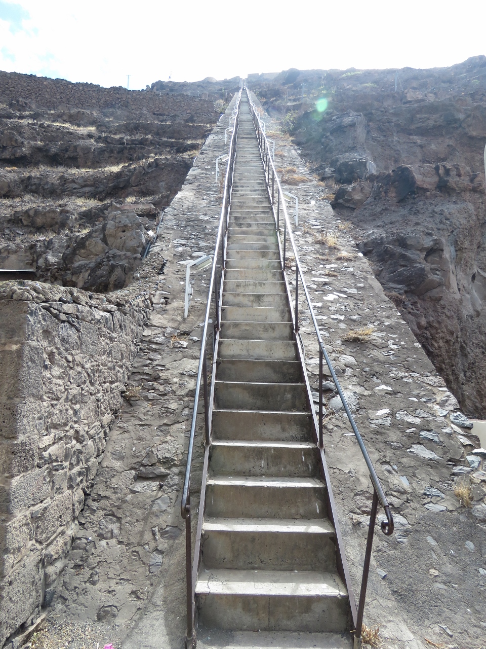 |
Jacob’s Ladder
Position: -5 43.07, -15 55.51
Jacob’s Ladder is a 900ft, 699-step staircase built in 1829 to connect Jamestown with the garrison high above on Ladder Hill. We’ll save the climb up for another day.
|
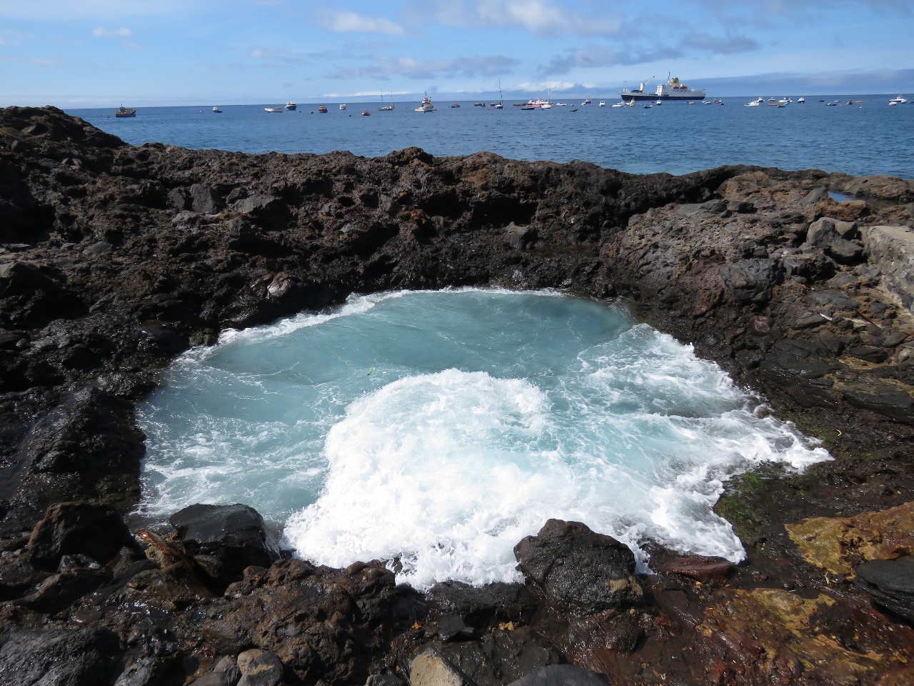 |
Blow hole
Position: -5 43.20, -15 55.47
Jamestown is on the lee side of St. Helena for the prevailing winds, but big swell still pounds into shore. The wave action has carved complex patterns into the volcanic rock. This blow hole occasionally ejected a spray of water as we watched.
|
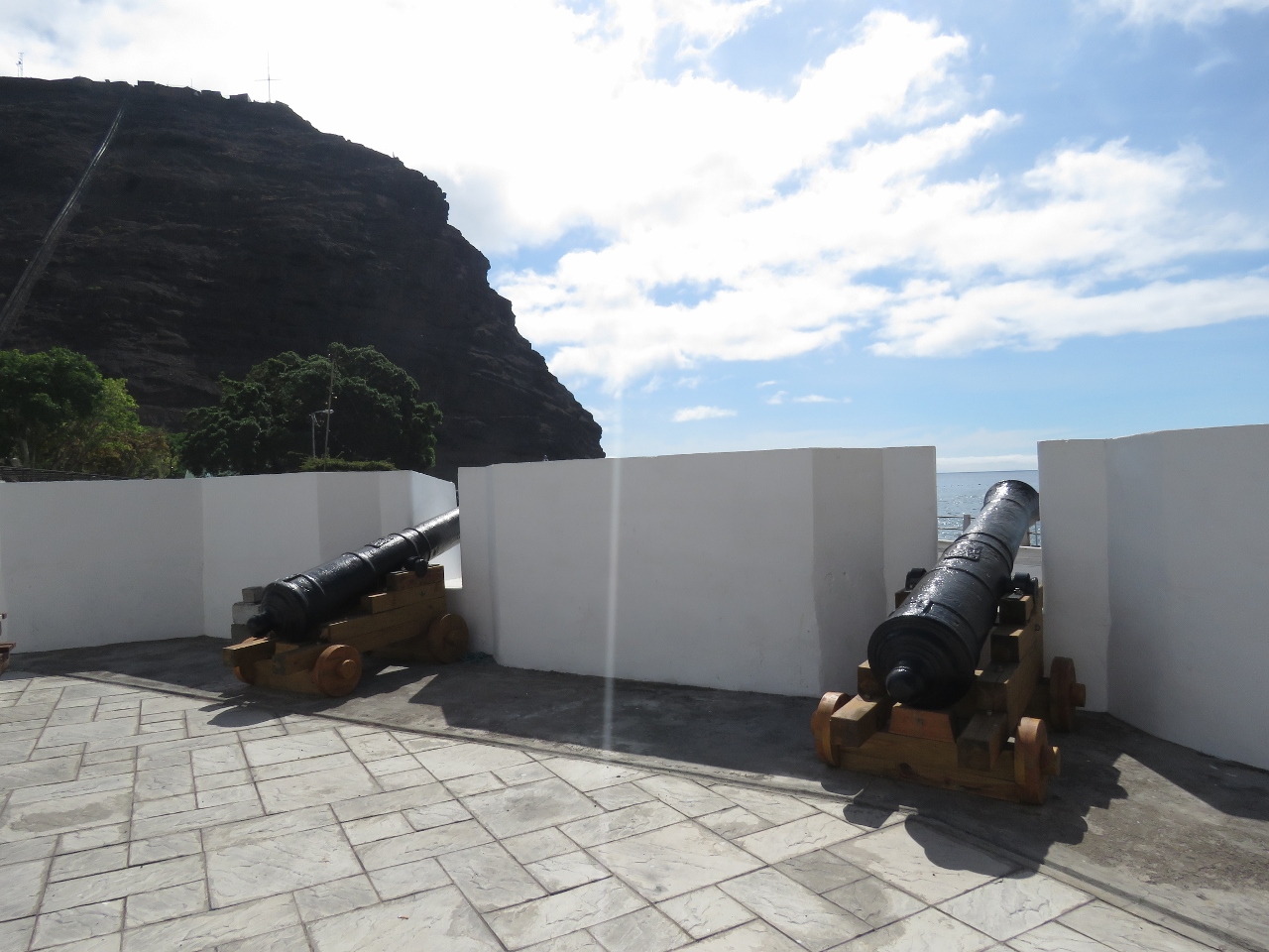 |
Cannons
Position: -5 43.08, -15 55.42
Jamestown has a lot of cannons leftover from it’s colonial heritage.
|
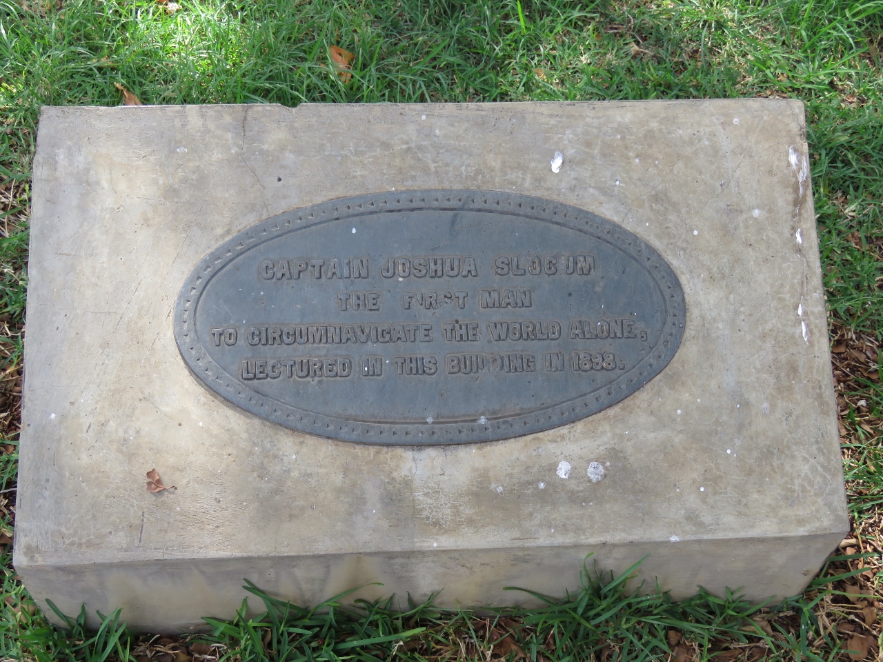 |
Captain Slocum
Position: -5 43.06, -15 55.43
This plaque by a building in the Castle Gardens reads “Captain Joshua Slocum, the first man to circumnavigate the world alone, lectured in this building in 1898”.
|
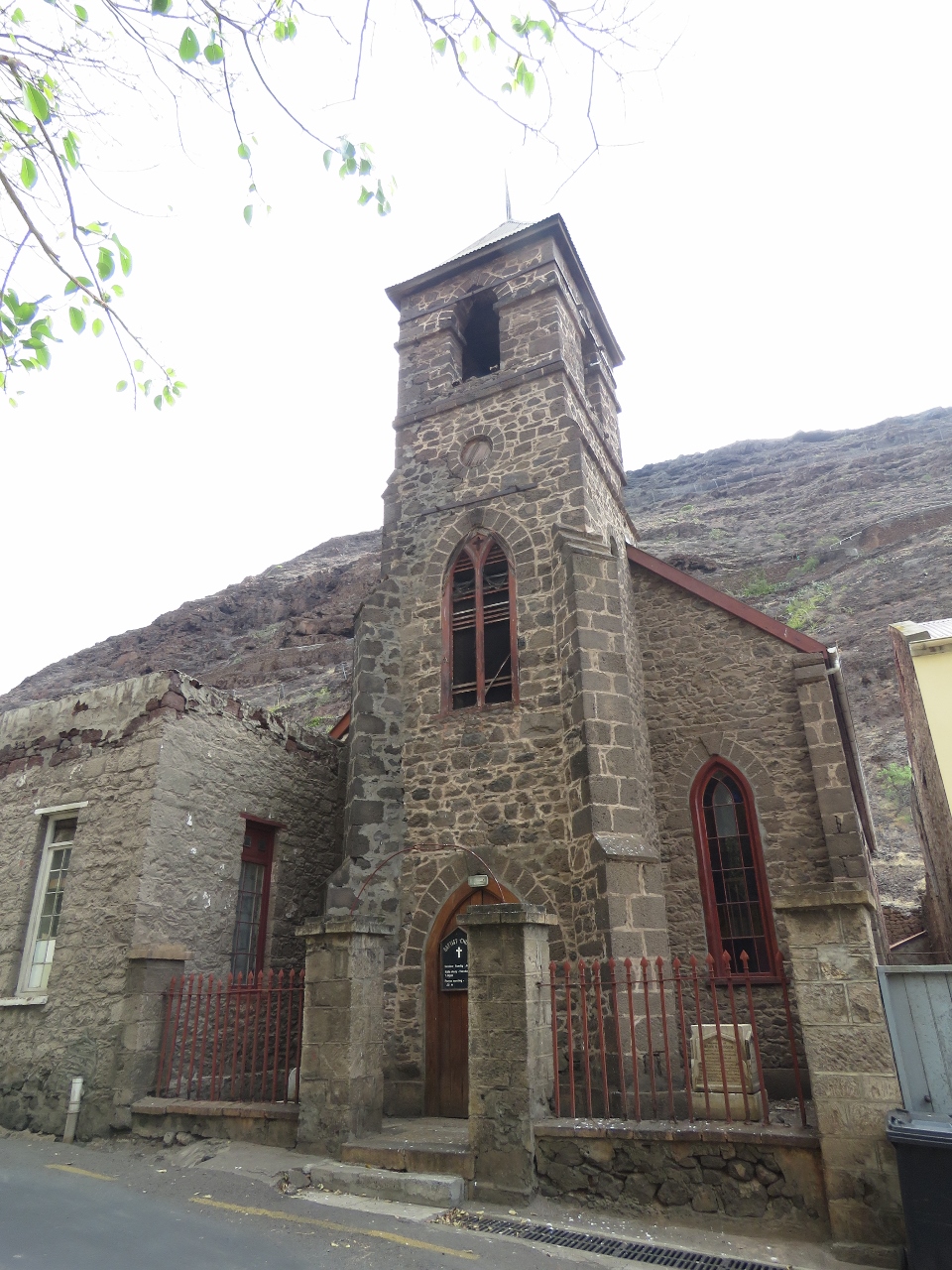 |
Church
Position: -5 42.88, -15 55.76
We walked up the Market Street to get more of a look around town. We couldn’t find a name or date on this church, but memorials in front dated to the 1800s.
|
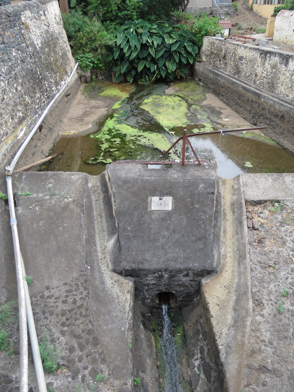 |
The Run
Position: -5 42.65, -15 56.09
This channel, called “The Run”, is presumed to have been the original channel that carried water through Jametown. It was paved in stone in 1857.
|
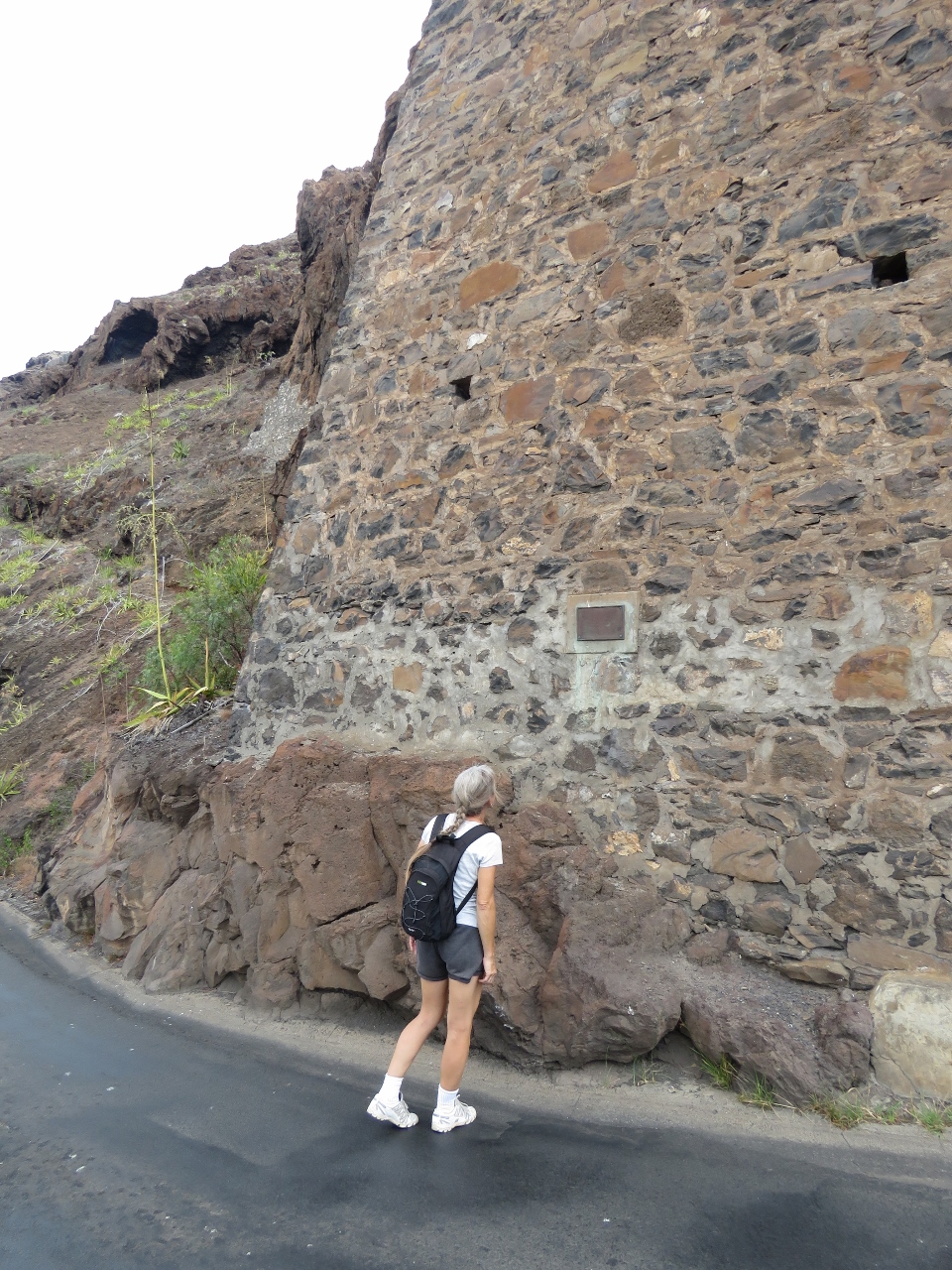 |
Memorial
Position: -5 43.06, -15 55.76
We continued walking the road as it twisted up and back towards town. This brick support keeps the wall from collapsing. A memorial plaque describes a massive rockfall that killed several people in the 1800s.
|
|
|
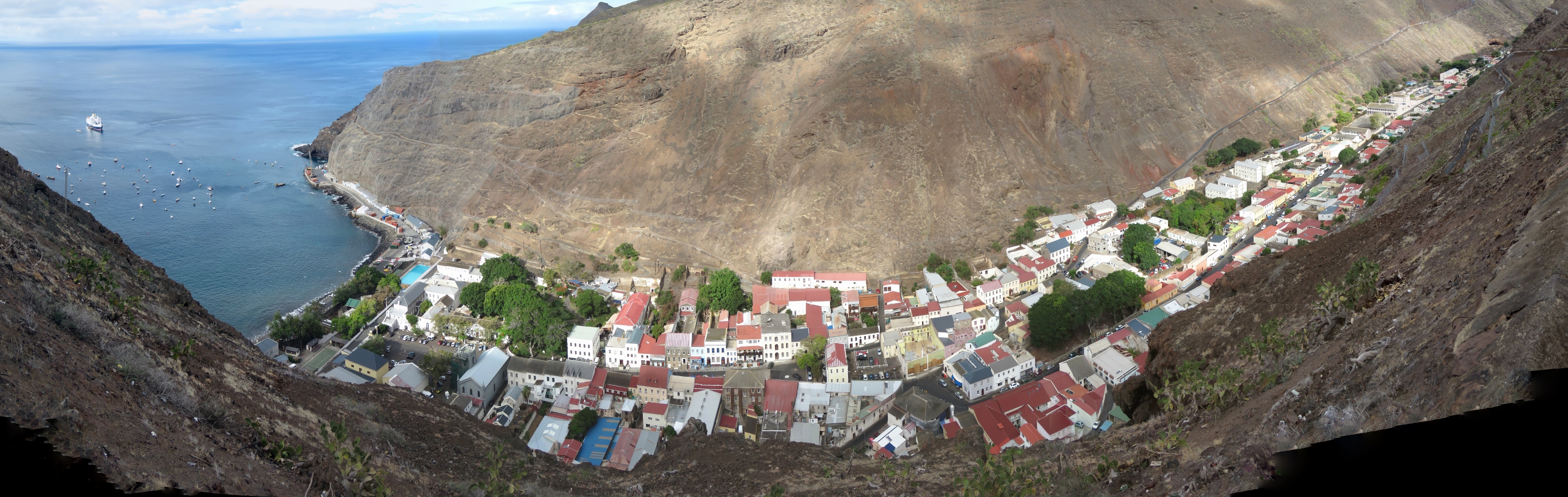
Jamestown from above
Position: -5 43.16, -15 55.65
The view to Jamestown from the road. The town extends through a valley between two towering cliffs.
|
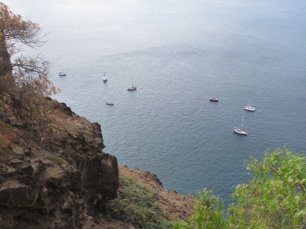 |
Ladder Hill
Position: -5 43.21, -15 55.59
The view from Ladder Hill down to Dirona and the other boats on the moorings.
|
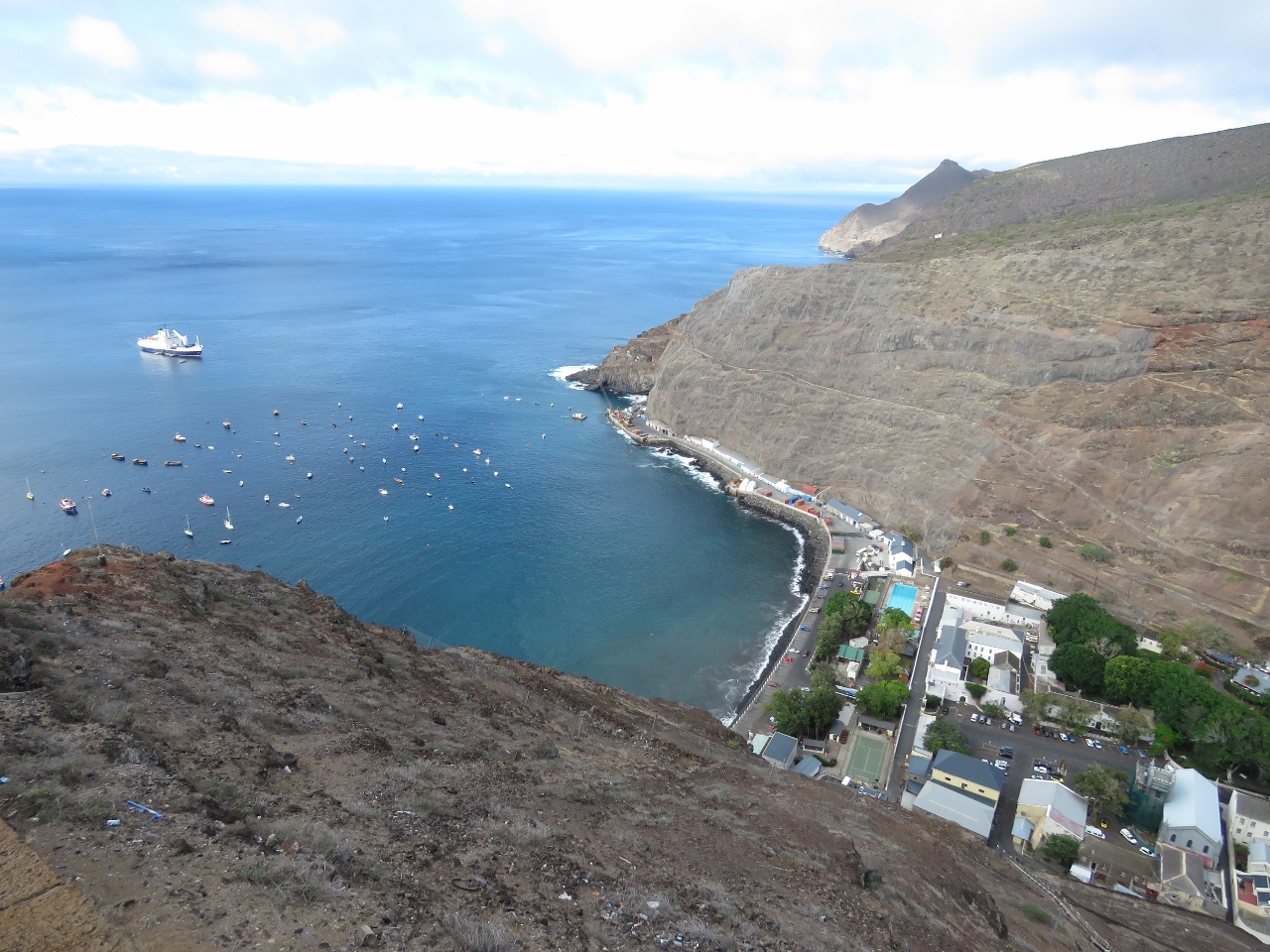 |
Jamestown Harbour
Position: -5 43.24, -15 55.59
Jamestown Harbour from the top of Jacob’s Ladder.
|
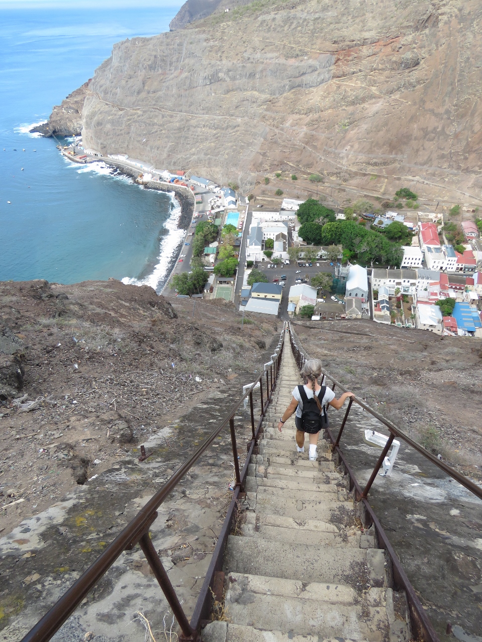 |
Going down
Position: -5 43.21, -15 55.59
We took Jacob’s Ladder back down. The combination of not being out hiking enough recently, our long hike of today and the steep stairs on the way down left us with stiff thighs for a couple of days.
|
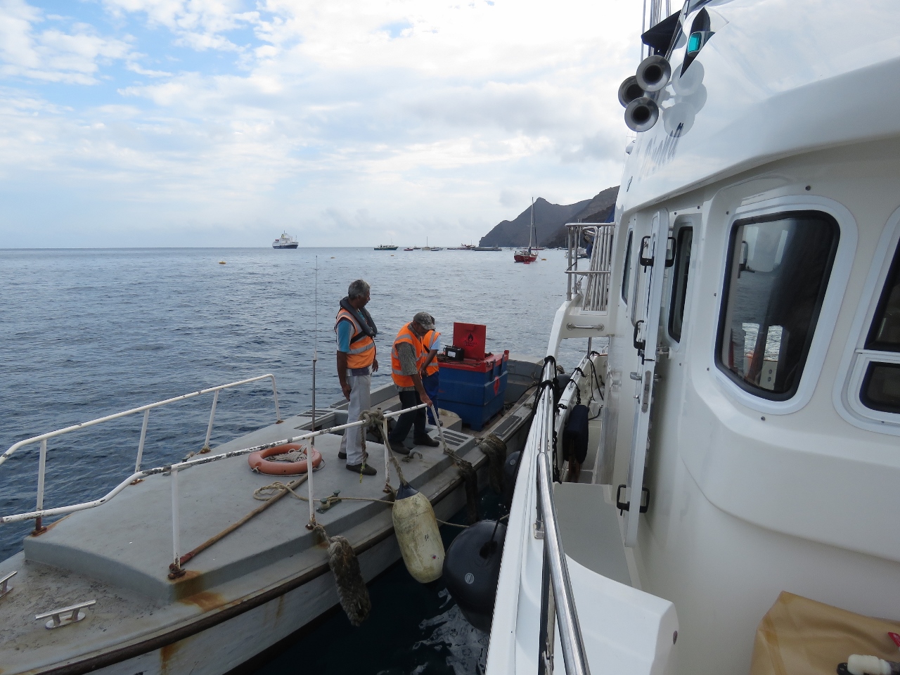 |
Fueling
Position: -5 43.51, -15 55.49
Today we took on 1,086 gallons (4,113 L) of diesel. The fueling was done by barge in several trips. (A larger barge is here that might have filled us in one trip, but we suspect it was in use with the RMS.) The fill process was lengthy, but otherwise went remarkably smoothly. It would be difficult to get another liter on board anywhere.
|
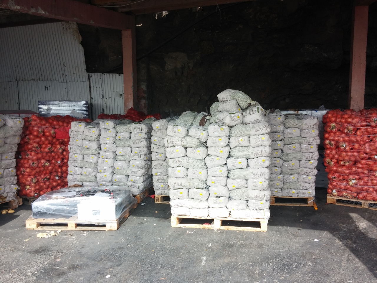 |
Onions and potatoes
Position: -5 43.06, -15 55.23
We finished fueling mid-afternoon then took the ferry into town. The storehouses ashore were packed with goods offloaded from the RMS. This shed was full of onions and potatoes.
|
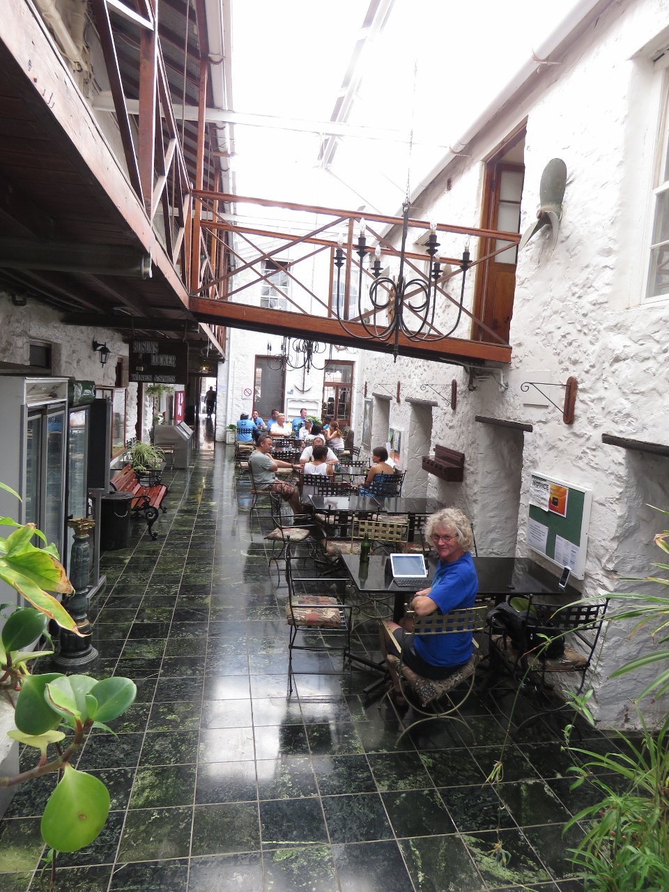 |
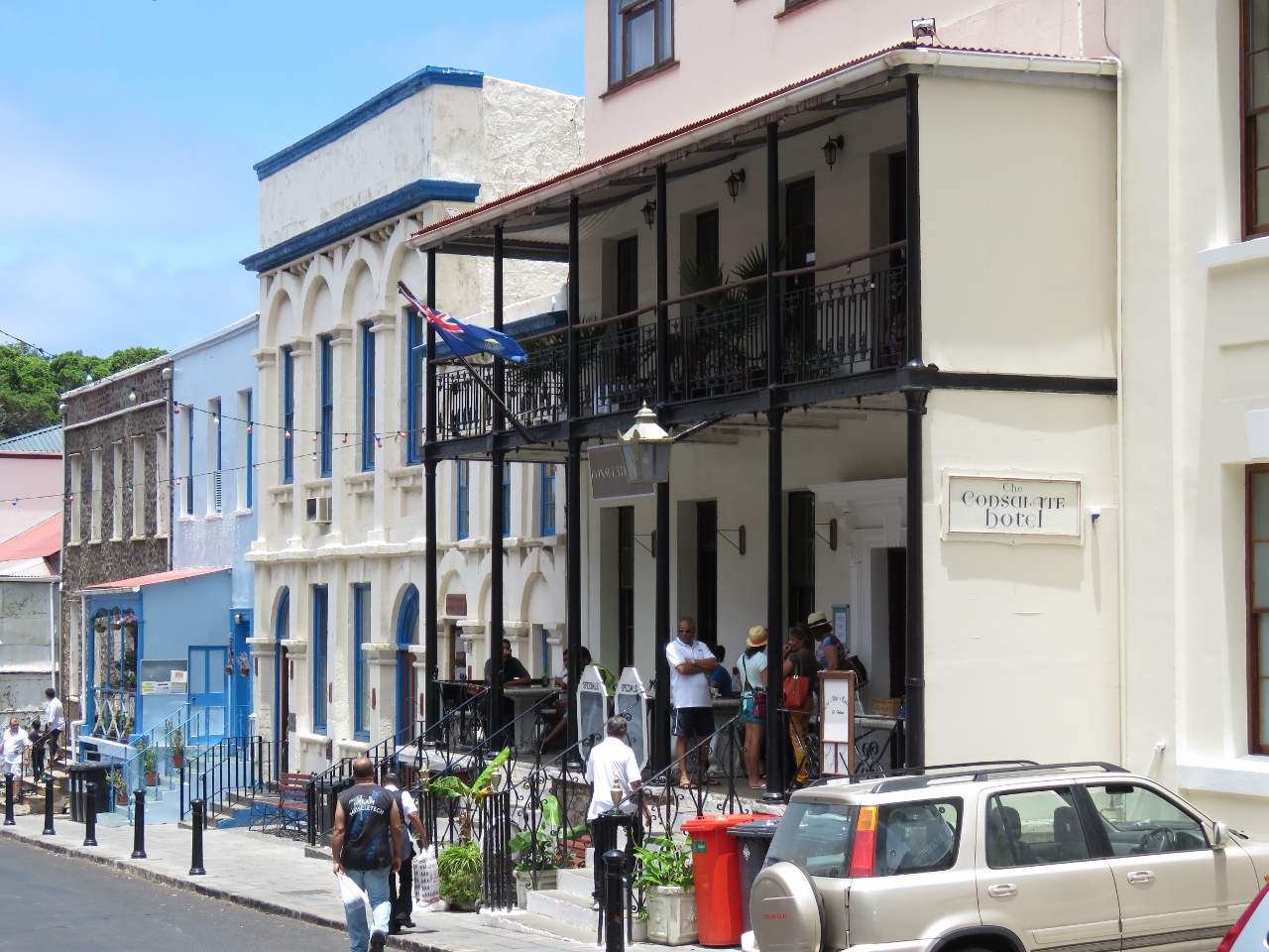
Consulate Hotel
Position: -5 43.02, -15 55.55
Cellular connectivity is pretty shaky from the anchorage, so we stopped off for a beer and some Wifi at the Consulate Hotel’s atrium bar. It became one of our favourite spots in town.
|
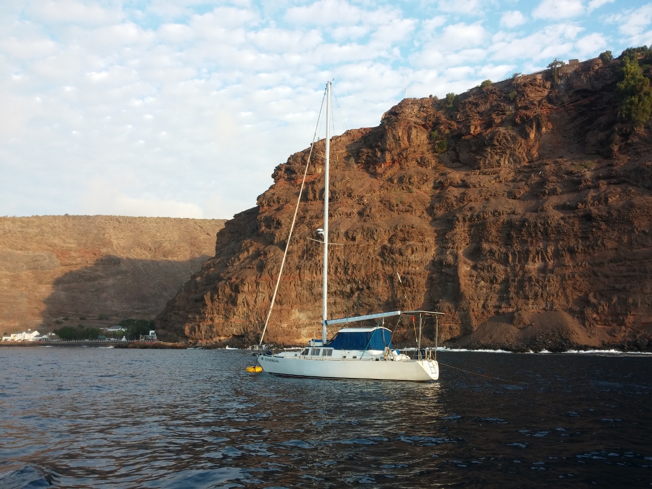 |
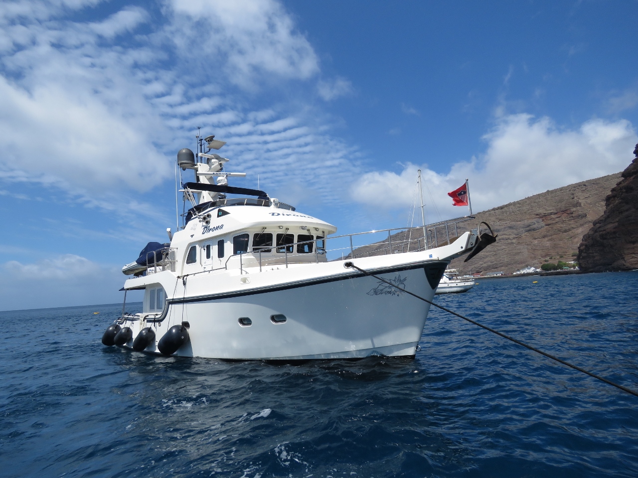
Ethereal
Position: -5 43.35, -15 55.39
Ethereal behind us in the mooring off the steep cliffs of St. Helena. Judy Hildebrand, who we met in Darwin, will be arriving in a few weeks to deliver it to the Caribbean.
|
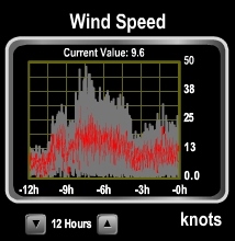 |
50 knots
Position: -5 43.50, -15 55.50
A massive high-pressure system is moving across the southern Atlantic right now, bringing big winds. We saw gusts to 50 knots last night.
|
 |
Shackle
Position: -5 43.51, -15 55.49
We normally don’t pick up a mooring as most aren’t strong enough for our weight, but when we have in the past on our previous boat, we ran a line from the port bow cleat, through the mooring ring and back to the boat on the starboard bow cleat. We did the same thing here, but with the surge and wind gusts the line is wearing heavily as it slides back and forth along the ring, and the slack has a tendency to get caught under the buoy and wear even more against the barnacles. So we decided to switch to a line attached at a single point to the boat with a shackle on the loop end with plenty of anti-chafe. We’ll then attach the shackle to the mooring ring. Leaving will be a little more involved because we can’t just undo the line and pull it through the ring, but releasing the shackle shouldn’t take long.
|
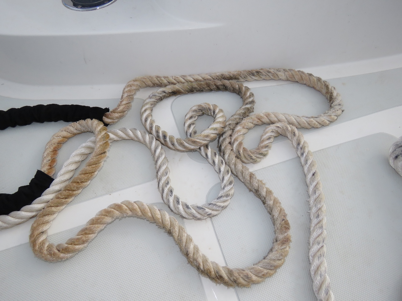 |
Line wear
Position: -5 43.50, -15 55.50
This is the original 75ft line we had attached to the buoy. The brown areas are where the line was wearing on the ring. We did have anti-chafe on the line, but the line pulled back and forth so much that the anti-chafe bunched up and rarely was protecting the line.
|
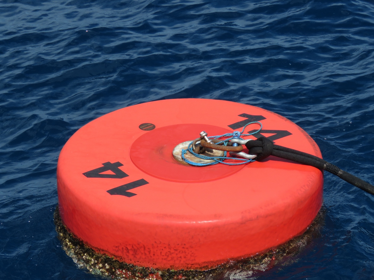 |
Buoy
Position: -5 43.51, -15 55.50
The mooring with our shackle attached. This was a much better setup.
|
 |
RMS
Position: -5 43.50, -15 55.50
The RMS leaving en route to Ascension Island. The ship had been here since we arrived and the anchorage felt a little empty without it there.
|
 |
Low
Position: -5 43.51, -15 55.49
With 2,707 gallons of fuel on board, we’re sitting very low in the water. The fenders are out for the fuel barge, and also for the harbour ferry to land against.
|
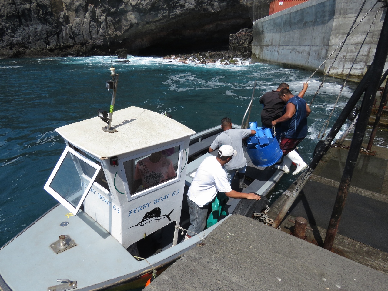 |
Harbour ferry
Position: -5 43.05, -15 55.23
The constant high swell in the harbour, visible in the background, makes landing and mooring a tender challenging, so almost everyone instead uses the harbour ferry. Lines hung above the harbour steps provide a steadying handhold when embarking and disembarking.
|
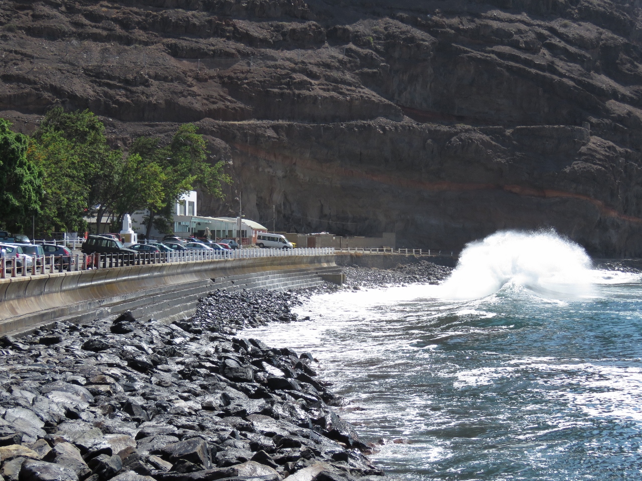 |
Waves
Position: -5 43.05, -15 55.37
That big high pressure system moving through the southern Atlantic is bringing bigger winds and waves than normal for this time of year.
|
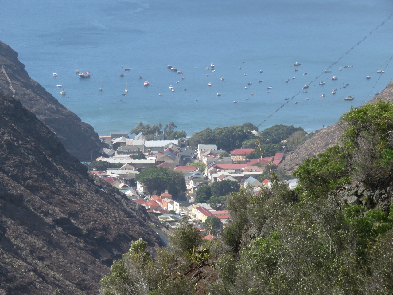 |
Jamestown
Position: -5 42.43, -15 56.58
The view north across Jamestown from the road high above on our way to visit the St. Helena distillery.
|
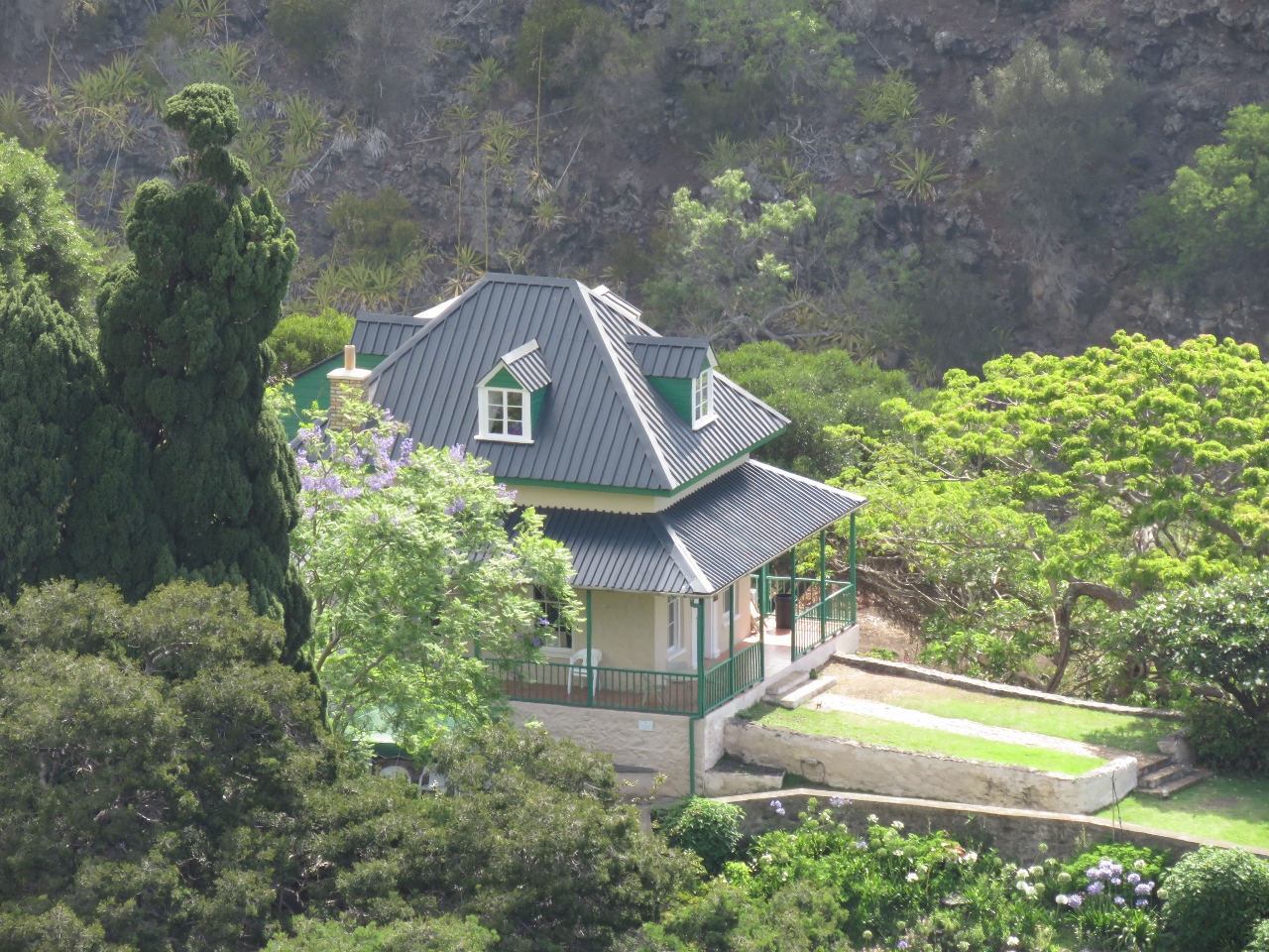 |
The Briars Pavilion
Position: -5 42.41, -15 56.50
St. Helena is the island where the British exiled Napolean. This is The Briars Pavilion, where Napolean was temporarily housed until his permanent residence at Longwood House was complete.
|
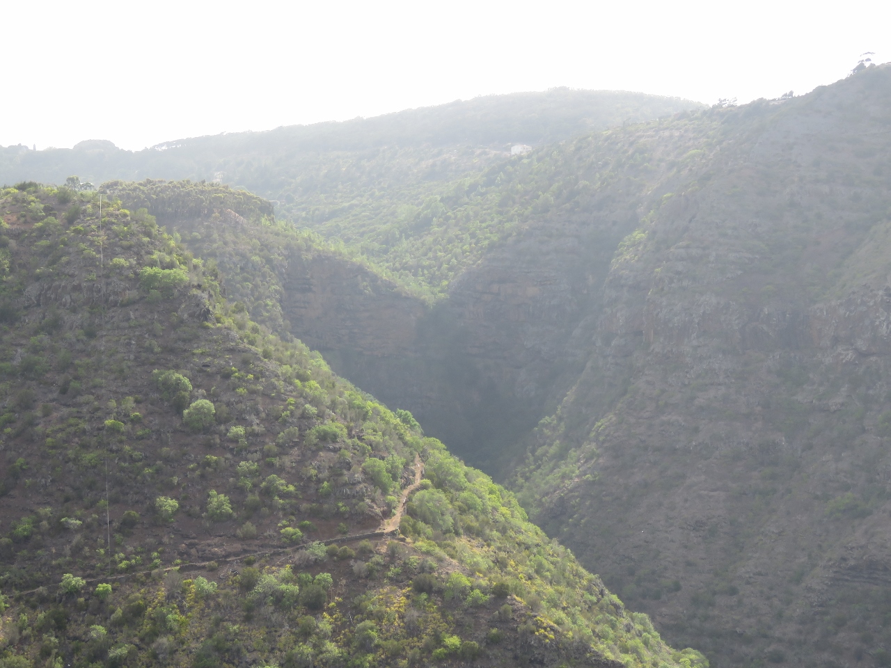 |
Heart-shaped waterfall
Position: -5 42.41, -15 56.50
In wetter weather, a waterfall flows over the cleft in the heart-shaped cliff in the distance.
|
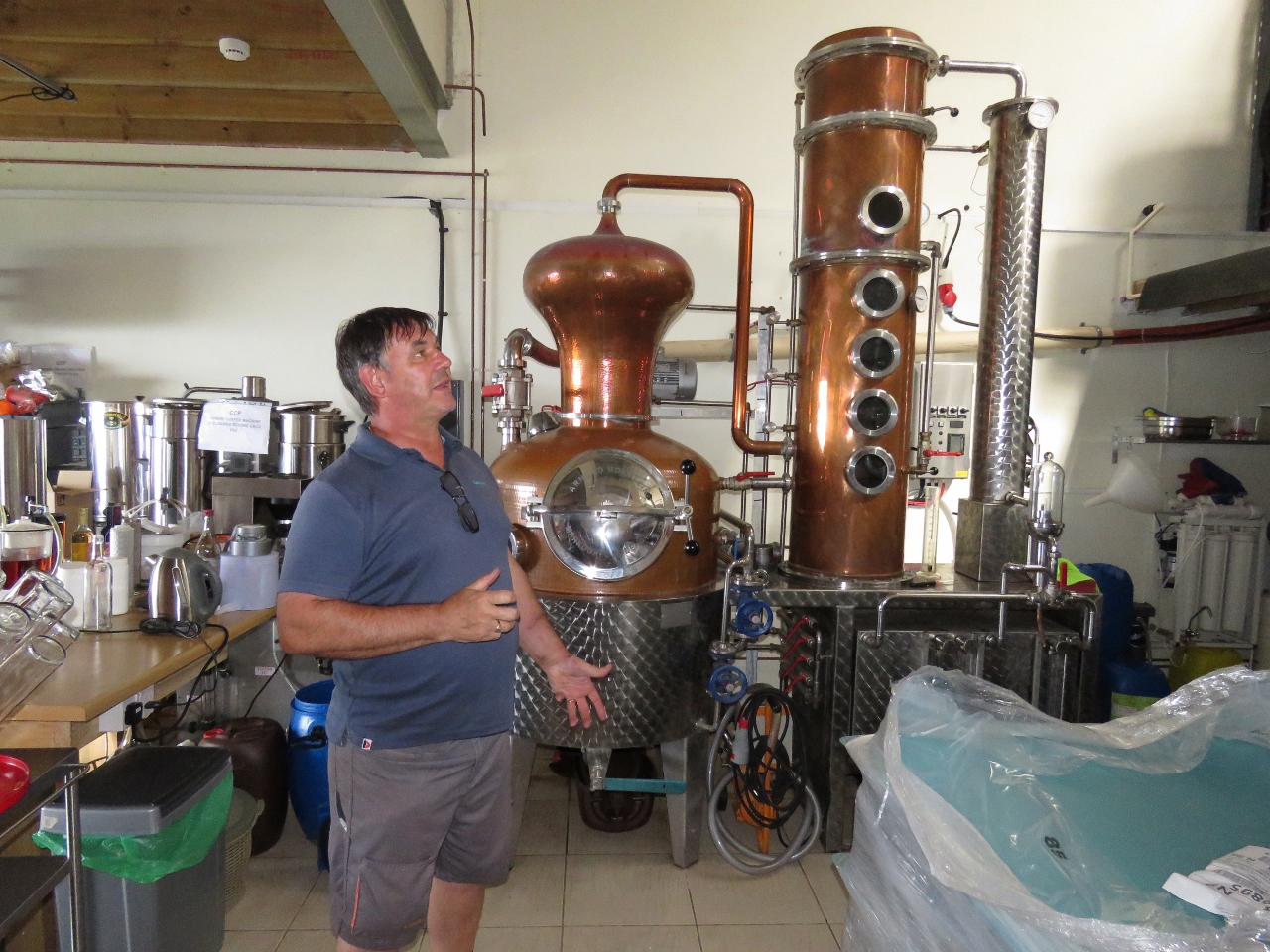 |
St. Helena Distillery
Position: -5 42.17, -15 57.10
Wyn Jones has been following our blog and shared it with Paul Hicking, Head Distiller at the St. Helena Distillery. Paul invited us to come tour the distillery and even came into Jamestown this afternoon to drive us up. We had a great time meeting Paul, touring the facility and learning about the distillation process.
|
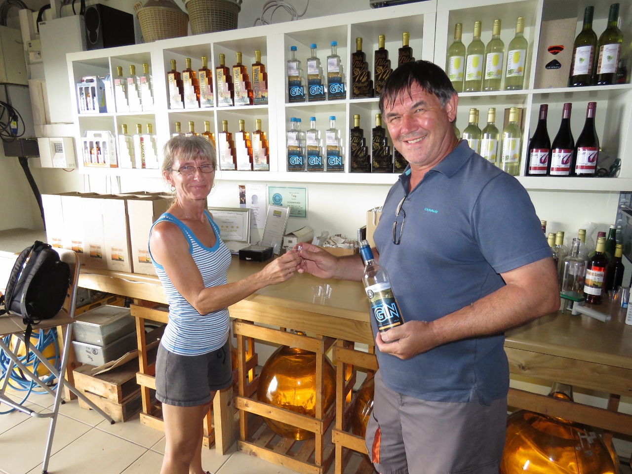 |
Tasting
Position: -5 42.17, -15 57.10
We tasted the range of products at the distillery, including their signature produce Tungi, a delicious spirit made from a locally-grown prickly pear called Tungi. Paul also brews excellent beer.
|

|
Click the travel log icon on the left to see these locations on a map, with the complete log of our cruise.
On the map page, clicking on a camera or text icon will display a picture and/or log entry for that location, and clicking on the smaller icons along the route will display latitude, longitude and other navigation data for that location. And a live map of our current route and most recent log entries always is available at http://mvdirona.com/maps. |
If your comment doesn't show up right away, send us email and we'll dredge it out of the spam filter.