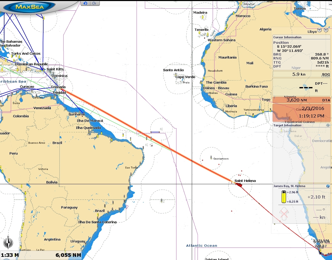
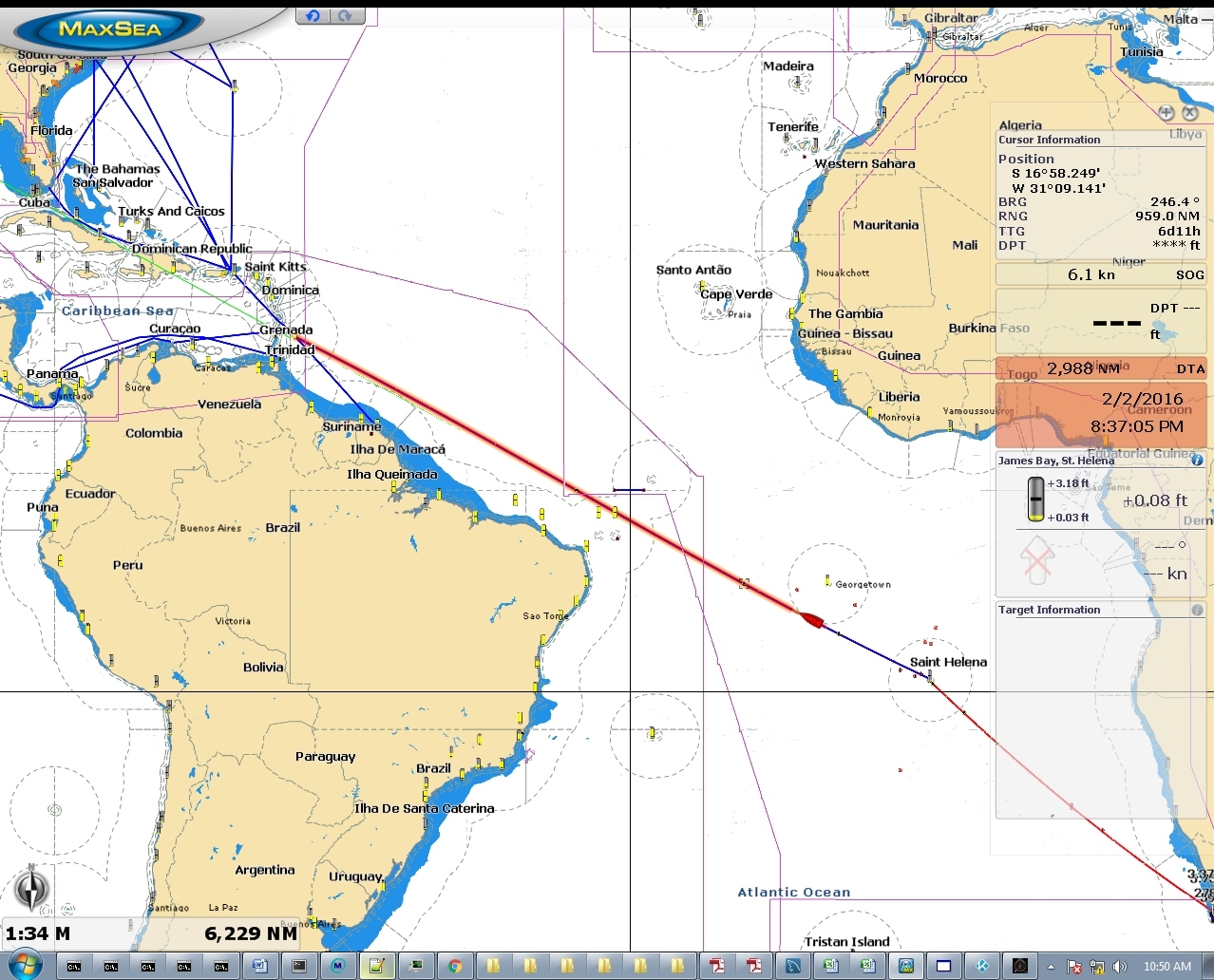
We departed from St. Helena on our longest non-stop run so far: a one-month, 3,650 nautical mile passage to Barbados. We were always planning to stop at St. Helena, as we’d need to refuel enroute to most destinations after South Africa. From St. Helena, we’d gone through several iterations of trip planning before deciding on our current route.
Initially, our plan was to head north to Europe. Then we saw some pictures from Patagonia and decided to head west to Brazil from St. Helena and travel down the South American coast to cruise Tierra del Fuega and Patagonia. Later we decided we would head to the Caribbean and pass through the Panama Canal. But sometime later, a friend sent us pictures from Labrador, so our desination now is going to be the Caribbean and up the US and Canadian eastern seaboards.
To reduce the non-stop distance of our current passage, we might have reached the Caribbean via the Cape Verde Islands off the northwest coast of Africa. That would be about 2,000 miles north and another 2,000 miles west. This would add 500-600 miles to the total distance. And the last part of the run to the Cape Verde Islands would be into the weather, and likely reminscent of our run from Fanning Island to the Marquesas, a passage we don’t remember fondly. Another possibility would be to stop at the Brazillian archipelago of Fernando de Noronah, roughly halfway between St. Helena and the Caribbean. But US citizens require visas to enter Brazil and they apparently are a pain to get. Also, we could only clear immigration there–we’d need to go to a more formal Brazilian port of entry to clear customs. We also might have made a 3,000nm run north of Brazil to French Guiana or Suriname, refueled there, then continued on about 800 miles to the Caribbean.
In the end we decided on the direct run to the Caribbean, partly because we didn’t feel like the overhead of diverting somewhere, but mainly because it would be another good test of Dirona‘s range. We’d learned on the Indian Ocean crossing that 3,000nm was well within our range, so we wanted to push the envelope a bit more. The longer the range we can comfortably take on, the more flexibiity we have in future routings. If we run into problems and don’t feel we can make the run in one leg, Suriname is our backup plan.
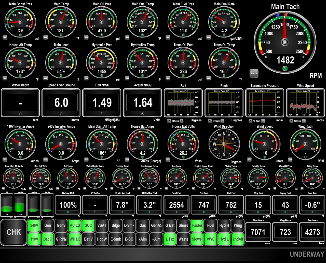
Our total fuel capacity is 2,707 gallons: 1747 in the internal tanks and 960 on deck. With a 300-400-gallon reserve, we would need to make 1.51 to 1.6nm/gallon. (We normally use a 200-gallon reserve, since we know the fuel levels fairly accuratetly. But on longer runs, with more potential for issue, we often at least start with greater reserves.) And for planning purposes, we assumed an average speed of 5.5 knots, which would be 28 days at sea. So far we are right on target with a fuel economy of 1.6nm/gallon and our speed is better than expected at an average of 6.0 knots.
We left on the tail end of a high-pressure system and for the first 2-3 days had 6-7ft seas on 7 seconds from behind. That produced a comfortable maximum roll of around 10 degrees, with max pitch around 4 degrees. In about 3-4 days, the wave period lengthened to about 10 seconds, which reduced roll even more and is about the closest you can get to flat water in open ocean. Overall, conditions have generally been so good it’s hard to believe we’re actually at sea.
Trip highlights from January 9th through 18th follow. Click any image for a larger view, or click the position to view the location on a map. And a live map of our current route and most recent log entries always is available at http://mvdirona.com/maps
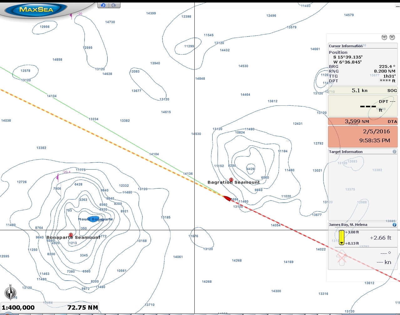 |
Seamounts
Position: -6 30.80, -15 33.34
We’re passing between Bagration Seamount to the north and Bonaparte Seamount to the south. From 14,000-ft depths, Bagration Seamount rises to about 4,000 feet below the surface, while Bonaparte Seamount is less than 350ft from the surface and is a popular fishing grounds for commercial boats from St. Helena. We saw several leave yesterday en route to fishs, but didn’t pick up any vessels on radar as we passed by.
|
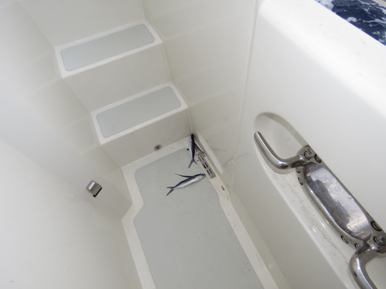 |
Eight-fish morning
Position: -6 49.47, -15 24.63
We found eight flying fish around the boat this morning.
|
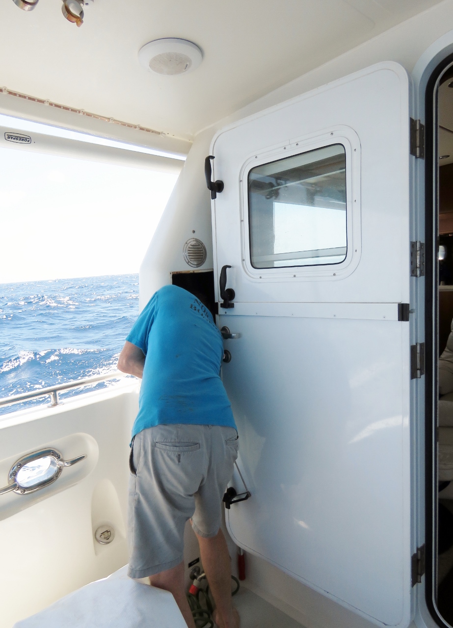 |
Water leak
Position: -7 26.37, -15 7.44
We traced a water leak that was showing up in the engine room around the port stabilizer to the cockpit raw water washdown faucet. The faucet was leaking inside the port engine room air intake, flowing into a conduit that runs to the forward side of the fuel tanks, out the end of the conduit and dribbling down onto the end of the stabilizer, around the stabilizer and down into the forward bilge area. Fluids sure can take strange paths on boats, making leaks a real challenge sometimes to track down.
|
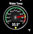 |
95.9
Position: -8 17.79, -14 43.42
The water is an incredibly warm 95.9°F
|
 |
Conditions
Position: -8 31.69, -14 36.92
Speed and fuel economy have been rather variable on the trip so far, particularly in the steeper waves. But the wave period is increasing a bit, and both fuel economy and speed are improving. We expect conditions will improve further in a couple of days from the already excellent conditions and this will continue to improve the fuel economy. We’re carrying 15% of the boat’s weight in fuel, and so as the fuel load goes down, fuel economy should improve slightly as well.
|
 |
Driving the lights
Position: -11 36.86, -13 7.29
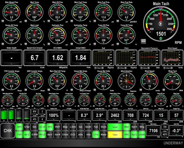
We’re “driving the lights” and just hit some positive current. Our fuel economy has increased to 1.84 nm/gallon (center of display), and the yellow indicator light at the bottom of the display indicates we can go faster and still meet our goal of 1.6nm/gallon. We actually need to attain only 1.5nm/gallon with 300 gallons of reserve, but are starting the trip a little conservatively and aiming for 400 gallons of reserve intitially. Conditions remain excellent, with 6-7ft seas on 7 seconds and 15-20kt winds, both from behind. We still expect conditions, and fuel economy, to improve slightly in a couple of days with the wave period increasing to 10-12 seconds, the wave height falling to 5-6ft, and winds dropping to around 10kts.
|
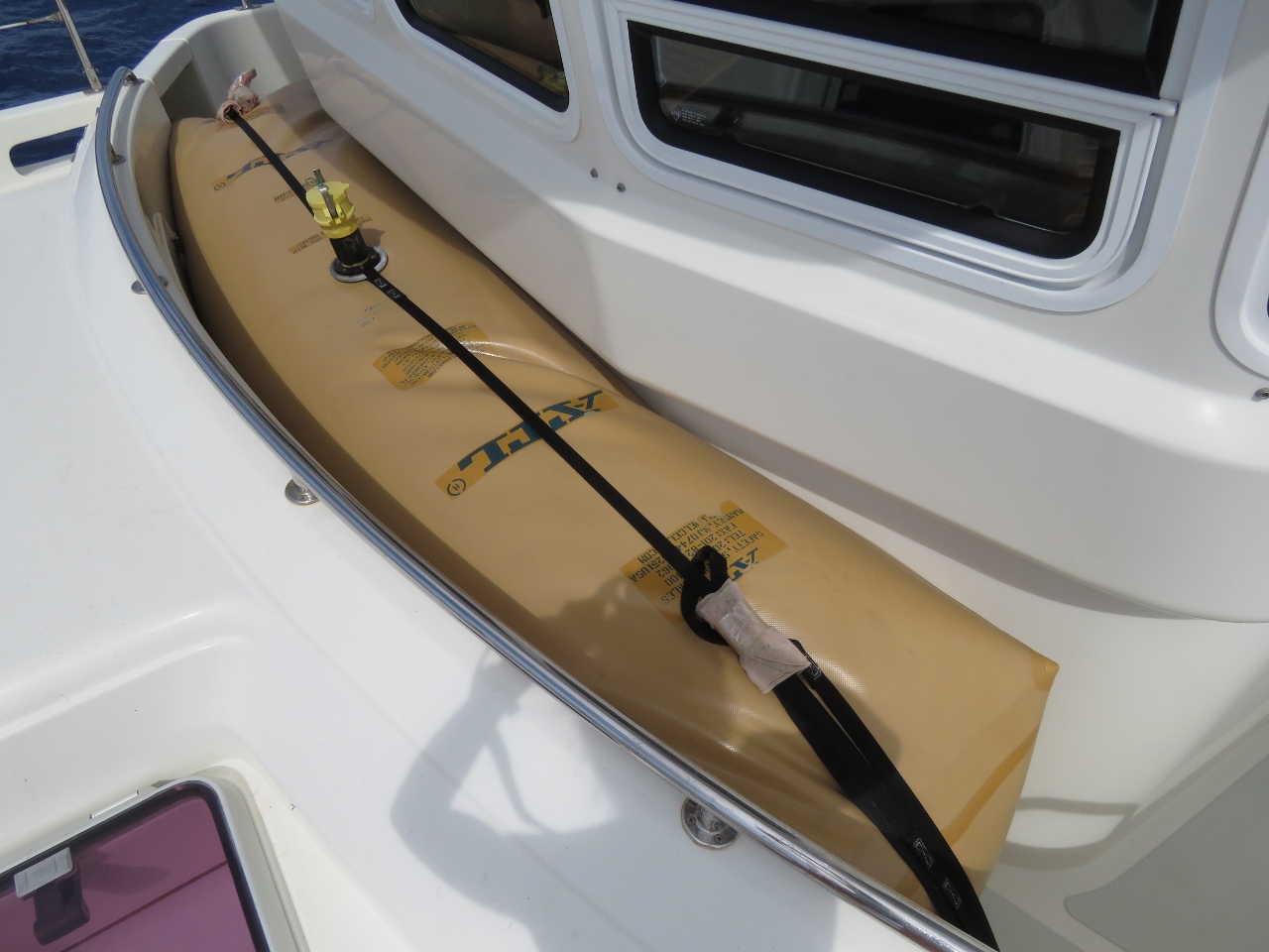 |
360 gallons down
Position: -14 39.93, -11 35.29
We’ve been at sea for four days now and at an average fuel economy of 1.63 nm/g have only consumed the amount of fuel carried in the 360-gallon forward bladder. The fuel in the picture is all we have burned so far. If we drained that bladder, the main tanks and the two 300-gallon cockpit bladders would still all be 100% full.
|
 |
Ascension Island
Position: -14 44.69, -11 32.83
It’s just before midnight and we’re about 200 miles directly south of Ascension Island. We’ve been asked why we didn’t stop at Ascension on our way to Barbados. The short answer is the world is a big place and you can’t stop everywhere. We needed to stop at Ascension or St. Helena for fuel. Fuel was easy to arrange in St. Helena and we had trouble getting data on fueling at Ascension. We could have fueled at St. Helena and stopped in Ascension but we didn’t feel like the diversion. We had a really good time in St. Helena and felt ready to get underway on the long crossing.
|
 |
2,988 to go
Position: -15 52.16, -10 57.95
We just dropped below 3,000nm to go. There’s still a lot of distance in front of us, but we’re now just barely within the furthest distance we’ve traveled non-stop so far.
|
 |
Conditions
Position: -16 29.10, -10 39.03
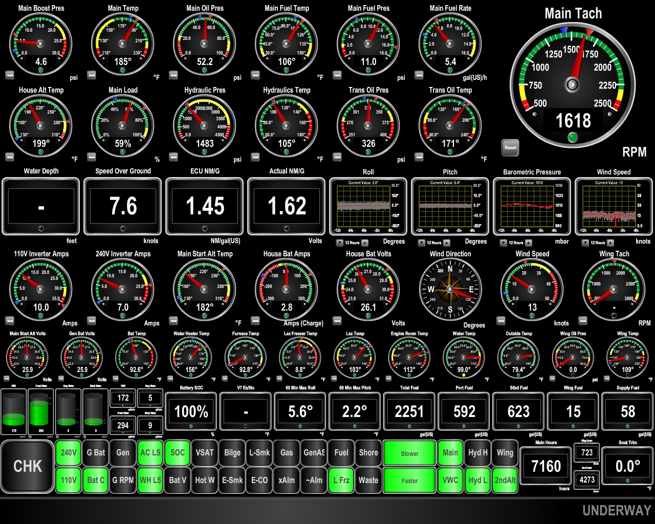
As the weather models indicated, the wave height has dropped slightly to around 5ft, the period has increased to over 10 seconds and winds are now 10-15 kts. This has had the expected impact on speed and fuel economy: we’re now doing 7.6kts with a fuel economy of 1.62. We also are clearly getting help from a positive current. Also as expected, max roll has dropped to 5.6° in the past hour, and max pitch over tha period is 2.2°. Boat motion now is so minimal we can hardly tell we are at sea.
|
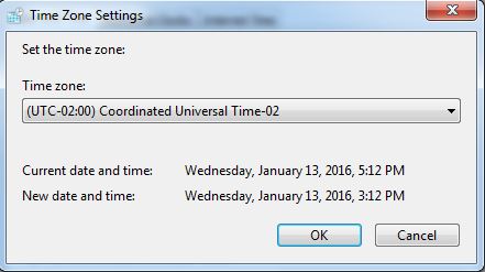 |
GMT-02
Position: -16 30.05, -10 38.55
The sun was setting around 8pm and it was still dark at 6am, so time to set the clocks back. We typically adjust the clocks in 2-hour increments on passages.
|
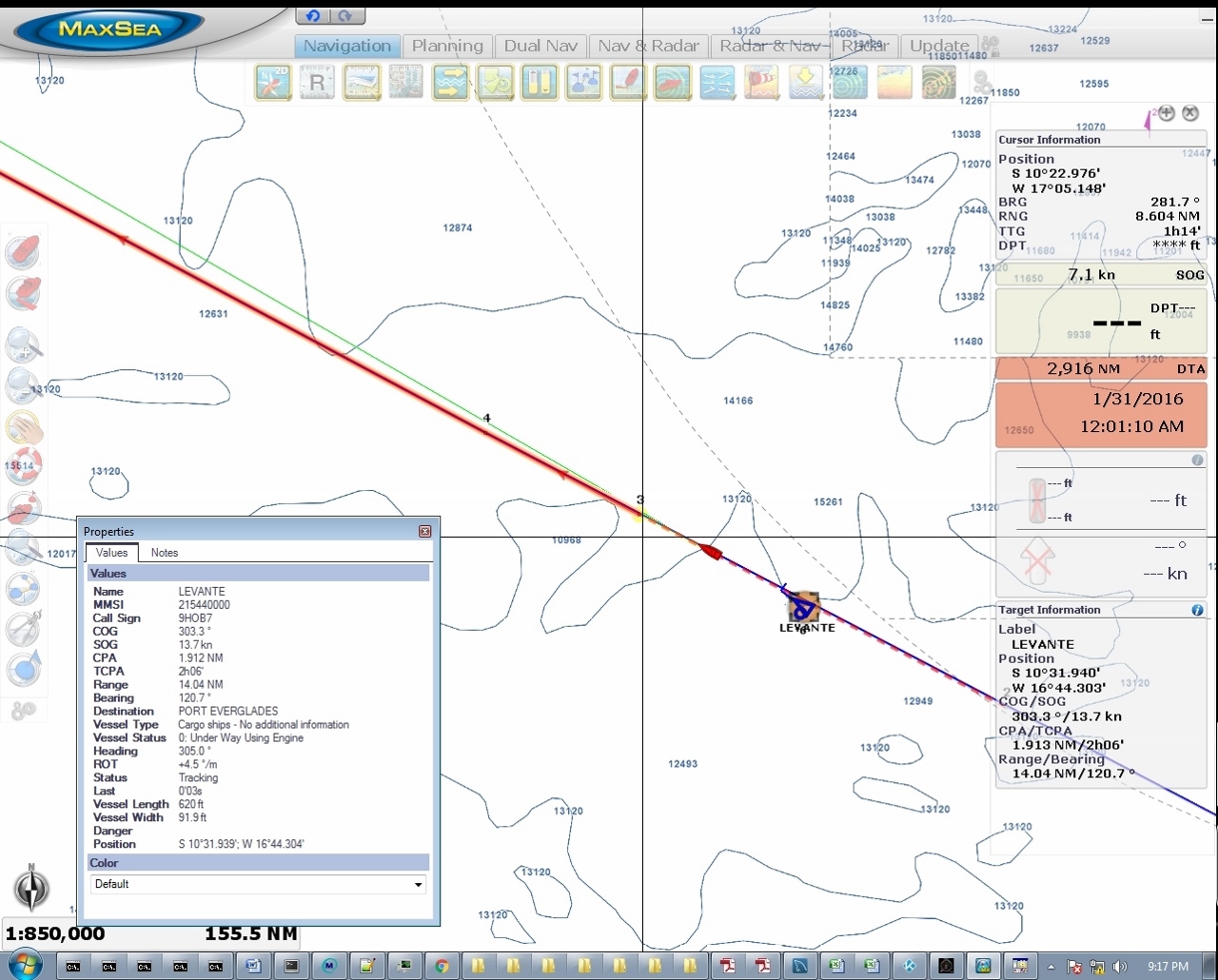 |
Levante
Position: -16 43.69, -10 31.45
The 620ft cargo ship Levante passed about two miles to our north tonight en route to Port Everglades, Florida. This is the first ship we’ve seen at sea since the Bomar Resilient over two weeks ago, before arriving at St. Helena, and only the second since leaving Cape Town over three weeks ago. As with the Bomar Resilient, we picked the Levante up on rader when it was over 24nm behind us.
|
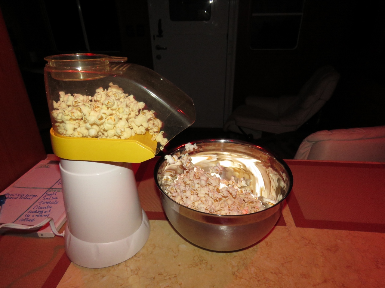 |
Popcorn
Position: -17 46.90, -9 58.25
Air-popped popcorn makes an excellent on-watch late-night snack.
|
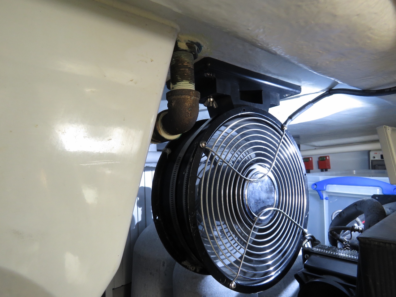 |
Lazarette temperature
Position: -17 57.05, -9 52.88
The 110v inverter cut out today without indication of cause, but came back online a few minutes later. We suspect thermal overload caused the shutoff, as the inverter case was 114F in a 104F lazarette. We turned on the lazarette fan and the inverter case temperature dropped quickly to 106F while the laz temperature went down a degree to 103F. We’ll watch it, but we expect it’ll be fine with the fan on when the lazarette is up over 100F.
|
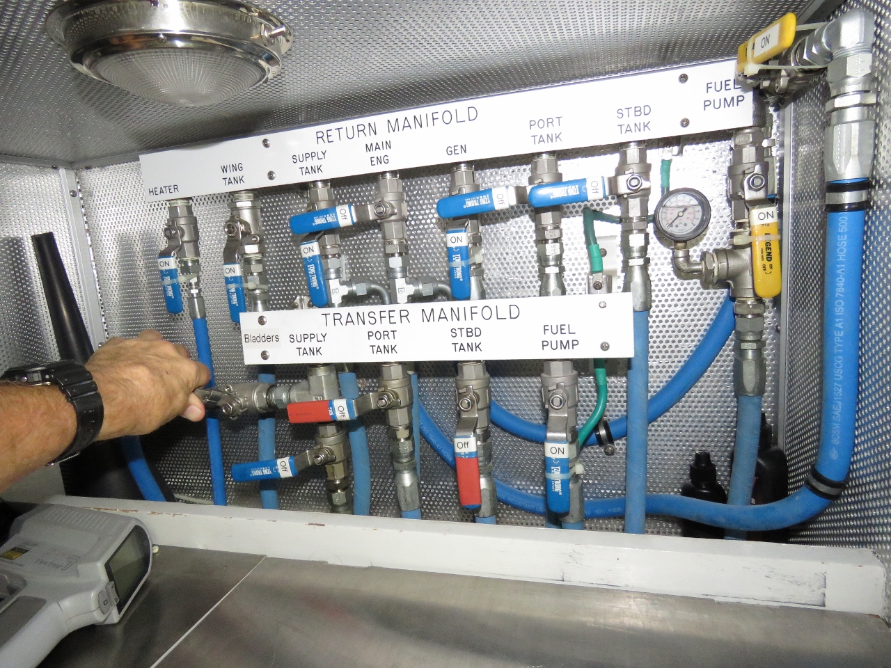 |
Fuel manifold
Position: -17 57.14, -9 52.83
We’ve consumed about 500 gallons now so have more than enough space in the main fuel tanks to drain the 360-gallon forward bladder. The bladders are unstable when partially filled, so we won’t drain one until we have enough space to hold the entire contents, with a good buffer for tank-level measurement error. Here we are opening the bladder valve at the fuel transfer manifold to begin the transfer. See Fuel for the Crossing for details of our fuel transfer process.
|
 |
Empty bladder
Position: -18 29.66, -9 35.57
The forward bladder is now completely drained and the main tanks are back to being almost full again.
|
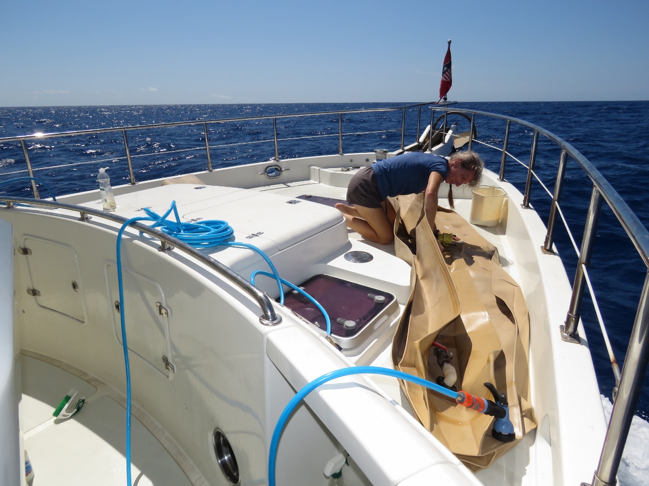 |
Cleaning
Position: -18 39.47, -9 30.36
The bladder and the portuguese bridge were quite dirty with saltwater spray from the first few days out of Cape Town, dust from the big winds in St. Helena, and fish scales from two flying fish that had landed there. We laid the bladder out on the foredeck and Jennifer cleaned it while James scrubbed the portuguese bridge. Notice how calm the seas are, with only tiny wind waves disturbing the water surface.
|
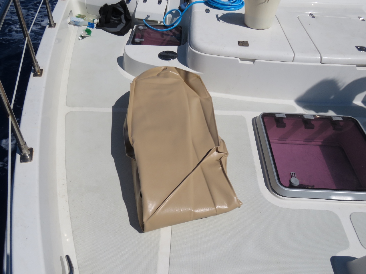 |
Ready to stow
Position: -18 42.60, -9 28.70
The forward bladder folded up and ready to stow.
|
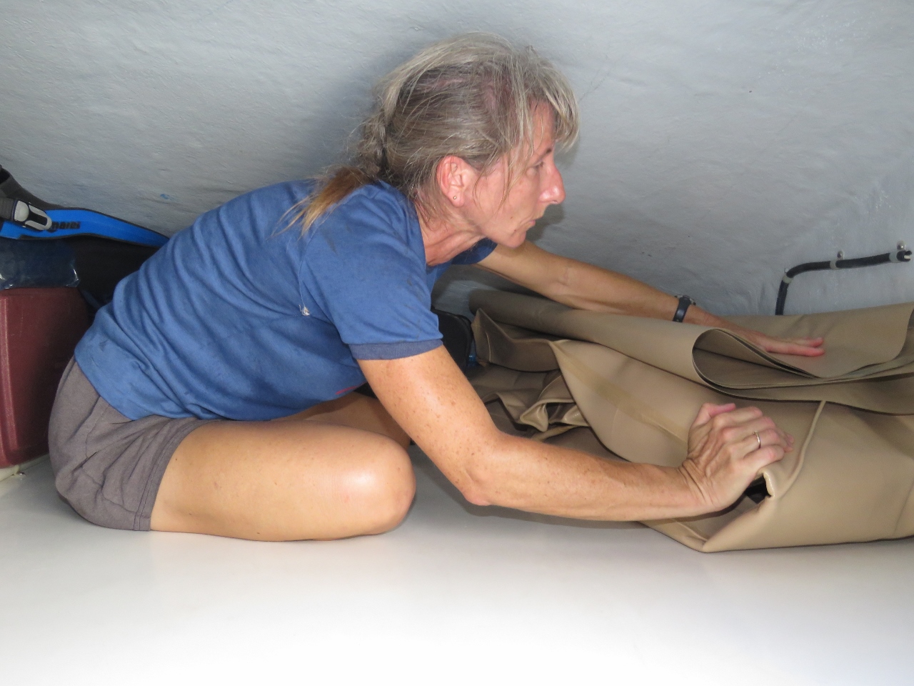 |
Stowing
Position: -18 43.37, -9 28.30
Sliding the forward bladder into storage in the flybridge brow. We’re not sure when we’ll use it again.
|
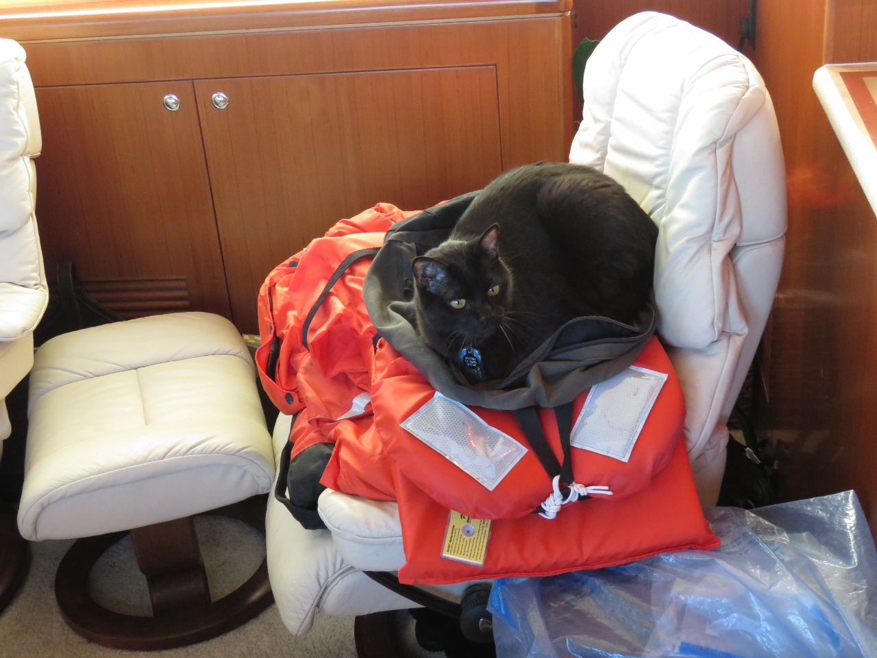 |
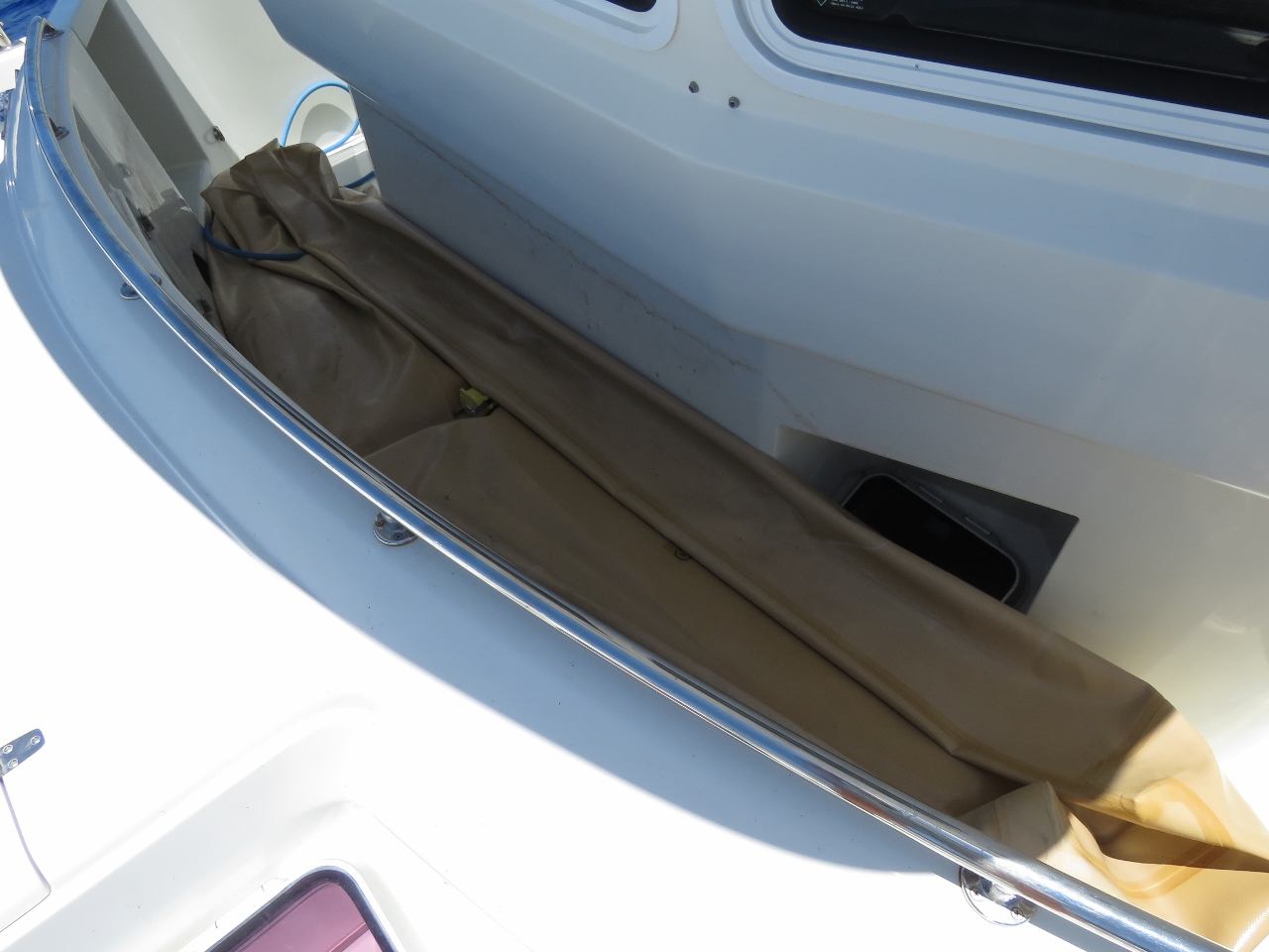
Ditch bag
Position: -19 0.83, -9 19.02
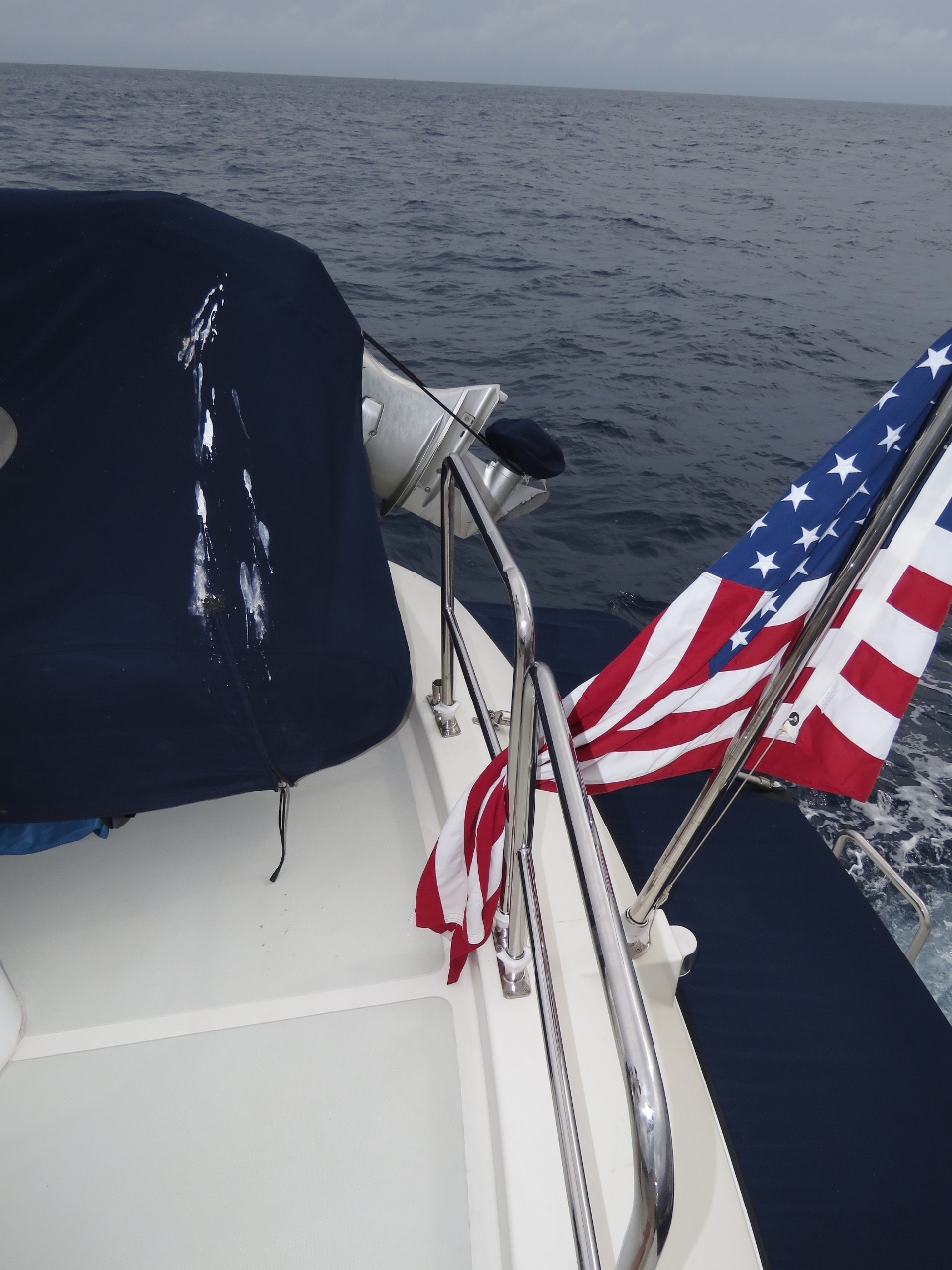
Spitfire apparently had some safety concerns and is preparing to abandon ship. Here he is ready to go on his ditch bag: a knapsack secured to an offshore lifejacket to make a sort of raft. Underneath it are our two Mustang 2175 exposure suits.
|
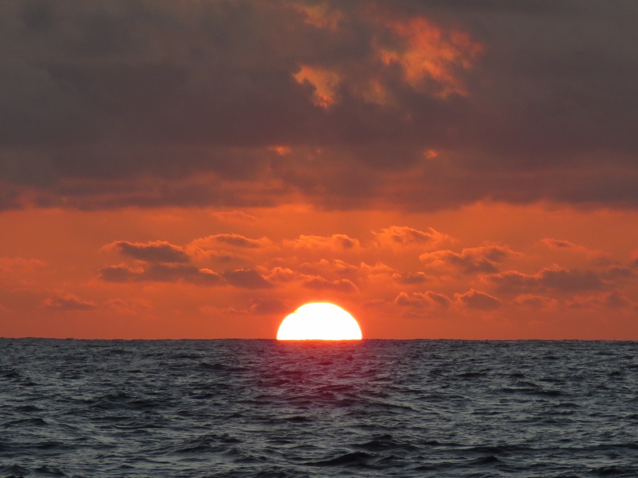 |
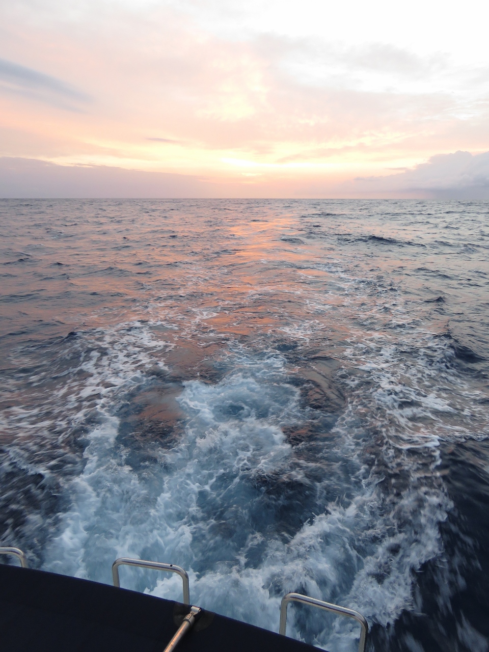
Sunset
Position: -19 4.28, -9 17.19
We had a beautiful sunset tonight, with a major green flash as it set. Sunsets like these always remind us of our many sunsets watched from the Halekulani in Waikiki.
|
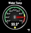 |
99.9
Position: -19 22.01, -9 7.96
The water temperature as we near the equator is an incredible 99.9°F–this is the most we’ve ever seen. A reading shortly after this had 100.0°F.
|
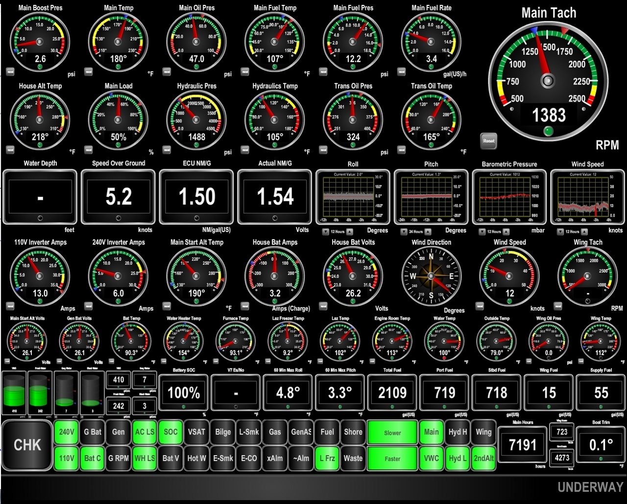 |
Slow
Position: -19 26.30, -9 5.67
We’ve hit some major negative current and have reduced RPM to below 1,400 to continue to meet our fuel economy goal. we’re only doing 5.2 kts now, at 1.54 nm/gal. The good news is that conditions are so calm, with max roll at 4.8° and max pitch at 3.3° over the past hour, that we hardly care about the speed. The boat is running well, and we’re getting plenty of sleep and generally enjoying the trip. We’ll just get there when we get there.
|
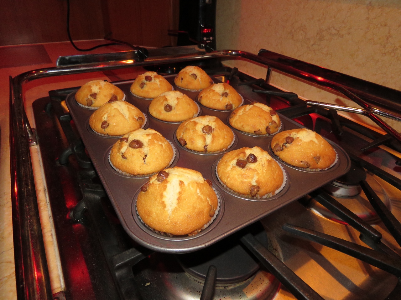 |
Muffins
Position: -19 51.60, -8 52.03
Fresh-baked chocolate chip muffins for breakfast.
|
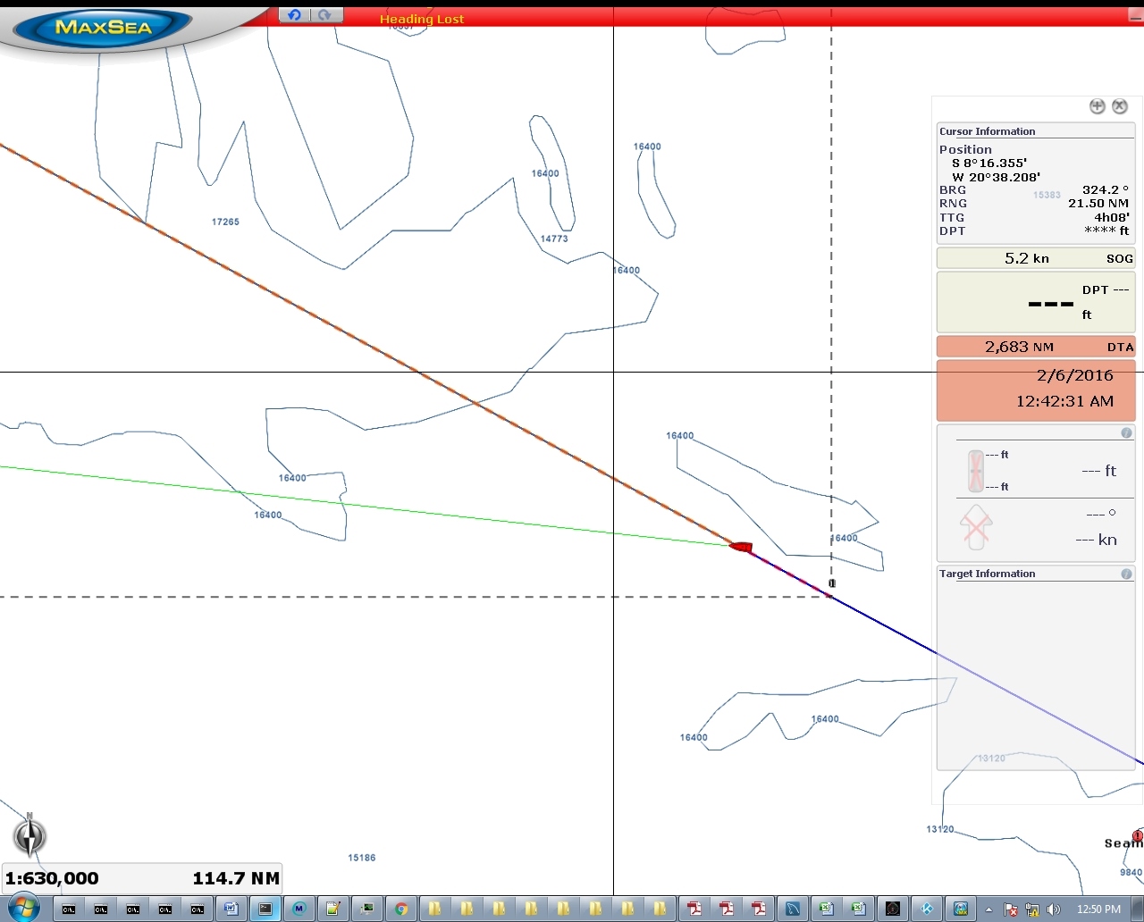 |
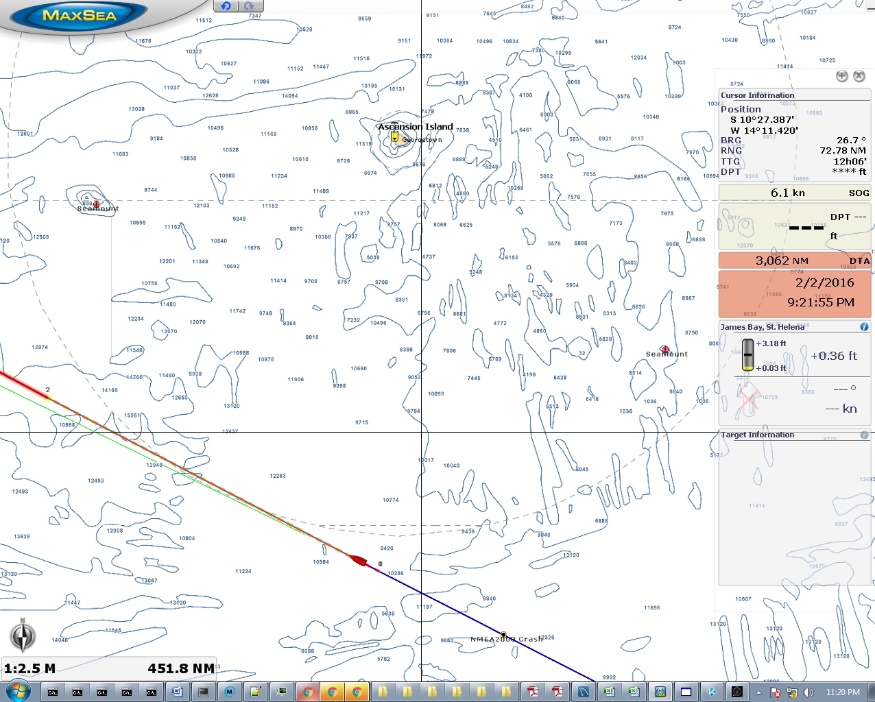
Heading lost
Position: -20 16.15, -8 38.97
That red band across the top of the MaxSea display indicates heading data has been lost. Our SC-30 satellite compass stopped producing heading data a couple of times over the past day or so and it’s starting to happen more frequently. This isn’t a big deal from a navigation perspective as we can just flick a switch at the dash to change over to a solid-state compass for the autopilot heading to keep NAV mode functioning. Further investigation shows that the weather station is failing at the same time the SC-30 is losing heading information. Once in the past we had an SC-30 problem that ended up just being a NMEA 2000 network traffic pattern that it didn’t like. That one was fixed by changing the transmission rate of the Maretron ACM100. So for this one, we know that it could just be the SC-30 not dealing well with current network traffic, or it could be the weather station failing, or it could be the SC-30 actually is having a problem itself. When you only have a fault every 4-6 hours, it’s really a challenge to isolate the real problem.
|
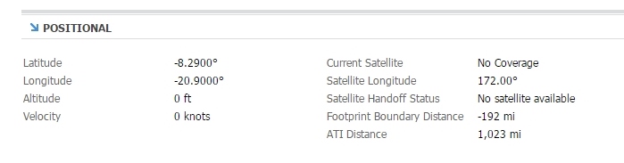 |
Footprint boundary distance
Position: -20 44.33, -8 23.70
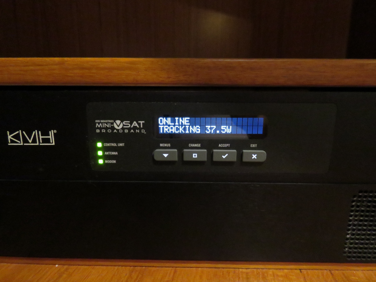
We’re 192 miles from the coverage area for our of our always-on KVH mini-VSAT satellite data system. This is just under 1.5 days away at our current speed of 6 kts. We usually have to be well within the coverage area to actually connect, so we’re expecting to be off BGAN and back on mini-VSAT in closer to two days. We’re really looking forward to that. BGAN works well as a backup, but we really miss an always-on connection and, although no satellite data is cheap, few are as expensive as BGAN. Since leaving the mini-VSAT coverage area two weeks ago, all of our web site updates underway have been “blind”, with minimally-sized images, to reduce data transfer costs. It will be nice to actually see the web site again, upload larger-resolution images, and re-enable automatic real-time position updates as well.
|
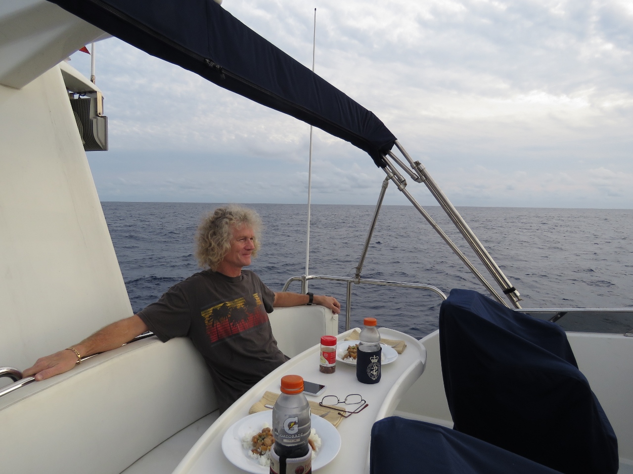 |
Dinner
Position: -20 57.95, -8 16.31
Dinner on the flybridge as we enjoy the wonderfully calm conditions. The seas are amazingly smooth.
|
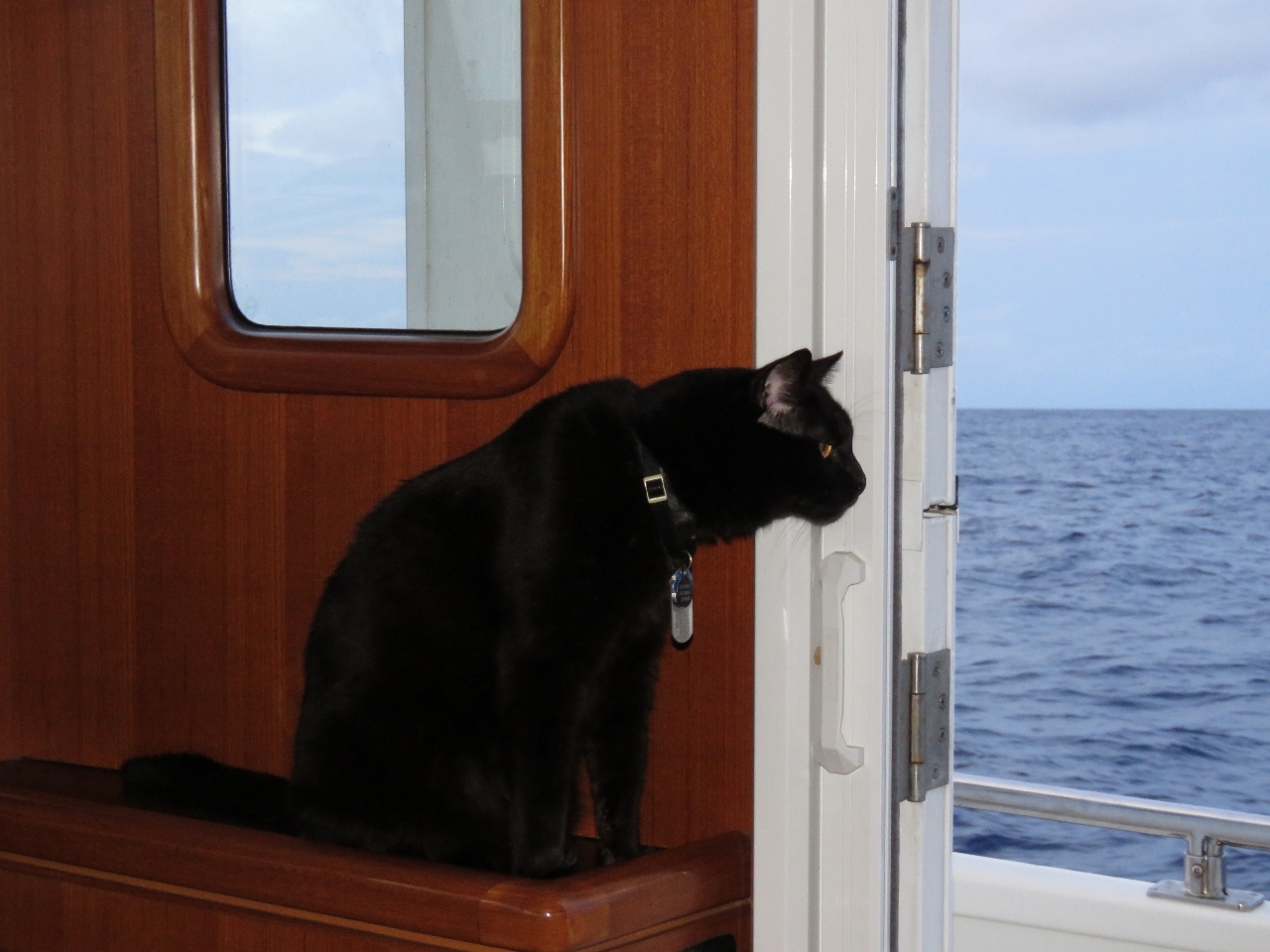 |
Outside
Position: -21 1.50, -8 14.39
We usually have the doors shut and the A/C running, but have them open in the cooler evening. Spitfire spent about 10 minutes smelling outside from beside the door, then stood just outside the door for another 10 minutes trying to decide if he wanted to walk down to the cockpit. Possibly he still remembers the paw-soaking he got on the Indian Ocean crossing. He eventually decided on a shorter walk around the Portuguese bridge and back in the other door.
|
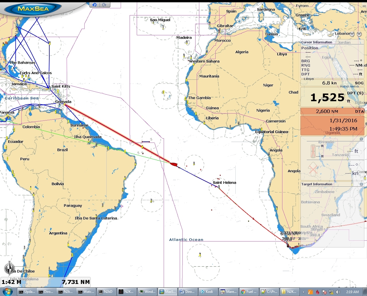 |
2,600 to go
Position: -21 26.83, -8 0.30
In the week since leaving St. Helena we’ve covered 1,050 miles and now are “only” 2,600 miles from Barbados. Since leaving Cape Town 3.5 weeks ago, we’ve travelled 2,763 miles. Our average speed on this leg from St. Helena has been 6kts with a fuel consumption of 662 gallons, yielding a fuel economy of 1.56nm/gallon. We’ve drained the 360-gallon forward deck bladder and are still carrying 2,029 gallons of diesel. We normally use a 200-300 gallon reserve, since we know the fuel levels on the boat fairly accuratetly. But on longer runs, with more potential for issue, we often at least start with greater reserves. With a 400-gallon reserve, we need to make 1.6nm/gallon. If we reduce the reserve to 300 gallons, we need to make 1.51nm/gallon.
|
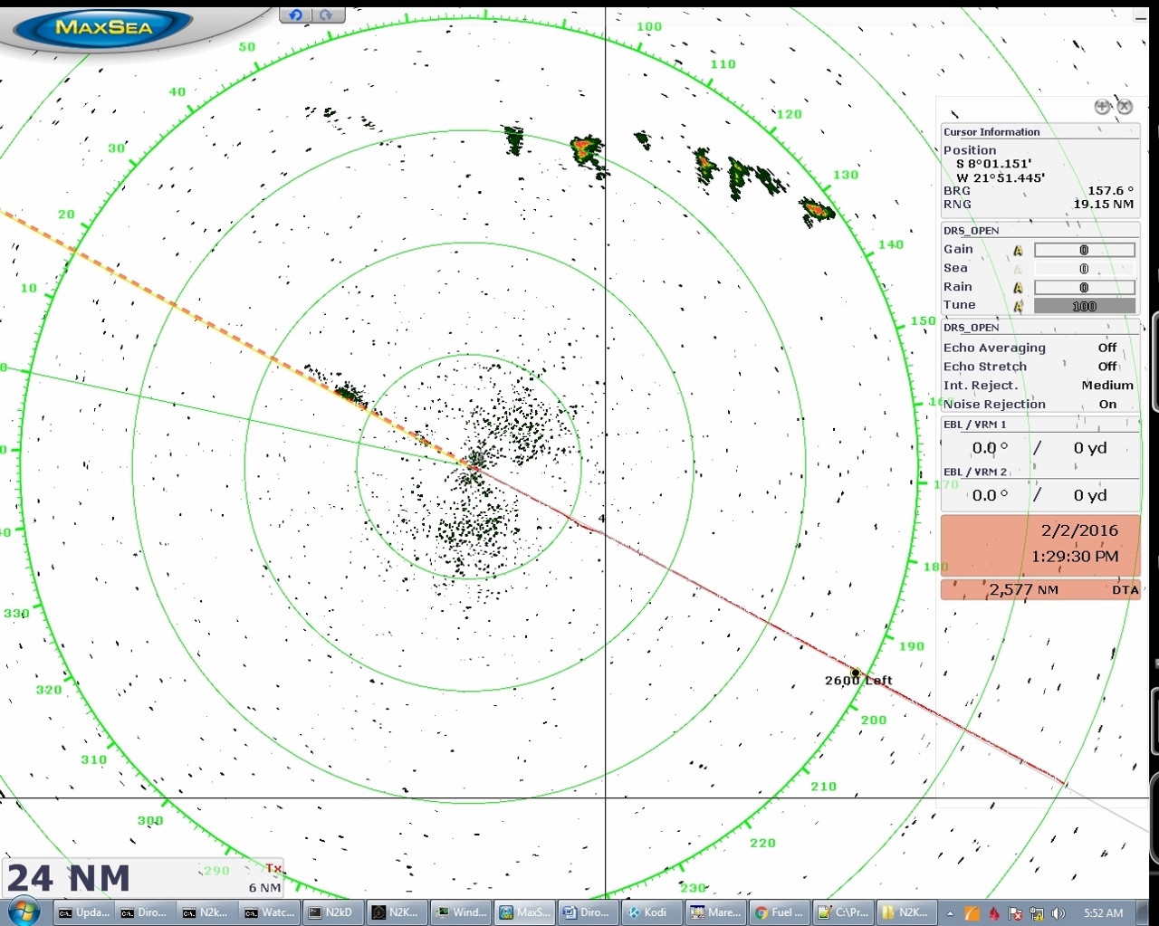 |
Storm system
Position: -21 47.18, -7 49.29
A storm system is showing up clearly on the radar to the northeast and a smaller system is directly in front of us. If anything, these systems bring a bit of rain, but not much wind.
|
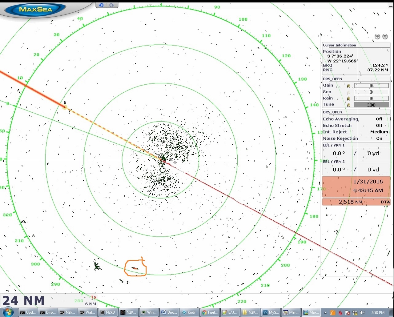 |
Ship
Position: -22 39.41, -7 21.19
We spotted another ship on radar today (the circled target to our SSW). It never got closer than about 17nm, so we didn’t pick up an AIS transmission.
|
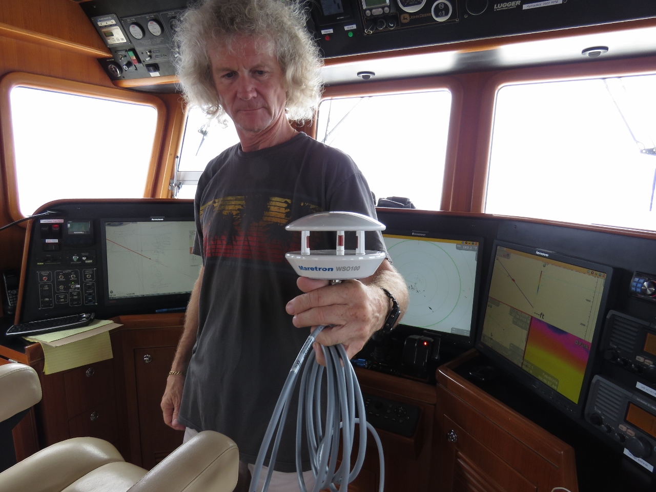 |
Weather station
Position: -22 43.52, -7 19.00
We’re continuing to debug the intermittent SC-30 lost heading issue. It’s challenging because it only happens a couple of times a day and, during those periods, it continues to send heading and position PGNs, but the heading PGNs have no data. The weather station is glitching at the same time, so here we are trying a spare weather station. It could be the weather station is faulting and causing the SC-30 to not send heading. Or it could be the SC-30 is faulting and causing the weather station to not send weather data. Or it could be unrelated to either one of them and the same external issue is causing intermittent failures on both these devices. The joys of debugging integrated electronics.
|
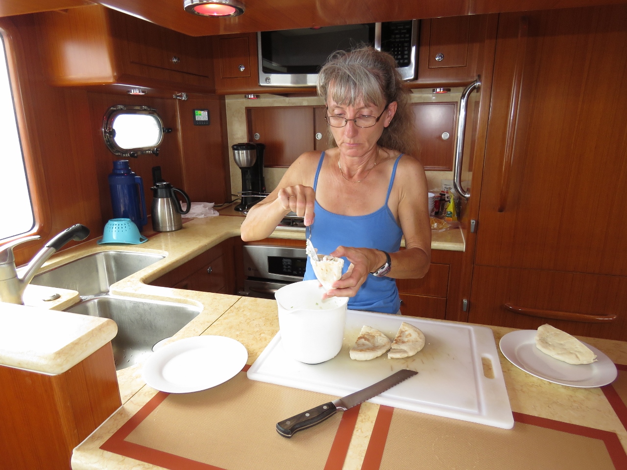 |
Lunch
Position: -22 48.56, -7 16.36
Shrimp-salad pita pockets for lunch. The placemats on the counter are non-skid silicon baking mats. We use them throughout the galley, inside the micowave and on the pilothouse settee table to keep loose items from shifting when at sea. The mats look slightly better than the non-skid liner we use in our lockers, and are thin, so items can rest partway on the mat. See Heavy Weather Preparation for other preparations we make when going to sea.
|
 |
Dolphins!
Position: -22 58.53, -7 10.85
A pod of perhaps 30 dolphins descended on the boat this afternoon and played in our bow wake, leaping and swerving. We spent ages enjoying the show.
|
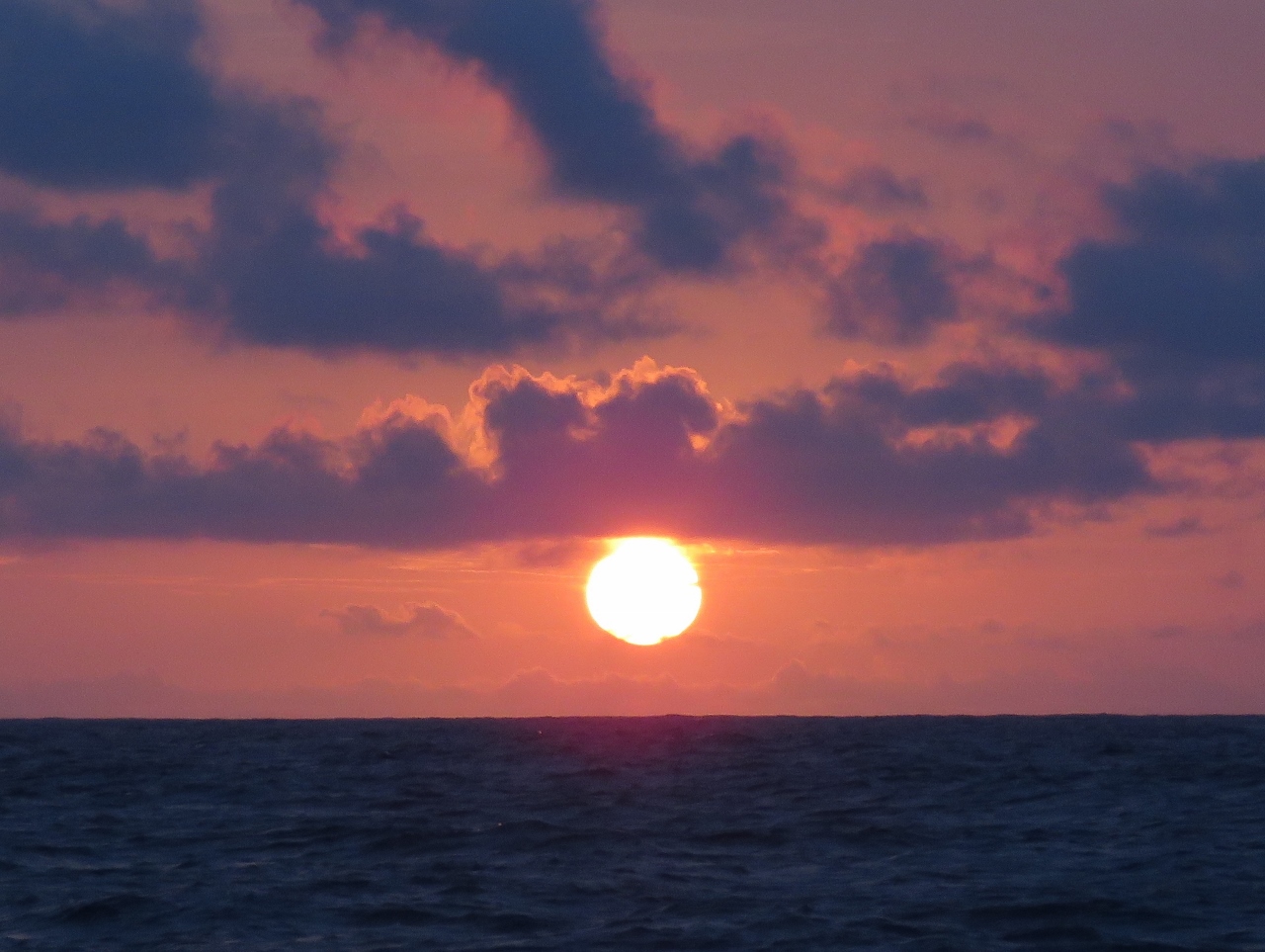 |
Sunset
Position: -23 17.15, -7 0.31
Another beautiful sunset at sea.
|
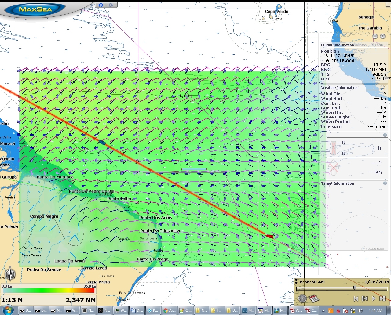 |
Conditions
Position: -23 37.74, -6 48.65
Conditions remain excellent, with winds 10-15 from the SE, and boat roll and pitch as close to zero as you’ll find in open ocean. Over the course of the past hour, the most we’ve seen from the “worst” wave is 3 degrees pitch and 5 degrees roll. And our speed has increased to 6 knots with a fuel economy of over 1.6m/gallon. Conditions should remain this way for the next week or so, but the weather models indicate they will deteriorate somewhat to 15-20-kt winds with 5-7ft seas on 7-8 seconds on the beam as we cross the equator and get into the northeast trade winds. The red boat icon shows our current position and the blue boat icon our expected location and weather for Jan 26th.
|
 |
Booby prize
Position: -24 34.07, -6 18.14
Some boobies rode on Dirona last night and left us a present all over the flybridge and boat deck. Nice.
|
 |
Woohoo!!!
Position: -24 53.45, -6 7.44
We entered the coverage area for our of our always-on KVH mini-VSAT satellite data system yesterday and have been watching it try unsuccessfully to log on since. It connected just now and has been rock-solid ever since. It’s sooo nice to have it back.
|
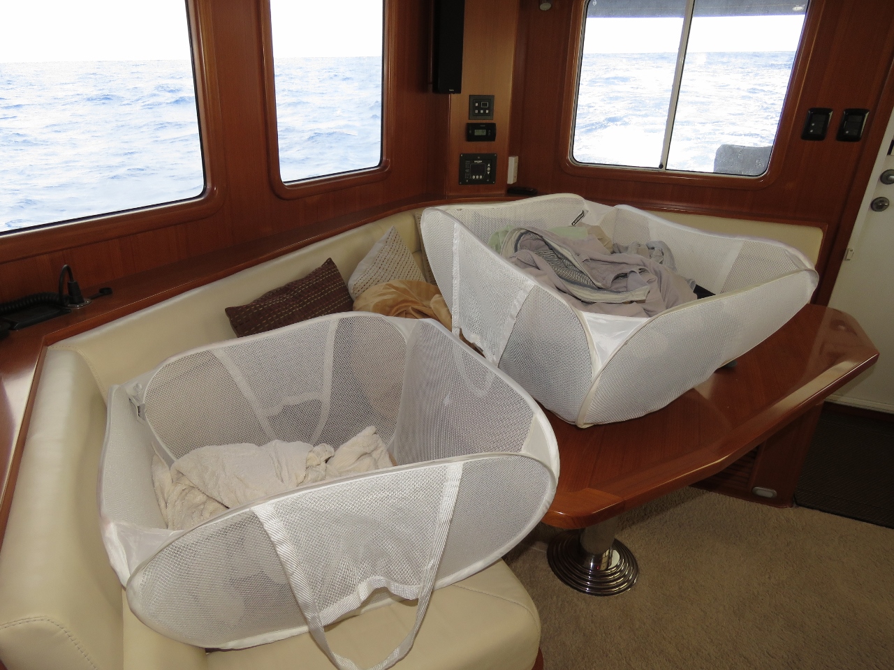 |
Laundry
Position: -25 9.63, -5 58.50
On the primary water tank, we carry 415 gallons. We only let it get down to 125 to 150 gallons before making water and filling it back up. If we have an uncorrectable water maker problem, we’ll still have more than 100 gallons of fresh water. On longer trips like this one, we’ll make water to refill at something closer to 200 gallons. Since laundry is a big water consumer, we often do it on the day we’re replenishing the water tanks. Then we can flush the water maker and shut it down for a week or so before repeating.
|
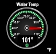 |
101 degrees
Position: -25 36.58, -5 43.58
The water temperature is an incredible 101°F.
|
 |
Sunrise
Position: -26 21.14, -5 18.78
Sunrise with our wake trailing behind us. Conditions remain excellent, with average winds below 15kts.
|
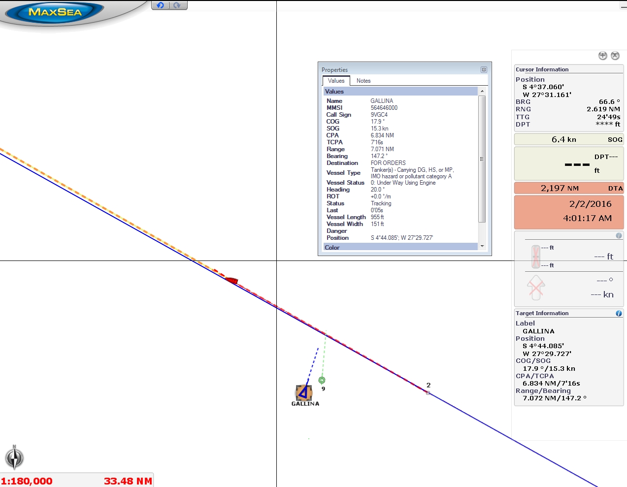 |
Gallina
Position: -27 22.37, -4 44.49
The 955ft tanker Gallina passed about seven miles behind us heading north.
|
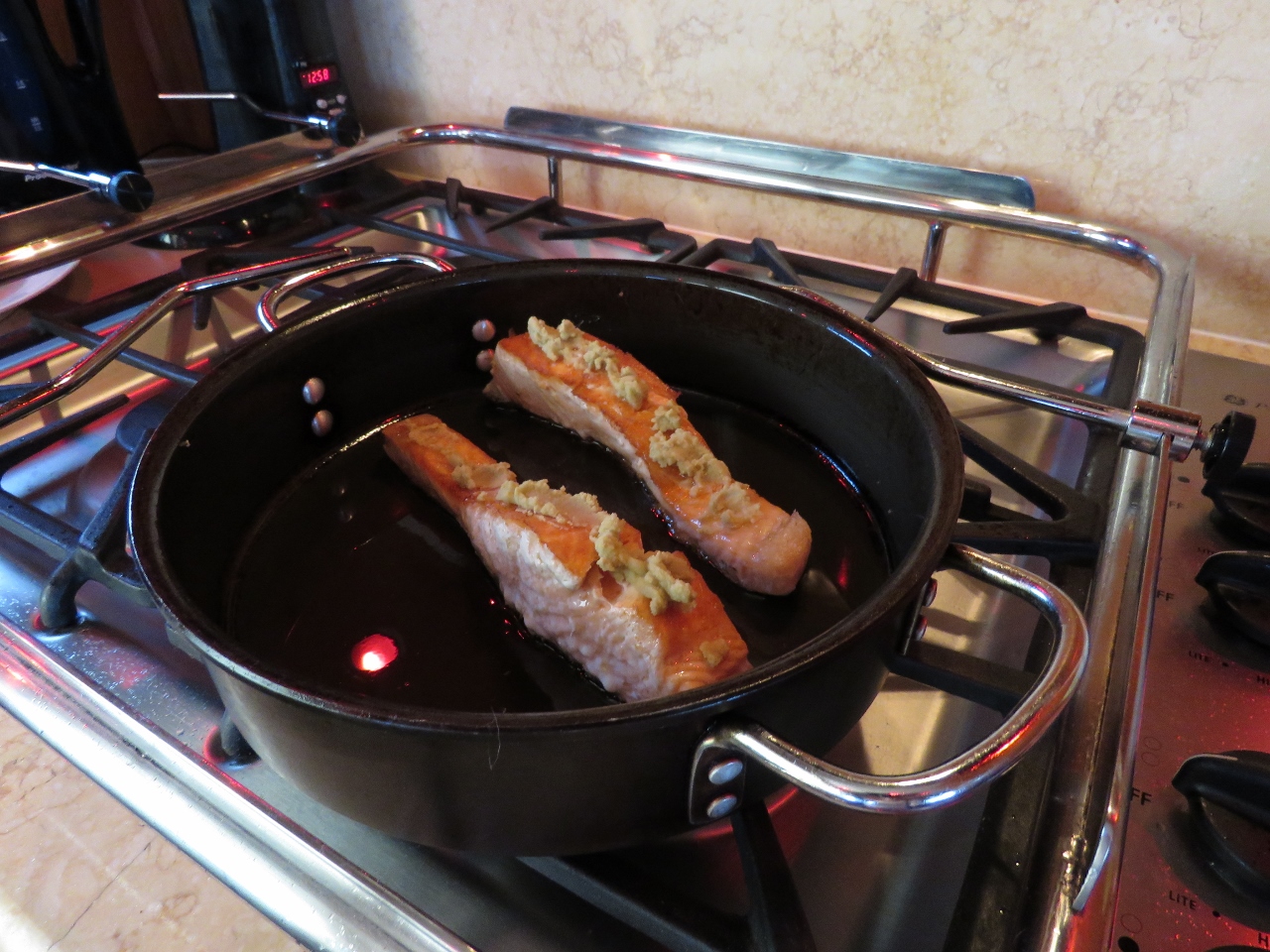 |
Wasabi salmon
Position: -27 27.61, -4 41.52
Sear-roasted Wasabi salmon for dinner. We’re definitely not starving on this trip. :)
|
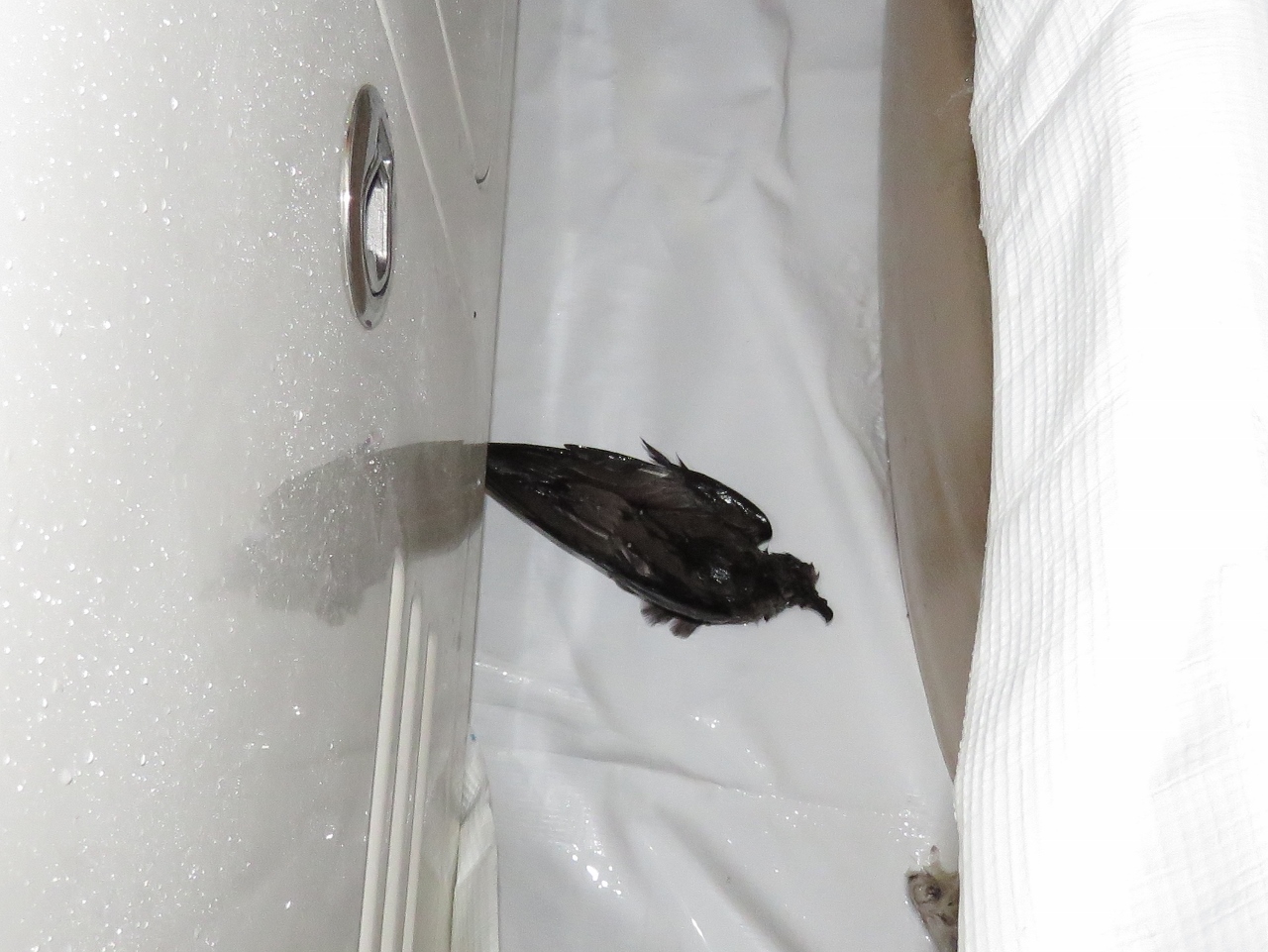 |
Dead bird
Position: -27 33.30, -4 38.26
We found a dead bird between the starboard bladder and the cockpit propane locker. It may have hit the boat and died, or it could have just been sick and seeking shelter.
|

|
Click the travel log icon on the left to see these locations on a map, with the complete log of our cruise.
On the map page, clicking on a camera or text icon will display a picture and/or log entry for that location, and clicking on the smaller icons along the route will display latitude, longitude and other navigation data for that location. And a live map of our current route and most recent log entries always is available at http://mvdirona.com/maps. |
If your comment doesn't show up right away, send us email and we'll dredge it out of the spam filter.
James,
There is a photo you took of 101F (38C) Sea Water temperature. I looked at the latest NOAA Ocean Observations
http://www1.ncdc.noaa.gov/pub/data/oisst/navy-sst-bb.gif
In your area NOAA reports nothing like 38C (more like 28C) so I am wondering about this discrepancy. Do you think 101F was just a local eddie or was this a consistent temperature across a period of time?
Its easy to worry about stuff like this as it is sea surface temperature that drives weather events (like hurricanes) and 38C seems off the chart to me.
Hope all else is well.
Peter Le Lievre
You and NOAA are correct. I mentioned this in comments elsewhere but I mention it again here since you asked about it. As much as I love and rely on redundancy. There are rare times when things still fail and this is one of them. Both sensors are being displayed inaccurately. I dipped a bucket and took reading from several different thermometers and it’s actually 86F. The Maretron sensor is reading 15F high. The Furuno sensor is reading correctly and transmitting the right data on the NMEA2000 bus but, on NMEA, we only use the Maretron sensor. Further obfuscating things, the Furuno depth sounder temperature display is stuck on 101F which just happens to match the error in the Maretron sensor at this temperature. I’m now using the NMEA data from the Furuno system, ignoring the Furuno display, and have recalibrated the Maretron sensor but I’m not only using it as a backup.