
Horizontal Falls are two narrow gorges about 300m apart that connect two saltwater basins. As the tide goes up and down outside in Talbot Bay, water can’t flow in or out of the basins fast enough to keep up. The result is extreme tidal currents and waterfalls sometimes several meters high on large tidal exchanges. Here’s a picture of what the flow can look like.
From the Prince Regent River, we headed directly for Horizontal Falls, stopping only to overnight at a couple of anchorages along the way. We’d timed our arrival at Horizontal Falls around high water on a spring tide and were able to run the tender through both sets of rapids. Even near high water, the inner rapids were turbulent, with several-foot overfalls. After the exploring the Horizontal Falls area, we spent some time in incredibly scenic Dugong Bay nearby.
Trip highlights from June 17th through 19th follow. Click any image for a larger view, or click the position to view the location on a map. And a live map of our current route and most recent log entries always is available at http://mvdirona.com/maps
 |
Hanover Bay Inlet
Position: 124 46.48, -15 18.89
After exiting the Prince Regent River, we made a quick run around the corner to Hanover Bay Inlet for the night. We arrived just in time to enjoy dusk from the flybridge. This is the view at dawn the next morning, looking west to the cliffs across the inlet. Anchored below is the charter boat Discover One, who preceded us out of the Prince Regent River.
|
 |
Port George IV
Position: 124 40.74, -15 14.54
We passed through Port George IV and Rogers Strait on a 21-ft tide at White Island about 3 hours before a 31.2ft high tide on a 25ft 6-hour exchange. The current was running a couple of knots, with some upwellings around Umbanganan Island, but they weren’t difficult. The scenery all through this route was impressive, starting with High Bluff as we entered Port George IV.
|
 |
Resort
Position: 124 31.68, -15 28.09
An old pearl farm in Kuri Bay was recently transformed into a luxury resort. Although the chart showed the area littered with aquaculture, we saw little evidence of it the entire way through Port George IV and out into Camden Sound.
|
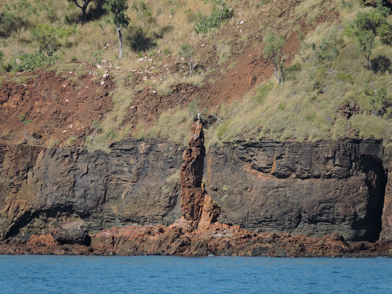 |
Needle Rock
Position: 124 29.60, -15 28.04
Distinctive Needle Rock at the South Entrance to Brecknock Harbour.
|
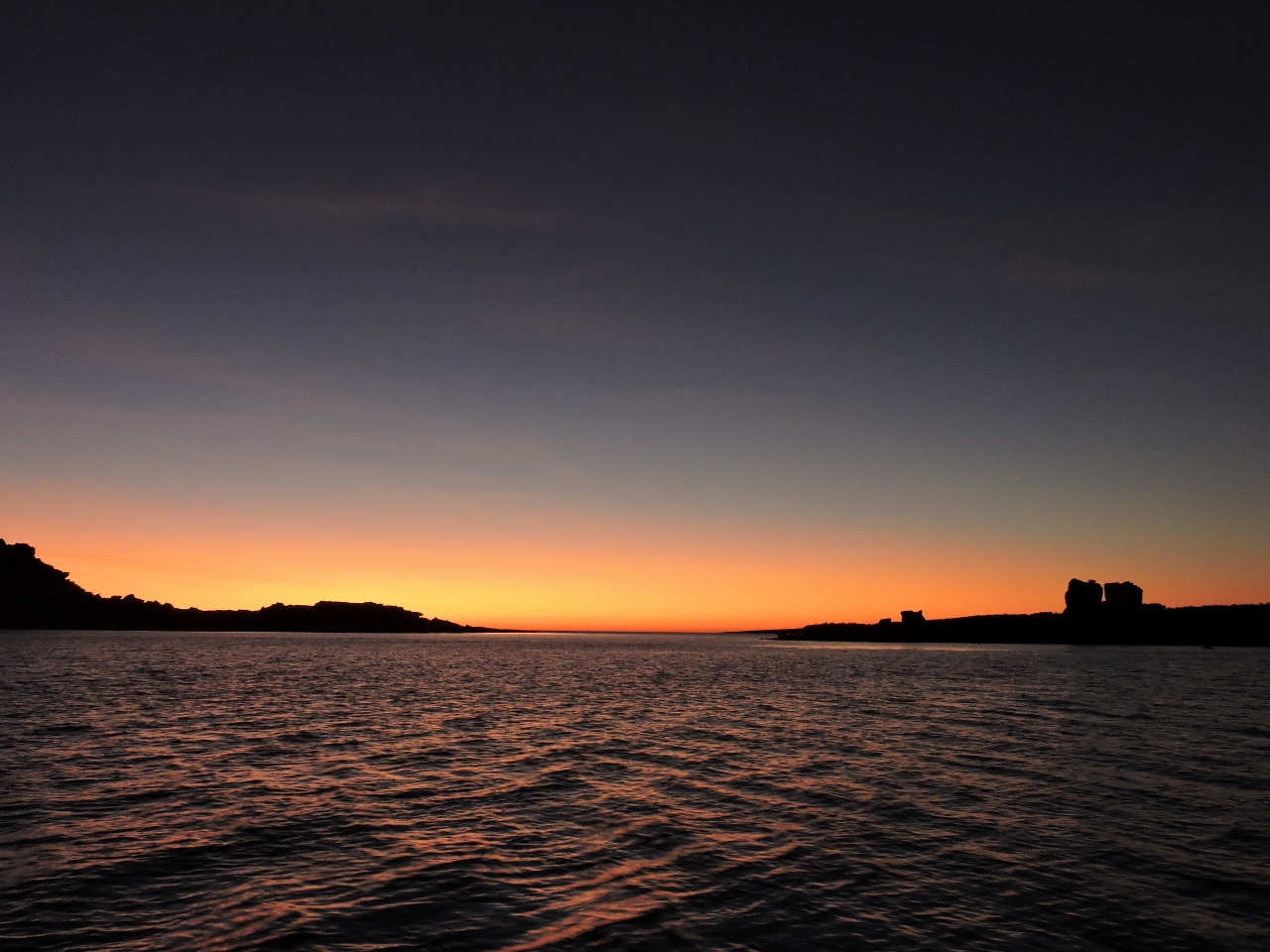 |
Claret Islands
Position: 124 23.19, -15 41.59
We checked out Deception Bay to the north as a possible anchorage, but it felt too big and open. Conditions were calm, so we continued south and instead found an excellent anchorage tucked in behind the Claret Islands. The sunset over the islets was fabulous.
|
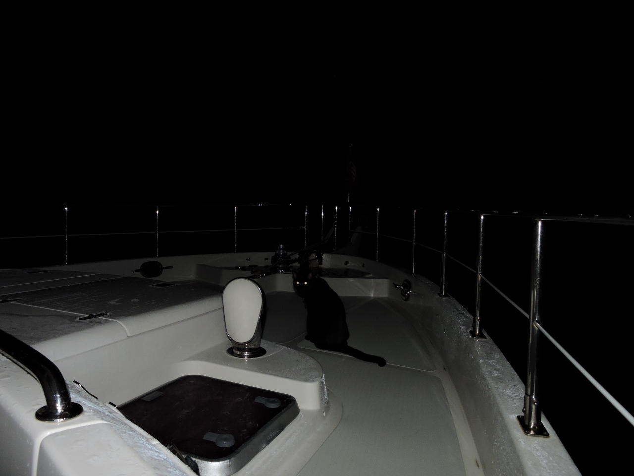 |
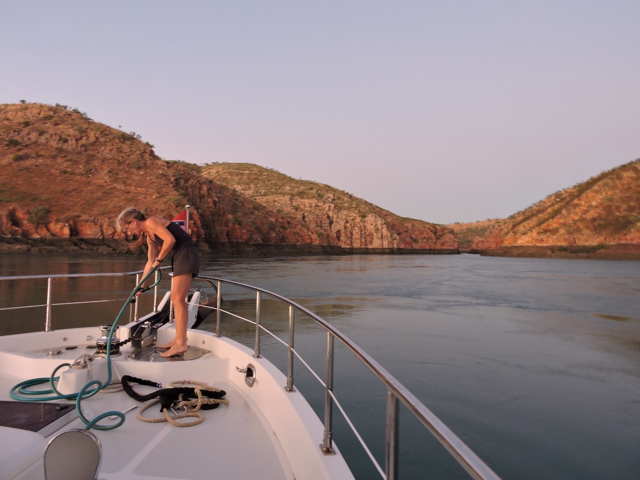
Bow watch
Position: 124 19.74, -15 43.24
Spitfire helping out with a bow watch as we leave Claret Islands before sunrise on the 62-mile run to Horizontal Falls. We want to arrive near high water, which is just past noon.
|
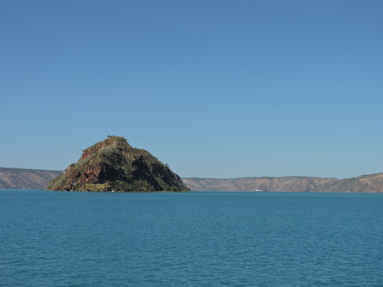 |
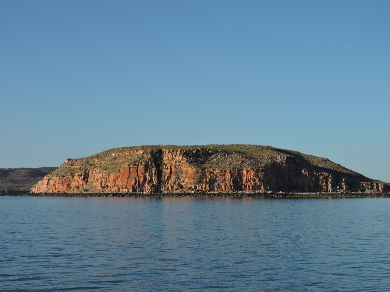
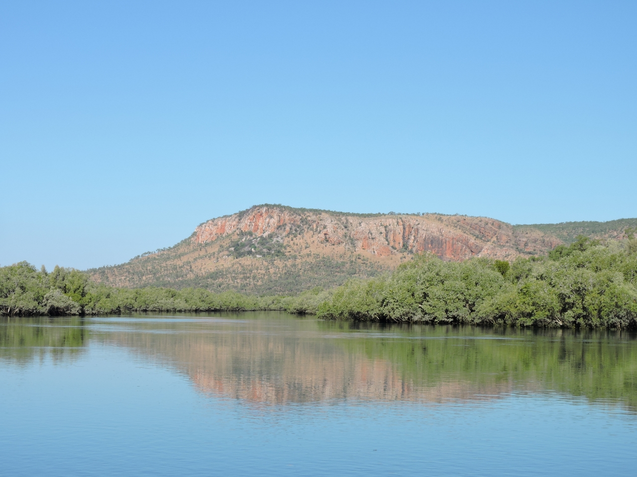
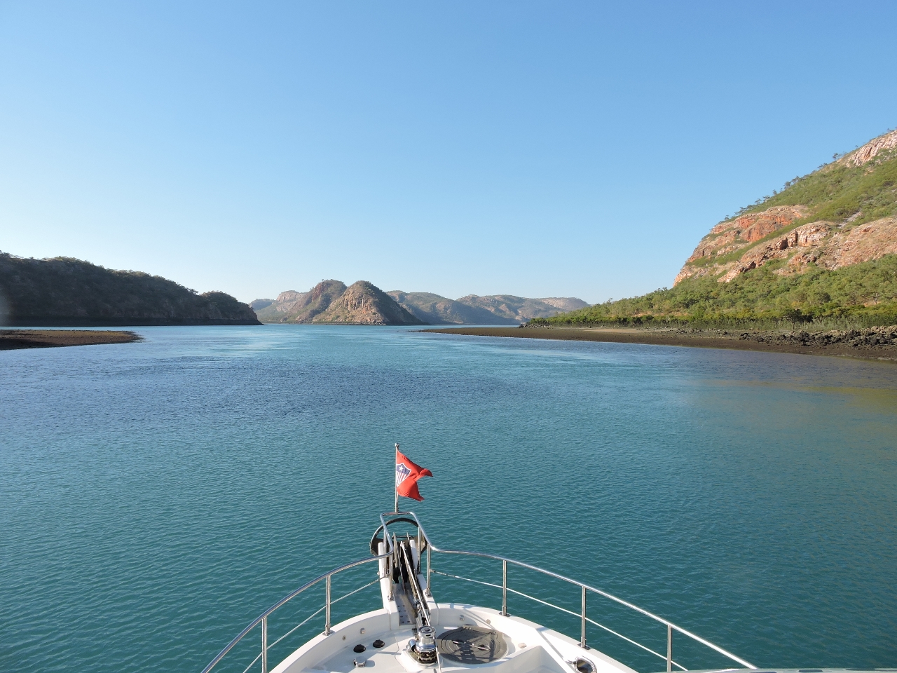
Talbot Bay
Position: 123 54.61, -16 19.15
Talbot Bay was much more scenic and dramatic than we were expecting. This is looking south towards Horizontal Falls. To give an idea of the scale, the small white speck visible in the distance to the right of Slug Island is the 297 ft (90.6m) cruise ship Caledonian Sky.
|
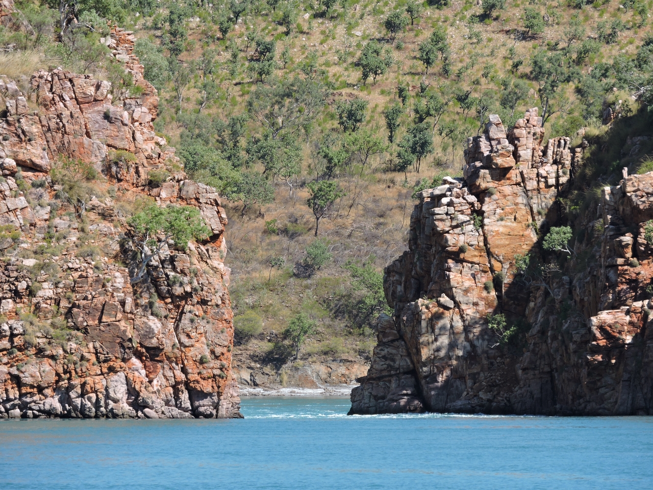 |
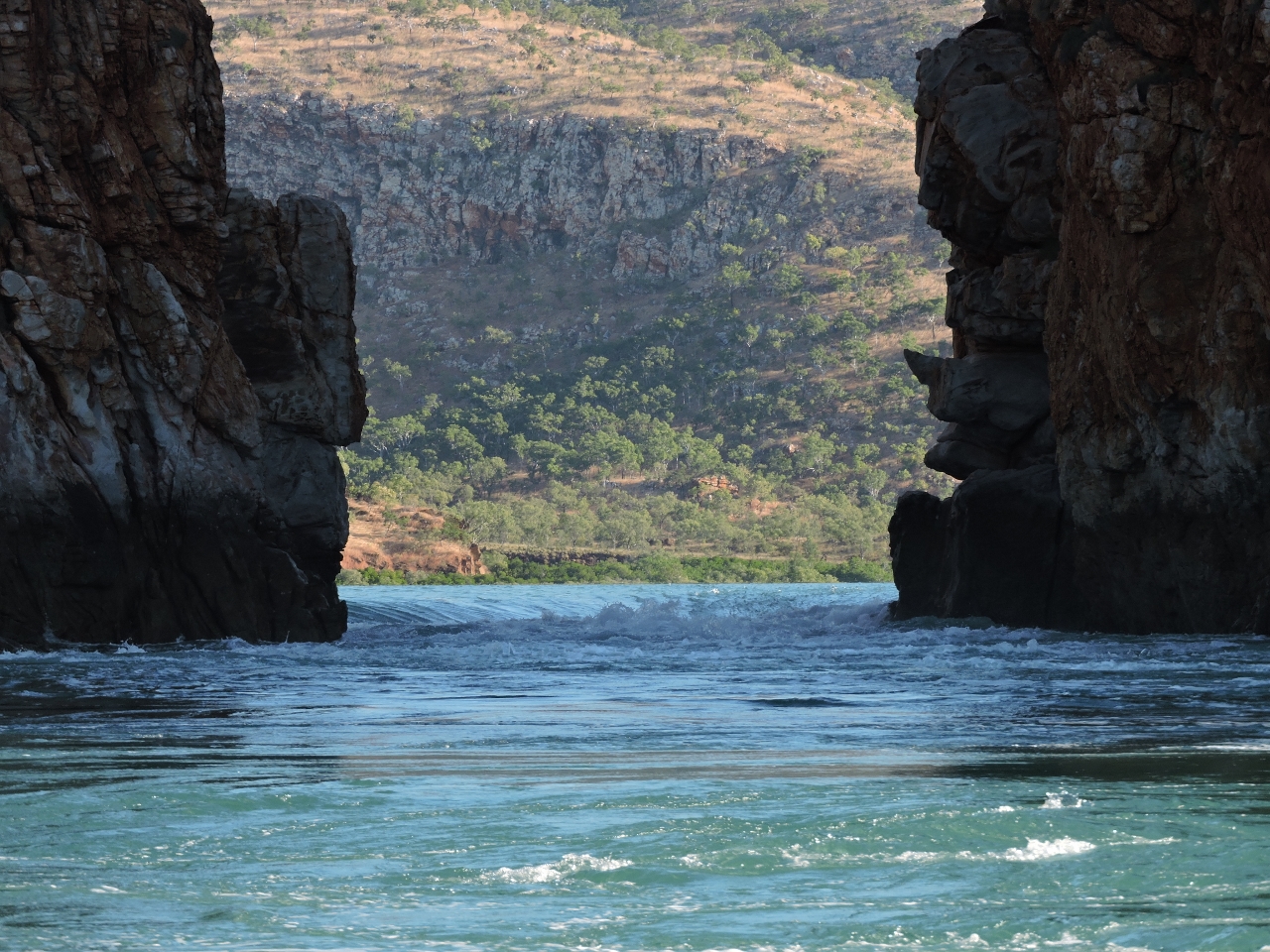
Horizontal Falls
Position: 123 57.85, -16 22.38
Looking from Dirona to the first of the two Horizontal Falls, two narrow gorges about 300m apart that connect two saltwater basins. As the tide goes up and down outside in Talbot Bay, water can’t flow in or out of the basins fast enough to keep up. The result is extreme tidal currents and waterfalls sometimes several meters high on large tidal exchanges. Here’s a picture of what the flow can look like.
|
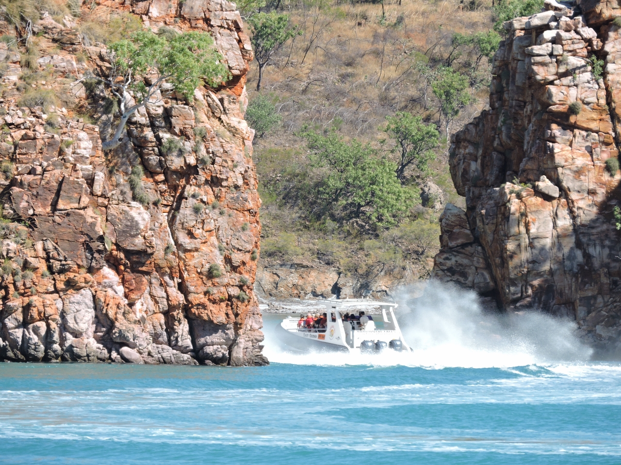 |
Tourist boat
Position: 123 57.83, -16 22.42
As we watched from Dirona, a high-speed tourist boat whipped through the opening.
|
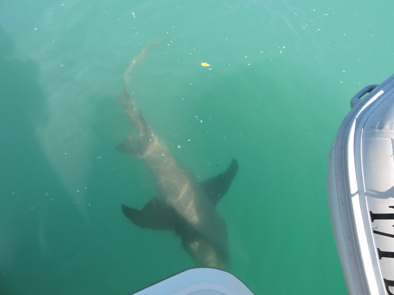 |
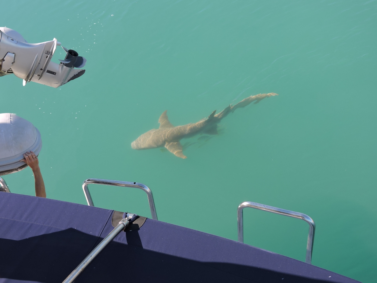
Shark
Position: 123 58.22, -16 22.19
Soon after we anchored, this large Tawny Nurse shark arrived to investigate. This breed of shark apparently isn’t particularly aggressive towards humans, but Bull Sharks are in the region, and they certainly are.
|
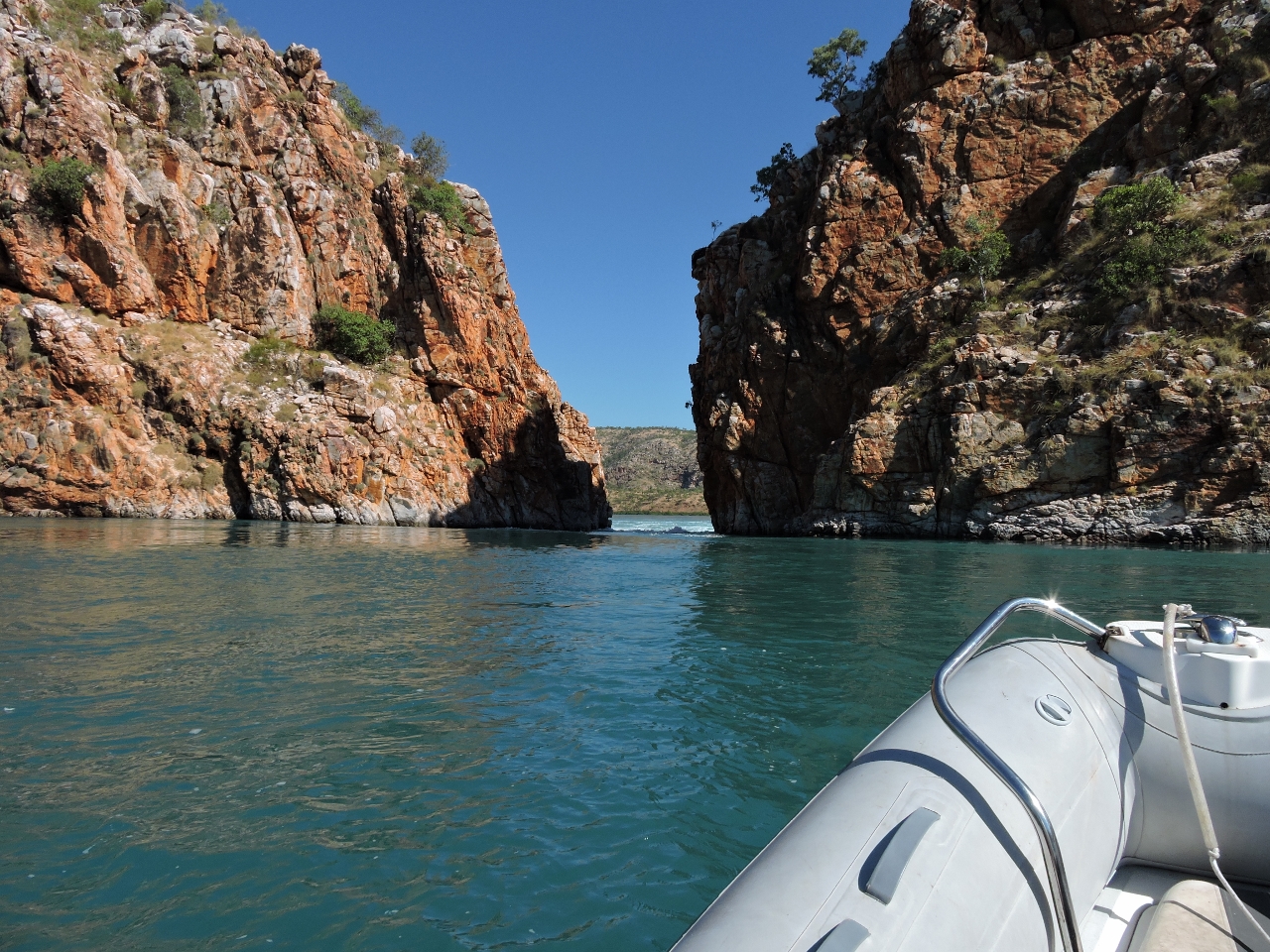 |
Through the rapids
Position: 123 57.62, -16 22.61
About 90 minutes after a 32ft (9.82m) high tide in Yampi Sound, the current was still flooding through the first gorge, but it was easily passable by dinghy. The second gorge was a different matter–the water level dropped several feet from one side to the other and the channel was a torrent. The video at https://youtu.be/xMrkCOwwsXo (2:44) shows us passing through the first gorge and arriving at the second. We watched a tour boat zip through a couple of times, then took on the rapids ourselves.
|
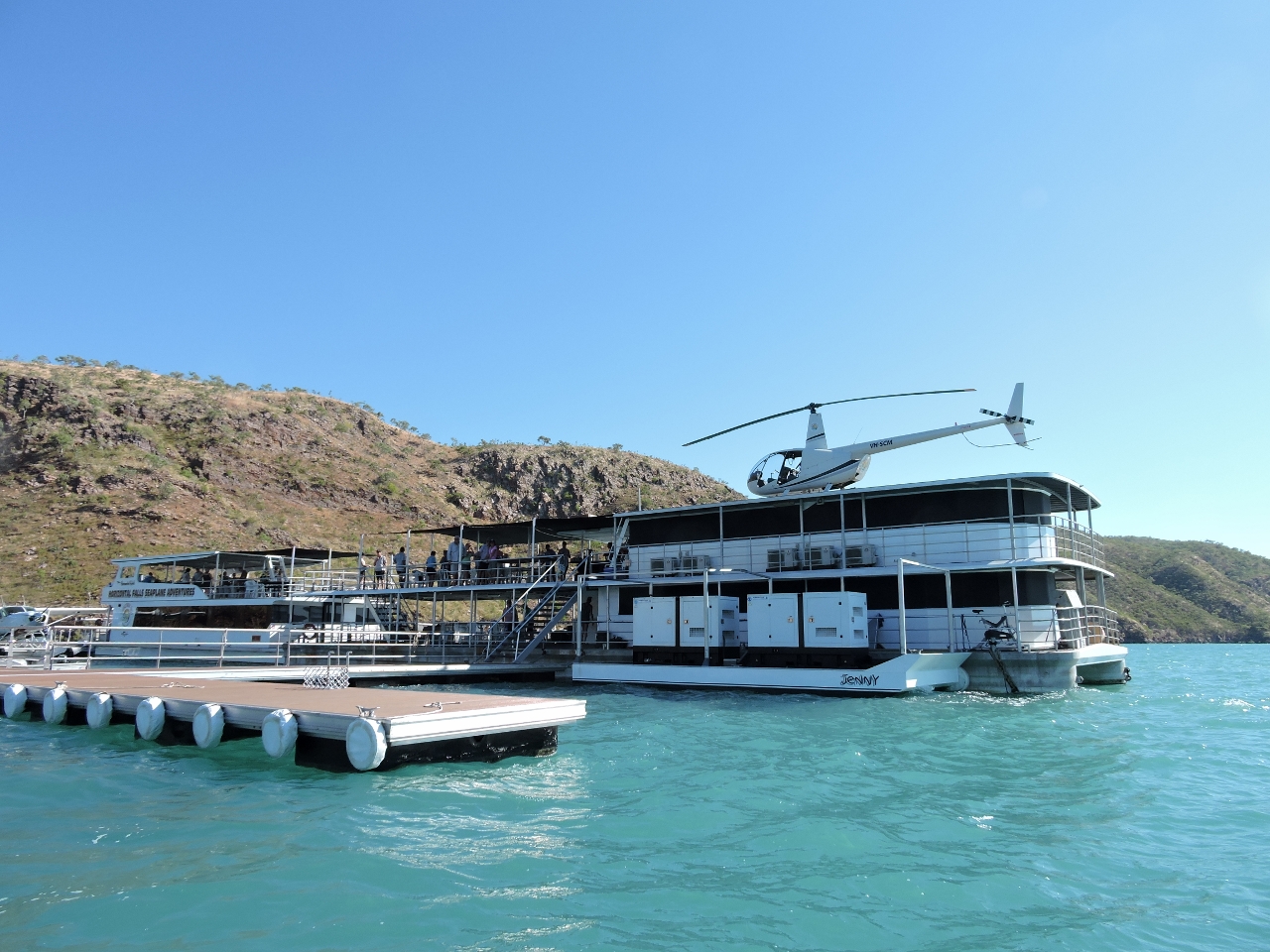 |
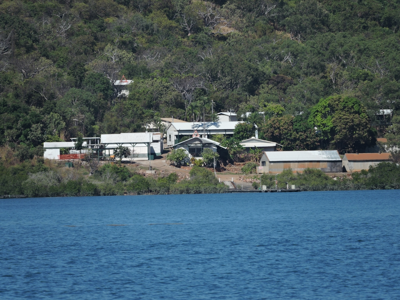
Resort
Position: 123 58.20, -16 22.45
Horizontal Falls Seaplane Adventures has a base near the falls from which they run helicopter, seaplane and high-speed boat tours. It was a busy operation–all their craft were constantly coming and going.
|
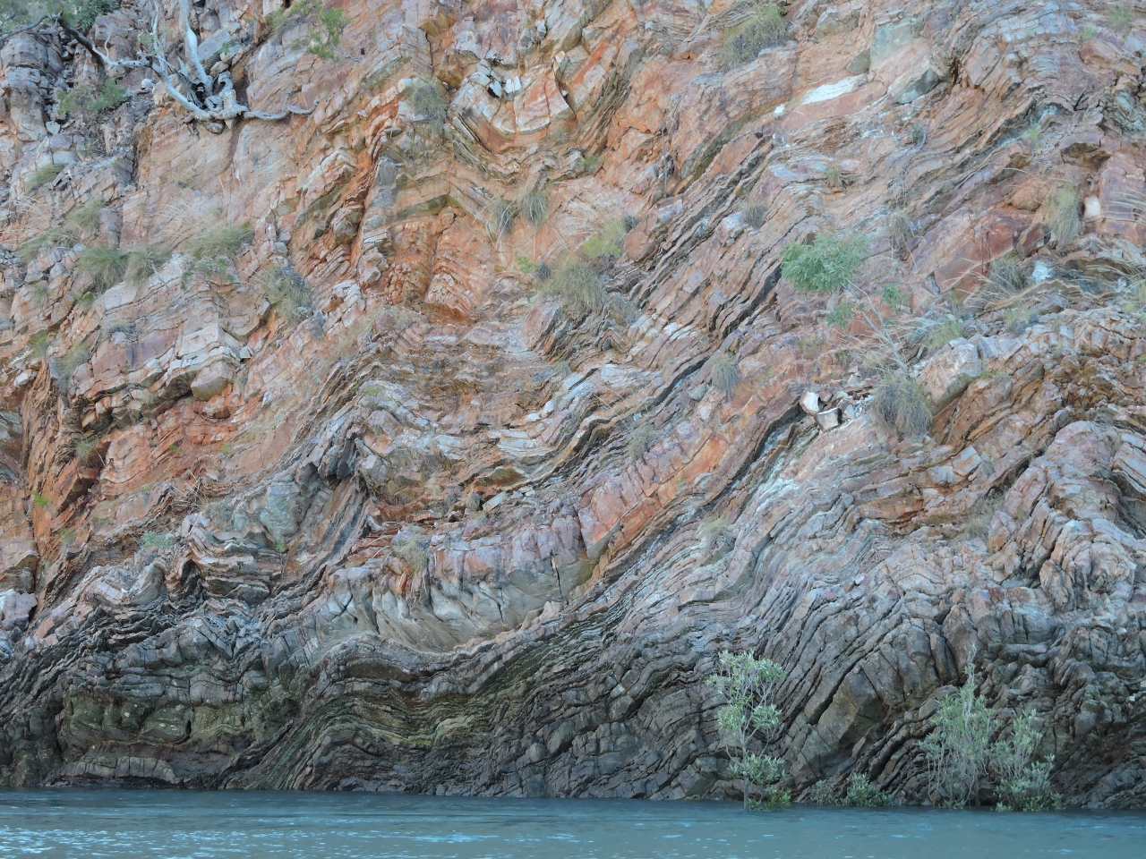 |
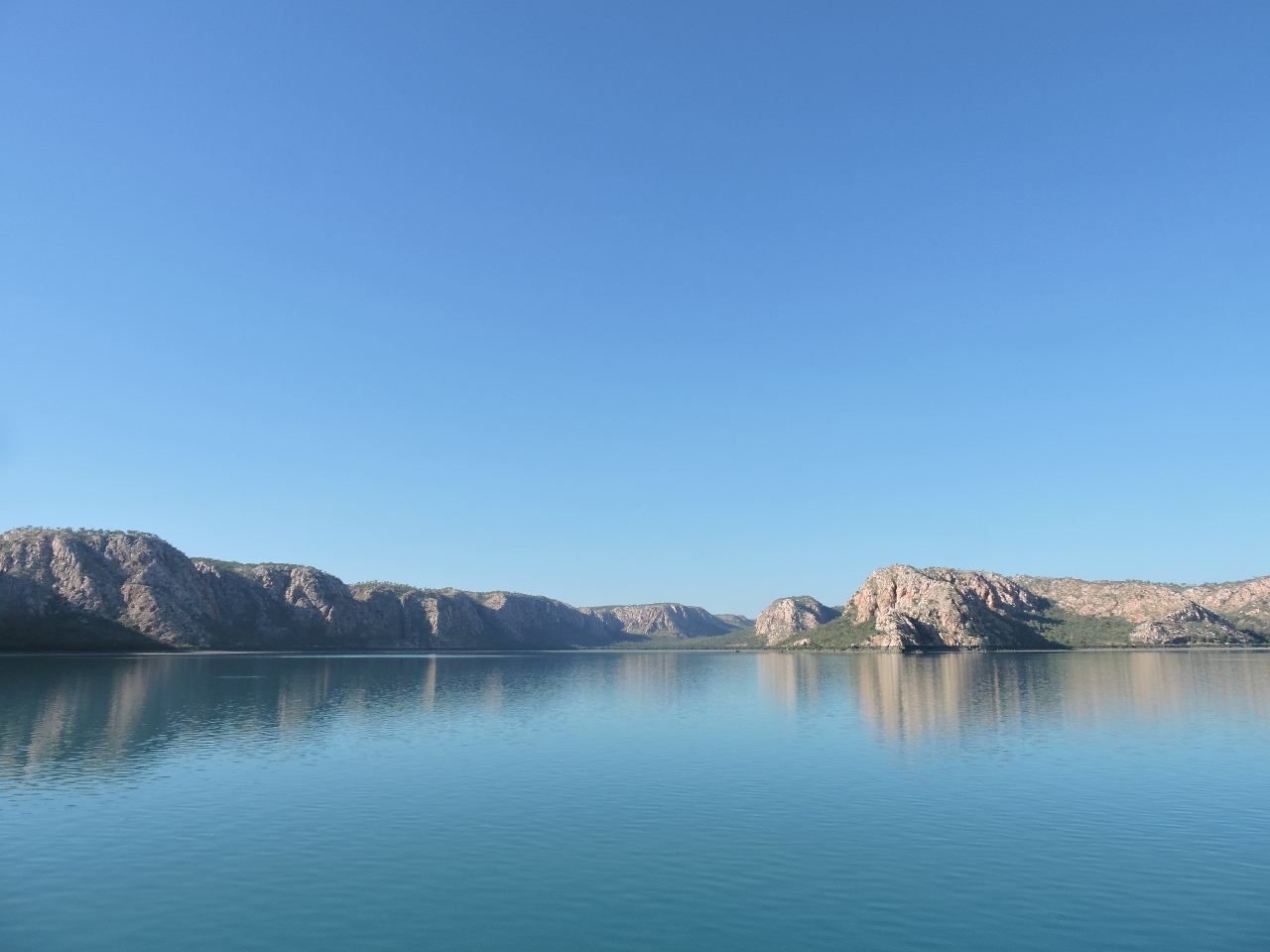
Cyclone Creek
Position: 123 59.99, -16 22.58
A strong ebb current was running at the entrance to Cyclone Creek about two hours after high water, but it had slackened notably by the time we returned back out. Just inside the creek entrance the weather has carved these striking patterns into the cliff.
|
 |
Bluff
Position: 124 1.87, -16 24.11
Cyclone Creek was quite scenic, particularly this bluff in the distance.
|
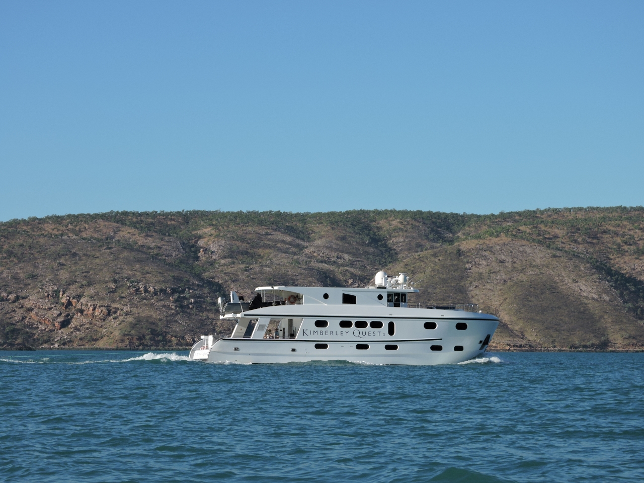 |
Kimberley Quest
Position: 123 57.21, -16 21.60
The charter boat Kimberley Quest arrived and anchored nearby. Later, one of the floating barges from the tourist base powered over and moored up against it. We think they might have been transferring fuel from the boat to the barge to support the local base.
|
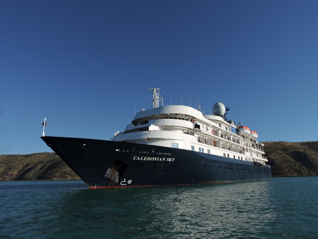 |
Caledonian Sky
Position: 123 57.05, -16 21.23
We’d last seen the cruise ship Caledonian Sky off the Hunter River. The ship had a flotilla of small zodiacs trailing astern when passed earlier. We saw many of them at the falls and up Cyclone Creek.
|
 |
Ebb
Position: 123 57.70, -16 22.52
About four hours after high tide, we took one more look at the Horizontal Falls. They were ebbing quite strongly now. We didn’t go through, but shot the video https://youtu.be/w0A0ie-L6k0 (1:10) showing the flow and of one of the tourist boats going through.
|
 |
Washdown
Position: 123 57.88, -16 22.26
Washing off the bow after raising anchor as depart Talbot Bay. The mud in most anchorages here is incredibly sticky and takes a while to wash off. We nosed over to Horizontal Falls on our way out. The ebbing flow isn’t running close to at strength, but even out here it’s really ripping.
|
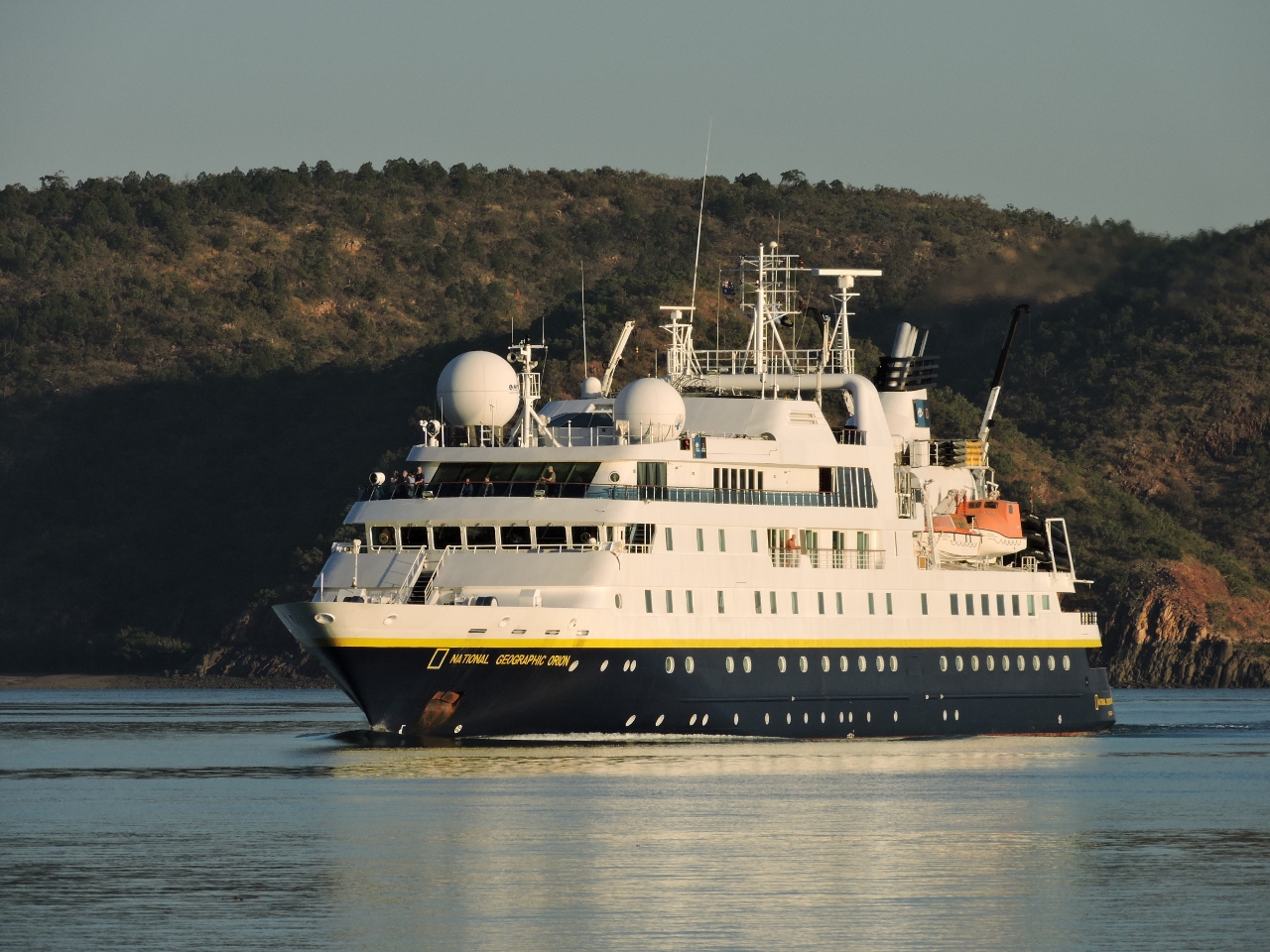 |
Orion
Position: 123 54.10, -16 18.36
The National Geographic expedition vessel Orion was entering Talbot Bay as we were leaving. Their captain radioed us to request “red to red”. Boats have red navigation lights on their port side and green to starboard, so “red to red” is a request to pass on each other’s port side.
|
|
Shallows
Position: 123 52.05, -16 19.96
We approached Dugong Bay just past low water to minimize the currents, as we were on a 26ft exchange. With 6.5ft ft of water at Talbot Bay, depths dropped to 12ft as we turned west. Altering course more to starboard gave us deeper water.
|
 |
Entry channel
Position: 123 52.48, -16 20.65
The cruising guide indicated two routes into Dugong Bay: one along the mainland shore and another farther east. We took the first and the minimum depth we saw through the channel was 32ft, with a slight flood current. But extensive mudflats were visible on both sides, and the navigable channel felt rather narrow. The route rather east looked more appealing and we will try it on the way back out.
|
 |
Dugong Bay
Position: 123 53.20, -16 23.93
We’ve been to so many places in the past few weeks that are vast and beautiful that it seems unlikely we’ll equal anything we’ve seen so far. Yet here we are again, in vast and beautiful Dugong Bay.
|
 |
Shark
Position: 123 53.44, -16 24.47
Another Tawny Nurse shark came over to investigate as soon as we’d anchored. A second arrived soon after and the two seemed to jostle for the territory.
|
 |
Anchorage view
Position: 123 53.60, -16 24.06
We climbed partway up the east shore for a sweeping view of the anchorage. Dirona is just visible in the distance on the far side of the bay.
|
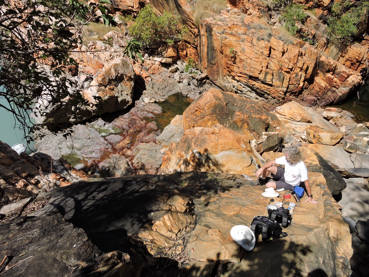 |
Lunch
Position: 123 50.70, -16 24.42
Lunch overlooking two freshwater pools to the left and right of James. A small waterfall is just out of the picture to the right.
|
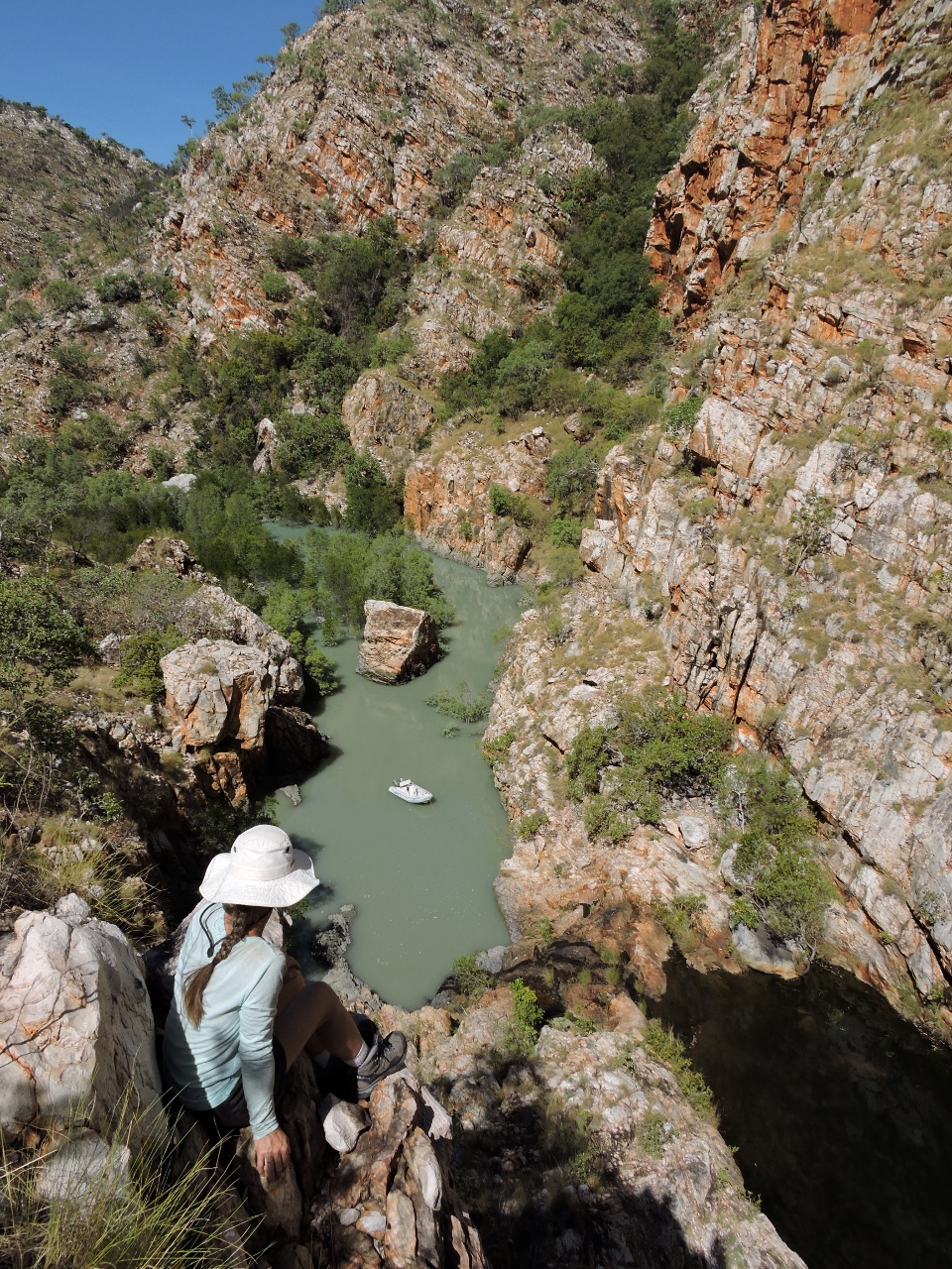 |
Gorge
Position: 123 50.08, -16 23.03
We landed the tender near a small waterfall below a freshwater pool and climbed up the cliffs for a view back down.
|
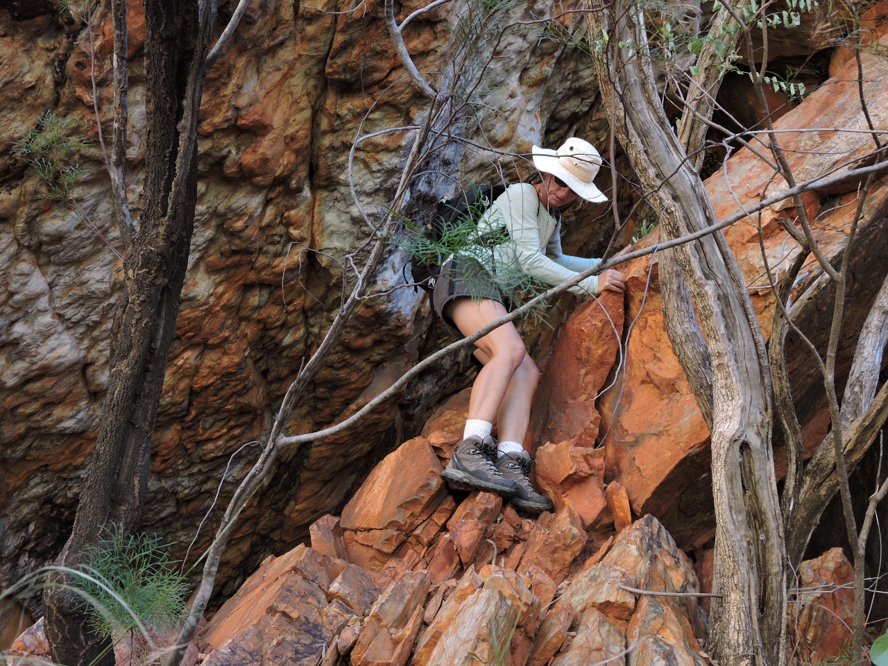 |
Climbing down
Position: 123 50.08, -16 23.03
The climb up and down wasn’t too difficult, but it was quite steep.
|
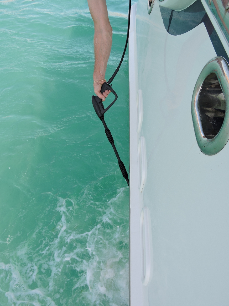 |
Bottom cleaning
Position: 123 53.44, -16 24.47
We won’t dive the boat with the crocodile, and to a far lesser extent shark, risk. So we experimented today with using a power washer and a brush on a long stick to clean the area around the waterline. For us the jury still is out when cleaning the top couple of feet near the water line. For sure the power washer is better on the longer stringier bits right at the surface that tended to clog the brush. But the brush did as well farther below the surface.
|

|
Click the travel log icon on the left to see these locations on a map, with the complete log of our cruise.
On the map page, clicking on a camera or text icon will display a picture and/or log entry for that location, and clicking on the smaller icons along the route will display latitude, longitude and other navigation data for that location. And a live map of our current route and most recent log entries always is available at http://mvdirona.com/maps. |
If your comment doesn't show up right away, send us email and we'll dredge it out of the spam filter.
Crocodiles seem abundant in your current area. What advice did you get about the limits of their mobility on land? And their speed! A week or two ago, I read a report (in a UK newspaper) that the Australian government was introducing a £15k bounty for every dead croc brought in. Presumably this is to reduce the apparent population explosion that has occurred since they were protected some years ago. Have you heard about this? And if true are you tempted to defray your cruising expenses this way? ;)
PS I am enjoying the vicarious travel experience you provide.
David Andrews
As scary as Crocadiles are, we would not kill Crocadiles to collect a bounty. We actually enjoy watching them in nature if we are at a safe distance. To my knowledge, there is no bounty for them in Australia or, if there is, we haven’t heard of it. Current government documents still refer to them as a protected species throughout Australia.
You were asking how fast they are. The adults tend to move slowly and, at the very top of the food chain, they are likely not a lot of reasons for the massive reptiles to move quickly. However, we have seen small crocadiles at impressive speeds if frightened. Presumably the big ones are capable of at least the same speed if motivated so I wouldn’t recommend giving them a run for it.
I have heard many apparently deffinitive statements that crocs won’t climb up into pools seperated by rocks banks. And certainly we have seen many people bathing in pools accessable by crocs from below. However, we generally play it conservative and assuume they may go anywhere physically accessable to get to under some tide and to assume they can out run us if sufficiently motivated.