While in Cairns we made a day trip to Karunda village in the World Heritage Listed Barron Gorge National Park. We reached Karunda on Skyrail, a 4.7-mile (7.5 km) cableway over the rainforest, and returned on the 23-mile (37 km) Karunda Scenic Railway.
Highlights from trip follow. Click any image for a larger view, or click the position to view the location on a map. And a live map of our current route and most recent log entries always is available at http://mvdirona.com/maps
 |
Skyrail
Position: 145 41.69, -16 50.86
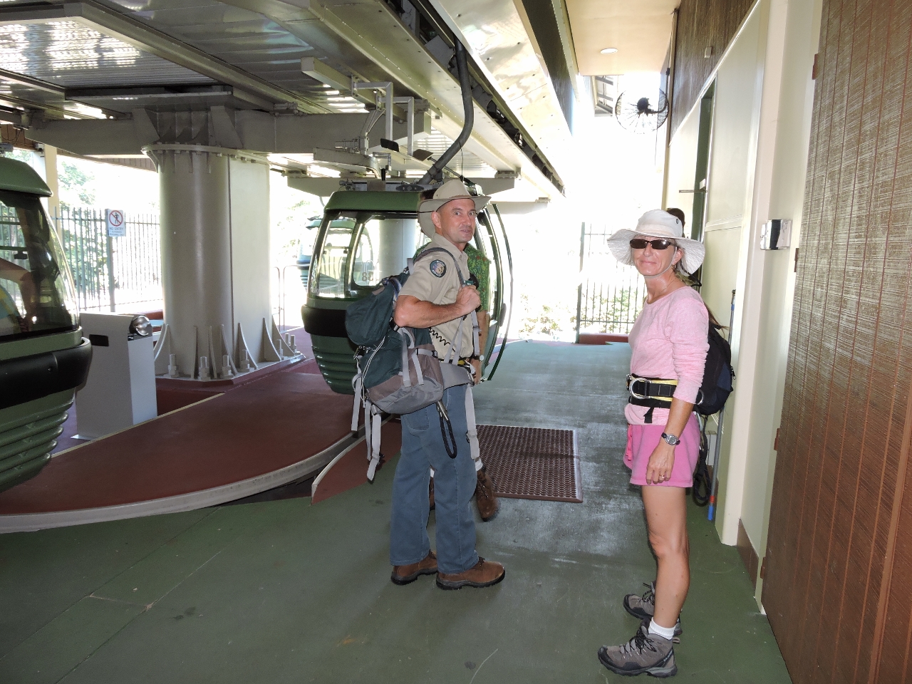
We took a shuttle bus from the marina to reach the lower Skyrail terminal. Pictured there with Jennifer is Skyrail ranger Phil–both wearing a safety harness. We upgraded from the enclosed gondolas to the open Canopy Glider, where riders must be clipped in and accompanied by a ranger.
|
 |
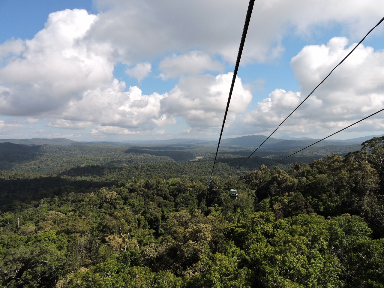
View
Position: 145 40.55, -16 50.94
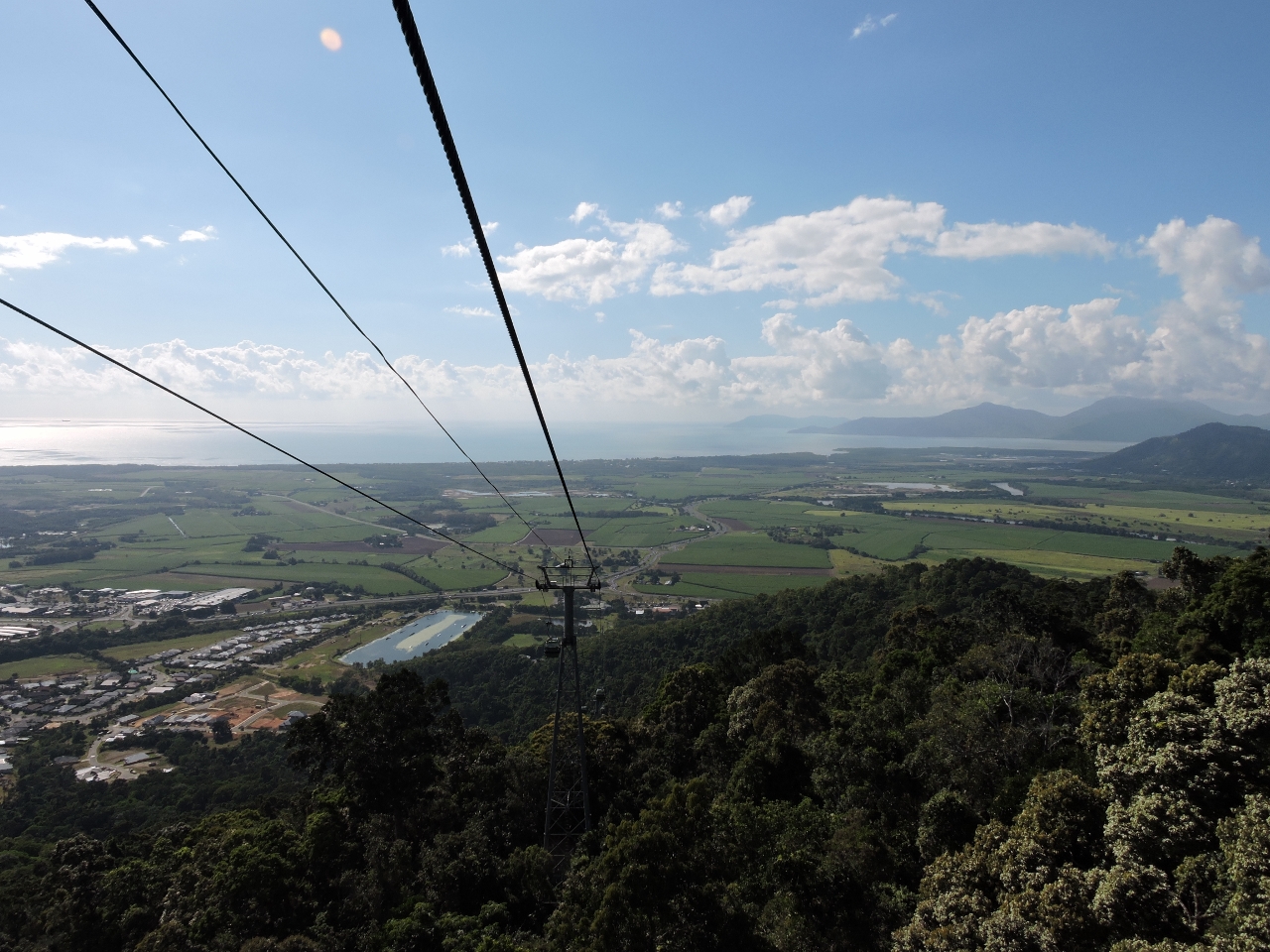
Riding above the rainforest was an amazing experience, with incredible views. Skyrail ranger Phil did a great job of explaining various aspects of the rainforest and the view along the way. The video https://youtu.be/dJSJzwC3_xY (1:15) highlights the first leg between the lower terminal and Red Peak Station.
|
 |
Red Peak Station
Position: 145 40.18, -16 50.97
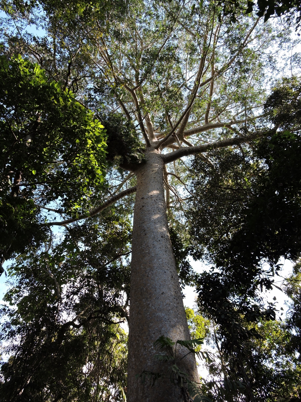
Skyrail is actually three separate cableways–riders disembark at two stations en route and switch gondolas. At Red Peak Station we walked a boardwalk through the rainforest, looking up to the trees instead of down from above. The Kuari Pine pictured can grow to 165 feet (50 meters) high and is the tallest Queensland tree species. The tree is an emergent species, meaning it can grow above the rainforest canopy.
|
 |
Canopy Glider
Position: 145 40.18, -16 50.96
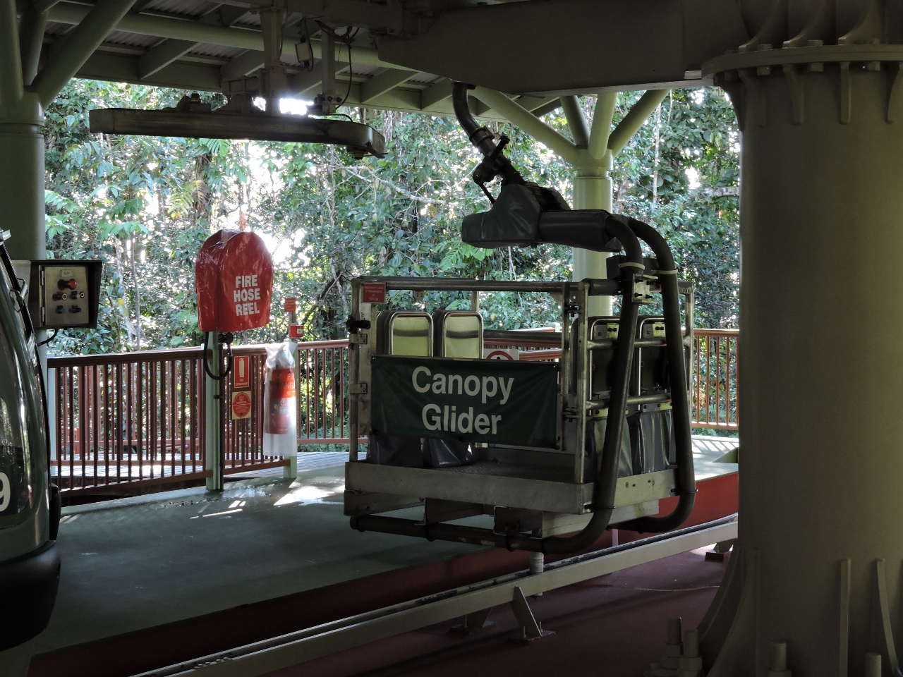
Our ride: the open Canopy Glider. Each of the three cableways that make up the total trip have one Canopy Glider. The open-air upgrade was a bit expensive, since for safety reasons each trip requires a ranger. The upside is an unparalleled viewing experience and the advantage of a knowledgeable ranger who can answer questions and point out features of interest.
|
 |
Red Peak to Barron Falls
Position: 145 39.96, -16 50.82
The view east between Red Peak and Barron Falls stations.
|
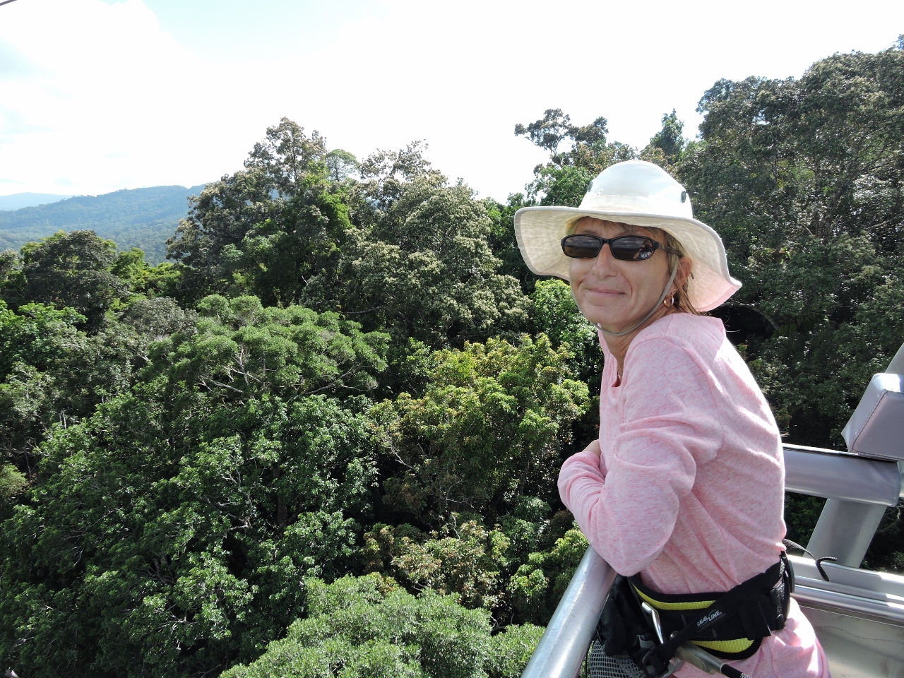 |
Ride
Position: 145 39.83, -16 50.73
Enjoying the ride. The glider is a unique experience because you’re outside and it feels much closer to the rainforest.
|
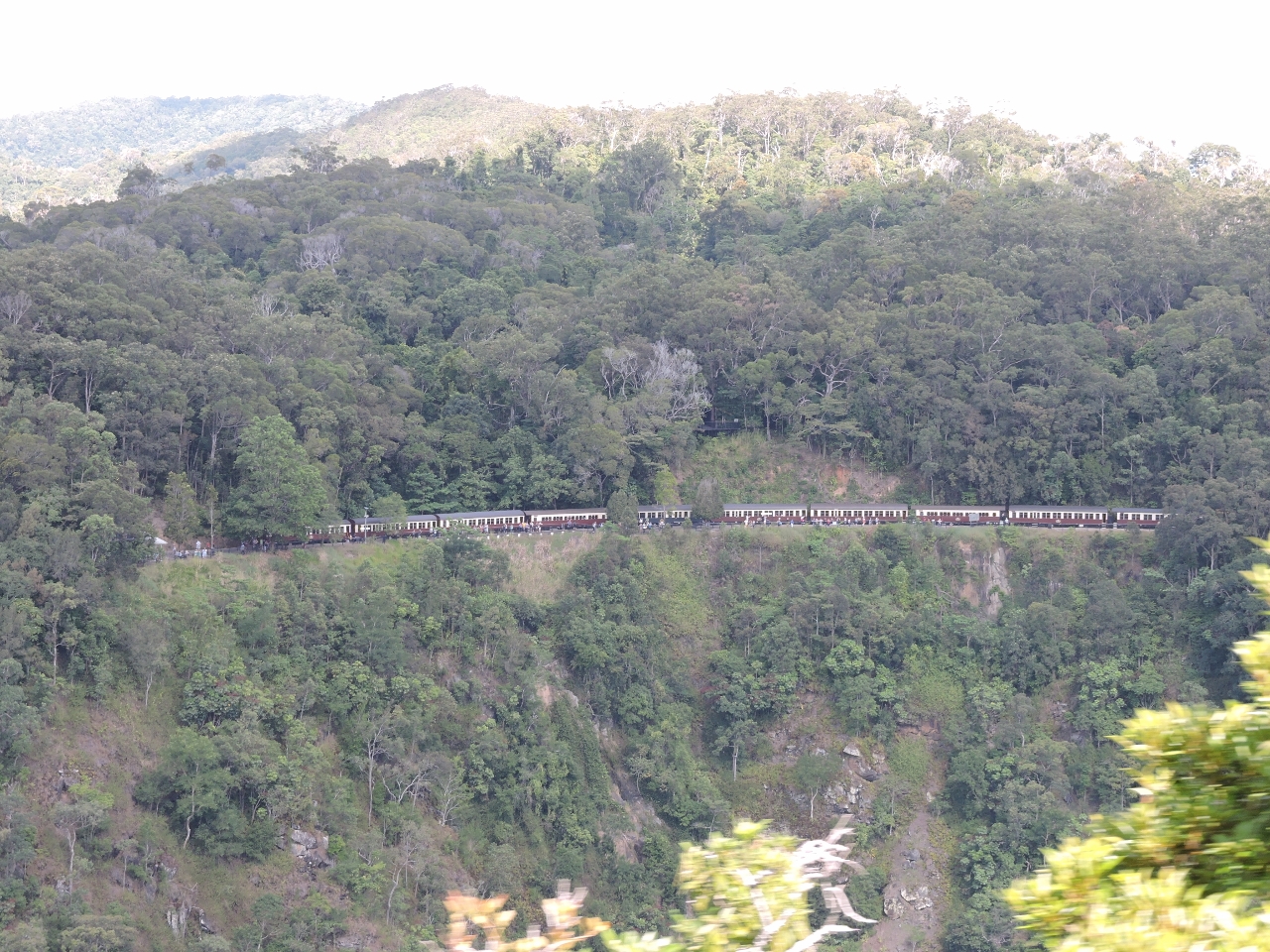 |
Kuranda Scenic Railway
Position: 145 38.74, -16 50.02
Looking north across the Baron River to a train on the Kuranda Scenic Railway–that’s how we’ll be getting back to Cairns.
|
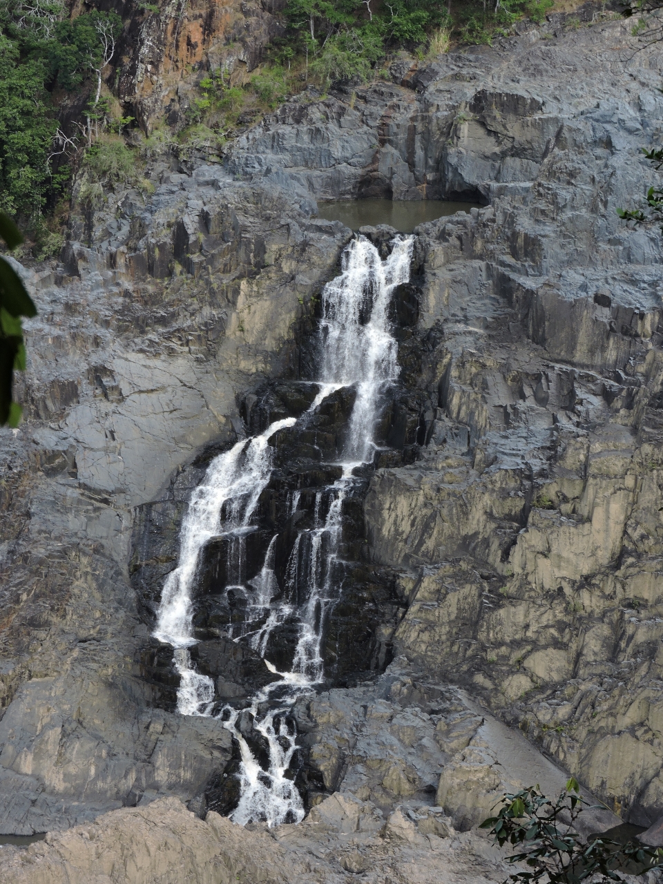 |
Barron Falls
Position: 145 38.72, -16 50.02
We got a pretty good view of Barron Falls from the cableway, but an even better one from the viewing platform at Barron Falls stations.
|
 |
Frogs
Position: 145 37.97, -16 49.15
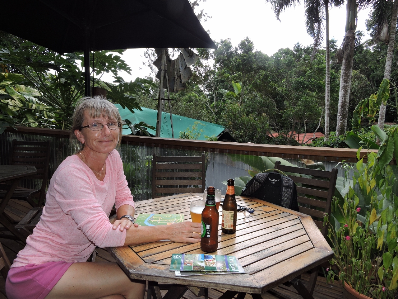
The town of Kuranda is larger than we were expecting and has a variety of restaurants and tourist shops. We had an excellent lunch amid the rainforest at Frog’s Restaurant at the north end of town. If we found ourselves back in Kuranda, it would be a hard to go anywhere else for lunch even though there are lots of alternatives we’ve not yet tried.
|
 |
Jum Rum Walk
Position: 145 38.00, -16 49.50
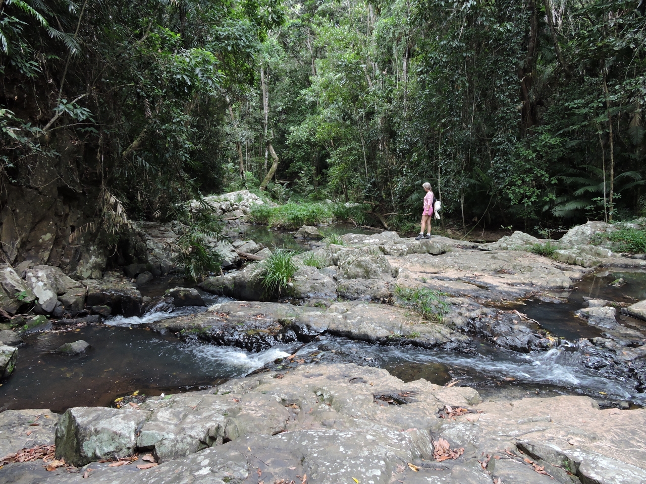
After lunch we walked the 1.4km Jum Rum track through the rainforest, along the river, and back through town. This is a small creek crossing along the way.
|
 |
Didgeridoo
Position: 145 39.14, -16 49.38
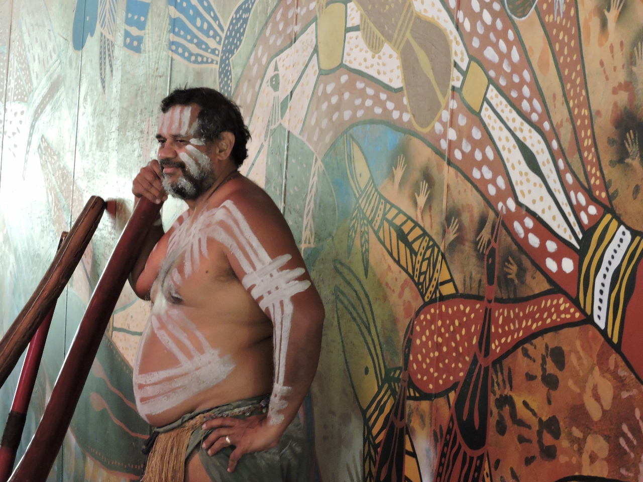
Following the Jum Rum walk, we took a 10-minute shuttle to visit Rainforestation Nature Park. The video https://youtu.be/lK5Qv0Y7KqM (0:24) shows an aboriginal Pamagirri playing a didgeridoo there.
|
 |
Duck
Position: 145 39.20, -16 49.53
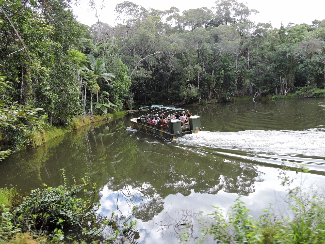
The primary reason we’d come to Rainforestation was to take the World War II amphibious army duck ride. The video https://youtu.be/ItKrthTI1MM (1:01) shows us entering the water about 20 seconds in. At 41 seconds in, the engine noise changes when the driver reaches behind him and switches to running on the propeller.
|
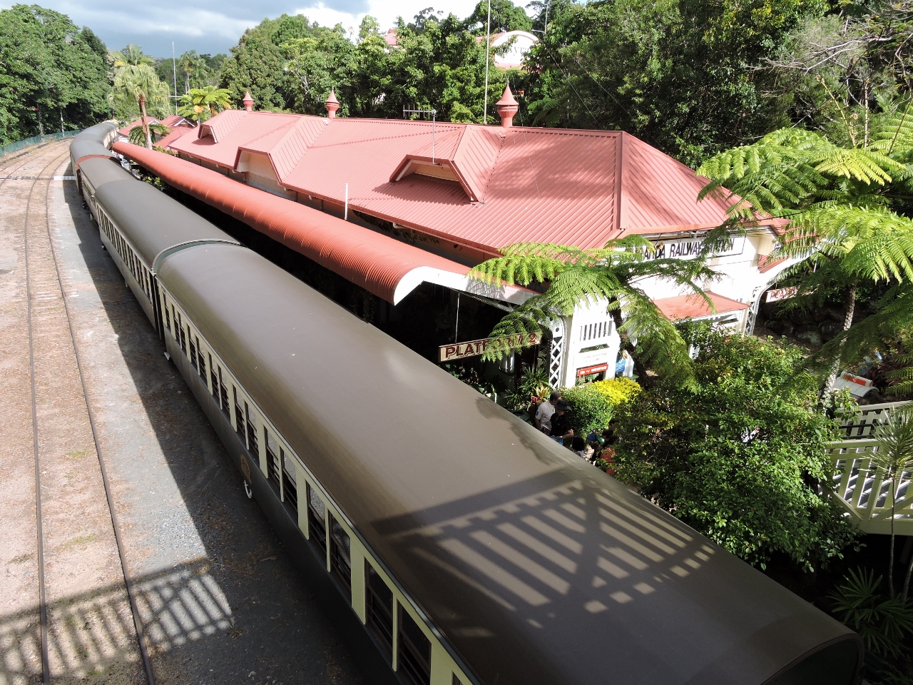 |
Karunda Station
Position: 145 38.33, -16 49.10
We returned to Cairns on the 23-mile (37km) Karunda Scenic Railway. The railway was built in the late 1800s as a gold rush supply line. This is Kuranda Station, where we’ll embark.
|
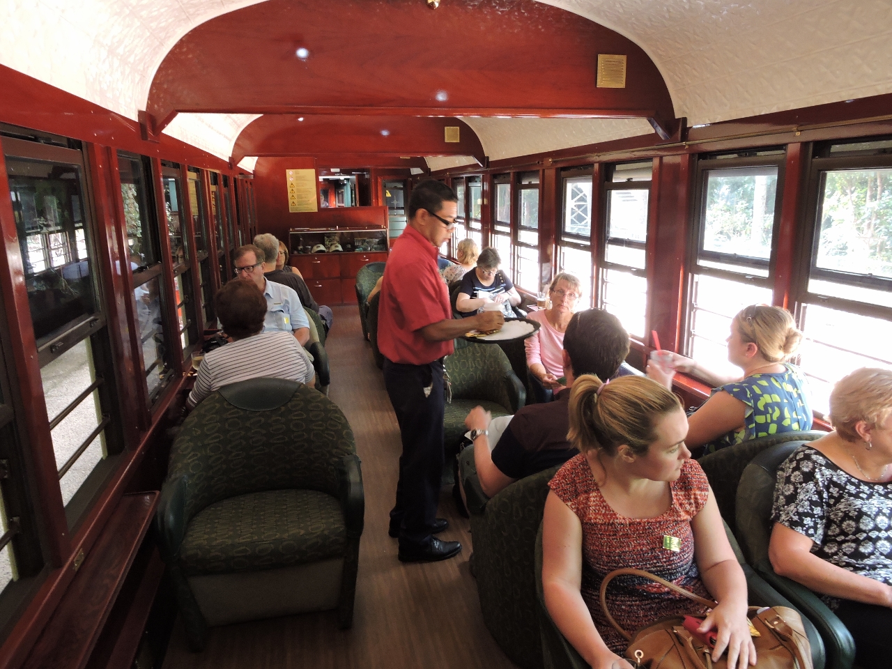 |
On board
Position: 145 38.34, -16 49.10
The carriages we traveled in date back to the early 1900s and had a beautiful Silky Oak wood interior. Jennifer, wearing pink, is seated to the right of the man serving drinks.
|
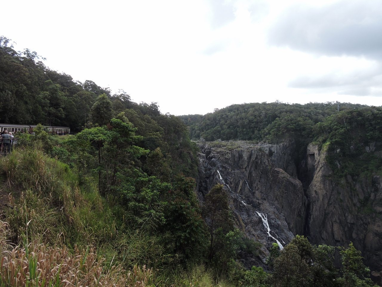 |
Barron Falls Lookout
Position: 145 38.61, -16 50.21
The train, visible on the left, stopped at Barron Falls Lookout so passengers could disembark and take in the falls.
|
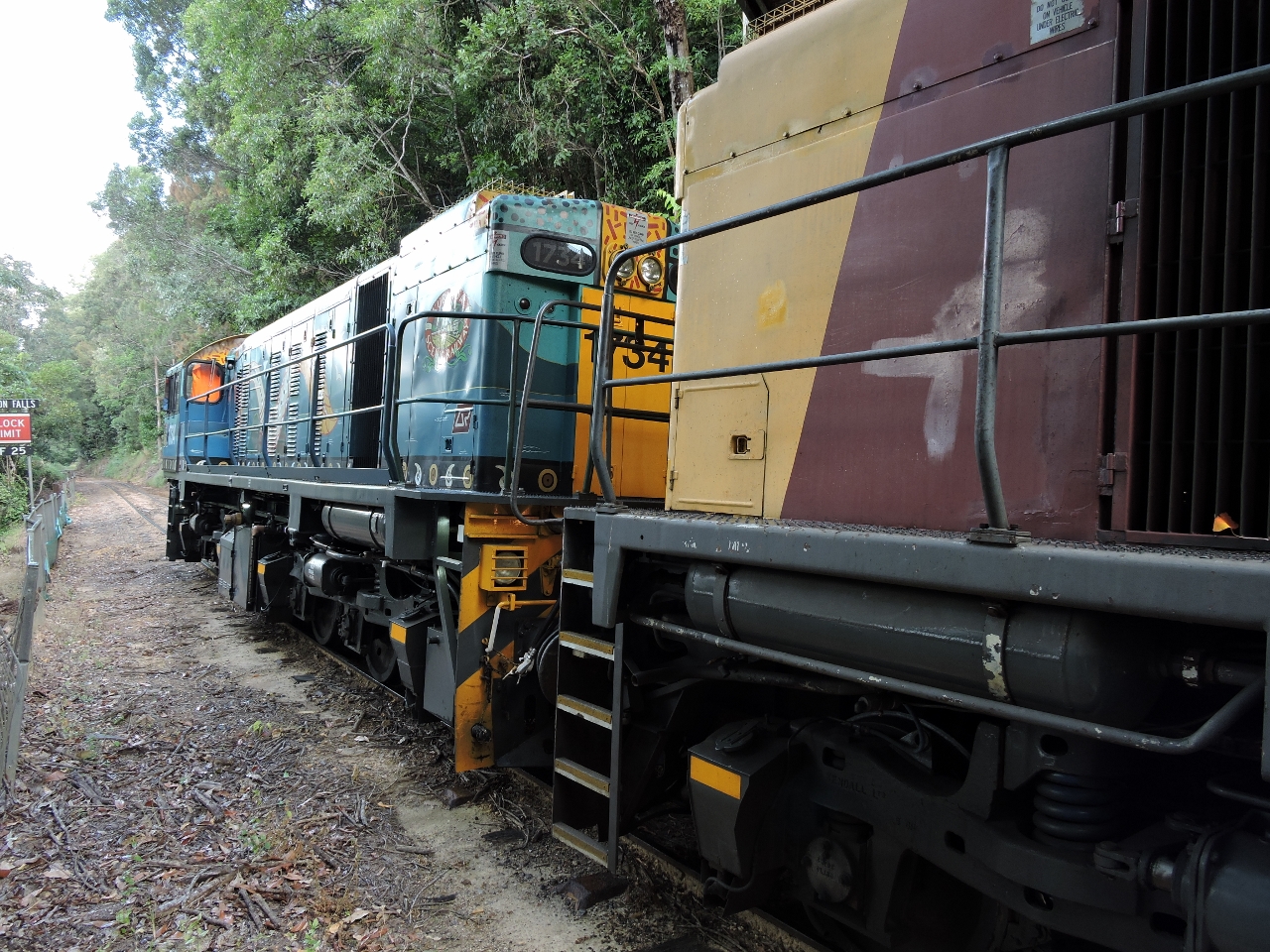 |
Locomotive
Position: 145 38.61, -16 50.20
The train locomotive is a 1720 class diesel-electric model GL18C, built in the 1960s in Brisbane by Commonwealth Engineering. It travels on a 3ft 6in narrow-gauge track. The track itself is a National Engineering Landmark, due to the difficulty of its construction, involving the removal of 2.3 million cubic meters of earth, 15 hand-carved tunnels, and 55 bridges.
|
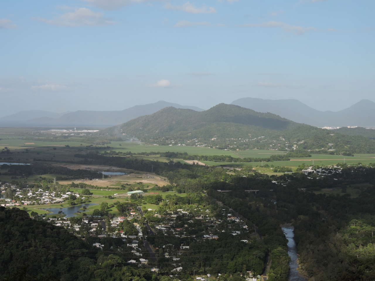 |
Views
Position: 145 39.98, -16 52.06
From the Kuranda Scenic Railway, we enjoyed excellent views over the valley and towards the ocean.
|
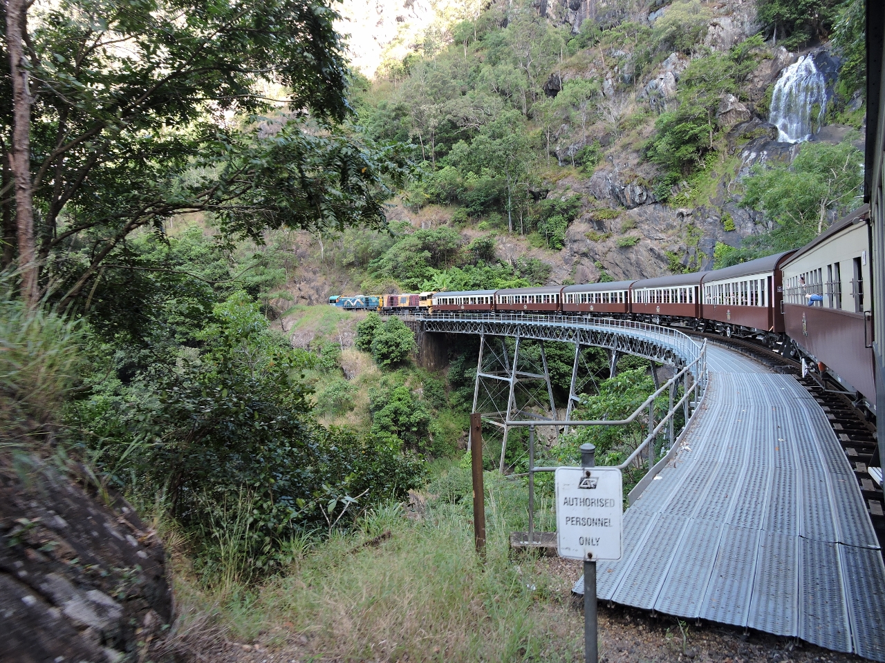 |
Stoney Creek
Position: 145 39.12, -16 52.84
Crossing the Stoney Creek Falls bridge, with the falls visible at the upper right. The iron lattice bridge, completed in 1890, is the most notable feature of the railway. It stands on three trestle piers and has a tight 265-ft (80 m) radius.
|

|
Click the travel log icon on the left to see these locations on a map, with the complete log of our cruise.
On the map page, clicking on a camera or text icon will display a picture and/or log entry for that location, and clicking on the smaller icons along the route will display latitude, longitude and other navigation data for that location. And a live map of our current route and most recent log entries always is available at http://mvdirona.com/maps. |
If your comment doesn't show up right away, send us email and we'll dredge it out of the spam filter.