Highlights from our last couple of days in Melbourne and the run north to the Gold Coast. Click any image for a larger view, or click the position to view the location on a map.
3/16/2015
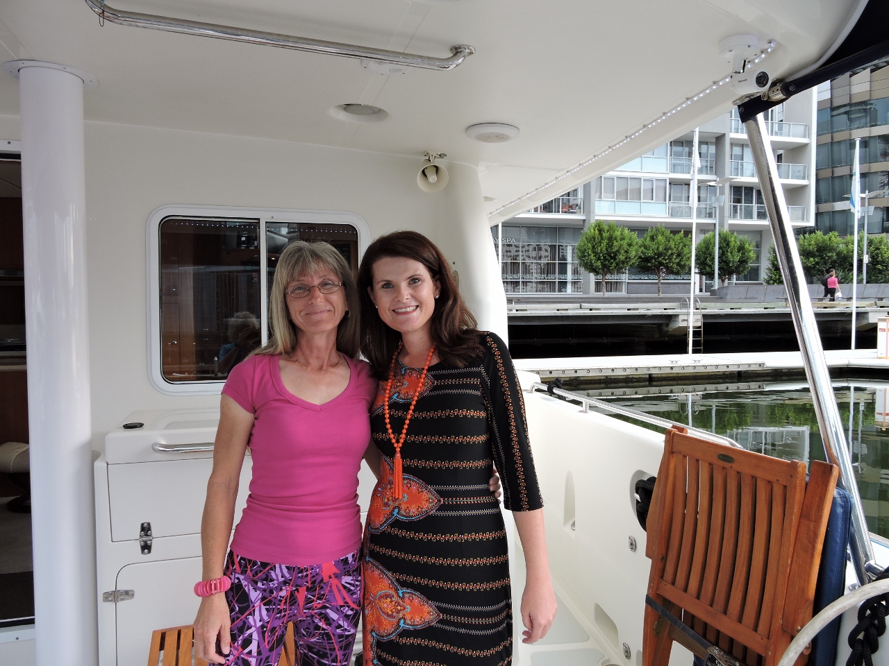 |
Kate Humphries
Position: 144 56.71, -37 49.45
Syndey resident Kate Humphries had sent us pictures of Dirona as we arrived in Farm Cove beside the famous Sydney Opera House four months ago. Now that we’re attached to land and actually can be visited, Kate happened to be in town and stopped by to enjoy glass of wine and talk boats.
|
3/17/2015
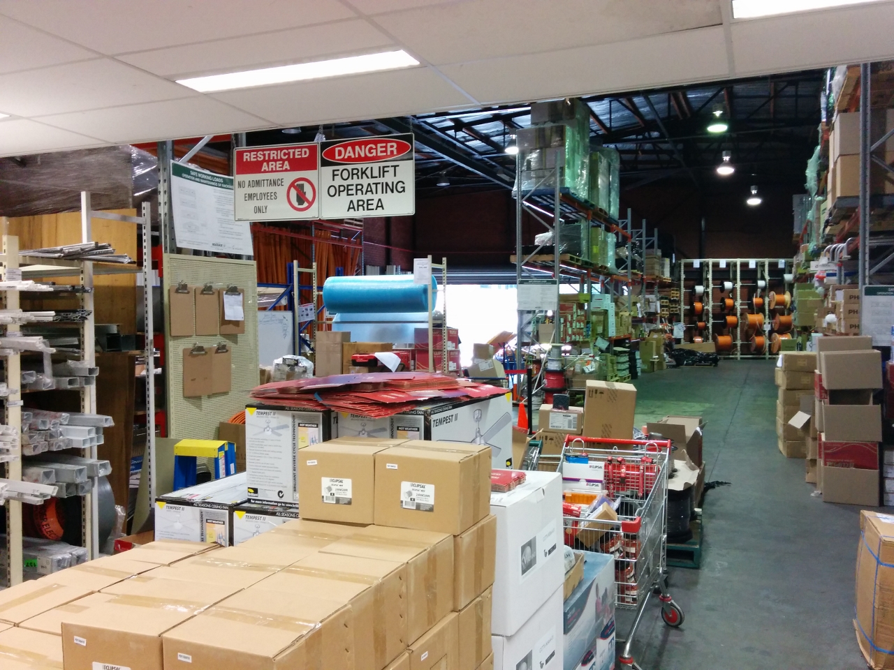 |
Lawrence and Hanson
Position: 144 57.84, -37 49.90
We biked out to Lawrence and Hanson Electrical Distributors to pickup some parts only available in large centers. It’s nice to visit a store with such a big selection.
|
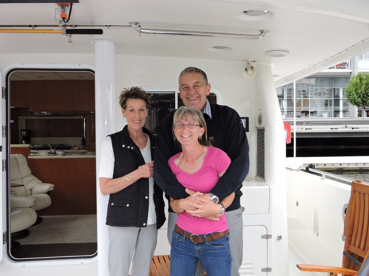 |
Finchams
Position: 144 56.71, -37 49.45
David and Jennifer Fincham from Nordhavn 57 Speedbird stopped by for a goodbye visit before we set off the next morning for the Gold Coast. They’d taken excellent care of us while we were in Melbourne and we’ll miss their conversation and hospitality.
|
3/18/2015
 |
Swansea Swinging Basin
Position: 144 55.32, -37 49.16
We left at 5am this morning, a good hour before sunrise. We could see up ahead on AIS that two tugs were turning the ship FMPC 22 in the the Swansea Swinging Basin, partially blocking the channel.
|
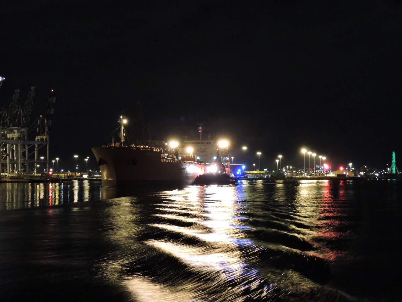 |
FPMC 22
Position: 144 54.32, -37 49.43
By the time we arrived, we had plenty of room to pass south of the FPMC 22 as the tugs had almost completed turning the ship for departure. We were expecting the ship might eventually overtake us farther down-river, but it never did.
|
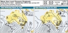 |
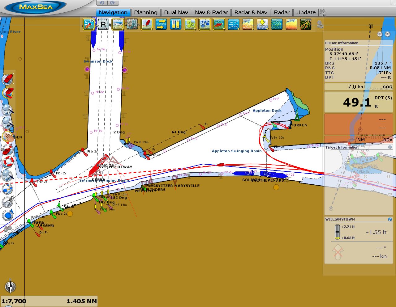
Prognosis
Position: 144 48.47, -38 6.49
We’re underway on a five-day passage from Melbourne to the Gold Coast, just south of Brisbane. A front passed through yesterday, and a brief high-pressure system is now over the Bass Strait with 15-knot westerly winds at our currently location in Port Phillip. We should arrive at the Rip about halfway between max flood and high-water slack on a relatively small 0.6m exchange, so conditions should be good to exit Port Phillips. From there we expect to have at a maximum of 15-20-knot westerly winds behind us most of the way along the southern Victoria coast. A 968-mb low-pressure system approaching south of Tasmania from the west is predicted to pass through Bass Strait late Thursday, and by that time we should be around the corner near Eden and get 20-25kt southerly winds behind us for a day or so as the system passes. Then we should have reasonably light winds all the way to the Gold Coast. This far south weather can change rapidly, so we’ll keep an eye on the forecast and stop to let the system pass if necessary. (Click image for a larger view.)
|
 |
The Rip
Position: 144 38.12, -38 17.70
The incoming current at the Rip slowed us down from 8 to less than 5 knots and the current moved us around a bit, but we had no problem exiting Port Phillip into Bass Strait.
|
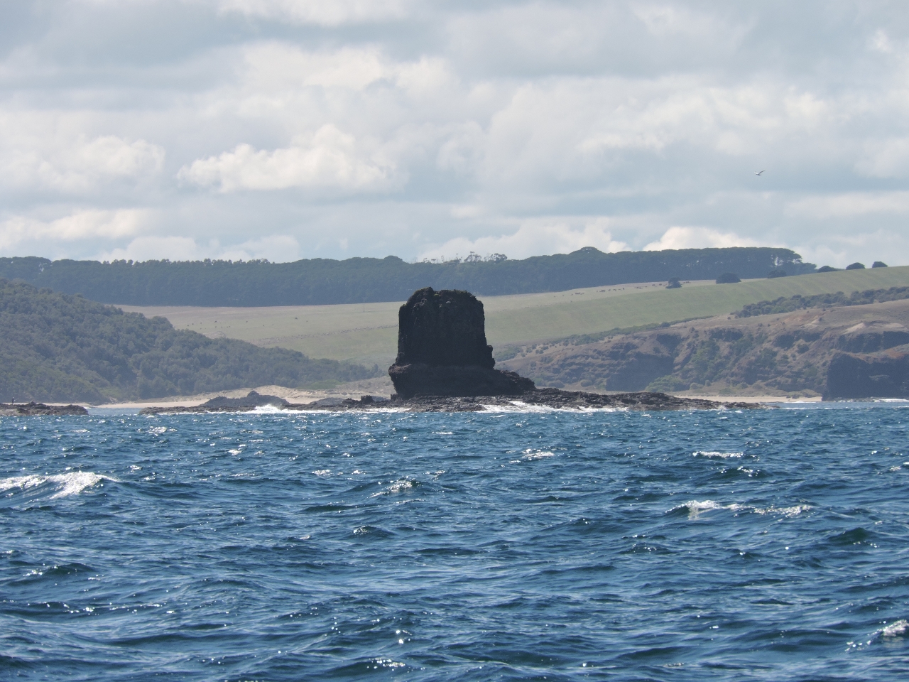 |
Cape Schanck
Position: 144 52.43, -38 30.53
Conditions have been excellent so far. Winds are less than 15 from the west and we’ve got a low swell mostly behind us as well. But even in these calm conditions, Cape Schanck looked a little bleak, particularly this detached rock.
|
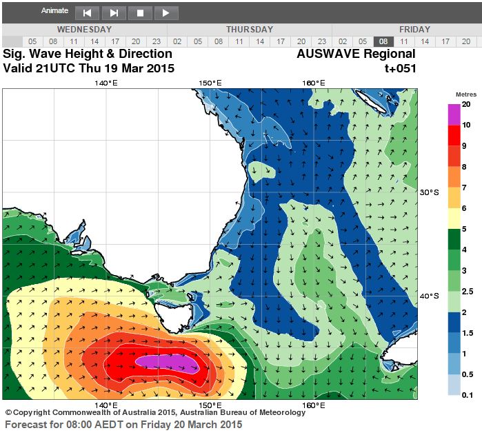 |
Wave height
Position: 145 29.63, -38 48.50
Conditions are still looking reasonably good for our run along the Victoria and New South Wales coasts. We’re making good time and should stay ahead of the low-pressure system coming in from the west. This is the wave height forecast for Friday morning, two days from now. We should be around the corner and heading north along the New South Wales coast by then, with southerly winds behind us. That purple section south of Tasmania is 10-20 meter seas–there’s something we hope never to see.
|
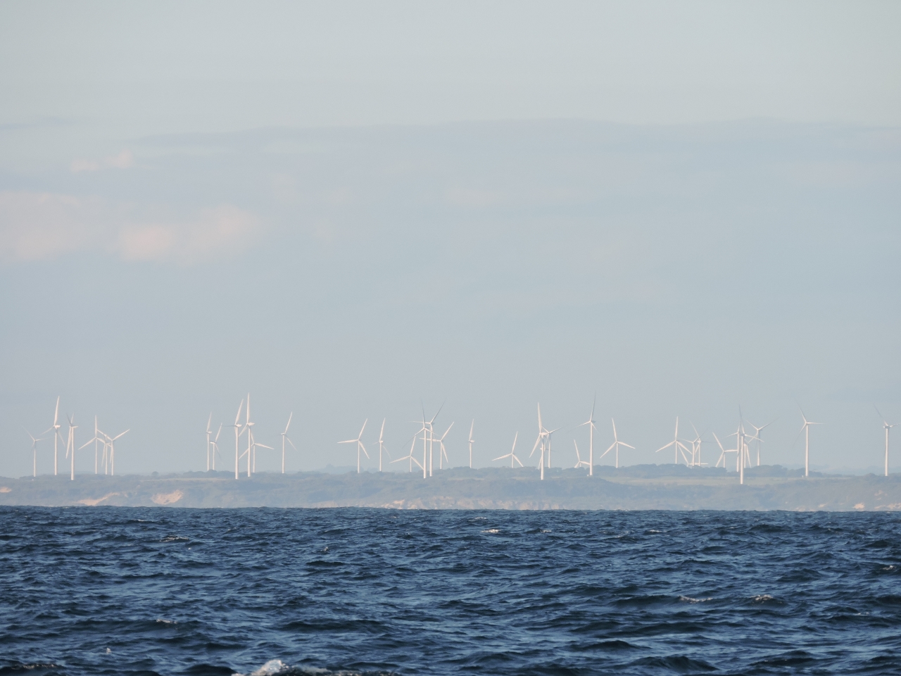 |
Wonthaggi wind farm
Position: 145 46.07, -38 56.40
The Wonthaggi wind farm to our north on Cape Patterson generates wind power 80% of the time–a testament to how much wind the area gets. Winds fortunately are light right now–less than 15 knots with a low southwesterly swell.
|
3/19/2015
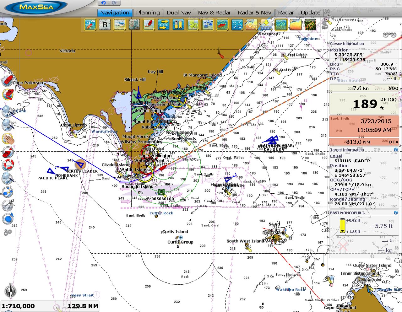 |
The Prom
Position: 146 33.18, -39 5.77
We plotted a course to run just north of the busy traffic lanes as we rounded Wilsons Prominatory, known locally as “The Prom”. This routing was a little closer to shore that we might normally run, but kept us out of the way of the many ships that passed us in the constricted area. The blue triangles are AIS (Automtic Identification System) targets. Dirona is the red boat-shaped target about center of the screen just east of the Prom. (Click image for a larger view.)
|
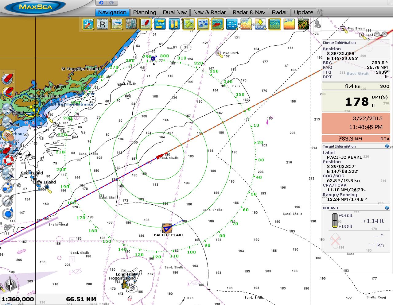 |
Pacific Pearl
Position: 147 6.78, -38 51.70
It felt a bit like old times to be running a coastal night passage with a cruise ship passing us. This often happened on our passages between Alaska and Seattle. (Click image for a larger view.)
|
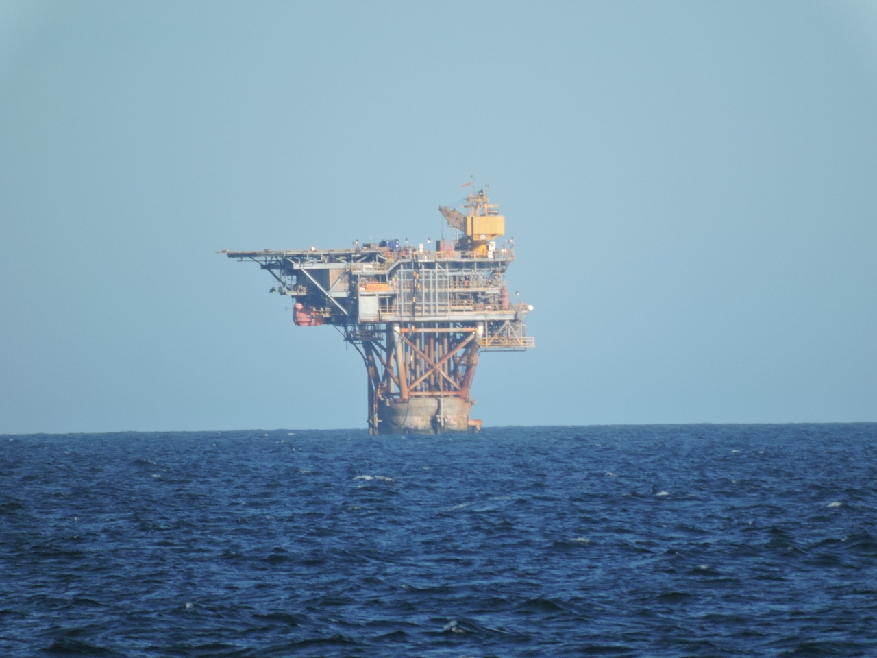 |
Gippsland Basin
Position: 147 53.61, -38 31.95
The first of perhaps a dozen oil rigs that we’ll see today as we pass through Gippsland Basin. Major oil and gas fields were discovered in the area starting in the 1960s and 21 oil and gas platforms operated here as of 2012.
|
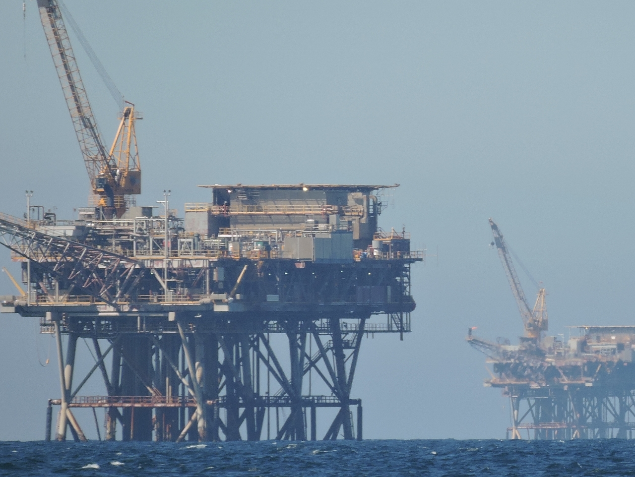 |
Last rigs
Position: 148 15.17, -38 22.09
The last rigs as we pass through the field.
|
3/20/2015
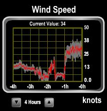 |
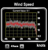
Winds
Position: 149 44.36, -37 41.52
Winds have been light most of the run, but picked up to 20 from the northeast late this afternoon. Not a big deal, but it did generate a fair bit of pitching motion into head seas. The winds dropped back down below 15 for a few hours and backed to the north, then backed farther to the WSW and shot up to a steady 30 in the last couple of hours. The waves are about 6-8′ behind us and closely packed. We expect winds to lessen a bit as we round Cape Howe and head north up the New South Wales coast.
|
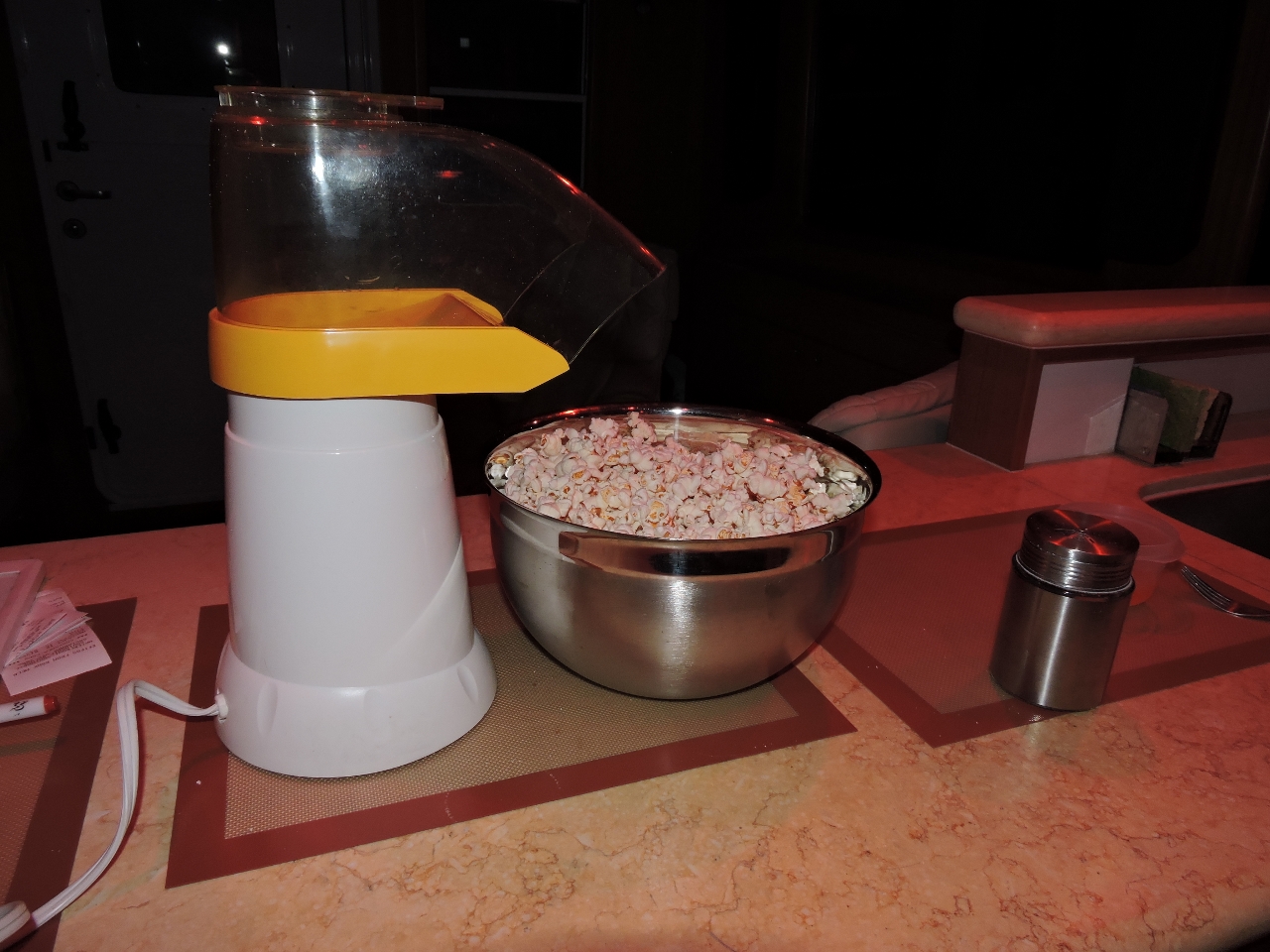 |
Midnight snack
Position: 150 2.20, -37 24.56
Air-popped popcorn makes an excellent midnight on-watch snack. Conditions have improved as we rounded the corner and turned north. Winds now are in 15-kt range from the south, with reasonably gentle seas.
|
3/21/2015
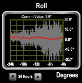 |
Roll
Position: 150 48.89, -34 55.94
As predicted, the winds picked up to a steady 25-30 knots from the south this afternoon, producing 10-12′ closely-spaced seas. They are mostly behind us, but are rolling the boat quite a bit when they catch the stern–we’ve seen rolls beyond 26 degrees. Conditions are rough enough that we were sldiing around on the bed too much so are both sleeping on the floor during our off-watches to limit motion–Jennifer wedged in the narrow gap to the port of the master berth and James on the opposite side. At one point we took a rool big enough to knock over Spitfire’s non-skid-based food and water dishes, something that hae never happened before. At the same time, our thermos carafe that was standing in the galley sink was flipped on its side so violently that the interior glass shattered. We’re now in the protection of Beecroft Peninsula to our south, and waves have lessened considerably. We’ve been running a course close to shore to keep out of the several-knot southbound offshore current that would both slow us down and generate big waves against the strong southerly winds. Winds still are steady 20-25 from the south, and we expect them to slowly lessen over the next 24 hours.
|
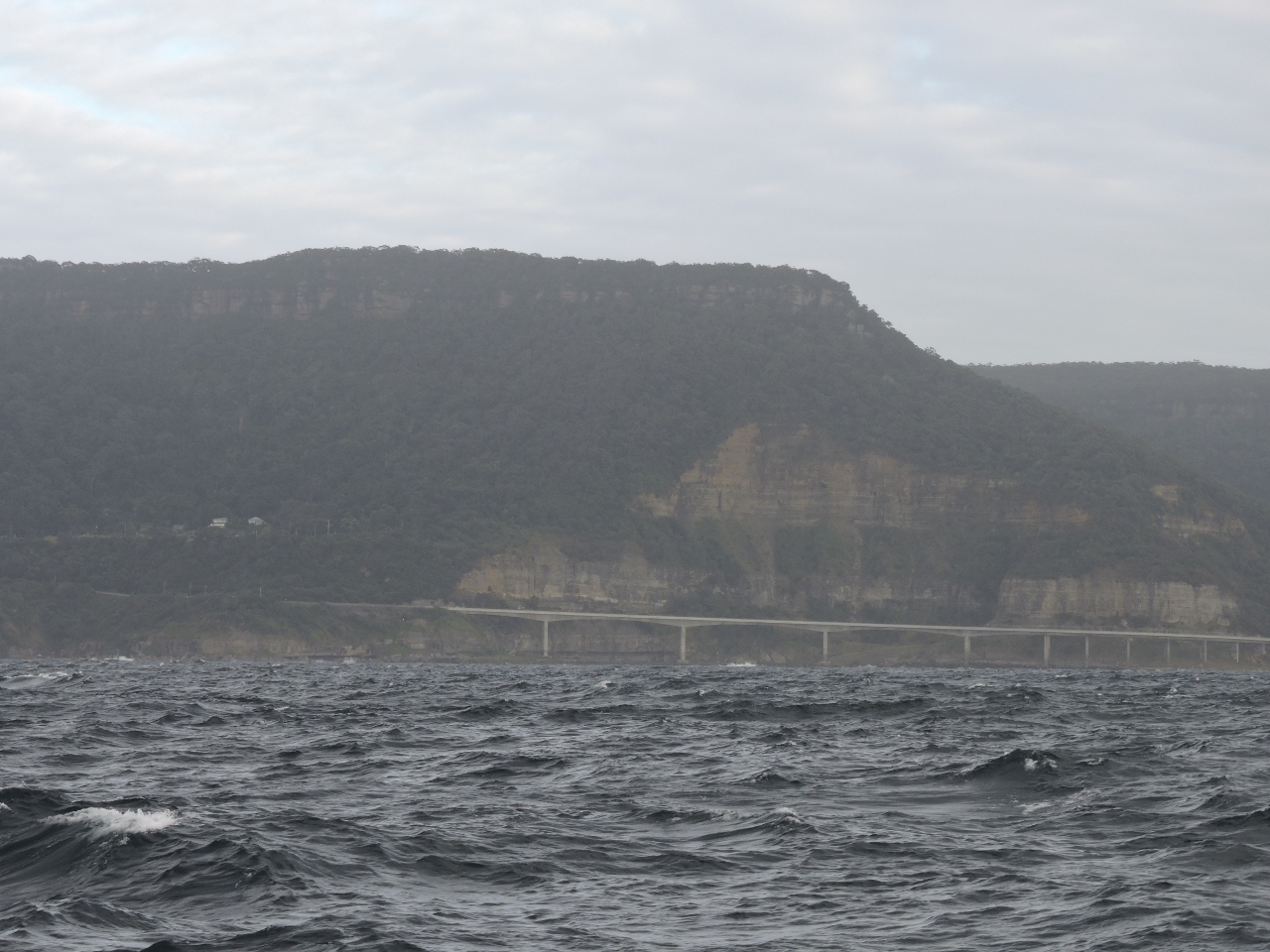 |
Sea Cliff Bridge
Position: 151 0.56, -34 15.99
The Sea Cliff Bridge is a balanced cantiliver bridge strung along the cliffs between the coastal towns of Coalcliff and Clifton. The bridge is a popular setting for car commercials, such as this Shell/Ferrari ad.
|
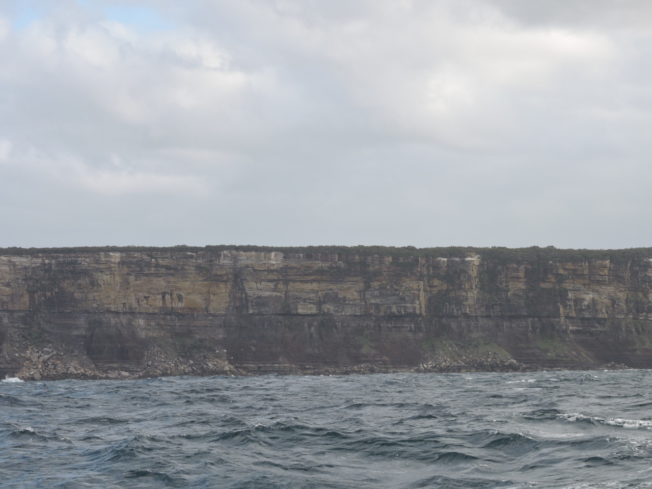 |
Cliffs
Position: 151 5.54, -34 10.74
The coastline here is dramatic, with little shelter.
|
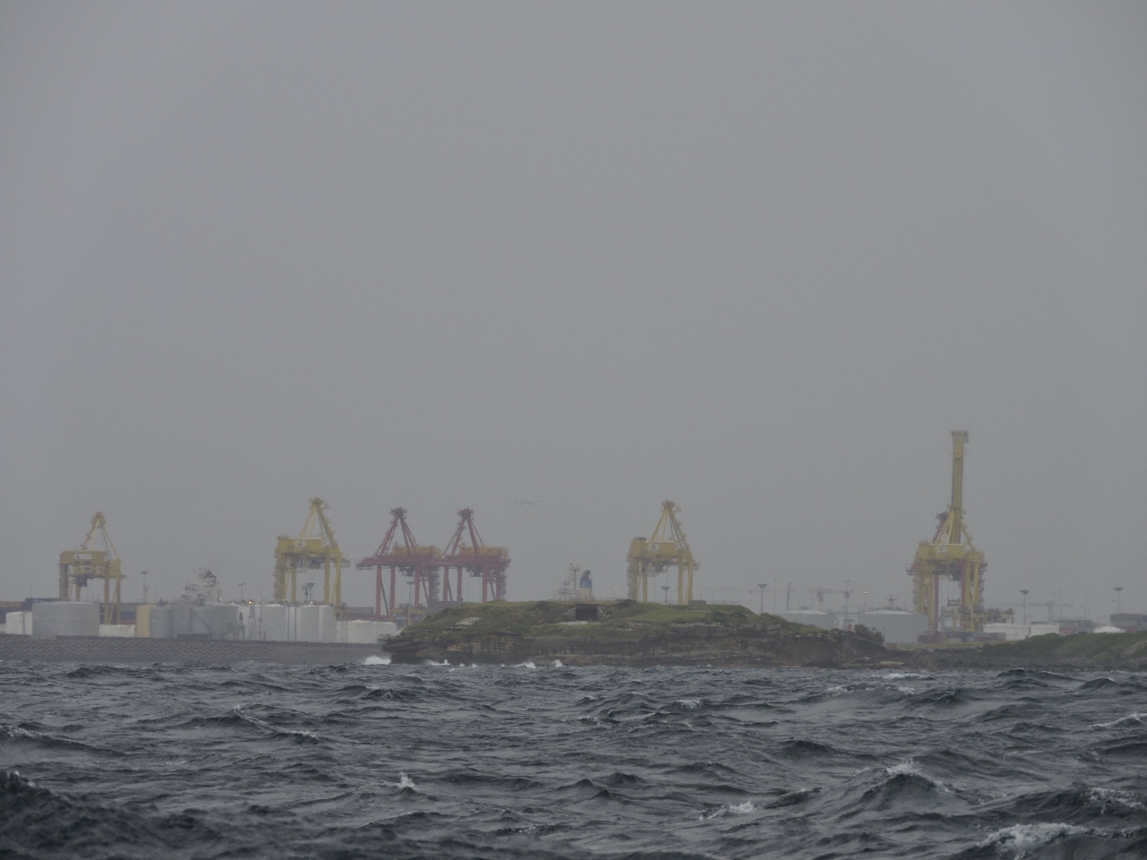 |
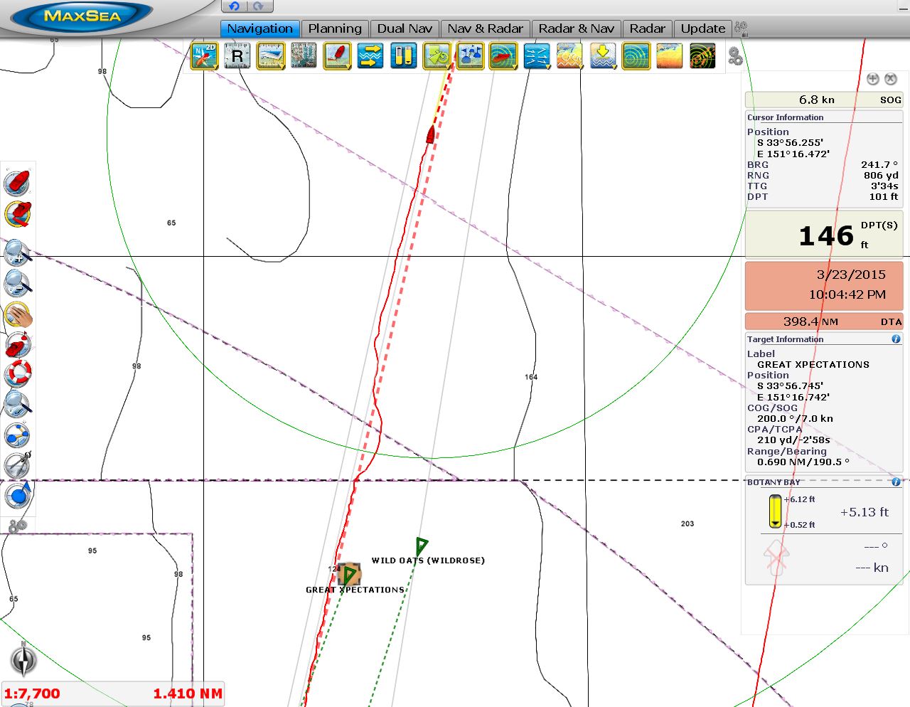
Botany Bay
Position: 151 15.18, -34 0.91
Cranes in the shipping terminal of Botany Bay–the major shipping harbour for Sydney. The airport also is nearyby–you can anchor here for that “end-of-the-runway” experience.
|
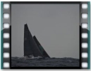 |
Sydney to Wollongong
Position: 151 16.62, -33 57.08
The Syndey to Wollongong race fleet passed us just south of Syndey Harbour, with several Sydney-Hobart boats amongst them. The race runs to Wollongong, about 45 miles south of Sydney and back. Conditions had improved over the course of the day, but you can see in the video some big waves still are rolling through. (Click the image to view the video).
|
 |
Course adjustment
Position: 151 16.88, -33 56.09
We were right in the middle of the Sydney to Wollongong race fleet and had to adjust course several times to get out of the way.
|
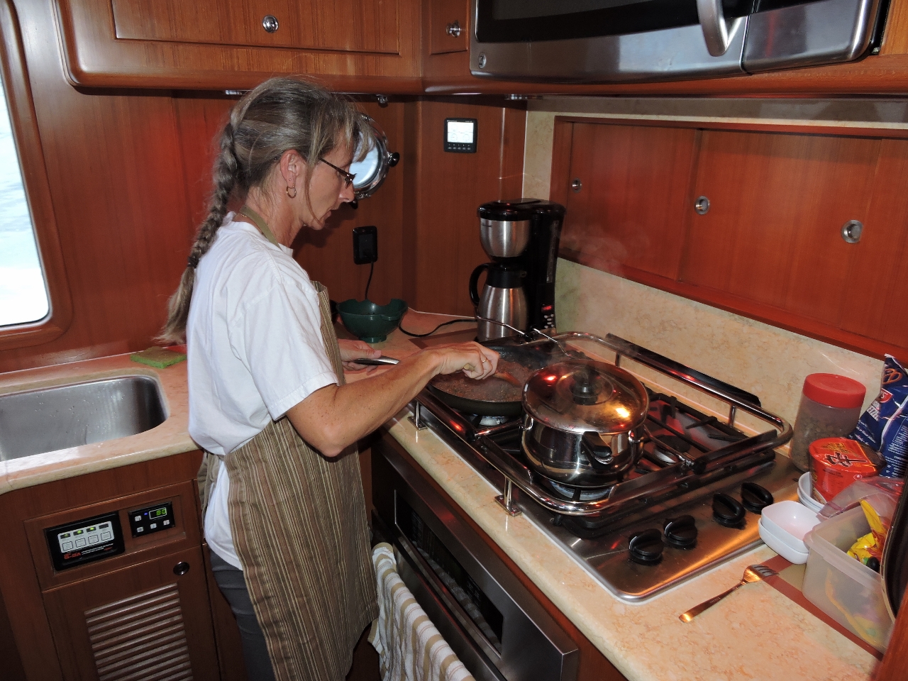 |
Dinner
Position: 151 42.22, -33 6.93
Making spaghetti with meatsauce for dinner. Unless conditions are extremely rough, we cook and eat dinners at sea the same as when moored, although we tend to favour less spciy food at sea. Seas are rough enough now that we’ve mounted potholders to the stovetop sea rails to prevent the pots from sliding around.
|
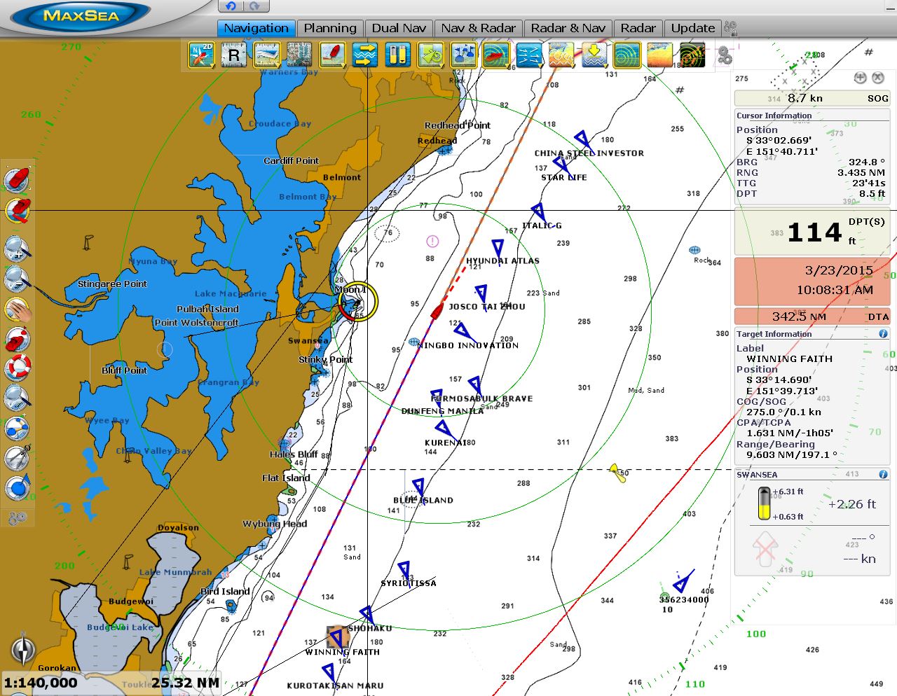 |
Newcastle
Position: 151 43.05, -33 5.52
Perhaps 20 ships were anchored off in a row, waiting to pickup coal at the Port of Newcastle, out of the screen shot to the north. The ships were anchored as far as 20 miles south of the port.
|
3/22/2015
 |
Conditions
Position: 152 36.84, -32 15.44
Winds were mostly below 20 today, but picked up again to a steady 30 kts from the southeast as we passed Seal Rocks. Boat motion from the large seas was again severe enough that we slept on the stateroom floor, wedged between the master berth and the wall, to limit our motion as we’d slide around on the berth too much. And for added excitement, we passed through a several-hour electrical storm with lightning illuminiting the area for miles every couple of minutes. At 6am, the winds suddently dropped to below 10 from the north, so conditions are starting to improve.
|
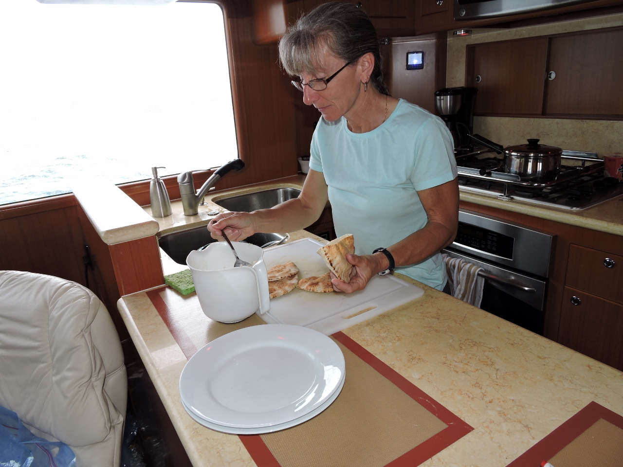 |
Lunch
Position: 152 54.03, -31 35.02
Shrimp salad pita pockets for lunch. Conditions have been calm most of the day, with winds below 15 kts, and we expect that to last most of the way to the Gold Coast. We’re making good time now–we’ve continued to tuck in close to shore to avoid the several-knot southbound current. This has been remarkably effective, and we sometimes get a push from a northbound backeddy.
|

|
Click the travel log icon on the left to see these locations on a map, with the complete log of our cruise.
On the map page, clicking on a camera or text icon will display a picture and/or log entry for that location, and clicking on the smaller icons along the route will display latitude, longitude and other navigation data for that location. And a live map of our current route and most recent log entries always is available at http://mvdirona.com/maps. |
If your comment doesn't show up right away, send us email and we'll dredge it out of the spam filter.